Next Issue
Volume 12, June
Previous Issue
Volume 12, April


Hydrology, Volume 12, Issue 5 (May 2025) – 28 articles

Cover Story (view full-size image): 
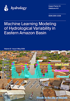
This study developed a computational modeling framework based on artificial neural networks and machine learning to simulate hydrological variability (monthly minimum/maximum river stages, 2001–2021) in the Itacaiúnas River Basin (BHRI) in the eastern Amazon. We evaluated two models—the Multilayer Perceptron (MLP) and the Support Vector Machine (SVM). Explanatory variables included meteorological, climatological, and environmental factors to represent local/regional drivers. Both models showed robust performance in capturing fluviometric variability, with the MLP accurately reproducing peak river levels during extreme hydrological events associated with floods in BHRI municipalities. These findings provide a scientific basis for enhancing early warning systems and mitigating hydrological disasters in vulnerable Amazonian communities. View this paper
  • Issues are regarded as officially published after their release is announced to the table of contents alert mailing list.
  • You may sign up for e-mail alerts to receive table of contents of newly released issues.
  • PDF is the official format for papers published in both, html and pdf forms. To view the papers in pdf format, click on the "PDF Full-text" link, and use the free Adobe Reader to open them.
Order results
Result details
Section
Select all
Export citation of selected articles as:
16 pages, 3311 KiB  
Article
Microplastic Pollution in Tropical River: Fourier Transform Infrared Spectroscopy-Based Characterization of Abundance and Polymer Composition in Water and Sediments from Filobobos River, Mexico
by Gleybis Hernández-Morales, María Cristina López-Mendez, Alan Antonio Rico-Barragán, Jesús Pérez-Moreno, Carolina Peña-Montes, Luis Alberto Peralta-Pelaez and Humberto Raymundo González-Moreno
Hydrology 2025, 12(5), 124; https://doi.org/10.3390/hydrology12050124 - 21 May 2025
Viewed by 649
Abstract
Veracruz is a megadiverse state facing great water resource management challenges. The contamination of water bodies with external materials of anthropogenic origin stands out, including those derived from plastic products, which are deemed ubiquitous, emerging contaminants that have gained notoriety in recent decades [...] Read more.
Veracruz is a megadiverse state facing great water resource management challenges. The contamination of water bodies with external materials of anthropogenic origin stands out, including those derived from plastic products, which are deemed ubiquitous, emerging contaminants that have gained notoriety in recent decades due to the extent and effects of their presence, persistence and distribution in aquatic ecosystems. Being a significant environmental threat, their presence, persistence and distribution in aquatic ecosystems are deserving of a more detailed study. This research focused on analyzing microplastic (MP) retention and characterization in environmental matrixes (water and sediment) in the Bobos River’s lower basin, also taking into account other water physicochemical parameters, including a pH range from slightly acidic (5.17) to slightly alkaline (8.94) as the maximum value and an average temperature of 28.87 °C (83.96 °F). MPs are most frequently found in the form of blue-colored fibers. A polymer analysis by Fourier Transform Infrared Spectroscopy (FTIR) revealed that the most common polymer was polyethylene (PE), which is the main component of most agricultural mulch and agrochemical containers. This research aims to enhance the understanding of the plastic matter contamination of water bodies, pointing out the need for further and deeper research on this subject. Full article
Show Figures

Graphical abstract

28 pages, 6148 KiB  
Article
The Utilization of a 3D Groundwater Flow and Transport Model for a Qualitative Investigation of Groundwater Salinization in the Ca Mau Peninsula (Mekong Delta, Vietnam)
by Tran Viet Hoan, Karl-Gerd Richter, Felix Dörr, Jonas Bauer, Nicolas Börsig, Anke Steinel, Van Thi Mai Le, Van Cam Pham, Don Van Than and Stefan Norra
Hydrology 2025, 12(5), 126; https://doi.org/10.3390/hydrology12050126 - 20 May 2025
Viewed by 418
Abstract
The Ca Mau Peninsula (CMP), the southernmost region of the Mekong Delta, is increasingly threatened by groundwater salinization, posing severe risks to both the freshwater supply and land sustainability. This study develops a three-dimensional, density-dependent groundwater flow and salinity transport model to investigate [...] Read more.
The Ca Mau Peninsula (CMP), the southernmost region of the Mekong Delta, is increasingly threatened by groundwater salinization, posing severe risks to both the freshwater supply and land sustainability. This study develops a three-dimensional, density-dependent groundwater flow and salinity transport model to investigate salinization dynamics across the CMP’s complex multi-aquifer system. Unlike previous studies that largely rely on model calibration, this research introduces a novel approach by systematically deriving the spatial distribution of longitudinal dispersivity based on sediment characteristics. Moreover, detailed land use mapping is integrated to assign spatially and temporally variable Total Dissolved Solids (TDS) values to the uppermost layers, thereby enhancing the model realism in areas where monitoring data are limited. The model was utilized not only to simulate the regional salinity evolution, but also to critically evaluate conceptual hypotheses related to the mechanisms driving groundwater salinization. Results reveal a strong influence of seasonal and land use factors on salinity variability in the upper aquifers, while deeper aquifers remain largely stable, affected primarily by paleosalinity and localized pumping. This integrated modeling approach contributes to a better understanding of regional-scale groundwater salinization and highlights both the potential and the limitations of numerical modeling under data-scarce conditions. The findings provide a valuable scientific basis for adaptive water resource management in vulnerable coastal zones. Full article
(This article belongs to the Topic Advances in Hydrogeological Research)
Show Figures

Figure 1

24 pages, 3815 KiB  
Article
Using High-Resolution Flood Hazard and Urban Heat Island Maps for High-Priority BGI Placement at the City Scale
by Stefan Reinstaller, Albert Wilhelm König and Dirk Muschalla
Hydrology 2025, 12(5), 125; https://doi.org/10.3390/hydrology12050125 - 20 May 2025
Viewed by 528
Abstract
This study presents a general workflow for creating a priority map for blue–green infrastructure (BGI) placement at the city scale, incorporating model-based benefit analysis. This workflow generates a BGI priority map, combining flood hazard and urban heat island maps, that guarantees multi-functional requirements [...] Read more.
This study presents a general workflow for creating a priority map for blue–green infrastructure (BGI) placement at the city scale, incorporating model-based benefit analysis. This workflow generates a BGI priority map, combining flood hazard and urban heat island maps, that guarantees multi-functional requirements are met. This approach was applied at a small study site in Feldbach, Austria. In the second part, we used the priority map generated to implement six BGI strategies in an integrated 1D-2D urban flood model and a semi-distributed hydrological model at high-priority and low-priority locations. The use of the efficiency index (EImod) enabled a multi-objective assessment. The results indicate that all the strategies led to a higher EImod when implemented in high-priority locations compared to low-priority locations. Our findings demonstrate that priority maps support decision making regarding where strategies should be implemented, providing remarkable benefits for water management objectives. Additionally, the findings highlight the importance of incorporating potential flooding areas to enhance prioritisation regarding flood hazard indicators. In future assessments, economic parameters, such as cost considerations, should also be integrated in order to optimise BGI placement efficiency. Full article
(This article belongs to the Special Issue Advances in Urban Hydrology and Stormwater Management)
Show Figures

Figure 1

26 pages, 27036 KiB  
Article
Managed Aquifer Recharge (MAR) in Semiarid Regions: Water Quality Evaluation and Dynamics from the Akrotiri MAR System, Cyprus
by Maria Achilleos, Ourania Tzoraki and Evangelos Akylas
Hydrology 2025, 12(5), 123; https://doi.org/10.3390/hydrology12050123 - 19 May 2025
Viewed by 601
Abstract
Managed Aquifer Recharge (MAR) is increasingly being adopted across Europe to enhance water security in semiarid regions, with over 230 operational sites. The Akrotiri MAR system in Limassol, Cyprus, comprises 17 recharge ponds operating since 2016 to counteract saltwater intrusion. This study evaluates [...] Read more.
Managed Aquifer Recharge (MAR) is increasingly being adopted across Europe to enhance water security in semiarid regions, with over 230 operational sites. The Akrotiri MAR system in Limassol, Cyprus, comprises 17 recharge ponds operating since 2016 to counteract saltwater intrusion. This study evaluates MAR effectiveness by analyzing spatial and temporal variations in water quality from 2016 to 2020. Parameters analyzed include nutrients, metals, pesticides, pharmaceuticals, fecal indicators, physicochemical characteristics, recharge and pumping volumes, and groundwater levels. The results show that soil aquifer treatment (SAT) generally improves groundwater quality but certain boreholes exhibited elevated nitrate (range 12.70–31 mg/L), electrical conductivity (range 936–10,420 μs/cm), and chloride concentrations (range 117–1631 mg/L), attributed to recharge water quality, seawater intrusion, and nearby agricultural activities. Tertiary treated wastewater used for recharge occasionally exceeds permissible limits, particularly in E. coli (up to 2420/100 mL), chloride (up to 385 mg/L), and nitrogen (up to 41 mg/L). Supplementing recharge with dam-supplied freshwater improves groundwater quality and raises water levels. These findings underline the importance of continuous monitoring and effective management, adopting sustainable farming practices, and the strict control of recharge water quality. The study offers valuable insights for optimizing MAR systems and supports integrating MAR into circular water management frameworks to mitigate pollution and seawater intrusion, enhancing long-term aquifer sustainability. Full article
Show Figures

Graphical abstract

20 pages, 6711 KiB  
Article
Identification of Attribution of Runoff Variations in the Tumen River Basin Based on Budyko’s Hypothesis
by Dongqing Huo, Jiaqi Wu, Chunzi Zhao, Yongtao Yan, Weihong Zhu, Ri Jin and Jingya Zhou
Hydrology 2025, 12(5), 122; https://doi.org/10.3390/hydrology12050122 - 18 May 2025
Viewed by 783
Abstract
The Tumen River Basin (TRB), a critical China border region, has experienced a complex evolution of runoff due to climate change and human activities. This study aims to quantify the main drivers of runoff variations in the TRB based on the Budyko framework [...] Read more.
The Tumen River Basin (TRB), a critical China border region, has experienced a complex evolution of runoff due to climate change and human activities. This study aims to quantify the main drivers of runoff variations in the TRB based on the Budyko framework to assess the relative contributions of climate change and human activities to runoff fluctuations. Results indicate pronounced warming and increased precipitation in the TRB, while runoff exhibits a declining trend with temporal variability. Runoff decreased during 1956–1980 but increased post 1980. Overall, climate change is the dominant factor driving runoff fluctuations in the TRB. A comparison across different sub-basins shows that the contribution of climate change to runoff variations is higher in the middle and upper reaches of the Tumen River, reaching up to 93.8%. In the lower basin, human activities contribute significantly to runoff variations. Higher forest cover and reservoir construction help maintain the long-term stability of watershed runoff. This study provides a scientific basis and data support for water resources development and ecological protection in the basin. Full article
Show Figures

Figure 1

23 pages, 3195 KiB  
Article
The Impact of Expanding Eucalyptus Plantations on the Hydrology of a Humid Highland Watershed in Ethiopia
by Habtamu M. Fenta, Tammo S. Steenhuis, Teshager A. Negatu, Fasikaw A. Zimale, Wim Cornelis and Seifu A. Tilahun
Hydrology 2025, 12(5), 121; https://doi.org/10.3390/hydrology12050121 - 17 May 2025
Viewed by 510
Abstract
Changes in climate and land use significantly impact downstream water availability. Quantifying these effects in the Ethiopian Highlands is crucial, as 85% of the transboundary water in Egypt and Sudan originates from these highlands. While the impact of climate change on water availability [...] Read more.
Changes in climate and land use significantly impact downstream water availability. Quantifying these effects in the Ethiopian Highlands is crucial, as 85% of the transboundary water in Egypt and Sudan originates from these highlands. While the impact of climate change on water availability has been widely studied, few experimental studies have examined how it is affected by eucalyptus reforestation. Therefore, the objective was to investigate how eucalyptus expansion impairs water availability in the Ethiopian Highlands. The study was conducted in the 39 km2 Amen watershed, located in the upper reaches of the Blue Nile. Rainfall data were collected from local agencies from 1990 to 2024, while streamflow data were available only for 2002–2009 and 2015–2018. Actual evapotranspiration was obtained using the WaPOR portal, and land use was derived from Landsat 5 TM and Landsat 8 OLI. The satellite images showed that the eucalyptus acreage increased from 238 ha in 2001 to 799 ha in 2024, or 24 ha y−1. The actual evapotranspiration of eucalyptus was up to 30% greater than that of other land uses during the dry monsoon phase (January to March), resulting in decreased water storage in the watershed over a 23-year period. Since runoff is generated by saturation excess runoff, it takes longer for the valley bottoms to become saturated. In the 2002–2009 period, it took an average of around 160 mm of cumulative effective rain for significant runoff to start, and from 2015 to 2018, 274 mm was needed. Additionally, base flow decreased significantly. The annual runoff trended upward when the annual rainfall was more than the additional amount of water evaporated by eucalyptus, but decreased otherwise. Full article
Show Figures

Figure 1

24 pages, 58090 KiB  
Article
Flood Risk Assessment Under Climate Change Scenarios in the Wadi Ibrahim Watershed
by Asep Hidayatulloh and Jarbou Bahrawi
Hydrology 2025, 12(5), 120; https://doi.org/10.3390/hydrology12050120 - 14 May 2025
Viewed by 604
Abstract
Flooding poses a significant hazard to urban areas, particularly under the pressures of climate change and rapid urbanization. This study evaluates the flood risk in the Wadi Ibrahim watershed, located in Makkah Al-Mukarramah City, Kingdom of Saudi Arabia (KSA), by analyzing the impacts [...] Read more.
Flooding poses a significant hazard to urban areas, particularly under the pressures of climate change and rapid urbanization. This study evaluates the flood risk in the Wadi Ibrahim watershed, located in Makkah Al-Mukarramah City, Kingdom of Saudi Arabia (KSA), by analyzing the impacts of climate change on flood hazards. The analysis incorporates projections from the Coordinated Regional Climate Downscaling Experiment (CORDEX) regional climate model (RCM) for three climate scenarios: representative concentration pathway (RCP) 2.6, RCP 4.5 and RCP 8.5. A novel aspect of this study is the integration of 2D HEC-RAS rain-on-grid (RoG) hydrodynamic modeling with climate change projection analysis, which has not been previously applied in this watershed. Flood risk maps are generated for each scenario at three return periods: 50, 100, and 200 years. The results indicate an increasing flood volume and depth under future climate scenarios. The flood risk mapping shows an expansion of medium- and high-risk zones compared to current conditions. Under the current climate, the low-risk areas (0–0.5 m) slightly decrease from 13.9 km2 (50 years) to 13.8 km2 (200 years), while the medium- (0.5–2 m) and high-risk areas (>2 m) increase from 6.5 km2 to 7.0 km2 and from 7.2 km2 to 9.8 km2, respectively. Under RCP 2.6, the low-risk zones decline from 13.6 km2 to 13.0 km2, the medium-risk zones grow from 14.5 km2 to 16.2 km2, and the high-risk zones rise from 4.3 km2 to 6.5 km2. The higher emissions scenarios show greater risk increases, with the high-risk areas expanding from 5.3 km2 to 12.0 km2 under RCP 4.5, and from 9.5 km2 to 16.6 km2 under RCP 8.5. These findings underscore the escalating flood risks due to climate change and highlight the need for mitigation in the Wadi Ibrahim watershed. Full article
Show Figures

Figure 1

43 pages, 8825 KiB  
Article
Regional Analysis of the Dependence of Peak-Flow Quantiles on Climate with Application to Adjustment to Climate Trends
by Thomas Over, Mackenzie Marti and Hannah Podzorski
Hydrology 2025, 12(5), 119; https://doi.org/10.3390/hydrology12050119 - 14 May 2025
Viewed by 675
Abstract
Standard flood-frequency analysis methods rely on an assumption of stationarity, but because of growing understanding of climatic persistence and concern regarding the effects of climate change, the need for methods to detect and model nonstationary flood frequency has become widely recognized. In this [...] Read more.
Standard flood-frequency analysis methods rely on an assumption of stationarity, but because of growing understanding of climatic persistence and concern regarding the effects of climate change, the need for methods to detect and model nonstationary flood frequency has become widely recognized. In this study, a regional statistical method for estimating the effects of climate variations on annual maximum (peak) flows that allows for the effect to vary by quantile is presented and applied. The method uses a panel–quantile regression framework based on a location-scale model with two fixed effects per basin. The model was fitted to 330 selected gauged basins in the midwestern United States, filtered to remove basins affected by reservoir regulation and urbanization. Precipitation and discharge simulated using a water-balance model at daily and annual time scales were tested as climate variables. Annual maximum daily discharge was found to be the best predictor of peak flows, and the quantile regression coefficients were found to depend monotonically on annual exceedance probability. Application of the models to gauged basins is demonstrated by estimating the peak-flow distributions at the end of the study period (2018) and, using the panel model, to the study basins as-if-ungauged by using leave-one-out cross validation, estimating the fixed effects using static basin characteristics, and parameterizing the water-balance model discharge using median parameters. The errors of the quantiles predicted as-if-ungauged approximately doubled compared to the errors of the fitted panel model. Full article
(This article belongs to the Special Issue Runoff Modelling under Climate Change)
Show Figures

Figure 1

29 pages, 8155 KiB  
Article
Time-Series Analysis of Monitoring Data from Springs to Assess the Hydrodynamic Characteristics of a Coastal Discharge Zone: Example of Jurjevska Žrnovnica Springs in Croatia
by Andrej Stroj, Jasmina Lukač Reberski, Louise D. Maurice and Ben P. Marchant
Hydrology 2025, 12(5), 118; https://doi.org/10.3390/hydrology12050118 - 13 May 2025
Viewed by 762
Abstract
This study assesses the functioning of the karst aquifer system located on the Croatian coast of the Adriatic Sea, where saltwater intrusion often presents a major problem for freshwater supply. We use two years of sensor data collected from two coastal springs to [...] Read more.
This study assesses the functioning of the karst aquifer system located on the Croatian coast of the Adriatic Sea, where saltwater intrusion often presents a major problem for freshwater supply. We use two years of sensor data collected from two coastal springs to conduct a range of time-invariant and time-variant statistical analyses over various timescales. We perform separate analyses of the within-day and longer-term variation in the data as well as the interactions between the spring levels, salinity, rainfall, and sea levels. Such comprehensive analyses provide a greater understanding into the inner functioning of the intricate, heavily karstified aquifers. Time-invariant time-series analyses of the hourly data indicate that the spring levels and salinity are strongly controlled by sea levels. Furthermore, time-variant wavelet analyses demonstrate that the variation in spring levels in both springs has two modes defined by flow regime. Increases in the delay of the spring response to sea level indicate that aquifer diffusivity decreases in low flow conditions. Analyses facilitated the development of a conceptual model of the karst subsurface in the discharge zone. Using daily data, we constructed a linear mixed model of the spring levels. This model identified long-term sea level changes, rainfall from previous weeks, and seasonal recharge patterns as the primary factors influencing longer-term spring dynamics. Full article
Show Figures

Figure 1

29 pages, 23090 KiB  
Article
Comparison of Flood Scenarios in the Cunas River Under the Influence of Climate Change
by Carlos-Enrique Torres-Mercado, Jhordan-Anderson Villafuerte-Jeremias, Giancarlo-Paul Guerreros-Ollero and Giovene Perez-Campomanes
Hydrology 2025, 12(5), 117; https://doi.org/10.3390/hydrology12050117 - 12 May 2025
Viewed by 1218
Abstract
Climate change has a significant impact on river flows, leading to overflows and floods that affect populations, especially in Andean regions. This study examines flood scenarios in the Cunas River Basin (Junín, Peru) through hydrological and hydraulic simulations under various climate projections. A [...] Read more.
Climate change has a significant impact on river flows, leading to overflows and floods that affect populations, especially in Andean regions. This study examines flood scenarios in the Cunas River Basin (Junín, Peru) through hydrological and hydraulic simulations under various climate projections. A Reliability Ensemble Averaging (REA) approach was employed using CMIP6 climate models. In this analysis, precipitation data were processed, basin parameters were calculated, and peak flows and the extent of flood-prone areas were estimated. HEC-HMS software was used to simulate peak flows corresponding to return periods of 25, 50, 100, 139, and 200 years, while HEC-RAS was employed to determine flood zones. Model calibration and validation relied on historical precipitation data from nearby stations. The results indicate a considerable increase in peak flows and flood-prone areas due to climate change. A 3.32% increase in peak flow, a 55.35% expansion in flood-prone areas, and a 34.12% rise in flood depth are observed. These findings highlight the importance of implementing riverine protection structures. This study provides key information for flood risk management in the Peruvian highlands, using widely accepted tools to understand the hydrological response to climate change. Full article
Show Figures

Figure 1

27 pages, 7434 KiB  
Article
Baseflow Index Trends in Iowa Rivers and the Relationships to Other Hydrologic Metrics
by Elliot S. Anderson and Keith E. Schilling
Hydrology 2025, 12(5), 116; https://doi.org/10.3390/hydrology12050116 - 10 May 2025
Viewed by 619
Abstract
The US state of Iowa has experienced profound historical changes in its streamflow and baseflow. While several studies have noted increasing baseflow and baseflow index (BFI) values throughout the 20th century, analyses quantifying BFI trends in recent years or exploring spatial differences in [...] Read more.
The US state of Iowa has experienced profound historical changes in its streamflow and baseflow. While several studies have noted increasing baseflow and baseflow index (BFI) values throughout the 20th century, analyses quantifying BFI trends in recent years or exploring spatial differences in watersheds marked by varying land use and geologic properties have not been conducted. This study calculated annual values for BFI (and several other hydrologic metrics) using flow records from 42 Iowa stream gauges containing at least 50 years of uninterrupted measurements. While BFI overwhelmingly rose throughout the mid-1900s, circa 1990 it began to level off. In some areas of Iowa (e.g., the southwest), BFI has continued to rise over the past 30 years—albeit at a slower rate; in other regions, it has become stationary or declined. One site failed to follow this trend (Walnut Cr), the only basin to experience large-scale urbanization. Furthermore, BFI demonstrated a strong negative correlation to streamflow flashiness, indicating that rising baseflow has also made Iowa streams less dynamic. BFI was largely independent of overall streamflow. These results may suggest the increased influence of conservation practices and the diminishing impacts of tile drainage on the delivery of water to Iowa’s rivers. Full article
(This article belongs to the Special Issue Hydrological Processes in Agricultural Watersheds)
Show Figures

Figure 1

24 pages, 4060 KiB  
Article
River Stage Variability and Extremes in the Itacaiúnas Basin in the Eastern Amazon: Machine Learning-Based Modeling
by Luiz Rodolfo Reis Costa, Douglas Batista da Silva Ferreira, Renato Cruz Senna, Adriano Marlisom Leão de Sousa, Alexandre Melo Casseb do Carmo, João de Athaydes Silva, Jr., Felipe Gouvea de Souza and Everaldo Barreiros de Souza
Hydrology 2025, 12(5), 115; https://doi.org/10.3390/hydrology12050115 - 8 May 2025
Viewed by 1044
Abstract
This study fosters tropical hydroclimatology research by implementing a computational modeling framework based on artificial neural networks and machine learning techniques. We evaluated two models, Multilayer Perceptron (MLP) and Support Vector Machine (SVM), in their ability to simulate 20-year monthly time series (2001–2021) [...] Read more.
This study fosters tropical hydroclimatology research by implementing a computational modeling framework based on artificial neural networks and machine learning techniques. We evaluated two models, Multilayer Perceptron (MLP) and Support Vector Machine (SVM), in their ability to simulate 20-year monthly time series (2001–2021) of minimum and maximum river stage in the Itacaiúnas River Basin (BHRI), located in the eastern Brazilian Amazon. The models were configured using explanatory variables spanning meteorological, climatological, and environmental dimensions, ensuring representation of key local and regional hydrological drivers. Both models exhibited robust performance in capturing fluviometric variability, with a comprehensive multimetric statistical evaluation indicating MLP’s superior accuracy over SVM. Notably, the MLP model reproduced the maximum river level during a sequence of extreme hydrological events linked to natural disasters (floods) across BHRI municipalities. These findings underscore the computational model’s potential for refining hydrometeorological products, thus supporting water resource management and decision-making processes in the Amazon region. Full article
(This article belongs to the Section Hydrology–Climate Interactions)
Show Figures

Figure 1

22 pages, 7460 KiB  
Article
Surface and Subsurface Heatwaves in the Hypersaline Dead Sea Caused by Severe Dust Intrusion
by Pavel Kishcha, Isaac Gertman and Boris Starobinets
Hydrology 2025, 12(5), 114; https://doi.org/10.3390/hydrology12050114 - 6 May 2025
Viewed by 458
Abstract
The relationship between global warming and heatwaves contributes to environmental risks. We investigate lake heatwaves (LHWs) in the Eastern Mediterranean, where dust intrusions are frequently observed. The dust intrusions are characterized by the arrival of warm air masses containing dust pollution from the [...] Read more.
The relationship between global warming and heatwaves contributes to environmental risks. We investigate lake heatwaves (LHWs) in the Eastern Mediterranean, where dust intrusions are frequently observed. The dust intrusions are characterized by the arrival of warm air masses containing dust pollution from the desert. In saline lakes, LHWs caused by dust intrusions have not been investigated in previous studies. In our study we focus on this point. It was found for the first time that, in the hypersaline Dead Sea, a severe dust intrusion (aerosol optical depth of over 3) caused the formation of LHWs, as appeared in September 2015. At the water surface, the LHWs were represented by abnormally high daily maximal and minimal surface water temperature (SWT) in comparison with their seasonally varied 90th percentile thresholds for 10 consecutive days (7–17 September). The surface LHWs’ intensity was up to 3 °C. Satellite (MODIS-Terra and METEOSAT) SWT did not detect the LHWs. Surface LHWs were accompanied by subsurface LHWs down to a depth of 20 m. The subsurface LHWs lasted longer (16 days) than the surface LHWs (10 days). There was a 4-day delay between the first date of the surface LHWs (7 September) and the start date of the subsurface LHWs (11 September). The maximal intensity of the subsurface LHWs decreased with depth from 1 m (0.6 °C) down to 5 m (0.3 °C), followed by an increase (up to 0.6 °C) at the deeper layers (from 10 m to 20 m). Taking into account that, over the Eastern Mediterranean, desert dust has increased during the past several decades, one can expect frequent occurrence of dust-related intense persistent heatwaves in the Dead Sea in the coming years. This will contribute to additional water heating and further drying up of the Dead Sea. Full article
(This article belongs to the Special Issue Lakes as Sensitive Indicators of Hydrology, Environment, and Climate)
Show Figures

Figure 1

36 pages, 5817 KiB  
Article
Evaluating Bias Correction Methods Using Annual Maximum Series Rainfall Data from Observed and Remotely Sensed Sources in Gauged and Ungauged Catchments in Uganda
by Martin Okirya and JA Du Plessis
Hydrology 2025, 12(5), 113; https://doi.org/10.3390/hydrology12050113 - 6 May 2025
Viewed by 517
Abstract
This research addresses the challenge of bias in Remotely Sensed Rainfall (RSR) datasets used for hydrological planning in Uganda’s data-scarce, ungauged catchments. Four bias correction methods, Quantile Mapping (QM), Linear Transformation (LT), Delta Multiplicative (DM), and Polynomial Regression (PR), were evaluated using daily [...] Read more.
This research addresses the challenge of bias in Remotely Sensed Rainfall (RSR) datasets used for hydrological planning in Uganda’s data-scarce, ungauged catchments. Four bias correction methods, Quantile Mapping (QM), Linear Transformation (LT), Delta Multiplicative (DM), and Polynomial Regression (PR), were evaluated using daily rainfall data from four gauged stations (Gulu, Soroti, Jinja, Mbarara). QM consistently outperformed other methods based on statistical metrics, e.g., for National Oceanic and Atmospheric Administration Climate Prediction Center (NOAA_CPC) RSR data at Gulu, Root-Mean-Square Error (RMSE) was reduced from 29.20 mm to 19.00 mm, Mean Absolute Error (MAE) reduced from 22.44 mm to 12.84 mm, and Percent Bias (PBIAS) reduced from −19.23% to 1.05%, and improved performance goodness-of-fit tests (KS = 0.03, p = 1.00), while PR, though statistically strong, failed due to overfitting. A bias correction framework was developed for ungauged catchments, using predetermined bias factors derived from observed station data. Validation at Arua (tropical savannah) and Fort Portal (tropical monsoon) demonstrated significant improvements in RSR data when the bias correction framework was applied. At Arua, bias correction of Climate Hazards Group InfraRed Precipitation with Station (CHIRPS) data reduced RMSE from 49.14 mm to 21.41 mm, MAE from 45.74 mm to 17.38 mm, and PBIAS from −59.83% to −8.18%, while at Fort Portal, bias correction of the CHIRPS dataset reduced RMSE from 28.35 mm to 15.02 mm, MAE from 25.28 mm to 11.35 mm, and PBIAS from −46.2% to 4.74%. Our research concludes that QM is the most effective method, and that the framework is a tool for improving RSR data in ungauged catchments. Recommendations for future work includes machine learning integration and broader regional validation. Full article
Show Figures

Figure 1

32 pages, 3423 KiB  
Article
Investigation of Sediment Characteristics and Nutrient Content in Relation to Pilot Dredging at Kis-Balaton Water Protection System (Hungary)
by Hilda Hernádi, András Makó, Zsófia Lovász, Sándor Szoboszlay, Péter Harkai, Judit Háhn, Mihály Kocsis, Eszter Schöphen, Zoltán Tóth, András Bidló, Márk Rékási, Árpád Ferincz, Gábor Csitári and Gyöngyi Barna
Hydrology 2025, 12(5), 112; https://doi.org/10.3390/hydrology12050112 - 6 May 2025
Viewed by 614
Abstract
The internal nutrient load of natural and artificial lakes is a worldwide problem. To minimize its potential risks, the dredging of the highly eutrophic shallow first reservoir of Kis-Balaton (Lake Hídvégi) is planned in the near future. Our study aimed to evaluate the [...] Read more.
The internal nutrient load of natural and artificial lakes is a worldwide problem. To minimize its potential risks, the dredging of the highly eutrophic shallow first reservoir of Kis-Balaton (Lake Hídvégi) is planned in the near future. Our study aimed to evaluate the potential effects of dredging and desiccation on water and sediment quality. Experimental dredging was carried out in the northernmost part of Lake Hídvégi (2023). The physical and chemical characteristics of the sediment and nutrient loss during desiccation were examined in a column experiment. The relationships between the properties of leachate and sediment were identified using principal component analysis (SPSS). Spatial variations in sediment particle size distribution, nutrient content, and other chemical parameters (e.g., organic matter) suggest that deeper core sampling than the depth of preliminary dredging is necessary for a more comprehensive assessment of potential impacts. We found that spatiotemporally varying the dominance of chemical and biological processes affects the amount of and changes in phosphorus fractions under lake-/sediment-specific conditions. The readily available calcium- and iron-bound phosphorus, texture, and organic matter content of the sediment play an important role in phosphorus fixation/release. Based on our results, dredging and desiccation are feasible within the intended operating parameters. The sediment’s composition does not preclude potential agricultural disposal. Full article
(This article belongs to the Section Surface Waters and Groundwaters)
Show Figures

Figure 1

20 pages, 10040 KiB  
Article
Challenges and Future Opportunities of Groundwater Resources for Drinking Water Use: A Case Study of Slatina nad Bebravou (Slovakia)
by Marek Illes, Peter Lukac, Peter Halaj, Andrej Valek, Vera Hubacikova and Tatiana Kaletova
Hydrology 2025, 12(5), 111; https://doi.org/10.3390/hydrology12050111 - 6 May 2025
Viewed by 481
Abstract
The interlinked issues of climate change and increasing water demand are creating high pressure on water resources. In Slovakia, groundwater is a principal resource for human consumption. Consequently, an analysis was conducted of the current water yields of three springs, river discharges and [...] Read more.
The interlinked issues of climate change and increasing water demand are creating high pressure on water resources. In Slovakia, groundwater is a principal resource for human consumption. Consequently, an analysis was conducted of the current water yields of three springs, river discharges and precipitation trends, from several points of view. As a case study, we selected the area around Slatina nad Bebravou (Slovakia), which has the most relevant database. Descriptive statistics, the Mann–Kendall test and Sen’s slope were used for the trend analysis. The findings indicate that the current capacity of springs is sufficient to meet the present needs of water users. However, the downward trend in abundance, the increasing trend in water withdrawal, and the current poor state of infrastructure point to an early tipping point. Data analysis revealed a problem with the yield of springs, especially in the summer and autumn months. Full article
(This article belongs to the Section Surface Waters and Groundwaters)
Show Figures

Figure 1

15 pages, 2759 KiB  
Article
Quantitative Approach to the Early Evaluation of Agricultural Reservoir Overflow Risk
by Kyuhyun Shim, Youngkyu Jin, Dongwoo Ko and Joon Heo
Hydrology 2025, 12(5), 110; https://doi.org/10.3390/hydrology12050110 - 5 May 2025
Viewed by 420
Abstract
Climate change has intensified extreme rainfall events, increasing the risk of overflow in agricultural reservoirs originally designed without flood control. This study presents a practical approach for assessing the overflow risk by incorporating both hydrological and structural factors. The key evaluation indicators used [...] Read more.
Climate change has intensified extreme rainfall events, increasing the risk of overflow in agricultural reservoirs originally designed without flood control. This study presents a practical approach for assessing the overflow risk by incorporating both hydrological and structural factors. The key evaluation indicators used for analysis were freeboard (height from the flood level to the embankment level), height from the full water level to the embankment level, inflow–outflow relationship, and flood management capacity relative to the watershed area. Based on the design standards, reservoirs in Jeollanam-do were selected for assessment, and those with a high overflow risk were identified. Rainfall runoff simulations were conducted to evaluate the reservoirs, and the results indicated that considering all four indicators allowed an effective assessment of overflow risk. Multiple regression analysis yielded an R2 value of 0.79, suggesting that the relationships among the selected indicators were suitable and had high explanatory power. The findings of this study are expected to provide a practical method for rapidly assessing reservoir overflow risks and developing effective flood response strategies. Full article
Show Figures

Figure 1

23 pages, 5043 KiB  
Article
Assessing Hydrological Alterations and Environmental Flow Components in the Beht River Basin, Morocco, Using Integrated SWAT and IHA Models
by Fatima Daide, Thomas Hasiotis, Soumaya Nabih, Soufiane Taia, Abderrahim Lahrach, Eleni-Ioanna Koutsovili and Ourania Tzoraki
Hydrology 2025, 12(5), 109; https://doi.org/10.3390/hydrology12050109 - 2 May 2025
Viewed by 690
Abstract
This study presents a comprehensive analysis of hydrological alterations and environmental flow components in the Beht River basin in northwest Morocco, using a coupled approach involving the Soil and Water Assessment Tool (SWAT) for hydrological modeling, the Indicators of Hydrologic Alteration (IHA) for [...] Read more.
This study presents a comprehensive analysis of hydrological alterations and environmental flow components in the Beht River basin in northwest Morocco, using a coupled approach involving the Soil and Water Assessment Tool (SWAT) for hydrological modeling, the Indicators of Hydrologic Alteration (IHA) for flow regime assessment, and the Standardized Precipitation Index (SPI) for drought characterization. The SWAT model, run on a daily time step, showed satisfactory performance in terms of statistical criteria for both calibration and validation periods, despite encountering limitations, and proved its ability to simulate and reproduce the hydrological behavior of the basin. Using the IHA, we investigated changes in the hydrological regime over two distinct periods, revealing significant hydrological alteration. The SPI analysis supported these findings by highlighting the variable impacts of dry and wet periods on the hydrological regime, thus validating the observed changes in river flow indicators. As a preliminary step toward establishing environmental flows in the Beht River, this study provides foundational insights into the temporal evolution of its hydrology. These findings offer a valuable basis for better water resource management and conservation in the region. Full article
Show Figures

Figure 1

3 pages, 119 KiB  
Opinion
Some Human Dimensions of Understanding Flood Risk Management
by Edmund C. Penning-Rowsell
Hydrology 2025, 12(5), 108; https://doi.org/10.3390/hydrology12050108 - 30 Apr 2025
Viewed by 347
Abstract
Flood risk management involves managing the consequences of flooding as well at its hazard characteristics. This means attending to the human effects of floods and flood risk reduction. These effects are many and varied and are often poorly understood by those who make [...] Read more.
Flood risk management involves managing the consequences of flooding as well at its hazard characteristics. This means attending to the human effects of floods and flood risk reduction. These effects are many and varied and are often poorly understood by those who make the relevant decisions. This short piece addresses this issue and calls for a greater awareness of what measures those at risk are motivated likely to undertake to reduce the risks that they personally face. Full article
22 pages, 7273 KiB  
Article
Hydrological Modelling and Remote Sensing for Assessing the Impact of Vegetation Cover Changes
by Ángela M. Moreno-Pájaro, Aldhair Osorio-Gastelbondo, Dalia A. Moreno-Egel, Oscar E. Coronado-Hernández, María A. Narváez-Cuadro, Manuel Saba and Alfonso Arrieta-Pastrana
Hydrology 2025, 12(5), 107; https://doi.org/10.3390/hydrology12050107 - 29 Apr 2025
Cited by 1 | Viewed by 661
Abstract
This study presents a multi-temporal analysis of vegetation cover changes in the Guayepo stream watershed (Cartagena de Indias, Colombia) for 2000, 2010, and 2020 and their impact on surface runoff generation. Hydrological data from 1974 to 2019 were processed to model intensity–duration–frequency (IDF) [...] Read more.
This study presents a multi-temporal analysis of vegetation cover changes in the Guayepo stream watershed (Cartagena de Indias, Colombia) for 2000, 2010, and 2020 and their impact on surface runoff generation. Hydrological data from 1974 to 2019 were processed to model intensity–duration–frequency (IDF) curves and simulate heavy rainfall events using six storms of nine-hour duration. Following the Soil Conservation Service guidelines, these were used to estimate runoff flows for return periods of 25, 50, and 100 years via the curve number method in HEC-HMS. Vegetation cover was assessed using the CORINE land cover methodology applied to official land use maps. The analysis revealed a significant loss of natural vegetation: dense forest cover declined dramatically from 14.38% in 2000 to 0% in 2020, and clean pastures were reduced by 46%. In contrast, weedy pastures and pasture mosaics with natural areas increased by 299% and 136%, respectively, reflecting a shift towards more degraded land cover types. As a result of these changes, total runoff flows of the model increased by 9.7% and 4.3% under antecedent moisture conditions I and II, respectively, for the 100-year return period. These findings reveal ongoing degradation of the watershed’s natural cover, linked to expanding agricultural uses and changes in vegetation structure. The decline in forested areas has increased surface runoff, elevating flood risk and compromising the watershed’s hydrological regulation. The study suggests that integrated land management and ecological restoration strategies could be key in preserving hydrological ecosystem services and reducing the negative impacts of land use change. Full article
Show Figures

Figure 1

43 pages, 90873 KiB  
Article
A Null Space Sensitivity Analysis for Hydrological Data Assimilation with Ensemble Methods
by Nick Martin, Jeremy White and Paul Southard
Hydrology 2025, 12(5), 106; https://doi.org/10.3390/hydrology12050106 - 28 Apr 2025
Viewed by 537
Abstract
Predictive uncertainty analysis focuses on defensible variability in model projected values after estimation of the posterior parameter distribution. Inverse-style parameter estimation selects posterior parameters through history matching where parameters are varied and resulting model simulation values are compared to observations, and parameters are [...] Read more.
Predictive uncertainty analysis focuses on defensible variability in model projected values after estimation of the posterior parameter distribution. Inverse-style parameter estimation selects posterior parameters through history matching where parameters are varied and resulting model simulation values are compared to observations, and parameters are selected balancing goodness-of-fit between simulated and observed values and expert knowledge. When inverse-style parameter estimation approaches are used, parameter sensitivity, which is the change in simulated outputs relative to the change in parameter values, is an important consideration. Variation in null space parameters has a limited impact on history matching skill; however, these parameters become important when they impact predictions. A new null space sensitivity analysis for ensemble methods of data assimilation (DA) using observation error models is developed and implemented for an integrated hydrological model. Empirical parameter sensitivity is estimated by comparing the spreads of prior and posterior parameter distributions. Sensitivity analysis is generated by an ensemble of models with insensitive parameters varying across the prior parameter distribution and sensitive parameters fixed to best-fit model values. The result is identification of insensitive aquifer storage parameters that change storage-related model predictions by as much as two times. This null space analysis describes uncertainty from data insufficiency. Ensemble methods using observation error models also describe predictive uncertainty from noisy measurements and imperfect models. Full article
(This article belongs to the Section Hydrological and Hydrodynamic Processes and Modelling)
Show Figures

Figure 1

16 pages, 21540 KiB  
Article
Responses of Terrestrial Water Storage to Climate Change in the Closed Alpine Qaidam Basin
by Liang Chang, Qunhui Zhang, Xiaofan Gu, Rui Duan, Qian Wang and Xiangzhi You
Hydrology 2025, 12(5), 105; https://doi.org/10.3390/hydrology12050105 - 28 Apr 2025
Viewed by 421
Abstract
Terrestrial water storage (TWS) in the Qaidam Basin in western China is highly sensitive to climate change. The GRACE mascon products provide variations of TWS anomalies (TWSAs), greatly facilitating the exploration of water storage dynamics. However, the main meteorological factors affecting the TWSA [...] Read more.
Terrestrial water storage (TWS) in the Qaidam Basin in western China is highly sensitive to climate change. The GRACE mascon products provide variations of TWS anomalies (TWSAs), greatly facilitating the exploration of water storage dynamics. However, the main meteorological factors affecting the TWSA dynamics in this region need to be comprehensively investigated. In this study, variations in TWSAs over the Qaidam Basin from 2002 to 2024 were analyzed using three GRACE mascon products with CSR, JPL, and GSFC. The groundwater storage anomalies (GWAs) were extracted through GRACE and GLDAS products. The impact of meteorological elements on TWSAs and GWAs was identified. The results showed that the GRACE mascon products showed a significant increasing trend with a rate of 0.51 ± 0.13 mm per month in TWSAs across the entire basin from 2003 to 2016. The groundwater part accounted for the largest proportion and was the main contributor to the increase in TWS for the entire basin. In addition to the dominant role of precipitation, other meteorological elements, particularly air humidity and solar radiation, were also identified as important contributors to TWSA and GWA variations. This study highlighted the climatic effect on water storage variations, which have important implications for local water resource management and ecological conservation under ongoing climate change. Full article
(This article belongs to the Special Issue GRACE Observations for Global Groundwater Storage Analysis)
Show Figures

Figure 1

19 pages, 5313 KiB  
Article
A New Custom Deep Learning Model Coupled with a Flood Index for Multi-Step-Ahead Flood Forecasting
by Jianming Shen, Moyuan Yang, Juan Zhang, Nan Chen and Binghua Li
Hydrology 2025, 12(5), 104; https://doi.org/10.3390/hydrology12050104 - 26 Apr 2025
Viewed by 488
Abstract
Accurate and prompt flood forecasting is essential for effective decision making in flood control to help minimize or prevent flood damage. We propose a new custom deep learning model, IF-CNN-GRU, for multi-step-ahead flood forecasting that incorporates the flood index (IF) [...] Read more.
Accurate and prompt flood forecasting is essential for effective decision making in flood control to help minimize or prevent flood damage. We propose a new custom deep learning model, IF-CNN-GRU, for multi-step-ahead flood forecasting that incorporates the flood index (IF) to improve the prediction accuracy. The model integrates convolutional neural networks (CNNs) and gated recurrent neural networks (GRUs) to analyze the spatiotemporal characteristics of hydrological data, while using a custom recursive neural network that adjusts the neural unit output at each moment based on the flood index. The IF-CNN-GRU model was applied to forecast floods with a lead time of 1–5 d at the Baihe hydrological station in the middle reaches of the Han River, China, accompanied by an in-depth investigation of model uncertainty. The results showed that incorporating the flood index IF improved the forecast precision by up to 20%. The analysis of uncertainty revealed that the contributions of modeling factors, such as the datasets, model structures, and their interactions, varied across the forecast periods. The interaction factors contributed 17–36% of the uncertainty, while the contribution of the datasets increased with the forecast period (32–53%) and that of the model structure decreased (32–28%). The experiment also demonstrated that data samples play a critical role in improving the flood forecasting accuracy, offering actionable insights to reduce the predictive uncertainty and providing a scientific basis for flood early warning systems and water resource management. Full article
Show Figures

Figure 1

20 pages, 3878 KiB  
Article
Extraction of Major Groundwater Ions from Total Dissolved Solids and Mineralization Using Artificial Neural Networks: A Case Study of the Aflou Syncline Region, Algeria
by Mohammed Elamin Stamboul, Azzaz Habib, Abderrahmane Hamimed, Mousaab Zakhrouf, Il-Moon Chung and Sungwon Kim
Hydrology 2025, 12(5), 103; https://doi.org/10.3390/hydrology12050103 - 25 Apr 2025
Viewed by 463
Abstract
Global water demand due to population growth and agricultural development has led to widespread overexploitation of groundwater, particularly in semi-arid regions. The traditional hydrochemistry monitoring system still suffers from limited laboratory accessibility and high costs. This study aims to predict the major ions [...] Read more.
Global water demand due to population growth and agricultural development has led to widespread overexploitation of groundwater, particularly in semi-arid regions. The traditional hydrochemistry monitoring system still suffers from limited laboratory accessibility and high costs. This study aims to predict the major ions of groundwater, including Ca2+, Mg2+, Na+, SO42−, Cl, K+, HCO3, and NO3, utilizing two field-measurable parameters (i.e., total dissolved solids (TDS) and mineralization (MIN)) in the Aflou syncline region, Algeria. A multilayer perceptron (MLP) model optimized with Levenberg–Marquardt backpropagation (LMBP) provided the greatest predictive accuracy for the different ions of SO42−, Mg2+, Na+, Ca2+, and Cl with R2 = (0.842, 0.980, 0.759, 0.945, 0.895), RMSE = (53.660, 12.840, 14.960, 36.460, 30.530) (mg/L), and NSE = (0.840, 0.978, 0.754, 0.941, 0.892) in the testing phase, respectively. However, the predictive accuracy for the remaining ions of K+, HCO3, and NO3 was supplied as R2 = (0.045, 0.366, 0.004), RMSE = (6.480, 41.720, 40.460) (mg/L), and NSE = (0.003, 0.361, −0.933), respectively. The performance of our model (LMBP-MLP) was validated in adjacent and similar geological locations, including Aflou, Madna, and Ain Madhi. In addition, LMBP-MLP showed very promising results, with performance similar to that in the original research region. Full article
(This article belongs to the Section Hydrological and Hydrodynamic Processes and Modelling)
Show Figures

Figure 1

21 pages, 5045 KiB  
Article
Evaluating Water Level Variability Under Different Sluice Gate Operation Strategies: A Case Study of the Long Xuyen Quadrangle, Vietnam
by Dinh Van Duy, Nguyen Thai An, Tran Van Ty, Lam Tan Phat, Ngo Thanh Toan, Huynh Vuong Thu Minh, Nigel K. Downes and Hitoshi Tanaka
Hydrology 2025, 12(5), 102; https://doi.org/10.3390/hydrology12050102 - 23 Apr 2025
Viewed by 697
Abstract
The Vietnamese Mekong Delta (VMD) faces increasing challenges due to upstream hydrological fluctuations and climate change, necessitating optimized water management strategies. Sluice gates play a critical role in regulating water levels, yet their effectiveness under different operational modes remains insufficiently assessed. This study [...] Read more.
The Vietnamese Mekong Delta (VMD) faces increasing challenges due to upstream hydrological fluctuations and climate change, necessitating optimized water management strategies. Sluice gates play a critical role in regulating water levels, yet their effectiveness under different operational modes remains insufficiently assessed. This study examines water level fluctuations under three sluice gate operation scenarios implemented along the West Sea dike in the Long Xuyen Quadrangle, Kien Giang Province, using the MIKE 11 hydrodynamic model. The model was calibrated and validated using the observed data, yielding high accuracy at key sluice gates, including Kien River and Ba Hon. Three sluice gate management scenarios were tested: (1) the current automatic and partially forced operation, (2) fully automatic gate control, and (3) fully forced hydraulic operation. The simulation results indicate that Scenario 3 maintained water levels above +0.6 m more frequently, ensuring better water availability for irrigation and domestic use, while Scenarios 1 and 2 resulted in lower water levels at certain locations. Additionally, forced operation led to higher gate opening and closing frequencies at key sluices, allowing for more adaptive control over water levels. These findings emphasize the benefits of proactive sluice gate management in improving water regulation and mitigating the water scarcity risks. This study is among the first to provide empirical, scenario-based evidence comparing fully forced, automatic, and mixed sluice gate strategies under varying hydrological conditions in the Long Xuyen Quadrangle. Full article
(This article belongs to the Section Water Resources and Risk Management)
Show Figures

Figure 1

22 pages, 8440 KiB  
Article
Comparison and Prediction of the Ecological Footprint of Water Resources—Taking Guizhou Province as an Example
by Yongtao Wang, Wenfeng Yang, Jian Liu, Enhui Lu, Ye Li and Ning Chen
Hydrology 2025, 12(5), 99; https://doi.org/10.3390/hydrology12050099 - 22 Apr 2025
Viewed by 741
Abstract
Water resources are considered to be of paramount importance to the natural world on a global scale, being critical for the sustenance of ecosystems, the support of life, and the achievement of sustainable development. However, these resources are under threat from climate change, [...] Read more.
Water resources are considered to be of paramount importance to the natural world on a global scale, being critical for the sustenance of ecosystems, the support of life, and the achievement of sustainable development. However, these resources are under threat from climate change, population growth, urbanization and pollution. This necessitates the development of robust and effective assessment methods to ensure their sustainable use. Although assessing the ecological footprint (EF) of urban water systems plays a critical role in advancing sustainable cities and managing water assets, existing research has largely overlooked the application of geospatial visualization techniques in evaluating resource allocation strategies within karst mountain watersheds, an oversight this study aims to correct through innovative methodological integration. This research establishes an evaluation framework for predicting water resource availability in Guizhou through the synergistic application of three methodologies: (1) the water-based ecological accounting framework (WEF), (2) ecosystem service thresholds defined by the water ecological carrying capacity of water resources (WECC) thresholds, and (3) composite sustainability metrics, all correlated with contemporary hydrological utilization profiles. Spatiotemporal patterns were quantified across the province’s nine administrative divisions during the 2013–2022 period through time-series analysis, with subsequent WEF projections for 2023–2027 generated via Long Short-Term Memory (LSTM) temporal forecasting techniques. Full article
Show Figures

Figure 1

18 pages, 5765 KiB  
Article
River Meanders, Tributary Junctions, and Antecedent Morphology
by Jonathan D. Phillips
Hydrology 2025, 12(5), 101; https://doi.org/10.3390/hydrology12050101 - 22 Apr 2025
Viewed by 502
Abstract
Tributaries to meandering rivers rarely join the river on the interior of bends. The limited drainage area on bend interiors explains why tributaries seldom form there, but not why existing tributaries are redirected as meanders develop. Other relevant factors include flow dynamics at [...] Read more.
Tributaries to meandering rivers rarely join the river on the interior of bends. The limited drainage area on bend interiors explains why tributaries seldom form there, but not why existing tributaries are redirected as meanders develop. Other relevant factors include flow dynamics at junctions, runoff partitioning on inner vs. outer bends, and tributary deflection as the main channel migrates laterally. This study investigated whether the lack of confluences on bend interiors applies to lower coastal plain rivers in South and North Carolina, USA, where the factors above are not necessarily active, and if so how tributaries at sites of developing meanders are redirected. Of the 121 confluences examined using GIS data supplemented with field observations, none occurred on meander bend interiors. A total of 17 cases of potentially deflected tributaries were identified. Of these, 11 had sufficient evidence for a confident interpretation of how redirection occurred. In all 11 cases, pre-bend river paleochannels were involved in redirecting the tributaries away from the bend interior. This is explained by a model showing that the local slope gradient and mean depth advantages of the paleochannels provide velocity, stream power, and shear stress advantages over extension of the tributary channel into the bend interior. The results illustrate the importance of local hydraulic selection, and the influence of antecedent morphology on river hydrology and geomorphology. Full article
Show Figures

Figure 1

20 pages, 1702 KiB  
Article
Estimation of Hydraulic Properties of Growing Media from Numerical Inversion of Mini Disk Infiltrometer Data
by Hadi Hamaaziz Muhammed, Ruediger Anlauf and Diemo Daum
Hydrology 2025, 12(5), 100; https://doi.org/10.3390/hydrology12050100 - 22 Apr 2025
Viewed by 401
Abstract
Accurately determining the hydraulic properties of soilless growing media is essential for optimizing water management in container-based horticulture and agriculture. The very rapid estimation of hydraulic properties using a Mini Disk Infiltrometer has great potential for practical use compared to the very time-consuming [...] Read more.
Accurately determining the hydraulic properties of soilless growing media is essential for optimizing water management in container-based horticulture and agriculture. The very rapid estimation of hydraulic properties using a Mini Disk Infiltrometer has great potential for practical use compared to the very time-consuming standard methods. The objectives of this study were (1) to calibrate simulated cumulative stepwise infiltration under different suctions with the measured data from Mini Disk Infiltrometer, (2) to evaluate the efficiency of the Hydrus-2D inverse model to predict water dynamics through substrates, (3) to compare the substrate hydraulic parameters obtained through the numerical inversion model to those obtained via laboratory methods, and (4) to provide recommendations on how to effectively use the MDI-based method for practical applications. This study employs numerical inversion of Mini Disk Infiltrometer (MDI) data to estimate the hydraulic parameters of three different growing media, namely white peat, thermally treated wood fibre (WF4), and Seedling substrate. Infiltration experiments were conducted under suction-controlled conditions using varying initial moisture contents, followed by numerical simulations using the Hydrus-2D model and the Van Genuchten equation to describe the hydraulic parameters. The results demonstrated strong agreement between observed and simulated infiltration data, particularly under moistened conditions, with high R2 > 0.9 values indicating the model’s effectiveness. However, discrepancies were observed for substrates in their initial dry state, suggesting limitations in capturing early-stage infiltration dynamics. The findings highlighted the potential of numerical inversion methods for estimating substrate hydraulic properties but also revealed the need for methodological refinements. Modifying the Van Genuchten model or exploring alternative approaches such as the Brooks and Corey model may enhance accuracy. Extending the suction range of measurement techniques is also recommended to improve parameter estimation. This study provides important evidence that the inverse method based on MDI is an effective tool for rapidly determining the hydraulic functions of substrates, which are important in promoting sustainable horticultural practices. Future research should focus on refining parameter estimation methods and addressing model limitations to enhance the reliability of hydraulic property assessments in soilless growing media. Full article
Show Figures

Figure 1

Previous Issue
Next Issue
Back to TopTop