

ISPRS Int. J. Geo-Inf., Volume 14, Issue 5 (May 2025) – 28 articles
Cover Story (view full-size image):
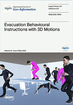
This study investigates how 3D motion—such as low crawling and climbing up/down—influences evacuation efficiency in indoor environments. Using a simulation method that combines a voxel-based 3D indoor model with an agent-based model, three use cases are examined, reflecting diverse building types, agent numbers, urgency levels, and demographic characteristics. The results indicate that 3D motion may reduce congestion by enabling alternative paths; however, it could also lead to exit bottlenecks under high urgency and density. As urgency and agent numbers increase, differences in the evacuation efficiency between scenarios with and without 3D motion may diminish. The findings suggest the conditional use of 3D motion across different buildings and recommend tailored instructions for diverse demographic groups. View this paper
- Issues are regarded as officially published after their release is announced to the table of contents alert mailing list.
- You may sign up for e-mail alerts to receive table of contents of newly released issues.
- PDF is the official format for papers published in both, html and pdf forms. To view the papers in pdf format, click on the "PDF Full-text" link, and use the free Adobe Reader to open them.
Previous Issue
Next Issue