Skip to Content
You are currently on the new version of our website. Access the old version .

ISPRS International Journal of Geo-Information, Volume 7, Issue 5

2018 May - 38 articles

Cover Story: 
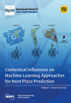
Deriving generalizable methodological recommendations for machine learning methods that incorporate contextual data in order to predict the next places that people will travel to is often difficult, since they use different datasets, methods for discretizing space, scales of prediction, algorithms, and context data, and therefore lack comparability. This work predicts next places based on a single trajectory dataset, but by systematically varying prediction algorithms, methods for space discretization, scales of prediction, and incorporated context data. We found that the prediction accuracy showed a varying dependency on the method of space discretization and the incorporated contextual factors at different spatial scales. Our study thus aims to provide insights into the individual and combinatory effects of model parameters and algorithms on the next place prediction accuracy. View the paper here.
  • Issues are regarded as officially published after their release is announced to the table of contents alert mailing list .
  • You may sign up for email alerts to receive table of contents of newly released issues.
  • PDF is the official format for papers published in both, html and pdf forms. To view the papers in pdf format, click on the "PDF Full-text" link, and use the free Adobe Reader to open them.

Articles (38)

  • Article
  • Open Access
20 Citations
6,547 Views
21 Pages

Suitability evaluation of urban construction land is critical for both urban master planning and the proper utilization of land resources. Using the Beihu New District of Jining City, China, as a case study, this paper introduces a novel research app...

  • Article
  • Open Access
53 Citations
9,868 Views
17 Pages

Population density and distribution of services represents the growth and demographic shift of the cities. For urban planners, population density and check-in behavior in space and time are vital factors for planning and development of sustainable ci...

  • Article
  • Open Access
14 Citations
5,369 Views
13 Pages

2D Cartography Training: Has the Time Come for a Paradigm Shift?

  • Carlos Carbonell-Carrera,
  • Allison J. Jaeger and
  • Thomas F. Shipley

2D maps with contour lines can be difficult for students to visualize in three-dimensions to interpret relief. Despite this challenge, teaching based on 2D contour lines is still used, which could generate frustration/motivation problems among studen...

  • Article
  • Open Access
25 Citations
6,936 Views
24 Pages

A Formalized 3D Geovisualization Illustrated to Selectivity Purpose of Virtual 3D City Model

  • Romain Neuville,
  • Jacynthe Pouliot,
  • Florent Poux,
  • Laurent De Rudder and
  • Roland Billen

Virtual 3D city models act as valuable central information hubs supporting many aspects of cities, from management to planning and simulation. However, we noted that 3D city models are still underexploited and believe that this is partly due to ineff...

  • Article
  • Open Access
13 Citations
5,010 Views
19 Pages

Nonnegative matrix factorization (NMF) is a blind source separation (BSS) method often used in hyperspectral unmixing. However, it tends to converge to a local optimum. To overcome this limitation, we present a simple, but effective endmember initial...

  • Article
  • Open Access
27 Citations
6,892 Views
25 Pages

Evaluation of the Cartographical Quality of Urban Plans by Eye-Tracking

  • Jaroslav Burian,
  • Stanislav Popelka and
  • Marketa Beitlova

This paper describes a study of the evaluation of cartographic quality of urban plans in the Czech Republic using eye-tracking. Although map visualization is a crucial part of the urban planning process, only a few studies have focused on the evaluat...

  • Article
  • Open Access
18 Citations
5,135 Views
13 Pages

Implementation of a Parallel GPU-Based Space-Time Kriging Framework

  • Yueheng Zhang,
  • Xinqi Zheng,
  • Zhenhua Wang,
  • Gang Ai and
  • Qing Huang

In the study of spatiotemporal geographical phenomena, the space–time interpolation method is widely applied, and the demands for computing speed and accuracy are increasing. For nonprofessional modelers, utilizing the space–time interpol...

  • Article
  • Open Access
32 Citations
11,245 Views
20 Pages

Supporting Facility Management Processes through End-Users’ Integration and Coordinated BIM-GIS Technologies

  • Claudio Mirarchi,
  • Alberto Pavan,
  • Francesco De Marco,
  • Xiangyu Wang and
  • Yongze Song

The integration of facility management and building information modelling (BIM) is an innovative and critical undertaking process to support facility maintenance and management. Even though recent research has proposed various methods and performed a...

  • Article
  • Open Access
15 Citations
5,175 Views
21 Pages

A Smartphone-Based System for Outdoor Data Gathering Using a Wireless Beacon Network and GPS Data: From Cyber Spaces to Senseable Spaces

  • Eneko Osaba,
  • Roberto Pierdicca,
  • Eva Savina Malinverni,
  • Anna Khromova,
  • Fernando J. Álvarez and
  • Alfonso Bahillo

Information and Communication Technologies (ICTs) and mobile devices are deeply influencing all facets of life, directly affecting the way people experience space and time. ICTs are also tools for supporting urban development, and they have also been...

  • Article
  • Open Access
11 Citations
8,368 Views
16 Pages

Mobile social networking services provide efficient and easy communication, enabling users to create, retrieve and disseminate messages on the go while making their messages widely available. Despite growing evidence suggesting that geographic locati...

  • Article
  • Open Access
39 Citations
9,369 Views
16 Pages

hackAIR: Towards Raising Awareness about Air Quality in Europe by Developing a Collective Online Platform

  • Evangelos Kosmidis,
  • Panagiota Syropoulou,
  • Stavros Tekes,
  • Philipp Schneider,
  • Eleftherios Spyromitros-Xioufis,
  • Marina Riga,
  • Polychronis Charitidis,
  • Anastasia Moumtzidou,
  • Symeon Papadopoulos and
  • Georgia Alexandri
  • + 7 authors

Although air pollution is one of the most significant environmental factors posing a threat to human health worldwide, air quality data are scarce or not easily accessible in most European countries. The current work aims to develop a centralized air...

  • Article
  • Open Access
3 Citations
3,689 Views
19 Pages

This paper describes the comprehensive analysis of system calibration between an optical camera and a range finder. The results suggest guidelines for accurate and efficient system calibration enabling high-quality data fusion. First, self-calibratio...

  • Article
  • Open Access
17 Citations
10,291 Views
23 Pages

Geographic Prevalence and Mix of Regional Cuisines in Chinese Cities

  • Jingwei Zhu,
  • Yang Xu,
  • Zhixiang Fang,
  • Shih-Lung Shaw and
  • Xingjian Liu

Previous research on the geographies of food put a considerable focus on analyzing how different types of food or ingredients are consumed across different places. Little is known, however, about how food culture is manifested through various cooking...

  • Article
  • Open Access
20 Citations
6,524 Views
18 Pages

The way in which risk maps are used in decision support processes for spatial planning at local scale is critical to helping decision makers in the definition of a prevention strategy to minimize risks. This paper presents a spatial decision support...

  • Article
  • Open Access
6 Citations
7,460 Views
11 Pages

Allocation of Tutors and Study Centers in Distance Learning Using Geospatial Technologies

  • Shahid Nawaz Khan,
  • Kamran Mir,
  • Ali Tahir,
  • Arshad Awan,
  • Zaib Un Nisa and
  • Syeda Areeba Gillani

Allama Iqbal Open University (AIOU) is Pakistan’s largest distance learning institute, providing education to 1.4 million students. This is a fairly large setup across a country where students are highly geographically distributed. Currently, the sys...

  • Article
  • Open Access
9 Citations
5,826 Views
19 Pages

The Quasi-Zenith Satellite System (QZSS) service area covers the Asia-Pacific region and there are four quasi-zenith satellites (QZS) in orbit with three QZS in operation until March 2018. The QZSS is not required to work in a stand-alone mode, but t...

  • Article
  • Open Access
10 Citations
4,608 Views
20 Pages

Currently, huge quantities of remote sensing images (RSIs) are becoming available. Nevertheless, the scarcity of labeled samples hinders the semantic understanding of RSIs. Fortunately, many ground-level image datasets with detailed semantic annotati...

  • Article
  • Open Access
11 Citations
5,832 Views
19 Pages

2DPR-Tree: Two-Dimensional Priority R-Tree Algorithm for Spatial Partitioning in SpatialHadoop

  • Ahmed Elashry,
  • Abdulaziz Shehab,
  • Alaa M. Riad and
  • Ahmed Aboul-Fotouh

Among spatial information applications, SpatialHadoop is one of the most important systems for researchers. Broad analyses prove that SpatialHadoop outperforms the traditional Hadoop in managing distinctive spatial information operations. This paper...

  • Article
  • Open Access
11 Citations
6,824 Views
15 Pages

A Low-Cost Collaborative Location Scheme with GNSS and RFID for the Internet of Things

  • Changfeng Jing,
  • Shouqing Wang,
  • Mingshu Wang,
  • Mingyi Du,
  • Lei Zhou,
  • Tiancheng Sun and
  • Jian Wang

The emergence and development of the Internet of Things (IoT) has attracted growing attention to low-cost location systems when facing the dramatically increased number of public infrastructure assets in smart cities. Various radio frequency identifi...

  • Article
  • Open Access
83 Citations
8,584 Views
16 Pages

Multilevel Cloud Detection for High-Resolution Remote Sensing Imagery Using Multiple Convolutional Neural Networks

  • Yang Chen,
  • Rongshuang Fan,
  • Muhammad Bilal,
  • Xiucheng Yang,
  • Jingxue Wang and
  • Wei Li

In high-resolution image data, multilevel cloud detection is a key task for remote sensing data processing. Generally, it is difficult to obtain high accuracy for multilevel cloud detection when using satellite imagery which only contains visible and...

  • Article
  • Open Access
22 Citations
5,696 Views
13 Pages

Urban agglomeration has become the predominant form of urbanization in China. In this process, spatial interaction evidently played a significant role in promoting the collaborative development of these correlated cities. The traditional urban model&...

  • Article
  • Open Access
11 Citations
7,717 Views
24 Pages

Agent-Based Modeling of Taxi Behavior Simulation with Probe Vehicle Data

  • Saurav Ranjit,
  • Apichon Witayangkurn,
  • Masahiko Nagai and
  • Ryosuke Shibasaki

Taxi behavior is a spatial–temporal dynamic process involving discrete time dependent events, such as customer pick-up, customer drop-off, cruising, and parking. Simulation models, which are a simplification of a real-world system, can help und...

  • Article
  • Open Access
14 Citations
7,431 Views
21 Pages

Points of interest (POIs) such as stores, gas stations, and parking lots are particularly important for maps. Using gas station as a case study, this paper proposed a novel approach to enhance POI information using low-frequency vehicle trajectory da...

  • Article
  • Open Access
61 Citations
8,273 Views
24 Pages

Texture features based on the gray-level co-occurrence matrix (GLCM) can effectively improve classification accuracy in geographical analyses of optical remote sensing (RS) images, with the parameters of scale of the GLCM texture window greatly affec...

  • Article
  • Open Access
26 Citations
4,614 Views
15 Pages

Land-cover changes are driven by different combinations of biophysical, economic, and cultural drivers that are acting at different scales. We aimed to (1) analyze trends in land use and land cover changes (conversion, abandonment, forest persistence...

  • Article
  • Open Access
36 Citations
7,777 Views
18 Pages

Coupling Traditional Monitoring and Citizen Science to Disentangle the Invasion of Halyomorpha halys

  • Robert Malek,
  • Clara Tattoni,
  • Marco Ciolli,
  • Stefano Corradini,
  • Daniele Andreis,
  • Aya Ibrahim,
  • Valerio Mazzoni,
  • Anna Eriksson and
  • Gianfranco Anfora

The brown marmorated stink bug, Halyomorpha halys Stål (Hemiptera: Pentatomidae), is an invasive pest that has expanded its range outside of its original confinements in Eastern Asia, spreading through the United States, Canada and most of the...

  • Article
  • Open Access
10 Citations
4,990 Views
19 Pages

Optimal Route Searching with Multiple Dynamical Constraints—A Geometric Algebra Approach

  • Dongshuang Li,
  • Zhaoyuan Yu,
  • Wen Luo,
  • Yong Hu,
  • Xiaoyu Che and
  • Linwang Yuan

The process of searching for a dynamic constrained optimal path has received increasing attention in traffic planning, evacuation, and personalized or collaborative traffic service. As most existing multiple constrained optimal path (MCOP) methods ca...

  • Article
  • Open Access
16 Citations
5,270 Views
17 Pages

Stakeholder Specific Multi-Scale Spatial Representation of Urban Building-Stocks

  • Magnus Österbring,
  • Liane Thuvander,
  • Érika Mata and
  • Holger Wallbaum

Urban building-stocks use a significant amount of resources and energy. At the same time, they have a large potential for energy efficiency measures (EEM). To support decision-making and planning, spatial building-stock models are used to examine the...

  • Article
  • Open Access
39 Citations
8,526 Views
20 Pages

In this paper, we develop a synthetic population as the first step in implementing an integrated land use/transport model. The model is agent-based, where every household, person, dwelling, and job is treated as an individual object. Therefore, detai...

  • Article
  • Open Access
15 Citations
7,643 Views
18 Pages

Obstacles and Opportunities of Using a Mobile App for Marine Mammal Research

  • Courtney H. Hann,
  • Lei Lani Stelle,
  • Andrew Szabo and
  • Leigh G. Torres

This study investigates the use of a mobile application, Whale mAPP, as a citizen science tool for collecting marine mammal sighting data. In just over three months, 1261 marine mammal sightings were observed and recorded by 39 citizen scientists in...

  • Article
  • Open Access
129 Citations
14,530 Views
16 Pages

The goal of this study is to analyse the predictive performance of the random forest machine learning technique in comparison to commonly used hedonic models based on multiple regression for the prediction of apartment prices. A data set that include...

  • Feature Paper
  • Article
  • Open Access
13 Citations
5,503 Views
24 Pages

For next place prediction, machine learning methods which incorporate contextual data are frequently used. However, previous studies often do not allow deriving generalizable methodological recommendations, since they use different datasets, methods...

  • Article
  • Open Access
43 Citations
8,484 Views
15 Pages

Bogor as one of the satellite cities of Jakarta Metropolitan experiences rapid population growth and urban development. The urban landscape that is changed by urban development affects the city expansion, the increase of land surface temperature (LST...

  • Article
  • Open Access
19 Citations
5,363 Views
23 Pages

Rapidly growing GPS (Global Positioning System) trajectories hide much valuable information, such as city road planning, urban travel demand, and population migration. In order to mine the hidden information and to capture better clustering results,...

  • Article
  • Open Access
24 Citations
7,223 Views
13 Pages

In this paper, we demonstrate three unique use cases of LiDAR data and processing, which can be implemented in an urban metropolis to determine the challenges that are associated with climate change. LiDAR data for the City of Toronto were collected...

  • Article
  • Open Access
28 Citations
7,552 Views
22 Pages

This study introduces the BIM (building information modeling)-GIS (geographic information system) conceptual mapping (B2GM) standard ISO N19166 and proposes a mapping mechanism. In addition, the major issues concerning BIM-GIS integration, and the co...

  • Article
  • Open Access
10 Citations
9,517 Views
15 Pages

The extraction of terrain feature lines is an important yet challenging problem in the processing and usage of contour lines. Most research has focused on identifying terrain feature points by using methods such as the Douglas–Peucker (D–...

Get Alerted

Add your email address to receive forthcoming issues of this journal.

XFacebookLinkedIn
ISPRS Int. J. Geo-Inf. - ISSN 2220-9964