

ISPRS Int. J. Geo-Inf., Volume 12, Issue 9 (September 2023) – 39 articles
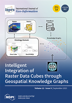
Cover Story (view full-size image):
The intelligent integration of earth observation (EO) data, primarily represented in the form of raster data cubes using knowledge graphs (KGs), plays a crucial role in managing geospatial data heterogeneity and enhancing semantics. This paper introduces a framework that conceptually defines a semantic model for raster data cubes, extending GeoSPARQL ontology. This model combines raster data cube semantics with feature-based geometry and spatial relationships, enabling spatiotemporal queries using SPARQL through ontological concepts. The implementation of this framework involves virtual querying, which refers to dynamically constructing the geospatial knowledge graph during the querying process. This approach eliminates the need to pre-translate all data into a KG, thereby reducing redundancy and cutting storage and processing costs. View this paper
- Issues are regarded as officially published after their release is announced to the table of contents alert mailing list.
- You may sign up for e-mail alerts to receive table of contents of newly released issues.
- PDF is the official format for papers published in both, html and pdf forms. To view the papers in pdf format, click on the "PDF Full-text" link, and use the free Adobe Reader to open them.
Previous Issue
Next Issue