Skip Content
You are currently on the new version of our website. Access the old version .

Remote Sensing, Volume 13, Issue 4

2021 February-2 - 292 articles

Cover Story: 
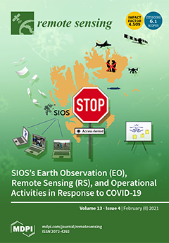
The COVID-19 pandemic has impacted polar research in many ways since the start of 2020, including cancellation of field campaigns, cancellation and/or postponement of important conferences, workshops, and training courses, delays in delivery of scientific outputs because of shutdown of campuses, cancellations and/or delay in funding and many more. Further, field campaigns to Svalbard are expected to remain severely affected in 2021. In response to the changing situation, SIOS initiated several operational activities suitable to mitigate new challenges resulting from the pandemic. The paper provides an extensive overview of EO, RS and other operational activities developed in response to COVID-19. It is probably the first attempt to highlight the role of EO and RS in mitigating the damage in terms of possible data gaps in long time data series of scientific observations in one of the most remote places on planet Earth.View this paper
  • Issues are regarded as officially published after their release is announced to the table of contents alert mailing list .
  • You may sign up for email alerts to receive table of contents of newly released issues.
  • PDF is the official format for papers published in both, html and pdf forms. To view the papers in pdf format, click on the "PDF Full-text" link, and use the free Adobe Reader to open them.

Articles (292)

  • Article
  • Open Access
8 Citations
3,797 Views
16 Pages

23 February 2021

The joint CloudSat–Cloud-Aerosol Lidar and Infrared Pathfinder Satellite Observation (CALIPSO) climatology remains the only dataset that provides a global, vertically-resolved cloud amount statistic. However, data are affected by uncertainty that is...

  • Review
  • Open Access
210 Citations
24,073 Views
41 Pages

23 February 2021

Availability of very high-resolution remote sensing images and advancement of deep learning methods have shifted the paradigm of image classification from pixel-based and object-based methods to deep learning-based semantic segmentation. This shift d...

  • Article
  • Open Access
5 Citations
3,374 Views
18 Pages

Mapping Woody Volume of Mediterranean Forests by Using SAR and Machine Learning: A Case Study in Central Italy

  • Emanuele Santi,
  • Marta Chiesi,
  • Giacomo Fontanelli,
  • Alessandro Lapini,
  • Simonetta Paloscia,
  • Simone Pettinato,
  • Giuliano Ramat and
  • Leonardo Santurri

23 February 2021

In this paper, multi-frequency synthetic aperture radar (SAR) data at L- and C-bands (ALOS PALSAR and Envisat/ASAR) were used to estimate forest biomass in Tuscany, in Central Italy. The ground measurements of woody volume (WV, in m3/ha), which can b...

  • Article
  • Open Access
17 Citations
4,646 Views
24 Pages

Beamforming of LOFAR Radio-Telescope for Passive Radiolocation Purposes

  • Aleksander Droszcz,
  • Konrad Jędrzejewski,
  • Julia Kłos,
  • Krzysztof Kulpa and
  • Mariusz Pożoga

23 February 2021

This paper presents the results of investigations on the beamforming of a low-frequency radio-telescope LOFAR which can be used as a receiver in passive coherent location (PCL) radars for aerial and space object detection and tracking. The use of a L...

  • Article
  • Open Access
14 Citations
4,333 Views
28 Pages

23 February 2021

The variability in sea surface salinity (SSS) on different time scales plays an important role in associated oceanic or climate processes. In this study, we compare the SSS on sub-annual, annual, and interannual time scales among ten datasets, includ...

  • Article
  • Open Access
44 Citations
11,281 Views
24 Pages

Rangeland Fractional Components Across the Western United States from 1985 to 2018

  • Matthew Rigge,
  • Collin Homer,
  • Hua Shi,
  • Debra Meyer,
  • Brett Bunde,
  • Brian Granneman,
  • Kory Postma,
  • Patrick Danielson,
  • Adam Case and
  • George Xian

23 February 2021

Monitoring temporal dynamics of rangelands to detect and understand change in vegetation cover and composition provides a wealth of information to improve management and sustainability. Remote sensing allows the evaluation of both abrupt and gradual...

  • Article
  • Open Access
10 Citations
3,904 Views
33 Pages

23 February 2021

Target detection on the sea-surface has always been a high-profile problem, and the detection of weak targets is one of the most difficult problems and the key issue under this problem. Traditional techniques, such as imaging, cannot effectively dete...

  • Article
  • Open Access
39 Citations
7,187 Views
19 Pages

InSAR Monitoring of Landslide Activity in Dominica

  • Mary-Anne Fobert,
  • Vern Singhroy and
  • John G. Spray

23 February 2021

Dominica is a geologically young, volcanic island in the eastern Caribbean. Due to its rugged terrain, substantial rainfall, and distinct soil characteristics, it is highly vulnerable to landslides. The dominant triggers of these landslides are hurri...

  • Article
  • Open Access
69 Citations
17,024 Views
28 Pages

Landsat and Sentinel-2 Based Burned Area Mapping Tools in Google Earth Engine

  • Ekhi Roteta,
  • Aitor Bastarrika,
  • Magí Franquesa and
  • Emilio Chuvieco

23 February 2021

Four burned area tools were implemented in Google Earth Engine (GEE), to obtain regular processes related to burned area (BA) mapping, using medium spatial resolution sensors (Landsat and Sentinel-2). The four tools are (i) the BA Cartography tool fo...

  • Article
  • Open Access
34 Citations
8,264 Views
23 Pages

Upscaling Northern Peatland CO2 Fluxes Using Satellite Remote Sensing Data

  • Sofia Junttila,
  • Julia Kelly,
  • Natascha Kljun,
  • Mika Aurela,
  • Leif Klemedtsson,
  • Annalea Lohila,
  • Mats B. Nilsson,
  • Janne Rinne,
  • Eeva-Stiina Tuittila and
  • Lars Eklundh
  • + 2 authors

23 February 2021

Peatlands play an important role in the global carbon cycle as they contain a large soil carbon stock. However, current climate change could potentially shift peatlands from being carbon sinks to carbon sources. Remote sensing methods provide an oppo...

  • Article
  • Open Access
26 Citations
6,168 Views
36 Pages

23 February 2021

The World Health Organization has reported that the number of worldwide urban residents is expected to reach 70% of the total world population by 2050. In the face of challenges brought about by the demographic transition, there is an urgent need to...

  • Article
  • Open Access
4 Citations
3,152 Views
19 Pages

TNNG: Total Nuclear Norms of Gradients for Hyperspectral Image Prior

  • Ryota Yuzuriha,
  • Ryuji Kurihara,
  • Ryo Matsuoka and
  • Masahiro Okuda

23 February 2021

We introduce a novel regularization function for hyperspectral image (HSI), which is based on the nuclear norms of gradient images. Unlike conventional low-rank priors, we achieve a gradient-based low-rank approximation by minimizing the sum of nucle...

  • Technical Note
  • Open Access
9 Citations
3,060 Views
16 Pages

23 February 2021

This paper presents a composite kernel method (MWASCK) based on multiscale weighted adjacent superpixels (ASs) to classify hyperspectral image (HSI). The MWASCK adequately exploits spatial-spectral features of weighted adjacent superpixels to guarant...

  • Article
  • Open Access
13 Citations
4,175 Views
20 Pages

23 February 2021

Equivalent water thickness (EWT) is a major indicator for indirect monitoring of leaf water content in remote sensing. Many vegetation indices (VIs) have been proposed to estimate EWT based on passive or active reflectance spectra. However, the selec...

  • Article
  • Open Access
7 Citations
4,395 Views
14 Pages

Diurnal Cycle of Passive Microwave Brightness Temperatures over Land at a Global Scale

  • Zahra Sharifnezhad,
  • Hamid Norouzi,
  • Satya Prakash,
  • Reginald Blake and
  • Reza Khanbilvardi

23 February 2021

Satellite-borne passive microwave radiometers provide brightness temperature (TB) measurements in a large spectral range which includes a number of frequency channels and generally two polarizations: horizontal and vertical. These TBs are widely used...

  • Article
  • Open Access
30 Citations
5,153 Views
27 Pages

Interdecadal Changes in Aerosol Optical Depth over Pakistan Based on the MERRA-2 Reanalysis Data during 1980–2018

  • Rehana Khan,
  • Kanike Raghavendra Kumar,
  • Tianliang Zhao,
  • Waheed Ullah and
  • Gerrit de Leeuw

23 February 2021

The spatiotemporal evolution and trends in aerosol optical depth (AOD) over environmentally distinct regions in Pakistan are investigated for the period 1980–2018. The AOD data for this period was obtained from the Modern-era retrospective analysis f...

  • Article
  • Open Access
1 Citations
3,164 Views
16 Pages

23 February 2021

Since the traditional real-time kinematic positioning method is limited by the reduced satellite visibility from the deprived navigational environments, we, therefore, propose an improved RTK method with multiple rover receivers sharing a common cloc...

  • Article
  • Open Access
25 Citations
6,853 Views
29 Pages

The SARSense Campaign: Air- and Space-Borne C- and L-Band SAR for the Analysis of Soil and Plant Parameters in Agriculture

  • David Mengen,
  • Carsten Montzka,
  • Thomas Jagdhuber,
  • Anke Fluhrer,
  • Cosimo Brogi,
  • Stephani Baum,
  • Dirk Schüttemeyer,
  • Bagher Bayat,
  • Heye Bogena and
  • Harry Vereecken
  • + 13 authors

23 February 2021

With the upcoming L-band Synthetic Aperture Radar (SAR) satellite mission Radar Observing System for Europe L-band SAR (ROSE-L) and its integration into existing C-band satellite missions such as Sentinel-1, multi-frequency SAR observations with high...

  • Article
  • Open Access
10 Citations
4,677 Views
14 Pages

23 February 2021

The environmental impact of shale energy development is a growing concern in the US and worldwide. Although the topic is well-studied in general, shale development’s impact on drylands has received much less attention in the literature. This study fo...

  • Article
  • Open Access
33 Citations
7,278 Views
18 Pages

23 February 2021

This study investigates the applicability of Satellite Precipitation Products (SPPs) in near real-time for the simulation of sub-daily runoff in the Vilcanota River basin, located in the southeastern Andes of Peru. The data from rain gauge stations a...

  • Article
  • Open Access
26 Citations
5,633 Views
19 Pages

23 February 2021

Hyperspectral image (HSI) is easily corrupted by different kinds of noise, such as stripes, dead pixels, impulse noise, Gaussian noise, etc. Due to less consideration of the structural specificity of stripes, many existing HSI denoising methods canno...

  • Article
  • Open Access
15 Citations
5,889 Views
16 Pages

Tracking the Evolution of Riverbed Morphology on the Basis of UAV Photogrammetry

  • Teresa Gracchi,
  • Guglielmo Rossi,
  • Carlo Tacconi Stefanelli,
  • Luca Tanteri,
  • Rolando Pozzani and
  • Sandro Moretti

23 February 2021

Unmanned aerial vehicle (UAV) photogrammetry has recently become a widespread technique to investigate and monitor the evolution of different types of natural processes. Fluvial geomorphology is one of such fields of application where UAV potentially...

  • Article
  • Open Access
11 Citations
4,804 Views
19 Pages

23 February 2021

Factors influencing the accuracy of UAV-photogrammetry-based snow depth distribution maps were investigated. First, UAV-based surveys were performed on the 0.04 km2 snow-covered study site in South Korea for 37 times over the period of 13 days under...

  • Article
  • Open Access
8 Citations
4,260 Views
30 Pages

Monitoring the Efficacy of Crested Floatingheart (Nymphoides cristata) Management with Object-Based Image Analysis of UAS Imagery

  • Adam R. Benjamin,
  • Amr Abd-Elrahman,
  • Lyn A. Gettys,
  • Hartwig H. Hochmair and
  • Kyle Thayer

23 February 2021

This study investigates the use of unmanned aerial systems (UAS) mapping for monitoring the efficacy of invasive aquatic vegetation (AV) management on a floating-leaved AV species, Nymphoides cristata (CFH). The study site consists of 48 treatment pl...

  • Article
  • Open Access
29 Citations
7,515 Views
19 Pages

Landsat 8 OLI Broadband Albedo Validation in Antarctica and Greenland

  • Giacomo Traversa,
  • Davide Fugazza,
  • Antonella Senese and
  • Massimo Frezzotti

22 February 2021

The albedo is a fundamental component of the processes that govern the energy budget, and particularly important in the context of climate change. However, a satellite-based high-resolution (30 m) albedo product which can be used in the polar regions...

  • Article
  • Open Access
39 Citations
5,486 Views
11 Pages

Wind Effects for Floating Algae Dynamics in Eutrophic Lakes

  • Yuchao Zhang,
  • Steven Loiselle,
  • Kun Shi,
  • Tao Han,
  • Min Zhang,
  • Minqi Hu,
  • Yuanyuan Jing,
  • Lai Lai and
  • Pengfei Zhan

22 February 2021

Wind-speed decline is an important impact of climate change on the eastern Asian atmospheric circulation. Although wind does not determine algae biomass in eutrophic lakes, it is a decisive factor in the formation and severity of algae blooms. Based...

  • Article
  • Open Access
11 Citations
3,664 Views
19 Pages

Identification of Abandoned Jujube Fields Using Multi-Temporal High-Resolution Imagery and Machine Learning

  • Xingrong Li,
  • Chenghai Yang,
  • Hongri Zhang,
  • Panpan Wang,
  • Jia Tang,
  • Yanqin Tian and
  • Qing Zhang

22 February 2021

The jujube industry plays a very important role in the agricultural industrial structure of Xinjiang, China. In recent years, the abandonment of jujube fields has gradually emerged. It is critical to inventory the abandoned land soon after it is gene...

  • Article
  • Open Access
22 Citations
4,564 Views
17 Pages

Study and Evolution of the Dune Field of La Banya Spit in Ebro Delta (Spain) Using LiDAR Data and GPR

  • Inmaculada Rodríguez-Santalla,
  • David Gomez-Ortiz,
  • Tomás Martín-Crespo,
  • María José Sánchez-García,
  • Isabel Montoya-Montes,
  • Silvia Martín-Velázquez,
  • Fernando Barrio,
  • Jordi Serra,
  • Juan Miguel Ramírez-Cuesta and
  • Francisco Javier Gracia

22 February 2021

La Banya spit, located at the south of the River Ebro Delta, is a sandy formation, developed by annexation of bars forming successive beach ridges, which are oriented and modeled by the eastern and southern waves. The initial ridges run parallel to t...

  • Article
  • Open Access
30 Citations
6,673 Views
16 Pages

UAV Based Estimation of Forest Leaf Area Index (LAI) through Oblique Photogrammetry

  • Lingchen Lin,
  • Kunyong Yu,
  • Xiong Yao,
  • Yangbo Deng,
  • Zhenbang Hao,
  • Yan Chen,
  • Nankun Wu and
  • Jian Liu

22 February 2021

As a key canopy structure parameter, the estimation method of the Leaf Area Index (LAI) has always attracted attention. To explore a potential method to estimate forest LAI from 3D point cloud at low cost, we took photos from different angles of the...

  • Communication
  • Open Access
29 Citations
5,112 Views
13 Pages

Modeling Transpiration with Sun-Induced Chlorophyll Fluorescence Observations via Carbon-Water Coupling Methods

  • Huaize Feng,
  • Tongren Xu,
  • Liangyun Liu,
  • Sha Zhou,
  • Jingxue Zhao,
  • Shaomin Liu,
  • Ziwei Xu,
  • Kebiao Mao,
  • Xinlei He and
  • Linna Chai
  • + 1 author

22 February 2021

Successfully applied in the carbon research area, sun-induced chlorophyll fluorescence (SIF) has raised the interest of researchers from the water research domain. However, current works focused on the empirical relationship between SIF and plant tra...

  • Article
  • Open Access
7 Citations
3,994 Views
25 Pages

Intraday Variation Mapping of Population Age Structure via Urban-Functional-Region-Based Scaling

  • Yuncong Zhao,
  • Yuan Zhang,
  • Hongyan Wang,
  • Xin Du,
  • Qiangzi Li and
  • Jiong Zhu

22 February 2021

The spatial distribution of the population is uneven for various reasons, such as urban-rural differences and geographical conditions differences. As the basic element of the natural structure of the population, the age structure composition of popul...

  • Article
  • Open Access
31 Citations
5,677 Views
30 Pages

Potential of Sentinel-1 C-Band Time Series to Derive Structural Parameters of Temperate Deciduous Forests

  • Moritz Bruggisser,
  • Wouter Dorigo,
  • Alena Dostálová,
  • Markus Hollaus,
  • Claudio Navacchi,
  • Stefan Schlaffer and
  • Norbert Pfeifer

22 February 2021

With the increasing occurrence of forest fires in the mid-latitudes and the alpine region, fire risk assessments become important in these regions. Fuel assessments involve the collection of information on forest structure as, e.g., the stand height...

  • Article
  • Open Access
33 Citations
4,809 Views
20 Pages

Single-Pass Soil Moisture Retrieval Using GNSS-R at L1 and L5 Bands: Results from Airborne Experiment

  • Joan Francesc Munoz-Martin,
  • Raul Onrubia,
  • Daniel Pascual,
  • Hyuk Park,
  • Miriam Pablos,
  • Adriano Camps,
  • Christoph Rüdiger,
  • Jeffrey Walker and
  • Alessandra Monerris

22 February 2021

Global Navigation Satellite System—Reflectometry (GNSS-R) has already proven its potential for retrieving a number of geophysical parameters, including soil moisture. However, single-pass GNSS-R soil moisture retrieval is still a challenge. This stud...

  • Article
  • Open Access
24 Citations
5,925 Views
23 Pages

Crop Biomass Mapping Based on Ecosystem Modeling at Regional Scale Using High Resolution Sentinel-2 Data

  • Liming He,
  • Rong Wang,
  • Georgy Mostovoy,
  • Jane Liu,
  • Jing M. Chen,
  • Jiali Shang,
  • Jiangui Liu,
  • Heather McNairn and
  • Jarrett Powers

22 February 2021

We evaluate the potential of using a process-based ecosystem model (BEPS) for crop biomass mapping at 20 m resolution over the research site in Manitoba, western Canada driven by spatially explicit leaf area index (LAI) retrieved from Sentinel-2 spec...

  • Article
  • Open Access
33 Citations
6,961 Views
39 Pages

21 February 2021

Over the last 50 years, countries across North Africa and the Middle East have seen a significant increase in dam construction which, notwithstanding their benefits, have endangered archaeological heritage. Archaeological surveys and salvage excavati...

  • Article
  • Open Access
25 Citations
5,819 Views
23 Pages

An In-Depth Assessment of the New BDS-3 B1C and B2a Signals

  • Qinghua Zhang,
  • Yongxing Zhu and
  • Zhengsheng Chen

21 February 2021

An in-depth and comprehensive assessment of new observations from BDS-3 satellites is presented, with the main focus on the Carrier-to-Noise density ratio (C/N0), the quality of code and carrier phase observations for B1C and B2a signal. The signal c...

  • Article
  • Open Access
23 Citations
6,228 Views
15 Pages

Estimations of Global Horizontal Irradiance and Direct Normal Irradiance by Using Fengyun-4A Satellite Data in Northern China

  • Dongyu Jia,
  • Jiajia Hua,
  • Liping Wang,
  • Yitao Guo,
  • Hong Guo,
  • Pingping Wu,
  • Min Liu and
  • Liwei Yang

21 February 2021

Accurate solar radiation estimation is very important for solar energy systems and is a precondition of solar energy utilization. Due to the rapid development of new energy sources, the demand for surface solar radiation estimation and observation ha...

  • Article
  • Open Access
7 Citations
3,773 Views
18 Pages

A Critical Analysis of Red Ceramic Blocks Roughness Estimation by 2D and 3D Methods

  • Daiana Cristina Metz Arnold,
  • Valéria Costa de Oliveira,
  • Claudio de Souza Kazmierczak,
  • Leandro Tonietto,
  • Camila Werner Menegotto,
  • Luiz Gonzaga,
  • Cristiano André da Costa and
  • Maurício Roberto Veronez

21 February 2021

The method of measuring the roughness of ceramic substrates is not consensual, with unsuccessful attempts to associate roughness with the adhesion of coatings because the ceramic blocks have different areas of contact, shapes, and dimensions of the r...

  • Article
  • Open Access
18 Citations
4,494 Views
17 Pages

21 February 2021

Remote sensing of atmospheric hydrogen fluoride (HF) is challenging because it has weak absorption signatures in the atmosphere and is surrounded by strong absorption lines from interfering gases. In this study, we first present a multi-year time ser...

  • Article
  • Open Access
49 Citations
6,562 Views
17 Pages

21 February 2021

Many post-fire on-site factors, including fire severity, management strategies, topography, and local climate, are concerns for forest managers and recovery ecologists to formulate forest vegetation recovery plans in response to climate change. We us...

  • Article
  • Open Access
17 Citations
3,273 Views
23 Pages

21 February 2021

BeiDou global navigation satellite system (BDS) began to provide positioning, navigation, and timing (PNT) services to global users officially on 31 July, 2020. BDS constellations consist of regional (BDS-2) and global navigation satellites (BDS-3)....

  • Article
  • Open Access
14 Citations
4,645 Views
22 Pages

21 February 2021

Solar-induced chlorophyll fluorescence (SIF) measured from space has shed light on the diagnosis of gross primary production (GPP) and has emerged as a promising way to quantify plant photosynthesis. The SCOPE model can explicitly simulate SIF and GP...

  • Article
  • Open Access
9 Citations
4,349 Views
23 Pages

Adjacent-Track InSAR Processing for Large-Scale Land Subsidence Monitoring in the Hebei Plain

  • Xi Li,
  • Li Yan,
  • Lijun Lu,
  • Guoman Huang,
  • Zheng Zhao and
  • Zechang Lu

21 February 2021

Large-scale land subsidence has threatened the safety of the Hebei Plain in China. For tens of thousands of square kilometers of the Hebei Plain, large-scale subsidence monitoring is still one of the most difficult problems to be solved. In this pape...

  • Article
  • Open Access
5 Citations
3,386 Views
24 Pages

21 February 2021

The locations and breathing signal of people in disaster areas are significant information for search and rescue missions in prioritizing operations to save more lives. For detecting the living people who are lying on the ground and covered with dust...

  • Technical Note
  • Open Access
34 Citations
6,196 Views
17 Pages

21 February 2021

Machine learning has been successfully used for object recognition within images. Due to the complexity of the spectrum and texture of construction and demolition waste (C&DW), it is difficult to construct an automatic identification method for C...

  • Article
  • Open Access
29 Citations
5,380 Views
18 Pages

20 February 2021

Simultaneous Localization and Mapping (SLAM) has always been the focus of the robot navigation for many decades and becomes a research hotspot in recent years. Because a SLAM system based on vision sensor is vulnerable to environment illumination and...

  • Article
  • Open Access
31 Citations
11,482 Views
30 Pages

20 February 2021

In this study, we used Landsat Earth observations and gridded weather data along with global soil datasets available in Google Earth Engine (GEE) to estimate crop yield at 30 m resolution. We implemented a remote sensing and evapotranspiration-based...

  • Article
  • Open Access
11 Citations
4,606 Views
22 Pages

20 February 2021

The west branch of Karayaylak Glacier (eastern Pamir Plateau) surged in May 2015, significantly impacting on local socio-economic development. This event was also of great significance for studies of surging glaciers. Using Sentinel-1 imagery analyze...

  • Article
  • Open Access
8 Citations
3,873 Views
20 Pages

20 February 2021

With the ongoing trend towards deep learning in the remote sensing community, classical pixel based algorithms are often outperformed by convolution based image segmentation algorithms. This performance was mostly validated spatially, by splitting tr...

  • Technical Note
  • Open Access
8 Citations
3,479 Views
16 Pages

Using Digital Photography to Track Understory Phenology in Mediterranean Cork Oak Woodlands

  • Catarina Jorge,
  • João M. N. Silva,
  • Joana Boavida-Portugal,
  • Cristina Soares and
  • Sofia Cerasoli

20 February 2021

Monitoring vegetation is extremely relevant in the context of climate change, and digital repeat photography is a method that has gained momentum due to a low cost–benefit ratio. This work aims to demonstrate the possibility of using digital cameras...

of 6

Get Alerted

Add your email address to receive forthcoming issues of this journal.

XFacebookLinkedIn
Remote Sens. - ISSN 2072-4292