Next Issue
Volume 12, October
Previous Issue
Volume 12, August


Land, Volume 12, Issue 9 (September 2023) – 175 articles

Cover Story (view full-size image): 
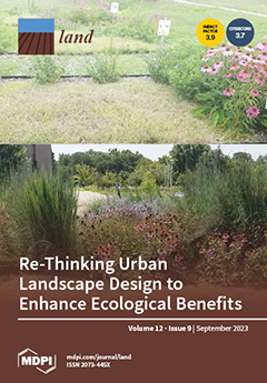
In this study, an interdisciplinary team of researchers and practitioners evaluate the impacts of designed landscapes on several environmental outcomes essential for urban sustainability. The results indicate that key landscape choices such as the selection of drought-tolerant plants and a diverse native plant palette can simultaneously enhance water conservation, increase resources for pollinators, and reduce maintenance impacts. Importantly, the designs that rated highly for visual quality were also those that supported other environmental benefits. In urban landscapes, aesthetic appeal is often a top priority, and these results indicate that visual quality does not need to be sacrificed to design landscapes that additionally support water conservation and provide resources for pollinators. View this paper
  • Issues are regarded as officially published after their release is announced to the table of contents alert mailing list.
  • You may sign up for e-mail alerts to receive table of contents of newly released issues.
  • PDF is the official format for papers published in both, html and pdf forms. To view the papers in pdf format, click on the "PDF Full-text" link, and use the free Adobe Reader to open them.
Order results
Result details
Section
Select all
Export citation of selected articles as:
16 pages, 6785 KiB  
Article
Delineation of Urban Development Boundary and Carbon Emission Effects in Xuzhou City, China
by Haitao Ji, Xiaoshun Li, Yiwei Geng, Xin Chen, Yuexiang Wang, Jumei Cheng and Zhuang Chen
Land 2023, 12(9), 1819; https://doi.org/10.3390/land12091819 - 21 Sep 2023
Viewed by 907
Abstract
Urban development boundary (UDB) has always served as a crucial aspect of urban sprawl research. The objective of this paper is to investigate boundary delineation and carbon emission effects. Firstly, we examined the patterns of land use changes. Additionally, this paper utilized the [...] Read more.
Urban development boundary (UDB) has always served as a crucial aspect of urban sprawl research. The objective of this paper is to investigate boundary delineation and carbon emission effects. Firstly, we examined the patterns of land use changes. Additionally, this paper utilized the FLUS model and land use carbon emission calculation model to delineate UDB and calculate carbon emission effects within UDB under typical scenarios. The research results are as follows: (1) Xuzhou city witnessed a significant increase in both forest land and construction land from 2010 to 2020. (2) Under the CPS, the area of cultivated land increased by 217.05 km2 compared to the NDS. The UDB area under the NDS and CPS was 971.50 km2 and 968.99 km2, respectively. (3) Compared to the NDS, the CPS led to a net carbon emission increase of 4759.93 t within the UDB. Therefore, we should enhance the carbon sequestration and emission reduction capacity of the agricultural system. This study is beneficial for expanding the depth of research on the UDB and guiding the low-carbon urban development. We sincerely encourage readers to download this paper to improve this paper. Full article
(This article belongs to the Special Issue Feature Papers for Land Systems and Global Change Section)
Show Figures

Figure 1

21 pages, 1003 KiB  
Article
Transit-Oriented Development in China: A Comparative Content Analysis of the Spatial Plans of High-Speed Railway Station Areas
by Biyue Wang, Martin de Jong, Ellen van Bueren, Aksel Ersoy and Yanchun Meng
Land 2023, 12(9), 1818; https://doi.org/10.3390/land12091818 - 21 Sep 2023
Viewed by 1487
Abstract
With rapid high-speed railway (HSR) developments in China, HSR-based transit-oriented development (TOD) has proliferated across the country. Although local governments claim that HSR station areas are planned according to TOD principles, some scholars argue that these station areas actually contribute to unsustainable development. [...] Read more.
With rapid high-speed railway (HSR) developments in China, HSR-based transit-oriented development (TOD) has proliferated across the country. Although local governments claim that HSR station areas are planned according to TOD principles, some scholars argue that these station areas actually contribute to unsustainable development. This study investigates two main questions: (1) what success factors should be included in a TOD plan for HSR station areas? (2) to what extent are these factors considered in the plans of Chinese HSR station areas? To answer these questions, we use content analysis to compare spatial plans for 15 HSR station areas across China, triangulating the findings via in-depth interviews and field investigations. This study reveals that most of the factors in the plans for HSR station areas deviate from TOD principles, especially in small- and medium-sized cities. We find that Chinese local governments mainly use TODs as a tool to promote suburban expansion around HSR stations. Full article
Show Figures

Figure 1

21 pages, 10778 KiB  
Article
The Role of “Nostalgia” in Environmental Restorative Effects from the Perspective of Healthy Aging: Taking Changchun Parks as an Example
by Tianjiao Yan, Hong Leng and Qing Yuan
Land 2023, 12(9), 1817; https://doi.org/10.3390/land12091817 - 21 Sep 2023
Viewed by 1442
Abstract
Aging and elderly health issues have always been the focus of attention, both within and outside the industry. With the introduction of the national “14th Five-Year Plan” for healthy aging, it is urgent to address how to implement this plan. Among them, the [...] Read more.
Aging and elderly health issues have always been the focus of attention, both within and outside the industry. With the introduction of the national “14th Five-Year Plan” for healthy aging, it is urgent to address how to implement this plan. Among them, the restorative environment is an important part of implementing healthy aging. For older adults, “nostalgia” is a common emotional experience, and “nostalgia therapy” is also commonly used for mental health recovery, which has important significance for healthy aging. However, although existing research on “nostalgia” has already involved local attachment and the environment, there are few studies that use space as a carrier in the context of environmental restorative effects. Therefore, from the perspective of healthy aging, combined with structural equation modeling, this study took four parks in Changchun City as examples to explore the role of “nostalgia” in the restorative effect of the park environment. It found that, firstly, both the “nostalgia inclination” influenced by individual conditions and the “landscape perception” influenced by landscape quality had a positive impact on the “nostalgia affection”; secondly, nostalgia affection and place attachment were important mediating factors for environmental restorative effects, and the pathways of “landscape perception → nostalgic affection → environmental restorative effects”, “landscape perception → place attachment → environmental restorative effects”, and “landscape perception → nostalgic affection → place attachment → environmental restorative effects” all existed. Based on the above path exploration, corresponding spatial optimization ideas for effectively improving the health level of older adults have been provided. Full article
Show Figures

Figure 1

15 pages, 1402 KiB  
Article
Does Labor Aging Inhibit Farmers’ Straw-Returning Behavior? Evidence from Rural Rice Farmers in Southwest China
by Wenfeng Zhou, Yan Yang, Jia He and Dingde Xu
Land 2023, 12(9), 1816; https://doi.org/10.3390/land12091816 - 21 Sep 2023
Viewed by 827
Abstract
As a typical green production technology, straw return affects environmental pollution control and waste recycling. However, in reality, farmers are not active in returning straw to the field. This study constructed a theoretical analysis of farmers’ straw-returning behavior under the conditions of labor [...] Read more.
As a typical green production technology, straw return affects environmental pollution control and waste recycling. However, in reality, farmers are not active in returning straw to the field. This study constructed a theoretical analysis of farmers’ straw-returning behavior under the conditions of labor aging, socialization service, and environmental regulation. Based on the survey data from 540 households in the Province of Sichuan, we empirically study the relationship between labor aging and farmers’ straw-returning behavior by using the binary logistic regression model and explore the moderating effects of socialization service and environmental regulation on labor aging and straw-returning behavior. The results show that: (1) Aging laborers in rural households constitute a higher proportion, accounting for 29% of the rural household labor force. However, there is limited enthusiasm among farmers to adopt straw returning to the field, with only 65% of farmers adopting this technology. (2) The labor aging hinders farmers’ straw-returning behavior. Specifically, under other fixed conditions, the behavior of straw returning decreases by 0.647 units when the labor aging increases by one unit. (3) Socialization services and economic incentives can mitigate the adverse effects of labor aging on straw-returning behavior, while mandatory constraints do not. (4) The heterogeneity analysis shows that labor aging has a stronger inhibitory effect on straw-returning behavior when the land scale of farmers is lower than the average level and the area is not plain. Full article
(This article belongs to the Section Land Socio-Economic and Political Issues)
Show Figures

Figure 1

22 pages, 1694 KiB  
Article
Planning for Socio-Ecological Conservation in South African Nature Reserves: Model of Influences on the Attitudes of Proximate Communities
by Dorothy Ruth Queiros
Land 2023, 12(9), 1815; https://doi.org/10.3390/land12091815 - 21 Sep 2023
Viewed by 936
Abstract
Conservation planning models need to be more inclusive, considering both social and ecological dimensions in order to achieve sustainable conservation. To do this, stakeholders need to understand the communities that border protected areas, which involves insight into attitudes. This research therefore aimed to [...] Read more.
Conservation planning models need to be more inclusive, considering both social and ecological dimensions in order to achieve sustainable conservation. To do this, stakeholders need to understand the communities that border protected areas, which involves insight into attitudes. This research therefore aimed to determine what influences the attitudes of local communities towards protected areas, culminating in a model. The research was conducted at three case study sites across South Africa, each involving a nature reserve and a proximate local community. Multiple qualitative methods were used to gather data from the local community and protected area staff around different aspects that influence attitudes. Following cross-case analysis, meta-themes were identified that formed the building blocks of the model and informed the accompanying practical recommendations regarding implementation thereof. The model outlines the centrality of relationships between local communities and park stakeholders, which are impacted by benefits, costs, facilitators and detractors. It also outlines how positive attitudes can be fostered through practical actions. As communities receive and perceive the benefits of living alongside wildlife, there is potential for positivity to improve while simultaneously achieving biodiversity conservation that is supported by the community. In line with adaptive management, users can test and adapt the model, continually aiming for conservation planning that is more community-based. Full article
(This article belongs to the Special Issue Modeling Biodiversity and Landscape Conservation Planning)
Show Figures

Figure 1

30 pages, 6906 KiB  
Article
Quantitative Evaluation of China’s Central-Level Land Consolidation Policies in the Past Forty Years Based on the Text Analysis and PMC-Index Model
by Guodong Huang, Xiaoqiang Shen, Xiaobin Zhang and Wei Gu
Land 2023, 12(9), 1814; https://doi.org/10.3390/land12091814 - 21 Sep 2023
Cited by 1 | Viewed by 878
Abstract
After nearly forty years of development, China’s land consolidation policies (CLCP) have become an important tool for promoting rural revitalization and sustainable development. However, as a major land management policy, there is still a lack of quantitative evaluation research on its text. This [...] Read more.
After nearly forty years of development, China’s land consolidation policies (CLCP) have become an important tool for promoting rural revitalization and sustainable development. However, as a major land management policy, there is still a lack of quantitative evaluation research on its text. This paper establishes an evaluation system for CLCP using text analysis and the PMC-Index model. Based on a reasonable definition of the connotation of land consolidation, this paper collects 313 related policies issued by China’s central government from 1982 to 2022, using text analysis to sort out the characteristics of issuance time, policy types, issuing institutions, and cooperation networks. By combining the outcomes of text mining with the previous research results to set evaluation indicators for the PMC-Index model, it distinguishes between comprehensive policies and specialized policies and separately evaluates them. Then, the PMC-Surface is established to clearly display the calculation results. The results show that the evaluation scores of comprehensive policies and specialized policies showed an upward trend over time. This indicates that the content of CLCP is constantly being enriched and expanded. The evaluation scores for different dimensions of comprehensive policies are relatively balanced, whereas there are significant differences in the evaluation scores of various dimensions of specialized policies. Both comprehensive policies and specialized policies have weaknesses in policy functions, incentives and constraints, and implementation guarantees, so improvements may be needed in these areas in the future. This study provides valuable insights into the advantages and disadvantages of a single land consolidation policy in China. Full article
(This article belongs to the Special Issue Advances in Land Consolidation and Land Ecology)
Show Figures

Figure 1

17 pages, 9834 KiB  
Article
YOLOV4_CSPBi: Enhanced Land Target Detection Model
by Lirong Yin, Lei Wang, Jianqiang Li, Siyu Lu, Jiawei Tian, Zhengtong Yin, Shan Liu and Wenfeng Zheng
Land 2023, 12(9), 1813; https://doi.org/10.3390/land12091813 - 21 Sep 2023
Cited by 55 | Viewed by 1241
Abstract
The identification of small land targets in remote sensing imagery has emerged as a significant research objective. Despite significant advancements in object detection strategies based on deep learning for visible remote sensing images, the performance of detecting a small and densely distributed number [...] Read more.
The identification of small land targets in remote sensing imagery has emerged as a significant research objective. Despite significant advancements in object detection strategies based on deep learning for visible remote sensing images, the performance of detecting a small and densely distributed number of small targets remains suboptimal. To address this issue, this study introduces an improved model named YOLOV4_CPSBi, based on the YOLOV4 architecture, specifically designed to enhance the detection capability of small land targets in remote sensing imagery. The proposed model enhances the traditional CSPNet by redefining its channel partitioning and integrating this enhanced structure into the neck part of the YOLO network model. Additionally, the conventional pyramid fusion structure used in the traditional BiFPN is removed. By integrating a weight-based bidirectional multi-scale mechanism for feature fusion, the model is capable of effectively reasoning about objects of various sizes, with a particular focus on detecting small land targets, without introducing a significant increase in computational costs. Using the DOTA dataset as research data, this study quantifies the object detection performance of the proposed model. Compared with various baseline models, for the detection of small targets, its AP performance has been improved by nearly 8% compared with YOLOV4. By combining these modifications, the proposed model demonstrates promising results in identifying small land targets in visible remote sensing images. Full article
(This article belongs to the Section Land – Observation and Monitoring)
Show Figures

Figure 1

20 pages, 2617 KiB  
Article
Diffuse Reflectance Spectroscopy for Mapping Soil Carbon Stock in the Gilbués Desertification Region at Brazilian Cerrado
by Julio César Galdino de Sousa, Yuri Jacques Agra Bezerra da Silva, Vanessa Martins, Sueli Rodrigues, Marcos Paulo Rodrigues Teixeira, Paulo Henrique Dalto, Laércio Vieira de Melo Wanderley Neves, Antonio Rafael Sánchez-Rodríguez and Ronny Sobreira Barbosa
Land 2023, 12(9), 1812; https://doi.org/10.3390/land12091812 - 20 Sep 2023
Viewed by 1185
Abstract
The carbon stock (C Stock) is a key soil attribute, especially in areas under degradation. The objective of this study was to map the C Stock and other physical and chemical attributes on the soil surface of a micro-watershed located in the Gilbués [...] Read more.
The carbon stock (C Stock) is a key soil attribute, especially in areas under degradation. The objective of this study was to map the C Stock and other physical and chemical attributes on the soil surface of a micro-watershed located in the Gilbués Desertification Nucleus and to calibrate pedometric functions to map them, applying spectra obtained by Diffuse Reflectance Spectroscopy (DRS) in the near-infrared (NIR) region. This study was developed in the Piripiri Stream Micro-watershed (PSMW), which presents different levels of degradation. A total of 214 composite soil samples were collected from the 0–0.10 m depth layer. Spectral and laboratory analyses were performed following traditional methods. The results from 100 samples were subjected to descriptive analysis, pedometric modeling, and geostatistics, while the remainder were used exclusively for the prediction and modeling of the predicted attribute maps. C Stock ranged from 0.3 to 11%, with the highest values associated with the least sandy sites. We assert that stakeholders, including government agencies, could utilize DRS for mapping main soil attributes, such as C Stocks, soil granulometry, or total organic carbon, in regions characterized by similar parent material and soil properties. This application can support informed decision-making regarding land management in extensive areas facing soil threats. Full article
Show Figures

Figure 1

20 pages, 4803 KiB  
Article
Assessing the Influence of Water Conservancy Projects on China’s Reserve Resources for Cultivated Land
by Yuan Yao, Guohua He, Wei Li, Yong Zhao, Haihong Li and Fan He
Land 2023, 12(9), 1811; https://doi.org/10.3390/land12091811 - 20 Sep 2023
Viewed by 656
Abstract
The development of reserve resources of cultivated land (RRCL) is a vital way of supplementing cultivated land in the northern arid and semi-arid regions of China. This study developed a suitability evaluation system for reserve resources of cultivated land from the nature–function–environment perspective. [...] Read more.
The development of reserve resources of cultivated land (RRCL) is a vital way of supplementing cultivated land in the northern arid and semi-arid regions of China. This study developed a suitability evaluation system for reserve resources of cultivated land from the nature–function–environment perspective. The evaluation considered the construction of water conservancy projects, establishing two scenarios of rain-fed and irrigated agriculture. The evaluation results for unused land were divided into four levels, including highly suitable, relatively suitable, moderately suitable and unsuitable, using the three-dimensional Rubik’s cube spatial classification method. The results show that: (1) Under the rain-fed agriculture scenario, the developable quantity and quality of unused land were poor. The potential area of reserve resources of cultivated land only accounted for 5% of the total area. (2) Under the irrigated agriculture scenario, the potential area of reserve resources of cultivated land increased to 21% of the total unused land. The areas were mainly distributed in Xinjiang, Inner Mongolia, and Gansu. The research considered the impact of water conservancy projects on the development and utilization of reserve resources of cultivated land. It can provide references for the development of arable land resources and territorial spatial planning in China. Full article
Show Figures

Figure 1

30 pages, 11169 KiB  
Article
Spatiotemporal Variation and Influencing Factors of Grain Yield in Major Grain-Producing Counties: A Comparative Study of Two Provinces from China
by Zhipeng Wang, Ershen Zhang and Guojun Chen
Land 2023, 12(9), 1810; https://doi.org/10.3390/land12091810 - 20 Sep 2023
Cited by 1 | Viewed by 986
Abstract
The exploration of the spatiotemporal variations and influencing factors of grain yield in major grain-producing regions is greatly important to maintain stable and sustainable agriculture. Taking Henan Province and Heilongjiang Province as examples, this study reveals the spatiotemporal characteristics of grain yield at [...] Read more.
The exploration of the spatiotemporal variations and influencing factors of grain yield in major grain-producing regions is greatly important to maintain stable and sustainable agriculture. Taking Henan Province and Heilongjiang Province as examples, this study reveals the spatiotemporal characteristics of grain yield at the county level by using multisource data on the economy, society, and natural geography from 2000 to 2021 and employing methods such as coefficients of variation, standard deviational ellipses, and spatial autocorrelation analysis. Moreover, geographical detector and geographically weighted regression models are combined to explore the differences in significant influencing factors between these provinces and the spatial heterogeneity of regression coefficients, respectively. The following findings are drawn: (1) Grain yield in both provinces gradually increased, with notable differences in the annual growth rate, the proportion, and at the county level. (2) The number of high-yield counties significantly increased and their spatial distribution became more concentrated, indicating a notable shift in the main regions. (3) The overall spatial correlation of grain yield steadily increased, and the local spatial correlation transitioned from random distribution to gradual aggregation. (4) There were significant differences in the influencing factors, where geographical environment, socio-economic factors, and input factors all affected both provinces. In summary, this study provides a scientific reference for governments worldwide to formulate rational and effective food production policies, thereby contributing to global food security and sustainable social development. Full article
(This article belongs to the Section Land Socio-Economic and Political Issues)
Show Figures

Figure 1

23 pages, 10591 KiB  
Article
Integrated Modeling of Land Degradation Dynamics and Insights on the Possible Future Management Alternatives in the Gidabo River Basin, Ethiopian Rift Valley
by Rediet Girma, Awdenegest Moges and Christine Fürst
Land 2023, 12(9), 1809; https://doi.org/10.3390/land12091809 - 20 Sep 2023
Cited by 3 | Viewed by 1348
Abstract
Land degradation is a pivotal environmental concern, bearing substantial impacts in the Gidabo river basin (GRB) in Ethiopia, prompting a critical need for effective mitigation strategies. In this study, we aimed to assess the dynamics of land degradation pathways in the context of [...] Read more.
Land degradation is a pivotal environmental concern, bearing substantial impacts in the Gidabo river basin (GRB) in Ethiopia, prompting a critical need for effective mitigation strategies. In this study, we aimed to assess the dynamics of land degradation pathways in the context of change in climate and land use. The identification of potential erosion hotspots and the appraisal of management strategies was also carried out. The Soil and Water Assessment Tool (SWAT) and the Good Practice Guidance (GPG) framework was employed. The results revealed a compelling synergy between land use dynamics and climate changes, asserting joint and individual prevalence in influencing surface runoff and sediment yield. The past simulation revealed 4–5.9% and 24–43% increments in mean annual runoff and sediment yield, respectively. While the near (2021–2040) and mid (2041–2060) future scenarios displayed varying trends under RCP4.5 and RCP8.5. Furthermore, sub-basins prone to soil erosion risk were identified, thereby enabling targeted conservation efforts. The assessment of trends in land degradation neutrality (LDN) unveiled the expansion of land degradation trajectories (by 26%) from 1985–2003 to 2003–2021. This might be attributed to the dynamic interplay between climate and land use land cover (LULC) change, with croplands and bare land emerging as high-risk degraded areas. Addressing these concerns, soil/stone bund, terracing, contour farming, and reforestation practice can significantly reduce the annual sediment yield in the future. The integration of soil erosion indicators with LDN sub-indicators can provide a more comprehensive approach that can lead to more effective land management and restoration strategies to achieve the LDN goal. The findings of this study could contribute crucial insights and substantial implications for policymakers, land managers, and conservationists. Moreover, future efforts should be directed to expand investigations into diverse land degradation pathways and mitigation measures. Full article
Show Figures

Figure 1

16 pages, 12292 KiB  
Article
Investigating the Spatial Heterogeneity and Influencing Factors of Urban Multi-Dimensional Network Using Multi-Source Big Data in Hangzhou Metropolitan Circle, Eastern China
by Jing Zhang, Lei Li, Congmou Zhu, Qi Hao, Xinming Chen, Zhoulu Yu, Muye Gan and Wuyan Li
Land 2023, 12(9), 1808; https://doi.org/10.3390/land12091808 - 19 Sep 2023
Viewed by 787
Abstract
Exploring the spatial heterogeneity of urban multi-dimensional networks and influencing factors are of great significance for the integrated development of metropolitan circle. This study took Hangzhou metropolitan circle as an example, using multi-source geospatial big data to obtain urban population, transportation, goods, capital, [...] Read more.
Exploring the spatial heterogeneity of urban multi-dimensional networks and influencing factors are of great significance for the integrated development of metropolitan circle. This study took Hangzhou metropolitan circle as an example, using multi-source geospatial big data to obtain urban population, transportation, goods, capital, and information flow information among sub-cities. Then, spatial visualization analysis, social network analysis, and geographical detector were applied to analyze the differences in spatial structure of multiple urban networks and influencing factors in Hangzhou metropolitan circle, respectively. The results showed that (1) the network connections of population, traffic, goods, and capital flows transcended geographical proximity except that of information flow, and population and traffic flow networks were found to be more flattened in Hangzhou metropolitan circle than in other urban networks; (2) the comprehensive urban network of Hangzhou metropolitan circle was imbalanced across sub-cities, presenting hierarchical and unipolar characteristics; and (3) the influence of traffic distance on the network spatial structure of Hangzhou metropolitan was stronger than the geographical distance, and the interactions between traffic distance and socioeconomic factors would further enhance the regional differentiation of the network spatial structure. This study could provide scientific reference for constructing a coordinated and integrated development pattern in a metropolitan circle. Full article
(This article belongs to the Special Issue Applying Earth Observation Data for Urban Land-Use Change Mapping)
Show Figures

Figure 1

17 pages, 9129 KiB  
Article
The Nature and Production of Urban Space in Latin America: A Historical Review of the Case of Ibagué (Colombia)
by Jorge Luis González-Calle, César Augusto Sánchez Contreras and Obdulia Monteserín Abella
Land 2023, 12(9), 1807; https://doi.org/10.3390/land12091807 - 19 Sep 2023
Viewed by 782
Abstract
The production of urban space in Latin America turns out to be a social product resulting from a historical process in which natural space undergoes significant transformations. This paper analyses how the urban history of Ibagué (Colombia) is related to three historical processes [...] Read more.
The production of urban space in Latin America turns out to be a social product resulting from a historical process in which natural space undergoes significant transformations. This paper analyses how the urban history of Ibagué (Colombia) is related to three historical processes crossed by nature, identifying common aspects with other Latin American cities: nature as a limit to urban growth (conquest and colony), nature as an artifice of urban space (modern city), and nature as a transition zone between the city and the countryside (metropolitan edge). Methodologically, the article is approached from the historical perspective proposed by Fernand Braudel as the longue durée. To this end, an analysis of primary sources was carried out. These sources allowed us to see how urban space was constructed and planned throughout history. The primary sources emphasized written sources: chronicles of the Indies, royal ordinances, municipal decrees, pilot plans for urban growth, and urban development plans. Visual sources were also used: maps, sketches, engravings, and photographs to construct an image of the city and its relationship with nature. The results showed the importance of urban planning by considering the relationship between urban space and nature as two inseparable elements and providing elements for reflecting on contemporary environmental problems. Full article
(This article belongs to the Section Urban Contexts and Urban-Rural Interactions)
Show Figures

Figure 1

19 pages, 11727 KiB  
Article
Examining the Overall and Heterogeneous Impacts of Urban Spatial Structure on Carbon Emissions: A Case Study of Guangdong Province, China
by Ke Luo, Shuo Chen, Shixi Cui, Yuantao Liao, Yu He, Chunshan Zhou and Shaojian Wang
Land 2023, 12(9), 1806; https://doi.org/10.3390/land12091806 - 19 Sep 2023
Cited by 1 | Viewed by 859
Abstract
The variation in the urban spatial structure (USS) has profound impacts on carbon emissions. Studying the relationship between the two can provide guidance for carbon neutrality strategies and the construction of low-carbon cities in China. However, there is currently a lack of comparative [...] Read more.
The variation in the urban spatial structure (USS) has profound impacts on carbon emissions. Studying the relationship between the two can provide guidance for carbon neutrality strategies and the construction of low-carbon cities in China. However, there is currently a lack of comparative research on the different regions within a province. In this paper, the spatiotemporal evolution of the USS and carbon emissions, at five-year intervals from 2000 to 2020, is investigated in 21 prefecture-level cities in Guangdong Province, China, and the overall relationship of the USS to carbon emissions and their spatiotemporal variations are analyzed by using a two-way fixed-effects model and a geographically and temporally weighted regression model, respectively. The results show that, first, over the past twenty years, the scale of cities has continued to expand, with increasing continuity and aggregation in the built-up areas, while the complexity and fragmentation of their shapes have gradually decreased. Second, the gap in carbon emissions between the Pearl River Delta and other regions in Guangdong shows a trend of first decreasing and then increasing, with high values concentrated in the Pearl River Delta region and the city of Shantou in the east. Third, compared to socio-economic factors, the USS has a more direct and pronounced impact on carbon emissions. Urban expansion and the increased complexity of land patches promote carbon emissions, whereas improving urban spatial continuity and compactness can reduce carbon emissions. Fourth, the dominant spatial structure indicators of carbon emissions differ among the regions of eastern, western, and northern Guangdong and the Pearl River Delta. This study proposes spatial optimization strategies for the low-carbon development of cities in Guangdong Province, providing a new perspective for integrating urban layout and emission reduction policies. Full article
Show Figures

Figure 1

18 pages, 2619 KiB  
Article
Identifying the Spatial Patterns and Influencing Factors of Leisure and Tourism in Xi’an Based on Point of Interest (POI) Data
by Xiaoshuang Qu, Gaoyang Xu, Jinghui Qi and Hongjie Bao
Land 2023, 12(9), 1805; https://doi.org/10.3390/land12091805 - 19 Sep 2023
Cited by 3 | Viewed by 1256
Abstract
Leisure and tourism spaces are shared by both residents and tourists seeking a higher quality of life. Most of the literature focuses only on the study of a particular type of leisure or tourism space in cities and lacks an overall exploration of [...] Read more.
Leisure and tourism spaces are shared by both residents and tourists seeking a higher quality of life. Most of the literature focuses only on the study of a particular type of leisure or tourism space in cities and lacks an overall exploration of the distribution patterns of urban leisure and tourism formats. Based on the leisure and tourism point of interest (POI) data of 11 districts in Xi’an, this paper uses geospatial analysis to examine the spatial patterns of leisure and tourism facilities and their influencing factors in Xi’an. It is found in this study that the distributions overall and the various types of leisure and tourism spaces in Xi’an show the characteristics of central urban agglomeration and sparse dispersion in the surrounding urban areas. Different types of leisure and tourism patterns have obvious spatial scale dependence, but there are differences in the scope of spatial selection. In general, the core agglomeration area has limited radiation and driving effects on the peripheral areas, and there is a prominent phenomenon of imbalance in the distribution of leisure and tourism facilities following a single industrial structure. The formation of the spatial patterns of leisure and tourism is the result of a combination of dominant factors, driving factors, safeguarding factors, and other triggering factors. Urban leisure and tourism spaces are intertwined, and the spatial balance and industrial diversification of leisure and tourism can be promoted through scientific spatial planning. This study aims to provide services for urban land planning and policy-making by revealing the spatial distribution principles of leisure and tourism sites in tourist cities as represented by Xi’an. Full article
(This article belongs to the Special Issue Smart Land Use Planning II)
Show Figures

Figure 1

14 pages, 2724 KiB  
Article
Decoupling CO2 Emissions from Economic Growth in China’s Cities from 2000 to 2020: A Case Study of the Pearl River Delta Agglomeration
by Zhixiong Wang, Fuhan Li, Zihan Xie, Qingyin Li, Yongli Zhang and Meilin Dai
Land 2023, 12(9), 1804; https://doi.org/10.3390/land12091804 - 18 Sep 2023
Cited by 3 | Viewed by 926
Abstract
As one of the most densely populated, economically developed, and outwardly open urban agglomerations in China, the Pearl River Delta (PRD) urban agglomeration is a key player in achieving China’s carbon peak and carbon neutrality targets. This study analyzes low-emission development by examining [...] Read more.
As one of the most densely populated, economically developed, and outwardly open urban agglomerations in China, the Pearl River Delta (PRD) urban agglomeration is a key player in achieving China’s carbon peak and carbon neutrality targets. This study analyzes low-emission development by examining the evolutionary patterns of carbon dioxide (CO2) emissions and the decoupling relationship between economic growth and CO2 emissions, using the latest available data from 2000 to 2020. Here are the main findings: (1) We found a significant fluctuation in the decoupling statuses between economic advancements and CO2 emissions within the PRD domain. Predominantly, a weak decoupling scenario was observed, where economic proliferations were paralleled by nearly equivalent increments in CO2 emissions. (2) The growth rate of carbon emissions increased significantly relative to economic expansion during 2015–2020, especially pronounced in cities such as Guangdong, Zhuhai, Foshan, and Dongguan. This delineates the persistent challenges in steering towards a pathway of energy conservation and emission abatement in the region. (3) Furthermore, a differential role of elasticity factors was noted across cities: Guangzhou and Shenzhen witnessed a significant influence of energy-saving elasticity in fostering a decoupling between economic surge and CO2 emissions, whereas in other cities, the emphasis shifted towards emission-reduction elasticity as a more vital determinant. The results of this study are of great significance for guiding policy makers and stakeholders in urban clusters across China and in similar regions globally to achieve low carbon development goals. Full article
(This article belongs to the Special Issue Land-Based Greenhouse Gas Mitigation for Carbon Neutrality)
Show Figures

Figure 1

16 pages, 1273 KiB  
Article
Research on Forest Ecological Product Value Evaluation and Conversion Efficiency: Case Study from Pearl River Delta, China
by Jingyu Wang, Wei Liu and Fanbing Kong
Land 2023, 12(9), 1803; https://doi.org/10.3390/land12091803 - 18 Sep 2023
Cited by 1 | Viewed by 743
Abstract
Exploring an effective scientific method to measure the economic benefits of ecological products is of great significance for green development. Based on the InVEST model, this paper, taking the Pearl River Delta (PRD) as an example, evaluated the FEPs value in the PRD [...] Read more.
Exploring an effective scientific method to measure the economic benefits of ecological products is of great significance for green development. Based on the InVEST model, this paper, taking the Pearl River Delta (PRD) as an example, evaluated the FEPs value in the PRD from 2000 to 2015; using a super-efficient DEA model, the conversion efficiency of ecological products was estimated, and its temporal and spatial variation characteristics were analyzed using the Malmquist index. The results showed that the value of FEPs in the PRD shot up during 2000–2015, and that the regulation services value is the main part of FEPs, followed by the value of cultural service. The overall conversion efficiency of FEPs is improving. However, cities differ greatly. Technical efficiency is the key driving factor for improving forest product conversion efficiency. The main reasons for the current efficiency loss are redundant inputs and insufficient outputs. This paper also suggests that conversion efficiency is a convincing method to evaluate the degree of transformation of ecological environment resources into economic benefits and the degree of ecological and economic coordinated development. Full article
(This article belongs to the Special Issue Regional Sustainable Management Pathways to Carbon Neutrality)
Show Figures

Figure 1

18 pages, 11751 KiB  
Article
The Influence of Urban Form on Land Surface Temperature: A Comprehensive Investigation from 2D Urban Land Use and 3D Buildings
by Jinlong Yan, Chaohui Yin, Zihao An, Bo Mu, Qian Wen, Yingchao Li, Yali Zhang, Weiqiang Chen, Ling Wang and Yang Song
Land 2023, 12(9), 1802; https://doi.org/10.3390/land12091802 - 18 Sep 2023
Cited by 2 | Viewed by 1154
Abstract
Urban form plays a critical role in shaping the spatial differentiation of land surface temperature (LST). However, limited research has investigated the underlying driving forces and interactions of multidimensional urban form, specifically considering two-dimensional (2D) urban land use and three-dimensional (3D) buildings, on [...] Read more.
Urban form plays a critical role in shaping the spatial differentiation of land surface temperature (LST). However, limited research has investigated the underlying driving forces and interactions of multidimensional urban form, specifically considering two-dimensional (2D) urban land use and three-dimensional (3D) buildings, on LST. Furthermore, their multi-scale outcomes remain unclear. Taking the main urban area of Wuhan City as an example, a total of nine indicators—the proportion of administration land (PA), the proportion of commercial land (PB), the proportion of industrial land (PM), the proportion of residential land (PR), the proportion of water area (PE), the building density (BD), the building height (BH), the floor area ratio (FAR), and the sky view factor (SVF)—were selected; this paper used the geographic detector model to investigate the driving force of LST spatial differentiation in winter and summer, as well as the interaction of various influencing factors from a multi-scale perspective. The results showed that (1) the average LST in industrial land was higher than that in commercial land, both in summer and winter. The LST in administration land was higher than that in residential land, while in winter, it is the opposite. (2) The spatial differentiation of summer LST was mainly dominated by 3D buildings, while the spatial differentiation of winter LST was mainly dominated by 2D land use. (3) BD was the leading driving force of LST spatial differentiation in summer, and the interaction between BD and any other indicator showed the most significant explanatory power, which is the same for PM in winter. (4) As scale increased, the explanatory power of 2D urban land use for LST spatial differentiation gradually increased both in winter and summer, while the explanatory power of PE on LST spatial differentiation decreased. The explanatory power of BD, FAR, and SVF on LST spatial differentiation remains basically unchanged. The explanatory power of BH on summer LST spatial differentiation decreases with increasing scale, while the explanatory power of BH on winter LST spatial differentiation remains in a stable state. (5) The interaction among all urban form factors primarily increases as the scale increases, except for the interaction between BH and 2D urban land use in summer, and the interaction between PE and PR in winter. The research can provide scientific decision-making support for the collaborative optimization of multiscale urban forms to improve the urban thermal environment. Full article
(This article belongs to the Special Issue Celebrating the 130th Anniversary of Wuhan University on Land Science)
Show Figures

Figure 1

11 pages, 549 KiB  
Article
Effects of Tax Incentive Policies for Land Use on Local Socioeconomic Conditions: A Case of Tax Policies for Urban Regeneration Projects in Republic of Korea
by JiSun Chung and SungMan Yoon
Land 2023, 12(9), 1801; https://doi.org/10.3390/land12091801 - 18 Sep 2023
Viewed by 905
Abstract
South Korea has implemented several housing urban regeneration projects (URPs) and offers various tax incentives to support these efforts. However, the reality is that there is insufficient empirical evidence to determine whether these incentives have a socioeconomic impact on URPs. The aim of [...] Read more.
South Korea has implemented several housing urban regeneration projects (URPs) and offers various tax incentives to support these efforts. However, the reality is that there is insufficient empirical evidence to determine whether these incentives have a socioeconomic impact on URPs. The aim of this study is to examine the effects of tax incentives related to urban regeneration projects (URPTAX) on local socioeconomic factors, such as Gross Regional Domestic Product (GRDP), aging housing reduction, and housing prices. Fixed-effect models and cost–benefit analysis methods were employed in the study. The results demonstrate the following outcomes. Firstly, URPTAX positively contributes to an increase in GRDP, a decrease in the proportion of aging housing, and an increase in housing price fluctuations. However, the effectiveness of these effects varies between metropolitan and non-metropolitan areas. Therefore, this study suggests the significance of providing stronger tax incentives for housing URPs in non-metropolitan areas to encourage active projects and foster balanced regional development in South Korea. Full article
Show Figures

Figure 1

19 pages, 2327 KiB  
Article
Spatiotemporal Evolution of Urban Resilience and Spatial Spillover Effects in Guangdong Province, China
by Haojian Deng and Kai Liu
Land 2023, 12(9), 1800; https://doi.org/10.3390/land12091800 - 17 Sep 2023
Cited by 1 | Viewed by 1051
Abstract
In the context of global environmental changes, the frequency of various disasters and extreme events is increasing, and enhancing urban resilience has become an important guide for current urban development. Previous studies have mainly focused on changes in urban resilience, with less consideration [...] Read more.
In the context of global environmental changes, the frequency of various disasters and extreme events is increasing, and enhancing urban resilience has become an important guide for current urban development. Previous studies have mainly focused on changes in urban resilience, with less consideration for the impact of spatial spillover effects on urban resilience. Therefore, this paper aims to analyze the temporal and spatial evolution of urban resilience and its spatial spillover effects in Guangdong from 2012 to 2020 based on the urban resilience assessment model, the Getis-Ord Gi* model, and the improved Capello model. The results are as follows: Affected by COVID-19, the urban resilience of Guangdong Province declined from 2019 to 2020, and 42.86% of the cities demonstrated negative growth in their urban resilience. Urban resilience exhibited significant spatially non-equilibrium characteristics among different cities. The urban resilience of the cities in eastern, northern, and western Guangdong, which are the “collapse zone” of urban resilience, was lower than 0.229 from 2012 to 2020. The intensity of urban resilience spillover in Guangdong presented a typical three-level circle structure of “core-subcore-periphery”, which decreased from the core circle to the surrounding circle. COVID-19 caused a 27.21% decrease in the total urban resilience spillover in Guangdong from 2019 to 2020. Finally, we identified critical driving factors of urban resilience using the optimal-parameters geographical detector model. This study can provide a scientific reference for the Chinese government to build resilient cities and improve sustainable urban development. Full article
Show Figures

Figure 1

21 pages, 5328 KiB  
Article
Key Area Recognition and Evaluation of Audio-Visual Landscape for Global Geoparks: A Case Study of Koktokay in China
by Yiting Zhu, Xueru Pang and Chunshan Zhou
Land 2023, 12(9), 1799; https://doi.org/10.3390/land12091799 - 17 Sep 2023
Viewed by 862
Abstract
A comprehensive and scientific recognition and evaluation of landscape resources is an important prerequisite for the sustainable development of global geoparks, but the existing research lacks specific means and methods. In the case of the Koktokay Global Geopark (GGp), for example, in this [...] Read more.
A comprehensive and scientific recognition and evaluation of landscape resources is an important prerequisite for the sustainable development of global geoparks, but the existing research lacks specific means and methods. In the case of the Koktokay Global Geopark (GGp), for example, in this study, we used GIS spatial analysis, SBE, and a questionnaire survey method to construct a comprehensive evaluation path and method for an audio-visual landscape for global geoparks and further built an audio-visual preference matrix. The research results show the following: (1) The Shenzhong Canyon scenic area has the best visual evaluation effect, whereas the Golden Triangle has the worst evaluation effect. (2) Tourists are generally satisfied with the soundscapes of the ten scenic locations in the Koktokay GGp. In addition, tourists do not think that a higher or lower volume of a soundscape would make their experience more comfortable or pleasant, so an increase in the threshold value of the sound level to a level that tourists can bear while traveling is possible. (3) The Shenzhong Canyon area is located in the key landscape area; the Aiguzi Mine and Cocosuri are located in the landscape natural development area; the No. 3 Mine Pit, Eremu Lakes, the Golden Triangle, and the Karadrola Falls are located in the landscape subpriority improvement area; and the Waterfall Fossil, Betula Forest, and Karashanger Earthquake Fault Zone are located in the landscape priority improvement area. The comprehensive audio-visual landscape evaluation method constructed in this study provides a methodological tool for evaluating other similar landscapes and provides professional guidance for the protection and development of geoparks. Full article
(This article belongs to the Special Issue Landscape Heritage: Geomorphology, Geoheritage and Geoparks)
Show Figures

Figure 1

23 pages, 6321 KiB  
Article
Potential Mechanism of Optimal Tillage Layer Structure for Improving Maize Yield and Enhancing Root Growth in Northeast China
by Hongbing Zheng, Ruiping Li, Pengxiang Sui, Hao Wang, Ying Ren, Ye Yuan, Shengtao Tian, Siqi Zhou, Wuren Liu, Yang Luo and Jinyu Zheng
Land 2023, 12(9), 1798; https://doi.org/10.3390/land12091798 - 16 Sep 2023
Viewed by 642
Abstract
A field experiment was conducted to evaluate the effect of different tillage structures on soil physical properties, soil chemical properties, maize root morphological and physiological characteristics, and yield. Four tillage structures were designed. Soil tillage plays a prominent role in agricultural sustainability. The [...] Read more.
A field experiment was conducted to evaluate the effect of different tillage structures on soil physical properties, soil chemical properties, maize root morphological and physiological characteristics, and yield. Four tillage structures were designed. Soil tillage plays a prominent role in agricultural sustainability. The different tillage layer structures affected soil physical properties. An enhancement in the optimal tillage layer structure improved soil structure. The MJ tillage layer structure created an improved soil structure by regulating the soil physical properties so that the soil compaction and soil bulk density would be beneficial for crop growth, increase soil water content, and adjust the soil phrase R value and GSSI. Soil nutrients are significantly affected by soil depth, with the exception of available potassium. However, soil nutrients are influenced by different tillage layer structures with soil depth. Soil nutrient responses with depth are different for MJ layer treatment compared with other tillage layer structures. Soil organic matter (SOM) is affected with an increase in depth and is significantly influenced by different tillage layer structures, except at 20–30 cm soil depth. MJ treatment increased by 10–20% compared with other tillage layer structures. In addition, QS treatment enhanced the increased pH value in soil profile compared to others. The root morphology characteristics, including root length, root ProjArea, root SurfArea, root AvgDiam, and root volume, were affected by years, depth, and the tillage layer structures. The MJ tillage layer structure enhanced root growth by improving tillage soil structure and increasing soil air and water compared with other tillage layer treatments. Specifically, the MJ layer structure significantly increased root length and root volume via deep tillage. However, the differences in root physiological properties were not significant among treatments. The root dry weight decreased with an increase in soil depth. Most of the roots were mainly distributed in a 0–40 cm soil layer. The MJ treatment enhanced the increase in root dry weight compared with others by breaking the tillage pan layer. Among the different tillage layer structures, the difference in root dry weight was smaller with an increase in soil depth. Moreover, the MJ treatment significantly improved maize yield compared with others. The yield was increased by 14.2% compared to others under MJ treatment via improvements in the soil environment. In addition, the correlation relationship was different among yield and root morphology traits, root physiology traits, soil nutrients, and soil physical traits. So, our results showed that the MJ tillage layer structure is the best tillage structure for increasing maize yield by enhancing soil nutrients, improving the soil environment and root qualities. Full article
(This article belongs to the Special Issue Plant-Soil Interactions in Agricultural Systems)
Show Figures

Figure 1

21 pages, 16297 KiB  
Article
The Spatiotemporal Change in Land Cover and Discrepancies within Different Countries on the Qinghai–Tibet Plateau over a Recent 30-Year Period
by Yan Chen and Erqi Xu
Land 2023, 12(9), 1797; https://doi.org/10.3390/land12091797 - 16 Sep 2023
Cited by 1 | Viewed by 818
Abstract
The Qinghai–Tibet Plateau is a unique global natural geographical unit with a high altitude and fragile ecology, where land cover change has been affecting its regional ecological security and sustainable development. The plateau covers nine countries with different variations in climate change and [...] Read more.
The Qinghai–Tibet Plateau is a unique global natural geographical unit with a high altitude and fragile ecology, where land cover change has been affecting its regional ecological security and sustainable development. The plateau covers nine countries with different variations in climate change and human activities, which cause significant spatial variations in its land cover change. This paper uses land cover data to reveal the spatiotemporal characteristics and multi-country differences in land cover change on the Qinghai–Tibet Plateau from 1992 to 2020 by applying spatiotemporal characteristic analysis and mapping methods. The results show that grassland (65.70%), bare land (15.56%), and woodland (10.25%) are the main types of land cover on the plateau, accounting for 91.51% of the total area. The interconversion of bare land and grassland was dominant in 1992–2020, with an area share of 67.83%. The turning point year of grassland change occurred in 2015. The grassland area increased by 6312 km2 in 1992–2015, while it decreased by 14,646 km2 in the plateau in 2015–2020. The areas of woodland, cropland, and water increased by 2.77%, 5.85%, and 7.57%, respectively, and the area of built-up land increased from 299.17 km2 to 1206.29 km2. Overall, a warming and wetting trend of the climate in the Qinghai–Tibet Plateau has driven the expansion of natural vegetation and water in the central plateau within China, with its natural vegetation area increasing by 0.11%. However, the development of regional warming and drying caused local grassland degradation, where Kyrgyzstan and India within the Qinghai–Tibet Plateau experienced the most prominent vegetation degradation. Human activities are relatively frequent in the Qinghai–Tibet Plateau within China and India, causing higher growth rates of built-up land and cropland than in other countries. The establishment of reserves and effective forest management policies have led to significant increases in woodland areas in China and Nepal within the plateau, while weak forest management and limited investment in forest conservation have led to high rates of deforestation in India and Myanmar. Accelerated temperature rises and regional differences in precipitation are the main drivers of large-scale land cover change on the plateau and differences in human activities and land use policies are responsible for the dramatic and diverse localized land cover change. Full article
(This article belongs to the Section Land – Observation and Monitoring)
Show Figures

Figure 1

22 pages, 10605 KiB  
Article
Spatiotemporal Variation of Per Capita Carbon Emissions and Carbon Compensation Zoning in Chinese Counties
by Juan Chen, Sensen Wu and Laifu Zhang
Land 2023, 12(9), 1796; https://doi.org/10.3390/land12091796 - 16 Sep 2023
Viewed by 863
Abstract
The per capita carbon balance and carbon compensation zoning of Chinese counties from the perspective of major function-oriented zones is important for realizing the carbon peaking and carbon neutral target. In this study, the Kernel-K-means++ algorithm is used and a more comprehensive per [...] Read more.
The per capita carbon balance and carbon compensation zoning of Chinese counties from the perspective of major function-oriented zones is important for realizing the carbon peaking and carbon neutral target. In this study, the Kernel-K-means++ algorithm is used and a more comprehensive per capita carbon compensation zoning model is constructed. Based on this, combined with the major function-oriented zones, Chinese counties are divided into per capita carbon compensation-type zones. Further, spatial and temporal characteristics are detected, and suggestions for optimizing low-carbon development are put forward. The main results are as follows: (1) From 2000 to 2017, the per capita carbon emissions (PCO2) of Chinese counties were large and showed a trend of stable expansion and a southeast–northwest pattern; (2) the per capita carbon emissions of key development zones accounted for the largest proportion of emissions; (3) there were 1410 payment zones, 170 balanced zones, and 242 compensated zones among China’s counties; and (4) 11 types of carbon compensation space optimization zones were finally formed, and low-carbon development directions and strategies were proposed for each type of area. Based on this, this study promotes regional carbon emissions management and reduction in China and provides a reference for other regions to reduce emissions. Full article
(This article belongs to the Special Issue Regional Sustainable Management Pathways to Carbon Neutrality)
Show Figures

Figure 1

22 pages, 1247 KiB  
Article
Assessing Peri-Urban Land Management Using 8Rs Framework of Responsible Land Management: The Case of Peri-Urban Land in Ekiti State, Nigeria
by Kehinde Hassan Babalola, Simon Hull and Jennifer Whittal
Land 2023, 12(9), 1795; https://doi.org/10.3390/land12091795 - 15 Sep 2023
Viewed by 1399
Abstract
The 8Rs framework for responsible land management (RLM) is designed to evaluate individual land management projects or interventions. This paper describes such an evaluation of land management interventions in peri-urban areas of Ekiti State, Nigeria, with a focus on the structures, processes, and [...] Read more.
The 8Rs framework for responsible land management (RLM) is designed to evaluate individual land management projects or interventions. This paper describes such an evaluation of land management interventions in peri-urban areas of Ekiti State, Nigeria, with a focus on the structures, processes, and impact of these interventions. Primary data were collected using semi-structured interviews and survey questionnaires. This article uses the 8Rs framework for RLM to show how responsible the land management interventions are in Ekiti State. The findings show that most elements of the 8Rs frameworks are missing from the interventions and need to be addressed. The RLM matrix shows that the structures, processes, and impact of the interventions need improvement. This study provides an understanding of the 8Rs framework for RLM and the state of responsibleness of land management in Ekiti State, which is crucial for politicians, policymakers, practitioners, and stakeholders. The findings will help these officials design an inclusive and collaborative land management system. Full article
(This article belongs to the Section Urban Contexts and Urban-Rural Interactions)
Show Figures

Figure 1

18 pages, 1919 KiB  
Article
The Regional Effect of Land Transfer on Green Total Factor Productivity in the Yangtze River Delta: A Spatial Econometric Investigation
by Wenqin Yan and Dongsheng Yan
Land 2023, 12(9), 1794; https://doi.org/10.3390/land12091794 - 15 Sep 2023
Viewed by 715
Abstract
This paper investigates the spatial mechanisms and impacts of land transfer on green total factor productivity (GTFP) in the economically dynamic Yangtze River Delta region of China. Using urban-level panel data from 2007 to 2020 and applying spatial econometric models, the study examines [...] Read more.
This paper investigates the spatial mechanisms and impacts of land transfer on green total factor productivity (GTFP) in the economically dynamic Yangtze River Delta region of China. Using urban-level panel data from 2007 to 2020 and applying spatial econometric models, the study examines the relationship between land transfer and GTFP. The results of the spatial econometric analysis show that land transfer in the overall Yangtze River Delta region contributes positively to the improvement of GTFP. The mediating mechanism of industrial restructuring and upgrading shows statistically significant effects. Further investigation reveals differences in the spatial interdependence of land transfer on the GTFP among cities in different regions. Land transfer in the core area has significant indirect effects on the GTFP of neighboring cities, while the impact of land transfer in peripheral cities on the GTFP of surrounding cities is less discernible. This suggests that there is still a need for further deepening and development of integration in peripheral cities, as factor integration is still insufficient. The findings of this study provide useful insights for local governments in optimizing land transfer practices and promoting industrial transformation, upgrading, and sustainable green development. Full article
(This article belongs to the Special Issue Regional Sustainable Development of Yangtze River Delta, China II)
Show Figures

Figure 1

17 pages, 6314 KiB  
Article
Assessing the Accessibility and Equity of Urban Green Spaces from Supply and Demand Perspectives: A Case Study of a Mountainous City in China
by Yawen Jin, Rongxiao He, Jingke Hong, Dan Luo and Guoling Xiong
Land 2023, 12(9), 1793; https://doi.org/10.3390/land12091793 - 15 Sep 2023
Cited by 1 | Viewed by 1716
Abstract
Urban green space accessibility is an essential consideration in determining environmental liveability and the well-being of individuals, and the spatial inequity of urban green space supply and demand has become a research focus. However, few studies have conducted a multidimensional and comprehensive assessment [...] Read more.
Urban green space accessibility is an essential consideration in determining environmental liveability and the well-being of individuals, and the spatial inequity of urban green space supply and demand has become a research focus. However, few studies have conducted a multidimensional and comprehensive assessment of the influences on accessibility from the different perspectives of supply and demand. To address this, our study centred on the mountainous Chongqing region and established a comprehensive research framework examining the spatial pattern of accessibility of urban green spaces and its correlation with physical geographical elements and socioeconomic factors. We reveal the spatial distribution characteristics of urban green space accessibility by using Gaussian-based two-step floating catchment area and network analysis methods and further observe the spatial clustering features utilising hotspot analysis. The ordinary least squares (OLS) model and the spatial lag model were used to evaluate the physical geographical and socioeconomic disparities. Our findings reveal explicit blind spots in urban green space accessibility, primarily within the 30 min travel threshold in the city’s marginal area. A discernible supply–demand imbalance existed in the urban core, constituted by implicit blind spots. Furthermore, we identified that the relationship between urban green space accessibility and elevation under different methods is not always consistently significant over space because spatial heterogeneity may exist. Most concerningly, the study found inequities in urban green space accessibility, particularly impacting vulnerable demographics such as the elderly and lower-income groups. These results can inform urban planners and policymakers about the blind spots of urban green space accessibility and sufficiently consider the physical and socioeconomic heterogeneity of the space to determine where and how to implement inclusive urban greening policies or planning schemes. It is also of great significance in increasing awareness of vulnerable groups and preventing environmental inequality. Full article
Show Figures

Figure 1

23 pages, 10943 KiB  
Article
Eco-Environment Quality Response to Climate Change and Human Activities on the Loess Plateau, China
by Xun Zhang, Zhaoliang Gao, Yonghong Li, Guanfan Sun, Yunfeng Cen, Yongcai Lou, Yihang Yao and Wenbo Liu
Land 2023, 12(9), 1792; https://doi.org/10.3390/land12091792 - 15 Sep 2023
Cited by 2 | Viewed by 901
Abstract
Climate change and human activities have caused a range of impacts on the ecological environment. The Loess Plateau (LP) is critical to the stability and health of ecosystems in central and western China, but there is still a lack of research on spatial [...] Read more.
Climate change and human activities have caused a range of impacts on the ecological environment. The Loess Plateau (LP) is critical to the stability and health of ecosystems in central and western China, but there is still a lack of research on spatial and temporal heterogeneity in the effects of climate and human activities on the EEQ of the LP. We quantified the ecological environment quality of the study area from 2001 to 2019 based on the improved remote sensing ecological index (RSEI-2) and studied the spatial and temporal evolution of EEQ and its drivers during this period by trend analysis and multiscale geographic weighted regression (MGWR) model. The EEQ of the LP showed an increasingly slowing trend during 2001–2019, with apparent spatial heterogeneity, the south-central part was the hot spot area of change, and the center of gravity of change shifted 124.56 km to the southwest. The driving effects and ranges of each factor changed over time during the study period, and the positive effects of precipitation (PRE) and temperature (TEM) on the EEQ of the southern LP became more apparent, but the negative effects of TEM on the northwestern part have expanded. The negative effect of the intensity of land utilization (LUI) has increased from north to south and has the most profound impact, while population growth has less impact on the central region. The results of this research indicate that the execution of the Grain to Green Program (GGP) in the LP over the last two decades has been effective, but more attention should be paid to the maintenance of the restoration effect in the central region and the reasonable development of the land in the southern area. This research can enhance the comprehension of alterations in ecological factors that impact the environment of the LP. Additionally, it serves as a foundation for investigating strategies for ecological preservation and sustainable land development. Full article
(This article belongs to the Section Land – Observation and Monitoring)
Show Figures

Figure 1

22 pages, 1887 KiB  
Article
Study on the Causes of Differences in Cropland Abandonment Levels among Farming Households Based on Hierarchical Linear Model—13,120 Farming Households in 26 Provinces of China as an Example
by Xiangdong Wang and Decheng Zhao
Land 2023, 12(9), 1791; https://doi.org/10.3390/land12091791 - 15 Sep 2023
Cited by 1 | Viewed by 637
Abstract
Cropland abandonment is a widespread phenomenon with an increasing trend around the world, including China. Cropland abandonment is the result of a multi-scale and multifactor nested structure. In order to comprehensively identify the individual and background effects, this study explores the causes of [...] Read more.
Cropland abandonment is a widespread phenomenon with an increasing trend around the world, including China. Cropland abandonment is the result of a multi-scale and multifactor nested structure. In order to comprehensively identify the individual and background effects, this study explores the causes of the differences in farmland abandonment levels at two levels: farm household and village, based on a hierarchical linear model. The results show that (1) 83.63% of the differences in farm abandonment rates are differences in farm households, while 16.37% are differences in their villages; (2) several factors, including whether the head of household is healthier, per capita cropland area, ratio of transferred farmland, possession of large-scale agricultural production machinery or livestock for agricultural production, ratio of agricultural income, and whether there are village cadres, have a significant negative impact on abandonment rates at the farm household level, while at the village level, commuting distance, whether it is a suburb of a large or medium-sized city, topography of the village is plain or not, and the ratio of the number of people in agricultural production in the village have a significant positive impact on abandonment rates. Furthermore, whether it has experienced land expropriation has a significant positive effect on the abandonment rate; (3) commuting distance weakens the negative correlation between the ratio of transferred cropland and the ratio of agricultural income and the abandonment rate. In addition, whether it is a suburb of a large or medium-sized city strengthens the negative correlation between whether it owns large-scale agricultural production machinery or livestock and the abandonment rate, and whether the topography of the village is plain weakens the negative correlation between the possession of large agricultural production machinery or livestock for agricultural production and the agricultural income ratio and the abandonment rate. Furthermore, ratio of the number of people in agricultural production in the village weakens the negative correlation between the ratio of transferred cropland and abandonment rate, and whether the village has experienced land expropriation strengthens the negative correlation between the ratio of agricultural income and abandonment rate. Full article
(This article belongs to the Special Issue Advances in Land Consolidation and Land Ecology)
Show Figures

Figure 1

16 pages, 4547 KiB  
Article
Simulated Runoff and Erosion on Soils from Wheat Agroecosystems with Different Water Management Systems, Iran
by Saeed Sharafi, Mehdi Mohammadi Ghaleni and Deirdre Dragovich
Land 2023, 12(9), 1790; https://doi.org/10.3390/land12091790 - 15 Sep 2023
Viewed by 589
Abstract
In developing countries, the demand for food has increased with significant increases in population. Greater demands are therefore being placed on the agricultural sector to increase production. This has led to increased soil erosion, especially in arid and semi-arid regions. The aim of [...] Read more.
In developing countries, the demand for food has increased with significant increases in population. Greater demands are therefore being placed on the agricultural sector to increase production. This has led to increased soil erosion, especially in arid and semi-arid regions. The aim of this study was to simulate runoff and erosion on soils of three different wheat agroecosystems (rainfed farming, traditional irrigation, and industrial irrigation systems). The effect of variations in soil texture, slopes (1, 3 and 5%) and rainfall intensity (10, 25 and 40 mm h−1) on runoff volume, runoff coefficient, sediment concentrations, and sediment loss (soil erosion) were recorded for soils from each management system. Soil chemical properties (pH, EC) and organic matter were not significantly related to soil erosion. Analysis of variance showed significant differences in soil erosion and runoff coefficients when slopes were increased from 1 to 5 percent. The highest soil erosion was recorded on a slope of 5% with a rainfall intensity of 40 mm h−1, and the lowest on a slope of 1% with a rainfall intensity of 10 mm h−1. Of the three management systems, the highest runoff volume, runoff coefficient, sediment concentration and soil erosion occurred on soils from the traditional irrigation treatment, with a soil texture of sandy loam, slopes of 5% and rainfall intensity of 40 mm h−1. Results of the study indicated that the influence of slope and rainfall intensity on runoff volume, runoff coefficient, sediment concentration and soil erosion varies with soil texture and agroecosystem. These results can be usefully applied to agricultural land use planning and water management systems for reducing soil erosion at regional and on-farm levels. Full article
Show Figures

Figure 1

Previous Issue
Next Issue
Back to TopTop