Next Issue
Volume 14, November
Previous Issue
Volume 14, September


Atmosphere, Volume 14, Issue 10 (October 2023) – 125 articles

Cover Story (view full-size image): 
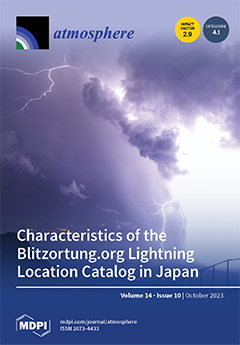
Information about the location of lightning strokes is necessary for academia and disaster prevention. The method of evaluating lightning stroke points on the earth’s surface is based on the detection of long-wavelength radio waves in the very-low-frequency/low-frequency (VLF/LF) band at multiple points. The lightning stroke seen in the photo was taken by T. Yamamoto (MFRS, Japan) from Japan’s highest mountain, Mt. Fuji (3776 m), and is visually recognizable due to its long-wavelength radio emissions. This paper evaluated the detection efficiency and location accuracy of Blitzortung.org, a volunteer-based global network of lightning strokes in Japan. View this paper
  • Issues are regarded as officially published after their release is announced to the table of contents alert mailing list.
  • You may sign up for e-mail alerts to receive table of contents of newly released issues.
  • PDF is the official format for papers published in both, html and pdf forms. To view the papers in pdf format, click on the "PDF Full-text" link, and use the free Adobe Reader to open them.
Order results
Result details
Section
Select all
Export citation of selected articles as:
26 pages, 1723 KiB  
Article
Adapting Almond Production to Climate Change through Deficit Irrigation and Foliar Kaolin Application in a Mediterranean Climate
by David Barreales, Susana Capitão, Albino António Bento, Pedro A. Casquero and António Castro Ribeiro
Atmosphere 2023, 14(10), 1593; https://doi.org/10.3390/atmos14101593 - 23 Oct 2023
Cited by 1 | Viewed by 1093
Abstract
Irrigation is the best strategy to reduce the adverse effects of water stress on almond trees [Prunus dulcis (Mill) D.A. Web] and improve their productivity. However, in the current context of climatic change, in which the amount of water available for irrigation [...] Read more.
Irrigation is the best strategy to reduce the adverse effects of water stress on almond trees [Prunus dulcis (Mill) D.A. Web] and improve their productivity. However, in the current context of climatic change, in which the amount of water available for irrigation is increasingly limited, deficit irrigation (DI) strategies have become essential in the almond orchards of southern Europe. Other practices, such as the foliar application of reflective compounds, are being implemented. A three-year experiment (2019–2021) was set in a factorial design in which the effect of regulated deficit irrigation and foliar kaolin spray was evaluated on physiological (predawn leaf water potential, relative water content, leaf area, leaf gas exchange, and chlorophyll fluorescence) and agronomic parameters (yield, yield components, and water use efficiency (WUE)). The treatments include full irrigation (FI), which received 100% of ETc (crop evapotranspiration) during all irrigation seasons; regulated deficit irrigation (RDI), which received 100% of ETc until the kernel-filling stage, reducing the application to 35% ETc during the kernel-filling stage until harvest; and both irrigation regimes combined with kaolin application and two cultivars, Constantí and Vairo. More negative water potential values were observed in the RDI treatments compared to the FI treatments. There were no significant differences in the stomatal conductance, photosynthetic rate, or transpiration rate between treatments with RDI and FI, demonstrating the almond tree’s good adaptation to irrigation reduction in the kernel-filling stage. The two cultivars had different responses in cumulative yield throughout the three years of the trial. The cv. Constantí did not present significant differences between the FI and RDI treatments, translating into improved WUE. In contrast, the cv. Vairo suffered a reduction in accumulated performance in the RDI treatments with respect to the FI. The foliar application of kaolin did not present differences in yield and very few in the physiological activity of the almond trees. With the results obtained, we can suggest that under the conditions of our experiment, the combination of RDI and the kaolin foliar application can help save irrigation water and produce almonds more sustainably. Full article
(This article belongs to the Section Biometeorology)
Show Figures

Figure 1

13 pages, 4705 KiB  
Article
Validation of MERRA-2 AOT Modeling Data over China Using SIAVNET Measurement
by Shuaiyi Shi, Hao Zhu and Xing Wang
Atmosphere 2023, 14(10), 1592; https://doi.org/10.3390/atmos14101592 - 23 Oct 2023
Viewed by 1019
Abstract
The Modern-Era Retrospective Analysis for Research and Applications version 2 (MERRA-2) Aerosol Optical Thickness (AOT) dataset is a consistent and comprehensive dataset combining observations from various satellite instruments and other sources with a numerical model, supporting climate studies, atmospheric modeling, air quality monitoring, [...] Read more.
The Modern-Era Retrospective Analysis for Research and Applications version 2 (MERRA-2) Aerosol Optical Thickness (AOT) dataset is a consistent and comprehensive dataset combining observations from various satellite instruments and other sources with a numerical model, supporting climate studies, atmospheric modeling, air quality monitoring, and environmental research. Due to the uneven and sparse distribution of the Aerosol Robotic Network (AERONET) in China, the validation for the MERRA-2 AOT dataset over China is inadequate. The construction of the National Civil Space Infrastructure Satellite Aerosol Product Validation Network (SIAVNET) is helpful to compensate for MERRA-2 AOT dataset validation over China. The validation results show that the accuracy of the MERRA-2 AOT goes down along with the aerosol loading in the atmosphere increase. In general, when the AOT is less than 1.0, the slope can reach 0.712 with R2 = 0.584. The percentage of data pairs that fall within the GCOS minimum requirement is less than 60%. Research also shows that MERRA-2 has a lower simulation quality of AOT at high altitudes than at low altitudes in China. Additionally, MERRA-2’s AOT simulation quality varies by season. Simulated quality is worst in spring, improving in subsequent seasons. During the winter season, simulations are of the highest quality. Full article
(This article belongs to the Section Aerosols)
Show Figures

Figure 1

13 pages, 5015 KiB  
Article
Spatiotemporal Characteristics of Ozone Pollution and Resultant Increased Human Health Risks in Central China
by Yuren Tian, Yun Wang, Yan Han, Hanxiong Che, Xin Qi, Yuanqian Xu, Yang Chen, Xin Long and Chong Wei
Atmosphere 2023, 14(10), 1591; https://doi.org/10.3390/atmos14101591 - 22 Oct 2023
Cited by 1 | Viewed by 1023
Abstract
The spatiotemporal characteristics of ozone pollution and increased human health risks in Central China were investigated using a long time series of ozone concentrations from 2014 to 2020. We found a gradual increase in ozone pollution, with the highest concentrations observed in the [...] Read more.
The spatiotemporal characteristics of ozone pollution and increased human health risks in Central China were investigated using a long time series of ozone concentrations from 2014 to 2020. We found a gradual increase in ozone pollution, with the highest concentrations observed in the northeastern region. The spatial distribution of population density showed distinct patterns, with the northeastern and east-central regions coinciding with areas of high ozone concentrations. The study found an overall increasing trend in MDA8 ozone concentrations, with a regional average increase of 3.5 (μg m−3) per year, corresponding to a 4.4% annual increase. We observed a significant clustering of areas at a higher risk of premature mortality associated with long-term ozone exposure, particularly in the northeastern region. Estimated premature mortality due to ozone pollution in Central China between 2014 and 2020 shows an increasing trend from 2014 to 2019 and a decreasing trend in 2020 due to the occurrence of extreme ozone pollution and the subsequent recovery of ozone concentrations after the closures due to COVID-19. Premature mortality due to ozone exposure is affected by both ozone levels and the exposed population, with high correlation coefficients exceeding 0.95. The high total population (more than 220 million per year) and increasing ozone levels exacerbate the problem of premature mortality due to ozone pollution. This study improves our understanding of the impact of ozone pollution on human health and emphasizes the dynamic nature of ozone pollution and its impacts on human health over time. It underscores the need for further study and comprehensive action to mitigate these health risks. Full article
Show Figures

Figure 1

15 pages, 10310 KiB  
Article
Evolution of a Stratified Turbulent Cloud under Rotation
by Tianyi Li, Minping Wan and Shiyi Chen
Atmosphere 2023, 14(10), 1590; https://doi.org/10.3390/atmos14101590 - 22 Oct 2023
Viewed by 1025
Abstract
Localized turbulence is common in geophysical flows, where the roles of rotation and stratification are paramount. In this study, we investigate the evolution of a stratified turbulent cloud under rotation. Recognizing that a turbulent cloud is composed of vortices of varying scales and [...] Read more.
Localized turbulence is common in geophysical flows, where the roles of rotation and stratification are paramount. In this study, we investigate the evolution of a stratified turbulent cloud under rotation. Recognizing that a turbulent cloud is composed of vortices of varying scales and shapes, we start our investigation with a single eddy using analytical solutions derived from a linearized system. Compared to an eddy under pure rotation, the stratified eddy shows the physical manifestation of a known potential vorticity mode, appearing as a static stable vortex. In addition, the expected shift from inertial waves to inertial-gravity waves is observed. In our numerical simulations of the turbulent cloud, carried out at a constant Rossby number over a range of Froude numbers, stratification causes columnar structures to deviate from vertical alignment. This deviation increases with increasing stratification, slowing the expansion rate of the cloud. The observed characteristics of these columnar structures are consistent with the predictions of linear theory, particularly in their tilt angles and vertical growth rates, suggesting a significant influence of inertial-gravity waves. Using Lagrangian particle tracking, we have identified regions where wave activity dominates over turbulence. In scenarios of milder stratification, these inertial-gravity waves are responsible for a significant energy transfer away from the turbulent cloud, a phenomenon that attenuates with increasing stratification. Full article
Show Figures

Figure 1

19 pages, 8321 KiB  
Article
Improving the Accuracy of Landsat 8 Land Surface Temperature in Arid Regions by MODIS Water Vapor Imagery
by Fahime Arabi Aliabad, Mohammad Zare, Hamidreza Ghafarian Malamiri and Ebrahim Ghaderpour
Atmosphere 2023, 14(10), 1589; https://doi.org/10.3390/atmos14101589 - 21 Oct 2023
Cited by 1 | Viewed by 1252
Abstract
Land surface temperature (LST) is a significant environmental factor in many studies. LST estimation methods require various parameters, such as emissivity, temperature, atmospheric transmittance and water vapor. Uncertainty in these parameters can cause error in LST estimation. The present study shows how the [...] Read more.
Land surface temperature (LST) is a significant environmental factor in many studies. LST estimation methods require various parameters, such as emissivity, temperature, atmospheric transmittance and water vapor. Uncertainty in these parameters can cause error in LST estimation. The present study shows how the moderate resolution imaging spectroradiometer (MODIS) water vapor imagery can improve the accuracy of Landsat 8 LST in different land covers of arid regions of Yazd province in Iran. For this purpose, water vapor variation is analyzed for different land covers within different seasons. Validation is performed using T-based and cross-validation methods. The image of atmospheric water vapor is estimated using the MODIS sensor, and its changes are investigated in different land covers. The bare lands and sparse vegetation show the highest and lowest accuracy levels for T-based validation, respectively. The root mean square error (RMSE) is also calculated as 0.57 °C and 1.41 °C for the improved and general split-window (SW) algorithms, respectively. The cross-validation results show that the use of the MODIS water vapor imagery in the SW algorithm leads to a reduction of about 2.2% in the area where the RMSE group is above 5 °C. Full article
(This article belongs to the Section Atmospheric Techniques, Instruments, and Modeling)
Show Figures

Figure 1

21 pages, 12639 KiB  
Article
Numerical Simulation of Charge Structure Evolution during the Feeder-Type Cells Merging
by Jie Deng, Fengxia Guo, Jing Sun, Zeyi Wu, Zhou Liu, Xian Lu, Ke Chen and Qingyuan Wang
Atmosphere 2023, 14(10), 1588; https://doi.org/10.3390/atmos14101588 - 20 Oct 2023
Viewed by 702
Abstract
Formation of the multipolar charge structure during feeder-type cell merging has important consequences in severe convective weather. This study used the Weather Research and Forecasting model with electrification and discharge parameterization schemes to simulate the feeder-type cell merging process in the tail of [...] Read more.
Formation of the multipolar charge structure during feeder-type cell merging has important consequences in severe convective weather. This study used the Weather Research and Forecasting model with electrification and discharge parameterization schemes to simulate the feeder-type cell merging process in the tail of a squall line that occurred on 27 June 2020 in Hubei Province (China). The results showed that the two cells involved in the merging process were at different life stages, but that the distribution of the inductive charging zones in the parent and child cells was broadly the same as that of the non-inductive charging zones. The charging zones were restricted to the mixed-phase region (between the 0 and −40 °C layers) with a cloud water content of >0.2 g/kg in the updraft zone, and the magnitude of the inductive charging rate was slightly smaller than that of the non-inductive charging rate. The differences in the vertical wind shear between the parent and child cells caused differences in the content, charge number, and polarity of the hydrometeors, which resulted in obvious differences in the charge structure characteristics between the two cells. Overall, the cloud droplets, ice, snow, and graupel were the main charged hydrometeors in the cells, whereas the rain and hail had little charge. Full article
Show Figures

Figure 1

18 pages, 9388 KiB  
Article
Study of Haze Boundary Layer Features Based on Multi-Source Data in Shihezi, China
by Gang Ren, Hu Ming, Jin Wang, Wenxiao Wang, Dongliang An, Wei Lei and Qing Zhang
Atmosphere 2023, 14(10), 1587; https://doi.org/10.3390/atmos14101587 - 20 Oct 2023
Viewed by 982
Abstract
To reveal the temporal–spatial characteristics of air pollution during winter haze events on the north slope of the Tianshan mountains, a combined detection experiment was conducted in this study using a tethered airship, Lidar, and ground monitors from December 2019 to January 2020 [...] Read more.
To reveal the temporal–spatial characteristics of air pollution during winter haze events on the north slope of the Tianshan mountains, a combined detection experiment was conducted in this study using a tethered airship, Lidar, and ground monitors from December 2019 to January 2020 in Shihezi. First, the boundary layer height (BLH) was calculated using the temperature, relative humidity, wind speed, and atmospheric pressure detected by the tethered airship; the BLHs were mainly distributed from 200 m to 450 m, with the visibility (V) mainly less than 3000 m. Subsequently, the temporal–spatial characteristics of the atmospheric pollutants were analyzed. The results show that during winter haze events, the temperature was mainly between −5 °C and −15 °C, and the relative humidity was between 60% and 75%, with a wind speed of less than 2 m/s. Moreover, the temperature difference (ΔT) within the BLH was basically greater than 0, except from 14:00 to 18:00, and a larger ΔT corresponded to a lower V and more severe pollution, which indicates that the sensible heat flux is very weak, and the atmospheric structure is very stable. Meanwhile, the PM2.5 and PM10 were mainly concentrated between 130 and 180 μg·m3 and between 160 and 230 μg·m3, respectively; the maximum PM2.5 and PM10 appeared at 11:00–13:00. Furthermore, the black carbon was distributed at 6–8 μg·m3 and decreased significantly around the BLH. Moreover, the extinction coefficient (EC) had a negative correlation with the V, and the maximum of the EC was 9 km−1 when V was the minimum (less than 1500 m) from 10:00 to 11:00. Finally, the relationship between V and the air quality index (AQI) is constructed as AQI=456e0.00061V. The conclusions obtained provide a reference for haze elimination and environmental governance of the locale. Full article
(This article belongs to the Section Air Quality)
Show Figures

Figure 1

16 pages, 13271 KiB  
Article
The Impact of Anthropogenic VOC Emissions on Atmospheric Pollution: A Case Study of a Typical Industrialized Area in China
by Xin Gao, Yanan Wang, Lin Wu, Fangyuan Zheng, Naixiu Sun, Guangxun Liu, Yongji Liu, Peng Meng, Luna Sun and Boyu Jing
Atmosphere 2023, 14(10), 1586; https://doi.org/10.3390/atmos14101586 - 20 Oct 2023
Viewed by 1408
Abstract
Volatile organic compounds (VOCs) are the main precursors of pollution from ground ozone (O3) and PM2.5, which cause the deterioration of urban air quality. The emissions of VOCs from industrialized areas are significant and their characteristics are complex, which [...] Read more.
Volatile organic compounds (VOCs) are the main precursors of pollution from ground ozone (O3) and PM2.5, which cause the deterioration of urban air quality. The emissions of VOCs from industrialized areas are significant and their characteristics are complex, which nowadays contribute significantly to the challenges of investigating the emission inventory. Taking a typical industrialized area in Tianjin as a case study, the anthropogenic VOCs emission inventory for 2020 was established in this study by using the activity data from a large-scale survey and the latest emission factors. The impact of VOCs on the environment was analyzed from the perspective of the combined control of PM2.5 and O3. The results showed that the total emission of VOCs in 2020 was about 1.68 Gg, mainly from industrial processes and mobile sources, which accounted for 38.4% and 36.5% of the total emissions, respectively. The top 10 emitted VOCs were toluene, acetone, ethylbenzene, m/p-xylene, i-pentane, n-hexane, formaldehyde, benzene, ethyl acetate and ethylene. The dominant species of O3 formation potential (OFP) were almost all aromatic hydrocarbons and alkenes, with m/p-xylene contributing the most to the OFP emissions (8.90%). The top 10 secondary organic aerosols formation potential (SOAP) emission species were aromatic hydrocarbons and long-chain alkanes, and the largest emission came from toluene (39.9%). An analysis of an ADMS diffusion model showed that VOCs emitted from traffic-heavy main roads and industrialized central areas had the greatest impact on the air quality in the surrounding areas. The VOCs concentration was higher in winter due to unfavorable meteorological conditions. Our research updated the VOC inventory of industrialized areas and evaluated VOCs species reactivity and their impact on ambient air quality. Full article
(This article belongs to the Special Issue Air Pollution in China (2nd Edition))
Show Figures

Figure 1

19 pages, 10045 KiB  
Article
Temporal Variation and Potential Sources of Water-Soluble Inorganic Ions in PM2.5 in Two Sites of Mexico City
by Fernando Millán-Vázquez, Rodolfo Sosa-Echevería, Ana Luisa Alarcón-Jiménez, José de Jesús Figueroa-Lara, Miguel Torres-Rodríguez, Brenda Liz Valle-Hernández and Violeta Mugica-Álvarez
Atmosphere 2023, 14(10), 1585; https://doi.org/10.3390/atmos14101585 - 20 Oct 2023
Viewed by 1025
Abstract
This study presents the characterization and source apportionment of water-soluble inorganic ions (WSII), contained in particulate matter with an aerodynamic diameter equal to or less than 2.5 μm (PM2.5), performed using the positive matrix factorization model (PMF). PM2.5 were collected [...] Read more.
This study presents the characterization and source apportionment of water-soluble inorganic ions (WSII), contained in particulate matter with an aerodynamic diameter equal to or less than 2.5 μm (PM2.5), performed using the positive matrix factorization model (PMF). PM2.5 were collected in Mexico City from two sites: at Merced (MER), which is a residential location with commercial activities, and at Metropolitan Autonomous University (UAM), which is located in an industrial area. The monitoring campaign was carried out across three seasons named Hot Dry (HD) (March–June), Rain (RA) (July–October), and Cold Dry (CD) (November-February). PM2.5 concentration behavior in both sites was similar, following the order: CD > HD > RA. The UAM site exhibited higher concentrations of PM2.5, of the five cations (Na+, Mg2+, Ca2+, K+ and NH4+), and of the four anions (Cl, SO42−, NO3 and PO43−) than MER, since the UAM site is surrounded by several industrial zones. PM2.5 average concentrations for UAM and MER were 28.4 ± 11.2 and 20.7 ± 8.4 μg m−3, respectively. The ratio of cation equivalent to anion equivalent (CE/AC) showed that aerosol pH is acidic, which was confirmed by direct pH measurements. The sulfur oxidation rate (SOR) was 20 times larger than the nitrogen oxidation rate (NOR). Additionally, SO42− was the most abundant ion during the whole year, especially during the CD season with 5.13 ± 2.5 μg m−3 and 4.9 ± 3.6 μg m−3 for UAM and MER, respectively, when solar radiation displayed a high intensity. On the opposite side, the conversion of NO2 to NO3, respectively, was low. The air mass backward trajectories were modeled using the National Oceanic and Atmospheric Administration (NOAA-HYSPLIT), which allowed us to know that differences in the mass trajectories during the days with higher concentrations were due to an effect of air recirculation, which favored PM2.5 accumulation and resuspension. On the other hand, on the days with less PM2.5, good air dispersion was observed. The main sources identified with the PMF model were secondary aerosol, vehicular, industrial crustal, and biomass burning for UAM, while for MER they were vehicular, secondary aerosol, and crustal. Full article
(This article belongs to the Section Aerosols)
Show Figures

Figure 1

13 pages, 2021 KiB  
Article
Preliminary Survey of Exposure to Indoor Radon in al-Farabi Kazakh National University, Kazakhstan
by Yuliya Zaripova, Vyacheslav Dyachkov, Mirgul Bigeldiyeva, Tatyana Gladkikh and Alexandr Yushkov
Atmosphere 2023, 14(10), 1584; https://doi.org/10.3390/atmos14101584 - 19 Oct 2023
Viewed by 902
Abstract
Radon is a major source of naturally occurring radioactivity, and its measurement is considered extremely important in radiation protection, given its association with lung cancer. This pilot study aimed to estimate the annual effective dose received by students and staff based on monitoring [...] Read more.
Radon is a major source of naturally occurring radioactivity, and its measurement is considered extremely important in radiation protection, given its association with lung cancer. This pilot study aimed to estimate the annual effective dose received by students and staff based on monitoring data on the concentration of radon in the buildings of al-Farabi Kazakh National University (Almaty, Republic of Kazakhstan), based on the distance to the tectonic fault. The measurements were recorded daily from February 2021 to September 2022 using a RAMON-02 radiometer (SOLO LLP, Almaty, Kazakhstan). All measurements were taken from the basement to the top floor under normal conditions of use. The average accumulated concentrations of radon in the studied buildings ranged from 16.34 to 78.33 Bq/m3, which is below the maximum level of 100 Bq/m3 established by the World Health Organization (WHO) and the legislation of the Republic of Kazakhstan (200 Bq/m3). Relatively high values were recorded in the basement of the Faculty of Physics and Technology building (282.0 Bq/m3 in winter, 1742.0 Bq/m3 in spring, 547.7 Bq/m3 in summer, and 550.7 Bq/m3 in autumn), which is located closest to the tectonic fault and poorly ventilated. In almost all rooms (94%), radon levels were within the WHO-recommended reference level. The averaged results show the influence of the distance to the fault on the average indoor radon levels. The annual effective dose of radon for university students and staff ranged from 1.09 mSv/year to 1.53 mSv/year. The excess lifetime risk of developing cancer ranged from 0.44% to 0.61%. Full article
Show Figures

Figure 1

24 pages, 38219 KiB  
Article
Spatiotemporal Distribution Characteristics and Multi-Factor Analysis of Near-Surface PM2.5 Concentration in Local-Scale Urban Areas
by Lin Liu, Huiyu He, Yushuang Zhu, Jing Liu, Jiani Wu, Zhuang Tan and Hui Xie
Atmosphere 2023, 14(10), 1583; https://doi.org/10.3390/atmos14101583 - 19 Oct 2023
Viewed by 967
Abstract
Near-surface PM2.5 concentrations have been greatly exacerbated by urban land expansion and dense urban traffic. This study aims to clarify the effects of multiple factors on near-surface PM2.5 concentrations from three perspectives of background climatic variables, urban morphology variables, and traffic-related [...] Read more.
Near-surface PM2.5 concentrations have been greatly exacerbated by urban land expansion and dense urban traffic. This study aims to clarify the effects of multiple factors on near-surface PM2.5 concentrations from three perspectives of background climatic variables, urban morphology variables, and traffic-related emission intensity. First, two case areas covering multiple local blocks were selected to conduct mobile measurements under different climatic conditions. The observed meteorological parameters and PM2.5 concentration were obtained through GIS-based imaging. These interpolation results of air temperature and relative humidity reveal highly spatiotemporal diversity, which is greatly influenced by artificial heat emissions and spatial morphology characteristics in local areas. The PM2.5 concentration on measurement days also varies considerably from the lowest value of 44~56 μg/m3 in October to about 500 μg/m3 in December in Harbin winter and ranges between about 5 μg/m3 and 50 μg/m3 in Guangzhou summer. The correlation analysis reveals that both the climatic conditions and urban morphology characteristics are significantly correlated with local PM2.5 concentration. Especially for Guangzhou summer, the PM2.5 concentration was positively correlated with the street traffic emission source intensity with correlation coefficient reaching about 0.79. Multivariate nonlinear formulas were applied to fit the association between these factors and PM2.5 concentration with higher determined coefficients. And optimization strategies are thus suggested to improve the urban air quality in local-scale areas. This attribution analysis contributes to environmentally friendly urban construction. Full article
(This article belongs to the Special Issue Advances in Urban Air Pollution Observation and Simulation)
Show Figures

Figure 1

21 pages, 8157 KiB  
Article
Changes in the Seasonal Cycle of Heatwaves, Dry and Wet Spells over West Africa Using CORDEX Simulations
by Assi Louis Martial Yapo, Benjamin Komenan Kouassi, Adama Diawara, Fidèle Yoroba, Adjoua Moise Landry Famien, Pêlèmayo Raoul Touré, Kouakou Kouadio, Dro Touré Tiemoko, Mouhamadou Bamba Sylla and Arona Diedhiou
Atmosphere 2023, 14(10), 1582; https://doi.org/10.3390/atmos14101582 - 19 Oct 2023
Viewed by 927
Abstract
This study analyzes the potential response of the seasonal cycle of heatwaves (HWDI) and dry (CDD) and wet (CWD) spell indices over West Africa for the near- (2031–2060) and the far-future periods (2071–2100) under RCP4.5 and RCP8.5 scenarios using Coordinated Regional Climate Downscaling [...] Read more.
This study analyzes the potential response of the seasonal cycle of heatwaves (HWDI) and dry (CDD) and wet (CWD) spell indices over West Africa for the near- (2031–2060) and the far-future periods (2071–2100) under RCP4.5 and RCP8.5 scenarios using Coordinated Regional Climate Downscaling Experiment (CORDEX) simulations. Despite the fact that some relative biases (an underestimation of 30% for CDD, an overestimation of about 60% for CWD, and an overestimation of about 50% for HWDI) exist, during the historical period (1976–2005) in general, the CORDEX simulations and their ensemble mean outperform the seasonal variability in the above-mentioned indices over three defined subregions of West Africa (i.e., the Gulf of Guinea and Western and Eastern Sahel). They show high correlation coefficients (0.9 in general) and less RMSE. They project an increase (about 10 and 20 days) in heatwave days for both the near- and far-future periods over the whole West African region under both RCP scenarios. In addition, projections indicate that the Sahel regions will experience a decrease (about 5 days) in wet spell days from March to November, while in the Gulf of Guinea, a decrease (about 3 days) is projected throughout the year, except in the CCCLM simulation, which indicates an increase (about 5 days) during the retreat phase of the monsoon (October to December). Our results also highlight an increase (about 80%) in dry spells over the Sahel regions that are more pronounced during the March–November period, while over the Gulf of Guinea, an increase (about 40%) is projected over the entire year. Moreover, the months of increasing dry spells and decreasing wet spells coincide, suggesting that countries in these regions could be simultaneously exposed to dry seasons associated with a high risk of drought and heatwaves under future climate conditions. Full article
(This article belongs to the Special Issue Heat Waves: Perspectives from Observations, Reanalysis and Modeling)
Show Figures

Figure 1

17 pages, 1234 KiB  
Article
Can Climate Change Increase the Spread of Animal Diseases? Evidence from 278 Villages in China
by Qian Chang, Hui Zhou, Nawab Khan and Jiliang Ma
Atmosphere 2023, 14(10), 1581; https://doi.org/10.3390/atmos14101581 - 19 Oct 2023
Viewed by 2942
Abstract
Several countries are currently evaluating the potential health impacts of climate change (CC), particularly in relation to the complex connections between CC-induced weather fluctuations. China, heavily affected by CC, provides clear evidence of its effects. Previous research in animal sciences indicates that factors [...] Read more.
Several countries are currently evaluating the potential health impacts of climate change (CC), particularly in relation to the complex connections between CC-induced weather fluctuations. China, heavily affected by CC, provides clear evidence of its effects. Previous research in animal sciences indicates that factors like temperature, humidity, precipitation, and wind speed can affect animal epidemics. In China, a major global hub for animal husbandry, these factors pose significant challenges, warranting further investigation into their quantitative relationship with disease outbreaks. This study investigates the influence of these climatic conditions on epizootic diseases in China. In the current study, using data from 278 village-level surveys and daily meteorological data spanning 2012 to 2018, we used a fixed-effect model for analysis. The findings reveal that increasing temperatures and wind speeds exacerbate disease development, while the precipitation anomaly index negatively impacts animal epidemics, with humidity showing minimal influence. Addressing CC’s potential impact on animal disease, governments, organizations, and farmers need to pay more attention to the impacts of climate change on animal diseases and work together to better cope with the impacts through policies, measures, and research. Full article
Show Figures

Figure 1

20 pages, 6180 KiB  
Review
Spatiotemporal Patterns of the Application of Surface Urban Heat Island Intensity Calculation Methods
by Jiyuan Zhang, Lili Tu and Biao Shi
Atmosphere 2023, 14(10), 1580; https://doi.org/10.3390/atmos14101580 - 19 Oct 2023
Viewed by 1110
Abstract
Using the China National Knowledge Infrastructure (CNKI) and Web of Science (WoS) databases, 487 articles that used remote sensing methods to study the intensity of surface urban heat islands (SUHIs) over the past 20 years were obtained using keyword searches. A multidimensional analysis [...] Read more.
Using the China National Knowledge Infrastructure (CNKI) and Web of Science (WoS) databases, 487 articles that used remote sensing methods to study the intensity of surface urban heat islands (SUHIs) over the past 20 years were obtained using keyword searches. A multidimensional analysis was conducted on these articles from the perspectives of the research methods used, spatiotemporal distribution characteristics of the research area, research development trends, and main challenges. The research found that (1) the growth trend of the various SUHI research methods over the years was similar to the overall trend in the number of publications, which has rapidly increased since 2009. (2) Among the SUHI research methods, temperature dichotomy is the most widely used worldwide; however, defining urban and rural areas is a main challenge. The Gaussian surface and local climate zoning methods have gradually emerged in recent years; however, owing to the limitations of the different urban development levels and scales, these methods require further improvement. (3) There are certain differences in the application of SUHI research methods between China and other countries. Full article
(This article belongs to the Special Issue UHI Analysis and Evaluation with Remote Sensing Data)
Show Figures

Figure 1

19 pages, 11472 KiB  
Article
Identification and Analysis of Multi-Station Atmospheric Electric Field Anomalies before the Yangbi Ms 6.4 Earthquake on 21 May 2021
by Lei Nie and Xuemin Zhang
Atmosphere 2023, 14(10), 1579; https://doi.org/10.3390/atmos14101579 - 19 Oct 2023
Viewed by 1081
Abstract
This study reports the atmospheric electric field (AEF) anomalies associated with seismic-geological activity recorded by the monitoring network in the Sichuan–Yunnan region of China during the 15–30 days prior to the Yangbi earthquake in Yunnan Province, China, on 21 May 2021. Based on [...] Read more.
This study reports the atmospheric electric field (AEF) anomalies associated with seismic-geological activity recorded by the monitoring network in the Sichuan–Yunnan region of China during the 15–30 days prior to the Yangbi earthquake in Yunnan Province, China, on 21 May 2021. Based on the real-time AEF data from continuous observation, this study summarized the characteristics of the anomalous interference of different meteorological factors on the AEF, compared the simultaneous meteorological data of the AEF anomalies, and ruled out the influence of precipitation, wind, fog, and other weather factors on the AEF anomalies in Yangbi County prior to the Yangbi Ms 6.4 earthquake. The AEF anomalies were identified and extracted from the two-month data from 1 April to 1 June, which were from multiple days, stations, and rupture zones near the 100 km radius from the epicenter of the Yangbi Ms 6.4 main earthquake. Using time series and wavelet transform analysis methods, the obvious common features of the anomalies were summarized, and the homology of the anomalies was verified. The main outcome of the investigation in this study will be used to distinguish and characterize the AEF anomalies associated with pre-seismic geologic activity of non-meteorological elements in the near future. Full article
Show Figures

Figure 1

16 pages, 4578 KiB  
Article
Analyzing the Influence of Vehicular Traffic on the Concentration of Pollutants in the City of São Paulo: An Approach Based on Pandemic SARS-CoV-2 Data and Deep Learning
by Gregori de Arruda Moreira, Alexandre Cacheffo, Izabel da Silva Andrade, Fábio Juliano da Silva Lopes, Antonio Arleques Gomes and Eduardo Landulfo
Atmosphere 2023, 14(10), 1578; https://doi.org/10.3390/atmos14101578 - 19 Oct 2023
Viewed by 813
Abstract
This study employs surface and remote sensing data jointly with deep learning techniques to examine the influence of vehicular traffic in the seasonal patterns of CO, NO2, PM2.5, and PM10 concentrations in the São Paulo municipality, as the [...] Read more.
This study employs surface and remote sensing data jointly with deep learning techniques to examine the influence of vehicular traffic in the seasonal patterns of CO, NO2, PM2.5, and PM10 concentrations in the São Paulo municipality, as the period of physical distancing (March 2020 to December 2021), due to SARS-CoV-2 pandemic and the resumption of activities, made it possible to observe significant variations in the flow of vehicles in the city of São Paulo. Firstly, an analysis of the planetary boundary layer height and ventilation coefficient was performed to identify the seasons’ patterns of pollution dispersion. Then, the variations (from 2018 to 2021) of the seasonal average values of air temperature, relative humidity, precipitation, and thermal inversion occurrence/position were compared to identify possible variations in the patterns of such variables that would justify (or deny) the occurrence of more favorable conditions for pollutants dispersion. However, no significant variations were found. Finally, the seasonal average concentrations of the previously mentioned pollutants were compared from 2018 to 2021, and the daily concentrations observed during the pandemic period were compared with a model based on an artificial neural network. Regarding the concentration of pollutants, the primarily sourced from vehicular traffic (CO and NO2) exhibited substantial variations, demonstrating an inverse relationship with the rate of social distancing. In addition, the measured concentrations deviated from the predictive model during periods of significant social isolation. Conversely, pollutants that were not primarily linked to vehicular sources (PM2.5 and PM10) exhibited minimal variation from 2018 to 2021; thus, their measured concentration remained consistent with the prediction model. Full article
(This article belongs to the Section Air Quality)
Show Figures

Figure 1

9 pages, 2234 KiB  
Article
Climate Change Impacts on the Density Altitude of Chinese Airports in Summer
by Xianbiao Kang, Zijing Meng, Wan Feng and Yunfeng Liu
Atmosphere 2023, 14(10), 1577; https://doi.org/10.3390/atmos14101577 - 18 Oct 2023
Cited by 1 | Viewed by 841
Abstract
This study examines the projected impact of climate change on the density altitude (DA) at Chinese airports during the summer by the end of the 21st century. Findings indicate that climate change is expected to significantly increase the DA at all Chinese airports, [...] Read more.
This study examines the projected impact of climate change on the density altitude (DA) at Chinese airports during the summer by the end of the 21st century. Findings indicate that climate change is expected to significantly increase the DA at all Chinese airports, with an estimated rise between 300 and 800 feet. The analysis suggests that temperature increases will universally contribute to a rise in DA. Pressure changes, however, are more variable. Most airports are predicted to see an increase in pressure, which could offset some temperature effects on the DA. Airports in Eastern China are expected to see a decrease in pressure, amplifying the effects on DA and creating operational challenges. Full article
(This article belongs to the Section Climatology)
Show Figures

Figure 1

39 pages, 13015 KiB  
Article
Projection of Future Climate Change and Its Influence on Surface Runoff of the Upper Yangtze River Basin, China
by Hanli Wan
Atmosphere 2023, 14(10), 1576; https://doi.org/10.3390/atmos14101576 - 18 Oct 2023
Viewed by 1258
Abstract
Global climate change will modify precipitation and temperatures’ temporal and spatial distribution, trigger more extreme weather events, and impact hydrological processes. The Yangtze River basin is one of the world’s largest basins, and understanding future climate changes is vital for water resource management [...] Read more.
Global climate change will modify precipitation and temperatures’ temporal and spatial distribution, trigger more extreme weather events, and impact hydrological processes. The Yangtze River basin is one of the world’s largest basins, and understanding future climate changes is vital for water resource management and supply. Research on predicting future climate change in the upper Yangtze River basin (UYRB) and introducing machine learning algorithms to analyze the impact of climate factors, including extreme weather indicators, on surface runoff is urgently needed. In this study, a statistical downscaling model (SDSM) was used to forecast the future climate in the UYRB, and the Mann–Kendall (MK) or modified Mann–Kendall (MMK) trend test at a 5% level of significance was applied to analyze temporal trends. The Spearman rank correlation (SRC) test at a 5% level of significance and random forest regression (RFR) model were employed to identify the key climatic factors affecting surface runoff from annual precipitation, annual temperature, maximum 5-day precipitation (R×5Day), number of tropical nights (TR), and consecutive dry days (CDD), and the RFR model was also used to predict future runoff. Based on the results, we found that, compared to the selected historical period (1985–2014), the mean annual precipitation (temperature) during the mid-term (2036–2065) increased by 18.93% (12.77%), 17.78% (14.68%), 20.03% (17.03%), and 19.67% (19.29%) under SSP1-2.6, SSP2-4.5, SSP3-7.0, and SSP5-8.5, respectively, and during the long term (2071–2100), increased by 19.44% (12.95%), 22.01% (21.37%), 30.31% (30.32%), and 34.48% (37.97%), respectively. The warming and humidification characteristics of the northwestern UYRB were more pronounced. The key climatic factors influencing surface runoff were annual precipitation, maximum 5-day precipitation (R×5day), and annual temperature. Because of warming and humidification, surface runoff in the UYRB is expected to increase relative to the historical period. The surface runoff during the mid-term (long term) increased by 12.09% (12.58%), 8.15% (6.84%), 8.86% (8.87%), and 5.77% (6.21%) under SSP1-2.6, SSP2-4.5, SSP3-7.0, and SSP5-8.5, respectively. The implementation of sustainable development pathways under the low radiative forcing scenario can be effective in mitigating climate change, but at the same time, it may increase the risk of floods in the UYRB. Full article
(This article belongs to the Section Climatology)
Show Figures

Figure 1

15 pages, 3389 KiB  
Article
Estimates of Global Forest Fire Carbon Emissions Using FY-3 Active Fires Product
by Yang Liu and Yusheng Shi
Atmosphere 2023, 14(10), 1575; https://doi.org/10.3390/atmos14101575 - 18 Oct 2023
Cited by 3 | Viewed by 1145
Abstract
Carbon emissions from forest fires release large amounts of carbon and have important implications for the global and regional carbon cycle and atmospheric carbon concentrations. Considering the significant spatial and temporal variations in different forest fires, this study explores the relationship between different [...] Read more.
Carbon emissions from forest fires release large amounts of carbon and have important implications for the global and regional carbon cycle and atmospheric carbon concentrations. Considering the significant spatial and temporal variations in different forest fires, this study explores the relationship between different forests and carbon emissions from forest fires. This study developed a high-resolution (0.05° × 0.05°) daily global inventory of carbon emissions from biomass burning during 2016–2022. The inventory estimates of carbon emissions from biomass burning are based on the newly released FY-3 data product, satellite and observational data of biomass density, and spatial and temporal variable combustion factors. Forest fire carbon emissions were assessed using active fire data from FY-3 series satellites from 2016 to 2022, and it was linearly compared with GFED, FEER, and GFAS data on time and spatial scales with R2 of 0.7, 0.73, and 0.69, respectively. The results show spatial patterns of forest cover and carbon emissions, with South America, Africa, South-East Asia, and northern Asia as high-emission zones. The analysis shows an overall upward trend in global forest fire carbon emissions over the study period. Different types of forests exhibited specific emission patterns and temporal variations. For example, most needleleaf forest fires occur in areas with low tree cover, while broadleaf forest fires tend to occur in areas with high tree cover. The study showed that there was a relationship between inter-annual trends in forest fire carbon emissions and land cover, with biomass burning occurring mainly in the range of 60–70% tree cover. However, there were also differences between evergreen broadleaf forest, evergreen needleleaf forest, deciduous broadleaf forest, deciduous needleleaf forest, and mixed forest indicating the importance of considering differences in forest types when estimating emissions. This study identifies the main sources of carbon emissions from forest fires globally, which will help policymakers to take more targeted measures to reduce carbon emissions and provide a reliable basis for appropriate measures and directions in future carbon mitigation actions. Full article
(This article belongs to the Special Issue Remote Sensing Measurement of Greenhouse Gases Emission)
Show Figures

Figure 1

22 pages, 5910 KiB  
Article
Simulating Heavy Rainfall Associated with Tropical Cyclones and Atmospheric Disturbances in Thailand Using the Coupled WRF-ROMS Model—Sensitivity Analysis of Microphysics and Cumulus Parameterization Schemes
by Kritanai Torsri, Apiwat Faikrua, Pattarapoom Peangta, Rati Sawangwattanaphaibun, Jakrapop Akaranee and Kanoksri Sarinnapakorn
Atmosphere 2023, 14(10), 1574; https://doi.org/10.3390/atmos14101574 - 17 Oct 2023
Viewed by 1283
Abstract
Predicting heavy rainfall events associated with Tropical Cyclones (TCs) and atmospheric disturbances in Thailand remains challenging. This study introduces a novel approach to enhance forecasting precision by utilizing the coupled Weather Research and Forecasting (WRF) and Regional Oceanic Model (ROMS), known as WRF-ROMS. [...] Read more.
Predicting heavy rainfall events associated with Tropical Cyclones (TCs) and atmospheric disturbances in Thailand remains challenging. This study introduces a novel approach to enhance forecasting precision by utilizing the coupled Weather Research and Forecasting (WRF) and Regional Oceanic Model (ROMS), known as WRF-ROMS. We aim to identify the optimal combination of microphysics (MP) and cumulus (CU) parameterization schemes. Three CU schemes, namely, Betts-Miller-Janjic (BMJ), Grell 3D Ensemble (G3), and Kain-Fritsch (KF), along with three MP schemes, namely, Eta (ETA), Purdue Lin (LIN), and WRF Single-moment 3-class (WSM3), are selected for the sensitivity analysis. Seven instances of heavy (35.1–90.0 mm) to violent (>90.1 mm) rainfall in Thailand, occurring in 2020 and associated with tropical storms and atmospheric disturbances, are simulated using all possible combinations of the chosen physics schemes. The simulated rain intensities are compared against observations from the National Hydroinformatics Data Center. Performance was assessed using the probability of detection (POD), false alarm ratio (FAR), and critical success index (CSI) metrics. While the models performed well for light (0.1–10.0 mm) to moderate (10.1–35.0 mm) rainfall, forecasting heavy rainfall remained challenging. Certain parameter combinations showed promise, like BMJ and KF with LIN microphysics, but challenges persisted. Analyzing density distribution of daily rainfall, we found effective parameterizations for different sub-regions. Our findings emphasize the importance of tailored parameterizations for accurate rainfall prediction in Thailand. This customization can benefit water resource management, flood control, and disaster preparedness. Further research should expand datasets, focusing on significant heavy rainfall events and considering climate factors, for example, the Madden-Julian Oscillation (MJO) for extended-range forecasts, potentially contributing to sub-seasonal and seasonal (S2S) predictions. Full article
(This article belongs to the Special Issue Prediction and Modeling of Extreme Weather Events)
Show Figures

Figure 1

13 pages, 9210 KiB  
Article
Are Near-Coastal Sea Levels Accelerating Faster Than Global during the Satellite Altimetry Era?
by Ying Qu, Svetlana Jevrejeva and Hindumathi Palanisamy
Atmosphere 2023, 14(10), 1573; https://doi.org/10.3390/atmos14101573 - 17 Oct 2023
Viewed by 1005
Abstract
Impact and risk assessments in coastal areas are informed by current and future sea level rise and acceleration, which demands a better understanding of drivers for regional sea level acceleration. In our study, we analyze the near-coastal sea level acceleration compared with global [...] Read more.
Impact and risk assessments in coastal areas are informed by current and future sea level rise and acceleration, which demands a better understanding of drivers for regional sea level acceleration. In our study, we analyze the near-coastal sea level acceleration compared with global values during satellite altimetry (1993–2020) and discuss the potential drivers of regional sea level acceleration. We estimate regional sea level acceleration using high-resolution satellite altimetry sea surface height anomalies. Our study reveals a wide range of regional acceleration estimates, varying from −1.2 to 1.2 mm·yr−2, which can be up to 20 times larger or smaller than the global mean sea level acceleration of 0.07 mm·yr−2. Notably, sea level acceleration near the global coastline is calculated at 0.10 ± 0.03 mm·yr−2, exceeding the global mean sea level acceleration by 40%. Regional patterns of sea level acceleration are in good agreement with acceleration patterns calculated from the steric sea level. However, the magnitude of acceleration is only partially explained by the changes in steric sea level, with increasing contributions from the non-steric component. Full article
(This article belongs to the Special Issue The Water Cycle and Climate Change (2nd Edition))
Show Figures

Figure 1

11 pages, 5784 KiB  
Article
Extended-Range Forecast of Regional Persistent Extreme Cold Events Based on Deep Learning
by Weichen Wu, Yaqiang Wang, Fengying Wei, Boqi Liu and Xiaoxiong You
Atmosphere 2023, 14(10), 1572; https://doi.org/10.3390/atmos14101572 - 17 Oct 2023
Viewed by 768
Abstract
Regional persistent extreme cold events are meteorological disasters that cause serious harm to people’s lives and production; however, they are very difficult to predict. Low-temperature weather systems and their effects have a significant low-frequency oscillation period (10–20 d and 30–60 d). This paper [...] Read more.
Regional persistent extreme cold events are meteorological disasters that cause serious harm to people’s lives and production; however, they are very difficult to predict. Low-temperature weather systems and their effects have a significant low-frequency oscillation period (10–20 d and 30–60 d). This paper uses deep learning to analyze the extended-range time scale and predict regional persistent extreme cold events. The dominant low-frequency oscillation components of cold events are obtained via wavelet transform and Butterworth filtering. The low-frequency oscillation component is decomposed via empirical orthogonal function decomposition to extract the main spatial mode and time coefficient. A convolutional neural network is used to establish the correlation between large-scale circulations and the time coefficient of the low-frequency oscillation component of the lowest temperature. The proposed deep learning model exhibits good prediction accuracy for regional persistent extreme cold events with low-frequency oscillations. Full article
(This article belongs to the Section Atmospheric Techniques, Instruments, and Modeling)
Show Figures

Figure 1

22 pages, 15880 KiB  
Article
Evaluation of Ten Fresh Snow Density Parameterization Schemes for Simulating Snow Depth and Surface Energy Fluxes on the Eastern Tibetan Plateau
by Wenjing Li, Siqiong Luo, Jingyuan Wang and Yuxuan Wang
Atmosphere 2023, 14(10), 1571; https://doi.org/10.3390/atmos14101571 - 16 Oct 2023
Viewed by 1089
Abstract
Snow cover on the Tibetan Plateau has a shallow depth, plaque distribution, and repeated ablation. The applicability of the snow parameterization scheme in the current land surface process model on the TP needs to be further tested using observational data. In this paper, [...] Read more.
Snow cover on the Tibetan Plateau has a shallow depth, plaque distribution, and repeated ablation. The applicability of the snow parameterization scheme in the current land surface process model on the TP needs to be further tested using observational data. In this paper, using the land surface process model CLM4.5 and ten fresh snow density parameterization schemes characterized by temperature, wind speed, and relative humidity, three discontinuous snow processes in Maqu, Madoi, and Yakou and two continuous snow processes in Madoi and Yakou were simulated. By comparing the simulated snow depth with the observed, it was found that this model can clearly describe repeated snow accumulation and ablation processes for the discontinuous snow cover process. The KW scheme, compared with the original Anderson scheme, performed the best regarding snow depth simulation. However, all schemes overestimated the melting rate of snow, and were not able to simulate continuous snow accumulation. The simulation effect of the Schmucki scheme on radiation and energy flux under discontinuous snow cover was significantly improved compared with other scheme. None of schemes performed perfectly, so future studies that focus on the simulations of snow depth, radiation flux, and energy flux under continuous snow cover for accurate and wide applications are recommended. Full article
(This article belongs to the Special Issue Land-Atmosphere Interactions over the Tibetan Plateau)
Show Figures

Figure 1

17 pages, 4432 KiB  
Article
Investigation on the Perception of Microclimatic Factors by the Elderly in Humid and Hot Areas: The Case of Guangzhou, China
by Chang Lin, Qiao Feng, Jun Huang and Ruize Zhong
Atmosphere 2023, 14(10), 1570; https://doi.org/10.3390/atmos14101570 - 16 Oct 2023
Viewed by 775
Abstract
The problem of population aging in China is becoming increasingly serious. Increasing outdoor space can increase the frequency of outdoor activities for the elderly and effectively improve their quality of life. In this study, we examined the thermal comfort of outdoor activity spaces [...] Read more.
The problem of population aging in China is becoming increasingly serious. Increasing outdoor space can increase the frequency of outdoor activities for the elderly and effectively improve their quality of life. In this study, we examined the thermal comfort of outdoor activity spaces for older adults in summer using a subjective questionnaire in Guangzhou City, calculated and analyzed the perception and comfort range of microclimatic factors for older adults in hot and humid areas, and explored gender differences. The specific results were as follows: (1) The neutral physiological equivalent temperature (PET) for the overall respondents was 30.4 °C, compared to an acceptable PET of 33.8 °C. The neutral wind speed and acceptable wind speed for the overall respondents were both 0.4 m/s. The neutral relative humidity for the overall respondents was 56.49%, whereas the acceptable relative humidity was 64.94%. (2) Gender differences were observed among older respondents regarding PET and relative humidity, while no significant gender differences were found among older respondents regarding wind speed. (3) Summer thermal sensation voting for older adults in hot and humid areas were mainly centered on “hot” (30.2%), and “not too hot nor cold” (38.7%). The wind sensation voting was centered on “not high or low” (44.6%). Humidity sensation voting was mainly concentrated on “not wet nor dry” (69.4%). This study provides guidance to urban planners and architects to help them create urban environments that are more comfortable and responsive to the needs of the aging population. Full article
(This article belongs to the Section Climatology)
Show Figures

Figure 1

26 pages, 13052 KiB  
Article
Performance-Based Evaluation of CMIP5 and CMIP6 Global Climate Models and Their Multi-Model Ensembles to Simulate and Project Seasonal and Annual Climate Variables in the Chungcheong Region of South Korea
by Bashir Adelodun, Mirza Junaid Ahmad, Golden Odey, Qudus Adeyi and Kyung Sook Choi
Atmosphere 2023, 14(10), 1569; https://doi.org/10.3390/atmos14101569 - 16 Oct 2023
Cited by 4 | Viewed by 1340
Abstract
Extreme climate change events are major causes of devastating impacts on socioeconomic well-being and ecosystem damage. Therefore, understanding the performance of appropriate climate models representing local climate characteristics is critical for future projections. Thus, this study analyses the performance of 24 GCMs from [...] Read more.
Extreme climate change events are major causes of devastating impacts on socioeconomic well-being and ecosystem damage. Therefore, understanding the performance of appropriate climate models representing local climate characteristics is critical for future projections. Thus, this study analyses the performance of 24 GCMs from the Coupled Model Intercomparison Project Phases 5 and 6 (CMIP5 and 6) and their multi-model ensembles in simulating climate variables including average rainfall, maximum (Tmax), and minimum (Tmin) temperatures at annual and seasonal scales over the Chungcheong region of South Korea from 1975 to 2015. A trend analysis was conducted to estimate the future trends in climate variables in the 2060s (2021–2060) and 2080s (2061–2100). Inverse distance weighting and quantile delta mapping were applied to bias-correct the GCM data. Further, six major evaluating indices comprising temporal and spatial performance assessments were used, after which a comprehensive GCM ranking was applied. The results showed that CMIP6 models performed better in simulating rainfall, Tmax, and Tmin at both temporal and spatial scales. For CMIP5, the top three performing models were GISS, ACCESS1-3, and MRI-CGCM3 for rain; CanESM2, GISS, and MPI-ESM-L-R for Tmax; and GFDL, MRI-CGCM3, and CanESM2 for Tmin. However, the top three performing models in the CMIP6 were MRI-ESM2-0, BCC_CSM, and GFDL for rain; MIROC6, BCC_CSM, and MRI-ESM2-0 for Tmax, and GFDL, MPI_ESM_HR, and MRI-ESM2-0 for Tmin. The multi-model ensembles (an average of the top three GCMs) performed better in simulating rain and Tmin for both CMIP5 and CMIP6 compared with multi-model ensembles (an average of all the GCMs), which only performed slightly better in simulating Tmax. The trend analysis of future projection indicates an increase in rain, Tmax, and Tmin; however, with distinct changes under similar radiative forcing levels in both CMIP5 and CMIP6 models. The projections under RCP4.5 and RCP8.5 increase more than the SSP2-4.5 and SSP5-8.5 scenarios for most climate conditions but are more pronounced, especially for rain, under RCP8.5 than SSP5-8.5 in the far future (2080s). This study provides insightful findings on selecting appropriate GCMs to generate reliable climate projections for local climate conditions in the Chungcheong region of South Korea. Full article
(This article belongs to the Special Issue Statistical Approaches in Climatic Parameters Prediction)
Show Figures

Figure 1

20 pages, 5225 KiB  
Article
Prediction of Storm Surge Water Level Based on Machine Learning Methods
by Yun Liu, Qiansheng Zhao, Chunchun Hu and Nianxue Luo
Atmosphere 2023, 14(10), 1568; https://doi.org/10.3390/atmos14101568 - 16 Oct 2023
Cited by 2 | Viewed by 1329
Abstract
Storm surge disasters result in severe casualties and economic losses. Accurate prediction of storm surge water level is crucial for disaster assessment, early warning, and effective disaster management. Machine learning methods are relatively more efficient and straightforward compared to numerical simulation approaches. However, [...] Read more.
Storm surge disasters result in severe casualties and economic losses. Accurate prediction of storm surge water level is crucial for disaster assessment, early warning, and effective disaster management. Machine learning methods are relatively more efficient and straightforward compared to numerical simulation approaches. However, most of the current research on storm surge water level prediction based on machine learning methods is primarily focused on point predictions. In this study, we explore the feasibility of spatial water level prediction using the ConvLSTM model. We focus on the coastal area of Guangdong Province and employ MIKE21(2019) software to simulate historical typhoons that have made landfall in the region from 1991 to 2018. We construct two datasets: one for direct water level prediction and the other for indirect water level prediction based on water level changes. Utilizing the ConvLSTM network, we employ it to forecast storm surges on both datasets, effectively capturing both temporal and spatial characteristics and thus ensuring the production of dependable results. When directly predicting water levels, we achieve an MAE (mean absolute error) of 0.026 m and an MSE (mean squared error) of 0.0038 m2. In contrast, the indirect prediction approach yields even more promising results, with an MAE of 0.014 m and an MSE of 0.0007 m2. Compared to traditional numerical simulation methods, the ConvLSTM-based approach is simpler, faster, and able to predict water levels accurately without boundary conditions or topographies. Furthermore, we consider worst-case scenarios by predicting the maximum water increase value using the random forest model. Our results indicate that the random forest model can serve as a valuable reference for forecasting the maximum water increase value of typhoon storm surges, supporting effective emergency responses to disasters. Full article
Show Figures

Figure 1

16 pages, 1439 KiB  
Article
Enhancing Cyclone Intensity Prediction for Smart Cities Using a Deep-Learning Approach for Accurate Prediction
by Senthil Kumar Jayaraman, Venkataraman Venkatachalam, Marwa M. Eid, Kannan Krithivasan, Sekar Kidambi Raju, Doaa Sami Khafaga, Faten Khalid Karim and Ayman Em Ahmed
Atmosphere 2023, 14(10), 1567; https://doi.org/10.3390/atmos14101567 - 16 Oct 2023
Viewed by 1169
Abstract
Accurate cyclone intensity prediction is crucial for smart cities to effectively prepare and mitigate the potential devastation caused by these extreme weather events. Traditional meteorological models often face challenges in accurately forecasting cyclone intensity due to cyclonic systems’ complex and dynamic nature. Predicting [...] Read more.
Accurate cyclone intensity prediction is crucial for smart cities to effectively prepare and mitigate the potential devastation caused by these extreme weather events. Traditional meteorological models often face challenges in accurately forecasting cyclone intensity due to cyclonic systems’ complex and dynamic nature. Predicting the intensity of cyclones is a challenging task in meteorological research, as it requires expertise in extracting spatio-temporal features. To address this challenge, a new technique, called linear support vector regressive gradient descent Jaccardized deep multilayer perceptive classifier (LEGEMP), has been proposed to improve the accuracy of cyclone intensity prediction. This technique utilizes a dataset that contains various attributes. It employs the Herfindahl correlative linear support vector regression feature selection to identify the most important characteristics for enhancing cyclone intensity forecasting accuracy. The selected features are then used in conjunction with the Nesterov gradient descent jeopardized deep multilayer perceptive classifier to predict the intensity classes of cyclones, including depression, deep depression, cyclone, severe cyclone, very severe cyclone, and extremely severe cyclone. Experimental results have demonstrated that LEGEMP outperforms conventional methods in terms of cyclone intensity prediction accuracy, requiring minimum time, error rate, and memory consumption. By leveraging advanced techniques and feature selection, LEGEMP provides more reliable and precise predictions for cyclone intensity, enabling better preparedness and response strategies to mitigate the impact of these destructive storms. The LEGEMP technique offers an improved approach to cyclone intensity prediction, leveraging advanced classifiers and feature selection methods to enhance accuracy and reduce error rates. We demonstrate the effectiveness of our approach through rigorous evaluation and comparison with conventional prediction methods, showcasing significant improvements in prediction accuracy. Integrating our enhanced prediction model into smart city disaster management systems can substantially enhance preparedness and response strategies, ultimately contributing to the safety and resilience of communities in cyclone-prone regions. Full article
(This article belongs to the Section Atmospheric Techniques, Instruments, and Modeling)
Show Figures

Figure 1

20 pages, 7858 KiB  
Article
Numerical Analysis of Various Heat Countermeasures: Effects on Energy Consumption and Indoor Thermal Comfort in Densely Built Wooden House Area
by Shanshan Liu, Ronnen Levinson and Daisuke Narumi
Atmosphere 2023, 14(10), 1566; https://doi.org/10.3390/atmos14101566 - 16 Oct 2023
Viewed by 1193
Abstract
Densely built areas with poor thermal insulation suffer from high thermal environmental risks and generally consume high energy in summer. Determining the relationship between density and energy consumption is necessary, particularly when implementing urban heat island (UHI) countermeasures. This study evaluated the effects [...] Read more.
Densely built areas with poor thermal insulation suffer from high thermal environmental risks and generally consume high energy in summer. Determining the relationship between density and energy consumption is necessary, particularly when implementing urban heat island (UHI) countermeasures. This study evaluated the effects of density and UHI countermeasures on the energy consumption and indoor thermal comfort of a detached house in a typical densely built wooden house area in Yokohama City, Japan. Three densities and six countermeasures were considered. Annual hourly simulations based on the SCIENCE-Vent thermal environment simulation model yielded the following results: in densely built wooden house areas, the energy consumption and thermal discomfort increased with density. The green roof yielded the largest energy savings in the cooling and heating seasons, demonstrating the highest annual energy savings with 5.7%. Density had little impact on rooftop countermeasures, but the effect of the high-reflectance walls increased with density, and the reduction in annual energy consumption (air conditioning and lighting) is 2.6%, 3.0%, 3.6% in 37%, 47%, and 59% density cases, respectively. The impact of thermal countermeasures on indoor thermal comfort varied according to the thermal control mechanism. Full article
(This article belongs to the Special Issue Urban Heat Islands and Global Warming (2nd Edition))
Show Figures

Figure 1

17 pages, 1405 KiB  
Article
Evaluation of Climate Suitability for Nature-Based Tourism (NBT) in Arid Regions of Isfahan Province (Iran)
by Fatemeh Nourmohammadi Najafabadi and María Belén Gómez-Martín
Atmosphere 2023, 14(10), 1565; https://doi.org/10.3390/atmos14101565 - 15 Oct 2023
Cited by 1 | Viewed by 1093
Abstract
This article applies the weather types method to assess the climate suitability for nature-based tourism (NBT) in the arid and hyper-arid climate zones of the province of Isfahan (Iran) based on bioclimatic criteria and the preferences of Iranian domestic tourists identified by means [...] Read more.
This article applies the weather types method to assess the climate suitability for nature-based tourism (NBT) in the arid and hyper-arid climate zones of the province of Isfahan (Iran) based on bioclimatic criteria and the preferences of Iranian domestic tourists identified by means of a survey. To date, there are no climate potential assessments for the practice of nature tourism based on an analysis of climate preferences in the study area. According to the results, the distribution of favorable weather types in the study area between March and November during the period 1998–2017 showed that there is a low season in summer and two high seasons corresponding to autumn and spring. The highest frequencies of weather types conducive to NBT were recorded between the second half of September to the first half of November and between the second half of April until the end of May. The calendars resulting from application of the weather types method will serve as an efficient tool for providing tourists and the region’s main tourist stakeholders with information; in the case of the latter, they will be particularly useful for destination planning and activity scheduling. Full article
(This article belongs to the Section Climatology)
Show Figures

Figure 1

9 pages, 1688 KiB  
Communication
Increasing Antarctic Ice Mass to Help Offset Sea Level Rise
by Erik J. L. Larson, Karen H. Rosenlof and Ru-Shan Gao
Atmosphere 2023, 14(10), 1564; https://doi.org/10.3390/atmos14101564 - 15 Oct 2023
Viewed by 1571
Abstract
Global sea level is predicted to rise for centuries even if greenhouse gas emissions are greatly reduced. Sea level rise (SLR) threatens coastal communities where a large fraction of the human population lives. A possible mitigation effort is to increase the ice mass [...] Read more.
Global sea level is predicted to rise for centuries even if greenhouse gas emissions are greatly reduced. Sea level rise (SLR) threatens coastal communities where a large fraction of the human population lives. A possible mitigation effort is to increase the ice mass in Antarctica. Coastal Antarctic radiosonde profiles are supersaturated with respect to ice on average 47% of the time. If all of this excess water vapor and supercooled liquid cloud water were removed from the atmosphere and deposited on the Antarctic landmass, it would offset 11 cm of SLR by 2100, or about 15 (8–17) percent of the predicted SLR. This strategy could be used to supplement other efforts to reduce climate change impacts, such as carbon dioxide removal or solar climate intervention. Full article
(This article belongs to the Section Climatology)
Show Figures

Figure 1

Previous Issue
Next Issue
Back to TopTop