Next Issue
Volume 16, June-2
Previous Issue
Volume 16, May-2
 
 
remotesensing-logo

Journal Browser

Journal Browser

Remote Sens., Volume 16, Issue 11 (June-1 2024) – 225 articles

Cover Story (view full-size image): 
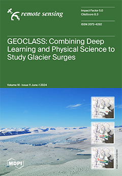
A surge is a natural catastrophe during which a glacier accelerates to 100–200 times its normal speed, resulting in rapid mass transfer from the cryosphere to the oceans and contributing significantly to sea-level rise. To study the current surge of the Negribreen Glacier System in Arctic Svalbard, we investigate the trade-offs between two different approaches to modern machine learning in the geosciences: (1) deep, convolutional neural networks (CNNs) and (2) NNs informed by Earth observations and geophysical knowledge (physically constrained NNs). Combining the advantages from each method in the GEOCLASS-image system, we derive a physically informed CNN, VarioCNN, that allows rapid and efficient extraction of complex geophysical information from submeter-resolution satellite imagery. View this paper
  • Issues are regarded as officially published after their release is announced to the table of contents alert mailing list.
  • You may sign up for e-mail alerts to receive table of contents of newly released issues.
  • PDF is the official format for papers published in both, html and pdf forms. To view the papers in pdf format, click on the "PDF Full-text" link, and use the free Adobe Reader to open them.
Order results
Result details
Section
Select all
Export citation of selected articles as:
19 pages, 5326 KiB  
Article
Lunar High Alumina Basalts in Mare Imbrium
by Jingran Chen, Shengbo Chen, Ming Ma and Yijun Jiang
Remote Sens. 2024, 16(11), 2045; https://doi.org/10.3390/rs16112045 - 6 Jun 2024
Viewed by 251
Abstract
High-alumina (HA) mare basalts play a critical role in lunar mantle differentiation. Although remote sensing methods have speculated their potential presence regions based on sample FeO and TiO2 compositions, the location and distribution characteristics of HA basalts have not been provided. In [...] Read more.
High-alumina (HA) mare basalts play a critical role in lunar mantle differentiation. Although remote sensing methods have speculated their potential presence regions based on sample FeO and TiO2 compositions, the location and distribution characteristics of HA basalts have not been provided. In this study, the compositions of exposed rocks in Mare Imbrium were determined using Lunar Reconnaissance Orbiter (LRO) Diviner oxides and Lunar Prospector Gamma-Ray Spectrometer (LP-GRS) Thorium (Th) products. The exposed HA basalts were identified based on laboratory lithology classification criteria and Al2O3 abundance. The HA basalt units were mapped based on lunar topographic data, and their morphological geological characteristics were calculated based on elevation data. The results show that there are 8406 HA basalt pixels and 17 original units formed by volcanic eruptions in Mare Imbrium. The statistics of their morphology characteristics show that the HA basalts are widely distributed in the northern part of Mare Imbrium, and their compositions have a large range of variation. These units have different area and volume, and the layers formed were discontinuous. The characteristic analysis shows that the aluminum-bearing volcanic activities in Mare Imbrium were irregular. The eruptions of four different source regions occurred in three phases, and the scale and extent of the eruptions were different. The results in this study provide reliable evidence for the heterogeneity of the lunar mantle and contribute valuable information to the formation process of early lunar mantle materials. Full article
(This article belongs to the Section Satellite Missions for Earth and Planetary Exploration)
Show Figures

Figure 1

20 pages, 6559 KiB  
Article
Study of Fast and Reliable Time Transfer Methods Using Low Earth Orbit Enhancement
by Mingyue Liu, Rui Tu, Qiushi Chen, Qi Li, Junmei Chen, Pengfei Zhang and Xiaochun Lu
Remote Sens. 2024, 16(11), 2044; https://doi.org/10.3390/rs16112044 - 6 Jun 2024
Viewed by 218
Abstract
The Global Navigation Satellite System (GNSS) can be utilized for long-distance and high-precision time transmission. With the ongoing development of low Earth orbit (LEO) satellites and the rapidly changing geometric relationships between them, the convergence rate of ambiguity parameters in Precise Point Positioning [...] Read more.
The Global Navigation Satellite System (GNSS) can be utilized for long-distance and high-precision time transmission. With the ongoing development of low Earth orbit (LEO) satellites and the rapidly changing geometric relationships between them, the convergence rate of ambiguity parameters in Precise Point Positioning (PPP) algorithms has increased, enabling fast and reliable time transfer. In this paper, GPS is used as an experimental case, the LEO satellite constellation is designed, and simulated LEO observation data are generated. Then, using the GPS observation data provided by IGS, a LEO-enhanced PPP model is established. The LEO-augmented PPP model is employed to facilitate faster and more reliable high-precision time transfer. The application of the LEO-augmented PPP model to time transfer is examined and discussed through experimental examples. These examples show multiple types of time transfer links, and the experimental outcomes are uniform. GPS + LEO is compared with exclusive GPS time transfer schemes. The clock offset of the time transfer link for the GPS + LEO scheme converges more swiftly, meaning that the time required for the clock offset to reach a stable level is the briefest. In this paper, standard deviation is employed to assess stability, and Allan deviation is utilized to assess frequency stability. The results show that the clock offset stability and frequency stability achieved by the GPS + LEO scheme are superior within the convergence time range. Controlled experiments with different numbers of satellites for LEO enhancement indicate that time transfer performance can be improved by increasing the number of satellites. As a result, augmenting GPS tracking data with LEO observations enhances the time transfer service compared to GPS alone. Full article
(This article belongs to the Topic GNSS Measurement Technique in Aerial Navigation)
Show Figures

Figure 1

18 pages, 9341 KiB  
Article
Evaluation of Soybean Drought Tolerance Using Multimodal Data from an Unmanned Aerial Vehicle and Machine Learning
by Heng Liang, Yonggang Zhou, Yuwei Lu, Shuangkang Pei, Dong Xu, Zhen Lu, Wenbo Yao, Qian Liu, Lejun Yu and Haiyan Li
Remote Sens. 2024, 16(11), 2043; https://doi.org/10.3390/rs16112043 - 6 Jun 2024
Viewed by 248
Abstract
Drought stress is a significant factor affecting soybean growth and yield. A lack of suitable high-throughput phenotyping techniques hinders the drought tolerance evaluation of multi-genotype samples. A method for evaluating drought tolerance in soybeans is proposed based on multimodal remote sensing data from [...] Read more.
Drought stress is a significant factor affecting soybean growth and yield. A lack of suitable high-throughput phenotyping techniques hinders the drought tolerance evaluation of multi-genotype samples. A method for evaluating drought tolerance in soybeans is proposed based on multimodal remote sensing data from an unmanned aerial vehicle (UAV) and machine learning. Hundreds of soybean genotypes were repeatedly planted under well water (WW) and drought stress (DS) in different years and locations (Jiyang and Yazhou, Sanya, China), and UAV multimodal data were obtained in multiple fertility stages. Notably, data from Yazhou were repeatedly obtained during five significant fertility stages, which were selected based on days after sowing. The geometric mean productivity (GMP) index was selected to evaluate the drought tolerance of soybeans. Compared with the results of manual measurement after harvesting, support vector regression (SVR) provided better results (N = 356, R2 = 0.75, RMSE = 29.84 g/m2). The model was also migrated to the Jiyang dataset (N = 427, R2 = 0.68, RMSE = 15.36 g/m2). Soybean varieties were categorized into five Drought Injury Scores (DISs) based on the manually measured GMP. Compared with the results of the manual DIS, the accuracy of the predicted DIS gradually increased with the soybean growth period, reaching a maximum of 77.12% at maturity. This study proposes a UAV-based method for the rapid high-throughput evaluation of drought tolerance in multi-genotype soybean at multiple fertility stages, which provides a new method for the early judgment of drought tolerance in individual varieties, improving the efficiency of soybean breeding, and has the potential to be extended to other crops. Full article
Show Figures

Figure 1

23 pages, 28193 KiB  
Article
Using Ground-Penetrating Radar (GPR) to Investigate the Exceptionally Thick Deposits from the Storegga Tsunami in Northeastern Scotland
by Charlie S. Bristow, Lucy K. Buck and Rishi Shah
Remote Sens. 2024, 16(11), 2042; https://doi.org/10.3390/rs16112042 - 6 Jun 2024
Viewed by 239
Abstract
A submarine landslide on the edge of the Norwegian shelf that occurred around 8150 ± 30 cal. years BP triggered a major ocean-wide tsunami, the deposits of which are recorded around the North Atlantic, including Scotland. Ground-penetrating radar (GPR) was used here to [...] Read more.
A submarine landslide on the edge of the Norwegian shelf that occurred around 8150 ± 30 cal. years BP triggered a major ocean-wide tsunami, the deposits of which are recorded around the North Atlantic, including Scotland. Ground-penetrating radar (GPR) was used here to investigate tsunami sediments within estuaries on the coast of northeastern Scotland where the tsunami waves were funnelled inland. Around the Dornoch Firth, the tsunami deposits are up to 1.6 m thickness, which is exceptionally thick for tsunami deposits and about twice the thickness of the 2004 IOT or 2011 Tohoku-oki tsunami deposits. The exceptional thickness is attributed to a high sediment supply within the Dornoch Firth. At Ardmore, the tsunami appears to have overtopped a beach ridge with a thick sand layer deposited inland at Dounie and partly infilled a valley. Later, fluvial activity eroded the tsunami sediments locally, removing the sand layer. At Creich, on the north side of the Dornoch Firth, the sand layer varies in thickness; mapping of the sand layer with GPR shows lateral thickness changes of over 1 m attributed to a combination of infilling an underlying topography, differential compaction, and later reworking by tidal inlets. Interpretation of the GPR profiles at Wick suggests that there has been a miscorrelation of Holocene stratigraphy based on boreholes. Changes in the stratigraphy of spits at Ardmore are attributed to the balance between sediment supply and sea-level change with washovers dominating a spit formed during the early Holocene transgression, while spits formed during the subsequent mid-Holocene high-stand are dominated by progradation. Full article
(This article belongs to the Collection Feature Papers for Section Environmental Remote Sensing)
Show Figures

Figure 1

19 pages, 9652 KiB  
Article
Focus on the Crop Not the Weed: Canola Identification for Precision Weed Management Using Deep Learning
by Michael Mckay, Monica F. Danilevicz, Michael B. Ashworth, Roberto Lujan Rocha, Shriprabha R. Upadhyaya, Mohammed Bennamoun and David Edwards
Remote Sens. 2024, 16(11), 2041; https://doi.org/10.3390/rs16112041 - 6 Jun 2024
Viewed by 426
Abstract
Weeds pose a significant threat to agricultural production, leading to substantial yield losses and increased herbicide usage, with severe economic and environmental implications. This paper uses deep learning to explore a novel approach via targeted segmentation mapping of crop plants rather than weeds, [...] Read more.
Weeds pose a significant threat to agricultural production, leading to substantial yield losses and increased herbicide usage, with severe economic and environmental implications. This paper uses deep learning to explore a novel approach via targeted segmentation mapping of crop plants rather than weeds, focusing on canola (Brassica napus) as the target crop. Multiple deep learning architectures (ResNet-18, ResNet-34, and VGG-16) were trained for the pixel-wise segmentation of canola plants in the presence of other plant species, assuming all non-canola plants are weeds. Three distinct datasets (T1_miling, T2_miling, and YC) containing 3799 images of canola plants in varying field conditions alongside other plant species were collected with handheld devices at 1.5 m. The top performing model, ResNet-34, achieved an average precision of 0.84, a recall of 0.87, a Jaccard index (IoU) of 0.77, and a Macro F1 score of 0.85, with some variations between datasets. This approach offers increased feature variety for model learning, making it applicable to the identification of a wide range of weed species growing among canola plants, without the need for separate weed datasets. Furthermore, it highlights the importance of accounting for the growth stage and positioning of plants in field conditions when developing weed detection models. The study contributes to the growing field of precision agriculture and offers a promising alternative strategy for weed detection in diverse field environments, with implications for the development of innovative weed control techniques. Full article
Show Figures

Figure 1

27 pages, 4080 KiB  
Review
Satellite Remote Sensing Tools for Drought Assessment in Vineyards and Olive Orchards: A Systematic Review
by Nazaret Crespo, Luís Pádua, João A. Santos and Helder Fraga
Remote Sens. 2024, 16(11), 2040; https://doi.org/10.3390/rs16112040 - 6 Jun 2024
Viewed by 664
Abstract
Vineyards and olive groves are two of the most important Mediterranean crops, not only for their economic value but also for their cultural and environmental significance, playing a crucial role in global agriculture. This systematic review, based on an adaptation of the 2020 [...] Read more.
Vineyards and olive groves are two of the most important Mediterranean crops, not only for their economic value but also for their cultural and environmental significance, playing a crucial role in global agriculture. This systematic review, based on an adaptation of the 2020 PRISMA statement, focuses on the use of satellite remote sensing tools for the detection of drought in vineyards and olive groves. This methodology follows several key steps, such as defining the approach, selecting keywords and databases, and applying exclusion criteria. The bibliometric analysis revealed that the most frequently used terms included “Google Earth Engine” “remote sensing” “leaf area index” “Sentinel-2”, and “evapotranspiration”. The research included a total of 81 articles published. The temporal distribution shows an increase in scientific production starting in 2018, with a peak in 2021. Geographically, the United States, Italy, Spain, France, Tunisia, Chile, and Portugal lead research in this field. The studies were classified into four categories: aridity and drought monitoring (ADM), agricultural water management (AWM), land use management (LUM), and water stress (WST). Research trends were analysed in each category, highlighting the use of satellite platforms and sensors. Several case studies illustrate applications in vineyards and olive groves, especially in semi-arid regions, focusing on the estimation of evapotranspiration, crop coefficients, and water use efficiency. This article provides a comprehensive overview of the current state of research on the use of satellite remote sensing for drought assessment in grapevines and olive trees, identifying trends, methodological approaches, and opportunities for future research in this field. Full article
(This article belongs to the Special Issue Remote Sensing in Viticulture II)
Show Figures

Figure 1

24 pages, 6459 KiB  
Article
An Efficient Ground Moving Target Imaging Method for Synthetic Aperture Radar Based on Scaled Fourier Transform and Scaled Inverse Fourier Transform
by Xin Zhang, Haoyu Zhu, Ruixin Liu, Jun Wan and Zhanye Chen
Remote Sens. 2024, 16(11), 2039; https://doi.org/10.3390/rs16112039 - 6 Jun 2024
Viewed by 216
Abstract
The unknown relative motions between synthetic aperture radar (SAR) and a ground moving target will lead to serious range cell migration (RCM) and Doppler frequency spread (DFS). The energy of the moving target will defocus, given the effect of the RCM and DFS. [...] Read more.
The unknown relative motions between synthetic aperture radar (SAR) and a ground moving target will lead to serious range cell migration (RCM) and Doppler frequency spread (DFS). The energy of the moving target will defocus, given the effect of the RCM and DFS. The moving target will easily produce Doppler ambiguity, due to the low pulse repetition frequency of radar, and the Doppler ambiguity complicates the corrections of the RCM and DFS. In order to address these issues, an efficient ground moving target focusing method for SAR based on scaled Fourier transform and scaled inverse Fourier transform is presented. Firstly, the operations based on the scaled Fourier transform and scaled inverse Fourier transforms are presented to focus the moving targets in consideration of Doppler ambiguity. Subsequently, in accordance with the detailed analysis of multiple target focusing, the spurious peak related to the cross term is removed. The proposed method can accurately eliminate the DFS and RCM, and the well-focused result of the moving target can be achieved under the complex Doppler ambiguity. Then, the blind speed sidelobe can be further avoided. The presented method has high computational efficiency without the step of parameter search. The simulated and measured SAR data are provided to demonstrate the effectiveness of the developed method. Full article
(This article belongs to the Special Issue Technical Developments in Radar—Processing and Application)
Show Figures

Figure 1

21 pages, 4492 KiB  
Article
Changes in Global Aviation Turbulence in the Remote Sensing Era (1979–2018)
by Diandong Ren and Mervyn J. Lynch
Remote Sens. 2024, 16(11), 2038; https://doi.org/10.3390/rs16112038 - 6 Jun 2024
Viewed by 248
Abstract
Atmospheric turbulence primarily originates from abrupt density variations in a vertically stratified atmosphere. Based on the prognostic equation of turbulent kinetic energy (TKE), we here chose three indicators corresponding to the forcing terms of the TKE generation. By utilizing ERA5 reanalysis data, we [...] Read more.
Atmospheric turbulence primarily originates from abrupt density variations in a vertically stratified atmosphere. Based on the prognostic equation of turbulent kinetic energy (TKE), we here chose three indicators corresponding to the forcing terms of the TKE generation. By utilizing ERA5 reanalysis data, we investigate first the maximum achievable daily thickness of the planetary boundary layer (PBL). The gradient Richardson number (Ri) is used to represent turbulence arising from shear instability and the daily maximum convective available potential energy (CAPE) is examined to understand the turbulence linked with convective instability. Our analysis encompasses global turbulence trends. As a case study, we focus on the North Atlantic Corridor (NAC) to reveal notable insights. Specifically, the mean annual number of hours featuring shear instability (Ri < 0.25) surged by more than 300 h in consecutive 20-year periods: 1979–1998 and 1999–2018. Moreover, a substantial subset within the NAC region exhibited a notable rise of over 10% in the number of hours characterized as severe shear instability. Contrarily, turbulence associated with convective instability (CAPE > 2 kJ/kg), which can necessitate rerouting and pose significant aviation safety challenges, displays a decline. Remote sensing of clouds confirms these assertions. This decline contains a component of inherent natural variability. Our findings suggest that, as air viscosity increases and hence a thickened PBL due to a warming climate, the global inflight turbulence is poised to intensify. Full article
Show Figures

Figure 1

15 pages, 12660 KiB  
Article
Contactless X-Band Detection of Steel Bars in Cement: A Preliminary Numerical and Experimental Analysis
by Adriana Brancaccio and Simone Palladino
Remote Sens. 2024, 16(11), 2037; https://doi.org/10.3390/rs16112037 - 6 Jun 2024
Viewed by 288
Abstract
This work presents preliminary experimental results for advancing non-destructive testing methods for detecting steel bars in cement via contactless investigations in the X-band spectrum. This study reveals the field’s penetration into cement, extracting insights into embedded bars through scattered data. Applying a quasi-quadratic [...] Read more.
This work presents preliminary experimental results for advancing non-destructive testing methods for detecting steel bars in cement via contactless investigations in the X-band spectrum. This study reveals the field’s penetration into cement, extracting insights into embedded bars through scattered data. Applying a quasi-quadratic inverse scattering technique to numerically simulated data yields promising results, confirming the effectiveness and reliability of the proposed approach. In this realm, using a higher frequency allows for the use of lighter equipment and smaller antennas. Identified areas for improvement include accounting for antenna behavior and establishing the undeformed target morphology and precise orientation. Transitioning from powder-based and sand specimens to real, solid, reinforced concrete structures is expected to alleviate laboratory challenges. Although accurately determining concrete properties such as its relative permittivity and conductivity is essential, it remains beyond the scope of this study. Finally, overcoming these challenges could significantly enhance non-invasive testing, improving structural health monitoring and disaster prevention. Full article
Show Figures

Figure 1

21 pages, 6923 KiB  
Article
Instrument Overview and Radiometric Calibration Methodology of the Non-Scanning Radiometer for the Integrated Earth–Moon Radiation Observation System (IEMROS)
by Hanyuan Zhang, Xin Ye, Duo Wu, Yuwei Wang, Dongjun Yang, Yuchen Lin, Hang Dong, Jun Zhou and Wei Fang
Remote Sens. 2024, 16(11), 2036; https://doi.org/10.3390/rs16112036 - 6 Jun 2024
Viewed by 231
Abstract
The non-scanning radiometer with short-wavelength (SW: 0.2–5.0 μm) and total-wavelength (TW: 0.2–50.0 μm) channels is the primary payload of the Integrated Earth–Moon Radiation Observation System (IEMROS), which is designed to provide comprehensive Earth radiation measurements and lunar calibrations at the L1 Lagrange point [...] Read more.
The non-scanning radiometer with short-wavelength (SW: 0.2–5.0 μm) and total-wavelength (TW: 0.2–50.0 μm) channels is the primary payload of the Integrated Earth–Moon Radiation Observation System (IEMROS), which is designed to provide comprehensive Earth radiation measurements and lunar calibrations at the L1 Lagrange point of the Earth–Moon system from a global perspective. This manuscript introduces a radiometer preflight calibration methodology, which involves background removal and is validated using accurate and traceable reference sources. Simulated Earth view tests are performed to evaluate repeatability, linearity, and gain coefficients over the operating range. Both channels demonstrate repeatability uncertainties better than 0.34%, indicating consistent and reliable measuring performance. Comparative polynomial regression analysis confirms significant linear response characteristics with two-channel nonlinearity less than 0.20%. Gain coefficients are efficiently determined using a two-point calibration approach. Uncertainty analysis reveals an absolute radiometric calibration accuracy of 0.97% for the SW channel and 0.92% for the TW channel, underscoring the non-scanning radiometer’s capability to provide dependable global Earth radiation budget data crucial to environmental and climate studies. Full article
(This article belongs to the Section Satellite Missions for Earth and Planetary Exploration)
Show Figures

Figure 1

28 pages, 5098 KiB  
Article
A Robust High-Accuracy Star Map Matching Algorithm for Dense Star Scenes
by Quan Sun, Zhaodong Niu, Yabo Li and Zhuang Wang
Remote Sens. 2024, 16(11), 2035; https://doi.org/10.3390/rs16112035 - 6 Jun 2024
Viewed by 290
Abstract
The algorithm proposed in this paper aims at solving the problem of star map matching in high-limiting-magnitude astronomical images, which is inspired by geometric voting star identification techniques. It is a two-step star map matching algorithm relying only on angular features, and adopts [...] Read more.
The algorithm proposed in this paper aims at solving the problem of star map matching in high-limiting-magnitude astronomical images, which is inspired by geometric voting star identification techniques. It is a two-step star map matching algorithm relying only on angular features, and adopts a reasonable matching strategy to overcome the problem of poor real-time performance of the geometric voting algorithm when the number of stars is large. The algorithm focuses on application scenarios where there are a large number of dense stars (limiting magnitude greater than 13, average number of stars per square degree greater than 185) in the image, which is different from the sparse star identification problem of the star tracker, which is more challenging for the robustness and real-time performance of the algorithm. The proposed algorithm can be adapted to application scenarios such as unreliable brightness information, centroid positioning error, visual axis pointing deviation, and a large number of false stars, with high accuracy, robustness, and good real-time performance. Full article
(This article belongs to the Section Remote Sensing Image Processing)
Show Figures

Figure 1

20 pages, 7017 KiB  
Article
Inter-Comparison of SST Products from iQuam, AMSR2/GCOM-W1, and MWRI/FY-3D
by Yili Zhao, Ping Liu and Wu Zhou
Remote Sens. 2024, 16(11), 2034; https://doi.org/10.3390/rs16112034 - 6 Jun 2024
Viewed by 283
Abstract
Evaluating sea surface temperature (SST) products is essential before their application in marine environmental monitoring and related studies. SSTs from the in situ SST Quality Monitor (iQuam) system, Advanced Microwave Scanning Radiometer 2 (AMSR2) aboard the Global Change Observation Mission 1st-Water, and the [...] Read more.
Evaluating sea surface temperature (SST) products is essential before their application in marine environmental monitoring and related studies. SSTs from the in situ SST Quality Monitor (iQuam) system, Advanced Microwave Scanning Radiometer 2 (AMSR2) aboard the Global Change Observation Mission 1st-Water, and the Microwave Radiation Imager (MWRI) aboard the Chinese Fengyun-3D satellite are intercompared utilizing extended triple collocation (ETC) and direct comparison methods. Additionally, error characteristic variations with respect to time, latitude, SST, sea surface wind speed, columnar water vapor, and columnar cloud liquid water are analyzed comprehensively. In contrast to the prevailing focus on SST validation accuracy, the random errors and the capability to detect SST variations are also evaluated in this study. The result of ETC analysis indicates that iQuam SST from ships exhibits the highest random error, above 0.83 °C, whereas tropical mooring SST displays the lowest random error, below 0.28 °C. SST measurements from drifters, tropical moorings, Argo floats, and high-resolution drifters, which possess random errors of less than 0.35 °C, are recommended for validating remotely sensed SST. The ability of iQuam, AMSR2, and MWRI to detect SST variations diminishes significantly in ocean areas between 0°N and 20°N latitude and latitudes greater than 50°N and 50°S. AMSR2 and iQuam demonstrate similar random errors and capabilities for detecting SST variations, whereas MWRI shows a high random error and weak capability. In comparison to iQuam SST, AMSR2 exhibits a root-mean-square error (RMSE) of about 0.51 °C with a bias of −0.05 °C, while MWRI shows an RMSE of about 1.26 °C with a bias of −0.14 °C. Full article
Show Figures

Figure 1

30 pages, 42903 KiB  
Article
Monitoring Chlorophyll-a Concentration Variation in Fish Ponds from 2013 to 2022 in the Guangdong-Hong Kong-Macao Greater Bay Area, China
by Zikang Li, Xiankun Yang, Tao Zhou, Shirong Cai, Wenxin Zhang, Keming Mao, Haidong Ou, Lishan Ran, Qianqian Yang and Yibo Wang
Remote Sens. 2024, 16(11), 2033; https://doi.org/10.3390/rs16112033 - 5 Jun 2024
Viewed by 296
Abstract
Aquaculture plays a vital role in global food production, with fish pond water quality directly impacting aquatic product quality. The Guangdong-Hong Kong-Macao Greater Bay Area (GBA) serves as a key producer of aquatic products in South China. Monitoring environmental changes in fish ponds [...] Read more.
Aquaculture plays a vital role in global food production, with fish pond water quality directly impacting aquatic product quality. The Guangdong-Hong Kong-Macao Greater Bay Area (GBA) serves as a key producer of aquatic products in South China. Monitoring environmental changes in fish ponds serves as an indicator of their health. This study employed the extreme gradient boosting tree (BST) model of machine learning, utilizing Landsat imagery data, to assess Chlorophyll-a (Chl-a) concentration in GBA fish ponds from 2013 to 2022. The study also examined the corresponding spatiotemporal variations in Chl-a concentration. Key findings include: (1) clear seasonal fluctuations in Chl-a concentration, peaking in summer (56.7 μg·L−1) and reaching lows in winter (43.5 μg·L−1); (2) a slight overall increase in Chl-a concentration over the study period, notably in regions with rapid economic development, posing a heightened risk of eutrophication; (3) influence from both human activities and natural factors such as water cycle and climate, with water temperature notably impacting summer Chl-a levels; (4) elevated Chl-a levels in fish ponds compared to surrounding natural water bodies, primarily attributed to human activities, indicating an urgent need to revise breeding practices and address eutrophication. These findings offer a quantitative assessment of fish pond water quality and contribute to sustainable aquaculture management in the GBA. Full article
Show Figures

Figure 1

26 pages, 22249 KiB  
Article
Terrain Shadow Interference Reduction for Water Surface Extraction in the Hindu Kush Himalaya Using a Transformer-Based Network
by Xiangbing Yan and Jia Song
Remote Sens. 2024, 16(11), 2032; https://doi.org/10.3390/rs16112032 - 5 Jun 2024
Viewed by 220
Abstract
Water is the basis for human survival and growth, and it holds great importance for ecological and environmental protection. The Hindu Kush Himalaya (HKH) is known as the “Water Tower of Asia”, where water influences changes in the global water cycle and ecosystem. [...] Read more.
Water is the basis for human survival and growth, and it holds great importance for ecological and environmental protection. The Hindu Kush Himalaya (HKH) is known as the “Water Tower of Asia”, where water influences changes in the global water cycle and ecosystem. It is thus very important to efficiently measure the status of water in this region and to monitor its changes; with the development of satellite-borne sensors, water surface extraction based on remote sensing images has become an important method through which to do so, and one of the most advanced and accurate methods for water surface extraction involves the use of deep learning networks. We designed a network based on the state-of-the-art Vision Transformer to automatically extract the water surface in the HKH region; however, in this region, terrain shadows are often misclassified as water surfaces during extraction due to their spectral similarity. Therefore, we adjusted the training dataset in different ways to improve the accuracy of water surface extraction and explored whether these methods help to reduce the interference of terrain shadows. Our experimental results show that, based on the designed network, adding terrain shadow samples can significantly enhance the accuracy of water surface extraction in high mountainous areas, such as the HKH region, while adding terrain data does not reduce the interference from terrain shadows. We obtained the water surface extraction results in the HKH region in 2021, with the network and training datasets containing both water surface and terrain shadows. By comparing these results with the data products of Global Surface Water, it was shown that our water surface extraction results are highly accurate and the extracted water surface boundaries are finer, which strongly confirmed the applicability and advantages of the proposed water surface extraction approach in a wide range of complex surface environments. Full article
Show Figures

Figure 1

20 pages, 7213 KiB  
Article
Improvement of High-Resolution Daytime Fog Detection Algorithm Using GEO-KOMPSAT-2A/Advanced Meteorological Imager Data with Optimization of Background Field and Threshold Values
by Ji-Hye Han, Myoung-Seok Suh, Ha-Yeong Yu and So-Hyeong Kim
Remote Sens. 2024, 16(11), 2031; https://doi.org/10.3390/rs16112031 - 5 Jun 2024
Viewed by 283
Abstract
This study aimed to improve the daytime fog detection algorithm GK2A_HR_FDA using the GEO-KOMPSAT-2A (GK2A) satellite by increasing the resolution (2 km to 500 m), improving predicted surface temperature by the numerical model, and optimizing some threshold values. GK2A_HR_FDA uses numerical model prediction [...] Read more.
This study aimed to improve the daytime fog detection algorithm GK2A_HR_FDA using the GEO-KOMPSAT-2A (GK2A) satellite by increasing the resolution (2 km to 500 m), improving predicted surface temperature by the numerical model, and optimizing some threshold values. GK2A_HR_FDA uses numerical model prediction temperature to distinguish between fog and low clouds and evaluates the fog detection level using ground observation visibility data. To correct the errors of the numerical model prediction temperature, a dynamic bias correction (DBC) technique was developed that reflects the geographic location, time, and altitude in real time. As the numerical model prediction temperature was significantly improved after DBC application, the fog detection level improved (FAR: −0.02–−0.06; bias: −0.07–−0.23) regardless of the training and validation cases and validation method. In most cases, the fog detection level was improved due to DBC and threshold adjustment. Still, the detection level was abnormally low in some cases due to background reflectance problems caused by cloud shadow effects and navigation errors. As a result of removing navigation errors and cloud shadow effects, the fog detection level was greatly improved. Therefore, it is necessary to improve navigation accuracy and develop removal techniques for cloud shadows to improve fog detection levels. Full article
(This article belongs to the Section Satellite Missions for Earth and Planetary Exploration)
Show Figures

Graphical abstract

19 pages, 6940 KiB  
Article
Evaluation of Two Satellite Surface Solar Radiation Products in the Urban Region in Beijing, China
by Lin Xu and Yuna Mao
Remote Sens. 2024, 16(11), 2030; https://doi.org/10.3390/rs16112030 - 5 Jun 2024
Viewed by 236
Abstract
Surface solar radiation, as a primary energy source, plays a pivotal role in governing land–atmosphere interactions, thereby influencing radiative, hydrological, and land surface dynamics. Ground-based instrumentation and satellite-based observations represent two fundamental methodologies for acquiring solar radiation information. While ground-based measurements are often [...] Read more.
Surface solar radiation, as a primary energy source, plays a pivotal role in governing land–atmosphere interactions, thereby influencing radiative, hydrological, and land surface dynamics. Ground-based instrumentation and satellite-based observations represent two fundamental methodologies for acquiring solar radiation information. While ground-based measurements are often limited in availability, high-temporal- and spatial-resolution, gridded satellite-retrieved solar radiation products have been extensively utilized in solar radiation-related studies, despite their inherent uncertainties in accuracy. In this study, we conducted an evaluation of the accuracy of two high-resolution satellite products, namely Himawari-8 (H8) and Moderate Resolution Imaging Spectroradiometer (MODIS), utilizing data from a newly established solar radiation observation system at the Beijing Normal University (BNU) station in Beijing since 2017. The newly acquired measurements facilitated the generation of a firsthand solar radiation dataset comprising three components: Global Horizontal Irradiance (GHI), Direct Normal Irradiance (DNI), and Diffuse Horizontal Irradiance (DHI). Rigorous quality control procedures were applied to the raw minute-level observation data, including tests for missing data, the determination of possible physical limits, the identification of solar tracker malfunctions, and comparison tests (GHI should be equivalent to the sum of DHI and the vertical component of the DNI). Subsequently, accurate minute-level solar radiation observations were obtained spanning from 1 January 2020 to 22 March 2022. The evaluation of H8 and MODIS satellite products against ground-based GHI observations revealed strong correlations with R-squared (R2) values of 0.89 and 0.81, respectively. However, both satellite products exhibited a tendency to overestimate solar radiation, with H8 overestimating by approximately 21.05% and MODIS products by 7.11%. Additionally, solar zenith angles emerged as a factor influencing the accuracy of satellite products. This dataset serves as crucial support for investigations of surface solar radiation variation mechanisms, future energy utilization prospects, environmental conservation efforts, and related studies in urban areas such as Beijing. Full article
(This article belongs to the Section Atmospheric Remote Sensing)
Show Figures

Graphical abstract

24 pages, 9011 KiB  
Article
A New Dual-Branch Embedded Multivariate Attention Network for Hyperspectral Remote Sensing Classification
by Yuyi Chen, Xiaopeng Wang, Jiahua Zhang, Xiaodi Shang, Yabin Hu, Shichao Zhang and Jiajie Wang
Remote Sens. 2024, 16(11), 2029; https://doi.org/10.3390/rs16112029 - 5 Jun 2024
Viewed by 210
Abstract
With the continuous maturity of hyperspectral remote sensing imaging technology, it has been widely adopted by scholars to improve the performance of feature classification. However, due to the challenges in acquiring hyperspectral images and producing training samples, the limited training sample is a [...] Read more.
With the continuous maturity of hyperspectral remote sensing imaging technology, it has been widely adopted by scholars to improve the performance of feature classification. However, due to the challenges in acquiring hyperspectral images and producing training samples, the limited training sample is a common problem that researchers often face. Furthermore, efficient algorithms are necessary to excavate the spatial and spectral information from these images, and then, make full use of this information with limited training samples. To solve this problem, a novel two-branch deep learning network model is proposed for extracting hyperspectral remote sensing features in this paper. In this model, one branch focuses on extracting spectral features using multi-scale convolution and a normalization-based attention module, while the other branch captures spatial features through small-scale dilation convolution and Euclidean Similarity Attention. Subsequently, pooling and layering techniques are employed to further extract abstract features after feature fusion. In the experiments conducted on two public datasets, namely, IP and UP, as well as our own labeled dataset, namely, YRE, the proposed DMAN achieves the best classification results, with overall accuracies of 96.74%, 97.4%, and 98.08%, respectively. Compared to the sub-optimal state-of-the-art methods, the overall accuracies are improved by 1.05, 0.42, and 0.51 percentage points, respectively. The advantage of this network structure is particularly evident in unbalanced sample environments. Additionally, we introduce a new strategy based on the RPNet, which utilizes a small number of principal components for feature classification after dimensionality reduction. The results demonstrate its effectiveness in uncovering compressed feature information, with an overall accuracy improvement of 0.68 percentage points. Consequently, our model helps mitigate the impact of data scarcity on model performance, thereby contributing positively to the advancement of hyperspectral remote sensing technology in practical applications. Full article
Show Figures

Graphical abstract

16 pages, 2965 KiB  
Technical Note
Evaluation of IMERG Data over Open Ocean Using Observations of Tropical Cyclones
by Stephen L. Durden
Remote Sens. 2024, 16(11), 2028; https://doi.org/10.3390/rs16112028 - 5 Jun 2024
Viewed by 210
Abstract
The IMERG data product is an optimal combination of precipitation estimates from the Global Precipitation Mission (GPM), making use of a variety of data types, primarily data from various spaceborne passive instruments. Previous versions of the IMERG product have been extensively validated by [...] Read more.
The IMERG data product is an optimal combination of precipitation estimates from the Global Precipitation Mission (GPM), making use of a variety of data types, primarily data from various spaceborne passive instruments. Previous versions of the IMERG product have been extensively validated by comparisons with gauge data and ground-based radars over land. However, IMERG rain rates, especially sub-daily, over open ocean are less validated due to the scarcity of comparison data, particularly with the relatively new Version 07. To address this issue, we consider IMERG V07 30-min data acquired in tropical cyclones over open ocean. We perform two tasks. The first is a straightforward comparison between IMERG precipitation rates and those retrieved from the GPM Dual-frequency Precipitation Radar (DPR). From this, we find that IMERG and DPR are close at low rain rates, while, at high rain rates, IMERG tends to be lower than DPR. The second task is the assessment of IMERG’s ability to represent or detect structures commonly seen in tropical cyclones, including the annular structure and concentric eyewalls. For this, we operate on IMERG data with many machine learning algorithms and are able to achieve a 96% classification accuracy, indicating that IMERG does indeed contain TC structural information. Full article
(This article belongs to the Special Issue Remote Sensing and Parameterization of Air-Sea Interaction)
Show Figures

Figure 1

15 pages, 15001 KiB  
Article
Attributing the Decline of Evapotranspiration over the Asian Monsoon Region during the Period 1950–2014 in CMIP6 Models
by Xiaowei Zhu, Zhiyong Kong, Jian Cao, Ruina Gao and Na Gao
Remote Sens. 2024, 16(11), 2027; https://doi.org/10.3390/rs16112027 - 5 Jun 2024
Viewed by 262
Abstract
Evapotranspiration (ET) accounts for over half of the moisture source of Asian monsoon rainfall, which has been significantly altered by anthropogenic forcings. However, how individual anthropogenic forcing affects the ET over monsoonal Asia is still elusive. In this study, we found a significant [...] Read more.
Evapotranspiration (ET) accounts for over half of the moisture source of Asian monsoon rainfall, which has been significantly altered by anthropogenic forcings. However, how individual anthropogenic forcing affects the ET over monsoonal Asia is still elusive. In this study, we found a significant decline in ET over the Asian monsoon region during the period of 1950–2014 in Coupled Model Intercomparison Project Phase 6 (CMIP6) models. The attribution analysis suggests that anthropogenic aerosol forcing is the primary cause of the weakening in ET in the historical simulation, while it is only partially compensated by the strengthening effect from GHGs, although GHGs are the dominant forcings for surface temperature increase. The physical mechanisms responsible for ET changes are different between aerosol and GHG forcings. The increase in aerosol emissions enhances the reflection and scattering of the downward solar radiation, which decreases the net surface irradiance for ET. GHGs, on the one hand, increase the moisture capability of the atmosphere and, thus, the ensuing rainfall; on the other hand, they increase the ascending motion over the Indian subcontinent, leading to an increase in rainfall. Both processes are beneficial for an ET increase. The results from this study suggest that future changes in the land–water cycle may mainly rely on the aerosol emission policy rather than the carbon reduction policy. Full article
Show Figures

Figure 1

26 pages, 28936 KiB  
Article
L1RR: Model Pruning Using Dynamic and Self-Adaptive Sparsity for Remote-Sensing Target Detection to Prevent Target Feature Loss
by Qiong Ran, Mengwei Li, Boya Zhao, Zhipeng He and Yuanfeng Wu
Remote Sens. 2024, 16(11), 2026; https://doi.org/10.3390/rs16112026 - 5 Jun 2024
Viewed by 267
Abstract
Limited resources for edge computing platforms in airborne and spaceborne imaging payloads prevent using complex image processing models. Model pruning can eliminate redundant parameters and reduce the computational load, enhancing processing efficiency on edge computing platforms. Current challenges in model pruning for remote-sensing [...] Read more.
Limited resources for edge computing platforms in airborne and spaceborne imaging payloads prevent using complex image processing models. Model pruning can eliminate redundant parameters and reduce the computational load, enhancing processing efficiency on edge computing platforms. Current challenges in model pruning for remote-sensing object detection include the risk of losing target features, particularly during sparse training and pruning, and difficulties in maintaining channel correspondence for residual structures, often resulting in retaining redundant features that compromise the balance between model size and accuracy. To address these challenges, we propose the L1 reweighted regularization (L1RR) pruning method. Leveraging dynamic and self-adaptive sparse modules, we optimize L1 sparsity regularization, preserving the model’s target feature information using a feature attention loss mechanism to determine appropriate pruning ratios. Additionally, we propose a residual reconstruction procedure, which removes redundant feature channels from residual structures while maintaining the residual inference structure through output channel recombination and input channel recombination, achieving a balance between model size and accuracy. Validation on two remote-sensing datasets demonstrates significant reductions in parameters and floating point operations (FLOPs) of 77.54% and 65%, respectively, and a 48.5% increase in the inference speed on the Jetson TX2 platform. This framework optimally maintains target features and effectively distinguishes feature channel importance compared to other methods, significantly enhancing feature channel robustness for difficult targets and expanding pruning applicability to less difficult targets. Full article
Show Figures

Figure 1

24 pages, 7257 KiB  
Article
Radiation Feature Fusion Dual-Attention Cloud Segmentation Network
by Mingyuan He and Jie Zhang
Remote Sens. 2024, 16(11), 2025; https://doi.org/10.3390/rs16112025 - 5 Jun 2024
Viewed by 273
Abstract
In the field of remote sensing image analysis, the issue of cloud interference in high-resolution images has always been a challenging problem, with traditional methods often facing limitations in addressing this challenge. To this end, this study proposes an innovative solution by integrating [...] Read more.
In the field of remote sensing image analysis, the issue of cloud interference in high-resolution images has always been a challenging problem, with traditional methods often facing limitations in addressing this challenge. To this end, this study proposes an innovative solution by integrating radiative feature analysis with cutting-edge deep learning technologies, developing a refined cloud segmentation method. The core innovation lies in the development of FFASPPDANet (Feature Fusion Atrous Spatial Pyramid Pooling Dual Attention Network), a feature fusion dual attention network improved through atrous spatial convolution pooling to enhance the model’s ability to recognize cloud features. Moreover, we introduce a probabilistic thresholding method based on pixel radiation spectrum fusion, further improving the accuracy and reliability of cloud segmentation, resulting in the “FFASPPDANet+” algorithm. Experimental validation shows that FFASPPDANet+ performs exceptionally well in various complex scenarios, achieving a 99.27% accuracy rate in water bodies, a 96.79% accuracy rate in complex urban settings, and a 95.82% accuracy rate in a random test set. This research not only enhances the efficiency and accuracy of cloud segmentation in high-resolution remote sensing images but also provides a new direction and application example for the integration of deep learning with radiative algorithms. Full article
(This article belongs to the Special Issue Deep Learning for Satellite Image Segmentation)
Show Figures

Figure 1

19 pages, 3074 KiB  
Article
Two-Stage Adaptive Network for Semi-Supervised Cross-Domain Crater Detection under Varying Scenario Distributions
by Yifan Liu, Tiecheng Song, Chengye Xian, Ruiyuan Chen, Yi Zhao, Rui Li and Tan Guo
Remote Sens. 2024, 16(11), 2024; https://doi.org/10.3390/rs16112024 - 5 Jun 2024
Viewed by 312
Abstract
Crater detection can provide valuable information for humans to explore the topography and understand the history of extraterrestrial planets. Due to the significantly varying scenario distributions, existing detection models trained on known labelled crater datasets are hardly effective when applied to new unlabelled [...] Read more.
Crater detection can provide valuable information for humans to explore the topography and understand the history of extraterrestrial planets. Due to the significantly varying scenario distributions, existing detection models trained on known labelled crater datasets are hardly effective when applied to new unlabelled planets. To address this issue, we propose a two-stage adaptive network (TAN) for semi-supervised cross-domain crater detection. Our network is built on the YOLOv5 detector, where a series of strategies are employed to enhance its cross-domain generalisation ability. In the first stage, we propose an attention-based scale-adaptive fusion (ASAF) strategy to handle objects with significant scale variances. Furthermore, we propose a smoothing hard example mining (SHEM) loss function to address the issue of overfitting on hard examples. In the second stage, we propose a sort-based pseudo-labelling fine-tuning (SPF) strategy for semi-supervised learning to mitigate the distributional differences between source and target domains. For both stages, we employ weak or strong image augmentation to suit different cross-domain tasks. Experimental results on benchmark datasets demonstrate that the proposed network can enhance domain adaptation ability for crater detection under varying scenario distributions. Full article
(This article belongs to the Special Issue Recent Advances in Remote Sensing Image Processing Technology)
Show Figures

Figure 1

20 pages, 18584 KiB  
Article
A New Grid Zenith Tropospheric Delay Model Considering Time-Varying Vertical Adjustment and Diurnal Variation over China
by Jihong Zhang, Xiaoqing Zuo, Shipeng Guo, Shaofeng Xie, Xu Yang, Yongning Li and Xuefu Yue
Remote Sens. 2024, 16(11), 2023; https://doi.org/10.3390/rs16112023 - 4 Jun 2024
Viewed by 287
Abstract
Improving the accuracy of zenith tropospheric delay (ZTD) models is an important task. However, the existing ZTD models still have limitations, such as a lack of appropriate vertical adjustment function and being unsuitable for China, which has a complex climate and great undulating [...] Read more.
Improving the accuracy of zenith tropospheric delay (ZTD) models is an important task. However, the existing ZTD models still have limitations, such as a lack of appropriate vertical adjustment function and being unsuitable for China, which has a complex climate and great undulating terrain. A new approach that considers the time-varying vertical adjustment and delicate diurnal variations of ZTD was introduced to develop a new grid ZTD model (NGZTD). The NGZTD model employed the Gaussian function and considered the seasonal variations of Gaussian coefficients to express the vertical variations of ZTD. The effectiveness of vertical interpolation for the vertical adjustment model (NGZTD-H) was validated. The root mean squared errors (RMSE) of the NGZTD-H model improved by 58% and 22% compared to the global pressure and temperature 3 (GPT3) model using ERA5 and radiosonde data, respectively. The NGZTD model’s effectiveness for directly estimating the ZTD was validated. The NGZTD model improved by 22% and 31% compared to the GPT3 model using GNSS-derived ZTD and layered ZTD at radiosonde stations, respectively. Seasonal variations in Gaussian coefficients need to be considered. Using constant Gaussian coefficients will generate large errors. The NGZTD model exhibited outstanding advantages in capturing diurnal variations and adapting to undulating terrain. We analyzed and discussed the main error sources of the NGZTD model using validation of spatial interpolation accuracy. This new ZTD model has potential applications in enhancing the reliability of navigation, positioning, and interferometric synthetic aperture radar (InSAR) measurements and is recommended to promote the development of space geodesy techniques. Full article
Show Figures

Figure 1

27 pages, 9472 KiB  
Article
A GPU-Based Integration Method from Raster Data to a Hexagonal Discrete Global Grid
by Senyuan Zheng, Liangchen Zhou, Chengshuai Lu and Guonian Lv
Remote Sens. 2024, 16(11), 2022; https://doi.org/10.3390/rs16112022 - 4 Jun 2024
Viewed by 271
Abstract
This paper proposes an algorithm for the conversion of raster data to hexagonal DGGSs in the GPU by redevising the encoding and decoding mechanisms. The researchers first designed a data structure based on rhombic tiles to convert the hexagonal DGGS to a texture [...] Read more.
This paper proposes an algorithm for the conversion of raster data to hexagonal DGGSs in the GPU by redevising the encoding and decoding mechanisms. The researchers first designed a data structure based on rhombic tiles to convert the hexagonal DGGS to a texture format acceptable for GPUs, thus avoiding the irregularity of the hexagonal DGGS. Then, the encoding and decoding methods of the tile data based on space-filling curves were designed, respectively, so as to reduce the amount of data transmission from the CPU to the GPU. Finally, the researchers improved the algorithmic efficiency through thread design. To validate the above design, raster integration experiments were conducted based on the global Aster 30 m digital elevation dataDEM, and the experimental results showed that the raster integration accuracy of this algorithms was around 1 m, while its efficiency could be improved to more than 600 times that of the algorithm for integrating the raster data to the hexagonal DGGS data, executed in the CPU. Therefore, the researchers believe that this study will provide a feasible method for the efficient and stable integration of massive raster data based on a hexagonal grid, which may well support the organization of massive raster data in the field of GIS. Full article
Show Figures

Figure 1

22 pages, 6406 KiB  
Article
LPI Sequences Optimization Method against Summation Detector Based on FFT Filter Bank
by Qiang Liu, Fucheng Guo, Kunlai Xiong, Zhangmeng Liu and Weidong Hu
Remote Sens. 2024, 16(11), 2021; https://doi.org/10.3390/rs16112021 - 4 Jun 2024
Viewed by 226
Abstract
Waveform design is a crucial factor in electronic surveillance (ES) systems. In this paper, we introduce an algorithm that designs a low probability of intercept (LPI) radar waveform. Our approach directly minimizes the detection probability of summation detectors based on FFT filter banks. [...] Read more.
Waveform design is a crucial factor in electronic surveillance (ES) systems. In this paper, we introduce an algorithm that designs a low probability of intercept (LPI) radar waveform. Our approach directly minimizes the detection probability of summation detectors based on FFT filter banks. The algorithm is derived from the general quadratic optimization framework, which inherits the monotonic properties of such methods. To expedite overall convergence, we have integrated acceleration schemes based on the squared iterative method (SQUAREM). Additionally, the proposed algorithm can be executed through fast Fourier transform (FFT) operations, enhancing computational efficiency. With some modifications, the algorithm can be adjusted to incorporate spectral constraints, increasing its flexibility. Numerical experiments indicate that our proposed algorithm outperforms existing ones in terms of both intercept properties and computational complexity. Full article
(This article belongs to the Section Engineering Remote Sensing)
Show Figures

Figure 1

42 pages, 1593 KiB  
Article
Higher-Order Convolutional Neural Networks for Essential Climate Variables Forecasting
by Michalis Giannopoulos, Grigorios Tsagkatakis and Panagiotis Tsakalides
Remote Sens. 2024, 16(11), 2020; https://doi.org/10.3390/rs16112020 - 4 Jun 2024
Viewed by 442
Abstract
Earth observation imaging technologies, particularly multispectral sensors, produce extensive high-dimensional data over time, thus offering a wealth of information on global dynamics. These data encapsulate crucial information in essential climate variables, such as varying levels of soil moisture and temperature. However, current cutting-edge [...] Read more.
Earth observation imaging technologies, particularly multispectral sensors, produce extensive high-dimensional data over time, thus offering a wealth of information on global dynamics. These data encapsulate crucial information in essential climate variables, such as varying levels of soil moisture and temperature. However, current cutting-edge machine learning models, including deep learning ones, often overlook the treasure trove of multidimensional data, thus analyzing each variable in isolation and losing critical interconnected information. In our study, we enhance conventional convolutional neural network models, specifically those based on the embedded temporal convolutional network framework, thus transforming them into models that inherently understand and interpret multidimensional correlations and dependencies. This transformation involves recasting the existing problem as a generalized case of N-dimensional observation analysis, which is followed by deriving essential forward and backward pass equations through tensor decompositions and compounded convolutions. Consequently, we adapt integral components of established embedded temporal convolutional network models, like encoder and decoder networks, thus enabling them to process 4D spatial time series data that encompass all essential climate variables concurrently. Through the rigorous exploration of diverse model architectures and an extensive evaluation of their forecasting prowess against top-tier methods, we utilize two new, long-term essential climate variables datasets with monthly intervals extending over four decades. Our empirical scrutiny, particularly focusing on soil temperature data, unveils that the innovative high-dimensional embedded temporal convolutional network model-centric approaches markedly excel in forecasting, thus surpassing their low-dimensional counterparts, even under the most challenging conditions characterized by a notable paucity of training data. Full article
(This article belongs to the Section Environmental Remote Sensing)
Show Figures

Graphical abstract

25 pages, 11944 KiB  
Article
Advancing the Limits of InSAR to Detect Crustal Displacement from Low-Magnitude Earthquakes through Deep Learning
by Elena C. Reinisch, Charles J. Abolt, Erika M. Swanson, Bertrand Rouet-Leduc, Emily E. Snyder, Kavya Sivaraj and Kurt C. Solander
Remote Sens. 2024, 16(11), 2019; https://doi.org/10.3390/rs16112019 - 4 Jun 2024
Viewed by 275
Abstract
Detecting surface deformation associated with low-magnitude (Mw5) seismicity using interferometric synthetic aperture radar (InSAR) is challenging due to the subtlety of the signal and the often challenging imaging environments. However, low-magnitude earthquakes are potential precursors to larger seismic [...] Read more.
Detecting surface deformation associated with low-magnitude (Mw5) seismicity using interferometric synthetic aperture radar (InSAR) is challenging due to the subtlety of the signal and the often challenging imaging environments. However, low-magnitude earthquakes are potential precursors to larger seismic events, and thus characterizing the crustal displacement associated with them is crucial for regional seismic hazard assessment. We combine InSAR time-series techniques with a Deep Learning (DL) autoencoder denoiser to detect the magnitude and extent of crustal deformation from the Mw=3.4 Gallina, New Mexico earthquake that occurred on 30 July 2020. Although InSAR alone cannot detect event-related deformation from such a low-magnitude seismic event, application of the DL method reveals maximum displacements as small as (±2.5 mm) in the vicinity of both the fault and earthquake epicenter without prior knowledge of the fault system. This finding improves small-scale displacement discernment with InSAR by an order of magnitude relative to previous studies. We additionally estimate best-fitting fault parameters associated with the observed deformation. The application of the DL technique unlocks the potential for low-magnitude earthquake studies, providing new insights into local fault geometries and potential risks from higher-magnitude earthquakes. This technique also permits low-magnitude event monitoring in areas where seismic networks are sparse, allowing for the possibility of global fault deformation monitoring. Full article
Show Figures

Figure 1

18 pages, 26335 KiB  
Article
Revealing the Eco-Environmental Quality of the Yellow River Basin: Trends and Drivers
by Meiling Zhou, Zhenhong Li, Meiling Gao, Wu Zhu, Shuangcheng Zhang, Jingjing Ma, Liangyu Ta and Guijun Yang
Remote Sens. 2024, 16(11), 2018; https://doi.org/10.3390/rs16112018 - 4 Jun 2024
Viewed by 250
Abstract
The Yellow River Basin (YB) acts as a key barrier to ecological security and is an important experimental region for high-quality development in China. There is a growing demand to assess the ecological status in order to promote the sustainable development of the [...] Read more.
The Yellow River Basin (YB) acts as a key barrier to ecological security and is an important experimental region for high-quality development in China. There is a growing demand to assess the ecological status in order to promote the sustainable development of the YB. The eco-environmental quality (EEQ) of the YB was assessed at both the regional and provincial scales utilizing the remote sensing-based ecological index (RSEI) with Landsat images from 2000 to 2020. Then, the Theil–Sen (T-S) estimator and Mann–Kendall (M-K) test were utilized to evaluate its variation trend. Next, the optimal parameter-based geodetector (OPGD) model was used to examine the drivers influencing the EEQ in the YB. Finally, the geographically weighted regression (GWR) model was utilized to further explore the responses of the drivers to RSEI changes. The results suggest that (1) a lower RSEI value was found in the north, while a higher RSEI value was found in the south of the YB. Sichuan (SC) and Inner Mongolia (IM) had the highest and the lowest EEQ, respectively, among the YB provinces. (2) Throughout the research period, the EEQ of the YB improved, whereas it deteriorated in both Henan (HA) and Shandong (SD) provinces. (3) The soil-available water content (AWC), annual precipitation (PRE), and distance from impervious surfaces (IMD) were the main factors affecting the spatial differentiation of RSEI in the YB. (4) The influence of meteorological factors (PRE and TMP) on RSEI changes was greater than that of IMD, and the influence of IMD on RSEI changes showed a significant increasing trend. The research results provide valuable information for application in local ecological construction and regional development planning. Full article
(This article belongs to the Special Issue Environmental Monitoring Using Satellite Remote Sensing)
Show Figures

Graphical abstract

20 pages, 4593 KiB  
Article
Observations, Remote Sensing, and Model Simulation to Analyze Southern Brazil Antarctic Ozone Hole Influence
by Lucas Vaz Peres, Damaris Kirsh Pinheiro, Hassan Bencherif, Nelson Begue, José Valentin Bageston, Gabriela Dorneles Bittencourt, Thierry Portafaix, Andre Passaglia Schuch, Vagner Anabor, Rodrigo da Silva, Theomar Trindade de Araujo Tiburtino Neves, Raphael Pablo Tapajós Silva, Gabriela Cacilda Godinho dos Reis, Marco Antônio Godinho dos Reis, Maria Paulete Pereira Martins, Mohamed Abdoulwahab Toihir, Nkanyiso Mbatha, Luiz Angelo Steffenel and David Mendes
Remote Sens. 2024, 16(11), 2017; https://doi.org/10.3390/rs16112017 - 4 Jun 2024
Viewed by 413
Abstract
This paper presents the observational, remote sensing, and model simulation used to analyze southern Brazil Antarctic ozone hole influence (SBAOHI) events that occurred between 2005 and 2014. To analyze it, we use total ozone column (TOC) data provided by a Brewer spectrophotometer (BS) [...] Read more.
This paper presents the observational, remote sensing, and model simulation used to analyze southern Brazil Antarctic ozone hole influence (SBAOHI) events that occurred between 2005 and 2014. To analyze it, we use total ozone column (TOC) data provided by a Brewer spectrophotometer (BS) and the OMI (Ozone Monitoring Instrument). In addition to the AURA/MLS (Microwave Limb Sounder) instrument, satellite ozone profiles were utilized with DYBAL (Dynamical Barrier Localization) code in the MIMOSA (Modélisation Isentrope du Transport Mésoéchelle de l’Ozone Stratosphérique par Advection) model Potential Vorticity (PV) fields. TOC has 7.0 ± 2.9 DU reductions average in 62 events. October has more events (30.7%). Polar tongue events are 19.3% in total, being more frequently observed in October (50% of cases), with medium intensity (58.2%), and in the stratosphere medium levels (55.0%). Already, polar filament events (80.7%) are more frequent in September (32.0%), with medium intensity (42.0%), and stratosphere medium levels (40.7%). Full article
Show Figures

Figure 1

20 pages, 3230 KiB  
Article
SLR Validation and Evaluation of BDS-3 MEO Satellite Precise Orbits
by Ran Li, Chen Wang, Hongyang Ma, Yu Zhou, Chengpan Tang, Ziqian Wu, Guang Yang and Xiaolin Zhang
Remote Sens. 2024, 16(11), 2016; https://doi.org/10.3390/rs16112016 - 4 Jun 2024
Viewed by 152
Abstract
Starting from February 2023, the International Laser Ranging Service (ILRS) began releasing satellite laser ranging (SLR) data for all BeiDou global navigation satellite system (BDS-3) medium earth orbit (MEO) satellites. SLR data serve as the best external reference for validating satellite orbits, providing [...] Read more.
Starting from February 2023, the International Laser Ranging Service (ILRS) began releasing satellite laser ranging (SLR) data for all BeiDou global navigation satellite system (BDS-3) medium earth orbit (MEO) satellites. SLR data serve as the best external reference for validating satellite orbits, providing a basis for comprehensive evaluation of the BDS-3 satellite orbit. We utilized the SLR data from February to May 2023 to comprehensively evaluate the orbits of BDS-3 MEO satellites from different analysis centers (ACs). The results show that, whether during the eclipse season or the yaw maneuver season, the accuracy was not significantly decreased in the BDS-3 MEO orbit products released from the Center for Orbit Determination in Europe (CODE), Wuhan University (WHU), and the Deutsches GeoForschungsZentrum (GFZ) ACs, and the STD (Standard Deviation) of SLR residuals of those three ACs are all less than 5 cm. Among these, CODE had the smallest SLR residuals, with 9% and 12% improvement over WHU and GFZ, respectively. Moreover, the WHU precise orbits exhibit the smallest systematic biases, whether during non-eclipse seasons, eclipse seasons, or satellite yaw maneuver seasons. Additionally, we found some BDS-3 satellites (C32, C33, C34, C35, C45, and C46) exhibit orbit errors related to the Sun elongation angle, which indicates that continued effort for the refinement of the non-conservative force model further to improve the orbit accuracy of BDS-3 MEO satellites are in need. Full article
(This article belongs to the Special Issue Space-Geodetic Techniques (Third Edition))
Show Figures

Figure 1

Previous Issue
Next Issue
Back to TopTop