


Remote Sens. 2026, 18(1), 134; https://doi.org/10.3390/rs18010134 - 31 Dec 2025
Viewed by 1395
Abstract
►
Show Figures
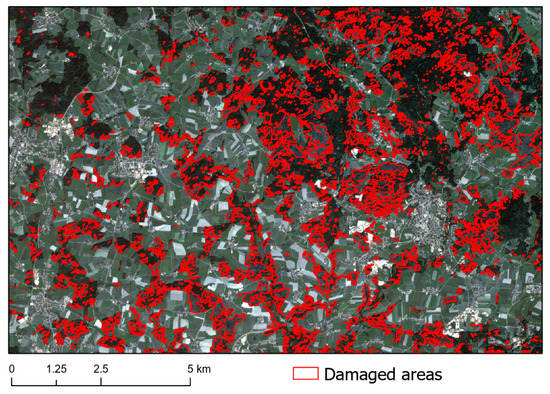
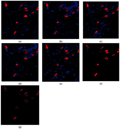
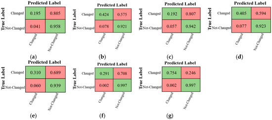
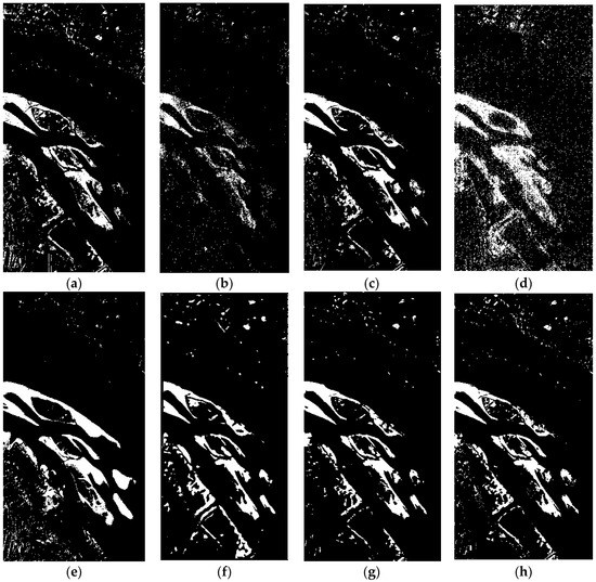
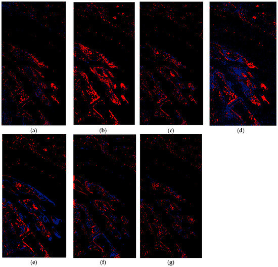
Reliable assessment of building damage is essential for effective disaster management. Synthetic Aperture Radar (SAR) has become a valuable tool for damage detection, as it operates independently of the daylight and weather conditions. However, the limited availability of high-resolution pre-disaster SAR data remains
[...] Read more.
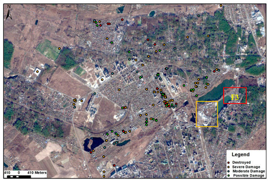
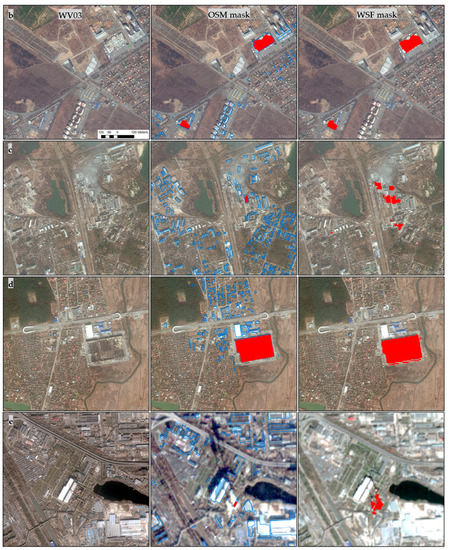
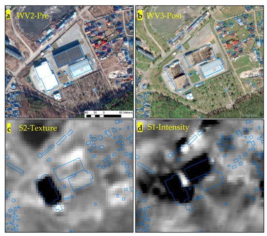
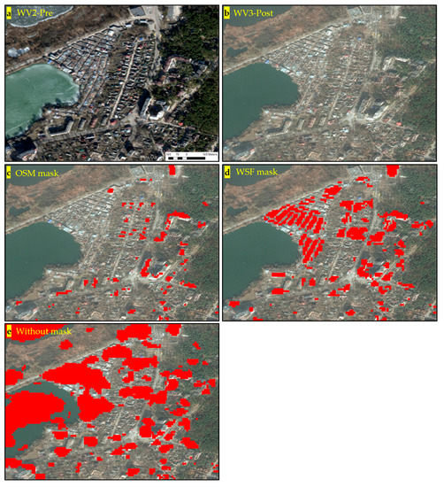
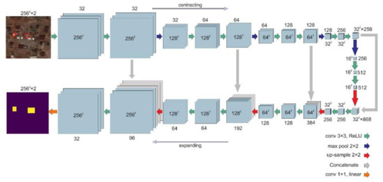
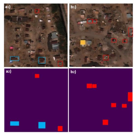
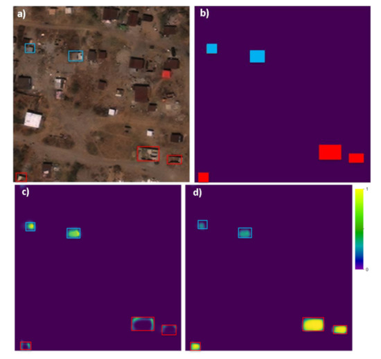
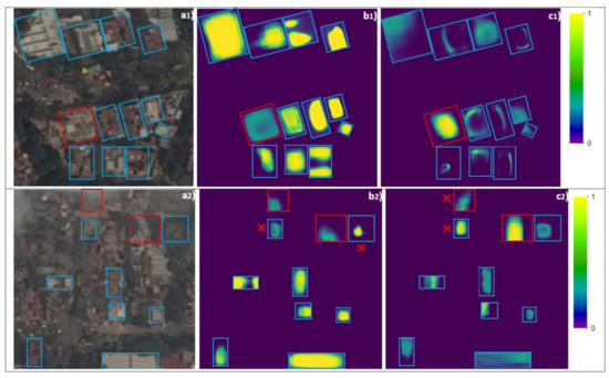
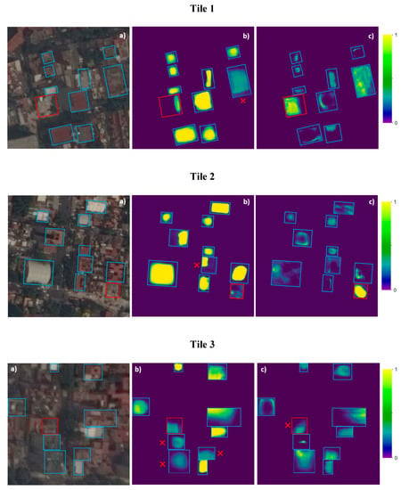
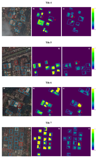
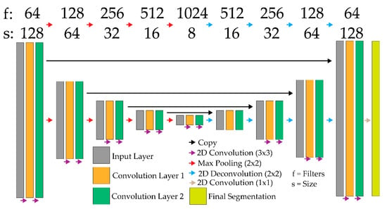
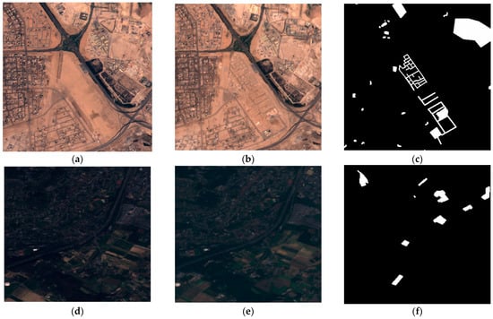
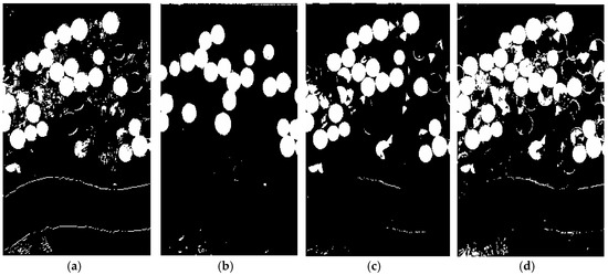
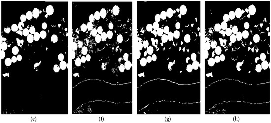
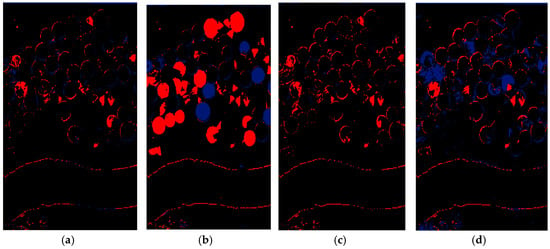
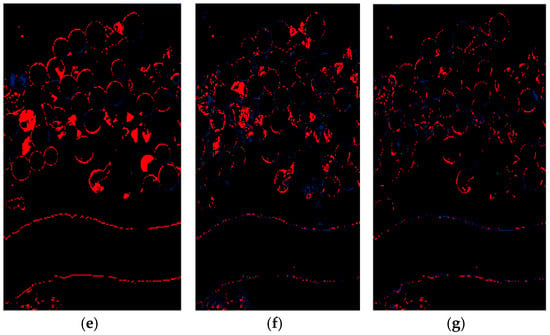
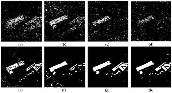
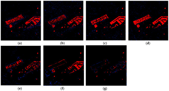
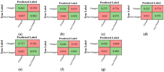
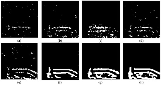
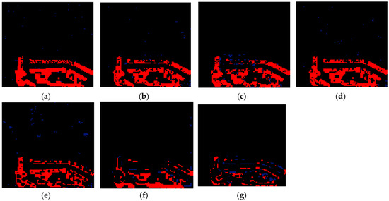
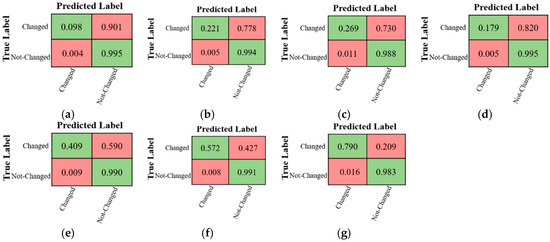
Reliable assessment of building damage is essential for effective disaster management. Synthetic Aperture Radar (SAR) has become a valuable tool for damage detection, as it operates independently of the daylight and weather conditions. However, the limited availability of high-resolution pre-disaster SAR data remains a major obstacle to accurate damage evaluation, constraining the applicability of traditional change-detection approaches. This study proposes a comprehensive framework that leverages generated SAR data alongside optical imagery for building damage detection and further examines the influence of elevation data quality on SAR synthesis and model performance. The method integrates SAR image synthesis from a Digital Surface Model (DSM) and land cover inputs with a multimodal deep learning architecture capable of jointly localizing buildings and classifying damage levels. Two data modality scenarios are evaluated: a change-detection setting using pre-disaster authentic SAR and another using GAN-generated SAR, both combined with post-disaster SAR imagery for building damage assessment. Experimental results demonstrate that GAN-generated SAR can effectively substitute for authentic SAR in multimodal damage mapping. Models using generated pre-disaster SAR achieved comparable or superior performance to those using authentic SAR, with

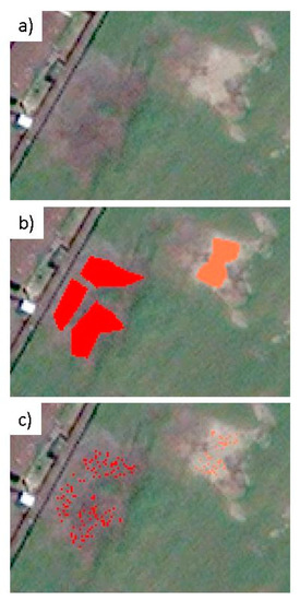
Figure 1


