Topic Editors

School of Life Sciences, Fudan University, Shanghai 200438, China
Donghai Academy, Department of Geography and Spatial Information Techniques, Zhejiang Collaborative Innovation Center for Land and Marine Spatial Utilization and Governance Research, Ningbo University, Ningbo 315211, China
College of Grassland Science and Technology, China Agricultural University, Beijing 100093, China
Dr. Xiaocui Wu
Institute for Sustainability, Energy, and Environment, University of Illinois Urbana-Champaign, Urbana, IL 61801, USA

Environmental Monitoring and Environmental Restoration for the Arid Lands and Wetlands

Abstract submission deadline
closed (29 February 2024)
Manuscript submission deadline
30 April 2024
Viewed by
17180

Topic Information

Dear Colleagues,

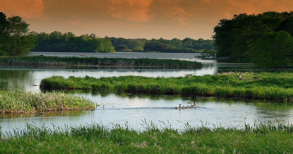
Arid lands and wetlands are among the most fragile ecosystems as they are vulnerable to climate change and human disturbances. However, they have received less attention in recent decades. Wetlands, occurring between terrestrial and aquatic environments, provide crucial ecosystem services for human beings and wildlife. However, because of climate change and intensified anthropogenic activities, wetlands have been substantially degraded or have disappeared. While arid lands are sparsely vegetated with low annual productivity, their services to more than two billion people include significant crop production and forage for wildlife and domestic livestock. They have been identified as an important player in global trends and variability in atmospheric CO2 concentrations. Thus, the environmental monitoring of and environmental restoration for arid lands and wetlands through remote sensing technologies are necessary to better evaluate the evolution of ecosystems (positive or negative) and carry out corresponding protection and management countermeasures.

This Topic, “Environmental Monitoring and Environmental Restoration for the Arid Lands and Wetlands”, aims to capture the recent advancements in the applications of remote sensing and big geospatial data in the monitoring and restoration of global or regional arid land and wetlands. Potential topics include (but are not limited to) the following: (i) automatic and accurate mapping algorithms of remote sensing (e.g., deep learning and object-oriented classification methods) for the monitoring of arid land and wetlands; (ii) tracking of spatial‒temporal dynamics of arid land and wetlands, and (iii) identification of major driving factors for the gains and losses of arid land and wetlands, such as climate, land use, population, restoration activities, and socioeconomic.

Dr. Xinxin Wang
Dr. Yongchao Liu
Prof. Dr. Jie Wang
Dr. Xiaocui Wu
Topic Editors

Keywords

  • arid land
  • wetlands
  • environmental monitoring
  • environmental restoration
  • spatial-temporal dynamics
  • big geospatial data
  • remote sensing

Participating Journals

Journal Name Impact Factor CiteScore Launched Year First Decision (median) APC
Conservation
conservation
- - 2021 30.5 Days CHF 1000 Submit
Diversity
diversity
2.4 3.1 2009 17.8 Days CHF 2600 Submit
Forests
forests
2.9 4.5 2010 16.9 Days CHF 2600 Submit
Land
land
3.9 3.7 2012 14.8 Days CHF 2600 Submit
Remote Sensing
remotesensing
5.0 7.9 2009 23 Days CHF 2700 Submit

Preprints.org is a multidiscipline platform providing preprint service that is dedicated to sharing your research from the start and empowering your research journey.

MDPI Topics is cooperating with Preprints.org and has built a direct connection between MDPI journals and Preprints.org. Authors are encouraged to enjoy the benefits by posting a preprint at Preprints.org prior to publication:

  1. Immediately share your ideas ahead of publication and establish your research priority;
  2. Protect your idea from being stolen with this time-stamped preprint article;
  3. Enhance the exposure and impact of your research;
  4. Receive feedback from your peers in advance;
  5. Have it indexed in Web of Science (Preprint Citation Index), Google Scholar, Crossref, SHARE, PrePubMed, Scilit and Europe PMC.

Published Papers (10 papers)

Order results
Result details
Journals
Select all
Export citation of selected articles as:
11 pages, 2010 KiB  
Article
What Is in the Bank? Assessing Persistent Soil Seed Bank Density of Sclerocactus wrightiae (Cactaceae)
by David Lariviere, Val Anderson, Robert Johnson and Randy Larsen
Diversity 2024, 16(3), 133; https://doi.org/10.3390/d16030133 - 21 Feb 2024
Viewed by 898
Abstract
Wright fishhook cactus is a small globose cactus endemic to an area of 280,000 ha in south-central Utah and was listed as endangered in October of 1979 by the U.S. Fish and Wildlife Service (USFWS). There is a general paucity of information about [...] Read more.
Wright fishhook cactus is a small globose cactus endemic to an area of 280,000 ha in south-central Utah and was listed as endangered in October of 1979 by the U.S. Fish and Wildlife Service (USFWS). There is a general paucity of information about this species, and no published data on the seed bank for any species in the genus. Our objective with this study was to provide insight into the established seed bank density for this species. We processed 500 soil samples from various locations near individual cacti and potential neighboring nurse plants. We found that the species had a detectable seed bank of a size similar to other members of the Cactaceae family. Seed bank densities were the highest immediately adjacent to, and downslope from, parent plants. Our data indicate that areas within 20 cm of seed-producing cacti contain by far the greatest density of seeds. These areas should be given special consideration in future management plans for this species. Full article
Show Figures

Figure 1

16 pages, 2738 KiB  
Article
Patterns of Diversity and Community Assembly and Their Environmental Explanation across Different Types of Shrublands in the Western Loess Plateau
by Jinshi Xu, Han Dang, Dechang Hu, Ping Zhang and Xiao Liu
Forests 2024, 15(2), 222; https://doi.org/10.3390/f15020222 - 23 Jan 2024
Viewed by 619
Abstract
Shrubland is an important type of vegetation in the semi-arid region of the western Loess Plateau, and it is of great value to the maintenance of biodiversity and soil and water conservation. Equally, there may be significant differences in the level of diversity [...] Read more.
Shrubland is an important type of vegetation in the semi-arid region of the western Loess Plateau, and it is of great value to the maintenance of biodiversity and soil and water conservation. Equally, there may be significant differences in the level of diversity and the community assembly patterns across different types of shrublands (desert, alpine, and secondary shrublands). This study aimed to reveal the diversity and the community assembly patterns of different types of shrublands and the environmental explanations for these by using a taxonomic and phylogenetic analysis approach, as well as by considering soil and climate factors. The diversity level of the desert shrublands was low, and the habitats of the three types of shrubland were significantly different. Precipitation may be the main environmental factor driving the variation in and diversity of these types of shrubland. All three types of shrubland were strongly affected by environmental filtering and competitive exclusion, and their community assembly patterns were similar. Full article
Show Figures

Figure 1

14 pages, 1379 KiB  
Article
Agricultural Production Efficiency and Ecological Transformation Efficiency in the Yangtze River Economic Belt
by Gui Jin, Han Yu, Dawei He and Baishu Guo
Land 2024, 13(1), 103; https://doi.org/10.3390/land13010103 - 17 Jan 2024
Viewed by 736
Abstract
Measuring the agricultural production efficiency (APE) and the ecological transformation efficiency (ETE) is key to agricultural modernization and regional ecological civilization construction. Based on the agricultural input–output dataset of the Yangtze River Economic Belt (YREB) from 2000 to 2015, we use the panel [...] Read more.
Measuring the agricultural production efficiency (APE) and the ecological transformation efficiency (ETE) is key to agricultural modernization and regional ecological civilization construction. Based on the agricultural input–output dataset of the Yangtze River Economic Belt (YREB) from 2000 to 2015, we use the panel stochastic frontier analysis (SFA) to measure the APE and ETE to explore the spatiotemporal patterns of regional APE and ETE from the geographical perspective. We rely on the quantitative association characteristics to explore the key threshold of ecological economic development in agriculture. The results show that: (1) In the study period, the APE increased from 0.2993 to 0.5495, indicating that the cumulative growth of the whole period was 83.60%, and the high-value units gradually changed from point distribution to spatial distribution; (2) Although the ETE of the YREB increased from 2000 to 2015, the proportion of the first-class species was still only 7.26% in 2015, and the inverted U-shaped polarization distribution characteristics of the high-efficiency cities and the band-like structure of global decision-making units were formed at the same time; (3) The improvement of ETE has obvious segment distribution and threshold crossing characteristics, and the APE is equal to 0.661, which is the threshold for high-speed growth and low-speed growth of ETE. The research framework, spatiotemporal rules and key thresholds have reference value for agricultural modernization and ecological civilization construction. Full article
Show Figures

Figure 1

18 pages, 12720 KiB  
Article
A “Status-Habitat-Potential” Model for the Evaluation of Plant Communities in Underwater Mining Areas via Time Series Remote Sensing Images and GEE
by Jiaxin Mi, Deli Yang, Huping Hou and Shaoliang Zhang
Land 2023, 12(12), 2097; https://doi.org/10.3390/land12122097 - 22 Nov 2023
Viewed by 1244
Abstract
Mining activities are the primary human-induced disturbances on plant communities in various ecosystems, and they also are important for implementing strategies of ecological protection and restoration based on them. The effects of underwater mining on plant communities in wetland ecosystems, however, are seldom [...] Read more.
Mining activities are the primary human-induced disturbances on plant communities in various ecosystems, and they also are important for implementing strategies of ecological protection and restoration based on them. The effects of underwater mining on plant communities in wetland ecosystems, however, are seldom demonstrated, and it is also difficult to accurately evaluate the state of plant communities’ condition, considering the dynamic and randomness of plant communities under multiple factors, including climate, mining, and other human activities. To address these issues, a “Status-Habitat-Potential” (SHP) model has been developed, with nine indicators from the status, habitat, and potential of plant communities, and the plant communities in the Nansi Lake mining area are evaluated to illustrate the effects of underwater mining. Time series remote sensing images from Sentinel-2 and Google Earth Engine are applied. Comparison analysis, Global Moran’s index, and hot and cold analysis are also used to demonstrate the spatial characteristics of the SHP index. Results show that the SHP index varies between 0 and 0.57 and shows a high aggregation pattern according to the Global Moran’s index (0.41), with high and low values aggregating in the center of the lake and living areas, respectively. The SHP index between subsidence and contrast areas shows no significant difference (at p < 0.05), indicating little effect of mining subsidence on plant communities directly. Overall, underwater mining would not cause as obvious effects on plant communities as underground mining, but human activities accompanied by mining activities will result in the loss of plant communities around lake shores and river channels. This study put forward a new model to evaluate plant communities in terms of their status, habitat, and potential, which could also be used to illustrate other long-term effects of disturbances on plant communities. Full article
Show Figures

Figure 1

20 pages, 4533 KiB  
Article
Assessing the Recent Trends of Land Degradation and Desertification in Romania Using Remote Sensing Indicators
by Irina Ontel, Sorin Cheval, Anisoara Irimescu, George Boldeanu, Vlad-Alexandru Amihaesei, Denis Mihailescu, Argentina Nertan, Claudiu-Valeriu Angearu and Vasile Craciunescu
Remote Sens. 2023, 15(19), 4842; https://doi.org/10.3390/rs15194842 - 06 Oct 2023
Cited by 3 | Viewed by 1772
Abstract
Land degradation (LD) and desertification (DS) are a sensitive global issue including southern and south-eastern Europe, which is severely affected by climate change. In this study, a state-of-the-art approach for assessing the intensity of LD and DS processes using remote-sensing-derived indicators within a [...] Read more.
Land degradation (LD) and desertification (DS) are a sensitive global issue including southern and south-eastern Europe, which is severely affected by climate change. In this study, a state-of-the-art approach for assessing the intensity of LD and DS processes using remote-sensing-derived indicators within a GIS environment was proposed. The analysis was carried out using the Principal Component Analysis based on integrating the significant trends of relevant biophysical parameters in Romania. The methodology was tested and validated at the national level in Romania. In total, 7.76% of the area was identified as LD and 60.8% of the total area tended to improve, and 31.44% was stable. Most of the regions with LD overlapped with the dryland areas, while improvement areas were identified outside of the drylands. In forested areas from high altitudes, a tendency to improve the condition of vegetation was observed, and most of the surfaces being protected were natural areas that have benefited from proper management. All these results can be used to adapt management practices to avoid, reduce, or restore the LD. The proposed model was based on globally available remote sensing datasets, with a high frequency of data acquisition and collection history that allows for the statistical analyses of changes on a global scale. Full article
Show Figures

Figure 1

17 pages, 6329 KiB  
Article
Land Use Change and the Structural Diversity of Affem Boussou Community Forest in the Tchamba 1 Commune (Tchamba Prefecture, Togo)
by Folega Fousseni, Badjare Bilouktime, Tchabi Mustapha, Mouctar Kamara, Atakpama Wouyo, Issifou Aboudoumisamilou, Djiwa Oyetunde, Wala Kperkouma, Batawila Komlan and Akpagana Koffi
Conservation 2023, 3(3), 346-362; https://doi.org/10.3390/conservation3030024 - 27 Jun 2023
Viewed by 1419
Abstract
Affem Boussou community forest (AFC) abounds in important biological resources. This study, which contributes to its better management, examines the spatiotemporal dynamics of the vegetation and its ecological and structural characteristics to propose a zoning plan for said forest. The analysis of the [...] Read more.
Affem Boussou community forest (AFC) abounds in important biological resources. This study, which contributes to its better management, examines the spatiotemporal dynamics of the vegetation and its ecological and structural characteristics to propose a zoning plan for said forest. The analysis of the spatiotemporal dynamics of land use in the AFC from Google Earth images of 2015, 2018, and 2021 revealed a regressive trend of formations: crops and fallows (−33.98%), dense dry forests (−7.92%), gallery forests (−3.46%), plantations (−100%), grassy savannahs, and meadows (−18.84%), except for tree/shrub savannahs (484.23%). The floristic inventory identified 163 species divided into 129 genera and 55 families. Fabaceae (14.02%), and Combretaceae (10.55%) are the most represented families. Anogeissus leiocarpa (5.19%) and Vitellaria paradoxa (4.72%) are the most frequent species. We note the dominance of individuals of small diameters. The regeneration potential of the AFC is 64 feet/ha due to 21 feet/ha of suckers, 29 feet/ha of seedlings, and 14 feet/ha of shoots. As a zoning plan, the AFC was subdivided into four zones: the agroforestry zone (18.80%), the sustainable production forest zone (42.22%), the buffer zone (11%), and the biological conservation zone (28%). These results constitute a scientific basis for testing ecological indicators of the sustainable management of community forests in Togo. Full article
Show Figures

Figure 1

20 pages, 22869 KiB  
Article
Plant Diversity and Distribution Patterns of Populus pruinosa Schrenk (Salicaceae) Floodplain Forests in Kazakhstan
by Liliya Dimeyeva, Anastassiya Islamgulova, Valeriya Permitina, Kapar Ussen, Aleksandr Kerdyashkin, Natalya Tsychuyeva, Zhuldyz Salmukhanbetova, Alfiya Kurmantayeva, Rashid Iskakov, Azhar Imanalinova and Bedel Kaliyev
Diversity 2023, 15(7), 797; https://doi.org/10.3390/d15070797 - 21 Jun 2023
Viewed by 1025
Abstract
Populus pruinosa is listed in the International Union for Conservation of Nature (IUCN) Red List of Threatened Species and the Red Data Book of Kazakhstan. The habitats of the species are associated with the floodplains of desert rivers, including the Syr Darya and [...] Read more.
Populus pruinosa is listed in the International Union for Conservation of Nature (IUCN) Red List of Threatened Species and the Red Data Book of Kazakhstan. The habitats of the species are associated with the floodplains of desert rivers, including the Syr Darya and the Ili. The reduction in tugai forests is associated with changes in the hydrological regimes of rivers, the reduction in groundwater, fires, and grazing. The aim of this research is to advance our knowledge of the woodlands and forests of P. pruinosa in Kazakhstan by analyzing the cenoflora and forestry characteristics, conducting ecological niche modeling to select suitable habitats for ecological restoration, and identifying rehabilitation strategies. The vegetation was studied using traditional methods of geobotanic field research in 2021 and 2022. Ecological niche modeling includes the calculation of all the environmental variables that are significant for the species, taken in their optimal ranges, and identifying the intersection of all the favorable conditions. To identify these variables, geographically linked meeting points of the studied species, climatic and soil conditions, relief characteristics identified by the SRTM and raster sets of the environmental variables (WorldClim), and distances to watercourses and settlements were accepted for consideration. A total of 102 environmental variables were used. Full article
Show Figures

Figure 1

29 pages, 4430 KiB  
Article
Comparative Phylogeography, Historical Demography, and Population Genetics of Three Common Coastal Fauna in Spartina Marshes of the Northwestern Gulf of Mexico
by Gloria Janelle Espinoza and Jaime R. Alvarado Bremer
Diversity 2023, 15(6), 792; https://doi.org/10.3390/d15060792 - 19 Jun 2023
Viewed by 1014
Abstract
Coastal wetlands worldwide are experiencing high rates of loss and degradation that may lead to a reduction in diversity in faunal populations. Since salt marsh habitats are subject to a multitude of stressors, evaluations of the genetic diversity, connectivity, and potential resilience of [...] Read more.
Coastal wetlands worldwide are experiencing high rates of loss and degradation that may lead to a reduction in diversity in faunal populations. Since salt marsh habitats are subject to a multitude of stressors, evaluations of the genetic diversity, connectivity, and potential resilience of faunal communities within salt marsh habitats are relevant. This study characterizes mitochondrial DNA (mtDNA) diversity for three common faunal residents of salt marshes along the northern Gulf of Mexico. Gulf Killifish (Fundulus grandis) samples were characterized for 1077 bp of the concatenated nucleotide sequence corresponding to the Control Region and Nitrogen Dehydrogenase, Subunits 2 and 5. Daggerblade grass shrimp (Palaemon pugio) samples were characterized using 466 bp of 16sRNA sequence, and phloem-feeding planthoppers (Prokelisia marginata) were characterized using 372 bp of Cytochrome c Oxidase Subunit I (COI) sequence. For F. grandis, our data revealed high levels of haplotypic diversity, evidence of isolation by distance (IBD), and regional population structuring associated with the distribution of two distinct phylogroups and distinct historical demography signatures. P. pugio and P. marginata displayed low levels of haplotypic diversity and evidence of population structure, but both appear to contain only snapshots of the total potential diversity for these species in the Gulf of Mexico. Greater resolution of the patterns of historical demography of Gulf Killifish may be obtained in future studies by including localities from Florida and Mexico. For both P. pugio and planthoppers, future studies would benefit from the characterization of genetic markers with a higher degree of polymorphism. We conclude that despite these three species inhabiting the same habitats along the same stretch of coast, each is subject to a different combination of evolutionary forces, and this study was able to reconstruct differences in how the genetic variation in each of these species emerged, and how it is maintained. Full article
Show Figures

Figure 1

19 pages, 3890 KiB  
Article
Mapping Phenology of Complicated Wetland Landscapes through Harmonizing Landsat and Sentinel-2 Imagery
by Chang Fan, Jilin Yang, Guosong Zhao, Junhu Dai, Mengyao Zhu, Jinwei Dong, Ruoqi Liu and Geli Zhang
Remote Sens. 2023, 15(9), 2413; https://doi.org/10.3390/rs15092413 - 05 May 2023
Cited by 3 | Viewed by 1750
Abstract
Wetlands are important CO2 sinks and methane sources, and their seasonality and phenological cycle play an essential role in understanding the carbon budget. However, given the spatial heterogeneity of wetland landscapes and the coarser spatial resolution of satellites, the phenological retrievals of [...] Read more.
Wetlands are important CO2 sinks and methane sources, and their seasonality and phenological cycle play an essential role in understanding the carbon budget. However, given the spatial heterogeneity of wetland landscapes and the coarser spatial resolution of satellites, the phenological retrievals of wetlands are challenging. Here we examined the phenology of wetlands from 30 m harmonized Landsat/Sentinel-2 (LandSent30) and 500 m MODIS satellite observations using the ground phenology network PhenoCam as a benchmark. This study used all 11 available wetland PhenoCam sites (about 30 site years), covering diverse wetland types from different climate zones. We found that the LandSent30-based phenology results were in overall higher consistency with the PhenoCam results compared to MODIS, which could be related to the better explanation capacity of LandSent30 data in the heterogeneous landscapes of wetlands. This also means that the LandSent30 has an advantage over the 500 m MODIS regarding wetland vegetation phenological retrievals. It should be noted that the LandSent30 did not show a greatly improved performance, which could be related to the specificity and complexity of the wetlands landscape. We also illustrated the potential effects of the location and observation direction of PhenoCam cameras, the selection of Region of Interest (ROI), as well as the landscape composition of the site. Overall, this study highlights the complexity of wetland phenology from both ground and remote sensing observations at different scales, which paves the road for understanding the role of wetlands in global climate change and provides a basis for understanding the real phenological changes of wetland surfaces. Full article
Show Figures

Graphical abstract

22 pages, 7610 KiB  
Article
Constructed Wetlands Using Treated Membrane Concentrate for Coastal Wetland Restoration and the Renewal of Multiple Ecosystem Services
by Rajat K. Chakraborti and James S. Bays
Land 2023, 12(4), 847; https://doi.org/10.3390/land12040847 - 07 Apr 2023
Cited by 1 | Viewed by 4453
Abstract
The management of reverse osmosis concentrate (ROC) poses a challenge to utilities as it requires expensive disposal methods and advanced treatment in order to comply with regulations. This paper presents studies of natural treatment approaches, such as constructed wetlands (CWs), that have been [...] Read more.
The management of reverse osmosis concentrate (ROC) poses a challenge to utilities as it requires expensive disposal methods and advanced treatment in order to comply with regulations. This paper presents studies of natural treatment approaches, such as constructed wetlands (CWs), that have been tailored to treat ROC. Conceptually, with testing and planning, these wetlands could meet regulatory criteria before discharging to the surface water and achieving multiple benefits. Lessons learned from pilot studies of wetland treatment of ROC point to the potential benefits of designing full-scale wetlands for concentrate management. Studies have illustrated the ability of CWs to reduce the concentrations of metals and simultaneously remove nutrients to meet state standards for aquatic and wildlife designated uses. Nutrient removal processes include denitrification for nitrogen removal (possibly supplemented with Annamox reduction of NO3-N), labile carbon assimilation supporting oxidized nitrogen reduction, and phosphate-P uptake and precipitation. Because of the evaporative water loss, mass removal efficiencies were greater than concentration reductions. Studies illustrate how engineered wetlands help with the management of ROC produced from reclaimed water through reductions in concentration and volume for disposal through evapotranspiration. The associated creation of wildlife habitats and coastal wetland restoration could result in the renewal of multiple ecosystem services. Full article
Show Figures

Figure 1

Back to TopTop