You are currently viewing a new version of our website. To view the old version click .

Remote Sensing, Volume 14, Issue 6

March-2 2022 - 227 articles

Cover Story: 
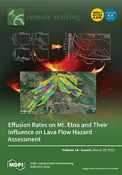
A statistical analysis of the effusion rate of recent flank eruptions at Mt Etna was performed, finding that most peaks occur at the beginning of eruptions, between 0.5% and 29% of the total duration, followed by a progressive decrease. Three generalized curves were derived through the calculation of the 25th, 50th, and 75th percentiles linked to the distribution of peaks and slope variations. Lava flow simulations were run by using each characteristic curve to quantify the differences in run-out distance, proving that an early incidence of the effusion rate peak can induce variations up to 40%. Our tests highlights how effusion rate strongly influences the emplacement of lava flow fields, with significant repercussion both on long- and short-term hazard assessment associated with effusive eruptions. View this paper
  • Issues are regarded as officially published after their release is announced to the table of contents alert mailing list .
  • You may sign up for email alerts to receive table of contents of newly released issues.
  • PDF is the official format for papers published in both, html and pdf forms. To view the papers in pdf format, click on the "PDF Full-text" link, and use the free Adobe Reader to open them.

Articles (227)

  • Article
  • Open Access
10 Citations
4,213 Views
21 Pages

21 March 2022

Aerosol optical depth (AOD) data derived from satellite products have been widely used to estimate fine particulate matter (PM2.5) concentrations. However, existing approaches to estimate PM2.5 concentrations are invariably limited by the availabilit...

  • Article
  • Open Access
25 Citations
5,913 Views
18 Pages

A Supervoxel-Based Random Forest Method for Robust and Effective Airborne LiDAR Point Cloud Classification

  • Lingfeng Liao,
  • Shengjun Tang,
  • Jianghai Liao,
  • Xiaoming Li,
  • Weixi Wang,
  • Yaxin Li and
  • Renzhong Guo

21 March 2022

As an essential part of point cloud processing, autonomous classification is conventionally used in various multifaceted scenes and non-regular point distributions. State-of-the-art point cloud classification methods mostly process raw point clouds,...

  • Article
  • Open Access
6 Citations
3,002 Views
20 Pages

21 March 2022

Moving target imaging in high-squint synthetic aperture radar (SAR) shows great potential for reconnaissance and surveillance tasks. For the desired resolution, high-squint SAR has a long-time coherent processing interval (CPI). In this case, the man...

  • Article
  • Open Access
55 Citations
10,798 Views
31 Pages

Calibration and Validation of SWAT Model by Using Hydrological Remote Sensing Observables in the Lake Chad Basin

  • Ali Bennour,
  • Li Jia,
  • Massimo Menenti,
  • Chaolei Zheng,
  • Yelong Zeng,
  • Beatrice Asenso Barnieh and
  • Min Jiang

21 March 2022

Model calibration and validation are challenging in poorly gauged basins. We developed and applied a new approach to calibrate hydrological models using distributed geospatial remote sensing data. The Soil and Water Assessment Tool (SWAT) model was c...

  • Article
  • Open Access
7 Citations
5,238 Views
22 Pages

21 March 2022

Remote sensing images are widely used in many applications. However, due to being limited by the sensors, it is difficult to obtain high-resolution (HR) images from remote sensing images. In this paper, we propose a novel unsupervised cross-domain su...

  • Article
  • Open Access
6 Citations
4,808 Views
14 Pages

A Proposed Satellite-Based Crop Insurance System for Smallholder Maize Farming

  • Wonga Masiza,
  • Johannes George Chirima,
  • Hamisai Hamandawana,
  • Ahmed Mukalazi Kalumba and
  • Hezekiel Bheki Magagula

21 March 2022

Crop farming in Sub-Saharan Africa is constantly confronted by extreme weather events. Researchers have been striving to develop different tools that can be used to reduce the impacts of adverse weather on agriculture. Index-based crop insurance (IBC...

  • Article
  • Open Access
8 Citations
4,740 Views
28 Pages

21 March 2022

Black carbon (BC) absorption aerosol optical depth (AAODBC) defines the contribution of BC in light absorption and is retrievable using sun/sky radiometer measurements provided by Aerosol Robotic Network (AERONET) inversion products. In this study, w...

  • Article
  • Open Access
16 Citations
4,915 Views
20 Pages

SIF-Based GPP Is a Useful Index for Assessing Impacts of Drought on Vegetation: An Example of a Mega-Drought in Yunnan Province, China

  • Chuanhua Li,
  • Lixiao Peng,
  • Min Zhou,
  • Yufei Wei,
  • Lihui Liu,
  • Liangliang Li,
  • Yunfan Liu,
  • Tianbao Dou,
  • Jiahao Chen and
  • Xiaodong Wu

21 March 2022

The impact of drought on terrestrial ecosystem Gross Primary Productivity (GPP) is strong and widespread; therefore, it is important to study the response of terrestrial ecosystem GPP to drought. In this paper, we compared the correlations of Sun-ind...

  • Article
  • Open Access
20 Citations
5,405 Views
29 Pages

Glacier Recession in the Altai Mountains after the LIA Maximum

  • Dmitry Ganyushkin,
  • Kirill Chistyakov,
  • Ekaterina Derkach,
  • Dmitriy Bantcev,
  • Elena Kunaeva,
  • Anton Terekhov and
  • Valeria Rasputina

20 March 2022

The study aims to reconstruct the Altai glaciers at the maximum of the LIA, to estimate the reduction of the Altai glaciers from the LIA maximum to the present, and to analyze glacier reduction rates on the example of the Tavan Bogd mountain range. R...

  • Article
  • Open Access
43 Citations
7,673 Views
23 Pages

20 March 2022

Remote sensing (RS) image classification has attracted much attention recently and is widely used in various fields. Different to natural images, the RS image scenes consist of complex backgrounds and various stochastically arranged objects, thus mak...

of 23

Get Alerted

Add your email address to receive forthcoming issues of this journal.

XFacebookLinkedIn
Remote Sens. - ISSN 2072-4292