You are currently viewing a new version of our website. To view the old version click .

Remote Sensing, Volume 14, Issue 7

April-1 2022 - 241 articles

  • Issues are regarded as officially published after their release is announced to the table of contents alert mailing list .
  • You may sign up for email alerts to receive table of contents of newly released issues.
  • PDF is the official format for papers published in both, html and pdf forms. To view the papers in pdf format, click on the "PDF Full-text" link, and use the free Adobe Reader to open them.
Cover Story: 
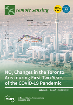
This work shows changes in tropospheric and surface nitrogen dioxide (NO2) that were observed during first two years of the COVID-19 pandemic in the Greater Toronto Area, Canada. Meteorological and satellite data were used to facilitate the analysis and reveal detailed local emission changes from different areas of the City of Toronto. Ground-based remote sensing data show a clear reduction in NO2, especially in the more polluted downtown and airport areas (reductions from 35% to 40% in 2020 compared to 5-year mean value). Compared to the sharp decline in NO2 emissions in 2020, the atmospheric NO2 amounts in 2021 started to recover, but were still below the mean values of the pre-pandemic time. For some sites, the pre-pandemic NO2 peak caused by local morning rush hour had still not returned in 2021, indicating a change in local traffic and commuter patterns. View this paper.

Articles (241)

  • Article
  • Open Access
10 Citations
3,374 Views
25 Pages

Hierarchical Disentangling Network for Building Extraction from Very High Resolution Optical Remote Sensing Imagery

  • Jianhao Li,
  • Yin Zhuang,
  • Shan Dong,
  • Peng Gao,
  • Hao Dong,
  • He Chen,
  • Liang Chen and
  • Lianlin Li

6 April 2022

Building extraction using very high resolution (VHR) optical remote sensing imagery is an essential interpretation task that impacts human life. However, buildings in different environments exhibit various scales, complicated spatial distributions, a...

  • Article
  • Open Access
9 Citations
3,646 Views
18 Pages

6 April 2022

As a unique ecosystem with multiple ecological functions but high fragility, grassland in arid areas is very vulnerable to changes in the natural environment or human activities, resulting in various ecological and environmental problems. In order to...

  • Article
  • Open Access
8 Citations
3,501 Views
23 Pages

6 April 2022

Tephra plumes from explosive volcanic eruptions can be hazardous for the lives and livelihoods of people living in the proximity of volcanoes. Monitoring and forecasting tephra plumes play essential roles in the detection, characterization and hazard...

  • Article
  • Open Access
4 Citations
3,334 Views
18 Pages

6 April 2022

Gravimetry measurements from the GRACE and GRACE-Follow-On satellites provide observations of ocean bottom pressure (OBP), which can be differenced between basin boundaries to infer mass transport variability at a given level in the deep ocean. Howev...

  • Technical Note
  • Open Access
5 Citations
2,568 Views
10 Pages

6 April 2022

The Soil Moisture Active Passive (SMAP) mission includes a unique combination of instruments intended to provide daily global soil moisture data with high accuracy and resolution. Due to radar instrument failure, the default resolution of the data pr...

  • Article
  • Open Access
3 Citations
2,868 Views
14 Pages

6 April 2022

Piton de la Fournaise is one of the most active worldwide volcanoes, located on the southeastern part of La Réunion Island. In this work, we focus on the eruption that occurred on the southeastern flank of this volcano, inside the Enclos Fouqu...

  • Article
  • Open Access
40 Citations
7,563 Views
17 Pages

Drone-Borne Ground-Penetrating Radar for Snow Cover Mapping

  • Andrea Vergnano,
  • Diego Franco and
  • Alberto Godio

6 April 2022

Ground-penetrating radar (GPR) is one of the most commonly used instruments to map the Snow Water Equivalent (SWE) in mountainous regions. However, some areas may be difficult or dangerous to access; besides, some surveys can be quite time-consuming....

  • Article
  • Open Access
8 Citations
3,687 Views
24 Pages

Grassland Conservation Effectiveness of National Nature Reserves in Northern China

  • Siqing Zhao,
  • Xiang Zhao,
  • Jiacheng Zhao,
  • Naijing Liu,
  • Mengmeng Sun,
  • Baohui Mu,
  • Na Sun and
  • Yinkun Guo

6 April 2022

Grasslands are crucial ecosystem biomes for breeding livestock and combatting climate change. By 2018, the national nature reserves (NNRs) in the Inner Mongolia Autonomous Region (IMAR) had constituted 8.55% of the land area. However, there is still...

  • Article
  • Open Access
34 Citations
7,023 Views
21 Pages

6 April 2022

Landslides, a major natural geohazard, obstruct municipal constructions and may destroy villages and towns, at worst causing significant casualties and economic losses. Interferometric Synthetic Aperture Radar (InSAR) technique offers distinct advant...

  • Article
  • Open Access
27 Citations
5,424 Views
23 Pages

Combinations of Feature Selection and Machine Learning Algorithms for Object-Oriented Betel Palms and Mango Plantations Classification Based on Gaofen-2 Imagery

  • Hongxia Luo,
  • Maofen Li,
  • Shengpei Dai,
  • Hailiang Li,
  • Yuping Li,
  • Yingying Hu,
  • Qian Zheng,
  • Xuan Yu and
  • Jihua Fang

6 April 2022

Betel palms and mango plantations are two crucial commercial crops in tropical agricultural areas. Accurate spatial distributions of these two crops are essential in tropical agricultural regional planning and management. However, the characteristics...

of 25