You are currently viewing a new version of our website. To view the old version click .

Remote Sensing, Volume 14, Issue 2

January-2 2022 - 190 articles

Cover Story: 
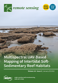
In coastal regions of Western Europe, the polychaete Sabellaria alveolata (Linné) builds large intertidal reefs of several hectares on soft-bottom substrates that host a high biodiversity and provide ecological functions, such as protection against coastal erosion. A multispectral UAV-based structure-from-motion photogrammetric survey was carried out to map the complex three-dimensional bioconstructions and the epibionts impacting the reef (oysters, mussels, green macroalgae) at a very high resolution (few cm per pixel). This survey was carried out in October 2020 over the second-largest known European reef on Noirmoutier Island (France). Both topographic and multispectral information was used to derive new variables and indices that can be relevant to describe the health status of large intertidal reefs and further help stakeholders in managing these protected habitats. View this paper.
  • Issues are regarded as officially published after their release is announced to the table of contents alert mailing list .
  • You may sign up for email alerts to receive table of contents of newly released issues.
  • PDF is the official format for papers published in both, html and pdf forms. To view the papers in pdf format, click on the "PDF Full-text" link, and use the free Adobe Reader to open them.

Articles (190)

  • Article
  • Open Access
14 Citations
5,851 Views
31 Pages

3D Modeling of Urban Area Based on Oblique UAS Images—An End-to-End Pipeline

  • Valeria-Ersilia Oniga,
  • Ana-Ioana Breaban,
  • Norbert Pfeifer and
  • Maximilian Diac

17 January 2022

3D modelling of urban areas is an attractive and active research topic, as 3D digital models of cities are becoming increasingly common for urban management as a consequence of the constantly growing number of people living in cities. Viewed as a dig...

  • Article
  • Open Access
16 Citations
4,087 Views
18 Pages

17 January 2022

Reliable estimation of the atmospheric boundary layer height (ABLH) is critical for a range of meteorological applications, including air quality assessment and weather forecasting. Several algorithms have been proposed to detect ABLH from aerosol Li...

  • Article
  • Open Access
122 Citations
8,205 Views
22 Pages

Small Object Detection Method Based on Adaptive Spatial Parallel Convolution and Fast Multi-Scale Fusion

  • Guanqiu Qi,
  • Yuanchuan Zhang,
  • Kunpeng Wang,
  • Neal Mazur,
  • Yang Liu and
  • Devanshi Malaviya

17 January 2022

As one type of object detection, small object detection has been widely used in daily-life-related applications with many real-time requirements, such as autopilot and navigation. Although deep-learning-based object detection methods have achieved gr...

  • Article
  • Open Access
2 Citations
2,544 Views
22 Pages

Hybrid Compact Polarimetric SAR Calibration Considering the Amplitude and Phase Coefficients Inconsistency

  • Wentao Hou,
  • Fengjun Zhao,
  • Xiuqing Liu,
  • Dacheng Liu,
  • Yonghui Han,
  • Yao Gao and
  • Robert Wang

17 January 2022

Calibration using corner reflectors is an effective way to estimate the distortion parameters of hybrid compact polarimetric (HCP) synthetic aperture radar (SAR) systems. However, the existing literature lacks a discussion on the inconsistency of the...

  • Article
  • Open Access
13 Citations
3,595 Views
19 Pages

17 January 2022

Since the COVID-19 outbreak in 2020, China’s air pollution has been significantly affected by control measures on industrial production and human activities. In this study, we analyzed the temporal variations of NO2 concentrations during the CO...

  • Article
  • Open Access
16 Citations
4,222 Views
17 Pages

17 January 2022

As natural wetlands are degrading worldwide, artificial wetlands can operate as a substitute to provide waterbirds with refuge, but they cannot replace natural wetlands. Reservoirs, one of the most common artificial wetlands in China, can be of great...

  • Article
  • Open Access
6 Citations
3,344 Views
22 Pages

17 January 2022

The paper presents a concept of an air pollution monitoring system with prediction abilities, based on wireless smart sensors, that takes into account local conditions (microclimate) prevailing in particular areas of the city. In most cases reported...

  • Article
  • Open Access
27 Citations
5,870 Views
25 Pages

17 January 2022

The leaf area index (LAI), a valuable variable for assessing vine vigor, reflects nutrient concentrations in vineyards and assists in precise management, including fertilization, improving yield, quality, and vineyard uniformity. Although some vegeta...

  • Article
  • Open Access
2 Citations
2,293 Views
16 Pages

Tomographic Inversion Methods for Retrieving the Tropospheric Water Vapor Content Based on the NDSA Measurement Approach

  • Agnese Mazzinghi,
  • Fabrizio Cuccoli,
  • Fabrizio Argenti,
  • Arjan Feta and
  • Luca Facheris

17 January 2022

In this paper, we deal with the problem of retrieving maps of tropospheric Water Vapor (WV) concentration by means of a set of Low Earth Orbit (LEO) satellites orbiting in the same plane and along the same direction. It is assumed that a number of mi...

  • Article
  • Open Access
47 Citations
5,836 Views
20 Pages

Capability of GPM IMERG Products for Extreme Precipitation Analysis over the Indonesian Maritime Continent

  • Ravidho Ramadhan,
  • Marzuki Marzuki,
  • Helmi Yusnaini,
  • Robi Muharsyah,
  • Wiwit Suryanto,
  • Sholihun Sholihun,
  • Mutya Vonnisa,
  • Alessandro Battaglia and
  • Hiroyuki Hashiguchi

17 January 2022

Integrated Multi-satellite Retrievals for GPM (IMERG) data have been widely used to analyze extreme precipitation, but the data have never been validated for the Indonesian Maritime Continent (IMC). This study evaluated the capability of IMERG Early...

of 19

Get Alerted

Add your email address to receive forthcoming issues of this journal.

XFacebookLinkedIn
Remote Sens. - ISSN 2072-4292