

Remote Sens., Volume 13, Issue 12 (June-2 2021) – 192 articles
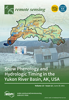
Cover Story (view full-size image):
Alaska’s Yukon River is a prominent feature of the Arctic–Boreal landscape—providing transportation and ecosystem services to many communities. We present a first analysis of satellite-derived snow properties and their interaction with hydrologic processes along the Yukon River, including the spring flood pulse and river ice break up (RIB) timing. A suite of passive microwave satellite-derived snow metrics, including Main Melt Onset Date, Snowoff Date, and Snowmelt Duration from 1988 to 2016, are presented and validated using in situ observations and complementary satellite data. We found meaningful correspondence between areal quantiles of the satellite snow metrics and measured streamflow quantiles and RIB observations, demonstrating the snow metrics’ potential for the monitoring and forecasting of hydrologic events along the Yukon River. View this paper
- Issues are regarded as officially published after their release is announced to the table of contents alert mailing list.
- You may sign up for e-mail alerts to receive table of contents of newly released issues.
- PDF is the official format for papers published in both, html and pdf forms. To view the papers in pdf format, click on the "PDF Full-text" link, and use the free Adobe Reader to open them.
Previous Issue
Next Issue