You are currently viewing a new version of our website. To view the old version click .

Remote Sensing, Volume 13, Issue 11

June-1 2021 - 213 articles

Cover Story: 
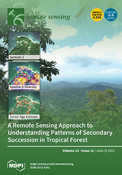
Monitoring biodiversity on a global scale is a major challenge for biodiversity conservation. In tropical forests, exhaustive and detailed field surveys are costly and challenging. In the face of increasing anthropogenic pressures, it is imperative that we find ways to efficiently assess patterns of biodiversity change. Recent developments in optical remote sensing have proven effective at estimating the biophysical parameters of vegetation, but a gap has yet to be bridged to manage remote-sensing-based biodiversity assessments. Quantifying spectral variation in terms of diversity indices is a novel possibility to link spectral information and field-based indices. This work presents the complementarity between those two sources of information to study patterns of biodiversity in secondary tropical forest. View this paper
  • Issues are regarded as officially published after their release is announced to the table of contents alert mailing list .
  • You may sign up for email alerts to receive table of contents of newly released issues.
  • PDF is the official format for papers published in both, html and pdf forms. To view the papers in pdf format, click on the "PDF Full-text" link, and use the free Adobe Reader to open them.

Articles (213)

  • Feature Paper
  • Article
  • Open Access
45 Citations
6,958 Views
32 Pages

Drivers of Organic Carbon Stocks in Different LULC History and along Soil Depth for a 30 Years Image Time Series

  • Mahboobeh Tayebi,
  • Jorge Tadeu Fim Rosas,
  • Wanderson de Sousa Mendes,
  • Raul Roberto Poppiel,
  • Yaser Ostovari,
  • Luis Fernando Chimelo Ruiz,
  • Natasha Valadares dos Santos,
  • Carlos Eduardo Pellegrino Cerri,
  • Sérgio Henrique Godinho Silva and
  • Nilton Curi
  • + 2 authors

7 June 2021

Soil organic carbon (SOC) stocks are a remarkable property for soil and environmental monitoring. The understanding of their dynamics in crop soils must go forward. The objective of this study was to determine the impact of temporal environmental con...

  • Article
  • Open Access
7 Citations
3,113 Views
18 Pages

7 June 2021

The imaging quality of InISAR under squint geometry can be greatly degraded due to the serious interferometric phase ambiguity (InPhaA) and thus result in image distortion problems. Aiming to solve these problems, a three-dimensional InISAR (3D ISAR)...

  • Article
  • Open Access
21 Citations
4,787 Views
19 Pages

Tropospheric Volcanic SO2 Mass and Flux Retrievals from Satellite. The Etna December 2018 Eruption

  • Stefano Corradini,
  • Lorenzo Guerrieri,
  • Hugues Brenot,
  • Lieven Clarisse,
  • Luca Merucci,
  • Federica Pardini,
  • Alfred J. Prata,
  • Vincent J. Realmuto,
  • Dario Stelitano and
  • Nicolas Theys

7 June 2021

The presence of volcanic clouds in the atmosphere affects air quality, the environment, climate, human health and aviation safety. The importance of the detection and retrieval of volcanic SO2 lies with risk mitigation as well as with the possibility...

  • Article
  • Open Access
7 Citations
4,087 Views
25 Pages

7 June 2021

The signature of the 2019 Declaration of Cooperation on advancing the digitization of cultural heritage in Europe shows the important role that the 3D digitization process plays in the safeguard and sustainability of cultural heritage. The digitizati...

  • Article
  • Open Access
33 Citations
7,631 Views
25 Pages

Validation of Sentinel-3 SLSTR Land Surface Temperature Retrieved by the Operational Product and Comparison with Explicitly Emissivity-Dependent Algorithms

  • Lluís Pérez-Planells,
  • Raquel Niclòs,
  • Jesús Puchades,
  • César Coll,
  • Frank-M. Göttsche,
  • José A. Valiente,
  • Enric Valor and
  • Joan M. Galve

7 June 2021

Land surface temperature (LST) is an essential climate variable (ECV) for monitoring the Earth climate system. To ensure accurate retrieval from satellite data, it is important to validate satellite derived LSTs and ensure that they are within the re...

  • Article
  • Open Access
18 Citations
3,904 Views
19 Pages

Multi-Scale Fused SAR Image Registration Based on Deep Forest

  • Shasha Mao,
  • Jinyuan Yang,
  • Shuiping Gou,
  • Licheng Jiao,
  • Tao Xiong and
  • Lin Xiong

7 June 2021

SAR image registration is a crucial problem in SAR image processing since the registration results with high precision are conducive to improving the quality of other problems, such as change detection of SAR images. Recently, for most DL-based SAR i...

  • Article
  • Open Access
26 Citations
5,232 Views
17 Pages

7 June 2021

Ground-based weather radar data plays an essential role in monitoring severe convective weather. The detection of such weather systems in time is critical for saving people’s lives and property. However, the limited spatial coverage of radars over th...

  • Article
  • Open Access
20 Citations
6,169 Views
18 Pages

Caching-Aware Intelligent Handover Strategy for LEO Satellite Networks

  • Tao Leng,
  • Yuanyuan Xu,
  • Gaofeng Cui and
  • Weidong Wang

7 June 2021

Recently, many Low Earth Orbit (LEO) satellite networks are being implemented to provide seamless communication services for global users. Since the high mobility of LEO satellites, handover strategy has become one of the most important topics for LE...

  • Article
  • Open Access
15 Citations
5,541 Views
36 Pages

Evaluating Carbon Monoxide and Aerosol Optical Depth Simulations from CAM-Chem Using Satellite Observations

  • Débora Souza Alvim,
  • Júlio Barboza Chiquetto,
  • Monica Tais Siqueira D’Amelio,
  • Bushra Khalid,
  • Dirceu Luis Herdies,
  • Jayant Pendharkar,
  • Sergio Machado Corrêa,
  • Silvio Nilo Figueroa,
  • Ariane Frassoni and
  • Vinicius Buscioli Capistrano
  • + 3 authors

7 June 2021

The scope of this work was to evaluate simulated carbon monoxide (CO) and aerosol optical depth (AOD) from the CAM-chem model against observed satellite data and additionally explore the empirical relationship of CO, AOD and fire radiative power (FRP...

  • Article
  • Open Access
34 Citations
7,162 Views
28 Pages

Making Use of 3D Models for Plant Physiognomic Analysis: A Review

  • Abhipray Paturkar,
  • Gourab Sen Gupta and
  • Donald Bailey

7 June 2021

Use of 3D sensors in plant phenotyping has increased in the last few years. Various image acquisition, 3D representations, 3D model processing and analysis techniques exist to help the researchers. However, a review of approaches, algorithms, and tec...

of 22

Get Alerted

Add your email address to receive forthcoming issues of this journal.

XFacebookLinkedIn
Remote Sens. - ISSN 2072-4292