

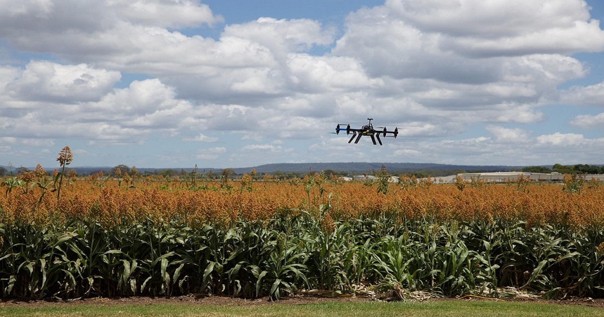
Advances of UAV in Precision Agriculture
A special issue of Drones (ISSN 2504-446X). This special issue belongs to the section "Drones in Agriculture and Forestry".
Deadline for manuscript submissions: closed (25 December 2024) | Viewed by 150101
Special Issue Editors

Interests: precision agriculture; remote sensing; phenology; photogrammetry
Special Issues, Collections and Topics in MDPI journals

Interests: bio-inspired perception and embodied intelligent control of unmanned systems
Special Issues, Collections and Topics in MDPI journals
Special Issue Information
Dear Colleagues,
At present, intelligent agricultural unmanned systems have covered space (navigation, remote sensing, meteorological, and communication satellites), air (plant-protection UAVs, remote sensing and mapping UAVs, long-endurance solar-powered UAVs, long-endurance airships, and bionic flying robots), ground (unmanned farming/harvesting machinery, biomass energy system, soil improved bionic robot, and unmanned animal-husbandry robot), and water (unmanned underwater vehicle, underwater operation robot, and unmanned aquaculture system): four spatial dimensions with broad development prospects. Establishing an agricultural integrated space–air–ground–water cooperation and precision operation system based on the closed-loop control of large systems, studying the intelligent sensing and control technology of intelligent agricultural unmanned systems and establishing application demonstration bases all over the world play an important role in supporting leaping developments regarding automotive operations, intelligent operations, unmanned operations, and cluster operations of intelligent agricultural machinery and equipment. It is also of great significance to realize the short-term goal “unmanned farming” and the long-term goal “unmanned agriculture” of world agricultural modernization.
This Special Issue is aimed at publishing state-of-the-art advances and the latest achievements of UAV technologies in precision agriculture which fully relates to the journal scope.
Articles covering but not limited to recent research on the following topics are invited to this Special Issue:
- Agricultural information integrated space-air-ground-water remote sensing and monitoring network (satellites, UAVs, UGVs, USVs and UUVs) and multi-source data fusion for agricultural applications;
- Unmanned agricultural intelligent sensing and control system, intelligent agricultural equipment, and autonomous systems for agricultural machinery field operations;
- Unmanned simultaneous localization and mapping, and sensing of unmanned robots in agriculture;
- Unmanned agricultural robots guidance (path planning), navigation and control;
- Bio-inspired swarm intelligence and multi-agent system cooperative control;
- Unmanned soil moisture and crop phenotype detection, hyper-spectral sensing, and quantitative inversion;
- Spray or seeding Drones for agricultural applications (Fertilization, Crop Protection);
- Drones for Precision Agriculture, e.g., nutrients analysis, insect infestation analysis, fungus infestation analysis, snails attack mapping, soil quality and soil compaction mapping, drainage system analysis, Harvest prediction;
- Bionic flying robots, and the flying robot with soft grasping manipulator;
- Drones in / for green house.
Dr. Görres Grenzdörffer
Dr. Jian Chen
Guest Editors
Manuscript Submission Information
Manuscripts should be submitted online at www.mdpi.com by registering and logging in to this website. Once you are registered, click here to go to the submission form. Manuscripts can be submitted until the deadline. All submissions that pass pre-check are peer-reviewed. Accepted papers will be published continuously in the journal (as soon as accepted) and will be listed together on the special issue website. Research articles, review articles as well as short communications are invited. For planned papers, a title and short abstract (about 250 words) can be sent to the Editorial Office for assessment.
Submitted manuscripts should not have been published previously, nor be under consideration for publication elsewhere (except conference proceedings papers). All manuscripts are thoroughly refereed through a single-blind peer-review process. A guide for authors and other relevant information for submission of manuscripts is available on the Instructions for Authors page. Drones is an international peer-reviewed open access monthly journal published by MDPI.
Please visit the Instructions for Authors page before submitting a manuscript. The Article Processing Charge (APC) for publication in this open access journal is 2600 CHF (Swiss Francs). Submitted papers should be well formatted and use good English. Authors may use MDPI's English editing service prior to publication or during author revisions.
Keywords
- agricultural UAV
- guidance, navigation and control
- SLAM
- swarm intelligence
- remote sensing
- crop phenotype awareness
- crop and/or water stress assessment
- drones for agricultural applications
- drones for precision agriculture
- precision viticulture
Benefits of Publishing in a Special Issue
- Ease of navigation: Grouping papers by topic helps scholars navigate broad scope journals more efficiently.
- Greater discoverability: Special Issues support the reach and impact of scientific research. Articles in Special Issues are more discoverable and cited more frequently.
- Expansion of research network: Special Issues facilitate connections among authors, fostering scientific collaborations.
- External promotion: Articles in Special Issues are often promoted through the journal's social media, increasing their visibility.
- Reprint: MDPI Books provides the opportunity to republish successful Special Issues in book format, both online and in print.
Further information on MDPI's Special Issue policies can be found here.
Related Special Issue
- Advances of UAV in Precision Agriculture—2nd Edition in Drones (10 articles)