Next Issue
Volume 9, March
Previous Issue
Volume 9, January


Smart Cities, Volume 9, Issue 2 (February 2026) – 21 articles

Cover Story (view full-size image): 
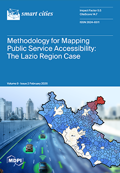
This study creates an agile and reproducible methodology that maps spatial access to essential education and healthcare services across the Lazio Region (Italy) using an urban-center scale and traffic-aware routing for car and public transport. High-resolution indicators of distance, travel time and intra-municipal variability reveal strong metropolitan peripheral gradients and underserved mountainous areas, especially for specialized healthcare and secondary schools. Results are published as linked open data and explored through an interactive web viewer, enabling transparent reuse and cross-regional benchmarking with the community of Madrid to support evidence-based territorial planning. View this paper
  • Issues are regarded as officially published after their release is announced to the table of contents alert mailing list.
  • You may sign up for e-mail alerts to receive table of contents of newly released issues.
  • PDF is the official format for papers published in both, html and pdf forms. To view the papers in pdf format, click on the "PDF Full-text" link, and use the free Adobe Reader to open them.
Order results
Result details
Section
Select all
Export citation of selected articles as:
44 pages, 1244 KB  
Review
The Convergence of Artificial Intelligence and Public Policy in Shaping the Future of Ride-Hailing: A Review
by Cătălin Beguni, Alin-Mihai Căilean, Eduard Zadobrischi, Sebastian-Andrei Avătămăniței, Alexandru Lavric and Florinel-Mădălin Stoian
Smart Cities 2026, 9(2), 40; https://doi.org/10.3390/smartcities9020040 - 23 Feb 2026
Viewed by 1606
Abstract
In the context in which on-demand mobility services are rapidly gaining popularity in the transportation sector, this article provides a literature review focusing on the emerging research topics related to ride-hailing. Based on a comprehensive review of the existing scientific literature, ten main [...] Read more.
In the context in which on-demand mobility services are rapidly gaining popularity in the transportation sector, this article provides a literature review focusing on the emerging research topics related to ride-hailing. Based on a comprehensive review of the existing scientific literature, ten main research areas are identified, covering aspects ranging from operational algorithms to macro-level policy impacts enforced by local authorities. Each topic is discussed and analyzed based on available published research. This work analyzes state-of-the-art research directions such as demand forecasting, passenger–driver matching algorithms, pricing strategies, electric vehicle integration, trust and security aspects, quality of service and user satisfaction, integration with public transportation, and robotaxi integration. The solutions identified pave the way for new, evolving technologies related to on-demand mobility services and ride-hailing, a domain at the intersection of data science, artificial intelligence, and futuristic urban planning. Finally, the main results of this work are focused on the integration of AI, the optimization of the latency–security trade-off, and the development of unified global transportation standards that better address the balance between technological efficiency, sustainability, environmental protection, and social equity. Full article
Show Figures

Figure 1

16 pages, 5636 KB  
Article
Co-Creating Climate-Resilient Streets: Digital Twin-Based Simulations for Outdoor Thermal Comfort
by Koldo Urrutia-Azcona, Valentina Bonetti, Mohammad Mizanur, Nele Janssen, Niall Buckley, Mark De Wit, Kieran Murray and Niall Byrne
Smart Cities 2026, 9(2), 39; https://doi.org/10.3390/smartcities9020039 - 22 Feb 2026
Viewed by 905
Abstract
Rapid urbanization and climate change are intensifying heat exposure in cities, making effective adaptation strategies essential. This study presents a streamlined digital twin modeling framework for simulating the impact of nature-based solutions (NBSs) on outdoor thermal comfort, developed within the Intelligent Communities Lifecycle [...] Read more.
Rapid urbanization and climate change are intensifying heat exposure in cities, making effective adaptation strategies essential. This study presents a streamlined digital twin modeling framework for simulating the impact of nature-based solutions (NBSs) on outdoor thermal comfort, developed within the Intelligent Communities Lifecycle (ICL) software suite. The approach automates the import of urban geometry from OpenStreetMap and integrates geolocated weather data, enabling users to efficiently test scenarios involving NBSs and surface material modifications. Outdoor thermal comfort is quantified using the Universal Thermal Climate Index (UTCI), with results visualized through an interactive cloud-based 3D platform to support participatory urban planning. The methodology is demonstrated in Meunierstraat, Leuven (Belgium), where three planning alternatives are compared across seasonal extremes. Simulations show that targeted NBS interventions, particularly temporary participatory measures, can improve thermal comfort under extreme heat. However, the benefits are seasonally dependent and spatially heterogeneous, emphasizing the value of high-resolution, scenario-based analysis. This integrated workflow enhances both technical evidence and stakeholder engagement. While the tool is capable of linking outdoor comfort improvements with building energy performance and carbon emissions, the present paper focuses solely on the outdoor thermal comfort results, leaving indoor–outdoor coupling analysis as a direction for future work. Full article
Show Figures

Figure 1

29 pages, 5767 KB  
Systematic Review
Advancing Smart Cities in Africa: Barriers, Potentials, and Strategic Pathways for Sustainable Urban Transformation
by Dillip Kumar Das, Ayodeji Olatunji Aiyetan and Mohamed Mostafa Hassan Mostafa
Smart Cities 2026, 9(2), 38; https://doi.org/10.3390/smartcities9020038 - 19 Feb 2026
Cited by 1 | Viewed by 1770
Abstract
Smart cities utilise advanced technology to enhance the quality of life, economic efficiency, and environmental sustainability of citizens. This transformation is both vital and complex in Africa due to rapid urbanisation and socio-economic challenges. This paper examines the prospects, challenges, and pathways toward [...] Read more.
Smart cities utilise advanced technology to enhance the quality of life, economic efficiency, and environmental sustainability of citizens. This transformation is both vital and complex in Africa due to rapid urbanisation and socio-economic challenges. This paper examines the prospects, challenges, and pathways toward smart city development in African cities. The study was conducted through a systematic literature review and case study analyses of initiatives for smart city development in Africa. The findings indicate that infrastructure deficits, financial constraints, weak policy frameworks, limited expertise, and socio-economic inequalities are the key challenges. The high use of mobile technologies, innovation hubs, and increasing policy support have created opportunities. Strategic actions for transforming African cities include strengthening infrastructure through public–private partnerships, developing financial mechanisms, creating coherent policies, promoting inclusivity, and building technical capacity. Technologies such as Information and Communication Technology (ICT) and Artificial Intelligence (AI) are among the key enablers, supporting the growth of Small and Medium-Sized Enterprises (SMEs), improving infrastructure, fostering inclusive governance, managing resources sustainably, and enhancing public services such as healthcare and education. The study also proposes a conceptual framework for smart cities in Africa and outlines a pathway to unlock the continent’s potential for smart cities. It is argued that African cities need to address systemic challenges, leverage unique opportunities, and ensure inclusivity at the urban level. An integrated approach that utilises advanced technologies and prioritises sustainability and resilience is essential for developing smart and inclusive cities. Full article
Show Figures

Figure 1

19 pages, 4027 KB  
Article
Estimating Building Air Change Rates with Multizone Models at Urban Scale: Comparative Case Studies
by Yasemin Usta, William Stuart Dols, Cristina Bertani and Guglielmina Mutani
Smart Cities 2026, 9(2), 37; https://doi.org/10.3390/smartcities9020037 - 18 Feb 2026
Viewed by 597
Abstract
Accurate estimation of building-specific air change rates is important for reliable urban-scale energy modeling, particularly in densely populated regions where airflow calculations must account for complex boundary conditions associated with urban geometry. This study applied lumped-parameter airflow models to simulate interzone airflow by [...] Read more.
Accurate estimation of building-specific air change rates is important for reliable urban-scale energy modeling, particularly in densely populated regions where airflow calculations must account for complex boundary conditions associated with urban geometry. This study applied lumped-parameter airflow models to simulate interzone airflow by calculating the internal pressures using simplified building representations. Air change rates were calculated by solving a system of nonlinear equations, with boundary conditions defined by localized wind inputs corrected using aerodynamic parameters extracted from three-dimensional urban geometry. By linking these wind-related boundary conditions with lumped-parameter airflow models, the methodology describes spatial variability in natural infiltration across a broad range of urban densities. Two cities were compared to test the variability in building air change rates using local boundary conditions: New York City, a dense modern city, and Turin, a typical medium-density European city. Moreover, verifying the lumped-parameter model against CONTAM (Version 3.4.0.6) showed accurate results, with a mean absolute percentage error of 1.2% across 120 simulated weather scenarios. Furthermore, comparing energy consumption predictions using building-specific air change rates to those using fixed air change rates showed improved accuracy, resulting in an average error reduction of 27% over the entire heating season for a sample building. This scalable, automated approach enables more accurate assessments of ventilation-driven energy use in compact urban areas. Full article
(This article belongs to the Topic Sustainable Building Development and Promotion)
Show Figures

Figure 1

21 pages, 9859 KB  
Article
Tackling the Complexity of Emergency Response Systems: Creating Transport-Focused Digital Twins
by Fabian Schuhmann, Moritz Sturm, Till Zacher and Markus Lienkamp
Smart Cities 2026, 9(2), 36; https://doi.org/10.3390/smartcities9020036 - 18 Feb 2026
Viewed by 659
Abstract
Providing medical and technical assistance to people in life-threatening situations requires the coordinated cooperation of numerous actors within the emergency response system. The efficiency of the emergency response system is thereby influenced by the transport infrastructure and the traffic conditions. Organizations and authorities [...] Read more.
Providing medical and technical assistance to people in life-threatening situations requires the coordinated cooperation of numerous actors within the emergency response system. The efficiency of the emergency response system is thereby influenced by the transport infrastructure and the traffic conditions. Organizations and authorities with safety responsibilities are increasingly faced with the challenge of assessing the impact of changes to the transport system on the overall system’s effectiveness. The overall objective of this paper is to develop an efficient and cost-effective simulation and analysis platform for generating transport-focused digital twins, enabling organizations and authorities to monitor the current emergency response system and digitally analyze various ‘what-if’ scenarios for future planning. Our model combines various data sources, including real-time traffic data, recorded GPS data from emergency vehicles (EVs), and the road network. The data serves as the foundation for the indicator-based network analysis and the system model. The main actors in the emergency response system are modeled in the agent-based model to analyze the spatiotemporal impact of changes in the transport system on the system’s effectiveness. The developed simulation and analysis platform is applied to a case study of the Munich Fire Department, Germany. First, a network analysis using regression of EV speed on reported real-time traffic speed helps identify problematic areas where EVs are affected by traffic. Secondly, the agent-based model of the Munich fire department demonstrates good validation results against historical incident data, with recorded trajectory data used for model calibration. Our work contributes to efficient, data-driven planning for future emergency response systems. Full article
(This article belongs to the Special Issue Cost-Effective Transportation Planning for Smart Cities)
Show Figures

Figure 1

23 pages, 4338 KB  
Article
A Stochastic Optimization Model for Electric Freight Operations on Predefined Long-Haul Routes with Partial Recharging and Heterogeneous Fleets
by Kantapong Niyomphon, Warisa Nakkiew, Parida Jewpanya and Wasawat Nakkiew
Smart Cities 2026, 9(2), 35; https://doi.org/10.3390/smartcities9020035 - 17 Feb 2026
Viewed by 871
Abstract
The electrification of long-haul freight transport introduces significant challenges in fleet planning, charging decisions, and reliability management under uncertainty. This study proposed a Stochastic Electric Freight Operations Planning Problem on Predefined Routes with Partial Recharging and Heterogeneous Fleets (SEFOP-PR-HF), to support corridor-based electric [...] Read more.
The electrification of long-haul freight transport introduces significant challenges in fleet planning, charging decisions, and reliability management under uncertainty. This study proposed a Stochastic Electric Freight Operations Planning Problem on Predefined Routes with Partial Recharging and Heterogeneous Fleets (SEFOP-PR-HF), to support corridor-based electric truck operations under uncertain demand. The model represents real-world interregional logistics, where vehicles operate on fixed long-haul routes and may perform partial recharging at fast-charging stations. Freight demand is modeled as a normally distributed random variable, and Chance-Constrained Programming (CCP) is employed to ensure probabilistic feasibility of vehicle capacity and battery constraints. The objective is to minimize total long-term system cost, including fleet acquisition and charging expenditures, while maintaining operational reliability. A Mixed-Integer Linear Programming (MILP) formulation is applied for multiple corridor instances using real heavy-duty electric truck data. Computational results show that incorporating demand uncertainty improves robustness but raises total cost by 6–33% compared to deterministic solutions. Sensitivity analyses further reveal how reliability levels and demand variability influence fleet allocation and charging strategies. Full article
(This article belongs to the Special Issue Cost-Effective Transportation Planning for Smart Cities)
Show Figures

Graphical abstract

46 pages, 4689 KB  
Article
Time-Dependent Green Location-Routing Problem with the Consideration of Spatio-Temporal Variations
by Junxi Chen, Zhenlin Wei, Bin Han, Xiao Tang, Zhihuan Jiang and Tianding Wang
Smart Cities 2026, 9(2), 34; https://doi.org/10.3390/smartcities9020034 - 14 Feb 2026
Viewed by 814
Abstract
Urban logistics systems are under mounting pressure to decarbonize while meeting growing freight demand. This study addresses this dual challenge by formulating a novel Time-Dependent Green Location-Routing Problem with Spatio-Temporal Variations (TDGLRP-STV). Our proposed framework integrates a dynamic carbon emission calculation method that [...] Read more.
Urban logistics systems are under mounting pressure to decarbonize while meeting growing freight demand. This study addresses this dual challenge by formulating a novel Time-Dependent Green Location-Routing Problem with Spatio-Temporal Variations (TDGLRP-STV). Our proposed framework integrates a dynamic carbon emission calculation method that explicitly links real-time traffic dynamics with the energy consumption patterns of electric logistics vehicles (ELVs), enabling precise, spatio-temporally resolved emission quantification. To tackle the NP-hard complexity arising from the coupling of emission objectives with location-routing decisions, we devise a Two-Stage Interactive Optimization Algorithm (TSI-LR-IACO). This algorithm synergizes Lagrangian Relaxation (LR) and an Improved Ant Colony Optimization (IACO) through a bidirectional feedback mechanism, effectively coordinating strategic facility location with tactical vehicle routing. Numerical experiments based on real-world metropolitan road network data from Beijing demonstrate the efficacy of our approach. The TSI-LR-IACO achieves a 5% reduction in total carbon emissions with a merely 0.01% increase in total system cost, validating its ability to balance environmental and economic objectives. This research provides a scalable and scientifically robust decision-support framework for advancing low-carbon urban logistics. Full article
Show Figures

Figure 1

40 pages, 15424 KB  
Article
BDNet: A Lightweight YOLOv12-Based Vehicle Detection Framework for Smart Urban Traffic Monitoring
by Md Mahibul Hasan, Zhijie Wang, Hong Fan, Kaniz Fatima, Muhammad Ather Iqbal Hussain, Rony Shaha and Tushar MD Ahasan Habib
Smart Cities 2026, 9(2), 33; https://doi.org/10.3390/smartcities9020033 - 14 Feb 2026
Cited by 2 | Viewed by 1147
Abstract
Accurate and real-time vehicle detection is a fundamental requirement for smart urban traffic monitoring, particularly in densely populated cities where heterogeneous traffic, frequent occlusion, and severe scale variation challenge lightweight vision systems deployed at the edge. To address these issues, this paper proposes [...] Read more.
Accurate and real-time vehicle detection is a fundamental requirement for smart urban traffic monitoring, particularly in densely populated cities where heterogeneous traffic, frequent occlusion, and severe scale variation challenge lightweight vision systems deployed at the edge. To address these issues, this paper proposes BDNet, a lightweight YOLOv12-based vehicle detection framework designed to enhance feature preservation, contextual modeling, and multi-scale representation for intelligent transportation systems. BDNet integrates three complementary architectural components: (i) HyDASE, a hybrid detail-preserving downsampling module that mitigates information loss during resolution reduction; (ii) C3k2_MogaBlock, which strengthens long-range contextual interactions through multi-order gated aggregation; and (iii) an A2C2f_FRFN neck, which refines multi-scale features by suppressing redundancy and emphasizing discriminative responses. To support evaluation under realistic developing-region traffic conditions, we introduce the Bangladeshi Road Vehicle Dataset (BRVD), comprising 10,200 annotated images across 13 native vehicle categories captured under diverse urban scenarios, including daytime, nighttime, fog, and rain. On BRVD, BDNet achieves 85.9% mAP50 and 67.3% mAP5095, outperforming YOLOv12n by +1.4 and +0.7 percentage points, respectively, while maintaining a compact footprint of 2.5 M parameters, 6.0 GFLOPs, and a real-time inference speed of 285.7 FPS. Cross-dataset evaluation on VisDrone-DET2019, using models trained exclusively on BRVD, further demonstrates improved generalization, achieving 31.9% mAP50 and 17.9% mAP5095. These results indicate that BDNet provides an effective and resource-efficient vehicle detection solution for smart city–scale urban traffic monitoring. Full article
Show Figures

Figure 1

4 pages, 161 KB  
Editorial
Energy Strategies of Smart Cities: Data-Driven, Sustainable, and Inclusive Approaches
by George Cristian Lazaroiu, Mariacristina Roscia and Daniel G. Costa
Smart Cities 2026, 9(2), 32; https://doi.org/10.3390/smartcities9020032 - 13 Feb 2026
Viewed by 471
Abstract
The rapid expansion of urban areas worldwide has intensified the pressure on energy systems, placing cities at the center of the global transition toward sustainability and climate neutrality [...] Full article
(This article belongs to the Special Issue Energy Strategies of Smart Cities)
26 pages, 7254 KB  
Article
Individual Street Tree Detection and Vitality Assessment Using GeoAI and Multi-Source Imagery
by Yeonsu Kang and Youngok Kang
Smart Cities 2026, 9(2), 31; https://doi.org/10.3390/smartcities9020031 - 11 Feb 2026
Viewed by 792
Abstract
Urban street trees provide essential environmental and social benefits, yet their vitality is often challenged by adverse urban conditions such as traffic emissions, impervious surfaces, and limited soil moisture. Conventional street tree management relies heavily on labor-intensive field inspections, making large-scale and repeatable [...] Read more.
Urban street trees provide essential environmental and social benefits, yet their vitality is often challenged by adverse urban conditions such as traffic emissions, impervious surfaces, and limited soil moisture. Conventional street tree management relies heavily on labor-intensive field inspections, making large-scale and repeatable assessment difficult. To address this limitation, this study proposes a GeoAI-based framework that integrates high-resolution aerial imagery, multispectral satellite data, and deep learning–based semantic segmentation to automatically delineate individual street trees and derive a remote sensing-based vitality proxy. Street trees are detected from orthorectified aerial imagery using semantic segmentation models, and vegetation indices—including NDVI, NDRE, and NDMI—are extracted from multispectral satellite imagery. An area-weighted object–pixel matching strategy is applied to associate spectral indicators with individual crowns across multi-resolution datasets. A composite vitality proxy is then constructed by integrating chlorophyll- and moisture-related indices. The results reveal spatial variability in spectral vitality signals across different urban environments. Trees along major road corridors tended to exhibit lower chlorophyll- and moisture-related indicators, while those near parks, riverfront walkways, and recently developed residential areas generally showed higher values. NDMI provided complementary insights into moisture-related stress that were not fully reflected by chlorophyll-based indices. Although the proposed vitality proxy is not a substitute for field-based diagnosis, the overall framework offers a scalable approach for citywide screening and prioritization of potentially stressed trees, supporting data-informed urban green infrastructure management within smart-city planning contexts. Full article
Show Figures

Figure 1

22 pages, 2365 KB  
Article
Greedy-VoI Time-Mesh Design for Rolling-Horizon EMS: Optimizing Block-Variable Granularity and Horizon Under Compute Budgets
by Gregorio Fernández, J. F. Sanz Osorio, Adrián Alarcón, Miguel Torres and Alfonso Calavia
Smart Cities 2026, 9(2), 30; https://doi.org/10.3390/smartcities9020030 - 10 Feb 2026
Viewed by 621
Abstract
Rolling-horizon energy management systems (EMSs) and model predictive control (MPC) for microgrids in smart cities face a fundamental trade-off: finer temporal discretization improves operational performance but rapidly increases the size of the optimization problem and execution time, jeopardizing real-time feasibility. Furthermore, in short-horizon [...] Read more.
Rolling-horizon energy management systems (EMSs) and model predictive control (MPC) for microgrids in smart cities face a fundamental trade-off: finer temporal discretization improves operational performance but rapidly increases the size of the optimization problem and execution time, jeopardizing real-time feasibility. Furthermore, in short-horizon operation, only the first control actions are implemented, while long-horizon decisions primarily guide feasibility and constraints. This paper proposes a computation-aware temporal mesh design layer that jointly selects a variable granularity of blocks and an optimization horizon, explicitly bounded by market-aligned settlement steps and per-cycle computation budgets. Candidate configurations are represented as pairs ⟨B, H⟩, where B is a constant-step block programme, and H is the optimization horizon, and they are uniquely tracked through an auditable mesh signature. The method first evaluates a predefined, market-consistent set of solutions ⟨B, H⟩ to establish reproducible cost and execution-time benchmarks, then applies a greedy value-of-information (Greedy-VoI) search that generates valid neighbouring meshes through local refinement, thickening, and resolution reallocation without violating the basic requirements that every solution must meet. All candidates are evaluated using the same microgrid use case and the same comparative KPIs, enabling the systematic identification of near-optimal mesh–horizon designs for practical EMS implementation. Full article
Show Figures

Graphical abstract

17 pages, 4239 KB  
Article
Autonomous Shuttle Service in Sub-Urban Mixed Traffic Conditions: Microscopic Simulation-Based Impact Assessment
by Sudipta Roy, Samiul Hasan and Bat-hen Nahmias-Biran
Smart Cities 2026, 9(2), 29; https://doi.org/10.3390/smartcities9020029 - 9 Feb 2026
Viewed by 639
Abstract
Autonomous shuttle services are currently introduced in different urban conditions throughout the world. As a result, studies are needed to assess the safety and mobility performance of such autonomous shuttle services. However, calibrating the movement of autonomous shuttles in a simulation environment has [...] Read more.
Autonomous shuttle services are currently introduced in different urban conditions throughout the world. As a result, studies are needed to assess the safety and mobility performance of such autonomous shuttle services. However, calibrating the movement of autonomous shuttles in a simulation environment has been a difficult task due to the absence of any real-world data. This study aims to assess the impact of the shuttle service on suburban road capacity through a calibrated simulation prototype of an operational shuttle system at Lake Nona, Orlando, Florida. The movements of autonomous vehicles are calibrated using real-world trajectory data, which helps replicate the driving behavior of the shuttle in the simulation. The analysis reveals that with increasing frequency of the shuttle service, the delay time percentage of the shared road sections increases and traveling speed decreases. A moving bottleneck phenomenon is also observed with the shuttle movement. The findings also demonstrate that increasing the speed of shuttles up to 10 mph can improve traffic conditions, which are constrained by the operational safety aspects. The findings from this study provide insights for policymakers and transportation agencies towards deploying autonomous shuttles and for planning road infrastructures for shared road-use of autonomous and human-driven vehicles. Full article
Show Figures

Figure 1

30 pages, 1077 KB  
Review
Implementation Maturity Levels of Digital Twin Technology and Data Content Design for Flood Digital Twin
by Jozef Ristvej, Bronislava Halúsková, Karin Nováková and Daniel Chovanec
Smart Cities 2026, 9(2), 28; https://doi.org/10.3390/smartcities9020028 - 6 Feb 2026
Viewed by 1493
Abstract
This study examines the potential of digital twin (DT) technology to strengthen urban security, with a specific focus on flood risk management in smart cities. A DT is understood as a virtual representation of real-world assets and processes, continuously synchronised with data from [...] Read more.
This study examines the potential of digital twin (DT) technology to strengthen urban security, with a specific focus on flood risk management in smart cities. A DT is understood as a virtual representation of real-world assets and processes, continuously synchronised with data from the physical environment. Building on an analysis of the existing DT literature and maturity assessment, identified operational requirements and the authors’ expertise in crisis management, this study proposes a structured set of DT maturity levels with stage boundary conditions and illustrative measurable indications and designs a maturity-driven data content model for a flood-oriented DT. The framework identifies essential data layers, sensing requirements and integration mechanisms necessary for representing hydrological, infrastructural and environmental conditions at operationally meaningful update frequencies. This study further outlines the conceptual architecture of a flood DT and discusses its potential to support prediction, situational awareness and decision making across crisis management phases. By providing recommendations for DT implementation and highlighting opportunities for future development, this study contributes to ongoing efforts to enhance the resilience and safety of urban areas through advanced digital technologies. Full article
Show Figures

Figure 1

34 pages, 9182 KB  
Article
A Reputation-Aware Adaptive Incentive Mechanism for Federated Learning-Based Smart Transportation
by Abir Raza, Elarbi Badidi and Omar El Harrouss
Smart Cities 2026, 9(2), 27; https://doi.org/10.3390/smartcities9020027 - 4 Feb 2026
Viewed by 791
Abstract
Federated learning (FL) has emerged as a promising paradigm for privacy-preserving distributed intelligence in modern urban transportation systems, where vehicles collaboratively train global models without sharing raw data. However, the dynamic nature of vehicular environments introduces critical challenges, including unstable participation, data heterogeneity, [...] Read more.
Federated learning (FL) has emerged as a promising paradigm for privacy-preserving distributed intelligence in modern urban transportation systems, where vehicles collaboratively train global models without sharing raw data. However, the dynamic nature of vehicular environments introduces critical challenges, including unstable participation, data heterogeneity, and the potential for malicious behavior. Conventional FL frameworks lack effective trust management and adaptive incentive mechanisms capable of maintaining fairness and reliability under these fluctuating conditions. This paper presents a reputation-aware federated learning framework that integrates multi-dimensional reputation evaluation, dynamic incentive control, and malicious client detection through an adaptive feedback mechanism. Each vehicular client is assessed based on data quality, stability, and behavioral consistency, producing a reputation score that directly influences client selection and reward allocation. The proposed feedback controller self-tunes the incentive weights in real time, ensuring equitable participation and sustained convergence performance. In parallel, a penalty module leverages statistical anomaly detection to identify, isolate, and penalize untrustworthy clients without compromising benign contributors. Extensive simulations conducted on real-world datasets demonstrate that the proposed framework achieves higher model accuracy and greater robustness against poisoning and gradient manipulation attacks compared to existing baseline methods. The results confirm the potential of our trust-regulated incentive mechanism to enable reliable federated learning in smart cities transportation systems. Full article
(This article belongs to the Topic Data-Driven Optimization for Smart Urban Mobility)
Show Figures

Graphical abstract

22 pages, 1038 KB  
Article
Towards the Decarbonization of Urban Communities: Evaluation of Smart and Green Strategies to Reduce Gas Carbon Emissions
by Fabio Bisegna, Flavia Vespasiano, Laura Pompei, Chiara Burattini, Emiliano Belli, Alessandro Maria Bellucci, Francesco Di Vittorio and Laura Blaso
Smart Cities 2026, 9(2), 26; https://doi.org/10.3390/smartcities9020026 - 2 Feb 2026
Cited by 1 | Viewed by 666
Abstract
One of the key aspects of a smart city is to reduce CO2 emissions by adopting different strategies that can also improve the quality of life of citizens. Current metropolises present additional issues compared to traditional cities, such as extremely heavy traffic [...] Read more.
One of the key aspects of a smart city is to reduce CO2 emissions by adopting different strategies that can also improve the quality of life of citizens. Current metropolises present additional issues compared to traditional cities, such as extremely heavy traffic and abandoned spaces. This paper, therefore, proposes two interventions aimed at improving the smartness of the municipality of Rome: the implementation of a photovoltaic field in an abandoned space used to charge electric buses and the implementation of smart traffic lights that optimise the traffic flow. To measure the impact and effectiveness of those interventions, key performance indicators (KPI) were defined to point out the benefits of the analysed strategies, and a quantitative matrix approach was applied. The aim was to establish a correlation between the different scenarios proposed, assigning numerical indices to each of them that can comprehensively express their impact on the identified smart axes. The results obtained showed the importance of selecting appropriate performance indicators to assess the impact of interventions. Furthermore, the findings revealed that the scenarios with the greatest number of indicators are not necessarily the most advantageous. Overall, the simulations indicated that the proposed interventions could produce a significant reduction in emissions due to the implementation of renewable energy production. Full article
Show Figures

Figure 1

24 pages, 2572 KB  
Article
Measurement of the Time of Boarding and Alighting from Trams Using the Traditional Method, and the Possibility of Using the YOLOs10 Algorithm
by Mikołaj Szyca, Emil Smyk, Krzysztof Radtke and Ján Dižo
Smart Cities 2026, 9(2), 25; https://doi.org/10.3390/smartcities9020025 - 2 Feb 2026
Viewed by 721
Abstract
This article examines differences between conventional manual measurements of tram operations and data extracted automatically using the REWIZOR program, based on the Yolo10s algorithm. The study addresses the broader question of how artificial intelligence can support analyses of passenger exchange processes in public [...] Read more.
This article examines differences between conventional manual measurements of tram operations and data extracted automatically using the REWIZOR program, based on the Yolo10s algorithm. The study addresses the broader question of how artificial intelligence can support analyses of passenger exchange processes in public transport and improve the efficiency of data collection. Measurements conducted in four Polish cities included tram types, stop times, and detailed boarding and alighting durations, while the REWIZOR software enabled automatic detection of stop times and passenger flows based on video recordings. The results show that, although both approaches yield consistent qualitative information regarding doors and passenger counts, significant quantitative discrepancies arise. These differences stem mainly from methodological inconsistencies and varying definitions of boarding, alighting, and stop times, as well as from software-related detection errors. The findings indicate that AI-based measurements require calibration against reference methods to allow reliable comparison with conventional datasets. As currently implemented, REWIZOR can be used effectively for internal analyses of passenger flows, if all compared data come from the same system. Further development—such as implementing simultaneous tracking of people and heads—may considerably improve accuracy and facilitate wider applicability in public transport studies. Full article
(This article belongs to the Special Issue Computer Vision for Creating Sustainable Smart Cities of Tomorrow)
Show Figures

Figure 1

23 pages, 5375 KB  
Article
Pollution-Aware Pedestrian Routing in Thessaloniki, Greece: A Data-Driven Approach to Sustainable Urban Mobility
by Josep Maria Salanova Grau, Thomas Dimos, Eleftherios Pavlou, Georgia Ayfantopoulou, Dimitrios Margaritis, Theodosios Kassandros, Serafim Kontos and Natalia Liora
Smart Cities 2026, 9(2), 24; https://doi.org/10.3390/smartcities9020024 - 26 Jan 2026
Viewed by 873
Abstract
Urban air pollution remains a critical public health issue, especially in densely populated cities where pedestrians experience direct exposure to traffic-related and environmental emissions. This study develops and tests a pollution-aware pedestrian routing framework for Thessaloniki, Greece, designed to minimize environmental exposure while [...] Read more.
Urban air pollution remains a critical public health issue, especially in densely populated cities where pedestrians experience direct exposure to traffic-related and environmental emissions. This study develops and tests a pollution-aware pedestrian routing framework for Thessaloniki, Greece, designed to minimize environmental exposure while maintaining route efficiency. The framework combines high-resolution air-quality data and computational techniques to represent pollution patterns at pedestrian scale. Air-quality is expressed as a continuous European Air Quality Index (EAQI) and is embedded in a network-based routing engine (OSRM) that balances exposure and distance through a weighted optimization function. Using 3000 randomly sampled origin-destination pairs, exposure-aware routes are compared with conventional shortest-distance paths across short, medium, and long walking trips. Results show that exposure-aware routes reduce cumulative AQI exposure by an average of 4% with only 3% distance increase, while maintaining stable scaling across all route classes. Exposure benefits exceeding 5% are observed for approximately 8% of medium-length routes and 24% of long routes, while short routes present minimal or no detours, but lower exposure benefits. These findings confirm that integrating high-resolution environmental data into pedestrian navigation systems is both feasible and operationally effective, providing a practical foundation for future real-time, pollution-aware mobility services in smart cities. Full article
(This article belongs to the Section Smart Urban Mobility, Transport, and Logistics)
Show Figures

Figure 1

29 pages, 7761 KB  
Article
TwinCity: An Urban Digital Twin Framework for Data-Scarce Environments—A Case Study of Benguerir, Morocco
by Ouzougarh Badreddine, Hassan Radoine and Rafika Hajji
Smart Cities 2026, 9(2), 23; https://doi.org/10.3390/smartcities9020023 - 26 Jan 2026
Viewed by 2325
Abstract
Urban Digital Twins (UDTs) are emerging as a new paradigm in smart city strategies, enabling real-time interaction with urban environments and supporting data-driven decision-making. By expanding beyond traditional smart functions, UDTs facilitate the analysis and simulation of urban resilience and sustainability indicators within [...] Read more.
Urban Digital Twins (UDTs) are emerging as a new paradigm in smart city strategies, enabling real-time interaction with urban environments and supporting data-driven decision-making. By expanding beyond traditional smart functions, UDTs facilitate the analysis and simulation of urban resilience and sustainability indicators within a virtual city ecosystem, addressing both immediate urban challenges and long-term planning goals. This paper introduces TwinCity, a city-scale Urban Digital Twin framework developed and validated through a case study of the Green City of Benguerir, Morocco. The framework incorporates a technical architecture based on semantic 3D city models, data integration, and simulation scenarios to analyse the solar energy potential of the rooftop, the energy consumption of the building and the morphological indicators. A user-friendly web interface was developed to visualise and interact with the UDT, ensuring its accessibility. By bridging the gap between technical challenges (such as data scarcity) and practical applications, this work offers a replicable model for cities in the Global South. Full article
(This article belongs to the Collection Digital Twins for Smart Cities)
Show Figures

Figure 1

19 pages, 2293 KB  
Article
Automated Identification of Heavy BIM Library Components: A Multi-Criteria Analysis Tool for Model Optimization
by Andrzej Szymon Borkowski
Smart Cities 2026, 9(2), 22; https://doi.org/10.3390/smartcities9020022 - 26 Jan 2026
Cited by 1 | Viewed by 702
Abstract
This study addresses the challenge of identifying heavy Building Information Modeling (BIM) library components that disproportionately degrade model performance. While BIM has become standard in the construction industry, heavy components characterized by excessive geometric complexity, numerous instances, or inefficient optimization—cause extended file loading [...] Read more.
This study addresses the challenge of identifying heavy Building Information Modeling (BIM) library components that disproportionately degrade model performance. While BIM has become standard in the construction industry, heavy components characterized by excessive geometric complexity, numerous instances, or inefficient optimization—cause extended file loading times, interface lag, and coordination difficulties, particularly in large cross-industry projects. Current identification methods rely primarily on designer experience and manual inspection, lacking systematic evaluation frameworks. This research develops a multi-criteria evaluation method based on Multi-Criteria Decision Analysis (MCDA) that quantifies component performance impact through five weighted criteria: instance count (20%), geometry complexity (30%), face count (20%), edge count (10%), and estimated file size (20%). These metrics are aggregated into a composite Weight Score, with components exceeding a threshold of 200 classified as requiring optimization attention. The method was implemented as HeavyFamilies, a pyRevit plugin for Autodesk Revit featuring a graphical interface with tabular results, CSV export functionality, and direct model visualization. Validation on three real BIM projects of varying scales (133–680 families) demonstrated effective identification of heavy components within 8–165 s of analysis time. User validation with six BIM specialists achieved 100% task completion rate, with automatic color coding and direct model highlighting particularly valued. The proposed approach enables a shift from reactive troubleshooting to proactive quality control, supporting routine diagnostics and objective prioritization of optimization efforts in federated and multi-disciplinary construction projects. Full article
Show Figures

Figure 1

16 pages, 993 KB  
Article
TSS GAZ PTP: Towards Improving Gumbel AlphaZero with Two-Stage Self-Play for Multi-Constrained Electric Vehicle Routing Problems
by Hui Wang, Xufeng Zhang and Chaoxu Mu
Smart Cities 2026, 9(2), 21; https://doi.org/10.3390/smartcities9020021 - 23 Jan 2026
Viewed by 701
Abstract
Deep reinforcement learning (DRL) with self-play has emerged as a promising paradigm for solving combinatorial optimization (CO) problems. The recently proposed Gumbel AlphaZero Plan-to-Play (GAZ PTP) framework adopts a competitive training setup between a learning agent and an opponent to tackle classical CO [...] Read more.
Deep reinforcement learning (DRL) with self-play has emerged as a promising paradigm for solving combinatorial optimization (CO) problems. The recently proposed Gumbel AlphaZero Plan-to-Play (GAZ PTP) framework adopts a competitive training setup between a learning agent and an opponent to tackle classical CO tasks such as the Traveling Salesman Problem (TSP). However, in complex and multi-constrained environments like the Electric Vehicle Routing Problem (EVRP), standard self-play often suffers from opponent mismatch: when the opponent is either too weak or too strong, the resulting learning signal becomes ineffective. To address this challenge, we introduce Two-Stage Self-Play GAZ PTP (TSS GAZ PTP), a novel DRL method designed to maintain adaptive and effective learning pressure throughout the training process. In the first stage, the learning agent, guided by Gumbel Monte Carlo Tree Search (MCTS), competes against a greedy opponent that follows the best historical policy. As training progresses, the framework transitions to a second stage in which both agents employ Gumbel MCTS, thereby establishing a dynamically balanced competitive environment that encourages continuous strategy refinement. The primary objective of this work is to develop a robust self-play mechanism capable of handling the high-dimensional constraints inherent in real-world routing problems. We first validate our approach on the TSP, a benchmark used in the original GAZ PTP study, and then extend it to the multi-constrained EVRP, which incorporates practical limitations including battery capacity, time windows, vehicle load limits, and charging infrastructure availability. The experimental results show that TSS GAZ PTP consistently outperforms existing DRL methods, with particularly notable improvements on large-scale instances. Full article
Show Figures

Figure 1

23 pages, 5680 KB  
Article
Mapping Service Accessibility Through Urban Analytics: A Linked Open Data Approach in the Lazio Region (Italy)
by Kevin Gumina, Javier García Guzmán, Eva Barrio Reyes and Ana Chacón Tanarro
Smart Cities 2026, 9(2), 20; https://doi.org/10.3390/smartcities9020020 - 23 Jan 2026
Viewed by 639
Abstract
This article presents a modular and replicable framework to assess spatial accessibility to essential public services in the Lazio Region (Italy). Current policies, framed within the EU Urban Agenda and the UN Sustainable Development Goals, emphasize improving accessibility rather than mobility, integrating land-use [...] Read more.
This article presents a modular and replicable framework to assess spatial accessibility to essential public services in the Lazio Region (Italy). Current policies, framed within the EU Urban Agenda and the UN Sustainable Development Goals, emphasize improving accessibility rather than mobility, integrating land-use and transport planning, and supporting sustainable modes. The study adopts urban centres, densely populated sub-municipal units, as the main spatial unit to capture intra-municipal variability. Accessibility is measured as distance and travel time to the nearest education and healthcare facilities, for both private car and public transport, considering traffic conditions. Distances and times are computed using routing APIs and aggregated into service-specific indicators at urban-centre and municipal levels. Due to GTFS availability, the public transport analysis is restricted to the Province of Rome. Indicators are published as Linked Open Data following DCAT-AP, exposed via a SPARQL endpoint, and visualized through an interactive web map viewer. Results highlight pronounced disparities: car accessibility is relatively uniform, while public transport shows critical gaps in peripheral and mountainous areas. The framework enables transparent benchmarking and supports evidence-based, place-sensitive planning across different European contexts. Full article
(This article belongs to the Special Issue Breaking Down Silos in Urban Services)
Show Figures

Figure 1

Previous Issue
Next Issue
Back to TopTop