Next Issue
Volume 12, September
Previous Issue
Volume 12, July


Geosciences, Volume 12, Issue 8 (August 2022) – 31 articles

Cover Story (view full-size image): 
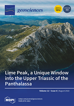
The study of carbonate platforms, and their systems, evolution, and paleobiogeography is crucial to the understanding of the coevolution of life and the Earth. Upper Triassic Panthalassan carbonate systems remain poorly studied and understood. Lime Peak, Yukon (Canada) represents a remarkable exception in the Panthalassa. There, the remains of an Upper Norian carbonate platform show very well-preserved depositional geometries and an excellent rock preservation. In this work, we analyze the lateral and vertical distribution of carbonate microfacies as well as the factors influencing sedimentation of the complex. This paper lays the first foundations for reconstructing more robust platform models for Upper Triassic Panthalassan carbonate systems. View this paper
  • Issues are regarded as officially published after their release is announced to the table of contents alert mailing list.
  • You may sign up for e-mail alerts to receive table of contents of newly released issues.
  • PDF is the official format for papers published in both, html and pdf forms. To view the papers in pdf format, click on the "PDF Full-text" link, and use the free Adobe Reader to open them.
Order results
Result details
Section
Select all
Export citation of selected articles as:
14 pages, 28381 KiB  
Article
Quantification of Alpine Metamorphism in the Edolo Diabase, Central Southern Alps
by Marco Filippi, Davide Zanoni, Gisella Rebay, Manuel Roda, Alessandro Regorda, Jean-Marc Lardeaux and Maria Iole Spalla
Geosciences 2022, 12(8), 312; https://doi.org/10.3390/geosciences12080312 - 21 Aug 2022
Cited by 2 | Viewed by 1724
Abstract
The Southern Alps are the retro-vergent belt of the European Alps that developed from Late Cretaceous subduction to Neogene times. The most prominent Alpine thrusts and folds, nowadays sealed off by the Adamello intrusion, were already developed before the continental collision and clasts [...] Read more.
The Southern Alps are the retro-vergent belt of the European Alps that developed from Late Cretaceous subduction to Neogene times. The most prominent Alpine thrusts and folds, nowadays sealed off by the Adamello intrusion, were already developed before the continental collision and clasts derived from the eroded pre-collisional wedge can be found in the Cretaceous foredeep sequences. In contrast, the thermal state attained by the Southern Alps during the long-lasting Alpine evolution is still unknown. This contribution provides evidence for Alpine metamorphism in the northern part of the central Southern Alps. Metamorphic conditions are determined for the alkaline Edolo diabase dykes that emplaced in the exhumed Variscan basement rocks before being deformed during the Alpine convergence (D3). The Alpine foliation in the Edolo diabase dykes is marked by actinolite, biotite, chlorite, epidote, albite, and titanite and it developed under greenschist facies conditions at temperature of 350–420 °C and pressure ≤0.2 GPa. The T/depth ratio indicates a minimum of 50–60 °C/km that is compatible with thermal gradients characteristic of arc settings. Based on radiometric ages from the literature, these conditions were attained during the Alpine subduction. Full article
(This article belongs to the Special Issue The Making of the Alps)
Show Figures

Figure 1

22 pages, 8201 KiB  
Article
Topographical Impact on Snow Cover Distribution in the Trans-Himalayan Region of Ladakh, India
by Stanzin Passang, Susanne Schmidt and Marcus Nüsser
Geosciences 2022, 12(8), 311; https://doi.org/10.3390/geosciences12080311 - 20 Aug 2022
Cited by 5 | Viewed by 7164
Abstract
This article presents the distribution of seasonal snow cover in the Trans-Himalayan region of Ladakh over the observation period of 2000–2019. Seasonal snow cover area and duration have been monitored and mapped based on the MODIS Normalised Difference Snow Index (NDSI). Using different [...] Read more.
This article presents the distribution of seasonal snow cover in the Trans-Himalayan region of Ladakh over the observation period of 2000–2019. Seasonal snow cover area and duration have been monitored and mapped based on the MODIS Normalised Difference Snow Index (NDSI). Using different MODIS cloud removal algorithms, monthly mean cloud-covered areas have been reduced to 3%. Pixel-wise approaches using Mann–Kendall (MK) and Sen’s slope trend tests allow to assess seasonal and annual trends of snow cover days (SCD) and snow cover area (SCA) across seven delineated subregions of Ladakh. Analyses include the impact of topographical parameters (elevation, slope, aspect). Overall, the mean annual SCA amounts to 42%, varying from 15% in August to 71% in February. However, large differences of SCA have been detected between and within subregions. The trend analysis of SCA shows a non-significant, slight increase for summer as well as for the entire year and a decrease for spring and winter seasons. The SCD trend analysis indicates more pixels with a significant increase than a decrease. In total, 12% of all pixels show an increasing trend in summer, 6% over the entire year, 3% in autumn, and 2% in spring and winter, whereas less than 2% of all pixels show a decreasing trend in all seasons. The results are important for regional irrigated agricultural production and freshwater supply in the context of climate change. Full article
(This article belongs to the Special Issue Mountain Glaciers, Permafrost, and Snow)
Show Figures

Figure 1

28 pages, 3178 KiB  
Article
Latest Pleistocene and Holocene Floodplain Evolution in Central Europe—Insights from the Upper Unstrut Catchment (NW-Thuringia/Germany)
by André Kirchner, Jasmin Karaschewski, Philipp Schulte, Tina Wunderlich and Tobias Lauer
Geosciences 2022, 12(8), 310; https://doi.org/10.3390/geosciences12080310 - 19 Aug 2022
Cited by 2 | Viewed by 1654
Abstract
The upper Unstrut River is located in Germany at the modern Central European climate boundary of Cfb and Dfb climate. The river drains a loess landscape, which has experienced important environmental changes throughout the last 12,000 years. To evaluate the impacts of these [...] Read more.
The upper Unstrut River is located in Germany at the modern Central European climate boundary of Cfb and Dfb climate. The river drains a loess landscape, which has experienced important environmental changes throughout the last 12,000 years. To evaluate the impacts of these changes on floodplain evolution, a multi-proxy research program, consisting of 2D electrical resistivity tomography profiling (ERT), vibracoring, and sedimentological investigations, 14C and OSL dating were applied. From base to top the investigations the following fluvial deposits were revealed: (1) gravels embedded in a fine-grained sediment matrix (interpreted as fluvial bedload deposits); (2) silty sediment with pedogenic features (interpreted as overbank floodplain deposits); (3) peat and tufa deposits (interpreted as wetland deposits) intercalated by pedogenetically influenced silty sediments (interpreted as overbank deposits); (4) humic silty sediment with some pedogenic features (interpreted as overbank floodplain deposits); and (5) silty sediments (interpreted as overbank deposits). Radiocarbon and luminescence dates yielded the following periods for sediment formation: (1) Younger Dryas to Preboreal period (around 11.6 cal ka BP); (2) Preboreal to early Atlantic period (approx. 11.6 to 7.0 cal ka BP); (3) early Atlantic to late Subboreal period (approx. 7.3 to 3.4 cal ka BP); (4) late Subboreal to early Subatlantic period (2.9 to 2.3 cal ka BP); and (5) late Subatlantic period (approx. 1.0 to 0.6 cal ka BP). The results suggest that floodplain development during the latest Pleistocene and early Holocene (approx. 11.6 to 7.0 cal ka BP) was considerably controlled by climatic conditions and short-term climate variabilities, which caused gravel deposition and overbank sedimentation. Afterwards floodplain conditions varied between rather stable (peat and tufa development, initial soil formation) and active periods (deposition of overbank fines). In this context, active periods with increased sediment input prevailed from approx. 5.1 to 3.4 cal ka BP, 2.9 to 2.3 cal ka, and 1.0 to 0.6 cal ka BP, temporally corresponding well with increased land-use phases of the past. In conclusion this study demonstrates that the investigated Unstrut catchment has reacted very sensitively to natural and human-induced changes during the latest Pleistocene and Holocene. Consequently, this high vulnerability to external changes should be considered in future river predictions or river management. Full article
Show Figures

Figure 1

12 pages, 3087 KiB  
Article
Deterioration Processes on Prehistoric Rock Art Induced by Mining Activity (Arenaza Cave, N Spain)
by Juan Carlos Cañaveras, María Concepción Muñoz-Cervera and Sergio Sánchez-Moral
Geosciences 2022, 12(8), 309; https://doi.org/10.3390/geosciences12080309 - 19 Aug 2022
Viewed by 1247
Abstract
Arenaza Cave is located in Vizcaya (N Spain) and contains important Palaeolithic rock art representations. This cave belongs to an active karstic system developed on Lower Cretaceous limestones, mainly consisting of micrites and biomicrites with abundant pyrite moulds. The paintings are made directly [...] Read more.
Arenaza Cave is located in Vizcaya (N Spain) and contains important Palaeolithic rock art representations. This cave belongs to an active karstic system developed on Lower Cretaceous limestones, mainly consisting of micrites and biomicrites with abundant pyrite moulds. The paintings are made directly on the host rock or on thin stalagmitic calcite crusts. Cretaceous limestones in this area contain important iron ore deposits, which have been mined by subsurface and surface-mining methods since the beginning of the 20th century. Mining activities have induced significant changes in the karstic drainage pattern and in the endo and exokarstic morphologies of the Arenaza karstic system, directly affecting the state of conservation of the prehistoric paintings. Thus, in addition to natural process of deterioration, the enlargement of the limestone fissure system as a result of blasting-induced vibrations seems to be the responsible for changes in the rates of water-rock interactions and of the formation of botryoidal gypsum concretions on the rock surface. The final result is the activation and acceleration of detachment processes and the increase of irreversible deterioration processes in the cave. Full article
(This article belongs to the Section Geoheritage, Geoparks and Geotourism)
Show Figures

Figure 1

24 pages, 10459 KiB  
Article
Maturity Matters in Provenance Analysis: Mineralogical Differences Explained by Sediment Transport from Fennoscandian and Variscan Sources
by Mette Olivarius, Henrik Vosgerau, Lars Henrik Nielsen, Rikke Weibel, Sebastian N. Malkki, Benjamin D. Heredia and Tonny B. Thomsen
Geosciences 2022, 12(8), 308; https://doi.org/10.3390/geosciences12080308 - 18 Aug 2022
Cited by 3 | Viewed by 2318
Abstract
The significance of mineralogical maturity as a provenance indicator has long been debated and we use this study to demonstrate that it can indeed be a powerful tool to track the distribution of sandstone reservoirs. We investigate the cause of the pronounced geographic [...] Read more.
The significance of mineralogical maturity as a provenance indicator has long been debated and we use this study to demonstrate that it can indeed be a powerful tool to track the distribution of sandstone reservoirs. We investigate the cause of the pronounced geographic and stratigraphic differences in mineralogical composition that are found in the Upper Triassic–Lower Jurassic Gassum Formation across the Norwegian–Danish Basin and surrounding areas. Zircon U-Pb dating of 46 sandstone samples including analysis of 4816 detrital grains are combined with quantifications of the detrital mineralogical composition and placed in a sequence stratigraphic framework. The results show that the Gassum Formation can be divided into a southeastern region with high mineralogical maturity and a less mature region to the northwest with more feldspars, rock fragments, micas, and heavy minerals. Both the mineralogical assemblage and the provenance signature have been thoroughly homogenized in the SE region where sediment supplies from the Fennoscandian Shield and the Variscan Orogen are evident. In the NW region, sediment was initially supplied from Fennoscandia only, but the provenance abruptly changed from the Telemarkia Terrane to comprising also the more distant Caledonian Orogen resulting in a different mineralogical assemblage. The change occurred during a basinwide regression and may be caused by tectonic movements in the hinterland that permanently changed the composition of the sediment supplied to the basin. Full article
(This article belongs to the Collection Detrital Minerals: Their Application in Palaeo-Reconstruction)
Show Figures

Figure 1

21 pages, 12051 KiB  
Article
A Chlorophyll Biomass Time-Series for the Distributed Biological Observatory in the Context of Seasonal Sea Ice Declines in the Pacific Arctic Region
by Lee W. Cooper and Jacqueline M. Grebmeier
Geosciences 2022, 12(8), 307; https://doi.org/10.3390/geosciences12080307 - 15 Aug 2022
Cited by 2 | Viewed by 1620
Abstract
Declines in seasonal sea ice in polar regions have stimulated projections of how primary production has shifted in response to greater light penetration over a longer open water season. Despite the limitations of remotely sensed observations in an often cloudy environment, remote sensing [...] Read more.
Declines in seasonal sea ice in polar regions have stimulated projections of how primary production has shifted in response to greater light penetration over a longer open water season. Despite the limitations of remotely sensed observations in an often cloudy environment, remote sensing data provide strong indications that surface chlorophyll biomass has increased (since 2000) as sea ice has declined in the Pacific Arctic region. We present here shipboard measurements of chlorophyll-a that have been made annually in July since 2000 from the Distributed Biological Observatory (DBO) stations in the Bering Strait region. This time series as well as shipboard observations made in other months since the late 1980s implicate complexities that intrude on a simple expectation that, as open water periods increase, the production and biomass of phytoplankton will increase predictably. These shipboard observations indicate that there have not been sharp increases in chlorophyll-a, for either maxima observed in the water column or integrated over the whole water column, at the DBO stations over a time-series extending for as long as 20 years coinciding with seasonal sea ice declines. On the other hand, biomass may be increasing in other months: we provide a shipboard confirmation of a fall bloom in October as wind mixing introduced nutrients back into the upper water column. The productive DBO stations may be at a high enough production already that additional enhancements in chlorophyll-a biomass should not be expected, but our time-series record does not exclude the possibility that additional enhanced production may be present in other areas outside the DBO station grid. These findings may also reflect limitations imposed by nutrient cycling and water column structure. The increasing freshwater component of waters flowing through the Bering Strait is likely associated with increased stratification that limits the potential change in biological production associated with decreases in seasonal sea ice persistence. Full article
(This article belongs to the Special Issue Biogeochemistry of Arctic and Antarctic Sea Ice)
Show Figures

Figure 1

22 pages, 6802 KiB  
Article
Principles of a Fast Probability-Based, Data-Adaptive Gravity Inversion Method for 3D Mass Density Modelling
by Marilena Cozzolino, Paolo Mauriello and Domenico Patella
Geosciences 2022, 12(8), 306; https://doi.org/10.3390/geosciences12080306 - 12 Aug 2022
Viewed by 1621
Abstract
The aim of this paper is to present a 3D Probability-based Earth Density Tomography Inversion (PEDTI) method derived from the principles of the Gravity Probability Tomography (GPT). The new method follows the rationale of a previous Probability-based Electrical Resistivity Inversion (PERTI) method, which [...] Read more.
The aim of this paper is to present a 3D Probability-based Earth Density Tomography Inversion (PEDTI) method derived from the principles of the Gravity Probability Tomography (GPT). The new method follows the rationale of a previous Probability-based Electrical Resistivity Inversion (PERTI) method, which has proved to be a fast and versatile user-friendly approach. Along with PERTI, PEDTI requires no external a priori information. In this paper, after recalling the GPT imaging method, the PEDTI theory is developed and concluded with a key inversion formula that allows a wide class of equivalent solutions to be computed. Two synthetic cases are discussed to show the resolution that can be achieved in the determination of density contrasts and to examine the nature of the gravity non-uniqueness problem. Regarding the first issue, it is shown that the estimate of the density by PEDTI can change by about two orders of magnitude and get closer to reality with a more focused solution on a specific source body. Regarding the second problem, it is shown that two levels of equivalence can be classified, i.e., weak and strong equivalence, for a finer selection among the solutions. This is obtained by defining two appropriate statistical indices based on the information power of both the input and output gravity datasets. Full article
(This article belongs to the Special Issue Bayesian Inference and Its Application to Geophysical Inversion)
Show Figures

Figure 1

20 pages, 95804 KiB  
Article
A Quick QGIS-Based Procedure to Preliminarily Define Time-Independent Rockfall Risk: The Case Study of Sorba Valley, Italy
by Giulia Torsello, Gianmarco Vallero, Lorenzo Milan, Monica Barbero and Marta Castelli
Geosciences 2022, 12(8), 305; https://doi.org/10.3390/geosciences12080305 - 10 Aug 2022
Cited by 4 | Viewed by 2270
Abstract
Rockfalls are widespread, rapid, and high-energy landslide phenomena that could potentially affect large portions of populated lands. The preliminary identification of the most rockfall-prone zones is a challenging task, especially in times of extreme and unpredictable climate change. Even slight environmental modifications can [...] Read more.
Rockfalls are widespread, rapid, and high-energy landslide phenomena that could potentially affect large portions of populated lands. The preliminary identification of the most rockfall-prone zones is a challenging task, especially in times of extreme and unpredictable climate change. Even slight environmental modifications can produce significant consequences in terms of exposure, hazard, and risk. Therefore, a timely risk assessment is paramount for territorial administrators to plan and prioritize adequate countermeasures. Risk assessment is crucial to guaranteeing the safety of human lives, the integrity of structures and infrastructures, the preservation of historic and environmental heritage, and the safeguard of economic activities. Hence, new and rapid evaluation methods for rockfall hazard, vulnerability, and risk are needed to identify the most critical areas where more indepth analyses aimed at the design of protective works should be carried out. This study proposes a quick, innovative, and completely GIS-based procedure to preliminarily assess rockfall time-independent hazard and risk in large areas. Propagation analysis is performed by integrating powerful QGIS plugin QPROTO, which can estimate rockfall energy within the invasion area in a simplified way, with the slope units polygons of the Italian territory for the definition of the input parameters. The quantification of risk was obtained by the application of the multidisciplinary IMIRILAND methodology, again within a free and open QGIS environment. Lastly, to test the capabilities of the method, the procedure was applied to a case study of the Sorba Valley (Piemonte, Italy), a tourist region in the northwestern Italian Alps. The findings offer an important contribution to the field of land-planning activities and risk-management strategies. Full article
(This article belongs to the Special Issue Rockfall Protection and Mitigation)
Show Figures

Figure 1

23 pages, 21124 KiB  
Article
Initial Accretion in Hamelin Pool Microbialites: The Role of Entophysalis in Precipitation of Microbial Micrite
by Brooke E. Vitek, Erica P. Suosaari, John F. Stolz, Amanda M. Oehlert and R. Pamela Reid
Geosciences 2022, 12(8), 304; https://doi.org/10.3390/geosciences12080304 - 09 Aug 2022
Cited by 7 | Viewed by 2239
Abstract
One of the largest assemblages of living marine microbialites, with shapes and sizes analogous to ancient structures, is found along the margins of Hamelin Pool, Shark Bay, Western Australia. An investigation of microbial mats on the surfaces of these structures using petrographic analysis, [...] Read more.
One of the largest assemblages of living marine microbialites, with shapes and sizes analogous to ancient structures, is found along the margins of Hamelin Pool, Shark Bay, Western Australia. An investigation of microbial mats on the surfaces of these structures using petrographic analysis, light, and scanning electron microscopy identified the in situ precipitation of micrite as an important accretion mechanism in all major mat types (pustular, smooth, and colloform). Within each mat type, peloidal micrite, composed of nano-bulbous spheres to tabular and rod-shaped crystals, was closely linked with cells of the coccoid cyanobacterium Entophysalis, and microtextures of the micrite reflected the size and distribution of Entophysalis colonies. In pustular surface mats, where large colonies of Entophysalis were common, large clots of micrite were distributed randomly throughout the mat. In contrast, in smooth and colloform mats, where smaller colonies of Entophysalis were distributed along horizons, micrite formed fine laminae. In all surface mat types, micrite associated with Entophysalis had a characteristic honeycomb appearance, resulting from cell and/or colony entombment. These findings redefine our understanding of microbialite accretion in Hamelin Pool, recognizing the importance of microbial micrite in microbialite growth and showing that coccoid cyanobacteria are capable of building laminated structures. Moreover, Entophysalis, the dominant visible microbe associated with the precipitation of micrite in Hamelin Pool, has a lineage to Eoentophysalis, found throughout early and middle Proterozoic microbialites assemblages. These findings reinforce the importance of Hamelin Pool as a window to the past. Full article
Show Figures

Figure 1

18 pages, 1778 KiB  
Article
Geospatial Assessment of Karst Spring Water Quality in Northeast Tennessee, USA
by Lukman Fashina, Ingrid Luffman, T. Andrew Joyner and Arpita Nandi
Geosciences 2022, 12(8), 303; https://doi.org/10.3390/geosciences12080303 - 09 Aug 2022
Cited by 3 | Viewed by 2000
Abstract
Karst springs are an essential source of private water supply for about 10% of households in Tennessee. However, the water quality of these springs is unmonitored and unregulated even though many springs are highly productive yet vulnerable to contamination. This study assesses spatial [...] Read more.
Karst springs are an essential source of private water supply for about 10% of households in Tennessee. However, the water quality of these springs is unmonitored and unregulated even though many springs are highly productive yet vulnerable to contamination. This study assesses spatial patterns in the water quality of roadside springs in northeast Tennessee. Karst spring water samples collected from 50 springs were assessed using EPA Standard methods for pathogens, nutrients, radon, and physicochemical parameters. From statistical and spatial analyses, all but five samples contained E. coli, while all samples contained fecal coliform. High E. coli was spatially clustered (Local Moran’s I = 0.177, pseudo p-value = 0.012) in regions of high agricultural land use, resulting in a fecal contamination hot spot on the border of Washington and Sullivan Counties, Tennessee. Radon concentrations exceeded the 300 pCi/L proposed MCL in 29 (58%) of springs, with one spring in Unicoi County exceeding 1000 pCi/L. A radon hot spot was identified in northern Washington County (Local Moran’s I = 0.160, pseudo p-value = 0.014). Cokriging of E. coli with land use and radon with distance to mapped fault did not improve interpolation models for either parameter. Other parameters, including nitrate, pH, and total dissolved solids, were within recommended ranges for drinking water. This snapshot of spring water quality status identifies areas of poor spring water quality of which spring water users in the region should be aware, and establishes the need for longitudinal sampling of spring water quality in contamination hot spots. Full article
(This article belongs to the Special Issue Karst Unsaturated Zone)
Show Figures

Figure 1

18 pages, 3325 KiB  
Article
Isostatic Adjustment, Vertical Motion Rate Variation and Potential Detection of Past Abrupt Mass Unloading
by Julien Gargani
Geosciences 2022, 12(8), 302; https://doi.org/10.3390/geosciences12080302 - 08 Aug 2022
Cited by 4 | Viewed by 1695
Abstract
Intraplate volcanic islands are often considered as stable relief with constant vertical motion and used for relative sea-level reconstruction. This study shows that large abrupt mass unloading causes non-negligible isostatic adjustment. The vertical motion that occurs after abrupt mass unloading is quantified using [...] Read more.
Intraplate volcanic islands are often considered as stable relief with constant vertical motion and used for relative sea-level reconstruction. This study shows that large abrupt mass unloading causes non-negligible isostatic adjustment. The vertical motion that occurs after abrupt mass unloading is quantified using a modeling approach. We show that a giant landslide causes a coastline uplift of 80–110 m for an elastic thickness of 15 km < Te < 20 km in Tahiti. Theoretical cases also reveal that a coastal motion of 1 m occurs for an abrupt mass unloading involving a displaced volume of 0.2 km3 and influences relative sea-level reconstruction. In Tahiti, a change in the subsidence rate of 0.1 mm/yr (from 0.25 to 0.15 mm/year) occurred during the last 6 kyr and could be explained by an abrupt mass unloading involving a minimum volume of 0.2 km3, 6 ± 1 kyr ago. Full article
Show Figures

Figure 1

10 pages, 3722 KiB  
Case Report
Petrography and Geotechnical Characteristics of Aggregates from the Oyo and Mongo Massifs (Chad): Implications for the Construction of Structures
by Hamid Zagalo Al-hadj, Pierre Rochette and Mahamat Tahir Abakar Djiddi
Geosciences 2022, 12(8), 301; https://doi.org/10.3390/geosciences12080301 - 03 Aug 2022
Viewed by 1223
Abstract
The present study focused on the petrography and geotechnics of aggregates of two sites around the city of Mongo for their use in construction. The study area is located in central Chad, in the Guéra province, at the eastern and north-western entrance to [...] Read more.
The present study focused on the petrography and geotechnics of aggregates of two sites around the city of Mongo for their use in construction. The study area is located in central Chad, in the Guéra province, at the eastern and north-western entrance to the city of Mongo. The area corresponds to a crystalline basement, and granitic massifs are abundant. Two deposits were studied: the Mongo massif, closest to the town of the same name, and the Oyo massif at the eastern exit of Mongo. The petrographic analysis showed that the studied materials are granites, light grey in color, composed of 30% quartz, 15% biotite, 20% feldspar, 30% plagioclase and 5% other minerals. From the geotechnical point of view, the materials of the Mongo site are more resistant to wear compared to those of Oyo which are less resistant. According to the results of micro-Deval and Los Angeles tests, the use of aggregates obtained from the Mongo site granites are usable in base courses for T1–T3 traffic admitting an axle of 8 to 10 tons and in surface dressings, contrary to those of Oyo, which are not favorable in road construction. Full article
(This article belongs to the Section Geomechanics)
Show Figures

Figure 1

15 pages, 9515 KiB  
Article
Early Carboniferous Ostracods (Crustacea) from Death Valley, California, USA
by Mark A. S. McMenamin
Geosciences 2022, 12(8), 300; https://doi.org/10.3390/geosciences12080300 - 03 Aug 2022
Viewed by 1642
Abstract
Silicified ostracods from the Tin Mountain Limestone provide new information regarding the Carboniferous paleontology of the Death Valley Region, California, USA. Acid maceration of marine limestones yielded the following ostracods: Acratia spp., Bairdia quasilecta, Bairdia sp. cf. B. orientalis, Ceratobairdia sp., [...] Read more.
Silicified ostracods from the Tin Mountain Limestone provide new information regarding the Carboniferous paleontology of the Death Valley Region, California, USA. Acid maceration of marine limestones yielded the following ostracods: Acratia spp., Bairdia quasilecta, Bairdia sp. cf. B. orientalis, Ceratobairdia sp., Kirkbya panamintensis sp. nov., Rectobairdia sp. cf. R. legumen, and Silenites sp. This is the first report of Ceratobairdia and Silenites from the Tin Mountain Limestone. These ostracods occupied a carbonate ramp environment that formed during a major Paleozoic transgression. The ostracods played an important paleoecological role, likely as benthic marine scavengers in a shallow marine biotope along the northern shores of Pangea. Full article
(This article belongs to the Section Sedimentology, Stratigraphy and Palaeontology)
Show Figures

Figure 1

19 pages, 4493 KiB  
Article
Drivers of Last Millennium Antarctic Climate Evolution in an Ensemble of Community Earth System Model Simulations
by Olivia J. Truax, Bette L. Otto-Bliesner, Esther C. Brady, Craig L. Stevens, Gary S. Wilson and Christina R. Riesselman
Geosciences 2022, 12(8), 299; https://doi.org/10.3390/geosciences12080299 - 31 Jul 2022
Cited by 1 | Viewed by 2239
Abstract
Improved understanding of the drivers of climate variability, particularly over the last millennium, and its influence on Antarctic ice melt have important implications for projecting ice sheet resilience in a changing climate. Here, we investigated the variability in Antarctic climate and sea ice [...] Read more.
Improved understanding of the drivers of climate variability, particularly over the last millennium, and its influence on Antarctic ice melt have important implications for projecting ice sheet resilience in a changing climate. Here, we investigated the variability in Antarctic climate and sea ice extent during the last millennium (850–1850 CE) by comparing paleoenvironmental reconstructions with simulations from the Community Earth System Model Last Millennium Ensemble (CESM-LME). Atmospheric and oceanic response to external forcing in CESM-LME simulations typically take the form of an Antarctic dipole: cooling over most of Antarctica and warming east of the Antarctic Peninsula. This configuration is also observed in ice core records. Unforced variability and a dipole response to large volcanic eruptions contribute to weaker cooling in the Antarctic than the Arctic, consistent with the absence of a strong volcanic signal in Antarctic ice core records. The ensemble does not support a clear link between the dipole pattern and baseline shifts in the Southern Annular Mode and El Niño-Southern Oscillation proposed by some paleoclimate reconstructions. Our analysis provides a point of comparison for paleoclimate reconstructions and highlights the role of internal climate variability in driving modeled last millennium climate evolution in the Antarctic. Full article
Show Figures

Figure 1

24 pages, 6514 KiB  
Article
Updated Understanding of the Ripley Landslide Kinematics Using Satellite InSAR
by Amir Soltanieh and Renato Macciotta
Geosciences 2022, 12(8), 298; https://doi.org/10.3390/geosciences12080298 - 30 Jul 2022
Cited by 10 | Viewed by 2764
Abstract
The Thompson River valley hosts 14 landslides along a 10 km section, which threaten the two major railroads connecting the Port of Vancouver and the interior provinces in Canada. The Ripley landslide is one of the active landslides in this section of the [...] Read more.
The Thompson River valley hosts 14 landslides along a 10 km section, which threaten the two major railroads connecting the Port of Vancouver and the interior provinces in Canada. The Ripley landslide is one of the active landslides in this section of the valley. Previous research at this site included an analysis of landslide deformations using satellite radar interferometry focusing on deformations measured in the line of sight between the satellite and the slopes, and average downslope displacement (deformations projected in the average downslope direction). Since then, further stratigraphic interpretation has provided an enhanced understanding of the Ripley landslide. In this update, the new stratigraphic interpretation is supplemented with satellite InSAR data from May 2015 to May 2017 to enhance the current understanding of the landslide kinematics. The results indicate that the Ripley landslide has been moving at a rate between 2 and 82 mm per year, corresponding to a very slow to slow landslide. It is also observed that the movements tend to be near-horizontal on areas closer to the toe of the landslide, while the vertical component of deformation increases near the scarp of the landslide. This, together with the interpreted stratigraphy, indicates the kinematics corresponds to a compound landslide. This is consistent with interpreted landslide kinematics of older, more mature landslides in the area that have shown episodes of retrogression and suggests the possibility of a similar future behaviour of the Ripley landslide. Full article
Show Figures

Figure 1

19 pages, 9877 KiB  
Article
Geotechnical Parameters of Landslide-Prone Laflamme Sea Deposits, Canada: Uncertainties and Correlations
by Amande-Gaston Sanou, Ali Saeidi, Shahriyar Heidarzadeh, Rama Vara Prasad Chavali, Hamza Es Samti and Alain Rouleau
Geosciences 2022, 12(8), 297; https://doi.org/10.3390/geosciences12080297 - 30 Jul 2022
Cited by 2 | Viewed by 1477
Abstract
Due to inherent variability arising from unpredictable geological depositional and post-depositional processes, the geotechnical parameters of Laflamme sea clay deposits remain highly uncertain. This study aims to develop and apply a methodology to assess the uncertainties of geotechnical parameters using statistical distributions for [...] Read more.
Due to inherent variability arising from unpredictable geological depositional and post-depositional processes, the geotechnical parameters of Laflamme sea clay deposits remain highly uncertain. This study aims to develop and apply a methodology to assess the uncertainties of geotechnical parameters using statistical distributions for a landslide-prone Saguenay Lac-Saint-Jean (SLSJ) region. We used the measured physical and mechanical parameters of Laflamme Sea clays of various locations in the SLSJ region to characterize the geotechnical parameters in a representative manner. Goodness-of-fit tests assign each physical and mechanical parameter a distribution function for their descriptive analysis. We found that the quality of these tests is significantly influenced by outliers. The detected outliers in the dataset considerably impact the distribution type and the uncertainties of the specific geotechnical parameter. Subsequently, appropriate distribution functions for each parameter were assigned after treating the outliers. The derived coefficient of variability values for the SLSJ region were significantly high in comparison to the literature with cone penetration test data being only the exception. Finally, the results indicated that the uncertainties of geotechnical parameters of the Saguenay-Lac-Saint-Jean region marine clays are high as compared to Scandinavian clays and are relatively comparable to other eastern Canadian clays. Full article
(This article belongs to the Special Issue Triggering Mechanisms and Dynamics of Landslides)
Show Figures

Figure 1

18 pages, 5987 KiB  
Article
Hydrothermal Numerical Simulation of Injection Operations at United Downs, Cornwall, UK
by Saeed Mahmoodpour, Mrityunjay Singh, Christian Obaje, Sri Kalyan Tangirala, John Reinecker, Kristian Bär and Ingo Sass
Geosciences 2022, 12(8), 296; https://doi.org/10.3390/geosciences12080296 - 29 Jul 2022
Cited by 4 | Viewed by 1747
Abstract
The United Downs Deep Geothermal Project (UDDGP) is designed to utilize a presumably permeable steep dipping fault damage zone (constituting the hydrothermal reservoir in a very low permeability granitic host rock) for fluid circulation and heat extraction between an injection well at 2.2 [...] Read more.
The United Downs Deep Geothermal Project (UDDGP) is designed to utilize a presumably permeable steep dipping fault damage zone (constituting the hydrothermal reservoir in a very low permeability granitic host rock) for fluid circulation and heat extraction between an injection well at 2.2 km depth (UD−2) and a production well at 5 km depth (UD−1). Soft hydraulic stimulation was performed to increase the permeability of the reservoir. Numerical simulations are performed to analyze the hydraulic stimulation results and evaluate the increase in permeability of the reservoir. Experimental and field data are used to characterize the initial reservoir static model. The reservoir is highly fractured, and two distinct fracture networks constitute the equivalent porous matrix and fault zone, respectively. Based on experimental and field data, stochastic discrete fracture networks (DFN) are developed to mimic the reservoir permeability behavior. Due to the large number of fractures involved in the stochastic model, equivalent permeability fields are calculated to create a model which is computationally feasible. Hydraulic test and stimulation data from UD−1 are used to modify the equivalent permeability field based on the observed difference between the real fractured reservoir and the stochastic DFN model. Additional hydraulic test and stimulation data from UD−2 are used to validate this modified permeability. Results reveal that the equivalent permeability field model derived from observations made in UD−1 is a good representation of the actual overall reservoir permeability, and it is useful for future studies. The numerical simulation results show the amount of permeability changes due to the soft hydraulic stimulation operation. Based on the validated permeability field, different flow rate scenarios of the petrothermal doublet and their respective pressure evolution are examined. Higher flow rates have a strong impact on the pressure evolution. Simulations are performed in the acidized enhanced permeability region to make a connection between the ongoing laboratory works on the acid injection and field response to the possible acidizing stimulation. Full article
Show Figures

Figure 1

13 pages, 4683 KiB  
Article
Best Practices for Developing Geotechnical Models and Seismic Hazard Procedures for Critical Infrastructure: The Viadotto Italia Case Study in Southern Italy
by Ernesto Ausilio, Maria Giovanna Durante and Paolo Zimmaro
Geosciences 2022, 12(8), 295; https://doi.org/10.3390/geosciences12080295 - 29 Jul 2022
Cited by 1 | Viewed by 1660
Abstract
The performance of a large number of critical infrastructure systems needs to be periodically re-evaluated. This is especially so when such systems are located in seismic areas and are subjected to ageing effects. Seismic re-evaluations are typically performed using numerical response history analyses [...] Read more.
The performance of a large number of critical infrastructure systems needs to be periodically re-evaluated. This is especially so when such systems are located in seismic areas and are subjected to ageing effects. Seismic re-evaluations are typically performed using numerical response history analyses based on a geotechnical model of the infrastructure and using hazard-consistent ground motions. We depart from the Viadotto Italia (the tallest multi-span bridge in Italy, located in a high-seismicity region) to draw best practices on how to construct a robust geotechnical model and derive appropriate target response spectra to be used in forward applications. Our proposed framework starts with the analysis of historical and new information and data. We then describe how to perform a multi-epoch consistency analysis that deals with the reliability and level of uncertainty of the data, culminating with the definition of a pragmatic geotechnical model that builds upon all available data, including investigation information produced at different spatial resolutions and quality levels. We also propose a consistent approach to perform site-specific probabilistic seismic hazard analysis to develop appropriate ground motions. This last step builds upon experiences with a data-rich high-seismicity zone in southern Italy, where both shallow crustal faults and deep subduction sources are present. Full article
(This article belongs to the Collection New Advances in Geotechnical Engineering)
Show Figures

Figure 1

24 pages, 5205 KiB  
Article
Vadose Zone Transport of Tritium and Nitrate under Ponded Water Conditions
by Philip H. Stauffer, Brent D. Newman, Kay H. Birdsell, Marvin O. Gard, Jeffrey M. Heikoop, Emily C. Kluk and Terry A. Miller
Geosciences 2022, 12(8), 294; https://doi.org/10.3390/geosciences12080294 - 28 Jul 2022
Viewed by 1538
Abstract
Vadose zone transport of tritium and nitrate can be important considerations at radioactive waste sites, landfills, or areas with industrial impacts. These contaminants are of particular concern because they typically have a relatively higher mobility in the subsurface compared to other compounds. Here, [...] Read more.
Vadose zone transport of tritium and nitrate can be important considerations at radioactive waste sites, landfills, or areas with industrial impacts. These contaminants are of particular concern because they typically have a relatively higher mobility in the subsurface compared to other compounds. Here, we describe a semiarid site with tritium and nitrate contamination involving a manmade ponded water source above a thick unsaturated zone at Los Alamos National Laboratory in New Mexico, USA. This study demonstrates the value of vadose zone flow and transport modeling for the development of field investigation plans (i.e., identifying optimal borehole locations and depths for contaminant characterization), and how a combination of modeling with isotope and geochemical measurements can provide insight into how tritium and nitrate transport in the vadose zone in semiarid environments. Modeling results suggest that at this location, tritium transport is well predicted by classical multiphase theory. Our work expands the demonstrated usefulness of a standard tritium conceptual model to sites with ponded surface conditions and agrees with previous results where a standard model was able to explain the evolution of a tritium plume at an arid waste disposal site. In addition, depth-based analyses of δ18O and δ2H of pore waters helped confirm the extent of pond infiltration into the vadose zone, and the δ15N of nitrate showed that the contaminant release history of the site was different than originally assumed. Full article
(This article belongs to the Special Issue Groundwater in Arid and Semiarid Areas II)
Show Figures

Figure 1

18 pages, 731 KiB  
Article
Integrated Geomatics Surveying and Data Management in the Investigation of Slope and Fluvial Dynamics
by Carlotta Parenti, Paolo Rossi, Mauro Soldati, Francesca Grassi and Francesco Mancini
Geosciences 2022, 12(8), 293; https://doi.org/10.3390/geosciences12080293 - 28 Jul 2022
Cited by 1 | Viewed by 2943
Abstract
In mountain environments, slope and fluvial dynamics often interact, and their relationship can be investigated through an integrated methodological approach. Landslides are a source of supplying sediments into riverbeds and can interact or interrupt the water course. Water courses can trigger or re-activate [...] Read more.
In mountain environments, slope and fluvial dynamics often interact, and their relationship can be investigated through an integrated methodological approach. Landslides are a source of supplying sediments into riverbeds and can interact or interrupt the water course. Water courses can trigger or re-activate slope movements. The complexity of investigating the interaction between the two dynamics needs a complementarity of methods and techniques, combining remote and proximal sensing, geotechnical in situ surveys, and repositories and catalogue datasets. This leads to a synergistic use of all the heterogeneous data from different fields and formats. The present paper provides a literature review on the approaches and surveying procedures adopted in the investigation of slope and fluvial dynamics and highlights the need to improve the integrated management of geospatial information complemented by quality information. In this regard, we outline a geodatabase structure capable of handling the variety of geoscientific data available at different spatial and temporal scales, with derived products that are useful in integrated monitoring tasks. Indeed, the future adoption of a shared physical structure would allow the merging and synergistic use of data provided by different surveyors as well as the effective storing and sharing of datasets from a monitoring perspective. Full article
(This article belongs to the Special Issue Development and Use of Databases to Analyze Geo-Hydrological Hazards)
Show Figures

Figure 1

64 pages, 23199 KiB  
Article
Upper Triassic Carbonate Records: Insights from the Most Complete Panthalassan Platform (Lime Peak, Yukon, Canada)
by Nicolò Del Piero, Sylvain Rigaud, Camille Peybernes, Marie-Beatrice Forel, Nicholas Farley and Rossana Martini
Geosciences 2022, 12(8), 292; https://doi.org/10.3390/geosciences12080292 - 28 Jul 2022
Cited by 2 | Viewed by 2773
Abstract
Upper Triassic carbonate platforms from the Panthalassa Ocean remain less-understood and less-studied than their Tethyan equivalents. This imbalance is largely due to the poorer preservation state of Panthalassan carbonate rock successions in terms of rock quality and depositional geometries, which prevents good appreciation [...] Read more.
Upper Triassic carbonate platforms from the Panthalassa Ocean remain less-understood and less-studied than their Tethyan equivalents. This imbalance is largely due to the poorer preservation state of Panthalassan carbonate rock successions in terms of rock quality and depositional geometries, which prevents good appreciation of depositional systems. In this context, carbonate exposures from Lime Peak (Yukon, Canada) represent an outstanding exception. There, the remains of an Upper Norian Panthalassan carbonate platform are well-exposed, show remarkably preserved depositional geometries and overall superior rock preservation. In this work, we analyse the carbonates from the Lime Peak area with particular attention to the vertical and lateral distribution of biotic assemblages and microfacies at the platform scale. Results demonstrate that the Lime Peak platform was surrounded by a basin with an aphotic sea bottom. The carbonate complex developed in warm waters characterized by high carbonate saturation. The area was also defined by moderate to high nutrient levels: this influenced the type of carbonate factory by favouring microbialites and sponges over corals. During its growth, Lime Peak was influenced by tectono-eustatism, which controlled the accommodation space at the platform top, primarily impacting the internal platform environments and the stability of the slope. Gaining better knowledge of the spatial distribution and dynamics of Upper Triassic organisms and sedimentary facies of Panthalassa in relation to tectono-eustatism lays the first foundations for reconstructing more robust platform models and understanding the evolution of other, more dismantled Upper Triassic Panthalassan carbonate systems through time. Full article
(This article belongs to the Special Issue Advances in Carbonate Sedimentology)
Show Figures

Figure 1

34 pages, 19145 KiB  
Article
A New Look at Cenozoic Fossil Wood from Thailand
by George Mustoe, Chiraporn Aranyanark, Nareerat Boonchai and Pratueng Jintasakul
Geosciences 2022, 12(8), 291; https://doi.org/10.3390/geosciences12080291 - 28 Jul 2022
Cited by 5 | Viewed by 2762
Abstract
Thailand contains two notable fossil forest regions. Pleistocene fluvial sediments in the Tak region in the northern highlands contain silicified trunks of large trees. Deposits in the Khorat Plateau in northeast Thailand contain a multitude of wood fossils that span a probable age [...] Read more.
Thailand contains two notable fossil forest regions. Pleistocene fluvial sediments in the Tak region in the northern highlands contain silicified trunks of large trees. Deposits in the Khorat Plateau in northeast Thailand contain a multitude of wood fossils that span a probable age range of Miocene to Pleistocene. At Ban Tak fossil logs are primarily mineralized with crystalline quartz. Incomplete mineralization is characteristic of the Tak wood, with intercellular spaces commonly remaining open. The resulting permeability allows penetration of moisture, and allows introduction of microbes and the accumulation of clays, iron oxides, soluble salts and other materials that may cause discoloration and deterioration. Hydration swelling of these components results in stress. Excavation of the huge logs means that they occupy topographically low positions prone to flooding during the monsoon season. These factors make the fossils vulnerable to weathering. A variety of methods have been employed in attempts to reduce the damage, including the construction of various styles of shelters to protect the fossil logs from direct precipitation. At Khorat, compositions of individual specimens range from pure quartz and pure opal to mixtures of the two polymorphs. Many specimens are preserved indoors in the Khorat Fossil Museum in Mueang Nakhon Ratchasima District, both as indoor exhibits and as outdoor displays in a garden plaza. The environmental complexities at the Tak and Khorat fossil wood localities challenge conservators, but their creative attempts provide useful lessons for future preservation efforts. Our report describes the geologic setting and our research mineralogy of specimens at both localities, and discusses conservation strategies. Full article
(This article belongs to the Section Sedimentology, Stratigraphy and Palaeontology)
Show Figures

Figure 1

15 pages, 2517 KiB  
Article
Soil Risk Assessment in the Surrounding Area of Hulene-B Waste Dump, Maputo (Mozambique)
by Bernardino Bernardo, Carla Candeias and Fernando Rocha
Geosciences 2022, 12(8), 290; https://doi.org/10.3390/geosciences12080290 - 28 Jul 2022
Cited by 4 | Viewed by 2691
Abstract
Soil contamination in areas close to unplanned dumpsites represents an increasing risk to the ecosystems and human health. This study aimed to evaluate soil quality in the area surrounding the Hulene-B waste dump, Maputo, Mozambique, and to estimate potential ecological and human health [...] Read more.
Soil contamination in areas close to unplanned dumpsites represents an increasing risk to the ecosystems and human health. This study aimed to evaluate soil quality in the area surrounding the Hulene-B waste dump, Maputo, Mozambique, and to estimate potential ecological and human health risks. A total of 71 surface soil samples were collected in the surrounding area of the dump, along with 10 samples in areas considered not impacted by the dump. Chemical and mineralogical analyses were performed using XRF and XRD. Quartz was the most abundant mineral phase, followed by feldspars, carbonates, clay minerals, and Fe oxides/hydroxides. Results showed a significant contribution to ecological degradation by PTE enrichment, ranked as Zn >> Cu > Cr > Zr > Pb > Ni > Mn. Carcinogenic risk for both children and adults was significant due to Pb soil content. Soil sample concentrations of Cr, Cu, Mn, Ni, Pb, Zn, and Zr, posing a risk especially in children, suggested the need for continuous monitoring, as well as the definition and implementation of mitigation measures. Full article
(This article belongs to the Section Geochemistry)
Show Figures

Figure 1

15 pages, 2751 KiB  
Article
Characteristics, Kinematics and Contributing Factors of Compound and Translational Landslides in the Interior Plains of Canada
by Luiz Biagini, Renato Macciotta, Chris Gräpel, Kristen Tappenden and Roger Skirrow
Geosciences 2022, 12(8), 289; https://doi.org/10.3390/geosciences12080289 - 25 Jul 2022
Cited by 2 | Viewed by 1892
Abstract
Understanding landslide kinematics, their characteristics, and contributing factors is crucial for decision-making regarding mitigation strategies for infrastructure projects. These characteristics depend on the geomorphology of the area, climate, and proximity to water bodies and anthropogenic activity. Some geomorphological features are shared between some [...] Read more.
Understanding landslide kinematics, their characteristics, and contributing factors is crucial for decision-making regarding mitigation strategies for infrastructure projects. These characteristics depend on the geomorphology of the area, climate, and proximity to water bodies and anthropogenic activity. Some geomorphological features are shared between some western Canadian regions, particularly within the Canadian Interior Plains (Interior Plains). This paper synthesizes the failure mechanisms, kinematics, triggering events, and contributing factors associated with 11 landslides in the Interior Plains, with detailed qualitative descriptions of two of them. The paper discusses the commonalities of bedrock formations that contain thin sub-horizontal and continuous deposits of weak materials as the main geomorphological predisposing factor for landslides in this region. The findings show commonalities in the effect of seasonal fluctuations in the characteristics of water bodies in contact with these landslides, driving episodes of landside reactivation, acceleration and deceleration. Importantly, anthropogenic activity as a trigger for the initiation of some of these landslides suggests a high susceptibility of certain slopes in the Interior Plains to instability resulting from relatively small changes in in-situ stresses. This information becomes critical for assessing the landslide susceptibility of valley slopes in this region for infrastructure planning, design, and operation. Full article
(This article belongs to the Special Issue Landslide Characteristics and Susceptibility Assessment)
Show Figures

Figure 1

15 pages, 4517 KiB  
Article
Characteristic Magnitude and Spatiotemporal Relationships of Aftershocks and Background Earthquakes
by Yi-Hsuan Wu
Geosciences 2022, 12(8), 288; https://doi.org/10.3390/geosciences12080288 - 25 Jul 2022
Cited by 3 | Viewed by 1500
Abstract
Aftershocks, background earthquakes, and their spatiotemporal parameters have been studied for decades for the purpose of hazard assessment and forecasting. Methods for determining these parameters or seismic attributes are becoming increasingly sophisticated and varied; some optimize the results to fit observations using trial [...] Read more.
Aftershocks, background earthquakes, and their spatiotemporal parameters have been studied for decades for the purpose of hazard assessment and forecasting. Methods for determining these parameters or seismic attributes are becoming increasingly sophisticated and varied; some optimize the results to fit observations using trial and error, while others do the same by giving prescriptions for a limited region. Here, we propose a method that is potentially useful in general hazard assessment and forecasting applications. We categorized the earthquakes into two groups, aftershocks (triggered events) and background earthquakes, by introducing the network distance, i.e., the shortest distance between two events of equal magnitude within a modified interevent time, into the k-means clustering, which couples the modified interevent time and magnitude hierarchically. Our results show a bimodal distribution consisting of a power law at shorter network distances and a lognormal distribution at longer network distances, implying that earthquakes of magnitudes larger than the characteristic magnitude, found to be 4.5 for Taiwan and 4.3 for California, may be only weakly linked to other same magnitude earthquakes and hence are hard to be triggered even by events of larger size. Full article
(This article belongs to the Collection Advances in Statistical Seismology)
Show Figures

Figure 1

29 pages, 5323 KiB  
Article
Evaluating the Effectiveness of Nanotechnology in Environmental Remediation of a Highly Metal-Contaminated Area—Minas Gerais, Brazil
by Rita Fonseca, Joana Araújo, Catarina Pinho and Teresa Albuquerque
Geosciences 2022, 12(8), 287; https://doi.org/10.3390/geosciences12080287 - 25 Jul 2022
Viewed by 1751
Abstract
A column experiment at a laboratory level was carried out to assess the effect of the application of nanotechnology in the decontamination of soils and alluvial deposits with high levels of potentially toxic elements (PTEs). A suspension of zero-valent iron nanoparticles (nZVI) was [...] Read more.
A column experiment at a laboratory level was carried out to assess the effect of the application of nanotechnology in the decontamination of soils and alluvial deposits with high levels of potentially toxic elements (PTEs). A suspension of zero-valent iron nanoparticles (nZVI) was injected at three different concentrations in selected samples (two sediments, one soil). For most of the elements, the retention by nZVI was proportional to the concentration of the suspension and the trend was similar. Metals were immobilized by adsorption on the surface layer of the nanoparticles and/or by complexation, co-precipitation, and chemical reduction. By day 60 following injection, the nZVI lost reactivity and the retained species were desorbed and back into the soluble phase. The definition of spatial patterns for PTEs’ distribution allowed for the construction of contamination risk maps using a geostatistical simulation approach. The analysis obtained from the extractable contents of five target elements (Zn, Cu, Cd, Pb, As) was cross-checked with the estimated map network to assess their retention efficiency. Data from the analysis of these elements, in the extractable phase and in the porewater of the sediments/soils, indicate the nZVI injection as a suitable technique for reducing the risk level of PTEs in contaminated Fe-rich tropical environments. Full article
(This article belongs to the Special Issue Aquatic Systems Quality and Pollution Control II)
Show Figures

Figure 1

18 pages, 14135 KiB  
Article
New Data of the 1755 Earthquake and Tsunami in Lisbon, Portugal
by Angela Santos and Delminda Rijo
Geosciences 2022, 12(8), 286; https://doi.org/10.3390/geosciences12080286 - 24 Jul 2022
Cited by 1 | Viewed by 3666
Abstract
In spite of the significant number of studies focused on the 1755 earthquake and tsunami, there are still many unknowns regarding this event in Lisbon, Portugal. Thus, in this research the authors compiled historical documents, including some that had never been analyzed, complemented [...] Read more.
In spite of the significant number of studies focused on the 1755 earthquake and tsunami, there are still many unknowns regarding this event in Lisbon, Portugal. Thus, in this research the authors compiled historical documents, including some that had never been analyzed, complemented with a field survey and tsunami numerical modeling at the historical civil parish of Santo Estevão, Lisbon. It was possible to identify 13 buildings, including three religious buildings and five palaces. Furthermore, the new data showed that contradicting the general idea, the earthquake caused significant damage to the selected territory because the number of households decreased by 52%. The number of residents decreased to about 51%, and in 1756, 1041 residents were still living in 297 temporary shelters. There were more than 44 dead and 1122 residents were unaccounted for. The fire did not hit the area, and the tsunami numerical model results were validated by the historical accounts and cartography, which indicate that the coastal area of the studied area was not significantly inundated by the tsunami. The consultation of historical documents that had never been analyzed by contemporary researchers provides a breakthrough in the knowledge of the event since it allowed a very detailed analysis of the disaster impact. Full article
(This article belongs to the Special Issue Interdisciplinary Geosciences Perspectives of Tsunami Volume 4)
Show Figures

Figure 1

13 pages, 1871 KiB  
Review
The Role of Fluids in Melting the Continental Crust and Generating Granitoids: An Overview
by Jiahao Li, Xing Ding and Junfeng Liu
Geosciences 2022, 12(8), 285; https://doi.org/10.3390/geosciences12080285 - 22 Jul 2022
Cited by 2 | Viewed by 2611
Abstract
Granite is a distinctive constituent part of the continental crust on Earth, the formation and evolution of which have long been hot research topics. In this paper, we reviewed the partial melting processes of crustal rocks without or with fluid assistance and summarized [...] Read more.
Granite is a distinctive constituent part of the continental crust on Earth, the formation and evolution of which have long been hot research topics. In this paper, we reviewed the partial melting processes of crustal rocks without or with fluid assistance and summarized the role of fluids and volatiles involved in the formation of granitic melts. As a conventional model, granitoids were thought to be derived from the dehydration melting of hydrous minerals in crustal basement metamorphic rocks in the absence of external fluids. However, the external-fluid-assisted melting of crustal metamorphic rocks has recently been proposed to produce granitoids as extensive fluids could be active in the deep continental crust, especially in the subduction zones. It has been demonstrated experimentally that H2O plays a crucial role in the partial melting of crustal rocks, in which H2O can (1) significantly lower the solidus temperature of the melted rocks to facilitate partial melting; (2) affect the melting reaction process, mineral stability, and the composition of melt; and (3) help the melt to separate more easily from the source area and aggregate to form a large-scale magma chamber. More importantly, dissolved volatiles and salts in the crustal fluids could also lower the solidus temperature of rocks, affect the partitioning behaviors of trace elements between minerals and melts, and facilitate the formation of some distinctive granitoids (e.g., B-rich, F-rich, and high-K granitoids). Furthermore, various volatiles dissolved in fluids could result in elemental or isotopic fractionation as well as the diversity of mineralization during fluid-assisted melting. In-depth studies regarding the fluid-assisted partial melting of crustal rocks will facilitate a more comprehensive understanding of melting of the Earth’s crust, thus providing strong theoretical constraints on the genesis and mineralization of granitoids as well as the formation and evolution of the continental crust. Full article
(This article belongs to the Special Issue Feature Review Papers in Geosciences)
Show Figures

Figure 1

19 pages, 4324 KiB  
Article
Validation of Analytical Solutions for Predicting Drilled Pile Behaviour under Bi-Directional Static Load Tests
by Runshen Wang, Dominic E. L. Ong, Jialin Zhou, Siwei Liu and Erwin Oh
Geosciences 2022, 12(8), 284; https://doi.org/10.3390/geosciences12080284 - 22 Jul 2022
Cited by 2 | Viewed by 1919
Abstract
A bi-directional static load test (BDSLT) is one of the most effective methods for accurately estimating pile bearing capacity, in which the test pile is divided into two portions by activating the single-loading device welded along the pile shaft. BDSLT, thus, eliminates the [...] Read more.
A bi-directional static load test (BDSLT) is one of the most effective methods for accurately estimating pile bearing capacity, in which the test pile is divided into two portions by activating the single-loading device welded along the pile shaft. BDSLT, thus, eliminates the safety concerns and space limitations imposed by the reaction system, as compared to conventional static load tests (kentledge). Based on this study’s project requirements, two loading devices (supercells) were welded along the pile shaft to provide sufficient bearing capacity under the BDSLT, and an equivalent method was applied to interpret the measured load–settlement response. Since the sacrificial loading device welded along the pile shaft cannot be re-used, BDSLTs lead to increased construction costs; however, their capacity for rapid set-up in a limited space and reliable application for long piles are benefits that easily justify their use. Therefore, researchers must understand how BDSLTs perform, especially regarding double-loading devices. As informed by site investigation, this paper validates the conventional analytical solutions regarding test piles in preliminary designs, including Alpha and Beta and semi-empirical methods. In terms of a soil stiffness reduction model, modified closed-form analytical solutions based on Randolph’s analytical method were applied to predict the load–settlement response. Full article
(This article belongs to the Special Issue Soil-Structure Interaction)
Show Figures

Figure 1

21 pages, 5310 KiB  
Article
Collection, Standardization and Attribution of Robust Disaster Event Information—A Demonstrator of a National Event-Based Loss and Damage Database in Austria
by Matthias Themessl, Katharina Enigl, Stefan Reisenhofer, Judith Köberl, Dominik Kortschak, Steffen Reichel, Marc Ostermann, Stefan Kienberger, Dirk Tiede, David N. Bresch, Thomas Röösli, Dagmar Lehner, Chris Schubert, Andreas Pichler, Markus Leitner and Maria Balas
Geosciences 2022, 12(8), 283; https://doi.org/10.3390/geosciences12080283 - 22 Jul 2022
Cited by 2 | Viewed by 2186
Abstract
Loss and damage databases are essential tools within the disaster risk management cycle for making informed decisions. However, even in data-rich countries such as Austria, no consistent and curated multi-hazard database is available. Based on the requirements of the United Nations, the European [...] Read more.
Loss and damage databases are essential tools within the disaster risk management cycle for making informed decisions. However, even in data-rich countries such as Austria, no consistent and curated multi-hazard database is available. Based on the requirements of the United Nations, the European Union, as well as on national demands to deal with disaster impacts, we conceived and set up a demonstrator for a consistent multi-hazard national event-based loss and damage database that addresses event identification, loss accounting and disaster forensics according to international standards. We built our database on already existing data from administration and federal agencies and formulated a process to combine those data in a synergetic way. Furthermore, we tested how earth observation and weather data could help to derive more robust disaster event information. Our demonstrator focuses on two Austrian federal provinces, three hazard types—floods, storms and mass movements—and the period between 2005 and 2018. By analyzing over 140.000 single event descriptions, we conclude that—despite some limitations in retrospective data harmonization—the implementation of a curated event-based national loss and damage database is feasible and adds significant value compared to the usage of single national datasets or existing international databases such as EM-DAT or the Risk Data Hub. With our demonstrator, we are able to support the national risk assessment, the national Sendai Monitoring and federal disaster risk management with the provision of best possible harmonized loss and damage information, tailored indicators and statistics as well as hazard impact maps on the municipality scale. Full article
(This article belongs to the Special Issue Development and Use of Databases to Analyze Geo-Hydrological Hazards)
Show Figures

Figure 1

Previous Issue
Back to TopTop