

Land, Volume 6, Issue 3 (September 2017) – 21 articles
Cover Story (view full-size image):
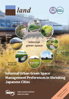
Urban residents’ health depends on green infrastructure to cope with climate change. Declining tax income makes creating new parks difficult—especially in Japan, where some cities already lack green space. Could informal urban green spaces (IGS), such as vacant lots and brownfields, provide a solution? This study used a representative online survey to ask how residents of four large shrinking cities perceive and use IGS, and what their preferences for IGS management are. Results show residents know of IGS areas that are close by, and 20% already use IGS for recreation. Recreation and urban agriculture were preferred as management goals, over redevelopment and non-management. Most residents said city administrations should mediate usage and liability, but participatory management could improve the appearance of IGS. On this basis, we propose eight principles for participatory informal green space
[...] Read more.
- Issues are regarded as officially published after their release is announced to the table of contents alert mailing list.
- You may sign up for e-mail alerts to receive table of contents of newly released issues.
- PDF is the official format for papers published in both, html and pdf forms. To view the papers in pdf format, click on the "PDF Full-text" link, and use the free Adobe Reader to open them.
Previous Issue
Next Issue