You are currently viewing a new version of our website. To view the old version click .

Remote Sensing, Volume 15, Issue 10

May-2 2023 - 219 articles

Cover Story: 
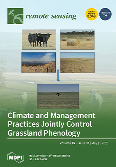
Climate and management practices jointly control the spatial and temporal patterns of land surface phenology. However, most studies solely focus on analyzing the climatic controls on the inter-annual variability and trends in vegetation phenology. This study examined the impacts of climate and management practices and their interactions. Results showed that the interactions of drought and management (baling or grazing) could greatly affect vegetation phenology and suppress production. Burning plus baling might be a good management strategy in a good rainfall year to increase forage productivity. The impacts of climate and management interactions suggested that ranchers need to adjust management strategies (dynamic instead of static management plans) based on climatic conditions to maintain productive and sustainable grasslands. View this paper
  • Issues are regarded as officially published after their release is announced to the table of contents alert mailing list .
  • You may sign up for email alerts to receive table of contents of newly released issues.
  • PDF is the official format for papers published in both, html and pdf forms. To view the papers in pdf format, click on the "PDF Full-text" link, and use the free Adobe Reader to open them.

Articles (219)

  • Article
  • Open Access
17 Citations
5,347 Views
22 Pages

22 May 2023

The spatial accuracy of unmanned aerial vehicles (UAVs) and the images they capture play a crucial role in the mapping process. Researchers are exploring solutions that use image-based techniques such as structure from motion (SfM) to produce topogra...

  • Article
  • Open Access
5 Citations
2,368 Views
24 Pages

22 May 2023

Downward continuation is a key technique for processing and interpreting gravity anomalies, as it has a major role in reducing values to horizontal planes and identifying small and shallow sources. However, it can be unstable and inaccurate, particul...

  • Article
  • Open Access
20 Citations
5,891 Views
19 Pages

22 May 2023

Hyperspectral image classification (HSI) has rich applications in several fields. In the past few years, convolutional neural network (CNN)-based models have demonstrated great performance in HSI classification. However, CNNs are inadequate in captur...

  • Article
  • Open Access
15 Citations
2,742 Views
23 Pages

Boosting Adversarial Transferability with Shallow-Feature Attack on SAR Images

  • Gengyou Lin,
  • Zhisong Pan,
  • Xingyu Zhou,
  • Yexin Duan,
  • Wei Bai,
  • Dazhi Zhan,
  • Leqian Zhu,
  • Gaoqiang Zhao and
  • Tao Li

22 May 2023

Adversarial example generation on Synthetic Aperture Radar (SAR) images is an important research area that could have significant impacts on security and environmental monitoring. However, most current adversarial attack methods on SAR images are des...

  • Article
  • Open Access
17 Citations
3,910 Views
25 Pages

22 May 2023

Accurate information on dominant tree species and their spatial distribution in subtropical natural forests are key ecological monitoring factors for accurately characterizing forest biodiversity, depicting the tree competition mechanism and quantita...

  • Article
  • Open Access
11 Citations
5,433 Views
18 Pages

22 May 2023

Continuous long-term eddy covariance (EC) measurements of CO2 fluxes (NEE) in a variety of terrestrial ecosystems are critical for investigating the impacts of climate change on ecosystem carbon cycling. However, due to a number of issues, approximat...

  • Article
  • Open Access
2 Citations
2,460 Views
23 Pages

22 May 2023

Old urban reform usually reactivates the urban fabric in a new era of sustainable development. However, what remains of the former fabric and how it interacts with the new one often inspires curiosity. How the old residents adapt their lives to the n...

  • Article
  • Open Access
3 Citations
2,948 Views
20 Pages

In-Situ GNSS-R and Radiometer Fusion Soil Moisture Retrieval Model Based on LSTM

  • Tianlong Zhang,
  • Lei Yang,
  • Hongtao Nan,
  • Cong Yin,
  • Bo Sun,
  • Dongkai Yang,
  • Xuebao Hong and
  • Ernesto Lopez-Baeza

22 May 2023

Global navigation satellite system reflectometry (GNSS-R) is a remote sensing technology of soil moisture measurement using signals of opportunity from GNSS, which has the advantages of low cost, all-weather detection, and multi-platform application....

  • Article
  • Open Access
19 Citations
4,497 Views
25 Pages

Integration of DInSAR-PS-Stacking and SBAS-PS-InSAR Methods to Monitor Mining-Related Surface Subsidence

  • Yuejuan Chen,
  • Xu Dong,
  • Yaolong Qi,
  • Pingping Huang,
  • Wenqing Sun,
  • Wei Xu,
  • Weixian Tan,
  • Xiujuan Li and
  • Xiaolong Liu

22 May 2023

Over-exploitation of coal mines leads to surface subsidence, surface cracks, collapses, landslides, and other geological disasters. Taking a mining area in Nalintaohai Town, Ejin Horo Banner, Ordos City, Inner Mongolia Autonomous Region, as an exampl...

  • Article
  • Open Access
8 Citations
2,828 Views
18 Pages

FusionPillars: A 3D Object Detection Network with Cross-Fusion and Self-Fusion

  • Jing Zhang,
  • Da Xu,
  • Yunsong Li,
  • Liping Zhao and
  • Rui Su

22 May 2023

In the field of unmanned systems, cameras and LiDAR are important sensors that provide complementary information. However, the question of how to effectively fuse data from two different modalities has always been a great challenge. In this paper, in...

of 22

Get Alerted

Add your email address to receive forthcoming issues of this journal.

XFacebookLinkedIn
Remote Sens. - ISSN 2072-4292