Next Issue
Volume 10, June
Previous Issue
Volume 10, April


Drones, Volume 10, Issue 5 (May 2026) – 85 articles

Cover Story (view full-size image): 
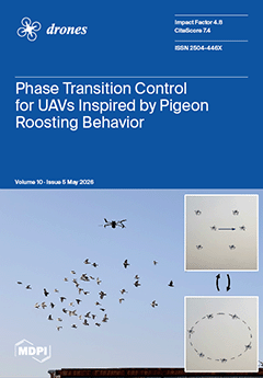
Inspired by the collective homing behavior of pigeon flocks, this research proposes a novel control framework derived from a bird-inspired interaction model. This enables UAV swarms to dynamically switch their motion phases through a biologically inspired roosting force, which allows a smooth transition between a translational motion phase and a vortex motion phase. Simulations demonstrate that the proposed framework reliably achieves stable transitions between these distinct motion phases. This work bridges collective animal behavior and the control of multi-UAV swarms, thereby significantly enhancing the adaptability and mission diversity of UAV swarms in complex environments. View this paper
  • Issues are regarded as officially published after their release is announced to the table of contents alert mailing list.
  • You may sign up for e-mail alerts to receive table of contents of newly released issues.
  • PDF is the official format for papers published in both, html and pdf forms. To view the papers in pdf format, click on the "PDF Full-text" link, and use the free Adobe Reader to open them.
Order results
Result details
Section
Select all
Export citation of selected articles as:
25 pages, 14069 KB  
Article
RSMamDet: Efficient UAV Remote Sensing Vehicle Detection via Linear State Space Models and Adaptive Multi-Level Feature Fusion
by Man Wu, Xiaozhang Liu, Xiulai Li and Wenbiao Gan
Drones 2026, 10(5), 396; https://doi.org/10.3390/drones10050396 - 21 May 2026
Viewed by 249
Abstract
Accurate and efficient vehicle detection from unmanned aerial vehicle (UAV) imagery is essential for intelligent transportation, urban monitoring, and public safety, yet this task remains challenging due to high target density, extreme scale variation, complex backgrounds, and stringent onboard computational constraints. Existing DETR-based [...] Read more.
Accurate and efficient vehicle detection from unmanned aerial vehicle (UAV) imagery is essential for intelligent transportation, urban monitoring, and public safety, yet this task remains challenging due to high target density, extreme scale variation, complex backgrounds, and stringent onboard computational constraints. Existing DETR-based detectors model global context through self-attention but incur quadratic O(N2) complexity that is prohibitive for high-resolution UAV images, while CNN-based methods lack the long-range contextual awareness needed for dense small-object scenarios. We propose RSMamDet, an efficient end-to-end detection framework built upon RT-DETR that replaces quadratic self-attention with linear O(N) State Space Model scanning. The framework integrates a MobileMamba backbone with a Selective Feature Scanning module for efficient global context modeling, a Dimension-Aware Selective Integration module for adaptive cross-scale feature fusion, a Poly Kernel Inception Network encoder for multi-receptive-field feature enrichment, and an Adaptive Multi-Level Feature Fusion module for content-aware dynamic upsampling, complemented by an Uncertainty-Minimal Composite loss for stable query selection in cluttered aerial scenes. Experiments on DroneVehicle and VisDrone2019 demonstrate that RSMamDet achieves mAP50 of 72.6% and 40.2%, surpassing state-of-the-art methods by 4.1% and 2.2%, respectively, while maintaining real-time inference at 186.2 FPS with only 19.8M parameters and 42.3 GFLOPs, representing a 6.14× reduction in computational cost and a 3.86× reduction in model parameters compared to the strongest baseline. Full article
(This article belongs to the Topic Advances in Autonomous Vehicles, Automation, and Robotics)
Show Figures

Figure 1

27 pages, 2961 KB  
Article
In-Hover Quadrotor Rotor Degradation Monitoring Using Null-Space Excitation and Lock-In Detection
by István Lovas
Drones 2026, 10(5), 395; https://doi.org/10.3390/drones10050395 - 21 May 2026
Viewed by 192
Abstract
In-flight propulsion system diagnosis in multirotor unmanned aerial vehicles (UAVs) remains a challenging problem due to closed-loop control interactions, strong environmental disturbances, and common-mode effects that obscure rotor-specific anomalies. Conventional passive monitoring approaches based solely on electrical or mechanical measurements are often insufficient [...] Read more.
In-flight propulsion system diagnosis in multirotor unmanned aerial vehicles (UAVs) remains a challenging problem due to closed-loop control interactions, strong environmental disturbances, and common-mode effects that obscure rotor-specific anomalies. Conventional passive monitoring approaches based solely on electrical or mechanical measurements are often insufficient for reliable fault localization and for distinguishing global degradations from nominal operation. This paper proposes an active diagnostic framework that exploits low-amplitude sinusoidal excitation injected into the control null space during hover operation. By employing lock-in detection, rotor responses are selectively extracted at the excitation frequency, enabling the derivation of robust amplitude-based sensitivity indicators from rotational speed, current, and electrical power signals. A pairwise signed diagnostic metric is formulated to achieve reliable localization of asymmetric rotor faults. In addition, an absolute indicator referenced to a baseline condition is introduced to capture symmetric degradations affecting all rotors through the combined use of current- and power-based sensitivities. The proposed method is validated in a high-fidelity quadrotor simulation environment incorporating viscous-friction and thrust-coefficient degradation faults. Extensive Monte Carlo analyses demonstrate robust fault-detection and localization performance, including scenarios that are indistinguishable using conventional pairwise normalization techniques. Full article
(This article belongs to the Section Drone Design and Development)
Show Figures

Figure 1

33 pages, 8970 KB  
Article
Adaptive Reinforcement Learning-Driven Jellyfish Search Optimizer for Cooperative Multi-UAV Path Planning Under Dynamic and Adversarial Conditions
by Nader Alotaibi and Wojdan BinSaeedan
Drones 2026, 10(5), 394; https://doi.org/10.3390/drones10050394 - 21 May 2026
Viewed by 459
Abstract
Cooperative multi-UAV path planning under dynamic and adversarial conditions demands simultaneous satisfaction of safety, efficiency, and coordination constraints, yet existing swarm-intelligence and RL–swarm hybrids rely on deterministic switching rules, tabular states, and ad hoc training schedules. This paper proposes RL-JSO, a hybrid framework [...] Read more.
Cooperative multi-UAV path planning under dynamic and adversarial conditions demands simultaneous satisfaction of safety, efficiency, and coordination constraints, yet existing swarm-intelligence and RL–swarm hybrids rely on deterministic switching rules, tabular states, and ad hoc training schedules. This paper proposes RL-JSO, a hybrid framework in which a dueling double deep Q-network with prioritized experience replay adaptively selects among the drift, passive, and active phases of a jellyfish search optimizer, replacing the deterministic time-control rule with a learned policy. The framework integrates a five-layer hierarchical safety control mechanism, a mastery-gated nine-stage curriculum, and a shared reward module that architecturally enforces fairness between RL-JSO and a paired RL-PSO counterpart. Evaluation across four progressive campaigns with 160 independent runs per algorithm shows that, within the evaluated JSO/PSO family, RL-JSO is the only method that sustains a 100% collision-free rate across all four progressive difficulty campaigns, its Cliff’s delta over standard JSO grows monotonically with difficulty from medium to large, and under a composite cooperation metric its coordination score remains nearly invariant while comparators degrade by 17–23%. A paired inference-time ablation on the trained checkpoint provides controlled inference-time evidence that adaptive phase switching is a principal contributor to the observed test-time performance within the trained system, rather than the heuristic fallback layers. Full article
Show Figures

Figure 1

19 pages, 8061 KB  
Article
A Greedy Routing Protocol Based on a Stable Relay Algorithm for UAV Ad Hoc Networks
by Zheng Yu, Jianguo Yu, Shangjing Lin and Churan Zhou
Drones 2026, 10(5), 393; https://doi.org/10.3390/drones10050393 - 20 May 2026
Viewed by 179
Abstract
In Unmanned Aerial Vehicle (UAV) ad hoc networks, nodes move at a high speed, leading to a low communication success rate. Therefore, communication between UAV nodes requires specific routing protocols. Many researchers have improved traditional routing protocols by enhancing the quality of the [...] Read more.
In Unmanned Aerial Vehicle (UAV) ad hoc networks, nodes move at a high speed, leading to a low communication success rate. Therefore, communication between UAV nodes requires specific routing protocols. Many researchers have improved traditional routing protocols by enhancing the quality of the one-hop link and handling the routing void. However, since they only took into account the one-hop link between the source node and the one-hop neighbor node, the improvement was not significant. In order to reduce the packet loss rate and improve the throughput, this paper proposes a greedy routing protocol based on the stable relay algorithm (GRPBSR). In GRPBSR, there are two modes for nodes to transfer data packets: the stable forwarding mode and the routing void forwarding mode. In the stable forwarding mode, the source node selects relay nodes based on the stable relay algorithm which takes into account the distance between the one-hop neighbor node and the destination node, the stability of the link between the source node and the one-hop neighbor node, as well as the quality of the link between the one-hop and the two-hop neighbor node. In routing void forwarding mode, the source node divides the routing void into five cases and assigns corresponding solutions to each of them based on the integrated link and the fine-tuned stable relay algorithm. Through analysis and comparison, the results show that the performance of GRPBSR is superior to other routing protocols. Full article
(This article belongs to the Section Drone Communications)
Show Figures

Figure 1

23 pages, 3775 KB  
Article
Slope Terrain Gait Planning and Admittance Control Method for Underwater Quadruped Robots Based on Righting Moment Compensation
by Kang Zhang, Hao Zhang, Hong Chen, Guanqiao Chen, Zongxia Jiao, Yuang Zhang, Wei Chen, Xinliang Wang and Junjie Liu
Drones 2026, 10(5), 392; https://doi.org/10.3390/drones10050392 - 20 May 2026
Viewed by 199
Abstract
Benthic AUVs (underwater quadruped robots) merge the cruising efficiency of submersibles with the bottom-crawling stability of legged robots for unstructured deep-sea exploration. However, the deliberate separation of the center of gravity and buoyancy—essential for static stability—generates a significant righting moment. When climbing steep [...] Read more.
Benthic AUVs (underwater quadruped robots) merge the cruising efficiency of submersibles with the bottom-crawling stability of legged robots for unstructured deep-sea exploration. However, the deliberate separation of the center of gravity and buoyancy—essential for static stability—generates a significant righting moment. When climbing steep slopes, this moment resists hull alignment. If the slope exceeds the robot’s maximum hydrostatic pitch limit, conventional inverse kinematics algorithms fail: the hind legs lose ground contact and propulsion is lost. To overcome this, this paper proposes a framework integrating optimal force distribution, adaptive trajectory probing, and admittance control. An analytical multi-point moment balance model derives the terrain-adaptive pitch boundaries. A Quadratic Program (QP) then distributes contact forces, tasking front legs with stabilizing the righting moment while hind legs provide thrust. During the swing phase, adaptive Bezier sequences prevent anterior slope collisions and ensure posterior ground contact. Furthermore, a Cartesian admittance controller provides active compliance to manage the nonlinear friction of dynamic waterproof seals. Validated via a high-fidelity physics-based simulation model calibrated against physical pool trials, the robot achieved robust traversal of 15° and 33° steep slopes. Statistical robustness is substantiated via a 30-trial Monte Carlo study, where postural stability remained remarkably consistent with a mean Pitch RMSE of 2.88° across a ±10% parameter uncertainty envelope. Compared to traditional baseline algorithms, the proposed method successfully suppressed torque chattering by 54.1% in the high-frequency band (2–50Hz) and improved energetic efficiency by up to 43% on steep gradients. These findings offer a validated control architecture for heavy-duty deep-sea platforms navigating complex benthic topographies. Full article
(This article belongs to the Special Issue Advances in Autonomy of Underwater Vehicles (AUVs))
Show Figures

Figure 1

30 pages, 7567 KB  
Article
Drone-Assisted Lightweight Authentication Protocol for Unmanned eVTOL Emergency Rescue
by Qi Xie and Huai Chen
Drones 2026, 10(5), 391; https://doi.org/10.3390/drones10050391 - 20 May 2026
Viewed by 239
Abstract
While drones play important roles in areas such as communication and logistics delivery, they have certain limitations in emergency rescue scenarios due to their inability to carry passengers. Building on mature drone technologies such as autonomous flight and environmental perception, unmanned passenger Electric [...] Read more.
While drones play important roles in areas such as communication and logistics delivery, they have certain limitations in emergency rescue scenarios due to their inability to carry passengers. Building on mature drone technologies such as autonomous flight and environmental perception, unmanned passenger Electric Vertical Take-off and Landing (eVTOL) aircraft are designed with a manned cabin, enabling them to operate without an onboard pilot while rapidly transporting injured people. Consequently, eVTOLs can play a significant role in emergency rescue that cargo-only drones cannot fulfill, as they are capable of rapidly reaching emergency scenes, effectively overcoming the delays caused by traditional ground traffic congestion. Despite their potential, eVTOLs still face several critical obstacles, including signal disruption, limited coverage of dispatching centers, mutual authentication among entities, and concerns related to security and privacy preservation. As a remedy, this paper presents a lightweight authentication protocol leveraging drone assistance to overcome these challenges for unmanned eVTOL emergency rescue. In scenarios where an unmanned eVTOL experiences signal blockage due to dense urban high-rise structures, neighboring drones can serve as a transmission relay to assist the unmanned eVTOL and the dispatch center (DC) in completing mutual authentication and session key negotiation, thereby enabling the unmanned eVTOL to safely complete its mission. To enhance security, physical unclonable functions (PUFs) are integrated into unmanned eVTOLs, drones, and the DC, safeguarding sensitive data against side-channel and physical capture attacks while preserving the confidentiality of unmanned eVTOL identities to mitigate privacy risks. Our protocol achieves provable security in the random oracle model while exhibiting strong resistance to various well-known attacks. Comparative analysis with the existing drone authentication and drone-assisted emergency rescue authentication protocols reveals that our protocol not only provides stronger security guarantees but also maintains a low computational overhead. Full article
(This article belongs to the Section Drone Communications)
Show Figures

Figure 1

29 pages, 59758 KB  
Article
Estimating Traits of Tillandsia landbeckii Using a Newly Developed VNIR/SWIR Multispectral UAV Imaging System in the Atacama Desert
by Fabian Reddig, Christoph Hütt, Leon Vehlken, Nora Tilly, Sebastián Yassir Espinoza Guzmán, Jan Wolf, Annika Klee, Marcus A. Koch, Georg Bareth and Alexander Jenal
Drones 2026, 10(5), 390; https://doi.org/10.3390/drones10050390 - 20 May 2026
Viewed by 263
Abstract
Fog-dependent Tillandsia landbeckii in the hyper-arid Atacama Desert lacks the red-edge reflectance pattern that supports vegetation monitoring, motivating shortwave infrared (SWIR) approaches. We evaluated a newly developed UAV-borne multispectral SWIR camera system for estimating plant water status and additional plant functional traits (fresh [...] Read more.
Fog-dependent Tillandsia landbeckii in the hyper-arid Atacama Desert lacks the red-edge reflectance pattern that supports vegetation monitoring, motivating shortwave infrared (SWIR) approaches. We evaluated a newly developed UAV-borne multispectral SWIR camera system for estimating plant water status and additional plant functional traits (fresh and dry biomass, and N uptake) from four spectral bands (1100, 1200, 1510, and 1650 nm) across 20 destructively sampled plots. Of five traits tested, only canopy water content (CWC) retained statistically robust spectral associations after multiple-testing correction, with most significant predictors concentrated in the 1200–1510 nm wavelength region. A physically interpretable predictor, the mean spectral slope between 1200 and 1510 nm, yielded conditional cross-validated Rcv2=0.51 (RMSEcv170 g m−2), though fully selection-corrected estimates were substantially lower (Rcv2=0.100.20), reflecting feature-selection instability at the given sample size. The absence of robust biomass- and nitrogen-related signals is physically interpretable given the species’ atypical surface optics. While expanded sampling and independent validation remain necessary to establish transferable performance estimates, these results demonstrate that SWIR-based water-status retrieval is feasible for this spectrally challenging species, opening a pathway toward functional monitoring of fog-dependent desert ecosystems. Full article
Show Figures

Figure 1

18 pages, 477 KB  
Systematic Review
Human-Drone Interaction in Older Adults: A Systematic Review
by Agustín Gómez-López, Yuxa Maya-López, Pablo Olivos-Jara and Rafael Morales
Drones 2026, 10(5), 389; https://doi.org/10.3390/drones10050389 - 20 May 2026
Viewed by 385
Abstract
An aging population, increased life expectancy and loneliness among older people constitute a growing challenge, driving interest in technological solutions such as home drones. The aim of this study is to analyze their potential for older adults through a systematic review following PRISMA [...] Read more.
An aging population, increased life expectancy and loneliness among older people constitute a growing challenge, driving interest in technological solutions such as home drones. The aim of this study is to analyze their potential for older adults through a systematic review following PRISMA guidelines, including articles indexed in Web of Science, Scopus, PubMed and the ACM Digital Library up to February 2026 and following the Joanna Briggs Institute (JBI) methodology. A total of 285 records were initially identified and imported into JBI, of which 41 duplicate records were removed, and 231 studies were excluded after screening, resulting in 13 studies meeting the inclusion criteria. The reviewed studies suggest generally favorable perceptions among some older adults regarding the use of drones in the areas of health, support and safety, alongside barriers related to usability, trust and user interaction. Recent studies incorporate practical applications, highlighting the potential applicability of drones in supporting aspects related to autonomy, health and safety among older adults. Overall, the literature, though still limited, shows a shift towards more specific applications, highlighting the potential of drones to support the autonomy, health and safety of older adults, although their implementation remains influenced by factors of acceptance and user experience. Full article
Show Figures

Graphical abstract

46 pages, 3292 KB  
Article
Autonomous Fault-Tolerant Cooperative Tracking and Obstacle Avoidance for UAV Swarm in Complex Maritime Environments
by Zhiyang Zhang, Xiaolong Liang, Aoyu Zheng and Ning Wang
Drones 2026, 10(5), 388; https://doi.org/10.3390/drones10050388 - 19 May 2026
Viewed by 183
Abstract
To address the challenge of stable tracking of moving maritime targets by unmanned aerial vehicle(UAV) swarm in environments with threat zones and platform failure risks, this paper proposes a cooperative tracking and guidance strategy integrating Distributed Model Predictive Control (DMPC) with Sequential Quadratic [...] Read more.
To address the challenge of stable tracking of moving maritime targets by unmanned aerial vehicle(UAV) swarm in environments with threat zones and platform failure risks, this paper proposes a cooperative tracking and guidance strategy integrating Distributed Model Predictive Control (DMPC) with Sequential Quadratic Programming (SQP). A cooperative tracking model is developed incorporating UAV kinematics, environmental threats, stereo-vision positioning, and field-of-view constraints. Two original strategies are introduced within the DMPC framework: an altitude-cooperative target recapture strategy reduces target total loss duration by approximately 7 s compared to fixed-altitude baselines, while a distributed formation reconfiguration strategy restores stable tracking within 10 s after member failure and ensures safe inter-UAV separation. A multi-constraint trajectory tracking controller based on DMPC-SQP achieves real-time co-optimization of threat avoidance, formation maintenance, and tracking accuracy. Simulation results in dense threat environments demonstrate a 93.4% Quadratic Programming feasibility rate, with mean tracking error reduced by 25.4% over fixed-altitude DMPC and 48.7% over methods based on the Linear Quadratic Regulator (LQR), while maintaining robust performance under 300 ms communication delay, sensor noise, and moderate wind disturbance. Full article
(This article belongs to the Special Issue Flight Control and Collision Avoidance of UAVs: 2nd Edition)
Show Figures

Figure 1

18 pages, 4388 KB  
Article
MUNILS: A Time-Synchronized and Traffic-Isolated Multi-UAV Simulation Platform Based on Integrated Physical and Network Simulators
by Sangyoon Lee, Geonwoo Yu, Dongwook Lee and Woonghee Lee
Drones 2026, 10(5), 387; https://doi.org/10.3390/drones10050387 - 18 May 2026
Viewed by 291
Abstract
Recent advancements in Unmanned Aerial Vehicle (UAV) physics simulators, flight control firmware, and network virtualization have been substantial. However, operating these systems independently fails to capture the complex dynamics of real-world multi-UAV networks, thereby compromising simulation reliability. To address this, we propose the [...] Read more.
Recent advancements in Unmanned Aerial Vehicle (UAV) physics simulators, flight control firmware, and network virtualization have been substantial. However, operating these systems independently fails to capture the complex dynamics of real-world multi-UAV networks, thereby compromising simulation reliability. To address this, we propose the Multi-UAV Network-in-the-Loop Simulation (MUNILS) platform, which seamlessly integrates the Gazebo physics engine, the PX4 flight controller, and the ns-3 network simulator via Robot Operating System 2 (ROS2) middleware. Specifically, MUNILS leverages Micro eXtremely Resource Constrained Environments–Data Distribution Service (XRCE-DDS) for high-speed data bridging and employs Linux network namespaces to enforce traffic isolation and routing exclusively through ns-3. Crucially, we introduce a precise cross-layer time synchronization mechanism spanning the physical, control, and network domains to resolve inherent clock discrepancies among these heterogeneous simulators. Experimental evaluations confirm that MUNILS achieves strict traffic isolation, scalable closed-loop flight control, and highly accurate time synchronization across all integrated modules (Gazebo, ns-3, ROS2, and PX4) without cumulative clock drift, thereby providing a highly reliable verification environment for large-scale swarm operations on a single machine. Full article
Show Figures

Figure 1

31 pages, 9128 KB  
Article
Surround and Tracking: An Innovative Multi-UAV Collaborative Search Approach for Maritime Rescue Under Imperfect Information
by Lang Ruan, Haotian Yu, Liuhao Chen and Xiao Yi
Drones 2026, 10(5), 386; https://doi.org/10.3390/drones10050386 - 18 May 2026
Viewed by 217
Abstract
Collaborative search of multiple uncrewed aerial vehicles (UAVs) is a critical technology for maritime rescue operations. To address the challenge posed by an unknown target motion direction, we present an innovative framework, “Dynamic Response-Intelligent Coverage,” and develop a multi-UAV collaborative search model. This [...] Read more.
Collaborative search of multiple uncrewed aerial vehicles (UAVs) is a critical technology for maritime rescue operations. To address the challenge posed by an unknown target motion direction, we present an innovative framework, “Dynamic Response-Intelligent Coverage,” and develop a multi-UAV collaborative search model. This study employs a hybrid methodology combining theoretical analysis and simulation optimization. By leveraging the geometric properties of logarithmic spiral (LS) curves, rigorous kinematic modeling and mathematical derivations were conducted to obtain the theoretically optimal solutions for single- and dual-UAV collaborative search. Furthermore, to address the traditional analytical methods’ “curse of dimensionality” issue through a strategy space search and adaptive adjustment mechanism, the genetic-optimization-based multi-UAV collaborative search strategy optimization algorithm (GA-MCSSO) is developed for scenarios involving three or more UAVs. Simulation results demonstrate that: (1) In the dual-UAV search scenario, the simulation optimization results closely align with the theoretically optimal solutions, with highly consistent convergence trajectories; (2) In multi-UAV search scenarios, Compared with SSB and GA-MCSSO-Seq, GA-MCSSO reduces the total coverage time by approximately 32% and improves the cumulative detection probability by approximately 18% under idealized spiral planning conditions. When evaluated under realistic constraints, the absolute improvement in total coverage time averages 0.1–0.2 s, with a maximum gain of nearly 1 s. The theoretical-simulation complementary framework established in this study provides a systematic solution for collaborative search from single UAV to multi-UAV scenarios. The methodology offers technical insights for multi-agent dynamic optimization problems and provides significant theoretical support for practical search operations. Full article
(This article belongs to the Special Issue Unmanned Aerial Vehicles for Enhanced Emergency Response)
Show Figures

Figure 1

39 pages, 1077 KB  
Article
UAV Mission Planning for Post-Disaster Victim Localisation via Federated Multi-Agent Reinforcement Learning
by Alparslan Güzey, Mehmet Akif Çifçi, Fazlı Yıldırım and Arda Yaşar Erdoğan
Drones 2026, 10(5), 385; https://doi.org/10.3390/drones10050385 - 18 May 2026
Viewed by 301
Abstract
Rapid localisation of trapped victims after urban disasters is essential but challenging because Bluetooth Low Energy (BLE) beacons are intermittent, radio propagation is obstructed by rubble, UAVs are energy-constrained, and real-world multi-UAV training is impractical in high-risk search-and-rescue (SAR) environments. This study formulates [...] Read more.
Rapid localisation of trapped victims after urban disasters is essential but challenging because Bluetooth Low Energy (BLE) beacons are intermittent, radio propagation is obstructed by rubble, UAVs are energy-constrained, and real-world multi-UAV training is impractical in high-risk search-and-rescue (SAR) environments. This study formulates post-disaster victim localisation as a cooperative Dec-POMDP and adapts a model-aided federated multi-agent reinforcement learning framework based on FedQMIX. The proposed pipeline combines a lightweight LoS/NLoS surrogate channel model, PSO-based victim-position estimation, return-to-base and map-feasibility safety checks, an SAR-aligned shaped reward, and a leakage-free centralised training state based on estimated rather than ground-truth victim locations. Each UAV trains locally inside a learned digital-twin simulator and periodically shares only QMIX network parameters, avoiding the exchange of raw trajectories or RSSI logs. The framework is evaluated on two synthetic post-earthquake urban maps representing a compact return-to-base scenario and a larger reach-to-destination scenario. Across five independent seeds per method and map, Model-Aided FedQMIX achieves the highest and most stable victim-localisation performance, with the clearest advantage observed in the larger long-horizon scenario. Additional diagnostic tests examine reward-weight sensitivity, RF channel-shift robustness, BLE/smartphone hardware heterogeneity, non-IID client-data variation, and partial-client FedAvg under missing client updates. The results indicate that combining model-aided localisation cues, decentralised value factorisation, SAR-aligned objective design, and federated parameter sharing can improve the robustness of UAV-based victim-localisation policies. The framework also clarifies deployment considerations for federated SAR coordination, including communication payload, privacy boundaries, heterogeneous client experience, device variability, and intermittent connectivity. This study remains simulation-based, and future validation with real UAVs, BLE devices, and rubble-inspired testbeds is required before operational deployment. Full article
Show Figures

Figure 1

35 pages, 12393 KB  
Article
Dynamic Event-Triggered Nonsingular Distributed Guidance for Multiple UAV Cooperative Salvo Attack with Impact-Time and Angle Constraints
by Fuqi Yang, Jikun Ye, Hao You, Lei Shao and Lei Zhang
Drones 2026, 10(5), 384; https://doi.org/10.3390/drones10050384 - 18 May 2026
Viewed by 213
Abstract
Modern UAV swarm operations face strict onboard bandwidth and autonomy constraints, making simultaneous multi-target interception under limited communication a critical unsolved challenge. This paper addresses three-dimensional cooperative interception of maneuvering targets by multiple unmanned aerial vehicles (UAVs) at prescribed line-of-sight (LOS) angles under [...] Read more.
Modern UAV swarm operations face strict onboard bandwidth and autonomy constraints, making simultaneous multi-target interception under limited communication a critical unsolved challenge. This paper addresses three-dimensional cooperative interception of maneuvering targets by multiple unmanned aerial vehicles (UAVs) at prescribed line-of-sight (LOS) angles under limited communication resources. In the LOS direction, a fixed-time consensus-based guidance law is designed with remaining flight time as the coordination variable, synchronizing each UAV’s impact time to a freely specified desired value with bounded gains throughout the engagement. Unlike most existing fixed-time cooperative guidance works, the consensus convergence time is rigorously proven to be strictly less than the maximum initial predicted flight time, guaranteeing impact-time agreement is reached before any UAV intercepts the target—a necessary condition for genuine simultaneous salvo attack. A dynamic event-triggered (DET) mechanism is incorporated to reduce inter-UAV communication frequency by adaptively updating the triggering threshold according to consensus state evolution. In the LOS normal directions, a piecewise nonsingular terminal sliding-mode law ensures fixed-time convergence of the LOS angle and its rate to desired values under impact-angle constraints. Fixed-time stability and Zeno-behavior exclusion are rigorously established via Lyapunov analysis. Comparative simulations against existing methods demonstrate clear advantages in impact-time accuracy, guidance smoothness, and communication efficiency. Full article
Show Figures

Figure 1

33 pages, 4198 KB  
Article
The Pull–Push Engine: Bidirectional Emotion Regulation for Emotionally Intelligent UAV Traffic Monitoring
by Mohamed Zaidan, Nafaâ Jabeur, Muhammad Aamir Basheer and Ansar-Ul-Haque Yasar
Drones 2026, 10(5), 383; https://doi.org/10.3390/drones10050383 - 17 May 2026
Viewed by 358
Abstract
Autonomous UAVs for urban traffic monitoring must respond quickly to changing operational conditions while maintaining stable, transparent decision-making. Rule-based controllers respond only at predefined thresholds, while learning-based methods adapt well but lack the certification transparency required for safety-critical deployment. This paper proposes a [...] Read more.
Autonomous UAVs for urban traffic monitoring must respond quickly to changing operational conditions while maintaining stable, transparent decision-making. Rule-based controllers respond only at predefined thresholds, while learning-based methods adapt well but lack the certification transparency required for safety-critical deployment. This paper proposes a bio-inspired emotion-regulated decision-control mechanism and introduces the Pull–Push Engine (PPE), a regulatory architecture that balances environmental stimuli against personality-anchored baselines through weighted temporal integration. The PPE is embedded in a three-layer framework combining Big Five personality traits, the Pleasure–Arousal–Dominance (PAD) model, and Ortony–Clore–Collins (OCC) event appraisal. Validation in a SUMO-based simulation across three scenarios of increasing complexity showed that PPE regulation maintained bounded PAD trajectories and zero saturation despite concurrent stressors, whereas removing the pull term caused 57–88% saturation. Behavioral diversity scaled naturally with operational demands: Surprised mood dominated across all scenarios (47.8–67.5%), with Anxious and Focused increasing systematically with complexity. Strategy entropy rose monotonically (1.885–2.033 bits). A sensitivity sweep confirmed robust regulation across a stable operating region, with degradation only at the boundary (p < 0.001 for all key comparisons). Every simulated decision remains causally traceable from stimulus through emotional processing to action. This ensures interpretability, which is essential for future safety-critical UAV deployment, although hardware implementation and field validation are still required. Full article
(This article belongs to the Section Innovative Urban Mobility)
Show Figures

Figure 1

28 pages, 5747 KB  
Article
Neural-Network Surrogate Framework for Rapid LCA Impact Screening of Potato Production: Manual Management vs. Drone-Assisted Technification
by Juan Carlos Almachi, Jessica Montenegro, Edwin Amaguaña, Danilo Arcentales and Esteban Valencia
Drones 2026, 10(5), 382; https://doi.org/10.3390/drones10050382 - 17 May 2026
Viewed by 350
Abstract
Potato cultivation in the Ecuadorian Andes is largely manual and relies on intensive agrochemical inputs. We introduce a reproducible workflow that couples life cycle assessment (LCA) with a neural-network surrogate to enable rapid multi-impact screening of two potato management scenarios in Ecuador: (i) [...] Read more.
Potato cultivation in the Ecuadorian Andes is largely manual and relies on intensive agrochemical inputs. We introduce a reproducible workflow that couples life cycle assessment (LCA) with a neural-network surrogate to enable rapid multi-impact screening of two potato management scenarios in Ecuador: (i) conventional manual management and (ii) Unmanned aerial vehicle (UAV)-based field monitoring to identify hotspots for targeted ground-based input application. Multi-category impacts are computed in OpenLCA using the environmental footprint method (EF 3.0) per kilogram of potatoes and scaled to annual national totals using reported national production data. UAV operation is parameterized as 0.51 kg CO2 eq·h−1, equivalent to 0.225 kg CO2 eq·ha−1 at a coverage rate of 2.27 ha·h−1. For 2024, the UAV-informed scenario reduces climate change from 4.29 × 10⁷ to 3.75 × 10⁷ kg CO2 eq (−12.7%), resource use, fossils from 5.09 × 10⁸ to 4.54 × 10⁸ MJ (−10.7%), and freshwater eutrophication from 3.33 × 10⁴ to 2.83 × 10⁴ kg P eq (−15.0%), while land use remains nearly unchanged at ~4.73 × 10⁹ Pt (−0.1%). To avoid repeated LCA recalculations, a multi-output artificial neural network (ANN) surrogate (29 outputs) was trained in Python (TensorFlow/Keras) and evaluated using leave-one-year-out (LOYO) cross-validation (2015–2024), showing strong agreement with the LCA results. This framework enables scalable what-if analysis and efficient evaluation of UAV-enabled precision monitoring strategies in resource-constrained settings. Full article
Show Figures

Figure 1

25 pages, 6807 KB  
Article
Experimental Analysis of a Hybrid Fuel Cell Powertrain for an Agricultural Rover
by Valerio Martini, Salvatore Martelli, Mattia Scanavino, Francesco Mocera and Aurelio Soma’
Drones 2026, 10(5), 381; https://doi.org/10.3390/drones10050381 - 16 May 2026
Viewed by 346
Abstract
Agriculture plays a relevant role in the food supply chain but is also a major contributor in terms of emissions. A possible solution to reduce its impact is to replace traditional machinery with innovative systems, such as agricultural rovers. In the proposed research, [...] Read more.
Agriculture plays a relevant role in the food supply chain but is also a major contributor in terms of emissions. A possible solution to reduce its impact is to replace traditional machinery with innovative systems, such as agricultural rovers. In the proposed research, a case study of an agricultural rover, specifically designed to operate in orchards, is presented. The powertrain features a Li-ion battery pack as the primary energy source and a fuel cell system operating as a range extender unit. Hydrogen is stored on board using a metal hydride tank to enhance compactness. Once the traction and range extender power output control strategies were defined, experimental tests in a closed warehouse were performed. During the tests, the rover was manually controlled using a joystick, since the main focus was to evaluate the powertrain behavior rather than to test the autonomous driving algorithm. During the tests, different maneuvers in narrow spaces were performed. The results showed that the rover successfully accomplished the tasks and the range extender unit can effectively extend the rover autonomy up to +150% compared to the pure battery solution. This result was obtained considering a 15 min test carried out in an indoor environment with a polished concrete floor. Full article
Show Figures

Figure 1

29 pages, 32981 KB  
Article
Aesthetic-Aware Trajectory Planning for Multi-ROI UAV Aerial Cinematography
by Zijun He, Yuchen Liu and Zheng Ji
Drones 2026, 10(5), 380; https://doi.org/10.3390/drones10050380 - 16 May 2026
Viewed by 214
Abstract
UAV aerial cinematography has become increasingly important in film production, surveying, and smart-city applications due to its efficiency and creative potential. However, existing UAV filming workflows still rely heavily on manual operation and professional piloting skills, resulting in complex mission design, limited planning [...] Read more.
UAV aerial cinematography has become increasingly important in film production, surveying, and smart-city applications due to its efficiency and creative potential. However, existing UAV filming workflows still rely heavily on manual operation and professional piloting skills, resulting in complex mission design, limited planning autonomy, and inconsistent visual quality. To address these challenges, this paper proposes a unified aesthetics-aware trajectory planning framework for multi-region-of-interest (multi-ROI) UAV aerial cinematography that automatically generates safe, efficient, and visually coherent flight paths from user-specified ROIs. The proposed framework consists of three main components. First, for each ROI, candidate viewpoints are sampled using a spiral trajectory, and a learning-based aesthetic evaluation network is applied to select visually optimal viewpoints for local trajectory generation. Second, transition trajectories between ROIs are generated using a Goal-biased Bidirectional Rapidly exploring Random Tree Star (Goal-biased BiRRT*) planner and evaluated through a multi-objective cost function to determine the most suitable transition paths. Third, the global connection of multiple ROIs is formulated as a Set Traveling Salesman Problem (STSP) to obtain an efficient visiting sequence. By integrating learning-based aesthetic evaluation with hierarchical trajectory planning and coordinated multi-ROI route organization, the proposed framework jointly considers flight feasibility, planning efficiency, visual composition quality, and trajectory continuity within a unified planning pipeline. Experimental results demonstrate that the proposed method generates more visually appealing and coherent aerial trajectories than traditional manual or rule-based approaches, while significantly reducing operational complexity. The proposed system provides an effective solution for autonomous UAV aerial cinematography with improved global consistency, aesthetic performance, and practical planning capability in complex environments. Full article
Show Figures

Figure 1

24 pages, 2768 KB  
Article
Design and Field Validation of a Modular Vision-Guided UAV System for Real-Time Adaptive Vegetative Restoration
by Andres Lugo-Molina, Camilo Lozoya, Luis Orona and Luis C. Felix-Herran
Drones 2026, 10(5), 379; https://doi.org/10.3390/drones10050379 - 15 May 2026
Viewed by 319
Abstract
Vegetative restoration in degraded landscapes requires scalable deployment strategies capable of adapting to heterogeneous terrain conditions. Conventional aerial seeding methods typically operate in open-loop mode, distributing seeds uniformly without considering terrain suitability. This study presents a modular, vision-guided unmanned aerial vehicle (UAV) system [...] Read more.
Vegetative restoration in degraded landscapes requires scalable deployment strategies capable of adapting to heterogeneous terrain conditions. Conventional aerial seeding methods typically operate in open-loop mode, distributing seeds uniformly without considering terrain suitability. This study presents a modular, vision-guided unmanned aerial vehicle (UAV) system for real-time adaptive seed deployment based on the closed-loop integration of onboard perception and actuation under embedded computational constraints. The proposed system combines RGB-based terrain classification, embedded processing, and altitude-adaptive seed dispensing within a unified perception–decision–actuation framework, enabling selective and context-aware seed deployment during flight. Terrain suitability is evaluated onboard using three convolutional neural network (CNN) models and a color-based baseline to distinguish sowable and non-sowable areas. A confidence-based decision strategy with temporal filtering improves reliability, while an altitude-adaptive control mechanism regulates seed distribution across varying flight heights. Field experiments conducted in semi-arid environments demonstrate classification accuracy above 85% with inference latency below 100 ms on a Jetson Nano platform. Additional offline evaluation under varying altitude, speed, illumination, and terrain conditions confirms the robustness of the perception module. The results demonstrate the feasibility of integrating real-time perception with adaptive actuation, enabling UAVs to transition from passive sensing platforms to active agents for environmental intervention. The proposed system provides a practical and scalable approach for precision vegetative restoration in heterogeneous environments. Full article
(This article belongs to the Special Issue Drone-Enabled Smart Sensing: Challenges and Opportunities)
Show Figures

Graphical abstract

43 pages, 15260 KB  
Article
Precision Docking of a Foldable Quadrotor on a Wheel-Legged Robot via CFNTSM with GFA-FEO and FiLM-SAC Deep Reinforcement Learning
by Qibin Gu and Zhenxing Sun
Drones 2026, 10(5), 378; https://doi.org/10.3390/drones10050378 - 14 May 2026
Viewed by 307
Abstract
Deploying unmanned aerial vehicles (UAVs) cooperatively with legged robots for disaster response and inspection requires autonomous docking on miniature walking platforms. This study addresses the problem of landing a foldable quadrotor onto the back of a trotting wheel-legged robot (300×180 [...] Read more.
Deploying unmanned aerial vehicles (UAVs) cooperatively with legged robots for disaster response and inspection requires autonomous docking on miniature walking platforms. This study addresses the problem of landing a foldable quadrotor onto the back of a trotting wheel-legged robot (300×180 mm) and subsequently taking off while carrying it as a payload. Four tightly coupled challenges distinguish this task from conventional mobile-platform landing: (i) an extremely small landing surface, (ii) gait-induced periodic vibrations at 2.5 Hz, (iii) continuous platform translation at 0.30.8 m/s, and (iv) surface docking that requires simultaneous position and attitude matching rather than mere point tracking. The proposed framework comprises four components: (1) a novel single-servo crank-rocker folding mechanism that reduces the folded body footprint by 48.5% and the maximum linear dimension from 590 mm to 309 mm (↓47.6%) compared with the prior dual-servo design; (2) a staged Continuous Fast Nonsingular Terminal Sliding Mode (CFNTSM) controller combined with a Gait-Frequency-Aware Finite-time Extended Observer (GFA-FEO); (3) a Feature-wise Linear Modulation Soft Actor-Critic (FiLM-SAC) residual reinforcement-learning policy conditioned on physical states and mission phase, with an adaptive trust weight λ(t); and (4) a payload-adaptive takeoff strategy with parameter hot-switching to handle the twofold mass increase. Extensive Monte Carlo simulations and ablation studies across three experiment groups demonstrate that the proposed hierarchical framework achieves sub-centimetre (<10 mm) position accuracy and <3° attitude matching on a walking platform. Quantitatively, the full method reduces docking RMSE by 42% relative to the model-based CFNTSM + GFA-FEO controller without residual RL (4.2 vs. 7.2 mm) and reduces post-lock takeoff RMSE by 63% through FEO hot-switching (16.2 vs. 44.2 mm). Full article
Show Figures

Figure 1

38 pages, 833 KB  
Review
Bridging the Fragmentation in Unmanned Aircraft System Traffic Management (UTM): A Systematic Survey on UTM
by Guanzhen Li, Xiao Han, Yuan Shi and Leye Wang
Drones 2026, 10(5), 377; https://doi.org/10.3390/drones10050377 - 14 May 2026
Viewed by 223
Abstract
The Unmanned Aircraft System Traffic Management (UTM) system is designed to autonomously coordinate dense Unmanned Aerial Vehicles (UAVs) within shared airspace, ensuring both the efficiency and safety of aerial traffic. With the rapid proliferation of UAV applications, autonomous UTM systems have become increasingly [...] Read more.
The Unmanned Aircraft System Traffic Management (UTM) system is designed to autonomously coordinate dense Unmanned Aerial Vehicles (UAVs) within shared airspace, ensuring both the efficiency and safety of aerial traffic. With the rapid proliferation of UAV applications, autonomous UTM systems have become increasingly essential, motivating various stakeholders to develop their distinct UTM solutions. However, due to the lack of common guidelines, these emerging solutions exhibit substantial incompatibilities, which hinder the transferability of existing techniques and the overall standardization of UTM. To address the fragmentation, this paper provides a systematic survey of existing UTM research and identifies commonalities across various UTM systems. Specifically, this paper summarizes core UTM service modules and groups them with similar objectives, thereby proposing a unified UTM framework with four layers: Fundamental Infrastructure, Pre-flight UTM, In-flight UTM, and UTM Application. Based on the framework, existing solutions for each module are reviewed in detail. Furthermore, this paper draws analogies between UTM systems and more mature transportation systems, like railways, to identify transferable solutions and derive UTM future trends. This survey aims to clarify the current state of UTM research and provide guidance for future studies in this field. Full article
Show Figures

Figure 1

20 pages, 1704 KB  
Article
Digital Twin-Driven Trajectory and Resource Optimization for UAV Swarms in Low-Altitude Urban Logistics and Communication Environments
by Hanyang Tong, Ziyang Song, Zhenyan Zhu and Jinlong Sun
Drones 2026, 10(5), 376; https://doi.org/10.3390/drones10050376 - 14 May 2026
Viewed by 390
Abstract
Unmanned aerial vehicles (UAVs) serve as both communication relays and aerial couriers in modern urban logistics networks. Conventional trajectory optimization methods assume perfect localization and isotropic free-space tracking signal propagation, which limits their effectiveness in urban canyons. To address the positional uncertainty and [...] Read more.
Unmanned aerial vehicles (UAVs) serve as both communication relays and aerial couriers in modern urban logistics networks. Conventional trajectory optimization methods assume perfect localization and isotropic free-space tracking signal propagation, which limits their effectiveness in urban canyons. To address the positional uncertainty and signal blockage from buildings, we propose a digital twin-driven framework for continuous trajectory and resource optimization in UAV swarms. We model an urban environment containing random high-rise structures, applying a non-line-of-sight (NLoS) uncertainty to reflect realistic communication degradation. The digital twin (DT) architecture utilizes a dual-layer spatial representation that captures a dynamically decaying positional uncertainty radius of the recipient. We define a strict visual localization boundary that initiates deterministic target tracking with a state transition mechanism. To manage the complexity of swarm routing, we apply Density-Based Spatial Clustering of Applications with Noise (DBSCAN), assigning one UAV courier and one logistics transfer station to each cluster. The system executes a continuous re-optimization loop using an adaptive multi-objective Genetic Algorithm. This framework jointly minimizes cumulative outage probability and total flight time while enforcing a signal-to-noise ratio threshold and throughput constraints. This continuous adaptation mechanism mitigates NLoS blockage risks, supporting reliable communication and efficient delivery in Global Navigation Satellite System (GNSS)-degraded and obstacle-dense urban environments. Full article
(This article belongs to the Section Innovative Urban Mobility)
Show Figures

Figure 1

19 pages, 1952 KB  
Article
A Novel Object Detection-Based Air-to-Ground Target Search and Localization Strategy
by Haoran Li, Qinling Zhang and Mi Zhen
Drones 2026, 10(5), 375; https://doi.org/10.3390/drones10050375 - 13 May 2026
Viewed by 210
Abstract
The ability of uncrewed aerial vehicles (UAVs) to hover, recognize, and localize ground targets is crucial for efficient and accurate intelligent low-altitude operations, such as material delivery, emergency rescue, and firefighting. This paper presents a technical solution for low-altitude UAV target recognition and [...] Read more.
The ability of uncrewed aerial vehicles (UAVs) to hover, recognize, and localize ground targets is crucial for efficient and accurate intelligent low-altitude operations, such as material delivery, emergency rescue, and firefighting. This paper presents a technical solution for low-altitude UAV target recognition and search localization. The core algorithm is a RepViT-enhanced detection model, which integrates the Re-Parameterization Vision Transformer (RepViT) lightweight neural network with an efficient object detection framework, further augmented by the Convolutional Block Attention Module (CBAM) to improve detection accuracy. The search localization strategy implements a tiered approach for exploring nearby areas from the current position, assigning targets to priority tiers and visiting them in order of priority. Experimental results demonstrate that the RepViT-enhanced model achieves a mean average precision (mAP) of 98.58% on a custom emergency rescue dataset, improving real-time detection speed by two frames per second (18.70 FPS vs. 16.70 FPS for the standard YOLOv4 baseline). Thus, the proposed method effectively enhances both detection accuracy and speed, enabling better target search and localization in complex environments. The search strategy was validated through simulations, confirming its feasibility. Full article
Show Figures

Figure 1

20 pages, 8678 KB  
Article
Research on Real-Time Drowning Detection in Open Water Using Unmanned Aerial Vehicles and Artificial Intelligence Image Recognition
by Shun-Yuan Cheng, Meng-Dar Shieh, Shuo-Yen Chen, Jin-Hua Chen, Ming-Chen Chen and An-Che Lee
Drones 2026, 10(5), 374; https://doi.org/10.3390/drones10050374 - 13 May 2026
Viewed by 861
Abstract
Accurate detection of drowning victims in open water remains a major challenge for search-and-rescue (SAR) operations due to low illumination, reflections, occlusions, and complex backgrounds that degrade human visual performance. This study proposes a multi-modal AI-assisted UAV system for real-time drowning detection using [...] Read more.
Accurate detection of drowning victims in open water remains a major challenge for search-and-rescue (SAR) operations due to low illumination, reflections, occlusions, and complex backgrounds that degrade human visual performance. This study proposes a multi-modal AI-assisted UAV system for real-time drowning detection using a multi-rotor platform (<15 kg) equipped with integrated visual, thermal, and distance sensing, along with geolocation capabilities. A deep learning-based detection model was trained on 7103 images collected from real human subjects simulating four drowning scenarios in riverine and coastal environments, with additional stabilization and preprocessing modules to improve data quality. The proposed system achieves 98% detection accuracy, with a mean Average Precision (mAP@0.5) of 0.991 and a peak F1-score of 0.97. Results demonstrate reliable detection performance under challenging conditions, including low light, reflective water surfaces, and complex backgrounds, and show improved identification of low-contrast targets such as dark-clothed victims. These findings indicate that the proposed system provides a robust and scalable solution for real-time aquatic SAR applications and enhances the effectiveness of UAV-assisted rescue operations. Full article
Show Figures

Figure 1

13 pages, 3466 KB  
Article
Aerodynamic Wing Design for an Unmanned Aerial Vehicle for Agricultural Applications
by Gibran Antonio Yáñez Juárez, Adrián Alberto Castro De La Cruz, Luis Pérez-Domínguez and Arturo Paz Pérez
Drones 2026, 10(5), 373; https://doi.org/10.3390/drones10050373 - 13 May 2026
Viewed by 455
Abstract
This study presents the aerodynamic design of the wing system for a fixed-wing vertical take-off and landing (VTOL) unmanned aerial vehicle (UAV), developed to enhance energy efficiency and operational performance in agricultural applications. The design responds to the limitations of conventional multirotor drones, [...] Read more.
This study presents the aerodynamic design of the wing system for a fixed-wing vertical take-off and landing (VTOL) unmanned aerial vehicle (UAV), developed to enhance energy efficiency and operational performance in agricultural applications. The design responds to the limitations of conventional multirotor drones, which are limited by low endurance and high energy consumption, and crop-dusting aircraft, which are unsuitable for irregular terrain such as that found in Chihuahua, Mexico. A comprehensive methodology was adopted, integrating the selection of airfoils optimized for low-Reynolds-number conditions, computational fluid dynamics (CFD) simulations, winglet incorporation, and experimental validation through wind tunnel testing. The SELIG 1223 airfoil was selected for its superior aerodynamic efficiency, demonstrating a potential reduction of up to 55% in power requirements compared to multirotor configurations. Despite some variability in experimental results, the proposed design demonstrated consistent feasibility and reliability. Future work will focus on field validation and geometric adaptation to diverse operational scenarios, reinforcing its applicability across heterogeneous agricultural landscapes. Full article
(This article belongs to the Section Drones in Agriculture and Forestry)
Show Figures

Figure 1

26 pages, 3028 KB  
Article
A Multi-Sensor UAV Platform: Design, Testing, and Application for High-Throughput Plant Phenotyping
by Liyike Ji, Xu Wang, Hani Hassan and Zhanao Deng
Drones 2026, 10(5), 372; https://doi.org/10.3390/drones10050372 - 13 May 2026
Viewed by 491
Abstract
Unmanned aerial vehicles (UAVs) are broadly used for high-throughput plant phenotyping, yet their long-term use in public-sector research is increasingly challenged by regulatory restrictions and reliance on proprietary platforms. This study presented a regulation-compliant, modular multi-sensor unmanned aerial system (UAS) designed to deliver [...] Read more.
Unmanned aerial vehicles (UAVs) are broadly used for high-throughput plant phenotyping, yet their long-term use in public-sector research is increasingly challenged by regulatory restrictions and reliance on proprietary platforms. This study presented a regulation-compliant, modular multi-sensor unmanned aerial system (UAS) designed to deliver flexible, high-quality phenotyping data without dependence on restricted ecosystems. A dual-mount, open-architecture payload integrated RGB, multispectral, and thermal sensors, enabling simultaneous acquisition of structural, spectral, and thermal information within a unified workflow. Field validation in a lantana (Lantana camara) breeding trial demonstrated high-precision multi-sensor data fusion and reliable trait extraction. Spatial co-registration achieved centimeter-level accuracy, with alignment errors of 0.88 cm (multispectral) and 3.23 cm (thermal) relative to the RGB reference. UAV-derived canopy height closely matched ground measurements (R2 up to 0.98; RMSE as low as 1.57 cm), while canopy coverage estimates showed consistency across sensing modalities (R2 = 0.99; RMSE = 0.02 m2). Calibrated thermal orthomosaics provided robust canopy temperature estimation (RMSE = 3.13 °C), supporting a quantitative assessment of plant physiological status. Together, these results demonstrate that a regulation-compliant, open-architecture UAV platform can achieve high accuracy in multi-modal phenotyping while maintaining flexibility and cost efficiency. This work demonstrates a scalable and sustainable framework for UAV-based phenotyping, enabling researchers to adapt to evolving regulations while advancing data-driven crop improvement. Full article
(This article belongs to the Special Issue Advances in UAV-Based Remote Sensing for Climate-Smart Agriculture)
Show Figures

Figure 1

44 pages, 680 KB  
Article
Stochastically Optimal Hierarchical Control for Long-Endurance UAVs Under Communication Degradation: Theory and Validation
by Mosab Alrashed, Ali Fenjan, Humoud Aldaihani and Mohammad Alqattan
Drones 2026, 10(5), 371; https://doi.org/10.3390/drones10050371 - 13 May 2026
Viewed by 514
Abstract
This paper establishes a theoretical framework for treating communication quality as a navigable resource in long-endurance unmanned aerial vehicle (UAV) control under stochastic degradation. We prove that a hierarchical architecture integrating communication-aware model predictive control (MPC) achieves ε-optimality with respect to the [...] Read more.
This paper establishes a theoretical framework for treating communication quality as a navigable resource in long-endurance unmanned aerial vehicle (UAV) control under stochastic degradation. We prove that a hierarchical architecture integrating communication-aware model predictive control (MPC) achieves ε-optimality with respect to the intractable stochastic dynamic programming formulation while maintaining exponential stability guarantees under switched system dynamics governed by continuous-time Markov chains. Three primary theoretical contributions were made: (1) A stochastic optimality theorem is given showing that sigmoid penalty function approximation yields bounded suboptimality of η0.12 under mild ergodicity conditions; (2) a formal stability result for mode switching based on hysteresis was established using multiple Lyapunov functions, and it showed exponentially fast convergence with a decay rate of λ0.23; and (3) bifurcation analysis showed that there is a critical time threshold of 72 h at which thermal-induced gyro-drift in the GPS sensor causes a transition in navigation error dynamics from linear to catastrophic nonlinear growth. The validation through 2430 Monte Carlo missions over 54,686 flight hours resulted in an average increase in endurance by 243% (18.2 days versus 5.3 days), while keeping CEP at approximately 8.7 m and achieving 82% mission success under extreme communication degradation (qcomm<0.3). The statistical results confirm a very strong positive relationship between the Resilience Quotient (RQ) and the length of successful missions (R2=0.89, p<0.001), supporting the theoretical model with empirical evidence. Full article
Show Figures

Graphical abstract

56 pages, 5988 KB  
Article
A Hierarchical Quantitative Risk Assessment Framework for Evaluating Performance and Resilience in Drone-Assisted Systems
by Nektarios Fotiou, Konstantinos Katzis, Stavros Katsaronas and Hamed Ahmadi
Drones 2026, 10(5), 370; https://doi.org/10.3390/drones10050370 - 11 May 2026
Viewed by 439
Abstract
The rapid integration of UAVs (Unmanned Aerial Platforms) introduces new operational capabilities but also raises critical challenges. This paper presents a quantitative risk assessment approach for evaluating the risks related to drone-assisted systems. The methodology combines established standards with the principles of the [...] Read more.
The rapid integration of UAVs (Unmanned Aerial Platforms) introduces new operational capabilities but also raises critical challenges. This paper presents a quantitative risk assessment approach for evaluating the risks related to drone-assisted systems. The methodology combines established standards with the principles of the multi-criteria hierarchy concept. First, a qualitative analysis is performed to identify and register the required risk elements. Following this, a hierarchical model is developed to model the dependencies between systems’ components, environmental factors, structural limitations, and operational uncertainties. An AHP-based (Analytic Hierarchy Process) process is applied to enable elements quantification. To demonstrate the applicability and feasibility of the proposed methodology, two different drone-assisted systems are examined, showcasing their effectiveness in evaluating critical risk elements and computing cumulative risk contribution to quantify and prioritize potential risk events. The results indicate the significance of the methodology in ranking the verified risk elements and identifying those that made the greatest contribution to system failure. As revealed, power- and weather-related elements are among the most significant contributors to performance deterioration. In addition, operator-related factors significantly contribute to the system’s overall functional performance, especially when it is manually controlled. Finally, a comparative analysis underscores the sensitivity of risk ranking to variations in AHP scoring. Full article
(This article belongs to the Section Drone Communications)
Show Figures

Figure 1

22 pages, 2017 KB  
Article
Fault-Aware Kalman-Based Method for UAV Altitude Estimation Under Radar Altimeter Anomalies
by Van Dung Vu, Xuan Sinh Mai, Kieu Trang Le, Minh Vu Tran and Thanh Dong Nguyen
Drones 2026, 10(5), 369; https://doi.org/10.3390/drones10050369 - 11 May 2026
Viewed by 297
Abstract
Reliable altitude and vertical speed estimation are fundamental for unmanned aerial vehicle (UAV) autonomous flight, especially during low-altitude operations such as takeoff and landing. Barometric altimeters are widely used due to their low cost, high availability, and good long-term stability, providing smooth altitude [...] Read more.
Reliable altitude and vertical speed estimation are fundamental for unmanned aerial vehicle (UAV) autonomous flight, especially during low-altitude operations such as takeoff and landing. Barometric altimeters are widely used due to their low cost, high availability, and good long-term stability, providing smooth altitude trends over a wide operating range. However, barometric measurements are indirectly inferred from static pressure and are therefore sensitive to local airflow disturbances. In particular, rotor downwash and ground effect-induced pressure perturbations near the surface can introduce significant biases and short-term fluctuations in barometric altitude, which propagate into erroneous vertical speed estimates during critical flight phases. Time-of-flight (TOF) altimeters, such as radar or laser sensors, provide direct above-ground-level (AGL) measurements and are largely insensitive to ground effect-related pressure disturbances. Within their limited operational range, TOF altimeters typically offer higher accuracy and lower short-term noise compared with barometric altitude. Nevertheless, TOF sensors are characterized by a restricted valid measurement range and frequently exhibit non-ideal behaviors in real-world UAV operations, including out-of-range outputs, frozen measurements, and in-range biased readings. These anomalies violate the nominal sensor assumptions used in conventional Kalman filter-based fusion and can significantly degrade estimation performance if not properly handled. This paper proposes a hybrid Kalman–rule-based altitude estimation framework that fuses barometric and TOF altitude measurements to exploit their complementary characteristics while mitigating their respective limitations. A vertical dynamic state-space model is formulated to jointly estimate altitude, vertical velocity, accelerometer bias, and ground height offset. A rule-based anomaly detection and classification module is developed to identify multiple TOF altimeter failure modes observed in operational UAV flights. The detected anomaly states are incorporated into the Kalman filter to adaptively weight, accept, or reject TOF measurements, thereby improving robustness against sensor non-idealities. The proposed approach is validated using 39 real UAV flight logs covering diverse flight regimes, including low-altitude maneuvers, cruise, and autonomous landing. Experimental results show that the proposed framework provides more stable and robust altitude and vertical speed estimation under practical sensor anomaly conditions compared with conventional barometer-only and standard Kalman fusion configurations. These results demonstrate the practical effectiveness of the proposed method for fault-aware altitude estimation in UAV autonomous flight. Full article
Show Figures

Figure 1

47 pages, 11692 KB  
Review
Low-Altitude Unmanned Aerial Vehicle Scheduling and Planning Methods in Disaster Scenarios: A Review
by Zhonghe He, Xiyao Su, Li Wang, Kailong Li, Min Li, Xinxin Guo, Ruosi Xu, Zizheng Gan, Shuang Li and Kaixuan Zhai
Drones 2026, 10(5), 368; https://doi.org/10.3390/drones10050368 - 11 May 2026
Viewed by 584
Abstract
Low-altitude UAV scheduling and planning has become a critical technological pillar in disaster response systems; however, systemic challenges in complex environments and under uncertain risk conditions remain insufficiently understood. Although substantial progress has been achieved in model formulation and algorithm design in recent [...] Read more.
Low-altitude UAV scheduling and planning has become a critical technological pillar in disaster response systems; however, systemic challenges in complex environments and under uncertain risk conditions remain insufficiently understood. Although substantial progress has been achieved in model formulation and algorithm design in recent years, scheduling and planning frameworks still lack a systematic representation of key risk factors, such as meteorological disturbances, terrain damage, and communication constraints, thereby undermining operational safety and decision reliability. This study conducts a systematic review of low-altitude UAV scheduling and planning research over the past decade, covering representative disaster scenarios including forest fires, large building fires, earthquakes, floods, major public health emergencies, and traffic accidents. By comparatively analyzing scheduling objectives and technical pathways across the pre-disaster, during-disaster, and post-disaster stages, this paper summarizes the dominant research paradigms and limitations of multi-UAV coordination, air–ground coordination, and risk reduction-oriented scheduling and planning. This review reveals that existing approaches generally lack explicit modeling of dynamic risks and uncertainties, highlighting an urgent need to incorporate risk-aware considerations and reliability analysis frameworks into scheduling and planning to enhance the overall robustness and decision credibility of UAV systems in disaster environments. Full article
Show Figures

Figure 1

36 pages, 3549 KB  
Article
A Physical-Prior Guided UAV Perception and Sailability Assessment Framework for Main Route Navigation Under Fog Conditions
by Jianan Chen, Qing Liu, Yong Wang and Lihui Wang
Drones 2026, 10(5), 367; https://doi.org/10.3390/drones10050367 - 11 May 2026
Viewed by 231
Abstract
Low-visibility environments induced by sea fog severely constrain the navigational efficiency and safety in narrow waterways, where traditional radar and Automatic Identification Systems (AIS) frequently encounter challenges such as perception blind spots and information lag. To address this critical issue, this study proposes [...] Read more.
Low-visibility environments induced by sea fog severely constrain the navigational efficiency and safety in narrow waterways, where traditional radar and Automatic Identification Systems (AIS) frequently encounter challenges such as perception blind spots and information lag. To address this critical issue, this study proposes a UAV-based perception and decision-making methodology for main navigational routes in fog, integrating physical priors with unmanned aerial vehicle (UAV) vision. Firstly, a joint physical dehazing and fog-domain adaptive detection network is constructed. This network addresses the overcomes the interference of non-uniform fog through feature-level enhancement, generating a spatio-temporally continuous visibility field and ship probability grids under a bird’s-eye view (BEV). Subsequently, a quantified “Sailability Score” model is established, providing a scientific basis for the dynamic diversion, speed limitation, and safe distance maintenance of main navigational routes. Simulation-based verifications using real-world fog navigation scenarios in the Qiongzhou Strait, coupled with a joint analysis of Vessel Traffic Service (VTS) and AIS data, suggest that at the critical visibility threshold (≤500 m), the proposed method improves the recall rate of long-distance small target detection by approximately 16.2% and reduces the visibility estimation error by 19.3%. Furthermore, the consistency between the proposed Sailability Score and the actual VTS navigation restriction windows reaches 82.1%, exhibiting a conservative preference for safety (i.e., risk preference ratio γ>1). Additionally, by introducing a temporal anti-jitter mechanism (parameterized by a smoothing window Δt), the proposed method extends the navigable time window of the main routes by approximately 12.4% while ensuring navigational safety. The simulation results indicate the framework’s potential perception capabilities and engineering applicability, providing reliable technical support for smart shipping and intelligent VTS systems. Full article
Show Figures

Figure 1

Previous Issue
Next Issue
Back to TopTop