Next Issue
Volume 6, June
Previous Issue
Volume 5, December


Urban Sci., Volume 6, Issue 1 (March 2022) – 25 articles

Cover Story (view full-size image): 
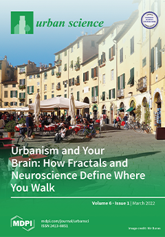
Our largely subconscious memories of cities are formed viscerally, at the physical scale of our bodies, mostly on the pedestrian level. Visual attractiveness reinforces forward ambulatory movement and fosters walkability. The process of navigating depends upon the information content of the surroundings. Our neural system perceives whether a façade mimics our ancestral environment—incorporating biophilia, fractal fluency, and nested symmetries—in its informational structure. Neuroscience experiments reveal how environmental geometry influences pedestrian ambulatory rhythm, independently of navigational goals fixed in the conscious memory. Unconscious processing of environmental information determines where we go, but forcing us to follow a trajectory through an unattractive visual field generates stress and mental fatigue. View this paper
  • Issues are regarded as officially published after their release is announced to the table of contents alert mailing list.
  • You may sign up for e-mail alerts to receive table of contents of newly released issues.
  • PDF is the official format for papers published in both, html and pdf forms. To view the papers in pdf format, click on the "PDF Full-text" link, and use the free Adobe Reader to open them.
Order results
Result details
Select all
Export citation of selected articles as:
15 pages, 294 KiB  
Article
Transformative Effects of Overtourism and COVID-19-Caused Reduction of Tourism on Residents—An Investigation of the Anti-Overtourism Movement on the Island of Mallorca
by Sebastian Amrhein, Gert-Jan Hospers and Dirk Reiser
Urban Sci. 2022, 6(1), 25; https://doi.org/10.3390/urbansci6010025 - 15 Mar 2022
Cited by 6 | Viewed by 4520
Abstract
The coronavirus outbreak in late 2019 and the subsequent restrictions on mobility and physical contacts caused an extreme collapse of international tourism. Shortly before the pandemic turned the world upside down, one of the most pressing issues in global tourism was a phenomenon [...] Read more.
The coronavirus outbreak in late 2019 and the subsequent restrictions on mobility and physical contacts caused an extreme collapse of international tourism. Shortly before the pandemic turned the world upside down, one of the most pressing issues in global tourism was a phenomenon that became known as overtourism. It describes massively the negative impacts of tourism on destinations and the frustrated residents protesting against it, with discontent reaching a dimension that could hardly be estimated at the time when Doxey’s Irritation Index was created. Especially in southern European destinations, thousands of people have taken to the streets over their dissatisfaction with the unlimited growth of tourism and its negative effects on their daily lives. Within a few years, small neighbourhood actions morphed into coordinated social movements demanding that politicians make fundamental changes to the socio-economic system. Those events demonstrate a politicizing effect of tourism that has not sufficiently been addressed hitherto in tourism research, which is mainly focused on the attitude of the visited towards tourism itself. This article offers a broader socio-political approach that focuses on tourism as one of the largest industries within a capitalist system that has massive impacts on people’s lives, rather than simply on changing attitudes towards tourism. Twelve problem-centred interviews with actors of the anti-overtourism movements in the Balearic Island of Mallorca were conducted to examine the effects of overtourism and COVID-19-caused tourism breakdown on residents’ socio-political perspectives. Building on the transformative learning theory developed by the American sociologist Jack Mezirow, the analysis of the data revealed far-reaching influences on residents’ personal development, fundamental perspectives and professional decisions. Full article
(This article belongs to the Special Issue The Post-COVID Urbanism)
22 pages, 324 KiB  
Article
Toward Achieving Local Sustainable Development: Market-Based Instruments (MBIs) for Localizing UN Sustainable Development Goals
by Ying Zhou, Amelia Clarke and Stephanie Cairns
Urban Sci. 2022, 6(1), 24; https://doi.org/10.3390/urbansci6010024 - 15 Mar 2022
Cited by 4 | Viewed by 2814
Abstract
In recent years, sustainable community development has gained traction for addressing local environmental, social, and economic issues. Cities worldwide are committed to implementing sustainable community plans (SCPs) in their efforts to achieve sustainable development, and more recently, to localize the United Nations’ Sustainable [...] Read more.
In recent years, sustainable community development has gained traction for addressing local environmental, social, and economic issues. Cities worldwide are committed to implementing sustainable community plans (SCPs) in their efforts to achieve sustainable development, and more recently, to localize the United Nations’ Sustainable Development Goals (SDGs). Although there are over 1000 plans in Canada, a gap exists between creating these plans and implementing them. Integrating market-based instruments (MBIs) with traditional policy tools would help to diversify revenue generation and thus mitigate these constraints. This paper presents a new and comprehensive categorization of MBIs that aligns the locally applicable ones with the environmental aims of both SCPs and SDGs. The categorization framework has been tested through focus groups with key municipal staff from two Canadian communities. The new categorization framework aligned over 50 locally applicable MBIs with 8 different environmental topics and 12 SDGs. The paper presents a useful tool for implementing SCPs and SDGs and contributes to the understanding of MBIs for enabling local progress in sustainable development. Full article
(This article belongs to the Special Issue Feature Papers in Urban Science)
22 pages, 5123 KiB  
Article
Ecosystem Services Analysis and Design through Nature-Based Solutions in Urban Planning at a Neighbourhood Scale
by Teodoro Semeraro, Aurelia Scarano and Rajiv Pandey
Urban Sci. 2022, 6(1), 23; https://doi.org/10.3390/urbansci6010023 - 13 Mar 2022
Cited by 5 | Viewed by 3728
Abstract
The new frontiers of sustainable cities should focus on urban planning tools and strategies that are able to integrate ecosystem services in urban development. An important step could include the design of nature-based solutions (NbSs) for introducing important ecological functions aiding human well-being [...] Read more.
The new frontiers of sustainable cities should focus on urban planning tools and strategies that are able to integrate ecosystem services in urban development. An important step could include the design of nature-based solutions (NbSs) for introducing important ecological functions aiding human well-being and mitigating the loss of soil. In this study, we propose a methodology to analyse, in a spatial way, the effect of land use scenarios generated by urban planning in the provision of ecosystem services. The methodology analyses the variation of ecosystem services, considering the ecosystem services of the study area and their potential roles in changing the functions of planned urban actions as the starting point. One scenario of analysis includes the integration of NbSs into urban planning. The case study is that of a peri-urban area, characterized by an agroecosystem, which is intended for urban development in the municipality of Gallipoli, Southern Italy. The analysis highlights a low provision of ecosystem services by the agroecosystem, which has had the effect of important olive trees being destroyed by Xylella fastidiosa bacteria. Thus, the integration of NbSs and reducing the construction of buildings in the urban neighbourhood plan could improve the quantity of ecosystem services in the area. Moreover, the ecological design of ecosystem services could improve the typology of ecosystem services provision in the area in consideration of the starting points. Therefore, the analysis of the capacity to integrate ecosystem services in urban planning at the neighbourhood scale could be a tool of ecological urban design, useful to support the decision-making processes. Full article
Show Figures

Figure 1

9 pages, 1169 KiB  
Article
Soundscape Assessment of Green and Blue Infrastructures
by Yalcin Yildirim, Merve Dilman, Volkan Muftuoglu and Sara Demir
Urban Sci. 2022, 6(1), 22; https://doi.org/10.3390/urbansci6010022 - 10 Mar 2022
Cited by 3 | Viewed by 2731
Abstract
Green and blue infrastructures provide economic, environmental, and social benefits to urban life. Various areas that are passing through such infrastructures have implications for those benefits. For instance, urban, rural, agricultural, and industrial zones extend the services and disservices of green and blue [...] Read more.
Green and blue infrastructures provide economic, environmental, and social benefits to urban life. Various areas that are passing through such infrastructures have implications for those benefits. For instance, urban, rural, agricultural, and industrial zones extend the services and disservices of green and blue infrastructures. Such extensions also have various implications on the environment and public health. Sound is one of those under-examined aspects of aggregated effects of green and blue infrastructures. This study aims to contribute to whether soundscape is affected by three pillars of urban, industrial, and rural areas among green and blue infrastructures. The study result shows no significant difference among those zones; however, urbanized areas include the highest sound levels. Industrial and rural zones show similar patterns. The study also identified that green infrastructure has more effects on the soundscape paradigm. The results also imply that green and blue infrastructures should be designated in harmony to produce a more sound-friendly environment considering the current major uses of the areas. Full article
(This article belongs to the Special Issue Healthy City Science: Citizens, Experts and Urban Governance)
Show Figures

Figure 1

20 pages, 6769 KiB  
Article
Assessing the Impacts of Dike Systems on Water Quality in Natural Reserves of the Vietnamese Mekong Delta
by Bui Thi Bich Lien, Nguyen Thi Thanh Ngan, Pankaj Kumar, Trinh Trung Tri Dang, Tran Thi Kim Hong, Tran Van Ty, Ram Avtar and Huynh Vuong Thu Minh
Urban Sci. 2022, 6(1), 21; https://doi.org/10.3390/urbansci6010021 - 9 Mar 2022
Cited by 1 | Viewed by 2480
Abstract
Protected places such as nature reserves (NRs) are used to maintain ecological balance, biodiversity, and support surrounding ecosystems. However, the development and operation of infrastructure such as dikes and sluice gates in NRs, as seen in the Vietnamese Mekong Delta (VMD), often adversely [...] Read more.
Protected places such as nature reserves (NRs) are used to maintain ecological balance, biodiversity, and support surrounding ecosystems. However, the development and operation of infrastructure such as dikes and sluice gates in NRs, as seen in the Vietnamese Mekong Delta (VMD), often adversely affects the hydrological regime and water quality at both local and regional scales. This study analyzes the consequences of a constructed dike system on the hydrological regime and water quality in the NRs through an integrated approach including hydrochemical analysis (using descriptive statistics and weighted arithmetic water quality index (WAWQI) analysis), traditional interviews (face to face), using semi-structured questionnaires, field surveys, and secondary data. Results show that constructed infrastructure has helped maintain water supplies for both livelihoods and forest fire prevention. However, considerable impacts on the hydrological regime and water quality have occurred. From water quality assessments in three NRs, 29% of sampling sites in the My Phuoc melaleuca forest (MPMF) had WAWQI values over 100, while all sites in Lung Ngoc Hoang NR (LNHNR) and Mua Xuan Agriculture Center (MXAC) had WAWQI values over 100. This was to a large extent due to elevated concentration of chemical oxygen demand (COD), biological oxygen demand (BOD5), and phosphate (PO43−). Meanwhile, during the wet season, pollution was marginally reduced by dilution, with 42.86% of sites at Lung Ngoc Hoang NR, 28.57% of sites at MXAC, and 78.57% of sites at MPMF having WAWQI values of less than 100. These results show the issue of water pollution at spatio-temporal scales, and call for better holistic management options for improving the hydrological regime and water quality. Full article
Show Figures

Figure 1

23 pages, 1773 KiB  
Article
Investigating the Association between Environmental Quality Characteristics and Mental Well-Being in Public Open Spaces
by Negin Karimi, Hassan Sajadzadeh and Farshid Aram
Urban Sci. 2022, 6(1), 20; https://doi.org/10.3390/urbansci6010020 - 9 Mar 2022
Cited by 2 | Viewed by 3339
Abstract
The issues related to the urban environment and mental well-being have become increasingly important in recent decades. Although this association has been mainly investigated in developed countries, there is limited knowledge on whether similar results can be acquired in the urban environments of [...] Read more.
The issues related to the urban environment and mental well-being have become increasingly important in recent decades. Although this association has been mainly investigated in developed countries, there is limited knowledge on whether similar results can be acquired in the urban environments of developing countries like Iran. This study intends to present a new dynamic and active approach to determine the environmental quality characteristics that influence the mental well-being of urban residents and to engage people to healthy urban public environments. In this respect, the research is directed by both qualitative and quantitative surveys in the public open spaces of Kermanshah, Iran. Firstly, the data are collected by Grounded Theory (GT) to identify significant environmental quality characteristics related to mental well-being by applying 24 semi-structured interviews. Secondly, the questionnaire survey based on Structural Equation Modeling (SEM) is applied to examine the association between each characteristic of the developed conceptual framework. The results reveal that the environmental quality characteristics of public open spaces, directly and indirectly, relate to users’ mental well-being. It should be noted that the public open spaces with unique functional and intrinsic features seem to have different impacts on mental well-being. Full article
(This article belongs to the Special Issue Healthy City Science: Citizens, Experts and Urban Governance)
Show Figures

Figure 1

22 pages, 7139 KiB  
Article
Integrating Ecosystem Vulnerability in the Environmental Regulation Plan of Izmir (Turkey)—What Are the Limits and Potentialities?
by Stefano Salata, Sıla Özkavaf-Şenalp and Koray Velibeyoğlu
Urban Sci. 2022, 6(1), 19; https://doi.org/10.3390/urbansci6010019 - 8 Mar 2022
Cited by 11 | Viewed by 3675
Abstract
The land-use regulatory framework in Turkey is composed of several hierarchical plans. The Environmental Regulation Plan pursues comprehensive planning management, which ranges between 1/100,000 and 1/25,000 and defines the framework for local master plans. Unfortunately, there is scarce knowledge of how these plans [...] Read more.
The land-use regulatory framework in Turkey is composed of several hierarchical plans. The Environmental Regulation Plan pursues comprehensive planning management, which ranges between 1/100,000 and 1/25,000 and defines the framework for local master plans. Unfortunately, there is scarce knowledge of how these plans effectively protect the environment. Besides, these plans have poor consideration of socio-economic dynamics and the ecosystem vulnerability, while evaluating the actual conflicts or synergies within the localization of ecological conservation and settlement expansion areas. In this work, an ecosystem-based geodatabase was created for the western Izmir area (Turkey). The dataset has been created by employing a supervised classification sampling of Sentinel-2 images acquired on 28 March 2021, while accessing ONDA-DIAS services to L2C products. Then, the InVEST software was used to map the Habitat Quality and the Habitat Decay, while the ArcMap raster analysis tool was employed to generate the Normalized Difference Vegetation Index. The results were used to classify the ecosystem vulnerability of the western metropolitan area of Izmir and then superimposed to the Environmental Regulation Plan of the city of Izmir (2021), thus evaluating synergies and conflicts. Although integration of the ecosystem services approach into spatial planning is lacking in the planning practice of Turkey, the paper provides an operative methodology to integrate ecosystem evaluation in environmental planning as a basic strategy to support sustainable development. Full article
Show Figures

Figure 1

18 pages, 4879 KiB  
Article
Assembling Transit Urban Design in the Global South: Urban Morphology in Relation to Forms of Urbanity and Informality in the Public Space Surrounding Transit Stations
by Nastaran Peimani and Hesam Kamalipour
Urban Sci. 2022, 6(1), 18; https://doi.org/10.3390/urbansci6010018 - 7 Mar 2022
Cited by 6 | Viewed by 7002
Abstract
The imperative to address the challenge of transforming car-dependent cities and promoting sustainable mobilities requires that we engage with the relationships between urban morphology and forms of urbanity in public spaces surrounding transit nodes. While there has been a surge of interest in [...] Read more.
The imperative to address the challenge of transforming car-dependent cities and promoting sustainable mobilities requires that we engage with the relationships between urban morphology and forms of urbanity in public spaces surrounding transit nodes. While there has been a surge of interest in investigating the agency of urban planning and design in mitigating urban sprawl and its environmental impacts by creating mixed-use, dense, and walkable places, the extent to which the public space can enable streetlife intensity in proximity to transit remains underexplored. Through extensive urban mapping and comparison of two transit nodes in Tehran, this paper articulates the key morphological elements of building density, functional mix, and access networks, how they work in relation to forms of urbanity and informality in public space around stations, and what inferences can be made on how public space within station areas work in the context of rapidly urbanising cities compared to those in Western contexts. The nexus between functional mix, retail edges, and forms of urbanity has been found critical to the spatial configuration, performance, and transformation of transit station areas. Forms of informality have also been found integral to how public space works in the context of transit urban design. This paper contributes to the newfound accent on urban design dimensions concerning TODs in the context of less formal and more congested cities of the global South. Full article
(This article belongs to the Special Issue The Future of Urban Transportation and Mobility Systems)
Show Figures

Figure 1

17 pages, 1025 KiB  
Article
A Case Study Evaluating Water Quality and Reach-, Buffer-, and Watershed-Scale Explanatory Variables of an Urban Coastal Watershed
by Laurissa C. Heidkamp and Alan D. Christian
Urban Sci. 2022, 6(1), 17; https://doi.org/10.3390/urbansci6010017 - 3 Mar 2022
Cited by 3 | Viewed by 2252
Abstract
Land use land cover within a watershed influences stream water quality, habitat quality, and biological community structure. As development and associated impervious surface increases in a watershed, changes in storm water and nutrient inputs generally cause declines in habitat conditions and biodiversity. The [...] Read more.
Land use land cover within a watershed influences stream water quality, habitat quality, and biological community structure. As development and associated impervious surface increases in a watershed, changes in storm water and nutrient inputs generally cause declines in habitat conditions and biodiversity. The first goal of our study was to evaluate the water quality in the Charles River watershed, in which our objective (G1O1) was to establish ten 100-meter reach-scale sampling stations and conduct physical, chemical, and biological assessments. The second goal of this study was to better understand the direct and indirect effects of hierarchical variables on water quality in the Charles River watershed. Our first objective of our second goal (G2O1) was to calculate land use land cover percentages at the pour-point subwatershed and local 100-meter buffer scale for each of our ten 100-meter reach sampling stations. Our second objective of our second goal (G2O2) was to use path analysis to determine the direct and indirect effects of land use land cover and impervious surface on water quality in the Charles River watershed. The results of G1O1 were that habitat quality assessments ranged from “marginal” to “optimal” and biological quality assessments ranged from “fair” to “good“, indicating overall “fair” or better water quality conditions in the watershed. The results of G2O2 were that our path analysis resulted in differences in effects of development between the buffer and sub-watershed scale. At the buffer scale, water quality was influenced more negatively by the percentage of developed land area versus the percentage of impervious cover. While both buffer development and habitat quality had a direct effect on Streamside Biosurvey Macroinvertebrates, buffer development also directly hindered habitat quality, thus having an indirect effect on Streamside Biosurvey Macroinvertebrates through habitat. Streamside Biosurvey Macroinvertebrate scores were shown to be more sensitive to development within the buffer versus at the sub-watershed scale, where impervious cover was a more important indicator of stream water quality. Through this small case study of 10 stations within the Charles River watershed, we illustrated how citizen-science level water quality assessments can be combined with water chemistry and hierarchical LULC data to provide insights into potential direct and indirect effects on water quality. As the fields of landscape ecology and conservation continue to grow, so does our ability to determine changes in land development and devise management strategies aimed at improving water quality. Full article
Show Figures

Figure 1

7 pages, 339 KiB  
Article
City-Wide Firearm Violence Spikes in Minneapolis following the Murder of George Floyd: A Comparative Time-Series Analysis of Three Cities
by Hunter M. Boehme, Robert J. Kaminski and Melissa S. Nolan
Urban Sci. 2022, 6(1), 16; https://doi.org/10.3390/urbansci6010016 - 3 Mar 2022
Cited by 7 | Viewed by 3278
Abstract
This study investigates the aftermath of a high-profile violent police incident as it relates to city-wide firearm violence. Utilizing two Midwest cities (Kansas City, Missouri and Omaha, Nebraska) as comparison cities, we assess whether violent firearm incidents increased in Minneapolis after the murder [...] Read more.
This study investigates the aftermath of a high-profile violent police incident as it relates to city-wide firearm violence. Utilizing two Midwest cities (Kansas City, Missouri and Omaha, Nebraska) as comparison cities, we assess whether violent firearm incidents increased in Minneapolis after the murder of George Floyd. Multiple interrupted time-series analyses showed statistically significant increases in weekly firearm incidents in Minneapolis (AME = 10.63, p < 0.05) and Omaha (AME = 1.47, p < 0.5) following the murder of George Floyd. No significant results were found in Kansas City. Similar relationships were found when examining monthly firearm incidents. The firearm spike in Minneapolis thus represents an approximate 10-fold increase in weekly firearm incidents relative to that observed in Omaha. We conclude, therefore, that the murder of George Floyd was associated with a substantially greater increase in firearm violence in Minneapolis than in the two comparison cities. Police training to reduce police violence and public health approaches to reduce urban firearm violence will alleviate the social and economic impacts of violence on federal and state governments. Full article
Show Figures

Figure 1

19 pages, 4280 KiB  
Article
Street Verge in Transition: A Study of Community Drivers and Local Policy Setting for Urban Greening in Perth, Western Australia
by Shania Hunt, Jeremy Maher, Mohammad Shahidul Hasan Swapan and Atiq Zaman
Urban Sci. 2022, 6(1), 15; https://doi.org/10.3390/urbansci6010015 - 25 Feb 2022
Cited by 4 | Viewed by 4096
Abstract
The United Nations’ Sustainable Development Goals (SDGs) are regarded as the key policy agenda for national, regional, and local government to combat climate change impacts and promote sustainable development. For example, in Perth and Peel metropolitan area, the capital city of Western Australia, [...] Read more.
The United Nations’ Sustainable Development Goals (SDGs) are regarded as the key policy agenda for national, regional, and local government to combat climate change impacts and promote sustainable development. For example, in Perth and Peel metropolitan area, the capital city of Western Australia, there has been a shift of policy setting from that of a sprawling city to a denser city, while maintaining and promoting its ecosystem services and achieving sustainable city goals. Residential verge gardens have been widely adopted in recent years by communities and local governments in the Perth metropolitan area. This study reviews the motivations and drivers for the uptake of verge gardens in metropolitan suburbs and identifies potential policy responses. The City of Bayswater local government area was surveyed for this research. The study considers a mixed-methods approach, including site auditing and a questionnaire survey for local residents who have transformed their verges. A total of 534 verge gardens were audited on residential lots, and 166 valid questionnaire responses were received from residents. The site-audit of the verge gardens in Bayswater found that native vegetation is the dominant verge garden of choice, followed by the ornamental garden, with food production (plants/vegetables) seeming to be the least popular option. Regarding the motivations and drivers, the study has found that social (e.g., aesthetics, flowers, social interactions, and social mimicry), environmental (e.g., attracting wildlife and birds and environmental practice waterwise garden), and personal (easy maintenance) drivers are the primary motivators for residents to adopt verge gardens. Whilst the on-ground surveys were prior to COVID-19, the article includes how this topic could relate to pandemic-resilient urban spaces. As local governments look towards supporting the sustainable outcome goals, the observations of this study will be helpful for developing local government policy and community programs in the promotion and uptake of verge gardens in Australian cities. Full article
(This article belongs to the Special Issue Feature Papers in Urban Science)
Show Figures

Figure 1

14 pages, 1684 KiB  
Article
Social Resilience Promotion Factors during the COVID-19 Pandemic: Insights from Urmia, Iran
by Hadi Alizadeh and Ayyoob Sharifi
Urban Sci. 2022, 6(1), 14; https://doi.org/10.3390/urbansci6010014 - 22 Feb 2022
Cited by 9 | Viewed by 4470
Abstract
Social resilience is an essential need for societies faced with adverse events such as pandemics. The recent COVID-19 outbreak has affected many communities around the globe. In fact, in addition to unprecedented mortality and infection rates, it has also caused major anxieties and [...] Read more.
Social resilience is an essential need for societies faced with adverse events such as pandemics. The recent COVID-19 outbreak has affected many communities around the globe. In fact, in addition to unprecedented mortality and infection rates, it has also caused major anxieties and social problems. Iran has been one of the hardest-hit countries and is among those that have experienced multiple waves of the outbreak. In this study, we try to identify major factors that can contribute to urban social resilience during the COVID-19 pandemic in Urmia, a major city located in Northwestern Iran. Data for the study were collected via a field visit and a semi-structured interview survey involving 194 participants. Findings show that several factors related to the following three themes play a significant role in promoting social resilience: (1) participative and supportive governance, (2) resource accessibility, and (3) citizen participation and lawfulness. Results can inform local authorities in Urmia and other contexts to deal with COVID-19 and similar pandemics. Full article
(This article belongs to the Special Issue The Post-COVID Urbanism)
Show Figures

Figure 1

14 pages, 252 KiB  
Article
Tiebout Sorting, Zoning, and Property Tax Rates
by Steven C. Bourassa and Wen-Chieh Wu
Urban Sci. 2022, 6(1), 13; https://doi.org/10.3390/urbansci6010013 - 17 Feb 2022
Viewed by 2536
Abstract
This paper examines certain implications from the literature on Tiebout’s model of local government service provision, particularly Hamilton’s extension of the model to include local control of land use and property taxation. Our empirical analysis focused on the use of fiscal zoning to [...] Read more.
This paper examines certain implications from the literature on Tiebout’s model of local government service provision, particularly Hamilton’s extension of the model to include local control of land use and property taxation. Our empirical analysis focused on the use of fiscal zoning to lower property tax rates, a topic that has not been addressed in the extensive literature on Tiebout’s model. Using data for over 100 municipalities in the Miami, Florida, metropolitan area, we specified property tax rates as a function of fiscal zoning measures, other municipal characteristics, and tax mimicking. We conclude that single-family zoning is by far the most important variable explaining municipal property tax rates. Full article
14 pages, 10995 KiB  
Article
Detect Megaregional Communities Using Network Science Analytics
by Ming Zhang and Bolin Lan
Urban Sci. 2022, 6(1), 12; https://doi.org/10.3390/urbansci6010012 - 16 Feb 2022
Cited by 7 | Viewed by 2935
Abstract
Urban science research and the research on megaregions share a common interest in the system of cities and its implications for world urbanization and sustainability. The two lines of inquiry currently remain largely separate efforts. This study aims to bridge urban science and [...] Read more.
Urban science research and the research on megaregions share a common interest in the system of cities and its implications for world urbanization and sustainability. The two lines of inquiry currently remain largely separate efforts. This study aims to bridge urban science and megaregion research by applying network science’s community detection algorithm to explore the spatial pattern of megaregions in the contiguous United States. A network file was constructed consisting of county centroids as nodes, the direct links between each pair of counties as edges, and inter-county commuting flows as the weight to capture spatial interactions. Analyses were carried out at two levels, one at the national level using Gephi and the other for the State of Texas involving NetworkX, an open-source Python programming package to implement a weighted community detection algorithm. Results show the detected communities largely conforming to the qualitative knowledge on megaregions. Despite a number of limitations, the study indicates the great potential of applying network science analytics to improve understanding of the spatial process of megaregions. Full article
Show Figures

Figure 1

15 pages, 1944 KiB  
Article
A Geometric Classification of World Urban Road Networks
by Mohamed Badhrudeen, Sybil Derrible, Trivik Verma, Amirhassan Kermanshah and Angelo Furno
Urban Sci. 2022, 6(1), 11; https://doi.org/10.3390/urbansci6010011 - 11 Feb 2022
Cited by 8 | Viewed by 3938
Abstract
This article presents a method to uncover universal patterns and similarities in the urban road networks of the 80 most populated cities in the world. To that end, we used degree distribution, link length distribution, and intersection angle distribution as topological and geometric [...] Read more.
This article presents a method to uncover universal patterns and similarities in the urban road networks of the 80 most populated cities in the world. To that end, we used degree distribution, link length distribution, and intersection angle distribution as topological and geometric properties of road networks. Moreover, we used ISOMAP, a nonlinear dimension reduction technique, to better express variations across cities, and we used K-means to cluster cities. Overall, we uncovered one universal pattern between the number of nodes and links across all cities and identified five classes of cities. Gridiron Cities tend to have many 90° angles. Long Link Cities have a disproportionately high number of long links and include mostly Chinese cities that developed towards the end of the 20th century. Organic Cities tend to have short links and more non-90 and 180° angles; they also include relatively more historical cities. Hybrid Cities tend to have both short and long links; they include cities that evolved both historically and recently. Finally, Mixed Cities exhibit features from all other classes. These findings can help transport planners and policymakers identify peer cities that share similar characteristics and use their characteristics to craft tailored transport policies. Full article
Show Figures

Graphical abstract

18 pages, 3757 KiB  
Article
The New Urban Profession: Entering the Age of Uncertainty
by Rob Roggema and Robert Chamski
Urban Sci. 2022, 6(1), 10; https://doi.org/10.3390/urbansci6010010 - 9 Feb 2022
Cited by 3 | Viewed by 2917
Abstract
The context of urbanism is changing rapidly. The context for working in the field of urban design and planning is influenced by the pace of change; uncertainty; and massive transitions. The urban professional, however, is still used to planning for small changes and [...] Read more.
The context of urbanism is changing rapidly. The context for working in the field of urban design and planning is influenced by the pace of change; uncertainty; and massive transitions. The urban professional, however, is still used to planning for small changes and repeating traditional approaches. In this paper, we have investigated major future tasks and problems that require rethinking the skills required from people working in the urban arena. By conducting in-depth conversation with leading thinkers in the field, the tension between idealism and the urgency to act versus realism and the trust in current systems dominated by economic laws is present. This results in the conclusion that a different skillset is required in order to face future complexities and to be able to connect design creativity with process sensitivity in short- and long-term periods and at small and large scales. Full article
Show Figures

Figure 1

19 pages, 52132 KiB  
Article
Microclimatic Landscape Architecture: From Theory to Application
by Jiawei Lin, Dongying Li and Robert D. Brown
Urban Sci. 2022, 6(1), 9; https://doi.org/10.3390/urbansci6010009 - 8 Feb 2022
Cited by 1 | Viewed by 3327
Abstract
Global climate change and urban heat island intensification are making many cities dangerously hot during heat waves. There is a need for a clear process for applying microclimate information in urban design to create cooler cities. A recent paper points out the gaps [...] Read more.
Global climate change and urban heat island intensification are making many cities dangerously hot during heat waves. There is a need for a clear process for applying microclimate information in urban design to create cooler cities. A recent paper points out the gaps in research methodology and suggests the need for implementation-oriented research. It suggests action steps to take research from theory to practice. The framework has five steps, and in our paper, we have addressed four of those steps: (1) understanding the needs of designers; (2) integrated research on urban microclimate factors; (3) development of guidance methods for better design; and (4) developing user-friendly tools. To address the first step, a group of Chinese landscape architects was given a questionnaire and it was found that they perceived principles and guidelines as being the most useful microclimatic design methods. The second step was addressed through a case study with on-site measurements and modeling. In step 3, microclimate information was used to redesign the site. The process that followed addressed the fourth step by illustrating user-friendly tools. Full article
Show Figures

Figure 1

3 pages, 149 KiB  
Editorial
Acknowledgment to Reviewers of Urban Science in 2021
by Urban Science Editorial Office
Urban Sci. 2022, 6(1), 8; https://doi.org/10.3390/urbansci6010008 - 8 Feb 2022
Viewed by 1492
Abstract
Rigorous peer-reviews are the basis of high-quality academic publishing [...] Full article
36 pages, 23301 KiB  
Article
Smart City Thailand: Visioning and Design to Enhance Sustainability, Resiliency, and Community Wellbeing
by K. N. Irvine, Asan Suwanarit, Fa Likitswat, Hansa Srilertchaipanij, Massimo Ingegno, Peeradorn Kaewlai, Pranisa Boonkam, Nij Tontisirin, Alisa Sahavacharin, Jitiporn Wongwatcharapaiboon and Shusak Janpathompong
Urban Sci. 2022, 6(1), 7; https://doi.org/10.3390/urbansci6010007 - 3 Feb 2022
Cited by 12 | Viewed by 11043
Abstract
A “Smart City” framework was used to investigate and develop visions of alternative futures for a peri-urban superblock north of Bangkok, Thailand. The Smart City framework considers seven smart pillars: environment, economy, energy, mobility, people, living, and governance, with a focus on community [...] Read more.
A “Smart City” framework was used to investigate and develop visions of alternative futures for a peri-urban superblock north of Bangkok, Thailand. The Smart City framework considers seven smart pillars: environment, economy, energy, mobility, people, living, and governance, with a focus on community wellbeing that is supported by information and communication technology (ICT). A mixed-method approach that included: community and industry surveys, both online and face-to-face (total n = 770); in depth, semi-structured, stakeholder interviews; passive participant observation; and photo-documentation was used to inform and organize the project visions and designs. Several themes emerged from the community surveys and key stakeholder interviews: (i) connected green space is highly valued and effectively links multiple smart pillars, enhancing community wellbeing and resiliency to flooding; (ii) superblock mobility, connectivity, and sustainable development could be achieved through a seamless, integrated public-transit system following the principles of transit-oriented development (TOD); (iii) the superblock should prepare for the implementation of Thailand 4.0 through the improved programmatic and physical integration of local industry, community, and universities, including plans for a Digital Village and co-work space. Example designs that address these considerations and vision alternative futures for the superblock are presented in this Smart City case study. Full article
Show Figures

Figure 1

16 pages, 2429 KiB  
Article
The Art and Science of Urban Gun Violence Reduction: Evidence from the Advance Peace Program in Sacramento, California
by Jason Corburn, Yael Nidam and Amanda Fukutome-Lopez
Urban Sci. 2022, 6(1), 6; https://doi.org/10.3390/urbansci6010006 - 2 Feb 2022
Cited by 2 | Viewed by 5093
Abstract
Urban gun violence is a critical human health and social justice issue. Strategies to reduce urban gun violence are increasingly being taken out of the domain of police and into community-based programs. One such community-driven gun violence reduction program analyzed here is called [...] Read more.
Urban gun violence is a critical human health and social justice issue. Strategies to reduce urban gun violence are increasingly being taken out of the domain of police and into community-based programs. One such community-driven gun violence reduction program analyzed here is called Advance Peace. Advance Peace (AP) uses street outreach workers as violence interrupters and adult mentors to support the decision making and life chances of those at the center of urban gun violence. We reported on the impact Advance Peace had on gun violence and program participants in the City of Sacramento, California, from 2018–2019. Using an interrupted time series model, we attributed a gun violence reduction of 18% city wide and up to 29% in one of the AP target neighborhoods from the intervention. We also found that of the 50 participants in the Advance Peace Sacramento program 98% were alive, 90% did not have a new gun charge or arrest, 84% reported an improved outlook on life, all received cognitive behavioral therapy, and 98% reported that their AP outreach worker was one of the most important adults in their life. Advance Peace is a viable community-driven, urban gun violence, and healing-focused program. Full article
(This article belongs to the Special Issue Healthy City Science: Citizens, Experts and Urban Governance)
Show Figures

Figure 1

12 pages, 993 KiB  
Article
The Image of the Smart City: New Challenges
by Giuseppe Borruso and Ginevra Balletto
Urban Sci. 2022, 6(1), 5; https://doi.org/10.3390/urbansci6010005 - 29 Jan 2022
Cited by 10 | Viewed by 4385
Abstract
The image of the Smart City recalls Lynch’s “Image of the City” (1960) and the ways in which urban spaces are perceived by the community and users. The categories presented there hold a physical, tangible component, related to the spatial and material aspects [...] Read more.
The image of the Smart City recalls Lynch’s “Image of the City” (1960) and the ways in which urban spaces are perceived by the community and users. The categories presented there hold a physical, tangible component, related to the spatial and material aspects of the city. Talking about Smart Cities, a little formulated and tackled question refers to what the image of the Smart City is, and how it is possible to represent it. The debate on the Smart City regards mainly the digital component and technological aspects, often not visible or perceivable, neglecting the more humanistic aspects and implications. We carry on a reflection on the “image of the smart city”. We propose some possible evolutions of the concept and research directions, in light of the new challenges posed by COVID-19 and the pandemic, as well as the need for a more human-centric approach to planning and managing urban areas and human settlements. Full article
(This article belongs to the Special Issue Technologies and Humanities for Smart Cities)
Show Figures

Figure 1

13 pages, 2813 KiB  
Article
Exposure of Malaysian Children to Air Pollutants over the School Day
by Eliani Ezani and Peter Brimblecombe
Urban Sci. 2022, 6(1), 4; https://doi.org/10.3390/urbansci6010004 - 18 Jan 2022
Cited by 2 | Viewed by 4415
Abstract
Children are sensitive to air pollution and spend long hours in and around their schools, so the school day has an important impact on their overall exposure. This study of Kuala Lumpur, Selangor and its surroundings assesses exposure to PM2.5 and NO [...] Read more.
Children are sensitive to air pollution and spend long hours in and around their schools, so the school day has an important impact on their overall exposure. This study of Kuala Lumpur, Selangor and its surroundings assesses exposure to PM2.5 and NO2, from travel, play and study over a typical school day. Most Malaysian children in urban areas are driven to school, so they probably experience peak NO2 concentrations in the drop-off and pick-up zones. Cyclists are likely to receive the greatest school travel exposure during their commute, but typically, the largest cumulative exposure occurs in classrooms through the long school day. Indoor concentrations tend to be high, as classrooms are well ventilated with ambient air. Exposure to PM2.5 is relatively evenly spread across Selangor, but NO2 exposure tends to be higher in areas with a high population density and heavy traffic. Despite this, ambient PM2.5 may be more critical and exceed guidelines as it is a particular problem during periods of widespread biomass burning. A thoughtful adjustment to school approach roads, design of playgrounds and building layout and maintenance may help minimise exposure. Full article
(This article belongs to the Special Issue Healthy City Science: Citizens, Experts and Urban Governance)
Show Figures

Figure 1

35 pages, 3815 KiB  
Article
What Happens in Your Brain When You Walk Down the Street? Implications of Architectural Proportions, Biophilia, and Fractal Geometry for Urban Science
by Aenne A. Brielmann, Nir H. Buras, Nikos A. Salingaros and Richard P. Taylor
Urban Sci. 2022, 6(1), 3; https://doi.org/10.3390/urbansci6010003 - 7 Jan 2022
Cited by 20 | Viewed by 24169
Abstract
This article reviews current research in visual urban perception. The temporal sequence of the first few milliseconds of visual stimulus processing sheds light on the historically ambiguous topic of aesthetic experience. Automatic fractal processing triggers initial attraction/avoidance evaluations of an environment’s salubriousness, and [...] Read more.
This article reviews current research in visual urban perception. The temporal sequence of the first few milliseconds of visual stimulus processing sheds light on the historically ambiguous topic of aesthetic experience. Automatic fractal processing triggers initial attraction/avoidance evaluations of an environment’s salubriousness, and its potentially positive or negative impacts upon an individual. As repeated cycles of visual perception occur, the attractiveness of urban form affects the user experience much more than had been previously suspected. These perceptual mechanisms promote walkability and intuitive navigation, and so they support the urban and civic interactions for which we establish communities and cities in the first place. Therefore, the use of multiple fractals needs to reintegrate with biophilic and traditional architecture in urban design for their proven positive effects on health and well-being. Such benefits include striking reductions in observers’ stress and mental fatigue. Due to their costs to individual well-being, urban performance, environmental quality, and climatic adaptation, this paper recommends that nontraditional styles should be hereafter applied judiciously to the built environment. Full article
(This article belongs to the Special Issue Human-Centered Design)
Show Figures

Figure 1

13 pages, 21062 KiB  
Case Report
Lessons from New York High Line Green Roof: Conserving Biodiversity and Reconnecting with Nature
by Kawar Salih, Zaid O. Saeed and Avar Almukhtar
Urban Sci. 2022, 6(1), 2; https://doi.org/10.3390/urbansci6010002 - 28 Dec 2021
Cited by 2 | Viewed by 7685
Abstract
The concept of sustainable urban design has appeared in different perspectives to minimize and reduce the negative impacts of urban expansion in terms of climatic and environmental drawbacks. One of the undeniable approaches of sustainable urban design is the adoption of green urban [...] Read more.
The concept of sustainable urban design has appeared in different perspectives to minimize and reduce the negative impacts of urban expansion in terms of climatic and environmental drawbacks. One of the undeniable approaches of sustainable urban design is the adoption of green urban roofs. Green roofs are seen to have a substantial role in addressing and resolving environmental issues in the context of climate change. Research investigations have indicated that green roofs have a remarkable impact on decreasing rainwater runoff, reducing the heat island effect in urban spaces, and increasing biodiversity. Nevertheless, green roofs in urban spaces as a competent alternative to nature remains a standing question. To what extent can green roofs mimic the biodiversity that is seen in nature? Moreover, to what level is this approach practical for achieving a tangible reconnection with nature, or so-called biophilia? This study attempts to discuss the essence and impact of green roofs in urban spaces based on a case study approach. The study reflected lessons from the New York High Line Green Roof regarding biophilia and biodiversity in this case study. It concludes with key lessons that can be transferred to other urban spaces with similar settings. Full article
Show Figures

Figure 1

12 pages, 1763 KiB  
Article
Industry Interconnectedness and Regional Economic Growth in Germany
by Shade T. Shutters, Holger Seibert, Bastian Alm and Keith Waters
Urban Sci. 2022, 6(1), 1; https://doi.org/10.3390/urbansci6010001 - 21 Dec 2021
Cited by 3 | Viewed by 3237
Abstract
Urban systems, and regions more generally, are the epicenters of many of today’s social issues. Yet they are also the global drivers of technological innovation, and thus it is critical that we understand their vulnerabilities and what makes them resilient to different types [...] Read more.
Urban systems, and regions more generally, are the epicenters of many of today’s social issues. Yet they are also the global drivers of technological innovation, and thus it is critical that we understand their vulnerabilities and what makes them resilient to different types of shocks. We take regions to be systems composed of internal networks of interdependent components. As the connectedness of those networks increases, it allows information and resources to move more rapidly within a region. Yet, it also increases the speed and efficiency at which the effects of shocks cascade through the system. Here we analyzed regional networks of interdependent industries and how their structures relate to a region’s vulnerability to shocks. Methodologically, we utilized a metric of economic connectedness called tightness which quantifies a region’s internal connectedness relative to other regions. We calculated tightness for German regions during the Great Recession, comparing it to each region’s economic performance during the shock (2007–2009) and during recovery (2009–2011). We find that tightness is negatively correlated with changes in economic performance during the shock but positively during recovery. This suggests that regional economic planners face a tradeoff between being more productive or being more vulnerable to the next economic shock. Full article
(This article belongs to the Special Issue Feature Papers in Urban Science)
Show Figures

Figure 1

Previous Issue
Next Issue
Back to TopTop