Next Issue
Volume 3, March
Previous Issue
Volume 2, September


Urban Sci., Volume 2, Issue 4 (December 2018) – 27 articles

Cover Story (view full-size image): 
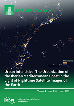
The use of night satellite images allows us to observe the intensity of the urban uses of space. This makes it possible to overcome the traditional analysis of the urbanization process based only on the level of artificialization of land cover. The cover image, from the new NASA SNPP satellite equipped with the VIIRS-DNB instrument, shows the nighttime image of the Iberian Mediterranean coast (Catalonia, Valencia, and the Balearic Islands). It is an area that has experienced intense urbanizing pressure in recent decades, and is becoming one of the main urban areas in Southern Europe. The article studies the potentialities of night satellite images in this region to assess the intensity of urban uses and its seasonal variations throughout the year. (Image: Earth Observation Group, NOAA National Centers for Environmental Information (NCEI)). View this paper.
  • Issues are regarded as officially published after their release is announced to the table of contents alert mailing list.
  • You may sign up for e-mail alerts to receive table of contents of newly released issues.
  • PDF is the official format for papers published in both, html and pdf forms. To view the papers in pdf format, click on the "PDF Full-text" link, and use the free Adobe Reader to open them.
Order results
Result details
Select all
Export citation of selected articles as:
26 pages, 4777 KiB  
Article
Influence of the Natural and Built Environment on Personal Exposure to Fine Particulate Matter (PM2.5) in Cyclists Using City Designated Bicycle Routes
by Jason Gilliland, Matthew Maltby, Xiaohong Xu, Isaac Luginaah and Tayyab Shah
Urban Sci. 2018, 2(4), 120; https://doi.org/10.3390/urbansci2040120 - 19 Dec 2018
Cited by 7 | Viewed by 3204
Abstract
Urban cyclists are exposed to many traffic-related air pollutants including particulate matter (PM) that may increase vulnerability to health effects. This study investigates second-by-second personal exposure to PM2.5 (fine particulate matter that is 2.5 microns in diameter and less) along bicycle commuting [...] Read more.
Urban cyclists are exposed to many traffic-related air pollutants including particulate matter (PM) that may increase vulnerability to health effects. This study investigates second-by-second personal exposure to PM2.5 (fine particulate matter that is 2.5 microns in diameter and less) along bicycle commuting paths, and assesses elements of the natural and built environment for the relative importance of these factors in understanding the variability in PM2.5 personal exposure. Urban cyclists were carrying high resolution PM2.5 monitors (placed in a backpack) in combination with portable GPS trackers to provide a spatial identity to each one-second pollutant measurement. The results of this study indicate that daily averages of PM2.5 concentrations from all bicycle routes were weakly correlated with meteorological variables, however, a strong influence of regional levels of PM2.5 was observed. Geospatial analysis of PM2.5 personal exposure concentrations showed a considerable variation within routes, correlated with land use (with lower concentrations in parks and higher in industrial areas) and clustered at four areas: busiest bridge, heavily trafficked road segments, the downtown urban core, and two construction sites. This study has found many incidences of personal exposure to PM2.5 exceeding the provincial guidelines for healthy activity (e.g., very poor (PM2.5 > 91 μg/m3) pollution concentrations are clustered in three regions: approaching the bridge in the west part of the city; the downtown urban core; and two under construction spots), which suggests behavioural and infrastructure modifications in balancing the health benefits of cycling with the environmental exposure to air pollutants. Full article
Show Figures

Figure 1

19 pages, 5214 KiB  
Article
Urban Projects and Residential Segregation: A Case Study of the Cabanyal Neighborhood in Valencia (Spain)
by Roxana-Diana Ilisei and Julia Salom-Carrasco
Urban Sci. 2018, 2(4), 119; https://doi.org/10.3390/urbansci2040119 - 13 Dec 2018
Cited by 3 | Viewed by 4347
Abstract
In this paper, we study the consequences of neoliberal urban policy, in terms of the segregation and social changes experienced in the Cabanyal neighborhood located in Valencia, Spain. In doing so, we analyze the process of residential mobility that has affected the neighborhood [...] Read more.
In this paper, we study the consequences of neoliberal urban policy, in terms of the segregation and social changes experienced in the Cabanyal neighborhood located in Valencia, Spain. In doing so, we analyze the process of residential mobility that has affected the neighborhood during the last decade, resulting in a segregation of space. This neighborhood had been affected, since 1988, by an urban project that was to bring about its partial destruction. Despite having been stopped, the project has caused a dynamic of physical and social degradation of the neighborhood against which the local government has only very recently started to intervene. Using microdata from the Residential Variation Statistics provided by the Statistical Office of the City of Valencia, we analyze the demographic profile of the mobility inside the Cabanyal neighborhood and also the origin of the arrivals and the destination of the departures from 2004–2016. The aim is to identify the territorial pattern of the socio-demographic changes that have affected the neighborhood. The results indicate that during the period under analysis, in which the area was affected by the urban project, a progressive loss in the Spanish population was occurring, as well as a substitution of non-EU immigrants, who were predominant at the beginning of the period, with EU immigrants. This process has produced a high level of residential segregation, since immigrants from the European Union are viewed more negatively than immigrants from outside of the European Union, which, along with their lower level of education and employment in low-skilled and poorly paid jobs, makes their social integration and interaction more difficult. Full article
(This article belongs to the Special Issue Land Squandering and Social Crisis in the Spanish City)
Show Figures

Figure 1

19 pages, 4881 KiB  
Article
Towards a Circular Economy: A Case Study of Waste Conversion into Housing Units in Cotonou, Benin
by Zaheer Allam and David Sydney Jones
Urban Sci. 2018, 2(4), 118; https://doi.org/10.3390/urbansci2040118 - 12 Dec 2018
Cited by 24 | Viewed by 7422
Abstract
Cotonou is the largest city and main economic centre of the nation of Benin, Africa. Following independence, the city has experienced major population growth resulting in the extensive development of slums on flood plains and marshes causing the loss of biodiversity of these [...] Read more.
Cotonou is the largest city and main economic centre of the nation of Benin, Africa. Following independence, the city has experienced major population growth resulting in the extensive development of slums on flood plains and marshes causing the loss of biodiversity of these fragile ecosystems. Infrastructural development, unable to keep pace with informal settlement development, and a cumbersome municipal service system, have led to the illegal dumping of organic and plastic wastes, and extensive land pollution. In addition, due to its primary dune coastal location, Cotonou is facing sea level rise risks demonstrating the urgent need to sustainably address urban development. Through a socio-technical framework, this paper considers the use of transformed plastic wastes as new settlement building blocks to reduce solid waste, create jobs, and develop low-cost housing. This new strategy offers employment empowerment and a strategy to generate an income of US$2,380,000 per annum and the creation of 3200 permanent jobs. Full article
Show Figures

Figure 1

17 pages, 540 KiB  
Article
Bayesian Inference on Dynamic Linear Models of Day-to-Day Origin-Destination Flows in Transportation Networks
by Anselmo Ramalho Pitombeira-Neto, Carlos Felipe Grangeiro Loureiro and Luis Eduardo Carvalho
Urban Sci. 2018, 2(4), 117; https://doi.org/10.3390/urbansci2040117 - 10 Dec 2018
Cited by 1 | Viewed by 3056
Abstract
Estimation of origin–destination (OD) demand plays a key role in successful transportation studies. In this paper, we consider the estimation of time-varying day-to-day OD flows given data on traffic volumes in a transportation network for a sequence of days. We propose a dynamic [...] Read more.
Estimation of origin–destination (OD) demand plays a key role in successful transportation studies. In this paper, we consider the estimation of time-varying day-to-day OD flows given data on traffic volumes in a transportation network for a sequence of days. We propose a dynamic linear model (DLM) in order to represent the stochastic evolution of OD flows over time. DLMs are Bayesian state-space models which can capture non-stationarity. We take into account the hierarchical relationships between the distribution of OD flows among routes and the assignment of traffic volumes on links. Route choice probabilities are obtained through a utility model based on past route costs. We propose a Markov chain Monte Carlo algorithm, which integrates Gibbs sampling and a forward filtering backward sampling technique, in order to approximate the joint posterior distribution of mean OD flows and parameters of the route choice model. Our approach can be applied to congested networks and in the case when data are available on only a subset of links. We illustrate the application of our approach through simulated experiments on a test network from the literature. Full article
Show Figures

Figure 1

14 pages, 6179 KiB  
Article
Qualitative Methodologies for the Analysis of Intra-Urban Socio-Environmental Vulnerability in Barcelona (Spain): Case Studies
by Antonio Palacios, Ana Mellado and Yazmín León
Urban Sci. 2018, 2(4), 116; https://doi.org/10.3390/urbansci2040116 - 03 Dec 2018
Cited by 6 | Viewed by 3320
Abstract
The city of Barcelona, like other cities in the world, suffers strong internal socio-economic inequalities in its neighborhoods. Numerous works have sought to detect, quantify, characterize, and/or map existing intra-urban differences, almost always based on quantitative methodologies. With this contribution, we intend to [...] Read more.
The city of Barcelona, like other cities in the world, suffers strong internal socio-economic inequalities in its neighborhoods. Numerous works have sought to detect, quantify, characterize, and/or map existing intra-urban differences, almost always based on quantitative methodologies. With this contribution, we intend to show the importance that qualitative methodologies can play in studies on urban socio-environmental vulnerability. We consider aspects that are not quantifiable but that may be inherent to many such vulnerable spaces, both in the constructed environment and in the social ambit. These questions are considered through selected neighborhoods of Barcelona which have been shown (in prior works, mainly studies of quantitative manufacturing) to possess elements of vulnerability including a high presence of immigrants from less-developed countries, low per capita income, aging populations, or low educational levels. The results reveal the multidimensionality of vulnerability in the neighborhoods analyzed, as well as the essential complementarity among methodologies that detect and support possible public actions aimed at reducing or eliminating intra-urban inequalities. Full article
(This article belongs to the Special Issue Land Squandering and Social Crisis in the Spanish City)
Show Figures

Figure 1

17 pages, 4136 KiB  
Article
Urban Intensities. The Urbanization of the Iberian Mediterranean Coast in the Light of Nighttime Satellite Images of the Earth
by Joan Checa and Oriol Nel·lo
Urban Sci. 2018, 2(4), 115; https://doi.org/10.3390/urbansci2040115 - 29 Nov 2018
Cited by 8 | Viewed by 4622
Abstract
The contribution shares the approach of critical urban studies that have conceptualized urbanization more as a process than as a sum of spatial forms. Thus, the contribution studies the urbanization process not only from the point of view of the physical occupation of [...] Read more.
The contribution shares the approach of critical urban studies that have conceptualized urbanization more as a process than as a sum of spatial forms. Thus, the contribution studies the urbanization process not only from the point of view of the physical occupation of land but also considers changes in the intensity of the uses of space. To fulfill this aim, the new sources of nocturnal satellite images are particularly useful. These allow us to observe the intensity of urban uses both in terms of their distribution over space and their recurrence over time. The research focuses on the Iberian Mediterranean coast and permits the verification of the intensity of the urban uses of the space for the whole of this area and their seasonal variations throughout the year. The source of the study are the nighttime satellite images of the Earth for the 2012–2017 period from the NASA SNPP satellite equipped with the VIIRS-DNB instrument. By establishing a threshold of urban light the research shows that those districts with the greatest extensions of urban light do not necessarily correspond with the most densely populated areas. Similarly the absence of urban light does not necessarily indicate the absence of urban uses. Finally, the variations of intensity of light prove to be a good indicator of seasonal variations of activity in tourist areas. Full article
(This article belongs to the Special Issue Land Squandering and Social Crisis in the Spanish City)
Show Figures

Figure 1

17 pages, 793 KiB  
Article
An Investigation of Links between Environmentally Responsible Behaviors and Built and Natural Features of Landscape in Central New Jersey
by Daniel G. Clark and Rebecca C. Jordan
Urban Sci. 2018, 2(4), 114; https://doi.org/10.3390/urbansci2040114 - 29 Nov 2018
Cited by 1 | Viewed by 2193
Abstract
Responses from Central New Jersey residents (n = 290) to nine survey items about pro-environmental behaviors were analyzed for their connection to survey respondents’ local built and natural landscape characteristics. These nine survey items were of interest due to their clustering in three [...] Read more.
Responses from Central New Jersey residents (n = 290) to nine survey items about pro-environmental behaviors were analyzed for their connection to survey respondents’ local built and natural landscape characteristics. These nine survey items were of interest due to their clustering in three groups in earlier dimension reduction analysis. Nine logistic regression models (one for each of these items) were built using a suite of built and natural features of landscape at the municipal level—including land use, population density, and access to parks. The logistic regression models using the landscape variables failed to provide effective explanations of engagement in pro-environmental behavior. In total, only ten landscape feature variables—out of a possible thirty-eight -were used in any of the most effective models. The logistic regression model of proper appliance disposal performed best and could correctly classify responses of whether respondents had disposed of an appliance correctly 84% of the time. The rest of the models were of little use. This suggests that there may not be a connection between these built and natural landscape features and these behaviors, or that the study did not look at location at a level that was granular enough to detect any patterns. Full article
Show Figures

Figure 1

19 pages, 1382 KiB  
Article
The Impact of Economic Crisis in Areas of Sprawl in Spanish Cities
by Arlinda García-Coll and Cristina López-Villanueva
Urban Sci. 2018, 2(4), 113; https://doi.org/10.3390/urbansci2040113 - 28 Nov 2018
Cited by 11 | Viewed by 3504
Abstract
The development of dispersed urbanism in Spain ran parallel to the real estate boom and consolidated a new model of city sprawl based on the expansion of suburban areas. This process, which started in the mid 1980s, came to a halt with the [...] Read more.
The development of dispersed urbanism in Spain ran parallel to the real estate boom and consolidated a new model of city sprawl based on the expansion of suburban areas. This process, which started in the mid 1980s, came to a halt with the onset of the economic crisis in 2007. With it, construction stopped, mobility fell, and urban growth came to a standstill. The purpose of this article is, firstly, to analyse the recent evolution and chronology of the expansion of dispersed urbanism in the Barcelona Metropolitan Region (BMR) in order to gain an insight into some of its explanatory factors, and secondly, to look into the future middle-term prospects of dispersed urbanism in the BMR and Spain. To this end, we examine trends in the housing market and residential mobility and take stock of the impact of business cycles on them. The conclusion is that dispersed areas still retain their appeal for people in the life stages of the creation and expansion of households. For this reason, an effective economic recovery and a renewed rise in the price of housing in denser cities may contribute to an upturn in the popularity of the dispersed residential model, which nowadays could be considered to be in a ‘lethargic’ phase, waiting for certain factors to concur and reactivate its expansion. Full article
(This article belongs to the Special Issue Land Squandering and Social Crisis in the Spanish City)
Show Figures

Figure 1

13 pages, 4073 KiB  
Article
Segregated in the City, Separated in the School. The Reproduction of Social Inequality through the School System
by Aina Gomà Garcia and Joel Muñoz Aranda
Urban Sci. 2018, 2(4), 112; https://doi.org/10.3390/urbansci2040112 - 27 Nov 2018
Cited by 2 | Viewed by 4435
Abstract
This paper explores the relationship between urban segregation and the educational level of the population. In the first place, the impacts of segregation in educational careers are analysed. Secondly, the contribution explores the interrelationship between urban segregation and schooling in Barcelona. For this [...] Read more.
This paper explores the relationship between urban segregation and the educational level of the population. In the first place, the impacts of segregation in educational careers are analysed. Secondly, the contribution explores the interrelationship between urban segregation and schooling in Barcelona. For this aim, different sources have been used: The map of urban segregation in Catalonia at the census tract level; data about the formal educational levels of the population, aged between 15 and 34 years, from the Catalan Youth Survey (Enquesta de Joventut de Catalunya); and schooling data in Barcelona’s schools and neighbourhoods. The research shows how urban segregation effects the educational level and fosters social inequalities amongst neighbourhoods. It also points out how choosing school and enrolment strategies could act by increasing school segregation in Barcelona. Therefore, the role of segregation in the reproduction and perpetuation of inequalities in the living conditions of the population is exposed. Full article
(This article belongs to the Special Issue Land Squandering and Social Crisis in the Spanish City)
Show Figures

Figure 1

24 pages, 4183 KiB  
Article
The Failure of Eco-Neighborhood Projects in the City of Madrid (Spain)
by Elia Canosa Zamora and Ángela García Carballo
Urban Sci. 2018, 2(4), 111; https://doi.org/10.3390/urbansci2040111 - 27 Nov 2018
Cited by 5 | Viewed by 5924
Abstract
The objective of this article is to analyze the implementation of eco-neighborhoods in the city of Madrid. This is a new formulation that joins, within neighborhood scale, purposes of environmental sustainability with social and economic aims. First, we make a general approach reviewing [...] Read more.
The objective of this article is to analyze the implementation of eco-neighborhoods in the city of Madrid. This is a new formulation that joins, within neighborhood scale, purposes of environmental sustainability with social and economic aims. First, we make a general approach reviewing the initiatives proposed in the capital city and then we will make an analysis of the eco-neighborhood of Vallecas, the only one still working. We have looked through the official approach, the present bibliography, the official statements, the interpretations of the technicians, the resident’s opinions exposed in websites, social networks and press. The field research and the collection of information through conversations with the agents involved were the keys to verify the real results of the projects. We consider that the development and the conclusion of these initiatives have been a failure. The reasons are in its origin and the process of realization, but mainly in the confused premises that were the foundation of its design and localization. The absence of dialogue with neighbors and associations turned the official speeches and plans in something strange to the citizen’s necessities of the southern area, with the lowest rents of Madrid. Full article
(This article belongs to the Special Issue Land Squandering and Social Crisis in the Spanish City)
Show Figures

Figure 1

18 pages, 13277 KiB  
Article
International Media and Tourism Industry as the Facilitators of Socialist Legacy Heritagization in the CEE Region
by Nebojša Čamprag
Urban Sci. 2018, 2(4), 110; https://doi.org/10.3390/urbansci2040110 - 27 Nov 2018
Cited by 2 | Viewed by 3150
Abstract
After the fall of state socialism in Central and Eastern Europe (CEE), the socialist legacy became a matter of contested discourses, coming from the new national governments. However, with the recently awakening nostalgia for socialism and growing international interest for the socialist pasts, [...] Read more.
After the fall of state socialism in Central and Eastern Europe (CEE), the socialist legacy became a matter of contested discourses, coming from the new national governments. However, with the recently awakening nostalgia for socialism and growing international interest for the socialist pasts, the approaches to its legacies began gradually to change. In this paper, the focus is on some recent international trends with regards to the socialist heritage for evaluating the share of their influences in the process of de-contestation occurring at the local/national levels. There are two processes standing in juxtaposition to be observed; on the one hand, official nation branding distances the state from socialist pasts to emphasize, often contrasting, post-socialist national identity. On the other hand, the development of communist heritage tourism attempts to reconsider and appropriate socialist legacies in the national frameworks for identity construction. Using the examples from Hungary, Romania, and the former Yugoslavia, the author demonstrates the role of international media and the tourism industry for meeting the objectives of economic development while maintaining post-socialist national identity senses, but also their potentials in reconsiderations of the contested history chapters. Full article
Show Figures

Figure 1

15 pages, 4918 KiB  
Article
Foreclosures and Evictions in Las Palmas de Gran Canaria during the Economic Crisis and Post-Crisis Period in Spain
by Juan M. Parreño-Castellano, Josefina Domínguez-Mujica, Maite Armengol-Martín, Tanausú Pérez García and Jordi Boldú Hernández
Urban Sci. 2018, 2(4), 109; https://doi.org/10.3390/urbansci2040109 - 22 Nov 2018
Cited by 14 | Viewed by 3543
Abstract
At the beginning of the economic crisis in 2008, the number of foreclosures and evictions increased dramatically in Spain. The severe economic situation and the lack of mitigation measures by public institutions seemed to be the main causes. However, the start of a [...] Read more.
At the beginning of the economic crisis in 2008, the number of foreclosures and evictions increased dramatically in Spain. The severe economic situation and the lack of mitigation measures by public institutions seemed to be the main causes. However, the start of a period of economic recovery since 2014 has meant that the number of the evictions continues to increase. In this article, we analyze in detail this phenomenon in the city of Las Palmas de Gran Canaria. Based on the disaggregated judicial data on the records of ejections and transfer of possession by foreclosures and evictions for the period 2009–2017, we carry out a study according to judicial procedures and proceedings and nature of the parties affected from a time-based and spatial perspective. This information allows us to discern that the causes that have led to the loss of housing are more varied than expected; that these circumstances have affected both societies and individuals, diverging on the period of incidence; and that the loss of housing has a different spatial impact in each stage. We conclude that both dispossession and loss of use are two structural occurrences coherent with the capitalist model of secondary accumulation developed in the world in the last 20 years. In the case of Spain, we have recognized these phases and modes of accumulation beyond the incidence of the crisis, revealing the structural character of the phenomenon analyzed. Full article
(This article belongs to the Special Issue Land Squandering and Social Crisis in the Spanish City)
Show Figures

Figure 1

24 pages, 2366 KiB  
Article
Urban Land-Use Dynamics in the Niger Delta: The Case of Greater Port Harcourt Watershed
by Nimi G. Dan-Jumbo, Marc J. Metzger and Andrew P. Clark
Urban Sci. 2018, 2(4), 108; https://doi.org/10.3390/urbansci2040108 - 20 Nov 2018
Cited by 13 | Viewed by 6468
Abstract
Cities in developing countries are urbanising at a rapid rate, resulting in substantial pressures on environmental systems. Among the main factors that lead to flooding, controlling land-use change offers the greatest scope for the management of risk. However, traditional analysis of a “from–to” [...] Read more.
Cities in developing countries are urbanising at a rapid rate, resulting in substantial pressures on environmental systems. Among the main factors that lead to flooding, controlling land-use change offers the greatest scope for the management of risk. However, traditional analysis of a “from–to” change matrix is not adequate to provide information of all the land-use changes that occur in a watershed. In this study, an in-depth analysis of land-use change enabled us to quantify the bulk of the changes accumulating from swap changes in a tropical watershed. This study assessed the historical and future land-use/land-cover (LULC) dynamics in the River State region of the Niger Delta. Land-use classification and change detection analysis was conducted using multi-source (Landsat TM, ETM, polygon map, and hard copy) data of the study area for 1986, 1995, and 2003, and projected conditions in 2060. The key findings indicate that historical urbanisation was rapid; urban expansion could increase by 80% in 2060 due to planned urban development; and 95% of the conversions to urban land occurred chiefly at the expense of agricultural land. Urban land was dominated by net changes rather than swap changes, which in the future could amplify flood risk and have other severe implications for the watershed. Full article
(This article belongs to the Special Issue Urban Futures—Landscape)
Show Figures

Figure 1

14 pages, 5671 KiB  
Article
Unique Projects of a Universal ‘Public Park Making’ Trend Viewed on the Example of Four Global Cities
by Ekaterina Shafray
Urban Sci. 2018, 2(4), 107; https://doi.org/10.3390/urbansci2040107 - 09 Nov 2018
Cited by 3 | Viewed by 5502
Abstract
From a social perspective, successful cities compete with other cities and with each other for residents, resources, and economic power. The important characteristic of that is the number of outdoor social activities (events, festivals, forums, etc.) held in cities that are included in [...] Read more.
From a social perspective, successful cities compete with other cities and with each other for residents, resources, and economic power. The important characteristic of that is the number of outdoor social activities (events, festivals, forums, etc.) held in cities that are included in several cities’ evaluation indexes. Attempting to analyze the urban environment features that foster a productive ground for social activities, this paper correlates the number of social activities with the recent ‘public park-making’ urban regeneration trend. It considers four unique project case studies in New York, Tokyo, Seoul, and Moscow in the 2016–2018 years, with outstanding and ambitious designs selected to represent the trend. This paper analyzes the global ‘public park making’ trend for city’s urban regeneration with different scales of project interventions viewed through qualitative case studies. This paper puts forward a question of global features of a public park and continues the discussion on keeping a balance between local architecture and the global public park making trend, as well as public facilities and profit, and a role of nature as a universal remedy and tool in reshaping the image of cities. Full article
Show Figures

Figure 1

16 pages, 3168 KiB  
Article
Measuring Neighborhood Quality of Life: Placed-Based Sustainability Indicators in Freiburg, Germany
by Craig A. Talmage, Bjoern Hagen, David Pijawka and Cara Nassar
Urban Sci. 2018, 2(4), 106; https://doi.org/10.3390/urbansci2040106 - 29 Oct 2018
Cited by 5 | Viewed by 11873
Abstract
There has been a recent upswing of academic interest in the social dimensions of sustainable cities, especially the dynamics of Quality of Life (QoL), Environmental Equity, Ecosystem Services, Eco-Friendliness, Public Engagement, and Well-Being and Happiness Indicators. These factors are only now being evaluated [...] Read more.
There has been a recent upswing of academic interest in the social dimensions of sustainable cities, especially the dynamics of Quality of Life (QoL), Environmental Equity, Ecosystem Services, Eco-Friendliness, Public Engagement, and Well-Being and Happiness Indicators. These factors are only now being evaluated as critical aspects of sustainable place-making and community development. This paper explores the social dimensions of neighborhood development in what some believe to be one of the most sustainable cities—Freiberg, Germany. We look at two neighborhoods that were specifically designed and built with sustainability principles and practices at their core. The authors surveyed residents of these neighborhoods to measure their levels of well-being, satisfaction with place, and other important QoL factors. Quantitative data was ascertained from residents using a survey questionnaire. The results show a high correlation between QoL factors as a function of place-making and sustainability practice. Full article
(This article belongs to the Special Issue Sustainable Place Making and Urban Governance)
Show Figures

Figure 1

14 pages, 8693 KiB  
Article
Locational Attractiveness Modelling of Retail in Santa Maria, Brazil
by Eliziéle Paroli and Clarice Maraschin
Urban Sci. 2018, 2(4), 105; https://doi.org/10.3390/urbansci2040105 - 16 Oct 2018
Cited by 5 | Viewed by 3679
Abstract
A central topic in the retail analysis is store location, which is related to its attractiveness and even with its profitability. In order to determine the force of attraction of a given point of sale, methodologies based on gravitational models have been developed. [...] Read more.
A central topic in the retail analysis is store location, which is related to its attractiveness and even with its profitability. In order to determine the force of attraction of a given point of sale, methodologies based on gravitational models have been developed. More recently, classic models have been integrated with Geographic Information Systems (GIS). This paper explores a methodology for retail spatial analysis in a GIS environment, and it aims to: (a) model the degree of influence of different store location attributes on the consumer choice among a collection of retail options, and (b) develop an empirical application for the clothing retail business sector in the city of Santa Maria, RS, Brazil. The study selects three relevant location attributes of store choice: retail market clustering, local accessibility of the street network, and topographic slope of the terrain. These three location features were taken as inputs for the attractiveness evaluation of each store, using the Huff model. As a result, we were able to model the trading areas of each shop related to the selected attributes. The paper provides a methodology for modelling the performance of retail location attributes and building different scenarios of probabilities for consumer patronage, allowing a first measure of the influence of each selected store location attribute. Full article
(This article belongs to the Special Issue Formalizing Urban Methodologies)
Show Figures

Figure 1

17 pages, 2474 KiB  
Article
Touristification, Sharing Economies and the New Geography of Urban Conflicts
by Luis Del Romero Renau
Urban Sci. 2018, 2(4), 104; https://doi.org/10.3390/urbansci2040104 - 15 Oct 2018
Cited by 35 | Viewed by 6631
Abstract
The aim of this study was to address the highly controversial problem of the increasing touristification of urban centers, analyzing the case of Valencia. The paper begins with a theoretical reflection to disambiguate the term “sharing economy”, the emergence of all kinds of [...] Read more.
The aim of this study was to address the highly controversial problem of the increasing touristification of urban centers, analyzing the case of Valencia. The paper begins with a theoretical reflection to disambiguate the term “sharing economy”, the emergence of all kinds of digital service platforms that are revolutionizing traditional economic sectors of services, such as transport, tourist accommodation, or personal services. The new geography of urban conflicts that has arisen in recent years in this city, largely as a consequence of the paradigm of the collaborative economy in the tourism sector, was analyzed. This situation contrasts sharply with the panorama of conflicts that existed before and during the international financial crisis. Finally, the main social, economic and environmental impacts of collaborative economies are discussed, from the approach of a new phase in neoliberal capitalism. Full article
(This article belongs to the Special Issue Land Squandering and Social Crisis in the Spanish City)
Show Figures

Figure 1

13 pages, 8810 KiB  
Article
The Clandestine Transition towards an Unsustainable Urban Model in Extremadura, Spain
by Víctor Jiménez and Antonio-José Campesino
Urban Sci. 2018, 2(4), 103; https://doi.org/10.3390/urbansci2040103 - 12 Oct 2018
Cited by 2 | Viewed by 2471
Abstract
Given the incessant and clandestine proliferation of housing on the Undevelopable Land of Extremadura, Spain, and that administrative attention to this problem has been scarce, it is inevitable that urban geographers will turn away from the main focus of their study: cities. Thus, [...] Read more.
Given the incessant and clandestine proliferation of housing on the Undevelopable Land of Extremadura, Spain, and that administrative attention to this problem has been scarce, it is inevitable that urban geographers will turn away from the main focus of their study: cities. Thus, a methodology has been designed to discover housing irregularities in the countryside, and to quantify, locate, and date them. To do this, we have digitalized all urban planning in the region and performed sweeps on orthophotos at a maximum scale of 1:1500. Every single dwelling in the region has been detected using this method. The rurbanization in this region means that there has been a change in the urban model that has not been gradual. The fragile and weakened urban network of Extremadura has agglutinated a large part of the population, which has resulted in territorial emptying, but not in a stagnation of artificialization. In fact, the urban network has become increasingly dispersed and isolated because of residential growth outside the limits of Urban and Developable Land. In addition, this growth is eminently clandestine. The worrying results show us that there is an urgent need for the Administration to create and apply a Regional Plan for the Management and Control of Rurban Development. Full article
(This article belongs to the Special Issue Land Squandering and Social Crisis in the Spanish City)
Show Figures

Figure 1

16 pages, 5715 KiB  
Article
“Howya gettin’ on?” Investigating Public Transport Satisfaction Levels in Galway, Ireland
by Mike Hynes, Olga Bolbocean, Michael McNally, Mike Conroy, Daniel Bednarczuk, Fiona Hyland, Emer Coyne and Cat Marie
Urban Sci. 2018, 2(4), 102; https://doi.org/10.3390/urbansci2040102 - 11 Oct 2018
Cited by 3 | Viewed by 5387
Abstract
Public transport transforms urban communities and the lives of citizens living in them by stimulating economic growth, promoting sustainable lifestyles and providing a greater quality of life. Globally, the healthiest cities have one thing in common, a public and active transport network that [...] Read more.
Public transport transforms urban communities and the lives of citizens living in them by stimulating economic growth, promoting sustainable lifestyles and providing a greater quality of life. Globally, the healthiest cities have one thing in common, a public and active transport network that does not depend on each person owning a personal motorised vehicle. Growing dependence on the automobile has created a multitude of problems, some of which public transport can help solve. Adverse social, environmental and health effects related to automobile emissions and car-dependency suggest that using public transport will result in a decrease in an individual’s carbon footprint, will lessen overall CO2 emissions, and will help to ease urban traffic congestion as well as encourage more effective and efficient land use. With many urban areas experiencing ongoing traffic problems, it is acknowledged that any sustainable long-term solution must entail a significant public transport element. The aim of this research study, conducted in November and December 2017, was to obtain essential baseline information on service user satisfaction levels with the existing public bus services in Galway City, Ireland. By measuring levels of satisfaction, it is possible to build our overall knowledge of the public transport network and thus identify improvements in the service that would lead to an increase in bus passenger numbers and result in reductions in the amount of cars on the roads. Results suggest deficiencies in public transport infrastructure, such as Dedicated Bus Lanes, and the lack of attention to customer services are hindering improvements in the public bus service. Full article
Show Figures

Figure 1

14 pages, 503 KiB  
Article
The Use of Patterns as an Urban Design Approach
by Hernan Casakin
Urban Sci. 2018, 2(4), 101; https://doi.org/10.3390/urbansci2040101 - 09 Oct 2018
Cited by 4 | Viewed by 3054
Abstract
Urban design is a complex problem-solving activity that commonly requires the aid of a variety of methods to support the process and enhance the quality of the outcomes. How to help designers with suitable methods to deal with ill-defined urban problems constitutes a [...] Read more.
Urban design is a complex problem-solving activity that commonly requires the aid of a variety of methods to support the process and enhance the quality of the outcomes. How to help designers with suitable methods to deal with ill-defined urban problems constitutes a major challenge in the urban design domain. In this regard, the use of urban design patterns is considered as a method that can contribute to urban design problem-solving. However, this tool was never investigated to understand its role in the task-related activities that take place during the design process by designers working in a team, and its influence on the creativity of the final design outcome as perceived by urban designers and students. Therefore, an empirical research based on a controlled experiment was carried out to explore the aid provided by design patterns during the conceptual stages of the process. Sixty-three master students working in teams of three were assigned a set of patterns to solve an urban design task. They were requested to use this material to produce as many creative conceptual solutions as possible. At the end of the sessions, they evaluated the creativity of their outcomes, and they completed a questionnaire about the aid afforded by the patterns. The solutions were also assessed by two independent urban designers. The study contributed to gain a better insight into the main design activities derived from the use of patterns as problem-solving tools and to unveil their contribution to urban design. The aid provided by the urban patterns was mainly concerned with task-related activities, and thereafter with team interactions. Overall, the use of patterns was seen to enhance the functionality of the design. Implications for design practice and design education are discussed. Full article
Show Figures

Figure 1

13 pages, 1847 KiB  
Article
A Hungarian and Ukrainian Competitors’ Network: A Spatial Network Analysis Perspective
by György Jóna
Urban Sci. 2018, 2(4), 99; https://doi.org/10.3390/urbansci2040099 - 25 Sep 2018
Cited by 2 | Viewed by 2958
Abstract
In this paper, the spatial dimensions of a transboundary, coopetitive (coopetition: cooperation of rivals) network, established by restaurant owners, are scrutinized empirically by applying advanced toolkits of spatial network analysis (SpNA). The paper emphasizes that the coopetitive network has geographical extensions, and on [...] Read more.
In this paper, the spatial dimensions of a transboundary, coopetitive (coopetition: cooperation of rivals) network, established by restaurant owners, are scrutinized empirically by applying advanced toolkits of spatial network analysis (SpNA). The paper emphasizes that the coopetitive network has geographical extensions, and on the other hand, interactions between vertices generate network space. The new type of economic network could thus be analyzed by SpNA to understand the spatial characteristics of a rivals’ network at transboundary level. The paper may be referred to as cutting-edge research, because on one hand, it dissects a new type of economic network (coopetitive networks) and on the other hand, a new method is utilized (SpNA) to study the geographical parameters of inter-firm relationships. This approach emerges as a novel method. As a result, the paper provides significant, fruitful and new findings in both network science and urban economics as well. By employing metrics of SpNA, the main spatial traits of the coopetitive network can be mapped, such as the circumference, spatial structure, diameter, spatial density, spatial small world phenomenon, and global connectivity of the network. The results show that the coopetitive network possesses hub-and spoke spatial framework, in which the hub is localized far from the cluster of players. Moreover, the coopetitive interaction does not require face-to-face nexus, because the focal firm communicates with them via IT devices. The coopetitive activities contribute significantly to the urban economic growth. The main agent (the hub) ought to be supported by the regional development policy at the local and inter-urban geographical scale as well. Full article
(This article belongs to the Special Issue Regional Economic Development)
Show Figures

Figure 1

17 pages, 3488 KiB  
Article
Socio-Economic Indicators for the Ex-Post Evaluation of Brownfield Rehabilitation: A Case Study
by Francesco Cappai, Daniel Forgues and Mathias Glaus
Urban Sci. 2018, 2(4), 100; https://doi.org/10.3390/urbansci2040100 - 25 Sep 2018
Cited by 4 | Viewed by 3576
Abstract
The reuse of brownfields is becoming a necessary option to meet the current requirements of urban densification and for the preservation of agricultural land, as well as for improvement in the quality of life. The purpose of this article is to evaluate the [...] Read more.
The reuse of brownfields is becoming a necessary option to meet the current requirements of urban densification and for the preservation of agricultural land, as well as for improvement in the quality of life. The purpose of this article is to evaluate the main objectives and benefits of a rehabilitation project implemented in Canada. The rehabilitation of the brownfield site Lachine-Turcot-Petite Bourgogne in Montréal was analyzed according to four indicators (revenue, average cost of rent, rental usage, and home resale price). The findings of the study demonstrate that the expectations (socio-economic benefits derived from Southwest borough—City of Montréal) of the local community were not respected and that the initial objectives of the project changed during its implementation. In particular, the average rent increased considerably after four years, by 165.47% in the period 2001–2006. The percentage of resident homeowners increased from 89% to about 95% in 10 years, and in the 1996–2014 period the total income per household increased from about $25,000 to about $78,000. We propose an evaluation tool that integrates an ontology of the elements necessary for decision-making and local indicators related to the environmental and socio-economic components with the goal of meeting the expectations of the local community. Full article
Show Figures

Figure 1

21 pages, 5855 KiB  
Article
Engaging the Senses: The Potential of Emotional Data for Participation in Urban Planning
by Afif Fathullah and Katharine S. Willis
Urban Sci. 2018, 2(4), 98; https://doi.org/10.3390/urbansci2040098 - 21 Sep 2018
Cited by 19 | Viewed by 6575
Abstract
This paper presents an exploratory study on the potential for sharing urban data; one where citizens create their own data and use it to understand and influence urban planning decisions. The aim of the study is to explore new models of participation through [...] Read more.
This paper presents an exploratory study on the potential for sharing urban data; one where citizens create their own data and use it to understand and influence urban planning decisions. The aim of the study is to explore new models of participation through the sharing of emotional data and focuses on the relationship between the physical space and emotions through identifying the links between stress levels and specific features of the urban environment. It addresses the problem in urban planning that, while people’s emotional connection with the physical urban setting is often valued, it is rarely recognised or used as a source of data to understand future decision making. The method involved participants using a (GSR) device linked to location data to measure participant’s emotional responses along a walking route in a city centre environment. Results show correlations between characteristics of the urban environment and stress levels, as well as how specific features of the city spaces create stress ‘peaks’. In the discussion we review how the data obtained could contribute to citizens creating their own information layer—an emotional layer—that could inform a shared approach to participation in urban planning decision-making. The future implications of the application of this method as an approach to public participation in urban planning are also considered. Full article
(This article belongs to the Special Issue Sharing Cities Shaping Cities)
Show Figures

Figure 1

16 pages, 3517 KiB  
Article
Beyond Productivity: Considering the Health, Social Value and Happiness of Home and Community Food Gardens
by Georgia Pollard, Philip Roetman, James Ward, Belinda Chiera and Evangeline Mantzioris
Urban Sci. 2018, 2(4), 97; https://doi.org/10.3390/urbansci2040097 - 20 Sep 2018
Cited by 20 | Viewed by 6583
Abstract
We are living in an age of concern for mental health and wellbeing. The objective of the research presented in this paper is to investigate the perceived health, social value and happiness benefits of urban agriculture (UA) by focusing on home and community [...] Read more.
We are living in an age of concern for mental health and wellbeing. The objective of the research presented in this paper is to investigate the perceived health, social value and happiness benefits of urban agriculture (UA) by focusing on home and community food gardens in South Australia. The results reported in this paper are from “Edible Gardens”, a citizen science project designed to investigate the social value, productivity and resource efficiency of UA in South Australia. Methods include an online survey and in-field garden data collection. Key findings include: dominant home gardener motivations were the produce, enjoyment, and health, while dominant community gardener motivations were enjoyment, connection to others and the produce. Exploratory factor analysis revealed four key factors: Tranquillity and Timeout, Develop and Learn Skills, the Produce, and Social Connection. The key difference between home and community gardeners was an overall social connection. Although home gardeners did not appear to actively value or desire inter-household social connection, this does not mean they do not value or participate in other avenues of social connection, such as via social learning sources or by sharing food with others. The combined results from this research regarding health and wellbeing, social connection and happiness support the premise that engagement in home or community food gardening may provide a preventative or supportive role for gardener health and wellbeing, regardless of whether it is a conscious motivation for participation. Full article
Show Figures

Graphical abstract

23 pages, 266 KiB  
Article
Ethical Analyses of Smart City Applications
by Sawyer Clever, Tyler Crago, Alex Polka, Jameela Al-Jaroodi and Nader Mohamed
Urban Sci. 2018, 2(4), 96; https://doi.org/10.3390/urbansci2040096 - 20 Sep 2018
Cited by 13 | Viewed by 7782
Abstract
When it comes to smart cities, one of the most important components is data. To enable smart city applications, data needs to be collected, stored, and processed to accomplish intelligent tasks. In this paper we discuss smart cities and the use of new [...] Read more.
When it comes to smart cities, one of the most important components is data. To enable smart city applications, data needs to be collected, stored, and processed to accomplish intelligent tasks. In this paper we discuss smart cities and the use of new and existing technologies to improve multiple aspects of these cities. There are also social and environmental aspects that have become important in smart cities that create concerns regarding ethics and ethical conduct. Thus we discuss various issues relating to the appropriate and ethical use of smart city applications and their data. Many smart city projects are being implemented and here we showcase several examples to provide context for our ethical analysis. Law enforcement, structure efficiency, utility efficiency, and traffic flow control applications are some areas that could have the most gains in smart cities; yet, they are the most pervasive as the applications performing these activities must collect and process the most private data about the citizens. The secure and ethical use of this data must be a top priority within every project. The paper also provides a list of challenges for smart city applications pertaining in some ways to ethics. These challenges are drawn from the studied examples of smart city projects to bring attention to ethical issues and raise awareness of the need to address and regulate such use of data. Full article
18 pages, 4810 KiB  
Article
Ridership and the Built-Form Indicators: A Study from Ahmedabad Janmarg Bus Rapid Transit System (BRTS)
by Md Rabiul Islam, Mark Brussel, Anna Grigolon and Talat Munshi
Urban Sci. 2018, 2(4), 95; https://doi.org/10.3390/urbansci2040095 - 20 Sep 2018
Cited by 7 | Viewed by 5857
Abstract
Although the Janmarg (people’s way) Bus Rapid Transit System (BRTS) system in Ahmedabad, India, achieved worldwide accolades since its introduction, it has not reached its expected ridership. In analyzing ridership, research shows that external factors of BRTS such as built-form indicators have a [...] Read more.
Although the Janmarg (people’s way) Bus Rapid Transit System (BRTS) system in Ahmedabad, India, achieved worldwide accolades since its introduction, it has not reached its expected ridership. In analyzing ridership, research shows that external factors of BRTS such as built-form indicators have a potentially greater effect on ridership than its internal factors. In order to assess the ridership of the Janmarg BRTS, a methodology was developed based on built-form indicators that were quantified using the “5D” approach. The use of appropriate geo-information science (GIS) techniques helped to analyze the built-form spatial data effectively. The calculated built-form indicators were used as inputs in a regression analysis. The consulted literature suggests a relationship between built-form indicators and ridership. However, in the present study this relationship was not confirmed. Moreover, land-use diversity, road connectivity, and job accessibility by BRTS were found to be relatively low. Several policy recommendations were suggested along the BRTS corridors in line with the existing policy such as the utilization of full Floor Space Index potential, the application of Transit Oriented Development strategies and the integration with non-motorized modes to increase the accessibility to the most important job locations. Full article
Show Figures

Figure 1

4 pages, 286 KiB  
Editorial
Urban Science: Putting the “Smart” in Smart Cities
by Shade T. Shutters
Urban Sci. 2018, 2(4), 94; https://doi.org/10.3390/urbansci2040094 - 20 Sep 2018
Cited by 3 | Viewed by 4227
Abstract
Increased use of sensors and social data collection methods have provided cites with unprecedented amounts of data. Yet, data alone is no guarantee that cities will make smarter decisions and many of what we call smart cities would be more accurately described as [...] Read more.
Increased use of sensors and social data collection methods have provided cites with unprecedented amounts of data. Yet, data alone is no guarantee that cities will make smarter decisions and many of what we call smart cities would be more accurately described as data-driven cities. Parallel advances in theory are needed to make sense of those novel data streams and computationally intensive decision support models are needed to guide decision makers through the avalanche of new data. Fortunately, extraordinary increases in computational ability and data availability in the last two decades have led to revolutionary advances in the simulation and modeling of complex systems. Techniques, such as agent-based modeling and systems dynamic modeling, have taken advantage of these advances to make major contributions to diverse disciplines such as personalized medicine, computational chemistry, social dynamics, or behavioral economics. Urban systems, with dynamic webs of interacting human, institutional, environmental, and physical systems, are particularly suited to the application of these advanced modeling and simulation techniques. Contributions to this special issue highlight the use of such techniques and are particularly timely as an emerging science of cities begins to crystallize. Full article
(This article belongs to the Special Issue Urban Modeling and Simulation)
Show Figures

Figure 1

Previous Issue
Next Issue
Back to TopTop