Previous Issue
Volume 9, July


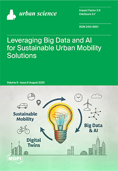
Urban Sci., Volume 9, Issue 8 (August 2025) – 27 articles

  • Issues are regarded as officially published after their release is announced to the table of contents alert mailing list.
  • You may sign up for e-mail alerts to receive table of contents of newly released issues.
  • PDF is the official format for papers published in both, html and pdf forms. To view the papers in pdf format, click on the "PDF Full-text" link, and use the free Adobe Reader to open them.
Order results
Result details
Select all
Export citation of selected articles as:
30 pages, 2552 KiB  
Article
Spatiotemporal Dynamics of Urban Sprawl Types in the Peri-Urban Area of Malang Municipality, Indonesia
by Adhitya Andi Hafiz, Fadly Usman, AR. Rohman Taufiq Hidayat and Dwi Maulidatuz Zakiyah
Urban Sci. 2025, 9(8), 313; https://doi.org/10.3390/urbansci9080313 (registering DOI) - 11 Aug 2025
Abstract
This study examines the spatial dynamics of urban sprawl in the peri-urban areas of Malang Municipality from 2004 to 2024. The findings reveal a rapid and uneven expansion of built-up areas, growing from 1825.87 ha (4%) in 2004 to 8017.22 ha (15.39%) in [...] Read more.
This study examines the spatial dynamics of urban sprawl in the peri-urban areas of Malang Municipality from 2004 to 2024. The findings reveal a rapid and uneven expansion of built-up areas, growing from 1825.87 ha (4%) in 2004 to 8017.22 ha (15.39%) in 2024. The most significant growth occurred in Singosari, Pakis, and Karangploso Districts, driven by proximity to higher education institutions, tourism centers, and commercial zones. Meanwhile, recent development trends in Kedungkandang District suggest emerging southeastern expansion supported by land availability and infrastructure. An analysis using the Landscape Expansion Index (LEI) indicates a transition from diffusion to coalescence phases, characterized by dominant edge-expansion, increasing infill, and persistent outlying patterns. However, discrepancies between spatial plans and actual land use were found, including 677.29 ha of non-built areas, 172.38 ha of which were sustainable agriculture zones converted into built-up land. These inconsistencies highlight the urgent need for stronger land-use control, including the implementation of Urban Growth Boundaries (UGBs) and stricter enforcement of spatial regulations. Future research should explore spatial drivers using logistic regression or spatial modeling approaches to support more sustainable urban planning in peri-urban regions. Full article
23 pages, 8193 KiB  
Article
Optimization Study of Hengqin Island Cycling System Based on Habitat Theory
by Sijing Wang and Jianyi Zheng
Urban Sci. 2025, 9(8), 312; https://doi.org/10.3390/urbansci9080312 - 11 Aug 2025
Abstract
With the global trend of green travel and demand for improving the quality of slow-moving systems in coastal cities, the optimization of the cycling system is crucial for improving the quality of the human environment. Based on the theory of “human–environment interaction” in [...] Read more.
With the global trend of green travel and demand for improving the quality of slow-moving systems in coastal cities, the optimization of the cycling system is crucial for improving the quality of the human environment. Based on the theory of “human–environment interaction” in habitat studies, the 22.15 km cycling route around Hengqin Island was studied considering the dimensions of energy flow, information interaction, and spatial–temporal utilization through field surveys, meteorological data analysis, and behavioral observation. The results showed that climate and topography significantly affect cyclists’ energy consumption and cycling efficiency, especially in hot and humid conditions in summer, greatly affecting the cycling experience. Meanwhile, the lack of a physical marking system and the disconnection of information transmission lead to difficulties in route selection, and there are significant time and seasonal variations in cycling behavior. Accordingly, microclimate adjustment, cultural symbol implantation, and flexible facility layout strategies are proposed to enhance the environmental comfort and information interaction efficiency of the cycling system. Full article
(This article belongs to the Special Issue Sustainable Urbanization, Regional Planning and Development)
Show Figures

Figure 1

26 pages, 1065 KiB  
Article
Electric Vehicles Sustainability and Adoption Factors
by Vitor Figueiredo and Goncalo Baptista
Urban Sci. 2025, 9(8), 311; https://doi.org/10.3390/urbansci9080311 - 11 Aug 2025
Abstract
Sustainability has an ever-increasing importance in our lives, mainly due to climate changes, finite resources, and a growing population, where each of us is called to make a change. Although climate change is a global phenomenon, our individual choices can make the difference. [...] Read more.
Sustainability has an ever-increasing importance in our lives, mainly due to climate changes, finite resources, and a growing population, where each of us is called to make a change. Although climate change is a global phenomenon, our individual choices can make the difference. The transportation sector is one of the largest contributors to global carbon emissions, making the transition toward sustainable mobility a critical priority. The adoption of electric vehicles is widely recognized as a key solution to reduce the environmental impact of transportation. However, their widespread acceptance depends on various technological, behavioral, and economical factors. Within this research we use as an artifact the CO2 Emission Management Gauge (CEMG) devices to better understand how the manufacturers, with integrated features on vehicles, could significantly enhance sales and drive the movement towards electric vehicle adoption. This study proposes an innovative new theoretical model based on Task-Technology Fit, Technology Acceptance, and the Theory of Planned Behavior to understand the main drivers that may foster electric vehicle adoption, tested in a quantitative study with structural equation modelling (SEM), and conducted in a South European country. Our findings, not without some limitations, reveal that while technological innovations like CEMG provide consumers with valuable transparency regarding emissions, its influence on the intention of adoption is dependent on the attitude towards electric vehicles and subjective norm. Our results also support the influence of task-technology fit on perceived usefulness and perceived ease-of-use, the influence of perceived usefulness on consumer attitude towards electric vehicles, and the influence of perceived ease-of-use on perceived usefulness. A challenge is also presented within our work to expand CEMG usage in the future to more intrinsic urban contexts, combined with smart city algorithms, collecting and proving CO2 emission information to citizens in locations such as traffic lights, illumination posts, streets, and public areas, allowing the needed information to better manage the city’s quality of air and traffic. Full article
Show Figures

Figure 1

23 pages, 5418 KiB  
Article
Optimal Roof Strategy for Mitigating Urban Heat Island in Hot Arid Climates: Simulation and Python-Based Multi-Criteria Decision Analysis
by Rehab Alaa, Amira Elbalazi and Walaa S.E. Ismaeel
Urban Sci. 2025, 9(8), 310; https://doi.org/10.3390/urbansci9080310 - 8 Aug 2025
Viewed by 254
Abstract
This study adopts a multi-scale, simulation-driven approach to evaluate the performance of different passive roof types in mitigating Urban Heat Island (UHI) in hot arid climate. A comparative analysis was performed for selected roof types; green, pond, cool, and dark roofs. At the [...] Read more.
This study adopts a multi-scale, simulation-driven approach to evaluate the performance of different passive roof types in mitigating Urban Heat Island (UHI) in hot arid climate. A comparative analysis was performed for selected roof types; green, pond, cool, and dark roofs. At the urban scale, ENVI-met v5.7.1 was employed to simulate microclimatic impacts, including Mean Radiant Temperature (MRT) at the pedestrian street level (1.4 m) and above building canopy level (25 m). The results revealed that green roofs were the most effective in mitigating UHI on the urban scale, reducing MRT by 1.83 °C at the pedestrian level and by 3.5 °C at the above canopy level. Surprisingly, dark roofs also performed well, with MRT reductions of 1.81 °C and 3.5 °C, respectively, outperforming pond roofs, which showed reductions of 1.80 °C and 0.31 °C. While cool roofs effectively reduced MRT at the pedestrian level by 1.80 °C, they had adverse effect at the canopy level, increasing MRT by 15.58 °C. At the building scale, Design Builder v7.3.1, coupled with Energy Plus, was used to assess indoor thermal and energy performance. Pond and cool roofs reduced operative temperature by 0.08 °C and 0.07 °C, respectively, followed by green roofs, with a 0.05 °C reduction, while dark roofs increased it by 0.07 °C. In terms of energy performance, green roofs yielded the greatest benefit, reducing cooling load by 3.3%, followed by pond roofs, with a 1.32% reduction; cool roofs showed negligible reduction, while dark roofs increased it by 1.2%. Finally, a Python-based Multi criteria Decision Making (MCDM) analytical framework integrated these findings with additional factors to optimize thermal comfort, environmental impact, sustainability, and feasibility and rank strategies accordingly. The analysis identified green roofs as the optimal solution, followed by pond roofs and then cool roofs tied with the base case, leaving dark roofs as the least favorable strategy. This study’s key contribution lies in its integrated simulation–decision analysis methodology, which bridges urban climatology and building performance to provide actionable insights for sustainable urban design. By validating green roofs as the most effective passive strategy in hot arid regions, this work aids policymakers and planners in prioritizing interventions that support climate-resilient urbanization. Full article
Show Figures

Figure 1

22 pages, 4279 KiB  
Article
Improving Urban Resilience Through a Scalable Multi-Criteria Planning Approach
by Carmine Massarelli and Maria Silvia Binetti
Urban Sci. 2025, 9(8), 309; https://doi.org/10.3390/urbansci9080309 - 7 Aug 2025
Viewed by 98
Abstract
In highly urbanised and industrialised settings, managing environmental pressures and enhancing urban resilience demand integrated, spatially explicit approaches. This study presents a methodological framework that integrates topographic data, land cover information, and open geodata to produce a high-resolution vulnerability map. A multi-criteria analysis [...] Read more.
In highly urbanised and industrialised settings, managing environmental pressures and enhancing urban resilience demand integrated, spatially explicit approaches. This study presents a methodological framework that integrates topographic data, land cover information, and open geodata to produce a high-resolution vulnerability map. A multi-criteria analysis was performed using indicators such as land use, population density, proximity to emission sources, vegetation cover, and sensitive services (e.g., schools and hospitals). The result is a high-resolution vulnerability map that classifies the urban, peri-urban, and coastal zones into five levels of environmental risk. These evaluation levels are derived from geospatial analyses combining pollutant dispersion modelling with land-use classification, enabling the identification of the most vulnerable urban zones. These findings support evidence-based planning and can guide local governments and environmental agencies in prioritising Nature-based Solutions (NBSs), enhancing ecological connectivity, and reducing exposure for vulnerable populations. Full article
Show Figures

Figure 1

14 pages, 359 KiB  
Article
Determinants of High-Speed Train Demand: Insights from the Jakarta—Bandung Corridor in Indonesia
by Mohammed Ali Berawi, Samidjan Samidjan, Perdana Miraj, Andyka Kusuma and Mustika Sari
Urban Sci. 2025, 9(8), 308; https://doi.org/10.3390/urbansci9080308 - 7 Aug 2025
Viewed by 179
Abstract
For the last few decades, the use of High-Speed Trains (HSTs) has been growing rapidly in various parts of the world. Despite rapid global expansion, many HST projects fail due to demand overestimation and cost overruns. This study analyzes factors influencing HST demand [...] Read more.
For the last few decades, the use of High-Speed Trains (HSTs) has been growing rapidly in various parts of the world. Despite rapid global expansion, many HST projects fail due to demand overestimation and cost overruns. This study analyzes factors influencing HST demand in Indonesia, aiming to identify impactful determinants from user perspectives. Employing a quantitative cross-sectional approach, this research utilized questionnaires distributed to users of different modes of transportation in the Jakarta–Bandung area, including trains, buses, travel services, and private cars. Structural Equation Modeling (SEM) via Lisrel software was used to analyze the data. The results indicate that Transit-Oriented Developments (TOD) and new urban areas significantly increase HST demand by facilitating urban growth and development. Additionally, supporting infrastructure and external factors such as road accessibility, parking availability, shuttle services, and environmental integration are pivotal in shaping commuter preferences. Although factors such as safety, comfort, and reliability are important, they alone may not be adequate to persuade consumers to use high-speed trains for their travel. Full article
Show Figures

Figure 1

16 pages, 825 KiB  
Article
Geographic Scale Matters in Analyzing the Effects of the Built Environment on Choice of Travel Modes: A Case Study of Grocery Shopping Trips in Salt Lake County, USA
by Ensheng Dong, Felix Haifeng Liao and Hejun Kang
Urban Sci. 2025, 9(8), 307; https://doi.org/10.3390/urbansci9080307 - 5 Aug 2025
Viewed by 190
Abstract
Compared to commuting, grocery shopping trips, despite their profound implications for mixed land use and transportation planning, have received limited attention in travel behavior research. Drawing upon a travel diary survey conducted in a fast-growing metropolitan region of the United States, i.e., Salt [...] Read more.
Compared to commuting, grocery shopping trips, despite their profound implications for mixed land use and transportation planning, have received limited attention in travel behavior research. Drawing upon a travel diary survey conducted in a fast-growing metropolitan region of the United States, i.e., Salt Lake County, UT, this research investigated a variety of influential factors affecting mode choices associated with grocery shopping. We analyze how built environment (BE) characteristics, measured at seven spatial scales or different ways of aggregating spatial data—including straight-line buffers, network buffers, and census units—affect travel mode decisions. Key predictors of choosing walking, biking, or transit over driving include age, household size, vehicle ownership, income, land use mix, street density, and distance to the central business district (CBD). Notably, the influence of BE factors on mode choice is sensitive to different spatial aggregation methods and locations of origins and destinations. The straight-line buffer was a good indicator for the influence of store sales amount on mode choices; the network buffer was more suitable for the household built environment factors, whereas the measurement at the census block and block group levels was more effective for store-area characteristics. These findings underscore the importance of considering both the spatial analysis method and the location (home vs. store) when modeling non-work travel. A multi-scalar approach can enhance the accuracy of travel demand models and inform more effective land use and transportation planning strategies. Full article
Show Figures

Figure 1

23 pages, 313 KiB  
Article
Changing Lifestyles in Highly Urbanized Regions of Russia: Short- and Longer-Term Effects of COVID Restrictions
by Irina D. Turgel and Olga A. Chernova
Urban Sci. 2025, 9(8), 306; https://doi.org/10.3390/urbansci9080306 - 5 Aug 2025
Viewed by 201
Abstract
The restrictions on business and social activity during the COVID-19 pandemic have led to significant changes in consumption patterns worldwide. Such changes are causing structural shifts in the markets of goods and services, thus affecting regional resilience. In this article, we aim to [...] Read more.
The restrictions on business and social activity during the COVID-19 pandemic have led to significant changes in consumption patterns worldwide. Such changes are causing structural shifts in the markets of goods and services, thus affecting regional resilience. In this article, we aim to assess the changing structure of the consumption of goods and services in highly urbanized Russian regions under the impact of the COVID-19 pandemic and to analyze its effects on the lifestyle of the population. According to our results, some Russian regions demonstrate a return to previous consumption levels, while others exhibit the emergence of new dynamics. The conclusion is made that COVID restrictions have invoked a paradigm shift in consumer behavior toward investment in self-development, safety, and comfort. This observation should be taken into account when developing strategies for the recovery growth of regional economies. Full article
26 pages, 2459 KiB  
Article
Urban Agriculture for Post-Disaster Food Security: Quantifying the Contributions of Community Gardens
by Yanxin Liu, Victoria Chanse and Fabricio Chicca
Urban Sci. 2025, 9(8), 305; https://doi.org/10.3390/urbansci9080305 - 5 Aug 2025
Viewed by 233
Abstract
Wellington, New Zealand, is highly vulnerable to disaster-induced food security crises due to its geography and geological characteristics, which can disrupt transportation and isolate the city following disasters. Urban agriculture (UA) has been proposed as a potential alternative food source for post-disaster scenarios. [...] Read more.
Wellington, New Zealand, is highly vulnerable to disaster-induced food security crises due to its geography and geological characteristics, which can disrupt transportation and isolate the city following disasters. Urban agriculture (UA) has been proposed as a potential alternative food source for post-disaster scenarios. This study examined the potential of urban agriculture for enhancing post-disaster food security by calculating vegetable self-sufficiency rates. Specifically, it evaluated the capacity of current Wellington’s community gardens to meet post-disaster vegetable demand in terms of both weight and nutrient content. Data collection employed mixed methods with questionnaires, on-site observations and mapping, and collecting high-resolution aerial imagery. Garden yields were estimated using self-reported data supported by literature benchmarks, while cultivated areas were quantified through on-site mapping and aerial imagery analysis. Six post-disaster food demand scenarios were used based on different target populations to develop an understanding of the range of potential produce yields. Weight-based results show that community gardens currently supply only 0.42% of the vegetable demand for residents living within a five-minute walk. This rate increased to 2.07% when specifically targeting only vulnerable populations, and up to 10.41% when focusing on gardeners’ own households. However, at the city-wide level, the current capacity of community gardens to provide enough produce to feed people remained limited. Nutrient-based self-sufficiency was lower than weight-based results; however, nutrient intake is particularly critical for vulnerable populations after disasters, underscoring the greater challenge of ensuring adequate nutrition through current urban food production. Beyond self-sufficiency, this study also addressed the role of UA in promoting food diversity and acceptability, as well as its social and psychological benefits based on the questionnaires and on-site observations. The findings indicate that community gardens contribute meaningfully to post-disaster food security for gardeners and nearby residents, particularly for vulnerable groups with elevated nutritional needs. Despite the current limited capacity of community gardens to provide enough produce to feed residents, findings suggest that Wellington could enhance post-disaster food self-reliance by diversifying UA types and optimizing land-use to increase food production during and after a disaster. Realizing this potential will require strategic interventions, including supportive policies, a conducive social environment, and diversification—such as the including private yards—all aimed at improving food access, availability, and nutritional quality during crises. The primary limitation of this study is the lack of comprehensive data on urban agriculture in Wellington and the wider New Zealand context. Addressing this data gap should be a key focus for future research to enable more robust assessments and evidence-based planning. Full article
Show Figures

Figure 1

22 pages, 5826 KiB  
Article
Re-Habiting the Rooftops in Ciutat Vella (Barcelona): Co-Designed Low-Cost Solutions for a Social, Technical and Environmental Improvement
by Marta Domènech-Rodríguez, Oriol París-Viviana and Còssima Cornadó
Urban Sci. 2025, 9(8), 304; https://doi.org/10.3390/urbansci9080304 - 4 Aug 2025
Viewed by 204
Abstract
This research addresses urban inequality by focusing on the rehabilitation of communal rooftops in Ciutat Vella, Barcelona, the city’s historic district, where residential vulnerability is concentrated in a particularly dense heritage urban environment with a shortage of outdoor spaces. Using participatory methodologies, this [...] Read more.
This research addresses urban inequality by focusing on the rehabilitation of communal rooftops in Ciutat Vella, Barcelona, the city’s historic district, where residential vulnerability is concentrated in a particularly dense heritage urban environment with a shortage of outdoor spaces. Using participatory methodologies, this research develops low-cost, removable, and recyclable prototypes aimed at improving social interaction, technical performance, and environmental conditions. The focus is on vulnerable populations, particularly the elderly. The approach integrates a bottom–up process and scalable solutions presented as a Toolkit of micro-projects. These micro-projects are designed to improve issues related to health, safety, durability, accessibility, energy savings, and acoustics. In addition, several possible material solutions for micro-projects are examined in terms of sustainability and cost. These plug-in interventions are designed for adaptability and replication throughout similar urban contexts and can significantly improve the quality of life for people, especially the elderly, in dense historic environments. Full article
Show Figures

Figure 1

19 pages, 2441 KiB  
Article
Simulation and Statistical Validation Method for Evaluating Daylighting Performance in Hot Climates
by Nivin Sherif, Ahmed Yehia and Walaa S. E. Ismaeel
Urban Sci. 2025, 9(8), 303; https://doi.org/10.3390/urbansci9080303 - 4 Aug 2025
Viewed by 278
Abstract
This study investigates the influence of façade-design parameters on daylighting performance in hot arid climates, with a particular focus on Egypt. A total of nine façade configurations of a residential building were modeled and simulated using Autodesk Revit and Insight 360, varying three [...] Read more.
This study investigates the influence of façade-design parameters on daylighting performance in hot arid climates, with a particular focus on Egypt. A total of nine façade configurations of a residential building were modeled and simulated using Autodesk Revit and Insight 360, varying three critical variables: glazing type (clear, blue, and dark), Window-to-Wall Ratio (WWR) of 15%, 50%, 75%, and indoor wall finish (light, moderate, dark) colors. These were compared to the Leadership in Energy and Environmental Design (LEED) daylighting quality thresholds. The results revealed that clear glazing paired with high WWR (75%) achieved the highest Spatial Daylight Autonomy (sDA), reaching up to 92% in living spaces. However, this also led to elevated Annual Sunlight Exposure (ASE), with peak values of 53%, exceeding the LEED discomfort threshold of 10%. Blue and dark glazing types successfully reduced ASE to as low as 0–13%, yet often resulted in underlit spaces, especially in private rooms such as bedrooms and bathrooms, with sDA values falling below 20%. A 50% WWR emerged as the optimal balance, providing consistent daylight distribution while maintaining ASE within acceptable limits (≤33%). Similarly, moderate color wall finishes delivered the most balanced lighting performance, enhancing sDA by up to 30% while controlling reflective glare. Statistical analysis using Pearson correlation revealed a strong positive relationship between sDA and ASE (r = 0.84) in highly glazed, clear glass scenarios. Sensitivity analysis further indicated that low WWR configurations of 15% were highly influenced by glazing and finishing types, leading to variability in daylight metrics reaching ±40%. The study concludes that moderate glazing (blue), medium WWR (50%), and moderate color indoor finishes provide the most robust daylighting performance across diverse room types. These findings support an evidence-based approach to façade design, promoting visual comfort, daylight quality, and sustainable building practices. Full article
(This article belongs to the Topic Application of Smart Technologies in Buildings)
Show Figures

Figure 1

30 pages, 5440 KiB  
Article
Canals, Contaminants, and Connections: Exploring the Urban Exposome in a Tropical River System
by Alan D. Ziegler, Theodora H. Y. Lee, Khajornkiat Srinuansom, Teppitag Boonta, Jongkon Promya and Richard D. Webster
Urban Sci. 2025, 9(8), 302; https://doi.org/10.3390/urbansci9080302 - 4 Aug 2025
Viewed by 198
Abstract
Emerging and persistent contaminants (EPCs) were detected at high concentrations in Chiang Mai’s Mae Kha Canal, identifying urban waterways as important sources of pollution in the Ping River system in northern Thailand. Maximum levels of metformin (20,000 ng/L), fexofenadine (15,900 ng/L), gabapentin (12,300 [...] Read more.
Emerging and persistent contaminants (EPCs) were detected at high concentrations in Chiang Mai’s Mae Kha Canal, identifying urban waterways as important sources of pollution in the Ping River system in northern Thailand. Maximum levels of metformin (20,000 ng/L), fexofenadine (15,900 ng/L), gabapentin (12,300 ng/L), sucralose (38,000 ng/L), and acesulfame (23,000 ng/L) point to inadequately treated wastewater as a plausible contributor. Downstream enrichment patterns relative to upstream sites highlight the cumulative impact of urban runoff. Five compounds—acesulfame, gemfibrozil, fexofenadine, TBEP, and caffeine—consistently emerged as reliable tracers of urban wastewater, forming a distinct chemical fingerprint of the riverine exposome. Median EPC concentrations were highest in Mae Kha, lower in other urban canals, and declined with distance from the city, reflecting spatial gradients in urban density and pollution intensity. Although most detected concentrations fell below predicted no-effect thresholds, ibuprofen frequently approached or exceeded ecotoxicological benchmarks and may represent a compound of ecological concern. Non-targeted analysis revealed a broader “chemical cocktail” of unregulated substances—illustrating a witches’ brew of pollution that likely escapes standard monitoring efforts. These findings demonstrate the utility of wide-scope surveillance for identifying key compounds, contamination hotspots, and spatial gradients in mixed-use watersheds. They also highlight the need for integrated, long-term monitoring strategies that address diffuse, compound mixtures to safeguard freshwater ecosystems in rapidly urbanizing regions. Full article
Show Figures

Figure 1

38 pages, 2159 KiB  
Review
Leveraging Big Data and AI for Sustainable Urban Mobility Solutions
by Oluwaleke Yusuf, Adil Rasheed and Frank Lindseth
Urban Sci. 2025, 9(8), 301; https://doi.org/10.3390/urbansci9080301 - 4 Aug 2025
Viewed by 336
Abstract
Urban population growth is intensifying pressure on mobility systems, with road transportation contributing to environmental and sustainability challenges. Policymakers must navigate complex uncertainties in addressing rising mobility demand while pursuing sustainability goals. Advanced technologies offer promise, but their real-world effectiveness in urban contexts [...] Read more.
Urban population growth is intensifying pressure on mobility systems, with road transportation contributing to environmental and sustainability challenges. Policymakers must navigate complex uncertainties in addressing rising mobility demand while pursuing sustainability goals. Advanced technologies offer promise, but their real-world effectiveness in urban contexts remains underexplored. This meta-review comprised three complementary studies: a broad analysis of sustainable mobility with Norwegian case studies, and systematic literature reviews on digital twins and Big Data/AI applications in urban mobility, covering the period of 2019–2024. Using structured criteria, we synthesised findings from 72 relevant articles to identify major trends, limitations, and opportunities. The findings show that mobility policies often prioritise technocentric solutions that unintentionally hinder sustainability goals. Digital twins show potential for traffic simulation, urban planning, and public engagement, while machine learning techniques support traffic forecasting and multimodal integration. However, persistent challenges include data interoperability, model validation, and insufficient stakeholder engagement. We identify a hierarchy of mobility modes where public transit and active mobility outperform private vehicles in sustainability and user satisfaction. Integrating electrification and automation and sharing models with data-informed governance can enhance urban liveability. We propose actionable pathways leveraging Big Data and AI, outlining the roles of various stakeholders in advancing sustainable urban mobility futures. Full article
(This article belongs to the Special Issue Sustainable Urbanization, Regional Planning and Development)
Show Figures

Figure 1

19 pages, 1654 KiB  
Article
New Weighting System for the Ordered Weighted Average Operator and Its Application in the Balanced Expansion of Urban Infrastructures
by Matheus Pereira Libório, Petr Ekel, Marcos Flávio Silveira Vasconcelos D’Angelo, Chris Brunsdon, Alexandre Magno Alves Diniz, Sandro Laudares and Angélica C. G. dos Santos
Urban Sci. 2025, 9(8), 300; https://doi.org/10.3390/urbansci9080300 - 1 Aug 2025
Viewed by 268
Abstract
Urban infrastructure, such as water supply networks, sewage systems, and electricity networks, is essential for the functioning of cities and, consequently, for the well-being of citizens. Despite its essentiality, the distribution of infrastructure in urban areas is not homogeneous, especially in cities in [...] Read more.
Urban infrastructure, such as water supply networks, sewage systems, and electricity networks, is essential for the functioning of cities and, consequently, for the well-being of citizens. Despite its essentiality, the distribution of infrastructure in urban areas is not homogeneous, especially in cities in developing countries. Socially vulnerable areas often face significant deficiencies in sewage and road paving, exacerbating urban inequalities. In this regard, urban planners must consider the multiple elements of urban infrastructure and assess the compensation levels between them to reduce inequality effectively. In particular, the complexity of the problem necessitates considering the multidimensionality and heterogeneity of urban infrastructure. This complexity qualifies the operational framework of composite indicators as the natural solution to the problem. This study develops a new weighting system for the balanced expansion of urban infrastructures through composite indicators constructed by the Ordered Weighted Average operator. Implementing these weighting systems provides an opportunity to analyze urban infrastructure from different perspectives, offering transparency regarding the weaknesses and strengths of each perspective. This prevents unreliable representations from being used in decision-making and provides a solid basis for allocating investments in urban infrastructure. In particular, the study suggests that adopting weighting systems that prioritize intermediate values and avoid extreme values can lead to better resource allocation, helping to identify areas with deficient infrastructure and promoting more equitable urban development. Full article
Show Figures

Figure 1

30 pages, 4409 KiB  
Article
Accident Impact Prediction Based on a Deep Convolutional and Recurrent Neural Network Model
by Pouyan Sajadi, Mahya Qorbani, Sobhan Moosavi and Erfan Hassannayebi
Urban Sci. 2025, 9(8), 299; https://doi.org/10.3390/urbansci9080299 - 1 Aug 2025
Viewed by 382
Abstract
Traffic accidents pose a significant threat to public safety, resulting in numerous fatalities, injuries, and a substantial economic burden each year. The development of predictive models capable of the real-time forecasting of post-accident impact using readily available data can play a crucial role [...] Read more.
Traffic accidents pose a significant threat to public safety, resulting in numerous fatalities, injuries, and a substantial economic burden each year. The development of predictive models capable of the real-time forecasting of post-accident impact using readily available data can play a crucial role in preventing adverse outcomes and enhancing overall safety. However, existing accident predictive models encounter two main challenges: first, a reliance on either costly or non-real-time data, and second, the absence of a comprehensive metric to measure post-accident impact accurately. To address these limitations, this study proposes a deep neural network model known as the cascade model. It leverages readily available real-world data from Los Angeles County to predict post-accident impacts. The model consists of two components: Long Short-Term Memory (LSTM) and a Convolutional Neural Network (CNN). The LSTM model captures temporal patterns, while the CNN extracts patterns from the sparse accident dataset. Furthermore, an external traffic congestion dataset is incorporated to derive a new feature called the “accident impact” factor, which quantifies the influence of an accident on surrounding traffic flow. Extensive experiments were conducted to demonstrate the effectiveness of the proposed hybrid machine learning method in predicting the post-accident impact compared to state-of-the-art baselines. The results reveal a higher precision in predicting minimal impacts (i.e., cases with no reported accidents) and a higher recall in predicting more significant impacts (i.e., cases with reported accidents). Full article
Show Figures

Figure 1

24 pages, 650 KiB  
Article
Investigating Users’ Acceptance of Autonomous Buses by Examining Their Willingness to Use and Willingness to Pay: The Case of the City of Trikala, Greece
by Spyros Niavis, Nikolaos Gavanas, Konstantina Anastasiadou and Paschalis Arvanitidis
Urban Sci. 2025, 9(8), 298; https://doi.org/10.3390/urbansci9080298 - 1 Aug 2025
Viewed by 420
Abstract
Autonomous vehicles (AVs) have emerged as a promising sustainable urban mobility solution, expected to lead to enhanced road safety, smoother traffic flows, less traffic congestion, improved accessibility, better energy utilization and environmental performance, as well as more efficient passenger and freight transportation, in [...] Read more.
Autonomous vehicles (AVs) have emerged as a promising sustainable urban mobility solution, expected to lead to enhanced road safety, smoother traffic flows, less traffic congestion, improved accessibility, better energy utilization and environmental performance, as well as more efficient passenger and freight transportation, in terms of time and cost, due to better fleet management and platooning. However, challenges also arise, mostly related to data privacy, security and cyber-security, high acquisition and infrastructure costs, accident liability, even possible increased traffic congestion and air pollution due to induced travel demand. This paper presents the results of a survey conducted among 654 residents who experienced an autonomous bus (AB) service in the city of Trikala, Greece, in order to assess their willingness to use (WTU) and willingness to pay (WTP) for ABs, through testing a range of factors based on a literature review. Results useful to policy-makers were extracted, such as that the intention to use ABs was mostly shaped by psychological factors (e.g., users’ perceptions of usefulness and safety, and trust in the service provider), while WTU seemed to be positively affected by previous experience in using ABs. In contrast, sociodemographic factors were found to have very little effect on the intention to use ABs, while apart from personal utility, users’ perceptions of how autonomous driving will improve the overall life standards in the study area also mattered. Full article
Show Figures

Figure 1

16 pages, 1833 KiB  
Article
Prediction of Waste Generation Using Machine Learning: A Regional Study in Korea
by Jae-Sang Lee and Dong-Chul Shin
Urban Sci. 2025, 9(8), 297; https://doi.org/10.3390/urbansci9080297 - 30 Jul 2025
Viewed by 295
Abstract
Accurate forecasting of household waste generation is essential for sustainable urban planning and the development of data-driven environmental policies. Conventional statistical models, while simple and interpretable, often fail to capture the nonlinear and multidimensional relationships inherent in waste production patterns. This study proposes [...] Read more.
Accurate forecasting of household waste generation is essential for sustainable urban planning and the development of data-driven environmental policies. Conventional statistical models, while simple and interpretable, often fail to capture the nonlinear and multidimensional relationships inherent in waste production patterns. This study proposes a machine learning-based regression framework utilizing Random Forest and XGBoost algorithms to predict annual household waste generation across four metropolitan regions in South Korea Seoul, Gyeonggi, Incheon, and Jeju over the period from 2000 to 2023. Independent variables include demographic indicators (total population, working-age population, elderly population), economic indicators (Gross Regional Domestic Product), and regional identifiers encoded using One-Hot Encoding. A derived feature, elderly ratio, was introduced to reflect population aging. Model performance was evaluated using R2, RMSE, and MAE, with artificial noise added to simulate uncertainty. Random Forest demonstrated superior generalization and robustness to data irregularities, especially in data-scarce regions like Jeju. SHAP-based interpretability analysis revealed total population and GRDP as the most influential features. The findings underscore the importance of incorporating economic indicators in waste forecasting models, as demographic variables alone were insufficient for explaining waste dynamics. This approach provides valuable insights for policymakers and supports the development of adaptive, region-specific strategies for waste reduction and infrastructure investment. Full article
Show Figures

Figure 1

18 pages, 1327 KiB  
Article
The Shifting Geography of Innovation in the Era of COVID-19: Exploring Small Business Innovation and Technology Awards in the U.S.
by Bradley Bereitschaft
Urban Sci. 2025, 9(8), 296; https://doi.org/10.3390/urbansci9080296 - 30 Jul 2025
Viewed by 288
Abstract
This research examines the shifting geography of small firm innovation in the U.S. by tracking the location of small business innovation research (SBIR) and small business technology transfer (STTR) awardees between 2010 and 2024. The SBIR and STTR are “seed fund” awards coordinated [...] Read more.
This research examines the shifting geography of small firm innovation in the U.S. by tracking the location of small business innovation research (SBIR) and small business technology transfer (STTR) awardees between 2010 and 2024. The SBIR and STTR are “seed fund” awards coordinated by the Small Business Administration (SBA) and funded through 11 U.S. federal agencies. Of particular interest is whether the number of individual SBA awards, awarded firms, and/or funding amounts are (1) becoming increasingly concentrated within regional innovation hubs and (2) exhibiting a shift toward or away from urban centers and other walkable, transit-accessible urban neighborhoods, particularly since 2020 and the COVID-19 pandemic. While the rise of remote work and pandemic-related fears may have reduced the desirability of urban spaces for both living and working, there remain significant benefits to spatial agglomeration that may be especially crucial for startups and other small firms in the knowledge- or information-intensive industries. The results suggest that innovative activity of smaller firms has indeed trended toward more centralized, denser, and walkable urban areas in recent years while also remaining fairly concentrated within major metropolitan innovation hubs. The pandemic appears to have resulted in a measurable, though potentially short-lived, cessation of these trends. Full article
Show Figures

Figure 1

17 pages, 3289 KiB  
Article
Significant Attribution of Urbanization to Triggering Extreme Rainfall in the Urban Core—A Case of Dallas–Fort Worth in North Texas
by Junaid Ahmad, Jessica A. Eisma and Muhammad Sajjad
Urban Sci. 2025, 9(8), 295; https://doi.org/10.3390/urbansci9080295 - 29 Jul 2025
Viewed by 419
Abstract
While rainfall occurs for several reasons, climate change and urbanization influence its frequency and geographical disparities. Although recent research suggests that urbanization may lead to increased rainfall, insights into how urbanization can trigger rainfall remain limited. We selected the Dallas–Fort Worth (DFW) metroplex, [...] Read more.
While rainfall occurs for several reasons, climate change and urbanization influence its frequency and geographical disparities. Although recent research suggests that urbanization may lead to increased rainfall, insights into how urbanization can trigger rainfall remain limited. We selected the Dallas–Fort Worth (DFW) metroplex, which has minimal orographic and coastal influences, to analyze the urban impact on rainfall. DFW was divided into 256 equal grids (10 km × 10 km) and grouped into four clusters using K-means clustering based on the urbanization ratio. Using Multi-Sensor Precipitation Estimator data (with a spatial resolution of 4 km), we examined rainfall exceeding the 95th percentile (i.e., extreme rainfall) on low synoptic days to highlight localized effects. The urban heat island (UHI) effect was estimated based on the average temperature difference between the urban core and the other three non-urban clusters. Multiple rainfall events were monitored on an hourly basis. Potential linkages between urbanization, the UHI, extreme rainfall, wind speed, wind direction, convective inhibition, and convective available potential energy were evaluated. An intense UHI within the DFW area triggered a tornado, resulting in maximum rainfall in the urban core area under high wind speeds and a dominant wind direction. Our findings further clarify the role of urbanization in generating extreme rainfall events, which is essential for developing better policies for urban planning in response to intensifying extreme events due to climate change. Full article
Show Figures

Figure 1

21 pages, 2355 KiB  
Article
Analysis of Residents’ Understanding of Encroachment Risk to Water Infrastructure in Makause Informal Settlement in the City of Ekurhuleni
by Mpondomise Nkosinathi Ndawo, Dennis Dzansi and Stephen Loh Tangwe
Urban Sci. 2025, 9(8), 294; https://doi.org/10.3390/urbansci9080294 - 29 Jul 2025
Viewed by 412
Abstract
This study investigates the encroachment risk in the Makause informal settlement by analysing resident survey data to identify key contributing factors and build predictive models. Encroachment threatens the water infrastructure through damage, contamination, and service disruptions, highlighting the need for informed, community-based planning. [...] Read more.
This study investigates the encroachment risk in the Makause informal settlement by analysing resident survey data to identify key contributing factors and build predictive models. Encroachment threatens the water infrastructure through damage, contamination, and service disruptions, highlighting the need for informed, community-based planning. The data was collected from 105 residents, with responses (“Yes,” “No,” “Unsure”) analysed using descriptive statistics and a one-way ANOVA to identify significant differences across categories. The ReliefF algorithm was used to rank the importance of features predicting the encroachment risk. These inputs were then used to train, validate, and test an Artificial Neural Network (ANN) model. The Artificial Neural Network demonstrated a high predictive accuracy, achieving correlation coefficients above 95% and low mean squared errors. The ANOVA identified statistically significant mean differences for selected variables, while ReliefF helped determine the most influential predictors. A high agreement level (p > 0.900) between predicted and actual responses confirmed the model’s validity. This research introduces an innovative, data-driven framework that integrates machine learning and a statistical analysis to support municipalities and utility providers in engaging informal communities to protect infrastructure. While this study is limited to Makause and may be affected by a self-reported bias, it demonstrates the potential of Artificial Neural Networks and ReliefF in enhancing the risk analysis and infrastructure management in informal settlements. Full article
Show Figures

Figure 1

26 pages, 3356 KiB  
Article
Integrating Urban Factors as Predictors of Last-Mile Demand Patterns: A Spatial Analysis in Thessaloniki
by Dimos Touloumidis, Michael Madas, Panagiotis Kanellopoulos and Georgia Ayfantopoulou
Urban Sci. 2025, 9(8), 293; https://doi.org/10.3390/urbansci9080293 - 29 Jul 2025
Viewed by 267
Abstract
While the explosive growth in e-commerce stresses urban logistics systems, city planners lack of fine-grained data in order to anticipate and manage the resulting freight flows. Using a three-stage analytical approach combining descriptive zonal statistics, hotspot analysis and different regression modeling from univariate [...] Read more.
While the explosive growth in e-commerce stresses urban logistics systems, city planners lack of fine-grained data in order to anticipate and manage the resulting freight flows. Using a three-stage analytical approach combining descriptive zonal statistics, hotspot analysis and different regression modeling from univariate to geographically weighted regression, this study integrates one year of parcel deliveries from a leading courier with open spatial layers of land-use zoning, census population, mobile-signal activity and household income to model last-mile demand across different land use types. A baseline linear regression shows that residential population alone accounts for roughly 30% of the variance in annual parcel volumes (2.5–3.0 deliveries per resident) while adding daytime workforce and income increases the prediction accuracy to 39%. In a similar approach where coefficients vary geographically with Geographically Weighted Regression to capture the local heterogeneity achieves a significant raise of the overall R2 to 0.54 and surpassing 0.70 in residential and institutional districts. Hot-spot analysis reveals a highly fragmented pattern where fewer than 5% of blocks generate more than 8.5% of all deliveries with no apparent correlation to the broaden land-use classes. Commercial and administrative areas exhibit the greatest intensity (1149 deliveries per ha) yet remain the hardest to explain (global R2 = 0.21) underscoring the importance of additional variables such as retail mix, street-network design and tourism flows. Through this approach, the calibrated models can be used to predict city-wide last-mile demand using only public inputs and offers a transferable, privacy-preserving template for evidence-based freight planning. By pinpointing the location and the land uses where demand concentrates, it supports targeted interventions such as micro-depots, locker allocation and dynamic curb-space management towards more sustainable and resilient urban-logistics networks. Full article
Show Figures

Figure 1

24 pages, 622 KiB  
Article
The Differential Impact of Human Capital on Social Integration Among Rural–Urban and Urban–Urban Migrants in China
by Tao Xu and Jiyan Ren
Urban Sci. 2025, 9(8), 292; https://doi.org/10.3390/urbansci9080292 - 25 Jul 2025
Viewed by 620
Abstract
Differences exist between rural–urban migrants and urban–urban migrants in terms of human capital’s accumulation and pathways of social integration, yet few studies have systematically compared these distinctions. Based on the CMDS2017 survey data, this study constructed a comprehensive social integration index across four [...] Read more.
Differences exist between rural–urban migrants and urban–urban migrants in terms of human capital’s accumulation and pathways of social integration, yet few studies have systematically compared these distinctions. Based on the CMDS2017 survey data, this study constructed a comprehensive social integration index across four dimensions—economic integration, behavioral adaptation, identity recognition, and psychological assimilation—to analyze the influencing factors and decompose the disparities in social integration levels between the two groups from a human capital perspective. Using Oaxaca mean decomposition and Machado–Mata (MM) quantile decomposition, the results indicated that urban–urban migrants exhibited higher social integration levels than rural–urban migrants, with human capital significantly influencing integration outcomes. Better education, health status, longer migration duration, and more work experience positively enhanced migrants’ social integration. Human capital accounted for 38.35% of the social integration gap between the two groups, while coefficient differences were the primary driver of disparities. The returns to education diminish at higher integration levels, suggesting education played a stronger role for those with lower integration. The social integration gap between the two groups followed an inverted U-shaped trend, with smaller disparities at higher quantiles. As integration levels rose, characteristic differences declined continuously, indicating convergence toward homogeneity among high-integration migrants. These research findings indicated that the improvement in the social integration level of migrants still requires continuous investment in cultivating the human capital of migrants. Full article
Show Figures

Figure 1

23 pages, 1593 KiB  
Article
Natural Ventilation Technique of uNVeF in Urban Residential Unit Through a Case Study
by Ming-Lun Alan Fong and Wai-Kit Chan
Urban Sci. 2025, 9(8), 291; https://doi.org/10.3390/urbansci9080291 - 25 Jul 2025
Viewed by 940
Abstract
The present study was motivated by the need to enhance indoor air quality and reduce airborne disease transmission in dense urban environments where high-rise residential buildings face challenges in achieving effective natural ventilation. The problem lies in the lack of scalable and convenient [...] Read more.
The present study was motivated by the need to enhance indoor air quality and reduce airborne disease transmission in dense urban environments where high-rise residential buildings face challenges in achieving effective natural ventilation. The problem lies in the lack of scalable and convenient tools to optimize natural ventilation rate, particularly in urban settings with varying building heights. To address this, the scientific technique developed with an innovative metric, the urbanized natural ventilation effectiveness factor (uNVeF), integrates regression analysis of wind direction, velocity, air change rate per hour (ACH), window configurations, and building height to quantify ventilation efficiency. By employing a field measurement methodology, the measurements were conducted across 25 window-opening scenarios in a 13.9 m2 residential unit on the 35/F of a Hong Kong public housing building, supplemented by the Hellman Exponential Law with a site-specific friction coefficient (0.2907, R2 = 0.9232) to estimate the lower floor natural ventilation rate. The results confirm compliance with Hong Kong’s statutory 1.5 ACH requirement (Practice Note for Authorized Persons, Registered Structural Engineers, and Registered Geotechnical Engineers) and achieving a peak ACH at a uNVeF of 0.953 with 75% window opening. The results also revealed that lower floors can maintain 1.5 ACH with adjusted window configurations. Using the Wells–Riley model, the estimation results indicated significant airborne disease infection risk reductions of 96.1% at 35/F and 93.4% at 1/F compared to the 1.5 ACH baseline which demonstrates a strong correlation between ACH, uNVeF and infection risks. The uNVeF framework offers a practical approach to optimize natural ventilation and provides actionable guidelines, together with future research on the scope of validity to refine this technique for residents and developers. The implications in the building industry include setting up sustainable design standards, enhancing public health resilience, supporting policy frameworks for energy-efficient urban planning, and potentially driving innovation in high-rise residential construction and retrofitting globally. Full article
Show Figures

Figure 1

15 pages, 1181 KiB  
Article
Smart City Concept: Implementation Features in Various Territories
by Magomed Mintsaev, Sayd-Alvi Murtazaev, Magomed Saydumov, Salambek Aliev, Adam Abumuslimov and Ismail Murtazaev
Urban Sci. 2025, 9(8), 290; https://doi.org/10.3390/urbansci9080290 - 25 Jul 2025
Viewed by 383
Abstract
Modern software solutions have a multiplicative effect on enhancing quality of life across various urban sectors, including the environment, education, public health, security, transportation, time efficiency, employment, and other key aspects of city living. This article addresses a specific issue concerning the organisation [...] Read more.
Modern software solutions have a multiplicative effect on enhancing quality of life across various urban sectors, including the environment, education, public health, security, transportation, time efficiency, employment, and other key aspects of city living. This article addresses a specific issue concerning the organisation of leisure activities for both local residents and tourists, using the Chechen Republic as a case study. In response, the study aimed to develop a digital solution to address this challenge, with potential for integration into the Republic’s unified digital ecosystem. By employing system analysis methods, the authors identified the key objects and stakeholders involved in the problem domain. They also defined the software product’s functionality and classified user categories. Using Unified Modelling Language methods, a use case diagram was developed to illustrate the conceptual operation of the system. Furthermore, object-oriented design methods were applied to create a user interface prototype for the software product. As a result, a digital service was developed that enables users to create personalised leisure routes, taking into account individual goals, time constraints, traffic conditions, and the real-time status of urban infrastructure. The resulting software solution is both customisable and scalable. The article also presents selected examples of project development. Full article
Show Figures

Figure 1

19 pages, 2278 KiB  
Article
Interplay Between Vegetation and Urban Climate in Morocco—Impact on Human Thermal Comfort
by Noura Ed-dahmany, Lahouari Bounoua, Mohamed Amine Lachkham, Mohammed Yacoubi Khebiza, Hicham Bahi and Mohammed Messouli
Urban Sci. 2025, 9(8), 289; https://doi.org/10.3390/urbansci9080289 - 25 Jul 2025
Viewed by 679
Abstract
This study examines diurnal surface temperature dynamics across major Moroccan cities during the growing season and explores the interaction between urban and vegetated surfaces. We also introduce the Urban Thermal Impact Ratio (UTIR), a novel metric designed to quantify urban thermal comfort as [...] Read more.
This study examines diurnal surface temperature dynamics across major Moroccan cities during the growing season and explores the interaction between urban and vegetated surfaces. We also introduce the Urban Thermal Impact Ratio (UTIR), a novel metric designed to quantify urban thermal comfort as a function of the surface urban heat island (SUHI) intensity. The analysis is based on outputs from a land surface model (LSM) for the year 2010, integrating high-resolution Landsat and MODIS data to characterize land cover and biophysical parameters across twelve land cover types. Our findings reveal moderate urban–vegetation temperature differences in coastal cities like Tangier (1.8 °C) and Rabat (1.0 °C), where winter vegetation remains active. In inland areas, urban morphology plays a more dominant role: Fes, with a 20% impervious surface area (ISA), exhibits a smaller SUHI than Meknes (5% ISA), due to higher urban heating in the latter. The Atlantic desert city of Dakhla shows a distinct pattern, with a nighttime SUHI of 2.1 °C and a daytime urban cooling of −0.7 °C, driven by irrigated parks and lawns enhancing evapotranspiration and shading. At the regional scale, summer UTIR values remain below one in Tangier-Tetouan-Al Hoceima, Rabat-Sale-Kenitra, and Casablanca-Settat, suggesting that urban conditions generally stay within thermal comfort thresholds. In contrast, higher UTIR values in Marrakech-Safi, Beni Mellal-Khénifra, and Guelmim-Oued Noun indicate elevated heat discomfort. At the city scale, the UTIR in Tangier, Rabat, and Casablanca demonstrates a clear diurnal pattern: it emerges around 11:00 a.m., peaks at 1:00 p.m., and fades by 3:00 p.m. This study highlights the critical role of vegetation in regulating urban surface temperatures and modulating urban–rural thermal contrasts. The UTIR provides a practical, scalable indicator of urban heat stress, particularly valuable in data-scarce settings. These findings carry significant implications for climate-resilient urban planning, optimized energy use, and the design of public health early warning systems in the context of climate change. Full article
Show Figures

Figure 1

26 pages, 2204 KiB  
Article
A Qualitative Methodology for Identifying Governance Challenges and Advancements in Positive Energy District Labs
by Silvia Soutullo, Oscar Seco, María Nuria Sánchez, Ricardo Lima, Fabio Maria Montagnino, Gloria Pignatta, Ghazal Etminan, Viktor Bukovszki, Touraj Ashrafian, Maria Beatrice Andreucci and Daniele Vettorato
Urban Sci. 2025, 9(8), 288; https://doi.org/10.3390/urbansci9080288 - 23 Jul 2025
Viewed by 405
Abstract
Governance challenges, success factors, and stakeholder dynamics are central to the implementation of Positive Energy District (PED) Labs, which aim to develop energy-positive and sustainable urban areas. In this paper, a qualitative analysis combining expert surveys, participatory workshops with practitioners from the COST [...] Read more.
Governance challenges, success factors, and stakeholder dynamics are central to the implementation of Positive Energy District (PED) Labs, which aim to develop energy-positive and sustainable urban areas. In this paper, a qualitative analysis combining expert surveys, participatory workshops with practitioners from the COST Action PED-EU-NET network, and comparative case studies across Europe identifies key barriers, drivers, and stakeholder roles throughout the implementation process. Findings reveal that fragmented regulations, social inertia, and limited financial mechanisms are the main barriers to PED Lab development, while climate change mitigation goals, strong local networks, and supportive policy frameworks are critical drivers. The analysis maps stakeholder engagement across six development phases, showing how leadership shifts between governments, industry, planners, and local communities. PED Labs require intangible assets such as inclusive governance frameworks, education, and trust-building in the early phases, while tangible infrastructures become more relevant in later stages. The conclusions emphasize that robust, inclusive governance is not merely supportive but a key driver of PED Lab success. Adaptive planning, participatory decision-making, and digital coordination tools are essential for overcoming systemic barriers. Scaling PED Labs effectively requires regulatory harmonization and the integration of social and technological innovation to accelerate the transition toward energy-positive, climate-resilient cities. Full article
(This article belongs to the Collection Urban Agenda)
Show Figures

Figure 1

19 pages, 468 KiB  
Article
Predicting Individual Residential Engagement: Exploring the Role of Perceived Residential Environmental Quality, Descriptive Norms, Problem Awareness, and Place Attachment
by Paola Passafaro, Ankica Kosic, Marina Molinari and Francesca Valeria Frisari
Urban Sci. 2025, 9(8), 287; https://doi.org/10.3390/urbansci9080287 - 23 Jul 2025
Viewed by 285
Abstract
This paper builds on place theory and the psycho-social approach to the study of perceived residential environmental quality to examine the relationship between environmental perceptions and residential action in the neighborhood. An exploratory study on (N = 185) Italian respondents assessed the [...] Read more.
This paper builds on place theory and the psycho-social approach to the study of perceived residential environmental quality to examine the relationship between environmental perceptions and residential action in the neighborhood. An exploratory study on (N = 185) Italian respondents assessed the role of perceived residential environmental quality (i.e., perceived quality of green areas and perceived maintenance levels within the neighborhood), awareness of neighborhood environmental problems, neighborhood descriptive norms, and place attachment (attachment to the neighborhood) as predictors of self-reported individual residential engagement (engagement in improving the environmental quality of the neighborhood). Likert-type measures of the corresponding constructs were included in a structured questionnaire and used to carry out an online survey. Findings showed problem awareness and descriptive norms to directly predict residential engagement. Problem awareness mediated the relationship between perceived maintenance levels and residential engagement. Place attachment was directly predicted by perceived residential quality (quality of green areas), but did not show an independent predictive power vis-à-vis residential engagement. Results suggest new possible research avenues for modelling the individual commitment to improve the environmental quality of one’s own residential architectural and green environment. Full article
Show Figures

Figure 1

Previous Issue
Back to TopTop