Next Issue
Volume 12, April
Previous Issue
Volume 12, February


Hydrology, Volume 12, Issue 3 (March 2025) – 23 articles

Cover Story (view full-size image): 
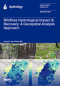
Assessing the effects of wildfires, as well as the process of recovering from them, is critical for mitigating their impacts. This paper presents a geospatial analysis approach that enables the investigation of the effects of wildfires on vegetation, soil, and hydrology, using the catastrophic wildfire that occurred in August 2021 in the wider area of Varybobi, north of Athens, Greece, as an example.  The proposed method provides deep insights into regeneration potential and the period needed for the restoration of hydrological behaviour to pre-fire conditions. The analysis is conducted in a spatially distributed manner in order to delineate the critical areas in which immediate interventions are required for the rapid restoration of the basin’s hydrological behaviour. View this paper
  • Issues are regarded as officially published after their release is announced to the table of contents alert mailing list.
  • You may sign up for e-mail alerts to receive table of contents of newly released issues.
  • PDF is the official format for papers published in both, html and pdf forms. To view the papers in pdf format, click on the "PDF Full-text" link, and use the free Adobe Reader to open them.
Order results
Result details
Section
Select all
Export citation of selected articles as:
26 pages, 11207 KiB  
Article
Glacier, Wetland, and Lagoon Dynamics in the Barroso Mountain Range, Atacama Desert: Past Trends and Future Projections Using CA-Markov
by German Huayna, Edwin Pino-Vargas, Jorge Espinoza-Molina, Carolina Cruz-Rodríguez, Fredy Cabrera-Olivera, Lía Ramos-Fernández, Bertha Vera-Barrios, Karina Acosta-Caipa and Eusebio Ingol-Blanco
Hydrology 2025, 12(3), 64; https://doi.org/10.3390/hydrology12030064 - 20 Mar 2025
Viewed by 372
Abstract
Glacial retreat is a major global challenge, particularly in arid and semi-arid regions where glaciers serve as critical water sources. This research focuses on glacial retreat and its impact on land cover and land use changes (LULC) in the Barroso Mountain range, Tacna, [...] Read more.
Glacial retreat is a major global challenge, particularly in arid and semi-arid regions where glaciers serve as critical water sources. This research focuses on glacial retreat and its impact on land cover and land use changes (LULC) in the Barroso Mountain range, Tacna, Peru, which is a critical area for water resources in the hyperarid Atacama Desert. Employing advanced remote sensing techniques through the Google Earth Engine (GEE) cloud computing platform, we analyzed historical trends (1985–2022) using Landsat satellite imagery. A normalized index classification was carried out to generate LULC maps for the years 1986, 2001, 2012, and 2022. Future projections until 2042 were developed using Cellular Automata–Markov (CA–Markov) modeling in QGIS, incorporating six predictive environmental variables. The resulting maps presented an overall accuracy (OA) greater than 83%. Historical analysis revealed a dramatic glacier reduction from 44.7 km2 in 1986 to 7.4 km2 in 2022. In contrast, wetlands expanded substantially from 5.70 km2 to 12.14 km2, indicating ecosystem shifts potentially driven by glacier meltwater availability. CA–Markov chain modeling projected further glacier loss to 3.07 km2 by 2042, while wetlands are expected to expand to 18.8 km2 and bodies of water will reach 4.63 km2. These future projections (with accuracies above 84%) underline urgent implications for water management, environmental sustainability, and climate adaptation strategies, particularly with regard to downstream hydrological risks and ecosystem resilience. Full article
Show Figures

Figure 1

15 pages, 1869 KiB  
Article
Molecular Composition of Stream Dissolved Organic Matter in Cool-Temperate Forest Headwaters with Landslides, Northern Japan
by Jun’ichiro Ide, Kenta Hara, Yohei Arata, Izuki Endo, Mizue Ohashi, Hiroshi Nishimura and Takashi Gomi
Hydrology 2025, 12(3), 63; https://doi.org/10.3390/hydrology12030063 - 19 Mar 2025
Viewed by 199
Abstract
Vegetation and subsequent ecosystem services can recover over time in forest headwaters devastated by massive disasters. However, in cold regions, their recovery rates are typically slow and often imperceptible, which makes it difficult to evaluate how much ecosystem services have recovered. This study [...] Read more.
Vegetation and subsequent ecosystem services can recover over time in forest headwaters devastated by massive disasters. However, in cold regions, their recovery rates are typically slow and often imperceptible, which makes it difficult to evaluate how much ecosystem services have recovered. This study targeted dissolved organic matter (DOM), which plays a central role in biogeochemical processes in forest ecosystems, and aimed to examine whether vegetation conditions affect the quality of stream DOM from cool-temperate forest headwaters in northern Japan. To achieve this, hydrological observations and stream water sampling were conducted monthly from May to December 2021 in three small forest catchments with different landslide coverage. Dissolved organic carbon (DOC) concentration in stream water was measured, and the molecular composition of DOM was analyzed using ultrahigh-resolution mass spectrometry and compared among the three catchments. The peak-intensity-weighted average aromaticity index (AIwa) increased with DOC concentration. We found that AIwa was the highest in the undisturbed catchment, followed by the catchments with landslide coverages of 16% and 52% at a given DOC level. These results indicate that the quality of DOM could dramatically change depending not only on DOC concentration but also on vegetation disturbance in cool-temperate forest headwaters. Full article
(This article belongs to the Section Surface Waters and Groundwaters)
Show Figures

Figure 1

18 pages, 3086 KiB  
Article
Earth Fissures During Groundwater Depletion and Recovery: A Case Study at Shitangwan, Wuxi, Jiangsu, China
by Guang-Ya Wang, Jin-Qi Zhu, Greg G. You, Dan Zhang, Jun Yu, Fu-Gang Gou and Jian-Qiang Wu
Hydrology 2025, 12(3), 62; https://doi.org/10.3390/hydrology12030062 - 19 Mar 2025
Viewed by 237
Abstract
The Shitangwan earth fissure is a resultant geological hazard due to prolonged groundwater depletion and land subsidence in Wuxi, China, since the 1980s. Initially observed in 1991, the earth fissure experienced continuous development over the next several decades. Employing a diverse array of [...] Read more.
The Shitangwan earth fissure is a resultant geological hazard due to prolonged groundwater depletion and land subsidence in Wuxi, China, since the 1980s. Initially observed in 1991, the earth fissure experienced continuous development over the next several decades. Employing a diverse array of techniques, including field monitoring via multilayered borehole extensometers, earth fissure monitoring for lateral and vertical movements, advanced geophysical exploration, and conventional geological investigations, this study aims to mitigate the risks associated with land subsidence and earth fissures. It is found that the groundwater has recovered to the levels in the 1980s, land subsidence and earth fissuring have ceased, and the earth fissuring is closely linked to the land subsidence. A bedrock ridge and a river course are underlying porous Quaternary sediments beneath the earth fissure. The formation of the earth fissure is the result of a combination of factors, including spatial and temporal variations in strata compression, rugged bedrock terrain, and the heterogeneity of the strata profile. Land subsidence is primarily attributed to the deep pumping aquifer and its adjacent aquitards, which are responsive to groundwater recovery with a time lag of a decade, and the land rebound accounts for 2% of the accumulated land subsidence. Estimations suggest that the depth of the earth fissure may have reached the bedrock ridge. The mechanism of the earth fissuring is the coupled effect of tension from the rotation of shallow soil strata along the bedrock ridge and shearing of strata driven by the differential compression of deep strata below the ridge level. Full article
(This article belongs to the Section Soil and Hydrology)
Show Figures

Figure 1

15 pages, 6404 KiB  
Article
Inferring Water Quality in the Songhua River Basin Using Random Forest Regression Based on Satellite Imagery and Geoinformation
by Zhanqiang Yu, Hangnan Yu, Lan Li, Jiangtao Yu, Jie Yu and Xinyue Gao
Hydrology 2025, 12(3), 61; https://doi.org/10.3390/hydrology12030061 - 17 Mar 2025
Viewed by 268
Abstract
Maintaining high water quality is essential not only for human survival but also for social and ecological safety. In recent years, due to the influence of human activities and natural factors, water quality has significantly deteriorated, and effective water quality monitoring is urgently [...] Read more.
Maintaining high water quality is essential not only for human survival but also for social and ecological safety. In recent years, due to the influence of human activities and natural factors, water quality has significantly deteriorated, and effective water quality monitoring is urgently needed. Traditional water quality monitoring requires substantial financial investment, whereas the remote sensing and random forest model not only reduces operational costs but also achieves a paradigm shift from discrete sampling points to spatially continuous surveillance. The random forest model was adopted to establish a remote sensing inversion model of three water quality parameters (conductivity, total nitrogen (TN), and total phosphorus (TP)) during the growing period (May to September) from 2020 to 2022 in the Songhua River Basin (SRB), using Landsat 8 imagery and China’s national water quality monitoring section data. Model verification shows that the R2 of conductivity is 0.67, followed by that of TN at 0.52 and TP at 0.47. The results revealed that the downstream conductivity of SRB (212.72 μS/cm) was significantly higher than that upstream (161.62 μS/cm), with TN and TP concentrations exhibiting a similar increasing pattern. This study is significant for improving ecological conservation and human health in the SRB. Full article
Show Figures

Figure 1

27 pages, 3485 KiB  
Article
Spatio-Temporal Graph Neural Networks for Streamflow Prediction in the Upper Colorado Basin
by Akhila Akkala, Soukaina Filali Boubrahimi, Shah Muhammad Hamdi, Pouya Hosseinzadeh and Ayman Nassar
Hydrology 2025, 12(3), 60; https://doi.org/10.3390/hydrology12030060 - 17 Mar 2025
Viewed by 472
Abstract
Streamflow prediction is vital for effective water resource management, enabling a better understanding of hydrological variability and its response to environmental factors. This study presents a spatio-temporal graph neural network (STGNN) model for streamflow prediction in the Upper Colorado River Basin (UCRB), integrating [...] Read more.
Streamflow prediction is vital for effective water resource management, enabling a better understanding of hydrological variability and its response to environmental factors. This study presents a spatio-temporal graph neural network (STGNN) model for streamflow prediction in the Upper Colorado River Basin (UCRB), integrating graph convolutional networks (GCNs) to model spatial connectivity and long short-term memory (LSTM) networks to capture temporal dynamics. Using 30 years of monthly streamflow data from 20 monitoring stations, the STGNN predicted streamflow over a 36-month horizon and was evaluated against traditional models, including random forest regression (RFR), LSTM, gated recurrent units (GRU), and seasonal auto-regressive integrated moving average (SARIMA). The STGNN outperformed these models across multiple metrics, achieving an R2 of 0.78, an RMSE of 0.81 mm/month, and a KGE of 0.79 at critical locations like Lees Ferry. A sequential analysis of input–output configurations identified the (36, 36) setup as optimal for balancing historical context and forecasting accuracy. Additionally, the STGNN showed strong generalizability when applied to other locations within the UCRB. These results underscore the importance of integrating spatial dependencies and temporal dynamics in hydrological forecasting, offering a scalable and adaptable framework to improve predictive accuracy and support adaptive water resource management in river basins. Full article
Show Figures

Figure 1

45 pages, 3649 KiB  
Review
Protocols for Water and Environmental Modeling Using Machine Learning in California
by Minxue He, Prabhjot Sandhu, Peyman Namadi, Erik Reyes, Kamyar Guivetchi and Francis Chung
Hydrology 2025, 12(3), 59; https://doi.org/10.3390/hydrology12030059 - 14 Mar 2025
Viewed by 621
Abstract
The recent surge in popularity of generative artificial intelligence (GenAI) tools like ChatGPT has reignited global interest in AI, a technology with a well-established history spanning several decades. The California Department of Water Resources (DWR) has been at the forefront of this field, [...] Read more.
The recent surge in popularity of generative artificial intelligence (GenAI) tools like ChatGPT has reignited global interest in AI, a technology with a well-established history spanning several decades. The California Department of Water Resources (DWR) has been at the forefront of this field, leveraging Artificial Neural Networks (ANNs), a core technique in machine learning (ML), which is a subfield of AI, for water and environmental modeling (WEM) since the early 1990s. While protocols for WEM exist in California, they were designed primarily for traditional statistical or process-based models that rely on predefined equations and physical principles. In contrast, ML models learn patterns from data and require different development methodologies, which existing protocols do not address. This study, drawing on DWR’s extensive experience in ML, addresses this gap by developing standardized protocols for the development and implementation of ML models in WEM in California. The proposed protocols cover four key phases of ML development and implementation: (1) problem definition, ensuring clear objectives and contextual understanding; (2) data preparation, emphasizing standardized collection, quality control, and accessibility; (3) model development, advocating for a progression from simple models to hybrid and ensemble approaches while integrating domain knowledge for improved accuracy; and (4) model deployment, highlighting documentation, training, and open-source practices to enhance transparency and collaboration. A case study is provided to demonstrate the practical application of these protocols step by step. Once implemented, these protocols can help achieve standardization, quality assurance, interoperability, and transparency in water and environmental modeling using machine learning in California. Full article
Show Figures

Figure 1

22 pages, 5720 KiB  
Article
Modelling of Groundwater Potential Zones in Semi-Arid Areas Using Unmanned Aerial Vehicles, Geographic Information Systems, and Multi-Criteria Decision Making
by Michel Constant Njock, Marthe Mbond Ariane Gweth, Andre Michel Pouth Nkoma, Jorelle Larissa Meli’I, Blaise Pascal Gounou Pokam, Serges Raoul Kouamou Njifen, Andre Talla, Wilson Fantong, Michel Mbessa and Philippe Njandjock Nouck
Hydrology 2025, 12(3), 58; https://doi.org/10.3390/hydrology12030058 - 14 Mar 2025
Viewed by 368
Abstract
Nowadays, modelling groundwater potential zones (GWPZs) based on scientific principles and modern techniques is a major challenge for scientists around the world. This challenge is even greater in arid and semi-arid areas. Unmanned aerial vehicles (UAVs), geographic information systems (GISs), and multi-criteria decision [...] Read more.
Nowadays, modelling groundwater potential zones (GWPZs) based on scientific principles and modern techniques is a major challenge for scientists around the world. This challenge is even greater in arid and semi-arid areas. Unmanned aerial vehicles (UAVs), geographic information systems (GISs), and multi-criteria decision making (MCDM) are modern techniques that have been applied in various fields, especially in groundwater exploration. This study attempts to apply a workflow for modelling the GWPZs using UAV technology, GIS, and MCDM in semi-arid areas. An aerial survey provided a high-resolution DEM of 4 cm. Six influencing factors, including elevation model, drainage density, lineament density, slope, flood zone, and topographic wetness index, were considered to delineate the GWPZs. Four classes of groundwater potential were identified, namely high (4.64%), moderate (23.74%), low (18.2%), and very low (53.42%). Three validation methods, namely borehole yield data, receiver operating characteristic area under the curve (ROC-AUC), and principal component analysis (PCA), were used and gave accuracies of 82.14%, 65.4%, and 72.49%, respectively. These validations indicate a satisfactory accuracy and justify the effectiveness of the approach. The mapping of GWPZs in semi-arid areas is very important for the availability and planning of water resources management and for sustainable development. Full article
Show Figures

Figure 1

28 pages, 4494 KiB  
Article
Drivers and Management of Nutrient Overload in Dams: Insights from Roodeplaat Dam, South Africa
by Samkele Siphelele Mnyango, Melusi Thwala, Christoff Truter, Nkosinathi Goodman Xulu, Yolandi Schoeman and Paul Johan Oberholster
Hydrology 2025, 12(3), 57; https://doi.org/10.3390/hydrology12030057 - 13 Mar 2025
Viewed by 1251
Abstract
Anthropogenic activities significantly threaten aquatic ecosystems, accelerating water quality deterioration through pollution, overexploitation, and habitat disturbance. Roodeplaat Dam in South Africa exemplifies these challenges, experiencing nutrient overload driven by malfunctioning wastewater treatment works (WWTWs), urban runoff, and agricultural activities. This study investigates the [...] Read more.
Anthropogenic activities significantly threaten aquatic ecosystems, accelerating water quality deterioration through pollution, overexploitation, and habitat disturbance. Roodeplaat Dam in South Africa exemplifies these challenges, experiencing nutrient overload driven by malfunctioning wastewater treatment works (WWTWs), urban runoff, and agricultural activities. This study investigates the spatio–temporal dynamics of flow patterns and nutrient loads in Roodeplaat Dam, focusing on the interplay between nutrient pollution, land use, and land cover change (LULCC). A multi-site sampling approach was employed to assess total phosphorus (TP) and nitrate–nitrite (NO3 + NO2) loading, complemented by geospatial analysis of LULCC impacts over two decades. The study revealed that TP and NO3 + NO2 concentrations surpassed permissible limits at certain monitoring sites, particularly downstream of WWTWs during low-flow periods, demonstrating their substantial role in elevating nutrient levels. The study further revealed that extensive human-driven changes in the catchment area were key contributors to nutrient dynamics. These changes included a reduction in vegetation cover from 65% to 45.17%, an increase in soil exposure from 10.25% to 22.01%, and urban expansion from 26.56% to 32.32%. These alterations disrupt natural nutrient cycles, leading to increased runoff and potential eutrophication of water bodies. Thus, to address these challenges, this study underscores the need for an integrated strategy that combines nature-based solutions, enhanced wastewater treatment, stricter regulatory compliance, and adaptive management to mitigate pollution and improve water resource sustainability. The insights gained from this case study provide valuable guidance for managing similar systems in developing regions under increasing anthropogenic and climatic pressures. Full article
Show Figures

Figure 1

24 pages, 12892 KiB  
Article
The Impact of a Clay-Core Embankment Dam Break on the Flood Wave Characteristics
by Cristina-Sorana Ionescu, Daniela-Elena Gogoașe-Nistoran, Constantin Alexandru Baciu, Andrei Cozma, Iana Motovilnic and Livioara Brașovanu
Hydrology 2025, 12(3), 56; https://doi.org/10.3390/hydrology12030056 - 10 Mar 2025
Viewed by 542
Abstract
Flood hazard studies for dam break cases are of utmost importance for understanding potential risks and minimizing the impact of such accidents. Siriu Dam, which has a clay core, is ranked as the third highest embankment dam in Romania. A fully dynamic 2D [...] Read more.
Flood hazard studies for dam break cases are of utmost importance for understanding potential risks and minimizing the impact of such accidents. Siriu Dam, which has a clay core, is ranked as the third highest embankment dam in Romania. A fully dynamic 2D hydraulic numerical model was developed using HEC-RAS software to simulate the routing of the flood waves formed by breaching this dam. Four different failure scenarios were considered: two for overtopping and two for piping. The breach parameters were chosen based on the dam characteristics in accordance with appropriate empirical relationships. The flood hazard was quantified and analyzed in terms of depths, velocities, depth x velocity values, and flooded areas. The results provide useful information concerning flood risk mitigation, such as the dam break wave routing, peak discharges, arrival time, travel velocity, and inundation boundary. The influence of the scenario and site characteristics (topography, river morphology, and constructions) on the results was analyzed. Depths and velocities over 10 m and 15 m/s, respectively, were obtained close to the dam, while those in Buzău City (90 km away) were under 1 m and 2 m/s, respectively. The city was flooded 7–8.5 h after the breach (depending on the scenario), and over 15 to 50% of its total area was affected. Moreover, the flood hazard parameters were compared for the different scenarios, providing the practical details necessary to develop flood risk management plans and the associated response measures for the inhabited areas. This is the first numerical study to simulate the impact of a potential break accident that can occur for this dam. Full article
(This article belongs to the Section Hydrological and Hydrodynamic Processes and Modelling)
Show Figures

Figure 1

19 pages, 3029 KiB  
Article
Statistical Model Development for Estimating Soil Hydraulic Conductivity Through On-Site Investigations
by Muhammad Waleed, Muhammad Azhar Inam, Raffaele Albano, Abdul Samad, Hafiz Umar Farid, Muhammad Shoaib and Muhammad Usman Ali
Hydrology 2025, 12(3), 55; https://doi.org/10.3390/hydrology12030055 - 10 Mar 2025
Viewed by 954
Abstract
In arid regions, irrigated agriculture is mainly dependent on groundwater. In Pakistan, 73% of agricultural land is directly or indirectly irrigated through groundwater. In Punjab (Pakistan), 1.2 million private tube wells are operating, mainly extracting 90% of the country’s groundwater. Most of these [...] Read more.
In arid regions, irrigated agriculture is mainly dependent on groundwater. In Pakistan, 73% of agricultural land is directly or indirectly irrigated through groundwater. In Punjab (Pakistan), 1.2 million private tube wells are operating, mainly extracting 90% of the country’s groundwater. Most of these wells are poorly designed due to improper site investigations and poor estimations of the aquifer’s hydraulic parameters. As a result, most wells become dry, causing considerable financial losses to farmers. Hence, optimizing the well-designed parameters through proper soil investigations is essential. This research aims to develop a statistical model for estimating the hydraulic conductivity of soil through on-site investigation: five sites were selected in Multan (Pakistan), and seven samples were collected at each location from 3, 6, 9,12,15,18, and 21 m depth. For hydraulic conductivity, soil texture, and porosity, soil laboratory tests were carried out. Finally, a statistical model was developed using hydrological parameters such as average grain size distribution (D50), uniformity coefficient (U), and porosity (n). Statistically computed hydraulic conductivity was verified with experimentally measured and empirically derived hydraulic conductivity. Statistically measured hydraulic conductivity showed closer agreement with experimentally measured hydraulic conductivity than the empirically measured hydraulic conductivity: root mean square error (RMSE), correlation coefficient (Cc), and mean absolute error (MAE) are, respectively, equal to 0.013, 0.93, and 0.011. Full article
Show Figures

Figure 1

28 pages, 34904 KiB  
Article
Evaluation of the Soil Conservation Service Curve Number (SCS-CN) Method for Flash Flood Runoff Estimation in Arid Regions: A Case Study of Central Eastern Desert, Egypt
by Mohammed I. Khattab, Mohamed E. Fadl, Hanaa A. Megahed, Amr M. Saleem, Omnia El-Saadawy, Marios Drosos, Antonio Scopa and Maha K. Selim
Hydrology 2025, 12(3), 54; https://doi.org/10.3390/hydrology12030054 - 8 Mar 2025
Viewed by 644
Abstract
Flash floods are highly destructive natural disasters, particularly in arid and semi-arid regions like Egypt, where data scarcity poses significant challenges for analysis. This study focuses on the Wadi Al-Barud basin in Egypt’s Central Eastern Desert (CED), where a severe flash flood occurred [...] Read more.
Flash floods are highly destructive natural disasters, particularly in arid and semi-arid regions like Egypt, where data scarcity poses significant challenges for analysis. This study focuses on the Wadi Al-Barud basin in Egypt’s Central Eastern Desert (CED), where a severe flash flood occurred on 26–27 October 2016. This flash flood event, characterized by moderate rainfall (16.4 mm/day) and a total volume of 8.85 × 10⁶ m3, caused minor infrastructure damage, with 78.4% of the rainfall occurring within 6 h. A significant portion of floodwaters was stored in dam reservoirs, reducing downstream impacts. Multi-source data, including Landsat 8 OLI imagery, ALOS-PALSAR radar data, Global Precipitation Measurements—Integrated Multi-satellite Retrievals for Final Run (GPM-FR) precipitation data, geologic maps, field measurements, and Triangulated Irregular Networks (TINs), were integrated to analyze the flash flood event. The Soil Conservation Service Curve Number (SCS-CN) method integrated with several hydrologic models, including the Hydrologic Modelling System (HEC-HMS), Soil and Water Assessment Tool (SWAT), and European Hydrological System Model (MIKE-SHE), was applied to evaluate flood forecasting, watershed management, and runoff estimation, with results cross-validated using TIN-derived DEMs, field measurements, and Landsat 8 imagery. The SCS-CN method proved effective, with percentage differences of 5.4% and 11.7% for reservoirs 1 and 3, respectively. High-resolution GPM-FR rainfall data and ALOS-derived soil texture mapping were particularly valuable for flash flood analysis in data-scarce regions. The study concluded that the existing protection plan is sufficient for 25- and 50-year return periods but inadequate for 100-year events, especially under climate change. Recommendations include constructing additional reservoirs (0.25 × 10⁶ m3 and 1 × 10⁶ m3) along Wadi Kahlah and Al-Barud Delta, reinforcing the Safaga–Qena highway, and building protective barriers to divert floodwaters. The methodology is applicable to similar flash flood events globally, and advancements in geomatics and datasets will enhance future flood prediction and management. Full article
Show Figures

Figure 1

26 pages, 2894 KiB  
Article
Predicting Water Distribution and Optimizing Irrigation Management in Turfgrass Rootzones Using HYDRUS-2D
by Jan Cordel, Ruediger Anlauf, Wolfgang Prämaßing and Gabriele Broll
Hydrology 2025, 12(3), 53; https://doi.org/10.3390/hydrology12030053 - 8 Mar 2025
Viewed by 416
Abstract
The increasing global reliance on water resources has necessitated improvements in turfgrass irrigation efficiency. This study aimed to compare measured field data with predicted data on irrigation water distribution in turfgrass rootzones to verify and enhance the accuracy of the HYDRUS-2D simulation model. [...] Read more.
The increasing global reliance on water resources has necessitated improvements in turfgrass irrigation efficiency. This study aimed to compare measured field data with predicted data on irrigation water distribution in turfgrass rootzones to verify and enhance the accuracy of the HYDRUS-2D simulation model. Data were collected under controlled greenhouse conditions across unvegetated plots with two- and three-layered rootzone construction methods, each receiving 10 mm of water (intensity of 10 mm h−1) via subsurface drip irrigation (SDI) or a sprinkler (SPR). The water content was monitored at various depths and time intervals. The hydraulic soil parameters required for the simulation model were determined through laboratory analysis. The HYDRUS-2D model was used for testing the sensitivity of various soil hydraulic parameters and subsequently for model calibration. Sensitivity analysis revealed that soil hydraulic property shape factor (n) was most sensitive, followed by factor θsw (water content at saturation for the wetting water retention curve). The model calibration based on shape factors n and αw either in Layer 1 for SPR variants or in both upper layers for SDI variants yielded the highest improvement in model efficiency values (NSEs). The calibrated models exhibited good overall performance, achieving NSEs up to 0.81 for the SDI variants and 0.75 for the SPR variants. The results of the irrigation management evaluation showed that, under SPR, dividing the irrigation amount of 10 mm into multiple smaller applications resulted in a higher soil storage of irrigation water (SOIL_S) and lower drainage flux (DFLU) compared to single large applications. Furthermore, the model data under the hybrid irrigation approach (HYBRID-IA) utilizing SPR and SDI indicated, after 48 h of observation, the following order in SOIL_S (mm of water storage in the topmost 50 cm of soil): HYBRID-IA3 (3.61 mm) > SDI-IA4 (2.53 mm) > SPR-IA3 (0.38 mm). HYDRUS-2D shows promise as an effective tool for optimizing irrigation management in turfgrass rootzones, although further refinement may be necessary for specific rootzone/irrigation combinations. This modeling approach has the potential to optimize irrigation management, improving water-use efficiency, sustainability, and ecosystem services in urban turfgrass management. Full article
Show Figures

Figure 1

17 pages, 4750 KiB  
Article
Impact of Three Gorges Reservoir Operation on Water Level at Jiujiang Station and Poyang Lake in the Yangtze River
by Yun Wang, Shenglian Guo, Xin Xiang, Chenglong Li and Na Li
Hydrology 2025, 12(3), 52; https://doi.org/10.3390/hydrology12030052 - 7 Mar 2025
Viewed by 363
Abstract
The variation in water level at Jiujiang Station (JJS) directly affects flow exchange between the Yangtze River and the Poyang Lake. Quantitative research on the influencing factors of water level changes at JJS is of great importance for water supply and eco-environment protection [...] Read more.
The variation in water level at Jiujiang Station (JJS) directly affects flow exchange between the Yangtze River and the Poyang Lake. Quantitative research on the influencing factors of water level changes at JJS is of great importance for water supply and eco-environment protection in the Poyang Lake region. In this study, the Mann-Kendall method was used to test the trend of water level variation, and the impacts of riverbed incision and flow volume changes on water level at JJS were macroscopically analyzed using the observed monthly flow data series from 1981 to 2021. Furthermore, Long Short-Term Memory (LSTM) neural network model was used to simulate the impacts of outflow discharge of Three Gorges Reservoir (TGR) and flow discharge of the interval basin between TGR and JJS on water level at JJS; the partial dependence plot was adopted to analyze the impact of single feature variable variation on the simulation results. The results show that, after the TGR was put into operation in 2003, the water level changes at JJS mainly occurred during the impoundment period, the annual average storage of TGR was decreased 6.9 billion m3, and the annual average runoff volume at JJS was decreased 11.5 billion m3, which resulted in the average water levels at JJS being decreased 1.74 m and 2.11 m in September and October, respectively. The annual average runoff of JJS was increased 4.5 billion m3 with TGR replenishment of 1.8 billion m3 from December to March of the following year. Impacted by riverbed incision, the water levels at JJS were decreased 0.59 m and 0.99 m in September and October and increased 0.63 m from December to March. Every additional 5000 m3/s (1000 m3/s) of TGR outflow discharge could increase 1.0 m (0.16 m) the water level at JJS in September and October (from December to March of the following year). Full article
Show Figures

Figure 1

20 pages, 7128 KiB  
Article
Evaluating the Performance of Hydrological Models for Flood Discharge Simulation in the Wangchu River Basin, Bhutan
by Damudar Dahal and Toshiharu Kojima
Hydrology 2025, 12(3), 51; https://doi.org/10.3390/hydrology12030051 - 6 Mar 2025
Viewed by 441
Abstract
Flood has become a major hazard globally, and in Bhutan, with its steep terrain and erratic rainfall, it has caused significant economic damage in recent years. Given these challenges, there is a lack of accurate flood prediction and management strategies. In this study, [...] Read more.
Flood has become a major hazard globally, and in Bhutan, with its steep terrain and erratic rainfall, it has caused significant economic damage in recent years. Given these challenges, there is a lack of accurate flood prediction and management strategies. In this study, therefore, we evaluated three hydrological models—Integrated Flood Analysis System (IFAS), Hydrologic Engineering Centre Hydrologic Modeling System (HEC-HMS), and Group on Earth Observation Global Water Sustainability (GEOGloWS)—and identified the most suitable model for simulating flood events in the Wangchu River Basin in Bhutan. Furthermore, we examined the models’ performance in a large and a small basin using the Nash–Sutcliffe Efficiency (NSE), Percent Bias (PBIAS), and Peak Flow Error (PFE) metrics. Overall, the GEOGloWS model demonstrated the highest accuracy in simulating flood in the large basin, achieving NSE, PBIAS, and PFE values of 0.93, 3.21%, and 4.48%, respectively. In the small basin, the IFAS model showed strong performance with an NSE value of 0.84. The GEOGloWS model provides simulated discharge but needs to be bias corrected before use. The calibrated parameters can be used in the IFAS and HEC-HMS models in future studies to simulate floods in the Wangchu River Basin and adjacent basins with similar geographical characteristics. Full article
Show Figures

Figure 1

22 pages, 4160 KiB  
Article
Evaluating Trends and Insights from Historical Suspended Sediment and Land Management Data in the South Fork Clearwater River Basin, Idaho County, Idaho, USA
by Kevin M. Humphreys and David C. Mays
Hydrology 2025, 12(3), 50; https://doi.org/10.3390/hydrology12030050 - 6 Mar 2025
Viewed by 449
Abstract
In forested watersheds, suspended sediment concentration (SSC) is an important parameter that impacts water quality and beneficial use. Water quality also has impacts beyond the stream channel, as elevated SSC can violate Indigenous sovereignty, treaty rights, and environmental law. To address elevated SSC, [...] Read more.
In forested watersheds, suspended sediment concentration (SSC) is an important parameter that impacts water quality and beneficial use. Water quality also has impacts beyond the stream channel, as elevated SSC can violate Indigenous sovereignty, treaty rights, and environmental law. To address elevated SSC, watershed partners must understand the dynamics of the sediment regime in the basins they steward. Collection of additional data is expensive, so this study presents modeling and analysis techniques to leverage existing data on SSC. Using data from the South Fork Clearwater River in Idaho County, Idaho, USA, we modeled SSC over water years 1986–2011 and we applied regression techniques to evaluate correlations between SSC and natural disturbances (channel-building flow events) and anthropogenic disturbances (timber harvesting, hazardous fuel management, controlled burns, and wildfire). Analysis shows that SSC did not change over the period of record. This study provides a monitoring program design to support future decision making leading to reductions in SSC. Full article
Show Figures

Graphical abstract

25 pages, 10057 KiB  
Article
Machine Learning Analysis of Hydrological and Hydrochemical Data from the Abelar Pilot Basin in Abegondo (Coruña, Spain)
by Javier Samper-Pilar, Javier Samper-Calvete, Alba Mon, Bruno Pisani and Antonio Paz-González
Hydrology 2025, 12(3), 49; https://doi.org/10.3390/hydrology12030049 - 6 Mar 2025
Viewed by 420
Abstract
The Abelar pilot basin in Coruña (northwestern Spain) has been monitored for hydrological and hydrochemical data to assess the effects of eucalyptus plantation and manure applications on water resources, water quality, and nitrate contamination. Here, we report the machine learning analysis of hydrological [...] Read more.
The Abelar pilot basin in Coruña (northwestern Spain) has been monitored for hydrological and hydrochemical data to assess the effects of eucalyptus plantation and manure applications on water resources, water quality, and nitrate contamination. Here, we report the machine learning analysis of hydrological and hydrochemical data from the Abelar basin. K-means cluster analysis (CA) is used to relate nitrate concentrations at the outlet of the basin with daily interflows and groundwater flows calculated with a hydrological balance. CA identifies three linearly separable clusters. Times series Gaussian process regression (TS-GPR) is employed to predict surface water nitrate concentration by incorporating hydrological variables as additional input parameters using a time series shifting. TS-GPR allows modelling nitrate concentrations based on shifted interflows and groundwater flows and chemical concentrations with R2 = 0.82 and 0.80 for training and testing, respectively. Groundwater flow from five days prior to the current date, Qg5, is the most important input parameter of the TS-GPR model. Interaction effects between the variables are found. TS-GPR validation with recent data provides results consistent with those of testing (R2 = 0.85). Model inspection by permutation feature importance and partial dependence plots shows interactions between Qg5 and Cl, and between Ca and Mg. Full article
Show Figures

Graphical abstract

18 pages, 3127 KiB  
Review
Creation of Artificial Aeration System to Improve Water Quality in Reservoirs
by Artyom F. Khasanov and Anzhelika M. Eremeeva
Hydrology 2025, 12(3), 48; https://doi.org/10.3390/hydrology12030048 - 4 Mar 2025
Viewed by 732
Abstract
Hydroelectric power plants are widely used around the world, particularly in the countries of Central and South America. In Russia, there are more than 15 large hydroelectric power plants, which form the backbone of the country’s energy sector, providing about 20% of its [...] Read more.
Hydroelectric power plants are widely used around the world, particularly in the countries of Central and South America. In Russia, there are more than 15 large hydroelectric power plants, which form the backbone of the country’s energy sector, providing about 20% of its energy needs. The construction and operation of these plants take a long time, and it is important to plan carefully and minimize environmental damage during their use. The most significant factors affecting the environmental condition of reservoirs is the low oxygen content and the impossibility of water self-purification due to low water turbulence in deep layers. Coastal erosion caused by large hydroelectric dams can lead to increased land and population destruction, as well as sedimentation in reservoirs. The objective of this review was to select a method that would enhance the quality of water in the reservoirs of hydroelectric power stations. The technical solution that has been proposed is the implementation of the aeration of the reservoir and the cleaning of the aquatorium from sediments, with the aim of compensating for the damage caused by the construction of the dam. Full article
Show Figures

Figure 1

29 pages, 27723 KiB  
Article
A Geospatial Analysis Approach to Investigate Effects of Wildfires on Vegetation, Hydrological Response, and Recovery Trajectories in a Mediterranean Watershed
by Konstantinos Soulis, Stergia Palli Gravani, Rigas Giovos, Evangelos Dosiadis and Dionissios Kalivas
Hydrology 2025, 12(3), 47; https://doi.org/10.3390/hydrology12030047 - 4 Mar 2025
Viewed by 545
Abstract
Wildfires are frequently observed in watersheds with a Mediterranean climate and seriously affect vegetation, soil, hydrology, and ecosystems as they cause abrupt changes in land cover. Assessing wildfire effects, as well as the recovery process, is critical for mitigating their impacts. This paper [...] Read more.
Wildfires are frequently observed in watersheds with a Mediterranean climate and seriously affect vegetation, soil, hydrology, and ecosystems as they cause abrupt changes in land cover. Assessing wildfire effects, as well as the recovery process, is critical for mitigating their impacts. This paper presents a geospatial analysis approach that enables the investigation of wildfire effects on vegetation, soil, and hydrology. The prediction of regeneration potential and the period needed for the restoration of hydrological behavior to pre-fire conditions is also presented. To this end, the catastrophic wildfire that occurred in August 2021 in the wider area of Varybobi, north of Athens, Greece, is used as an example. First, an analysis of the extent and severity of the fire and its effect on the vegetation of the area is conducted using satellite imagery. The history of fires in the specific area is then analyzed using remote sensing data and a regrowth model is developed. The effect on the hydrological behavior of the affected area was then systematically analyzed. The analysis is conducted in a spatially distributed form in order to delineate the critical areas in which immediate interventions are required for the rapid restoration of the hydrological behavior of the basin. The period required for the restoration of the hydrological response is then estimated based on the developed vegetation regrowth models. Curve Numbers and post-fire runoff response estimations were found to be quite similar to those derived from measured data. This alignment shows that the SCS-CN method effectively reflects post-fire runoff conditions in this Mediterranean watershed, which supports its use in assessing hydrological changes in wildfire-affected areas. The results of the proposed approach can provide important data for the restoration and protection of wildfire-affected areas. Full article
(This article belongs to the Section Hydrological and Hydrodynamic Processes and Modelling)
Show Figures

Figure 1

26 pages, 9680 KiB  
Article
Development of Transient Hydrodynamic and Hydrodispesive Models in Semi-Arid Environments
by Samir Hakimi, Mohamed Abdelbaset Hessane, Mohammed Bahir, Turki Kh. Faraj and Paula M. Carreira
Hydrology 2025, 12(3), 46; https://doi.org/10.3390/hydrology12030046 - 3 Mar 2025
Viewed by 447
Abstract
The hydrogeological study of the Rharb coastal basin, located in the semi-arid northwest region of Morocco, focuses on its two aquifers: the Plio-Quaternary aquifer characterized by high-quality water with salt concentrations ranging from 0.4 to 2 g/L, and the Upper Quaternary aquifer, with [...] Read more.
The hydrogeological study of the Rharb coastal basin, located in the semi-arid northwest region of Morocco, focuses on its two aquifers: the Plio-Quaternary aquifer characterized by high-quality water with salt concentrations ranging from 0.4 to 2 g/L, and the Upper Quaternary aquifer, with lower water quality (2 to 6 g/L). The deep aquifer is overexploited for agricultural purposes. This overexploitation has led to declining piezometric levels and the worsening of the oceanic intrusion phenomenon. The study aims to develop a numerical model for a period of 15 years, from 1992/93 to 2006/07 for monitoring groundwater quantity and quality, considering recharge, exploitation, and basin characteristics. A hydrodynamic model based on storage coefficient calibration identifies overexploitation for irrigation, increasing from 93 Mm3 in 1993 to 170 Mm3 in 2007, as the primary driver of declining water levels. A hydrodispersive model highlights higher salt concentrations in the shallow aquifer (up to 6 g/L), high nitrate concentrations due to human activity, and pinpoints areas of seawater intrusion approximately 500 m from the shoreline. Although the deeper aquifer remains relatively preserved, negative hydraulic balances from −15.4 Mm3 in 1993 to −36.6 Mm3 in 2007 indicate an impending critical period. Full article
Show Figures

Figure 1

17 pages, 3001 KiB  
Article
Potentially Toxic Elements in Soils, Channel Banks, and Riverbed Sediments of a Watershed Under Agricultural Pressure
by Kamylla Gonçalves Oliveira Assis, Rennan Cabral Nascimento, Marcos Paulo Rodrigues Teixeira, Fernando Braga Rimá, Clístenes Williams Araújo do Nascimento, Cinthia Maria Cordeiro Atanázio Cruz Silva, Katerin Manuelita Encina Oliva, José Wellington Batista Lopes, Ronny Sobreira Barbosa, Vijay Pal Singh and Yuri Jacques Agra Bezerra da Silva
Hydrology 2025, 12(3), 45; https://doi.org/10.3390/hydrology12030045 - 27 Feb 2025
Viewed by 534
Abstract
Anthropogenic activities increase the amount of potentially toxic elements (PTEs) in the environment and consequently affect the quality of soils and water resources. This study aimed to investigate the concentrations, spatial distribution, and sources of soil and sediment pollution at the watershed scale [...] Read more.
Anthropogenic activities increase the amount of potentially toxic elements (PTEs) in the environment and consequently affect the quality of soils and water resources. This study aimed to investigate the concentrations, spatial distribution, and sources of soil and sediment pollution at the watershed scale for the following PTEs: aluminum (Al), barium (Ba), cerium (Ce), cobalt (Co), chromium (Cr), copper (Cu), iron (Fe), lanthanum (La), manganese (Mn), neodymium (Nd), nickel (Ni), lead (Pb), praseodymium (Pr), scandium (Sc), samarium (Sm), thorium (Th), titanium (Ti), vanadium (V), yttrium (Y) and zinc (Zn). One hundred and eighty-eight composite samples collected from preserved Cerrado areas, channel banks, agricultural areas, pastures, and riverbed sediments were used. Environmental contamination was assessed using geochemical indices and ecological risk assessment. The concentration of these elements often followed the order of riverbed sediment > channel bank > pasture > agricultural areas. Based on the pollutant load index, riverbed sediments and channel banks were classified as polluted, acting as a source of PTEs. The Gurgueia watershed, Brazil, was classified as unpolluted to moderately polluted, with low to no enrichment by PTEs. These values serve as a basis for future monitoring of the impacts resulting from the advance of agricultural and industrial activities in the region. Full article
Show Figures

Figure 1

19 pages, 3487 KiB  
Article
Evaluating the Effectiveness of Soil Profile Rehabilitation for Pluvial Flood Mitigation Through Two-Dimensional Hydrodynamic Modeling
by Julia Atayi, Xin Zhou, Christos Iliadis, Vassilis Glenis, Donghee Kang, Zhuping Sheng, Joseph Quansah and James G. Hunter
Hydrology 2025, 12(3), 44; https://doi.org/10.3390/hydrology12030044 - 26 Feb 2025
Viewed by 436
Abstract
Pluvial flooding, driven by increasingly impervious surfaces and intense storm events, presents a growing challenge for urban areas worldwide. In Baltimore City, MD, USA, climate change, rapid urbanization, and aging stormwater infrastructure are exacerbating flooding impacts, resulting in significant socio-economic consequences. This study [...] Read more.
Pluvial flooding, driven by increasingly impervious surfaces and intense storm events, presents a growing challenge for urban areas worldwide. In Baltimore City, MD, USA, climate change, rapid urbanization, and aging stormwater infrastructure are exacerbating flooding impacts, resulting in significant socio-economic consequences. This study evaluated the effectiveness of a soil profile rehabilitation scenario using a 2D hydrodynamic modeling approach for the Tiffany Run watershed, Baltimore City. This study utilized different extreme storm events, a high-resolution (1 m) LiDAR Digital Terrain Model (DTM), building footprints, and hydrological soil data. These datasets were integrated into a fully coupled 2D hydrodynamic model, the City Catchment Analysis Tool (CityCAT), to simulate urban flood dynamics. The pre-soil rehabilitation simulation revealed a maximum water depth of 3.00 m in most areas, with hydrologic soil groups C and D, especially downstream of the study area. The post-soil rehabilitation simulation was targeted at vacant lots and public parcels, accounting for 33.20% of the total area of the watershed. This resulted in a reduced water depth of 2.50 m. Additionally, the baseline runoff coefficient of 0.49 decreased to 0.47 following the rehabilitation, and the model consistently recorded a peak runoff reduction rate of 4.10 across varying rainfall intensities. The validation using a contingency matrix demonstrated true-positive rates of 0.75, 0.50, 0.64, and 0 for the selected events, confirming the model’s capability at capturing real-world flood occurrences. Full article
(This article belongs to the Special Issue Runoff Modelling under Climate Change)
Show Figures

Figure 1

22 pages, 11656 KiB  
Article
Hydrologic Decision Support in the Nile Basin: Creating Status Products from the GEOGLOWS Hydrologic Model
by Rachel Huber Magoffin, Riley C. Hales, E. James Nelson, Calvince Wara, Gustavious P. Williams, Andrew South and Zeleke K. Challa
Hydrology 2025, 12(3), 43; https://doi.org/10.3390/hydrology12030043 - 25 Feb 2025
Viewed by 412
Abstract
Effective decision-making in water resource management requires timely and reliable streamflow information. This study demonstrates how the GEOGLOWS Hydrologic Model, River Forecast System (RFS), can generate actionable hydrologic status products, focusing on a case study in the Nile River Basin. Through collaboration with [...] Read more.
Effective decision-making in water resource management requires timely and reliable streamflow information. This study demonstrates how the GEOGLOWS Hydrologic Model, River Forecast System (RFS), can generate actionable hydrologic status products, focusing on a case study in the Nile River Basin. Through collaboration with stakeholders at the Nile Basin Initiative (NBI), we identify key information needs and apply standardized low flow calculations, including the Standardized Streamflow Index (SSI) and the 95th percentile (Q95) threshold, to assess stream conditions. Additionally, we apply the World Meteorological Organization’s (WMO) Hydrologic Status and Outlook System (HydroSOS) method for streams and generate the associated HydroSOS-styled graphs and maps. We present the hydrologic status products in a customized web application for stakeholders in the Nile Basin. We discuss how RFS can be applied globally to provide hydrologic information. Full article
Show Figures

Figure 1

20 pages, 5750 KiB  
Article
Simulating Nonpoint Source Pollution Impacts in Groundwater: Three-Dimensional Advection–Dispersion Versus Quasi-3D Streamline Transport Approach
by Georgios Kourakos, Mehrdad Bastani and Thomas Harter
Hydrology 2025, 12(3), 42; https://doi.org/10.3390/hydrology12030042 - 24 Feb 2025
Viewed by 316
Abstract
Numerical models are commonly used to support the management of diffuse pollution sources in large agricultural landscapes. This paper investigates the suitability of a three-dimensional groundwater streamline-based nonpoint source (NPS) assessment tool for agricultural aquifers. The streamline approach is built on the assumption [...] Read more.
Numerical models are commonly used to support the management of diffuse pollution sources in large agricultural landscapes. This paper investigates the suitability of a three-dimensional groundwater streamline-based nonpoint source (NPS) assessment tool for agricultural aquifers. The streamline approach is built on the assumption of steady-state groundwater flow and neglects the effect of transverse dispersion but offers considerable computational efficiency. To test the practical applicability of these assumptions, two groundwater transport models were developed using the standard three-dimensional advection–dispersion equation (ADE): one with steady-state flow and the other with transient flow conditions. The streamline approach was compared with both ADE models, under various nitrate management practice scenarios. The results show that the streamline approach predictions are comparable to the steady-state ADE, but both steady-state methods tend to overestimate the concentrations across wells by up to 10% compared to the transient ADE. The prediction of long-term attenuation of nitrate under alternative land management scenarios is identical between the streamline and the transient ADE results. Full article
(This article belongs to the Section Hydrological and Hydrodynamic Processes and Modelling)
Show Figures

Figure 1

Previous Issue
Next Issue
Back to TopTop