

Hydrology, Volume 11, Issue 6 (June 2024) – 15 articles
Cover Story (view full-size image):
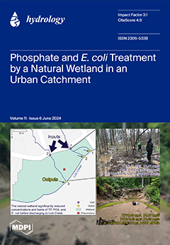
Inflow and outflow from a natural wetland receiving drainage from an urbanized catchment was evaluated over a two-year period for phosphate and E. coli concentrations and physicochemical analyses. The wetland reduced phosphate and E. coli loadings by 85% and 57%, respectively, and was most effective during the warmer growing season when evapotranspiration was greatest. Inflow infiltrated the wetland soil and concentrations of E. coli and phosphate sampled from multi-depth piezometers decreased with depth. While the wetland was providing ecosystem services, severe erosion near the wetland outlets may drain the wetland and lessen the nutrient and bacteria treatment efficiency. Efforts to slow runoff and stabilize the outlets are needed. View this paper
- Issues are regarded as officially published after their release is announced to the table of contents alert mailing list.
- You may sign up for e-mail alerts to receive table of contents of newly released issues.
- PDF is the official format for papers published in both, html and pdf forms. To view the papers in pdf format, click on the "PDF Full-text" link, and use the free Adobe Reader to open them.
Previous Issue
Next Issue