Next Issue
Volume 10, December
Previous Issue
Volume 10, October


Climate, Volume 10, Issue 11 (November 2022) – 26 articles

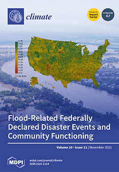
Cover Story (view full-size image): Understanding the effects of disasters of all kinds is key to enhancing both resistance to and recovery from significant events. Moreover, as disasters proliferate, we need improved ways of understanding the effects of multiple sequential events. Research and policy interventions have largely construed disasters as isolated events. Nevertheless, the experience of the last 15 years or so shows the precariousness of some locations, and the possibility of experiencing disastrous events again and again. Some places may, in fact, endure a kind of continuous disaster, never fully recovering or recovering only partially prior to the impact of another hazard, such as New Orleans, which narrowly escaped the effects of Hurricane Rita just a few weeks after Hurricane Katrina. View this paper
  • Issues are regarded as officially published after their release is announced to the table of contents alert mailing list.
  • You may sign up for e-mail alerts to receive table of contents of newly released issues.
  • PDF is the official format for papers published in both, html and pdf forms. To view the papers in pdf format, click on the "PDF Full-text" link, and use the free Adobe Reader to open them.
Order results
Result details
Section
Select all
Export citation of selected articles as:
15 pages, 5958 KiB  
Article
Temporal and Spatial Distribution of Lightning Activity over Bulgaria during the Period 2012–2021 Based on ATDnet Lightning Data
by Boryana Dimitrova Tsenova and Ilian Gospodinov
Climate 2022, 10(11), 184; https://doi.org/10.3390/cli10110184 - 21 Nov 2022
Cited by 2 | Viewed by 1810
Abstract
In the present study, lightning activity based on data from ATDnet over the territory of Bulgaria for the 10-year period between 2012 and 2021 is evaluated. This analysis shows the highest lightning activity with the greatest number of thunderstorm days in June. December [...] Read more.
In the present study, lightning activity based on data from ATDnet over the territory of Bulgaria for the 10-year period between 2012 and 2021 is evaluated. This analysis shows the highest lightning activity with the greatest number of thunderstorm days in June. December is the month with the lowest number of flashes and thunderstorm days. It was found that more than 30% of thunderstorm days annually are in the cold half of the year over the southern part of the considered domain. The average diurnal distribution showed a maximum of lightning activity between 12 and 15 UTC, while over some mountainous and sea regions it is between 03 and 06 UTC. The spatial distribution of flash density (fl km−2 y−1) reveals that the number of flashes and the number of thunderstorm days increase with altitude up to 1800 m and then decrease for higher altitudes. Full article
(This article belongs to the Special Issue Feature Papers for Section "Climate Dynamics and Modelling")
Show Figures

Figure 1

13 pages, 1382 KiB  
Review
Phosphorous Nanofertilizers for Precise Application in Rice Cultivation as an Adaptation to Climate Change
by Raquel Saraiva, Quirina Ferreira, Gonçalo C. Rodrigues and Margarida Oliveira
Climate 2022, 10(11), 183; https://doi.org/10.3390/cli10110183 - 20 Nov 2022
Cited by 4 | Viewed by 3553
Abstract
Rice is the staple food of more than half of the world’s population, which is still growing. The great dependence that agriculture, and rice specially, has on fertilizers alongside extreme events that result from climatic change creates an urge for adaptation. Fertilizers are [...] Read more.
Rice is the staple food of more than half of the world’s population, which is still growing. The great dependence that agriculture, and rice specially, has on fertilizers alongside extreme events that result from climatic change creates an urge for adaptation. Fertilizers are expensive, finite and a potential environmental problem. Their precise application, by the use of slow-release nanofertilizers, thus avoiding losses and consequently reducing the pressure on water resources, is one step forward in this adaptation. It can reduce costs and protect the environment while ensuring food production. Phosphorous is very important for rice, since it is involved in its flowering and root development, and its low availability to the plants constitutes a serious problem. The delivery of phosphorous through the crop cycle in the form of slow-release phosphorus nanofertilizer (Pnf) instead of the conventional annual bulk application reduces the amount of nutrients applied and increases the absorption by the crop. Combining the fertilizing effect with the use of natural stimulant compounds such as chitosan can protect the crop from diseases and increase its resilience to stress. The use of Pnf reduces the pressure on water resources and avoids imbalances in soil nutrients, thus responding to climatic change challenges and abiotic stresses. Full article
(This article belongs to the Special Issue Climate Change and Responses for Water and Environmental Security)
Show Figures

Figure 1

25 pages, 2977 KiB  
Article
A Proposed Approach towards Quantifying the Resilience of Water Systems to the Potential Climate Change in the Lali Region, Southwest Iran
by Nejat Zeydalinejad, Hamid Reza Nassery, Farshad Alijani, Alireza Shakiba and Babak Ghazi
Climate 2022, 10(11), 182; https://doi.org/10.3390/cli10110182 - 19 Nov 2022
Cited by 4 | Viewed by 1735
Abstract
Computing the resilience of water resources, especially groundwater, has hitherto presented difficulties. This study highlights the calculation of the resilience of water resources in the small-scale Lali region, southwest Iran, to potential climate change in the base (1961–1990) and future (2021–2050) time periods [...] Read more.
Computing the resilience of water resources, especially groundwater, has hitherto presented difficulties. This study highlights the calculation of the resilience of water resources in the small-scale Lali region, southwest Iran, to potential climate change in the base (1961–1990) and future (2021–2050) time periods under two Representative Concentration Pathways, i.e., RCP4.5 and RCP8.5. The Lali region is eminently suitable for comparing the resilience of alluvial groundwater (Pali aquifer), karst groundwater (Bibitarkhoun spring and the observation wells W1, W2 and W3) and surface water (Taraz-Harkesh stream). The log-normal distribution of the mean annual groundwater level and discharge rate of the water resources was initially calculated. Subsequently, different conditions from extremely dry to extremely wet were assigned to the different years for every water system. Finally, the resilience values of the water systems were quantified as a number between zero and one, such that they can be explicitly compared. The Pali alluvial aquifer demonstrated the maximum resilience, i.e., 1, to the future climate change. The Taraz-Harkesh stream, which is fed by the alluvial aquifer and the Bibitarkhoun karst spring, which is the largest spring of the Lali region, depicted average resilience of 0.79 and 0.59, respectively. Regarding the karstic observation wells, W1 being located in the recharge zone had the lowest resilience (i.e., 0.52), W3 being located in the discharge zone had the most resilience (i.e., 1) and W2 being located between W1 and W3 had an intermediate resilience (i.e., 0.60) to future climate change. Full article
Show Figures

Figure 1

16 pages, 4673 KiB  
Article
Assessing the Adaptive Capacity of Slum Households to Flooding in the Coastline of Portee and Rokupa, Freetown, Sierra Leone
by Bashiru Turay
Climate 2022, 10(11), 181; https://doi.org/10.3390/cli10110181 - 19 Nov 2022
Cited by 2 | Viewed by 2374
Abstract
Frequent flooding has been a significant problem in Freetown, causing loss of lives and properties. The situation is worse for coastal residents, who are more vulnerable and exposed to the impacts. The government has made commitments to strengthen resilience and adaptive capacity by [...] Read more.
Frequent flooding has been a significant problem in Freetown, causing loss of lives and properties. The situation is worse for coastal residents, who are more vulnerable and exposed to the impacts. The government has made commitments to strengthen resilience and adaptive capacity by 2030. However, there is currently insufficient information to comprehend the coastal residents of Portee and Rokupa’s capacity to adapt to the yearly flooding to which they are subjected. This study aims to assess the adaptive capacity of 204 slum households selected by purposive sampling and using the local adaptive capacity framework. The results show that the widespread adaptive concerns are unflood-proofed housing; low membership in community-based organizations; and the lack of innovative, flexible and forward-looking flood management initiatives. This study argues that the inhabitants have reached their adaptation limit and are now fated to more loss and damage. The author recommends future studies to forecast the assets in the study location that will potentially be affected by different flood intensities when subjected to future climate change scenarios. Full article
Show Figures

Figure 1

11 pages, 1899 KiB  
Article
Mitigation of Climate Change for Urban Agriculture: Water Management of Culinary Herbs Grown in an Extensive Green Roof Environment
by Stuart Alan Walters, Christina Gajewski, Amir Sadeghpour and John W. Groninger
Climate 2022, 10(11), 180; https://doi.org/10.3390/cli10110180 - 19 Nov 2022
Cited by 4 | Viewed by 1910
Abstract
Extensive green roofs provide space for local agriculture in dense urban environments. However, already extreme drought and heat conditions on green roofs are likely to worsen under future climates, challenging urban crop production and impeding food security. The potential productivity of annual and [...] Read more.
Extensive green roofs provide space for local agriculture in dense urban environments. However, already extreme drought and heat conditions on green roofs are likely to worsen under future climates, challenging urban crop production and impeding food security. The potential productivity of annual and perennial culinary herbs on an extensive green roof (~8 cm depth) with minimal, but consistent, water inputs was evaluated within a humid, subtropical climate (Southern Illinois University-Carbondale, Carbondale, IL, USA). Vigor, growth, and overwintering ability of four different perennial culinary herbs, namely garlic chives (Allium tuberosum), lavender (Lavandula angustifolia ‘Munstead Dwarf’), lemon balm (Melissa officinalis), and winter thyme (Thymus vulgaris ‘Winter Thyme’), as well as vigor and growth of annual ‘Italian large-leaf’ basil (Ocimum basilicum) were evaluated under twice-weekly, weekly, and fortnightly water applications of 1 L to each plant. All species of perennial herbs produced greater dry perennial biomass and overwintering potential under the two most frequent water applications. Similarly, with weekly water applications, basil proved highly suitable for production in an extensive green roof environment. Weekly watering was required to provide commercially viable plant growth, vigor, and overwinter survival for all perennial herbs. These results indicate that supplemental water is an important consideration for sustaining culinary herb production on extensive green roofs with the increasingly hot and dry conditions provided under the climate change scenarios projected for cities currently experiencing temperate climates. Full article
Show Figures

Figure 1

17 pages, 1556 KiB  
Review
Early Drought Stress Warning in Plants: Color Pictures of Photosystem II Photochemistry
by Michael Moustakas, Ilektra Sperdouli and Julietta Moustaka
Climate 2022, 10(11), 179; https://doi.org/10.3390/cli10110179 - 18 Nov 2022
Cited by 25 | Viewed by 3338
Abstract
Drought, the major limiting factor for plant growth and crop productivity, affecting several physiological and biochemical processes, is expected to increase in duration, intensity, and frequency as a consequence of climate change. Plants have developed several approaches to either avoid or tolerate water [...] Read more.
Drought, the major limiting factor for plant growth and crop productivity, affecting several physiological and biochemical processes, is expected to increase in duration, intensity, and frequency as a consequence of climate change. Plants have developed several approaches to either avoid or tolerate water deficit. Plants as a response to drought stress (DS), close stomata, reducing carbon dioxide (CO2) entry in the leaf, thus decreasing photosynthesis which results in reduced synthesis of essential organic molecules that sustain the life on earth. The reduced CO2 fixation, decreases electron transport rate (ETR), while the absorbed light energy overdoes what can be used for photochemistry resulting in excess reactive oxygen species (ROS) and oxidative stress. Current imaging techniques allow non-destructive monitoring of changes in the physiological state of plants under DS. Thermographic visualization, near-infrared imaging, and chlorophyll a fluorescence imaging are the most common verified imaging techniques for detecting stress-related changes in the display of light emission from plant leaves. Chlorophyll a fluorescence analysis, by use of the pulse amplitude modulation (PAM) method, can principally calculate the amount of absorbed light energy that is directed for photochemistry in photosystem II (PSII) (ΦPSII), dissipated as heat (ΦNPQ), or dissipated by the non-radiative fluorescence processes (ΦNO). The method of chlorophyll a fluorescence imaging analysis by providing colour pictures of the whole leaf PSII photochemistry, can successfully identify the early drought stress warning signals. Its implementation allowed visualization of the leaf spatial photosynthetic heterogeneity and discrimination between mild drought stress (MiDS), moderate drought stress (MoDS), and severe drought stress (SDS). The fraction of open reaction centers of PSII (qp) is suggested as the most sensitive and suitable indicator of an early drought stress warning and also for selecting drought tolerant cultivars. Full article
(This article belongs to the Special Issue Drought Early Warning)
Show Figures

Figure 1

15 pages, 9278 KiB  
Article
Climate Change and the Caribbean: Challenges and Vulnerabilities in Building Resilience to Tropical Cyclones
by Clint T. Lewis
Climate 2022, 10(11), 178; https://doi.org/10.3390/cli10110178 - 18 Nov 2022
Cited by 2 | Viewed by 3443
Abstract
Caribbean Small Island Developing States (SIDS) is one of the most vulnerable regions in the world to the impacts of climate change. The region has prioritized adaptation to climate change and has implemented many adaptation actions over the past 20 years. However, the [...] Read more.
Caribbean Small Island Developing States (SIDS) is one of the most vulnerable regions in the world to the impacts of climate change. The region has prioritized adaptation to climate change and has implemented many adaptation actions over the past 20 years. However, the region is becoming increasingly vulnerable to the impacts of tropical cyclones (TC). This paper analyses the impacts of TC on the region between 1980 to 2019. It aims to examine the economic loss and damage sustained by the region, identify the sectors most impacted, and ascertain the perspectives of key stakeholders on the factors that hinder building resilience. Statistical analysis techniques and semi-structured interviews were to unpack and understand the dataset. The paper finds that economic loss and damage has gradually increasing between 1980 to 2009 with a drastic increase between 2010 to 2019. The paper highlights the agriculture, housing, transport, and utility sectors as the most impacted. The findings also call to attention the need for increased access to adaptation financing for SIDS, the disadvantages of the income status that hinders building resilience, and the need for increased Early Warning Systems. The paper recommends revising the per capita national income as an eligibility criterion for accessing concessional development finance assistance, a comprehensive EWS for the countries in the region, and consideration of debt relief for countries affected by TC. Full article
Show Figures

Figure 1

24 pages, 6290 KiB  
Article
Comparative Analysis and Mitigation Strategy for the Urban Heat Island Intensity in Bari (Italy) and in Other Six European Cities
by Valentino Sangiorgio, Silvana Bruno and Francesco Fiorito
Climate 2022, 10(11), 177; https://doi.org/10.3390/cli10110177 - 17 Nov 2022
Cited by 3 | Viewed by 2641
Abstract
The presence of higher air temperatures in the city in comparison with the surrounding rural areas is an alarming phenomenon named the urban heat island (UHI). In the last decade, the scientific community demonstrated the severity of the phenomenon amplified by the combination [...] Read more.
The presence of higher air temperatures in the city in comparison with the surrounding rural areas is an alarming phenomenon named the urban heat island (UHI). In the last decade, the scientific community demonstrated the severity of the phenomenon amplified by the combination of heat waves. In southern Italy, the UHI is becoming increasingly serious due to the presence of a warming climate, extensive urbanization and an aging population. In order to extensively investigate such phenomenon in several cities, recent research calibrated quantitative indexes to forecast the maximum UHI intensity in urban districts by exploiting multicriteria approaches and open-source data. This paper proposes different mitigation strategy to mitigate the Urban Heat Island Intensity in Bari. Firstly, the research evaluates the absolute max UHI intensity of the 17 urban districts of Bari (a city in southern Italy, Puglia) by exploiting the recent index-based approach IUHII. Secondly, a comparative evaluation of seven European cities (Bari, Alicante, Madrid, Paris, Berlin, Milan and London) is achieved to point out the positives and negative aspects of the different urban districts. In total, the comparison required the analysis of 344 districts of 7 European cities: 17 districts in Bari (Italia); 9 districts in Alicante (Spain); 21 in Madrid (Spain); 80 in Paris (France); 96 in Berlin (Germany); 88 in Milan (Italy) and 33 in London (UK). Finally, the results emphasize some virtuous examples of UHII mitigation in the major European cities useful to draw inspiration for effective mitigation strategies suitable for the urban context of Bari. Full article
(This article belongs to the Special Issue Microclimate Variations and Urban Heat Island)
Show Figures

Figure 1

16 pages, 295 KiB  
Article
A Community Capitals Assessment of Climate Adaptations to Traditional Milpa Farming Practices in Mayan Communities of Southern Belize
by Kristin Drexler
Climate 2022, 10(11), 176; https://doi.org/10.3390/cli10110176 - 14 Nov 2022
Viewed by 1810
Abstract
Climate change has exacerbated food and livelihood insecurity for Mayan milpa farmers in Central America. For centuries, milpa farming has been sustainable for subsistence; however, in the last 50 years, milpas have become less reliable due to accelerating climate change, resource degradation, declining [...] Read more.
Climate change has exacerbated food and livelihood insecurity for Mayan milpa farmers in Central America. For centuries, milpa farming has been sustainable for subsistence; however, in the last 50 years, milpas have become less reliable due to accelerating climate change, resource degradation, declining markets, poverty, and other factors. Increasing climate-smart agriculture (CSA) practices may be needed. Using interviews with extension leaders and milpa farmers in Belize, this qualitative study examines the capacity for increasing CSA aspects of existing traditional milpa practices, specifically no-burn mulching, soil enrichment, and the use of cover plants. Applying a modified Community Capitals Framework, this study finds four key capitals were perceived by farmers and agriculture extension leaders as barriers for increasing CSA practices. Recommendations to reduce the key barriers include reinstating markets and crop-buying programs and easing border customs restrictions (Governance-Justice and Financial Capitals), improving roads and cellular access for farmers (Infrastructure Capital), and increasing budgets and resources for agriculture extension services and building farmer capacity for CSA practices of mulching, soil enrichment, and cover plants (Human-Capacity Capital). Reducing barriers to these key capitals can facilitate an increase in milpa CSA practices and crop productivity, promote food and livelihood security, and enable climate resilience of Mayan milpa communities in Belize. Full article
(This article belongs to the Collection Adaptation and Mitigation Practices and Frameworks)
20 pages, 620 KiB  
Article
Spatial and Climate Governance and Policy to Tackle the Challenges of the Anthropocene: A Critical Analysis Based on the Paradigmatic Tourism Destination of Mallorca (Spain)
by Luis A. Escudero-Gómez, Jesús M. González-Pérez and Rubén C. Lois-González
Climate 2022, 10(11), 175; https://doi.org/10.3390/cli10110175 - 14 Nov 2022
Viewed by 1736
Abstract
The Anthropocene era demands a future alternative to the current state of play. The aim of this study is to analyze spatial and climate governance and policy through a critical geographical study of the island of Mallorca (Spain), an example of the model [...] Read more.
The Anthropocene era demands a future alternative to the current state of play. The aim of this study is to analyze spatial and climate governance and policy through a critical geographical study of the island of Mallorca (Spain), an example of the model of urban development and tourism growth that has generated acute environmental impacts. Beginning with the European Union and Spain, the work then narrows its focus to the case study of Mallorca. The study is based on a review of the academic literature, statistical sources, and an analysis of the content of spatial and climate policy in Spain and the Balearic Islands. The work reflects on the flawed spatial planning responses to climate change and outlines strategies to adopt more radical measures for effective climate action. The work identifies six main shortcomings and makes proposals to tackle the challenges of the Anthropocene in Mallorca, responding to each of the deficiencies detected. The article seeks to encourage reflection and proposes key strategies for spatial governance and climate policy to lend coherence to the fight against climate change. Full article
(This article belongs to the Section Policy, Governance, and Social Equity)
Show Figures

Figure 1

23 pages, 3358 KiB  
Article
A Visual Analytics Pipeline for the Identification and Exploration of Extreme Weather Events from Social Media Data
by Lise Styve, Carlo Navarra, Julie Maria Petersen, Tina-Simone Neset and Katerina Vrotsou
Climate 2022, 10(11), 174; https://doi.org/10.3390/cli10110174 - 14 Nov 2022
Cited by 2 | Viewed by 2589
Abstract
Extreme weather events are expected to increase in frequency and intensity due to global warming. During disaster events, up-to-date relevant information is crucial for early detection and response. Recently, Twitter emerged as a potentially important source of volunteered geographic information of key value [...] Read more.
Extreme weather events are expected to increase in frequency and intensity due to global warming. During disaster events, up-to-date relevant information is crucial for early detection and response. Recently, Twitter emerged as a potentially important source of volunteered geographic information of key value for global monitoring systems and increasing situational awareness. While research on the use of machine learning approaches to automatically detect disaster events from social media is increasing, the visualization and exploration of the identified events and their contextual data are often neglected. In this paper, we address this gap by proposing a visual analytics pipeline for the identification and flexible exploration of extreme weather events, in particular floods, from Twitter data. The proposed pipeline consists of three main steps: (1) text classification, (2) location extraction, and (3) interactive visualization. We tested and assessed the performances of four classification algorithms for classifying relevant tweets as flood-related, applied an algorithm to assign location information, and introduced a visual interface for exploring their spatial, temporal, and attribute characteristics. To demonstrate our work, we present an example use case where two independent flooding events were identified and explored. The proposed approach has the potential to support real-time monitoring of events by providing data on local impacts collected from citizens and to facilitate the evaluation of extreme weather events to increase adaptive capacity. Full article
(This article belongs to the Special Issue Climate and Weather Extremes)
Show Figures

Figure 1

25 pages, 4897 KiB  
Article
Climate Change Effects upon Pasture in the Alps: The Case of Valtellina Valley, Italy
by Francesca Casale and Daniele Bocchiola
Climate 2022, 10(11), 173; https://doi.org/10.3390/cli10110173 - 07 Nov 2022
Cited by 6 | Viewed by 3263
Abstract
In this study, we assessed the potential effects of climate change upon the productivity of mountain pastures in the Valtellina valley of Italy. Two species, Trisetum flavescens and Nardus stricta, among the most abundant in Italian pastures, were chosen for the simulation [...] Read more.
In this study, we assessed the potential effects of climate change upon the productivity of mountain pastures in the Valtellina valley of Italy. Two species, Trisetum flavescens and Nardus stricta, among the most abundant in Italian pastures, were chosen for the simulation of low- and high-altitude pastures, respectively. We introduced some agroclimatic indices, related to growing season parameters, climate, and water availability, to evaluate the impacts of climate change upon pasture production. First, the dynamic of the pasture species was evaluated for the present period using the climate-driven, hydrologically based model Poli-Hydro, nesting the Poli-Pasture module simulating plants growth. Poli-Pasture was validated against yield data, at province scale, and at local scale. Then, agroclimatic indices were calculated. Subsequently, IPCC scenarios of the Fifth and Sixth Assessment Reports (AR5 and AR6) were used to project species production and agroclimatic indices until the end of the 21st century. In response to increased temperature under all scenarios, a large potential for an increased growing season length and species yield overall (between +30% and +180% for AR5 at 2100) was found. Potential for decreased yield (until −31% for AR5) is seen below 1100 m asl in response to heat stress; however, it is compensated by a large increase higher up (between +50% and +140% for AR5 above 2000 m asl). Larger evapotranspiration is foreseen and larger water demand expected. However, specific (for hectares of pasture) water use would decrease visibly, and no significant water limitations would be seen. Results provide preliminary evidence of potential livestock, and thereby economic development in the valley at higher altitudes than now. Full article
(This article belongs to the Special Issue Regional Special Issue: Climate Change in Italy)
Show Figures

Figure 1

38 pages, 2198 KiB  
Article
Exploring Gender and Climate Change Nexus, and Empowering Women in the South Western Coastal Region of Bangladesh for Adaptation and Mitigation
by Ashrafuzzaman Md, Carla Gomes, João Miguel Dias and Artemi Cerdà
Climate 2022, 10(11), 172; https://doi.org/10.3390/cli10110172 - 07 Nov 2022
Cited by 8 | Viewed by 7212
Abstract
This study has been conducted to identify vulnerabilities and effects of climate change on women in 12 unions in Shyamnagar upazila in the Satkhira district in the Southwestern Coastal Region of Bangladesh (SWCRB). Climate vulnerability and gender inequality may increase due to climate [...] Read more.
This study has been conducted to identify vulnerabilities and effects of climate change on women in 12 unions in Shyamnagar upazila in the Satkhira district in the Southwestern Coastal Region of Bangladesh (SWCRB). Climate vulnerability and gender inequality may increase due to climate change. Women may, thus, face specific conditions of vulnerability in society and daily livelihood. This paper focuses on investigating factors that influence women’s vulnerability from climate change, their adaptations, and the importance of women empowerment to reduce their inequality in SWCRB. This study also emphasizes gender inequality caused by climate change, and looks at accommodations for women to reduce hostile influences of climate change. From the 9 unions in SWCRB, a total of 320 household respondents were randomly selected to complete a questionnaire. The results of the statistical analysis showed that most of the survey’s perimeter has significant. Interviews, case studies, focus group discussions, workshops, and key informant interviews were also conducted from 12 unions, and it was found that climate change impacts men and women differently, with women being more vulnerable than men. Through case study this paper investigated the main factors influencing the vulnerability of women. In terms of empowerment women may also be well positioned to lead adaptation efforts alongside men, as this analysis represent that gender inequalities are leading by social norms. Women being more vulnerable both in short-term i.e., major natural disasters, cyclones, flood, and long-term i.e., sea level rise, salinity intrusion in water and soil, land erosion, droughts, climatic events, as they enhance gender inequalities. Further, gender inequality is seen in illiteracy, food shortages and poor health conditions, traditional norms, religious taboos, and patriarchy. Moreover, gender-based economic opportunities, women’s mobility, and income are changing, while household authority relations and gender-based socio-economic, cultural, and institutional constraints remain. This study examines the increased vulnerability of women in SWCRB to climate change, which can be mitigated through women empowerment; female involvement with environmentally friendly stoves, rural electrification and renewable energy development, microfinancing, and nakshikantha. (Nakshikantha is a special type of sewing art that is made by creating designs with different types of colored threads on plain stitches). Lastly, women may also lead adaptation efforts alongside men, make decisions, and promote their participation. Full article
(This article belongs to the Collection Adaptation and Mitigation Practices and Frameworks)
Show Figures

Figure 1

7 pages, 621 KiB  
Communication
Large-Scale Effects of Aridity on Leaf Nitrogen and Phosphorus Concentrations of Terrestrial Plants
by De-Juan Xie, Chun-Jing Wang and Ji-Zhong Wan
Climate 2022, 10(11), 171; https://doi.org/10.3390/cli10110171 - 07 Nov 2022
Cited by 1 | Viewed by 1440
Abstract
The leaf nitrogen (N) and phosphorus (P) concentrations of terrestrial plants make large contributions to ecosystem function and dynamics. The relationship between aridity and leaf N and P has been established through experimental studies. However, few studies have focused on the large-scale effects [...] Read more.
The leaf nitrogen (N) and phosphorus (P) concentrations of terrestrial plants make large contributions to ecosystem function and dynamics. The relationship between aridity and leaf N and P has been established through experimental studies. However, few studies have focused on the large-scale effects of aridity on the leaf N and P of terrestrial plants. In this paper, we used linear regression models to test the effects of aridity on terrestrial plant leaf N and P and the N:P ratio based on global datasets. We found that aridity had significant effects on the leaf N and P and the N:P ratio of terrestrial plants. The strongest relationships were between fern leaf P, the fern N:P ratio, tree leaf P, the tree N:P ratio, vine leaf N, and the tree N:P ratio. Aridity could be used to predict the P and N:P ratio of terrestrial plants, particularly those of ferns and trees, on large scales in arid environments. Our study contributes to maintaining ecosystem functioning and services in arid environments under climate change. Full article
(This article belongs to the Special Issue Impacts of Climate Change on Species and Ecosystems)
Show Figures

Figure 1

16 pages, 3511 KiB  
Article
Annual, Seasonal, and Monthly Rainfall Trend Analysis through Non-Parametric Tests in the Sebou River Basin (SRB), Northern Morocco
by Ridouane Kessabi, Mohamed Hanchane, Nir Y. Krakauer, Imane Aboubi, Jaafar El Kassioui and Bouchta El Khazzan
Climate 2022, 10(11), 170; https://doi.org/10.3390/cli10110170 - 05 Nov 2022
Cited by 3 | Viewed by 3431
Abstract
This paper explores the temporal and spatial patterns of annual, seasonal, and monthly rainfall series during the period of 1961–2018 at 15 stations in the agriculturally important Sebou river basin, northern Morocco. Trends were investigated using the classical non-parametric Mann–Kendall test and the [...] Read more.
This paper explores the temporal and spatial patterns of annual, seasonal, and monthly rainfall series during the period of 1961–2018 at 15 stations in the agriculturally important Sebou river basin, northern Morocco. Trends were investigated using the classical non-parametric Mann–Kendall test and the Theil–Sen approach at 90%, 95% and 99% confidence levels. A general decreasing trend was found at the annual scale, significant at the 95% confidence level at 8 stations out of 15 (53%). A particularly large decreasing trend between −30 mm and −50 mm per decade was found in the north and eastern parts of the basin. Autumn rainfall tended to increase, but this was not statistically significant. During the winter months, rainfall tended to decrease sharply (−27 mm and −40 mm per decade) in the northern slopes of the Rif mountains, while in spring, the mountainous area of the basin recorded decreases ranging between −12 mm and −16 mm per decade. During winter and spring, negative trends were significant at ten stations (66%). Summer rainfall tends toward a decrease, but the absolute change is small. These results help to understand the rainfall variability in the Sebou river basin and allow for improved mitigation strategies and water resource plans based on a prospective view of the impact of climate change on the river basin. Full article
(This article belongs to the Special Issue Drought Early Warning)
Show Figures

Figure 1

21 pages, 8084 KiB  
Article
Local Perspectives on Climate Change, Its Impact and Adaptation: A Case Study from the Westfjords Region of Iceland
by Deirdre Bannan, Rannveig Ólafsdóttir and Benjamin David Hennig
Climate 2022, 10(11), 169; https://doi.org/10.3390/cli10110169 - 04 Nov 2022
Cited by 6 | Viewed by 4695
Abstract
Climate change is one of the most pressing issues of our time. Rising temperatures, changing precipitation and more weather extremes pose risks to local societies worldwide. Yet, climate change is most often presented and reported on a global or national scale. This paper [...] Read more.
Climate change is one of the most pressing issues of our time. Rising temperatures, changing precipitation and more weather extremes pose risks to local societies worldwide. Yet, climate change is most often presented and reported on a global or national scale. This paper aims to analyze the key aspects of climate change on the local scale by assessing temporal and spatial changes in temperature and precipitation in the Westfjords in north-western Iceland and evaluate their impacts on the region’s livability. Existing temperature and precipitation data were used to model trends in climate change at an unprecedented resolution. The results show that the period of 2001–2020 was warmer than the 1961–1990 reference period in almost every month of every year, and that warming was more pronounced in the winter months. Furthermore, precipitation increased during 1991–2020 period compared to 1961–1990. These detected local patterns confirm some of the major predictions about climate change on the global scale. Considering the impact of climate change at the local level is critical, as it allows the community to envisage their future and provides better possibilities to mitigate, prepare for or adapt to the predicted changes. Full article
Show Figures

Figure 1

20 pages, 20966 KiB  
Article
A Comparative Study on the Performances of Spectral Nudging and Scale-Selective Data Assimilation Techniques for Hurricane Track and Intensity Simulations
by Xia Sun and Lian Xie
Climate 2022, 10(11), 168; https://doi.org/10.3390/cli10110168 - 03 Nov 2022
Viewed by 1810
Abstract
It is a common practice to use a buffer zone to damp out spurious wave growth due to computational error along the lateral boundary of limited-area weather and climate models. Although it is an effective technique to maintain model stability, an unintended side [...] Read more.
It is a common practice to use a buffer zone to damp out spurious wave growth due to computational error along the lateral boundary of limited-area weather and climate models. Although it is an effective technique to maintain model stability, an unintended side effect of using such buffer zones is the distortion of the data passing through the buffer zone. Various techniques are introduced to enhance the communication between the limited-area model’s inner domain and the outer domain, which provides lateral boundary values for the inner domain. Among them, scale-selective data assimilation (SSDA) and the spectral nudging (SPNU) techniques share similar philosophy, i.e., directly injecting the large-scale components of the atmospheric circulation from the outer model domain into the interior grids of the inner model domain by-passing the lateral boundary and the buffer zone, but the two methods are taking different implementation approaches. SSDA utilizes a 3-dimensional variational data assimilation procedure to accomplish the data injection objective, whereas SPNU uses a nudging process. In the present study, the two approaches are evaluated comparatively for simulating hurricane track and intensity in a pair of cases: Jeanne (2004) and Irma (2017) using the Weather Research and Forecasting (WRF) model. The results indicate that both techniques are effective in improving tropical cyclone intensity and track simulations by reducing the errors of the large-scale circulation in the inner model domain. The SSDA runs produced better simulations of temperature and humidity fields which are not directly nudged. The SSDA runs also produced more accurate storm intensities in both cases and more realistic structure in Hurricane Jeanne’s case than those produced by the SPNU runs. It should be noted, however, that extending these case study results to more general situations requires additional studies covering a large number of additional cases. Full article
(This article belongs to the Special Issue Feature Papers for Section "Climate Dynamics and Modelling")
Show Figures

Figure 1

19 pages, 8411 KiB  
Article
Analyzing Sensitive Aerosol Regimes and Active Geolocations of Aerosol Effects on Deep Convective Clouds over the Global Oceans by Using Long-Term Operational Satellite Observations
by Xuepeng Zhao and Michael J. Foster
Climate 2022, 10(11), 167; https://doi.org/10.3390/cli10110167 - 03 Nov 2022
Viewed by 2529
Abstract
Long-term satellite climate data records of aerosol and cloud along with meteorological reanalysis data have been used to study the aerosol effects on deep convective clouds (DCCs) over the global oceans from a climatology perspective. Our focus is on identifying sensitive aerosol regimes [...] Read more.
Long-term satellite climate data records of aerosol and cloud along with meteorological reanalysis data have been used to study the aerosol effects on deep convective clouds (DCCs) over the global oceans from a climatology perspective. Our focus is on identifying sensitive aerosol regimes and active geolocations of the aerosol effects on DCCs by using statistical analyses on long-term averaged aerosol and cloud variables. We found the aerosol effect tends to manifest relatively easily on the long-term mean values of observed cloud microphysical variables (e.g., cloud particle size and ice water amount) compared to observed cloud macrophysical variables (e.g., cloud cover and cloud top height). An increase of aerosol loading tends to increase DCC particle size and ice water amount in the tropical convergence zones but decrease them in the subtropical subsidence regions. The aerosol effect on the cloud microphysical variables is also likely to manifest over the northwestern Pacific Ocean and central and eastern subtropical Pacific Ocean. The aerosol effect manifested on the microphysical cloud variables may also propagate to cloud cover but weakly to cloud top height since the latter is more susceptible to the influence of cloud dynamical and thermodynamic processes. Our results, based on the long-term averaged operational satellite observation, are valuable for the evaluation and improvement of aerosol-cloud interactions in global climate models. Full article
(This article belongs to the Special Issue Climate Change Impacts at Various Geographical Scales)
Show Figures

Figure 1

19 pages, 2808 KiB  
Article
Energy System Transition in the Context of NDC and Mitigation Strategies in Tunisia
by Panagiotis Fragkos and Eleftheria Zisarou
Climate 2022, 10(11), 166; https://doi.org/10.3390/cli10110166 - 01 Nov 2022
Cited by 3 | Viewed by 2946
Abstract
The evolution of the Tunisian energy system in the next few decades will highly depend on the implementation of its Nationally Determined Contribution by 2030 and its potential long-term low-emission strategies. This study analyses the technology, emissions, energy systems and economic impacts of [...] Read more.
The evolution of the Tunisian energy system in the next few decades will highly depend on the implementation of its Nationally Determined Contribution by 2030 and its potential long-term low-emission strategies. This study analyses the technology, emissions, energy systems and economic impacts of meeting Tunisia’s NDC targets (conditional and unconditional) and long-term transition pathways compatible with the Paris Agreement. Different climate policy targets and settings are explored using a detailed energy system model (MENA-EDS) that integrates detailed representations of energy demand and supply and their complex linkages through energy pricing. The analysis shows that in order to meet its NDC targets for 2030, current climate policies in Tunisia need substantial strengthening, based on the massive uptake of renewable energy technologies (especially solar PV and wind) and a reduction of oil and gas use. Long-term low-emission transitions leading to emission reductions of about 80% from baseline levels in 2050 is based on the further expansion of renewable energy within and beyond the electricity sector; the increased electrification of energy end-uses (especially through the uptake of electric vehicles in transport); accelerated energy efficiency improvements in transport, industries and buildings; and the emergence of low-carbon fuels. The study provides insights into the challenges to achieve the deep decarbonization of the Tunisian economy but also into the opportunities from energy sector-restructuring, including reduced energy import dependence and increased low-carbon investment. Full article
Show Figures

Figure 1

25 pages, 4235 KiB  
Article
Analysis of Quadratic Correlation between Dryness Indices and Wine Grape Yield to Estimate Future Climate Impacts in Hungary
by László Lakatos and János Mika
Climate 2022, 10(11), 165; https://doi.org/10.3390/cli10110165 - 31 Oct 2022
Cited by 1 | Viewed by 1480
Abstract
In many regions, water availability influences grape yield fluctuations more than thermal conditions. This study analyzes dryness indices calculated from observed and simulated RCM data to establish statistical relationships with observed yield data, considered an indicator of food safety. Five dryness indices were [...] Read more.
In many regions, water availability influences grape yield fluctuations more than thermal conditions. This study analyzes dryness indices calculated from observed and simulated RCM data to establish statistical relationships with observed yield data, considered an indicator of food safety. Five dryness indices were analyzed: the number of days without rain, the maximum number of consecutive dry days, climatic water balance, dryness index, and vineyard water indicator. These indices were analyzed for three periods: 1986–2005 (recent past), 2016–2035 (near future) and 2081–2100 (distant future). After this analysis, quadratic regression connections were established between the indices and available wine grape yields in the 22 wine regions of Hungary for 2005–2021 without information on grape varieties and for 2017–2021 with data on grape varieties. Linear agro-technological trends were extracted from these wine grape yield series, whereas the residuals exhibited significant quadratic regression in slightly over 50% of the indices and regions, according to the F-test for the 17 year series. For the short series, these proportions are 29 and 27% for the selected seven white and seven red wine grapes. According to the most significant quadratic regressions, combined with the projected dryness indices, we can expect less average yields with higher interannual variability in the future. Full article
(This article belongs to the Special Issue Climate Change Impact on Food Safety)
Show Figures

Figure 1

21 pages, 1738 KiB  
Review
The Impacts of Urbanisation and Climate Change on the Urban Thermal Environment in Africa
by Xueqin Li, Lindsay C. Stringer and Martin Dallimer
Climate 2022, 10(11), 164; https://doi.org/10.3390/cli10110164 - 30 Oct 2022
Cited by 17 | Viewed by 18178
Abstract
Rapid urbanisation is affecting people in different ways, with some becoming more vulnerable to the impacts of climate change. Africa’s cities are projected to be home to nearly 60% of the continent’s population by 2050. In conjunction with climate change, these cities are [...] Read more.
Rapid urbanisation is affecting people in different ways, with some becoming more vulnerable to the impacts of climate change. Africa’s cities are projected to be home to nearly 60% of the continent’s population by 2050. In conjunction with climate change, these cities are experiencing critical environmental challenges, including changes in the urban thermal environment. Urban areas generally exhibit significantly higher air and surface temperatures than their surrounding rural areas, resulting in urban heat islands. However, little has been done to synthesise existing knowledge and identify the key research gaps in this area, particularly in Africa. This paper focuses on the combined effects of urbanisation and climate change on the urban thermal environment in Africa, and provides a comprehensive review of results, major advances and the dominant direction of research. Our review of 40 publications from peer-reviewed journals from 2000 to 2021 revealed that South Africa, Ethiopia and Nigeria were most frequently studied, and satellite imagery-based data and analysis were used predominantly. Results from a few studies have shown the practical implications for urban land-use planning, informal settlement management, human wellbeing and productivity, energy use, air pollution and disease spread. Integrated approaches, strengthening planning institutions, and early warning systems are proposed to address climate change. Low-income groups are emphasised in efforts to help people cope with heat stress. Solutions based on land use and land cover dynamics and blue–green infrastructure are mentioned but are in need of further research. Cities with similar patterns of urbanisation, geographies and climate conditions could benefit from multi-disciplinary research collaboration to address the combined impacts of rapid urbanisation and climate change. Full article
Show Figures

Figure 1

16 pages, 2022 KiB  
Article
Flames and Viruses: Australian and Hungarian Media Representation of the Australian Bushfires and the COVID-19 Pandemic, A Case Study
by Priszcilla Hafenscher and Ferenc Jankó
Climate 2022, 10(11), 163; https://doi.org/10.3390/cli10110163 - 27 Oct 2022
Viewed by 1740
Abstract
This study addresses the difference in media coverage of the Australian bushfires and the pandemic, using an Australian and a Hungarian news site. After a frame analysis of text and imagery, a narration analysis was conducted. Our results provided evidence that crises were [...] Read more.
This study addresses the difference in media coverage of the Australian bushfires and the pandemic, using an Australian and a Hungarian news site. After a frame analysis of text and imagery, a narration analysis was conducted. Our results provided evidence that crises were covered in different ways. For a distant news portal, it was an obvious option to use the bushfires in order to visualize climate change. In contrast, the bushfire–climate link has been a politicized subject in Australia for decades; hence, the exceptional bushfire season was also unable to get the issue on the agenda. Although the Australian news media in our sample strived to portray a crisis under control, when compared to the pandemic, it was not so effective. Therefore, localization is a major challenge for effective climate communication, where lessons from the pandemic, using more economic and social frames, could be helpful. Full article
Show Figures

Figure 1

15 pages, 2544 KiB  
Review
Flood Hazard and Management in Cambodia: A Review of Activities, Knowledge Gaps, and Research Direction
by Sophea Rom Phy, Ty Sok, Sophal Try, Ratboren Chan, Sovannara Uk, Chhordaneath Hen and Chantha Oeurng
Climate 2022, 10(11), 162; https://doi.org/10.3390/cli10110162 - 27 Oct 2022
Cited by 2 | Viewed by 8063
Abstract
Cambodia is located in one of the most severe flood-vulnerable zones in mainland Southeast Asia. Flooding is the country’s most recurrent and impactful hazard among other natural hazards. This hazard alone, observed in many river basins, has been inflicting huge damages on livelihoods, [...] Read more.
Cambodia is located in one of the most severe flood-vulnerable zones in mainland Southeast Asia. Flooding is the country’s most recurrent and impactful hazard among other natural hazards. This hazard alone, observed in many river basins, has been inflicting huge damages on livelihoods, social infrastructure, and the country’s economy. This study aims to review the current status of flood hazards, impacts, driving factors, management capacity, and future research directions on floods in Cambodia. The findings of this study suggested that there is still a lack of flood-related studies on flood hazard mapping, risk and damage assessment, and future flood analysis in Cambodia. The existing related studies mainly focused on the Tonle Sap Basin and its tributaries, the Lower Mekong Basin, the whole Mekong River Basin, and some of the tributaries of the Mekong River in Cambodia. The fundamental driving factors of the current flooding in Cambodia are impacts of climate change, land-use change, water infrastructure development, and weather extremes. The applications of mathematical and statistical tests and indices, conceptual and physically-based modeling, artificial intelligence and machine learning, and remote sensing are recommended to focus on future research directions on flood in Cambodia in the areas of land-use change, existing and planned operation of water infrastructure, flood hazard and damage assessment, and flood forecasting. The outcomes from these studies and applications would improve the understanding of flood hazard characteristics, reinforce flood management, and achieve flood damage reduction. Full article
(This article belongs to the Special Issue Flood and Drought Hazards under Extreme Climate)
Show Figures

Figure 1

12 pages, 4988 KiB  
Article
Using High-Resolution Climate Models to Identify Climate Change Hotspots in the Middle East: A Case Study of Iran
by Saeed Sotoudeheian, Ehsan Jalilvand and Amirhassan Kermanshah
Climate 2022, 10(11), 161; https://doi.org/10.3390/cli10110161 - 27 Oct 2022
Cited by 4 | Viewed by 2554
Abstract
The adverse effects of climate change will impact all regions around the world, especially Middle Eastern countries, which have prioritized economic growth over environmental protection. However, these impacts are not evenly distributed spatially, and some locations, namely climate change hotspots, will suffer more [...] Read more.
The adverse effects of climate change will impact all regions around the world, especially Middle Eastern countries, which have prioritized economic growth over environmental protection. However, these impacts are not evenly distributed spatially, and some locations, namely climate change hotspots, will suffer more from climate change consequences. In this study, we identified climate change hotspots over Iran—a developing country in the Middle East that is facing dire economic situations—in order to suggest pragmatic solutions for vulnerable regions. We used a statistical index as a representative of the differences in climatic parameters for the RCP8.5 and RCP4.5 forcing pathways between historical data (1975–2005), near-future data (2030–2060) and far-future data (2070–2100). More specifically, we used downscaled high-resolution (0.25°) meteorological data from five GCMs of the CMIP5 database to calculate the statistical metric. Results indicate that for the far-future period and RCP4.5, regions stretching from the northwest to southeast of Iran, namely the Hotspot Belt, are the most vulnerable areas, while, for RCP8.5, almost the whole country is vulnerable to climate change. The highest and lowest differences in temperature for RCP8.5 in 2070–2100 are observed during summer in the northwestern and central parts and during winter in the northern and northeastern parts. Moreover, the maximum increase and decrease in precipitation are identified over the western parts of Iran during fall and winter, respectively. Overall, western provinces (e.g., Lorestan and Kermanshah), which are mostly reliant on rainfed agriculture and other climate-dependent sectors, will face the highest change in climate in the future. As these regions have less adaptive capacity, they should be prioritized through upstream policy change and special budget allocation from the government to increase their resiliency against climate change. Full article
(This article belongs to the Section Climate Change and Urban Ecosystems)
Show Figures

Figure 1

22 pages, 4962 KiB  
Article
Numerical Simulation of Winter Precipitation over the Western Himalayas Using a Weather Research and Forecasting Model during 2001–2016
by Pravin Punde, Nischal, Raju Attada, Deepanshu Aggarwal and Chandrasekar Radhakrishnan
Climate 2022, 10(11), 160; https://doi.org/10.3390/cli10110160 - 25 Oct 2022
Cited by 2 | Viewed by 2137
Abstract
In the present study, dynamically downscaled Weather Research and Forecasting (WRF) model simulations of winter (DJF) seasonal precipitation were evaluated over the Western Himalayas (WH) at grey zone configurations (at horizontal resolutions of 15 km (D01) and 5 km (D [...] Read more.
In the present study, dynamically downscaled Weather Research and Forecasting (WRF) model simulations of winter (DJF) seasonal precipitation were evaluated over the Western Himalayas (WH) at grey zone configurations (at horizontal resolutions of 15 km (D01) and 5 km (D02)) and further validated using satellite-based (IMERG; 0.1°), observational (IMD; 0.25°), and reanalysis (ERA5; 0.25° and IMDAA; 0.108°) gridded datasets during 2001–2016. The findings demonstrate that both model resolutions (D01 and D02) are effective at representing precipitation characteristics over the Himalayan foothills. Precipitation features over the region, on the other hand, are much clearer and more detailed, with a significant improvement in D02, emphasizing the advantages of higher model grid resolution. Strong correlations and the lowest biases and root mean square errors indicate a closer agreement between model simulations and reanalyses IMDAA and ERA5. Vertical structures of various dynamical and thermodynamical features further confirm the improved and more realistic in WRF simulations with D02. Moreover, the seasonal patterns of upper tropospheric circulation, vertically integrated moisture transport, surface temperature and cloud cover show more realistic simulation in D02 compared to coarser domain D01. The categorical statistics reveal the efficiency of both D01 and D02 in simulating moderate and heavy precipitation events. Overall, our study emphasizes the significance of high-resolution data for simulating precipitation features specifically over complex terrains like WH. Full article
(This article belongs to the Special Issue Extreme Weather Detection, Attribution and Adaptation Design)
Show Figures

Figure 1

13 pages, 261 KiB  
Article
Flood-Related Federally Declared Disaster Events and Community Functioning (COPEWELL)
by Norma F. Kanarek, Qi Wang, Tak Igusa, Tara Kirk Sell, Zachary Anthony Cox, James M. Kendra and Jonathan Links
Climate 2022, 10(11), 159; https://doi.org/10.3390/cli10110159 - 23 Oct 2022
Cited by 1 | Viewed by 1578
Abstract
Objective: Understanding long-term disaster effects is key to building theories of recovery and informing policymaking. Findings regarding long-term recovery are inconsistent, with some scholars finding that disasters have little long-term impact, and others asserting otherwise. To assist in resolving this discord, we apply [...] Read more.
Objective: Understanding long-term disaster effects is key to building theories of recovery and informing policymaking. Findings regarding long-term recovery are inconsistent, with some scholars finding that disasters have little long-term impact, and others asserting otherwise. To assist in resolving this discord, we apply a conceptual framework and computational model of community resilience (“COPEWELL”) that places community functioning (CF) at the center of evaluating the effects of disaster over time. Using flooding as a disaster type, we hypothesize a change in baseline CF trend when a flood-related federally declared disaster event occurs. Methods: We used county-level flood-related federally declared disaster events (2010–2014) and selected population demographics to study their effects on annual CF trends among United States counties (N = 3141). Results: In multivariate analysis of baseline CF, we found a significant negative relationship of prior five-year flood status, federal regions relative to the Northeast (Region I), lower total earnings, and greater population size. Annual CF trend was 0.09% (95%CI: 0.01%–0.16%). In multivariate analysis, significant predictors included baseline CF (β = −0.0178, −0.0047–−0.0309), any concurrent flood-related federally declared disaster events (−0.0024, −0.0040–−0.0008), ten-year prior flood events (−0.0017, −0.0034–−0.0000) and concurrent population change (−0.0186, −0.0338–−0.0035). Conclusions: Recent floods depress baseline CF, while concurrent and ten-year-ago floods depress trend in CF. Resilience may potentially be modified by raising baseline CF and maintaining population over time. Full article
(This article belongs to the Special Issue Natural Disasters and Extreme Hazards under Changing Climate)
Previous Issue
Next Issue
Back to TopTop