Skip to Content
You are currently on the new version of our website. Access the old version .

ISPRS International Journal of Geo-Information, Volume 8, Issue 4

2019 April - 40 articles

Cover Story: 
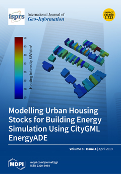
Microsimulation has been shown to be a powerful technique for modelling a building’s energy demands, and provides a platform to test strategies for reducing a building’s energy use. Despite this, spatially-explicit building energy microsimulation (i.e., where groups of buildings are modelled as urban scenes in their true geographic context) has remained challenging due to its detailed data requirements and high computational demands. Using off-the-shelf geospatial and energy survey data, we describe creating urban scenes as CityGML EnergyADE models, conduct geometric testing to simplify building shapes to reduce processing times, and report on the simulation results and trade-offs when using these models and techniques. View this paper.
  • Issues are regarded as officially published after their release is announced to the table of contents alert mailing list .
  • You may sign up for email alerts to receive table of contents of newly released issues.
  • PDF is the official format for papers published in both, html and pdf forms. To view the papers in pdf format, click on the "PDF Full-text" link, and use the free Adobe Reader to open them.

Articles (40)

  • Article
  • Open Access
11 Citations
4,682 Views
23 Pages

Topographic features impact biomass and other agriculturally relevant observables. However, conventional tools for processing digital elevation model (DEM) data in geographic information systems have severe limitations. Typically, 3-by-3 window sizes...

  • Article
  • Open Access
9 Citations
4,676 Views
14 Pages

Automatic Detection of Potential Dam Locations in Digital Terrain Models

  • Michael H. Wimmer,
  • Norbert Pfeifer and
  • Markus Hollaus

Structural measures for retaining and distributing water—i.e., reservoirs, flood retention and power plants—play a key role to protect and feed a growing world population in a rapidly changing climate. In this work, we introduce an automa...

  • Article
  • Open Access
53 Citations
8,054 Views
18 Pages

Mapping with Stakeholders: An Overview of Public Participatory GIS and VGI in Transport Decision-Making

  • Nadia Giuffrida,
  • Michela Le Pira,
  • Giuseppe Inturri and
  • Matteo Ignaccolo

Transport decision-making problems are typically spatially based and involve a set of feasible alternatives with multiple evaluation criteria. Besides, transport decisions affect citizens’ quality of life, as well as specific interests of gener...

  • Article
  • Open Access
11 Citations
6,204 Views
11 Pages

In a point set in dimension superior to 1, the statistical distribution of the number of pairs of points as a function of distance between the points of the pair is not uniform. This distribution is not considered in a large number of classic methods...

  • Creative
  • Open Access
3 Citations
4,469 Views
21 Pages

Dynamic Wildfire Navigation System

  • Mitsuhiro Ozaki,
  • Jagannath Aryal and
  • Paul Fox-Hughes

Wildfire, a natural part of many ecosystems, has also resulted in significant disasters impacting ecology and human life in Australia. This study proposes a prototype of fire propagation prediction as an extension of preceding research; this system i...

  • Article
  • Open Access
21 Citations
6,838 Views
20 Pages

This article aims at testing the possibilities of applying hierarchical spatial autoregressive models to create land value maps in urbanized areas. The use of HSAR (Hierarchical Spatial Autoregressive) models for spatial differentiation of prices in...

  • Article
  • Open Access
30 Citations
5,706 Views
17 Pages

So-called prismatic 3D building models, following the level-of-detail (LOD) 1 of the OGC City Geography Markup Language (CityGML) standard, are usually generated automatically by combining building footprints with height values. Typically, high-resol...

  • Article
  • Open Access
6 Citations
4,285 Views
26 Pages

Individualized Tour Route Plan Algorithm Based on Tourist Sight Spatial Interest Field

  • Xiao Zhou,
  • Yinhu Zhan,
  • Guanghui Feng,
  • De Zhang and
  • Shaomei Li

Smart tourism is the new frontier field of the tourism research. To solve current problems of smart tourism and tourism geographic information system (GIS), individualized tour guide route plan algorithm based on tourist sight spatial interest field...

  • Article
  • Open Access
92 Citations
9,126 Views
16 Pages

Recent technical developments made it possible to supply large-scale satellite image coverage. This poses the challenge of efficient discovery of imagery. One very important task in applications like urban planning and reconstruction is to automatica...

  • Article
  • Open Access
140 Citations
11,633 Views
16 Pages

The study investigates land use/cover classification and change detection of urban areas from very high resolution (VHR) remote sensing images using deep learning-based methods. Firstly, we introduce a fully Atrous convolutional neural network (FACNN...

  • Article
  • Open Access
4 Citations
3,991 Views
17 Pages

With the recent rapid development of cities, the dynamics of urban road-traffic commuting are becoming more and more complex. In this research, we study urban road-traffic commuting dynamics based on clustering analysis and a new proposed urban commu...

  • Article
  • Open Access
20 Citations
7,855 Views
23 Pages

Single photon sensitive airborne Light Detection And Ranging (LiDAR) enables a higher area performance at the price of an increased outlier rate and a lower ranging accuracy compared to conventional Multi-Photon LiDAR. Single Photon LiDAR, in particu...

  • Article
  • Open Access
66 Citations
7,877 Views
16 Pages

Social media has been applied to all natural disaster risk-reduction phases, including pre-warning, response, and recovery. However, using it to accurately acquire and reveal public sentiment during a disaster still presents a significant challenge....

  • Article
  • Open Access
5 Citations
4,169 Views
11 Pages

Public transit services should favor space equity, and the concern of this study is how the allocation of public transportation resources corresponds to the needs of transit users. Identifying mismatches between urban transit resources and regular tr...

  • Article
  • Open Access
45 Citations
6,643 Views
18 Pages

Transport System Models and Big Data: Zoning and Graph Building with Traditional Surveys, FCD and GIS

  • Antonello Ignazio Croce,
  • Giuseppe Musolino,
  • Corrado Rindone and
  • Antonino Vitetta

The paper deals with the integration of data provided from traditional transport surveys (small data) with big data, provided from Information and Communication Technology (ICT), in building Transport System Models (TSMs). Big data are used to observ...

  • Article
  • Open Access
7 Citations
5,019 Views
25 Pages

Multi-Constrained Optimization Method of Line Segment Extraction Based on Multi-Scale Image Space

  • Yiyuan Sun,
  • Qiang Wang,
  • Kevin Tansey,
  • Sana Ullah,
  • Fan Liu,
  • Haimeng Zhao and
  • Lei Yan

Image-based line segment extraction plays an important role in a wide range of applications. Traditional line segment extraction algorithms focus on the accuracy and efficiency, without considering the integrity. Serious line segmentation fracture pr...

  • Article
  • Open Access
105 Citations
14,878 Views
24 Pages

Geographic Knowledge Graph (GeoKG): A Formalized Geographic Knowledge Representation

  • Shu Wang,
  • Xueying Zhang,
  • Peng Ye,
  • Mi Du,
  • Yanxu Lu and
  • Haonan Xue

Formalized knowledge representation is the foundation of Big Data computing, mining and visualization. Current knowledge representations regard information as items linked to relevant objects or concepts by tree or graph structures. However, geograph...

  • Article
  • Open Access
9 Citations
4,150 Views
27 Pages

With the rapid development of the economy, urgent needs for 3-D Geographical Information System (GIS) have sprung up in many application fields. The precise expression of three-dimensional topological relations is the foundation of spatial analysis,...

  • Article
  • Open Access
63 Citations
9,508 Views
25 Pages

Delineating the cropping area of cocoa agroforests is a major challenge in quantifying the contribution of land use expansion to tropical deforestation. Discriminating cocoa agroforests from tropical transition forests using multispectral optical ima...

  • Article
  • Open Access
7 Citations
4,388 Views
11 Pages

Digital elevation model (DEM) resolution is closely related to the degree of expression of real terrain, the extraction of terrain parameters, and the uncertainty of statistical models. Therefore, based on DEMs with various resolutions, this paper ex...

  • Article
  • Open Access
33 Citations
5,046 Views
14 Pages

Marine oil spills seriously impact the marine environment and transportation. When oil spill accidents occur, oil spill distribution information, in particular, the relative thickness of the oil film, is vital for emergency decision-making and cleani...

  • Article
  • Open Access
6 Citations
4,441 Views
22 Pages

Registration of Multi-Sensor Bathymetric Point Clouds in Rural Areas Using Point-to-Grid Distances

  • Richard Boerner,
  • Yusheng Xu,
  • Ramona Baran,
  • Frank Steinbacher,
  • Ludwig Hoegner and
  • Uwe Stilla

This article proposes a method for registration of two different point clouds with different point densities and noise recorded by airborne sensors in rural areas. In particular, multi-sensor point clouds with different point densities are considered...

  • Article
  • Open Access
91 Citations
10,219 Views
27 Pages

The importance of the distribution of accommodation businesses over a certain area has grown remarkably, especially if such distribution is mapped using tools and techniques that utilize the territory as a variable in the analysis. The purpose of thi...

  • Article
  • Open Access
7 Citations
6,035 Views
15 Pages

Distance-Decay Effect in Probabilistic Time Geography for Random Encounter

  • Zhang-Cai Yin,
  • Zhang-Hao-Nan Jin,
  • Shen Ying,
  • Hui Liu,
  • San-Juan Li and
  • Jia-Qiang Xiao

Probabilistic time geography uses a fixed distance threshold for the definition of the encounter events of moving objects. However, because of the distance-decay effect, different distances within the fixed threshold ensure that the encounter events...

  • Article
  • Open Access
85 Citations
13,496 Views
28 Pages

Highway Alignment Optimization: An Integrated BIM and GIS Approach

  • Linlin Zhao,
  • Zhansheng Liu and
  • Jasper Mbachu

Highway infrastructure plays an important role in assuring the proper function of the nation’s transportation. Highway alignment is an essential part of the highway planning and design phase, which has significant effects on the surroundings. I...

  • Article
  • Open Access
21 Citations
9,928 Views
18 Pages

The design of a natural gas pipeline route is a very important stage in Natural Gas Transmission Pipeline projects. It is a very complicated process requiring many different criteria for various areas to be evaluated simultaneously. These criteria in...

  • Article
  • Open Access
79 Citations
9,147 Views
18 Pages

A Comparative Assessment of Geostatistical, Machine Learning, and Hybrid Approaches for Mapping Topsoil Organic Carbon Content

  • Lin Chen,
  • Chunying Ren,
  • Lin Li,
  • Yeqiao Wang,
  • Bai Zhang,
  • Zongming Wang and
  • Linfeng Li

Accurate digital soil mapping (DSM) of soil organic carbon (SOC) is still a challenging subject because of its spatial variability and dependency. This study is aimed at comparing six typical methods in three types of DSM techniques for SOC mapping i...

  • Article
  • Open Access
27 Citations
9,079 Views
22 Pages

In this study, different in-situ and close-range sensing surveying techniques were compared based on the spatial differences of the resultant datasets. In this context, the DJI Phantom 3 Advanced and Trimble UX5 Unmanned Aerial Vehicle (UAV) platform...

  • Article
  • Open Access
74 Citations
10,722 Views
15 Pages

The design and optimization of urban form has always been a hot topic in urban planning and development research. Besides, the creation of continuous vitality in urban areas is of critical importance in the development of urbanization. However, due t...

  • Article
  • Open Access
7 Citations
4,240 Views
16 Pages

A Methodology for Heterogeneous Sensor Data Organization and Near Real-Time Data Sharing by Adopting OGC SWE Standards

  • Bartolomeo Ventura,
  • Andrea Vianello,
  • Daniel Frisinghelli,
  • Mattia Rossi,
  • Roberto Monsorno and
  • Armin Costa

Finding a solution to collect, analyze, and share, in near real-time, data acquired by heterogeneous sensors, such as traffic, air pollution, soil moisture, or weather data, represents a great challenge. This paper describes the solution developed at...

  • Article
  • Open Access
9 Citations
7,938 Views
17 Pages

Since populations in the developing world have been rapidly increasing, accurately determining the population distribution is becoming more critical for many countries. One of the most widely used population density estimation methods is dasymetric m...

  • Article
  • Open Access
29 Citations
4,764 Views
18 Pages

Building groups with special patterns are common layouts in urban settlement areas, which should be carefully generalized. Typification is considered as an appropriate operator to generalize building groups with grid patterns. As an important operato...

  • Article
  • Open Access
28 Citations
6,146 Views
22 Pages

Mobility Data Warehouses

  • Alejandro Vaisman and
  • Esteban Zimányi

The interest in mobility data analysis has grown dramatically with the wide availability of devices that track the position of moving objects. Mobility analysis can be applied, for example, to analyze traffic flows. To support mobility analysis, traj...

  • Article
  • Open Access
8 Citations
7,235 Views
18 Pages

The last decade has witnessed a wide spread of small drones in many civil and military applications. With the massive advancement in the manufacture of small and lightweight Inertial Navigation System (INS), navigation in challenging environments bec...

  • Article
  • Open Access
17 Citations
3,829 Views
21 Pages

Multi-criterial analysis under the current use of digital geographic data is a quite common method used to evaluate the influence of the geographic environment on a planned or ongoing activity. The advantage of this method is a possibility of complex...

  • Article
  • Open Access
1 Citations
4,280 Views
11 Pages

Depression (pit or sink) filling is a key preprocessing step for the automatic hydrologic analysis of surface topography. The Planchon and Darboux (P&D) algorithm is a widely used depression filling algorithm. In this study, we propose an improve...

  • Article
  • Open Access
37 Citations
5,937 Views
21 Pages

Modelling Urban Housing Stocks for Building Energy Simulation Using CityGML EnergyADE

  • Julian F. Rosser,
  • Gavin Long,
  • Sameh Zakhary,
  • Doreen S. Boyd,
  • Yong Mao and
  • Darren Robinson

Understanding the energy demand of a city’s housing stock is an important focus for local and national administrations to identify strategies for reducing carbon emissions. Building energy simulation offers a promising approach to understand en...

  • Article
  • Open Access
3 Citations
6,296 Views
10 Pages

Map projections are one of the foundations of geographic information science and cartography. An understanding of the different projection variants and properties is critical when creating maps or carrying out geospatial analyses. The common way of t...

  • Article
  • Open Access
69 Citations
5,724 Views
14 Pages

Spectral characteristics play an important role in the classification of oil film, but the presence of too many bands can lead to information redundancy and reduced classification accuracy. In this study, a classification model that combines spectral...

  • Article
  • Open Access
15 Citations
7,623 Views
29 Pages

Ground-truth datasets are essential for the training and evaluation of any automated algorithm. As such, gold-standard annotated corpora underlie most advances in natural language processing (NLP). However, only a few relatively small (geo-)annotated...

Get Alerted

Add your email address to receive forthcoming issues of this journal.

XFacebookLinkedIn
ISPRS Int. J. Geo-Inf. - ISSN 2220-9964