Skip Content
You are currently on the new version of our website. Access the old version .

ISPRS International Journal of Geo-Information, Volume 13, Issue 4

2024 April - 35 articles

Cover Story: 
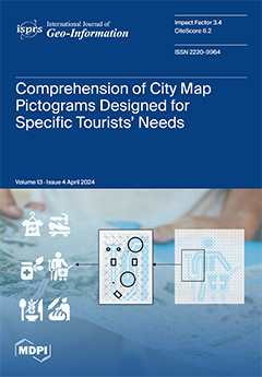
This study investigated the effectiveness of new point-of-interest pictograms on tourist maps to enhance the tourist experience in urban settings for individuals with specific needs, such as particular dietary, health, and clothing preferences. Six new pictogram designs showing healthcare, food, and apparel were assessed through a questionnaire involving 138 participants of diverse nationalities, ages, and educational backgrounds. The results revealed insights into the subtle cultural and lifestyle influences on pictogram perception. The findings provide a basis for considering the potential of the new pictogram designs in improving navigational experiences with geospatial information and encouraging sustainable tourist behaviors. View this paper
  • Issues are regarded as officially published after their release is announced to the table of contents alert mailing list .
  • You may sign up for email alerts to receive table of contents of newly released issues.
  • PDF is the official format for papers published in both, html and pdf forms. To view the papers in pdf format, click on the "PDF Full-text" link, and use the free Adobe Reader to open them.

Articles (35)

  • Article
  • Open Access
3 Citations
3,334 Views
18 Pages

AED Inequity among Social Groups in Guangzhou

  • Feng Gao,
  • Siyi Lu,
  • Shunyi Liao,
  • Wangyang Chen,
  • Xin Chen,
  • Jiemin Wu,
  • Yunjing Wu,
  • Guanyao Li and
  • Xu Han

Automated external defibrillators (AEDs) are regarded as the most important public facility after fire extinguishers due to their importance to out-of-hospital cardiac arrest (OHCA) victims. Previous studies focused on the location optimization of th...

  • Article
  • Open Access
4 Citations
3,616 Views
22 Pages

Tourist flows, crucial information within online travelogues, reveal the interactive relationships between different tourist destinations and serve as the nerve center and link of the tourism system. This study takes Hangzhou, China, as a case to inv...

  • Article
  • Open Access
2 Citations
2,304 Views
15 Pages

A Novel Address-Matching Framework Based on Region Proposal

  • Yizhuo Quan,
  • Yuanfei Chang,
  • Linlin Liang,
  • Yanyou Qiao and
  • Chengbo Wang

Geocoding is a fundamental component of geographic information science that plays a crucial role in various geographical studies and applications involving text data. Current mainstream geocoding methods fall into two categories: geodesic-grid predic...

  • Article
  • Open Access
3 Citations
2,473 Views
16 Pages

Analyses of urban hierarchy and scale distribution are crucial in urban research, as they examine the laws of urban development and the functional layout of urban spatial systems. However, previous studies have focused on the macro-spatial distributi...

  • Article
  • Open Access
5 Citations
3,486 Views
16 Pages

Comprehension of City Map Pictograms Designed for Specific Tourists’ Needs

  • Dorotea Kovačević,
  • Maja Brozović and
  • Klementina Možina

This study investigated the effectiveness of new point-of-interest (POI) pictograms on tourist maps within the Croatian and Slovenian contexts, focusing on enhancing the tourist experience in urban settings for individuals with specific needs. Despit...

  • Article
  • Open Access
4 Citations
2,980 Views
20 Pages

Geocoding converts unstructured geographic text into structured spatial data, which is crucial in fields such as urban planning, social media spatial analysis, and emergency response systems. Existing approaches predominantly model geocoding as a geo...

  • Article
  • Open Access
4 Citations
2,238 Views
23 Pages

Chongming Island and its surrounding areas are highly significant coastal regions in China. However, the regions undergo continuous changes owing to various factors, such as the sedimentation from the Yangtze River, human activities, and tidal moveme...

  • Article
  • Open Access
14 Citations
3,829 Views
18 Pages

Historical news media reports serve as a vital data source for understanding the risk of urban ground collapse (UGC) events. At present, the application of large language models (LLMs) offers unprecedented opportunities to effectively extract UGC eve...

  • Article
  • Open Access
5 Citations
2,393 Views
17 Pages

Evaluating the Impact of Human Activities on Vegetation Restoration in Mining Areas Based on the GTWR

  • Li Guo,
  • Jun Li,
  • Chengye Zhang,
  • Yaling Xu,
  • Jianghe Xing and
  • Jingyu Hu

The clarification of the impact of human activities on vegetation in mining areas contributes to the harmonization of mining and environmental protection. This study utilized Geographically and Temporally Weighted Regression (GTWR) to establish a qua...

  • Article
  • Open Access
5 Citations
3,713 Views
27 Pages

Promoting walking is crucial for sustainable development and fosters individual health and well-being. Therefore, comprehensive investigations of factors that make walking attractive are vital. Previous research has linked streetscapes at eye-level t...

  • Article
  • Open Access
2,572 Views
24 Pages

Multi-Criteria Framework for Routing on Access Land: A Case Study on Dartmoor National Park

  • Rafael Felipe Sprent,
  • James Haworth,
  • Stefano Cavazzi and
  • Ilya Ilyankou

Creating routes across open areas is challenging due to the absence of a defined routing network and the complexity of the environment, in which multiple criteria may affect route choice. In the context of urban environments, research has found Visib...

  • Article
  • Open Access
5 Citations
3,008 Views
25 Pages

In the current field of regional studies, there is a growing focus on regional spatial relationships from the perspective of functional linkages between cities. Inter-city population movement serves as an embodiment of the integrated functionality of...

  • Article
  • Open Access
4 Citations
2,494 Views
16 Pages

Search Engine for Open Geospatial Consortium Web Services Improving Discoverability through Natural Language Processing-Based Processing and Ranking

  • Elia Ferrari,
  • Friedrich Striewski,
  • Fiona Tiefenbacher,
  • Pia Bereuter,
  • David Oesch and
  • Pasquale Di Donato

The improvement of search engines for geospatial data on the World Wide Web has been a subject of research, particularly concerning the challenges in discovering and utilizing geospatial web services. Despite the establishment of standards by the Ope...

  • Article
  • Open Access
22 Citations
9,958 Views
21 Pages

In late 2023, the image-reading capability added to a Generative Pre-trained Transformer (GPT) framework provided the opportunity to potentially revolutionize the way we view and understand geographic maps, the core component of cartography, geograph...

  • Article
  • Open Access
1 Citations
3,490 Views
16 Pages

Dementia has become a profound public health problem due to the number of patients increasing every year. Previous studies have reported that environmental factors, including greenness, may influence the development and progression of dementia. Studi...

  • Article
  • Open Access
13 Citations
2,982 Views
24 Pages

Deep Learning (DL) has become a popular method for Remote Sensing (RS) Change Detection (CD) due to its superior performance compared to traditional methods. However, generating extensive labeled datasets for DL models is time-consuming and labor-int...

  • Article
  • Open Access
5 Citations
3,367 Views
20 Pages

Shoho Castle Maps are maps of castle towns throughout Japan drawn by Kano School painters on the order of the shogun in 1644. The Shoho Castle Map of Takada, Joetsu City, Niigata Prefecture was used to visualize local distortions in historical maps a...

  • Article
  • Open Access
4 Citations
2,689 Views
23 Pages

The severity and frequency of extremes are changing; thus, it is becoming necessary to evaluate the impacts of land cover changes and urbanisation along with climate change. A framework of the Generalised Extreme Value (GEV) method, Google Earth Engi...

  • Article
  • Open Access
10 Citations
4,178 Views
25 Pages

Balancing Flood Control and Economic Development in Flood Detention Areas of the Yangtze River Basin

  • Siyuan Liao,
  • Chao Wang,
  • Renke Ji,
  • Xiang Zhang,
  • Zhifei Wang,
  • Wei Wang and
  • Nengcheng Chen

Serving as a crucial part of the Yangtze River Basin (YRB)’s flood control system, Flood Detention Areas (FDAs) are vital in mitigating large-scale floods. Urbanization has led to the development of urban FDAs, but significant losses could ensu...

  • Article
  • Open Access
6 Citations
6,317 Views
38 Pages

Mapping the CityGML Energy ADE to CityGML 3.0 Using a Model-Driven Approach

  • Carolin Bachert,
  • Camilo León-Sánchez,
  • Tatjana Kutzner and
  • Giorgio Agugiaro

With the increasing adoption of semantic 3D city models, the relevance of applications in the field of Urban Building Energy Modelling (UBEM) has rapidly grown, as the building sector accounts for a large part of the total energy consumption. UBEM al...

  • Article
  • Open Access
17 Citations
6,022 Views
27 Pages

Studying driving factors of the urban heat island phenomenon is vital for enhancing urban ecological environments. Urban functional zones (UFZs), key for planning and management, have a substantial impact on the urban thermal environment through thei...

  • Article
  • Open Access
4 Citations
2,736 Views
15 Pages

The primary objective of this study is to assess how the motion of dynamic point symbols impacts preattentive processing on a map. Specifically, it involves identifying the motion velocity parameters for cartographic animated pictorial symbols that c...

  • Article
  • Open Access
9 Citations
4,129 Views
20 Pages

Low-Cost Data, High-Quality Models: A Semi-Automated Approach to LOD3 Creation

  • Harshit,
  • Pallavi Chaurasia,
  • Sisi Zlatanova and
  • Kamal Jain

In the dynamic realm of digital twin modeling, where advancements are swiftly unfolding, users now possess the unprecedented ability to capture and generate geospatial data in real time. This article delves into a critical exploration of this landsca...

  • Article
  • Open Access
9 Citations
4,520 Views
18 Pages

Notwithstanding the overall improvement in the ecological condition of the Qilian Mountains, there are localized occurrences of grassland degradation, desertification, and salinization. Moreover, timely and accurate acquisition of desertification inf...

  • Article
  • Open Access
2 Citations
2,635 Views
21 Pages

Accurately measuring industrial spatial agglomeration patterns is crucial for promoting regional economic development. However, few studies have considered both agglomeration degrees and cluster locations of industries. Moreover, the traditional mult...

  • Article
  • Open Access
3 Citations
4,666 Views
23 Pages

Understanding visitors’ spatial choice behavior is important in developing effective policies to counteract overcrowdedness in attractive urban heritage areas. This research presents a comprehensive analysis of visitor location choice behavior,...

  • Article
  • Open Access
4 Citations
4,146 Views
15 Pages

Mapping Street Patterns with Network Science and Supervised Machine Learning

  • Cai Wu,
  • Yanwen Wang,
  • Jiong Wang,
  • Menno-Jan Kraak and
  • Mingshu Wang

This study introduces a machine learning-based framework for mapping street patterns in urban morphology, offering an objective, scalable approach that transcends traditional methodologies. Focusing on six diverse cities, the research employed superv...

  • Article
  • Open Access
1 Citations
2,865 Views
11 Pages

In previous papers that have dealt with cylindrical map projections as limiting cases of conical projections, standard or equidistant parallels were used in the derivations. This paper shows that this is not necessary and that it is sufficient to use...

  • Article
  • Open Access
5 Citations
2,942 Views
18 Pages

The COVID-19 outbreak followed by the strict citywide lockdown in Shanghai has sparked negative emotion surges on social media platforms in 2022. This research aims to investigate the spatial–temporal heterogeneity of a unique emotion (helpless...

  • Article
  • Open Access
3 Citations
4,113 Views
15 Pages

Spatial Analysis of Exposure of Roads to Flooding and Its Implications for Mobility in Urban/Peri-Urban Accra

  • Gerald Albert Baeribameng Yiran,
  • Martin Oteng Ababio,
  • Albert Nii Moe Allotey,
  • Richard Yao Kofie and
  • Lasse Møller-Jensen

Climate change seriously threatens human systems, properties and livelihoods. Global projections suggest a continuous increase in the frequency and severity of weather events, with severe outcomes. Although the trends and impacts are highly variable...

  • Review
  • Open Access
12 Citations
7,400 Views
23 Pages

The halfway point for the implementation of the United Nations Sustainable Development Goals (SDGs) was marked in 2023, as set forth in the 2030 Agenda. Geospatial technologies have proven indispensable in assessing and tracking fundamental component...

  • Article
  • Open Access
1 Citations
2,815 Views
20 Pages

Spatio-Temporal Evolution Characteristics and Influencing Factors of INGO Activities in Myanmar

  • Sicong Liu,
  • Yinbao Zhang,
  • Jianzhong Liu,
  • Xinjia Zhang and
  • Xiaoshuang Huang

Myanmar is among the regions with the most frequent activities of International Non-Government Organizations (INGOs). Analyzing the spatio-temporal patterns of these activities holds crucial importance for optimizing organizational coordination and e...

  • Article
  • Open Access
8 Citations
3,160 Views
25 Pages

Dockless bike-sharing (DBS) is a green and flexible travel mode, which has been considered as an effective way to address the first-and-last mile problem. A two-level process is developed to identify the integrated DBS–metro trips. Then, DBS tr...

  • Article
  • Open Access
7 Citations
4,645 Views
29 Pages

Natural hazards can present a significant risk to road infrastructure. This infrastructure is a fundamental component of the transportation infrastructure, with significant importance. During emergencies, society heavily relies on the functionality o...

  • Article
  • Open Access
8 Citations
3,920 Views
20 Pages

Recent advances in knowledge graphs show great promise to link various data together to provide a semantic network. Place is an important part in the big picture of the knowledge graph since it serves as a powerful glue to link any data to its georef...

Get Alerted

Add your email address to receive forthcoming issues of this journal.

XFacebookLinkedIn
ISPRS Int. J. Geo-Inf. - ISSN 2220-9964