


Abstract
Despite abundant scholarship on religious architecture and urban history, a systematic city-wide analysis that treats the parish system as a territorially relevant infrastructure for planning remains uncommon. This article examines Barcelona’s network of 132 Catholic parish churches as a cartographic layer for interpreting distributed centralities and their relationships with public space. The study is grounded in an exhaustive inventory based on on-site visits and archival consultation, and on a standardised redrawing protocol (Sitte and Nolli conventions) developed from municipal cartography and architectural plans. Synthesis maps and fabric-specific drawings document spatial patterns that vary across phases of urban growth, as well as recurrent typologies of relationships between churches, squares, and urban axes. Across the corpus, at least 25 churches are associated with squares and can be grouped into four recurrent arrangements (12 with a single frontal square; 4 with concatenated lateral squares; 3 surrounded by open space; and 6 with squares severed by through-traffic infrastructure). District plates further reveal contrasting typological distributions between Ciutat Vella (n = 16), Eixample (n = 19), Gràcia (n = 11), and Nou Barris (n = 14). The findings show that Barcelona’s Catholic parish cartography constitutes a key interpretative layer for understanding the city’s complexity, including its social and urban transformations, neighbourhood-level mechanisms of resilience, and the interaction between religious networks, urban form, and civic culture. The resulting cartographic protocol is reproducible and transferable to studies of urbanisation and regional development, offering an operational framework for planning debates on the governance of public space, heritage conservation, and urban sustainability.
1. Introduction
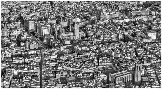
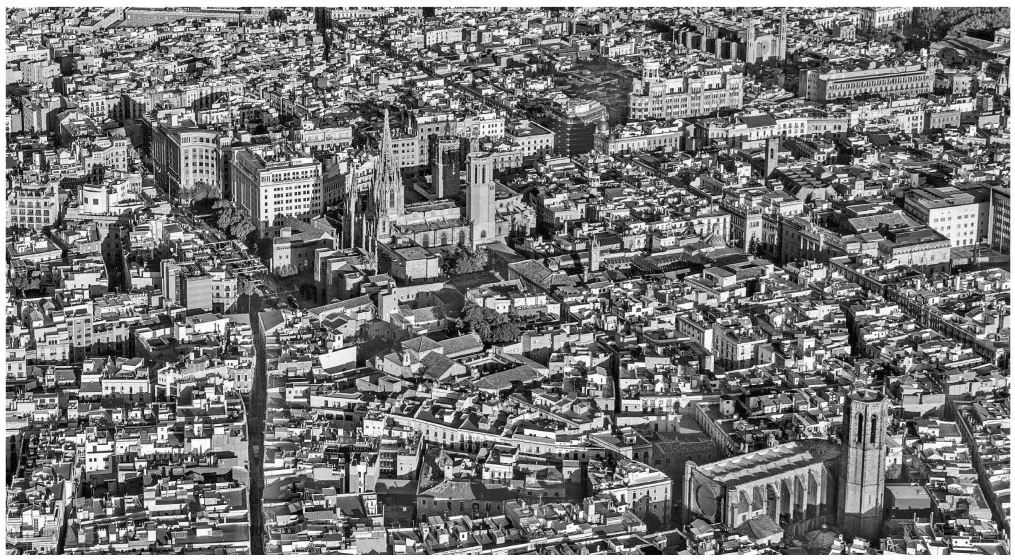
Barcelona’s Catholic parish churches form a dense, long-established territorial system that is woven into the city’s everyday geography, yet is rarely read as a single, city-scale structure. Beyond their religious function, parish churches have historically operated as stable points of orientation, meeting, and neighbourhood recognition, often shaping (and being shaped by) adjacent squares, street widenings, and pedestrian routes. Taken together, their distribution offers a distinctive lens through which to interpret how Barcelona has expanded, absorbed former municipalities, and produced local centres across very different urban fabrics. This article approaches the network of 132 parish churches as an urban layer that makes distributed centralities legible and allows the relationship between singular buildings and the public realm to be analysed consistently, from the compact medieval core to the planned grid of the Eixample and the larger residential fragments of the twentieth century (Figure 1).
Figure 1.
Aerial view of Ciutat Vella showing the churches of Santa Maria del Mar and Santa Maria del Pi, and the cathedral. Author: © Pere Vivas.
1.1. State of the Art
Research on the city–religion nexus has stressed the importance of locating religion in space and analysing its architectural, urban, territorial, and broadly material dimensions. Knott argues for understanding religion as a situated phenomenon that produces space, while Tweed conceptualises religions as systems that both traverse and inhabit, articulating movement and dwelling simultaneously [1,2]. In parallel, classic authors such as Camillo Sitte and Aldo Rossi describe churches as singular buildings that stand out within the ordinary fabric of the city [3,4]. Bringing these approaches together, the parish complex can be interpreted as a singular glocal node: territorially rooted and oriented towards local community life, yet integrated into a wider network connecting to the diocese and to the universal Church. It can also be read as a set of urban singularities contributing to the city’s image and collective memory, while functioning as an extension of public space [5]. More recent debates on proximity-based planning—particularly the ‘15-min city’—have renewed attention to neighbourhood-scale accessibility, distributed facilities, and the role of local anchors in supporting everyday life [6,7,8,9]. Relatedly, the notion of ‘social infrastructure’ has highlighted how durable, accessible places (including churches) can contribute to civic resilience and social cohesion [10]. Yet, despite extensive scholarship on religious architecture and urban history, the parish network is rarely analysed as a complete spatial system capable of revealing patterns of urban centrality and the city’s morphological formation.
A further value of parish mapping for urban history lies in its ability to connect analytical scales. At the micro scale, the parish church is associated with everyday practices, thresholds, and recognisable public places. At the macro scale, the territorial distribution of parishes expresses how institutional organisation adjusts to demographic growth and the incorporation of new urban fragments. Reading these scales together helps avoid treating churches as isolated monuments and instead situates them within the long-term production of urbanity [11,12]. In this sense, churches can be understood as architectural pieces that stitch together different levels of urban organisation [13].
This article proposes a morphological reading of Barcelona through its parish cartography. Specifically, it addresses two recurring limitations in prior work: the tendency to focus on individual buildings or small samples, and the lack of a consistent, city-wide redrawing protocol that enables systematic comparison across fabrics. The combined representation of the 132 Catholic parishes located within the current municipal boundaries reveals a territorial framework aligned with the city’s main phases of growth. The parish network is therefore not addressed here as an institutional phenomenon, but as a spatial structure that, when superimposed on the city plan, makes formal stratification legible. The article offers a cartographic and morphological, explicitly urban reading of the complete parish system, avoiding sample-based approaches or isolated case studies.
1.2. Theoretical Framework
Barcelona is often described as the outcome of successive processes of urban sedimentation: the compact medieval city, the planned expansion of the Eixample, the annexation of pre-existing municipalities, and the peripheral growth driven by mid-twentieth-century developmentalism [14,15,16]. This morphological reading emphasises continuity within transformation. Parish cartography provides an additional analytical layer that can help verify and refine these interpretations.
Here, the parish is understood as more than an ecclesiastical administrative unit. Historically, across Western Catholic territories, including Spain and Catalonia, it has operated as a territorial device and as a framework for everyday sociability, linking local communities to vertical institutional structures [17,18]. Rather than disappearing with modernity, religion often reconfigures itself within public life and social structures [19].
From the standpoint of urban theory, the city can be understood as a system of permanences that traverses historical change. The territorial distribution of parishes makes this persistence visible: density in the historic core, regularity in the Eixample, local centrality in annexed municipalities, and strategic implantation in twentieth-century residential estates. This continuity suggests that the parish framework is not merely overlaid on the city, but participates in its formal configuration.
If the contemporary city is built through the aggregation of fragments and the superposition of systems [12,20], the parish network can be read as one such continuous system within fragmentation. Its representation does not simply confirm existing readings of Barcelona’s growth; it provides an operational analytical framework for describing territorial continuities and relationships with public space.
1.3. Objectives and Hypotheses
The primary objective of this article is to demonstrate that the cartography of Barcelona’s Catholic parish network—considered as a complete corpus of 132 parishes within the municipal boundaries—constitutes a reproducible analytical layer for describing the city’s long-term morphological formation and its distributed centralities.
As a secondary objective, the study systematises and compares the main typologies of relationships between parish church and public space observable in the drawings (presence or absence of open space, continuities and discontinuities, and fit within the urban grid), emphasising their variation across the represented fabrics (medieval city, Eixample, annexed municipalities that originated as independent towns, and twentieth-century peripheries).
In line with these objectives, two working hypotheses are proposed: (a) there is a close correspondence between the territorial distribution of parishes and the stages of urban expansion; and (b) the intensity and quality of the church–public-space relationship depend on the configuration of adjacent voids (the existence of a square or open space and its degree of pedestrian continuity).
This study continues research initiated in the doctoral thesis of one of the authors [21] and developed through subsequent publications addressing churches and public space in Barcelona [22,23,24].
2. Material and Methods
The methodology is essentially cartographic: each foundation is located chronologically at its spatial coordinates and examined in relation to the urban fabric existing at the time of its creation. This procedure enables correspondences to be identified between demographic growth, physical expansion, and territorial reorganisation.
The contribution of this study is therefore empirical and cartographic. By mapping and comparing the full set of 132 parish churches, the article argues that parish cartography constitutes a productive analytical layer for reading Barcelona’s long-term morphological formation and its distributed centralities.
2.1. Corpus and Scope
The corpus comprises the 132 Catholic parish churches located within Barcelona’s current municipal boundaries, including foundational churches, churches incorporated from former conventual complexes, and cases that have disappeared, been replaced by new squares, or been repurposed, provided that at least the architectural element of the church is preserved.
2.2. Documentation: Church Files, Site Visits, and Archives
A file was produced for each church, combining plans, urban location, and historical information on past and present conditions. The corpus was built through systematic on-site visits to all 132 locations, complemented by searches across a wide range of archives and catalogues (diocesan, municipal, historical, photographic, architectural, and parish sources, among others). The cross-checking of plans, maps, and historical images constitutes the documentary basis of the research.
When discrepancies emerged between municipal cartography, archival plans, and present-day conditions observed during site visits, they were recorded in the church file and resolved through a simple hierarchy of evidence: (i) direct on-site observation and photographic documentation; (ii) architectural plans when available and attributable; and (iii) municipal base cartography as the common spatial reference. Cases that could not be unambiguously resolved were flagged and treated cautiously in comparative interpretation.
2.3. Redrawing and Graphic Protocols: Sitte and Nolli as Analytical Tools
A central methodological operation is the redrawing of the urban settings around each church using consistent graphic conventions, so that the whole can be compared across time and between different fabrics. The study adopts Camillo Sitte’s representational approach to emphasise the void of the square and the façades that delimit it, representing the church as a dark mass with a clear orientation marker. In parallel, the same settings are redrawn using a Nolli-type logic, incorporating church interiors into the network of public space. This dual protocol supports comparative readings of open space, thresholds, and the relationship between sacred interiors and the surrounding public realm. The software used was AutoCAD and Photoshop (AutoCAD 2016 20.1; Photoshop CC 2017).
To support consistency of visual interpretation and replication, redrawing followed a shared template (scale, symbol set, line weights, and annotation rules) applied to all cases. Because the drawings were produced as vector graphics, their quality was preserved at any scale, from the territorial overview down to the detailed reading of each individual case.
2.4. Analytical Strategy: Deductive Questions and Inductive Comparisons
The approach is both deductive and inductive. A shared set of questions structures the analysis (phases of growth; density and spacing; presence or absence of open space; and centrality patterns), while the selection of representative examples and the discussion of comparative readings are grounded in inductive comparison across the corpus. This strategy is intended to make the method transferable to other cities and to other kinds of singular buildings that structure urban fragments.
Operationally, the analytical variables derived from the drawings include (i) parish density and spacing; (ii) orientation patterns; (iii) the presence/absence and type of adjacent void (street alignment, widening/forecourt, square/open space, or block interior); and (iv) continuity or discontinuity of pedestrian access where open space is intersected by through-traffic infrastructure.
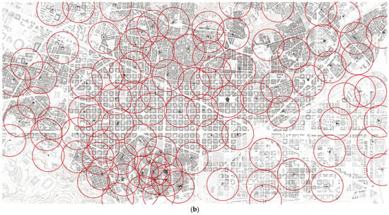
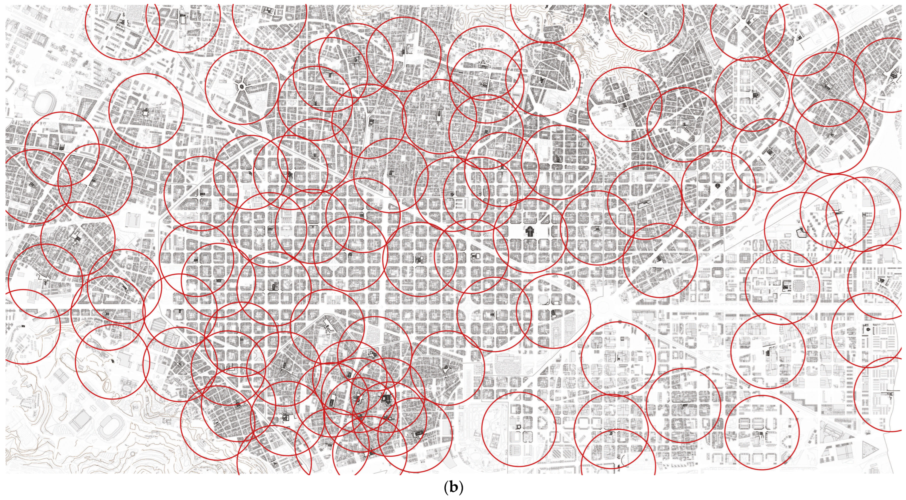
To connect the morphological reading with proximity-based planning debates, we added a 15 min walking catchment proxy for each parish church. Catchments are represented as radial buffers centred on each parish location and are intended as a first-order approximation of walkable reach rather than network-based isochrones. Network-derived walking times can be queried point-by-point in tools such as CarerCities (built on city data layers), and may be used to validate selected cases in future work.
2.5. Exclusion Criteria
Given the city-scale scope defined in this study, the analysis is limited to Catholic parish churches and does not address places of worship of other religions. The article focuses on morphological relationships and urban legibility and does not seek to exhaust sociological or devotional dimensions, which would require different research designs.
3. Results
Results are presented graphically—all drawings are original and produced by the article’s authors—and descriptively. Ciutat Vella, Eixample, Gràcia, and Nou Barris are drawn at the same scale to support direct comparison between districts. The four districts were selected because they represent four distinct phases and fabrics of Barcelona’s urban formation (medieval core, planned grid, annexed town, and twentieth-century residential estates).
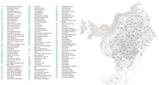
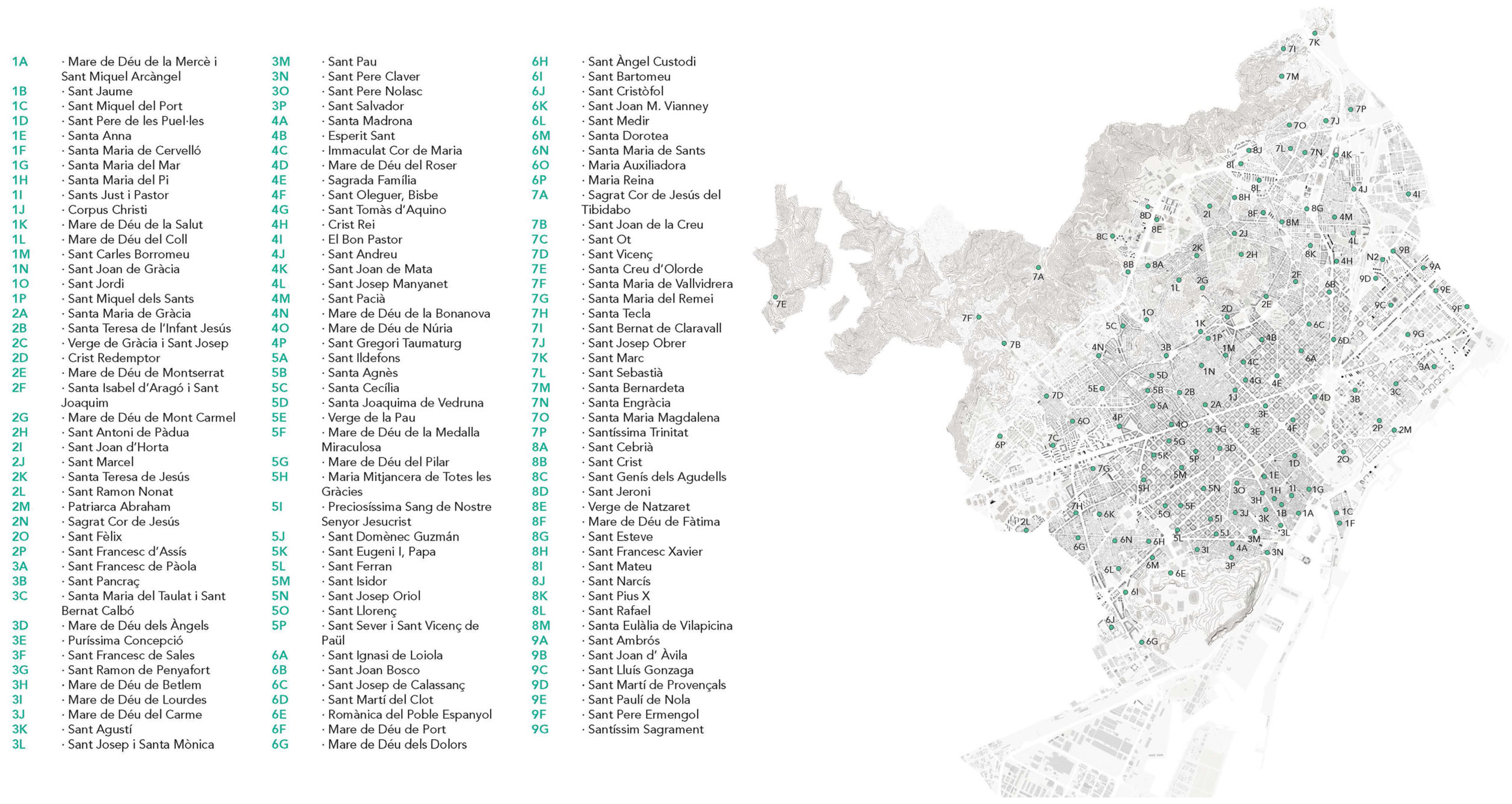
First, the article presents the list of the 132 Catholic parish churches located within Barcelona’s municipal boundaries. These parishes are then mapped by spatial coordinates, enabling their distribution to be observed at the city scale and relative concentrations and voids to be identified in relation to the continuity of urban fabric (Figure 2).
Figure 2.
Plan of Barcelona showing the location and name of all parish churches. Author: Alba Arboix-Alió.
The set of 132 points is distributed relatively evenly across Barcelona’s 10 districts and 73 neighbourhoods, which supports reading the parish network as a complete urban layer rather than as a collection of isolated cases. This initial map establishes the analytical framework at three complementary scales: the municipal scale, enabling comparison of densities and spacing; the neighbourhood scale, where churches can be related to specific urban fabrics and public-space conditions; and a territorial-coverage reading, useful for understanding how the network accompanies different stages of urban formation.
During the research period, Santa Maria de Cervelló (1F in the alphanumeric coding), in the Barceloneta neighbourhood, ceased to be a parish church. It is nevertheless retained in the corpus for three reasons: it is a relevant example of a church ‘camouflaged’ within the fine grain of the neighbourhood; it establishes a distinctive relationship with public space, given the absence of an associated square; and it continues to form part of the city’s contemporary parish image. Social services linked to Càritas (Caritas) remain in use, whereas regular liturgical activity has been discontinued, in a context of proximity to other parishes and of demographic and functional change in the area.
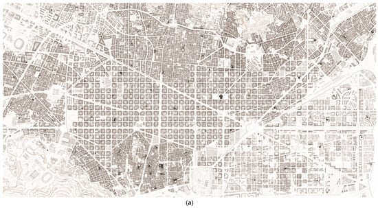
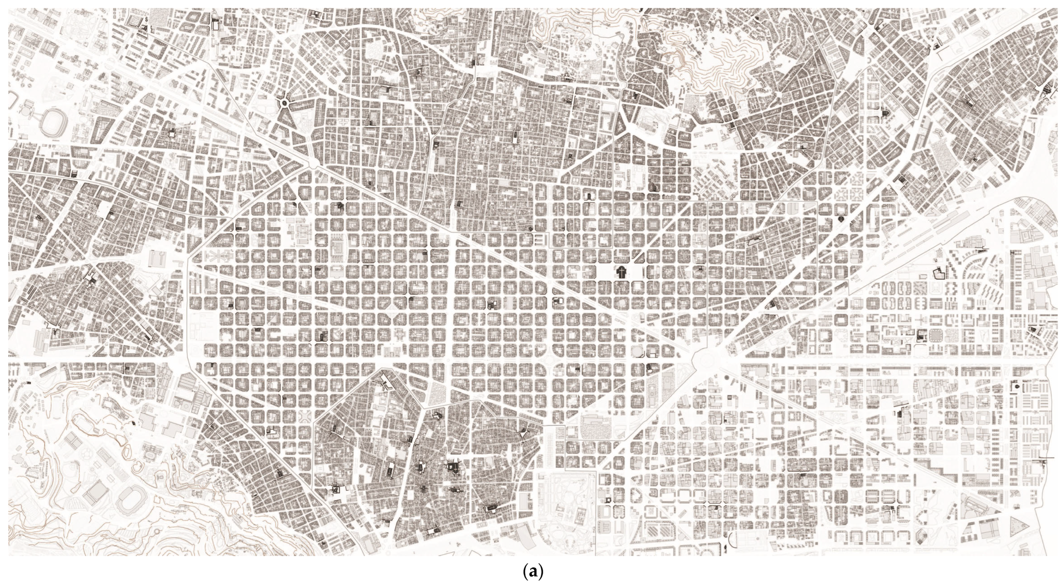
Representing parish churches together with their immediate urban surroundings allows the presence of adjacent voids, widenings, and urban rooms to be compared consistently. It also makes orientation legible: the graphic convention of the Latin cross is used not only to highlight the building within the fabric, but also to visualise the entrance–apse axis (Figure 3).
Figure 3.
Plan of Barcelona highlighting parish churches and their surrounding urban space ((a), above), and a 15 min walking catchment proxy centred on each parish church (radial buffers; (b), below). Author: Alba Arboix-Alió.
The 15 min catchment overlay (Figure 3b) supports reading the parish network as a capillary structure of proximity: overlap is denser in the historic core and across the Eixample, whereas peripheral fabrics show larger gaps and fewer overlaps. Read together with the district plates, this proxy makes visible where distributed centralities are reinforced by continuity of the public realm and where proximity is potentially weakened by fragmentation.
The black masses representing churches appear more intensively in the city centre, where churches adopt multiple orientations consistent with an irregular historical fabric. By contrast, within the Eixample grid, orientation is constrained by the geometry of the layout, and churches tend to align with the limited set of directions permitted by the reticular structure. At the periphery, their presence is likewise continuous and legible, tracing municipal limits and indicating an implantation driven by logics of territorial coverage.
This combined representation of church and immediate setting also makes visible the diversity of church–public-space relationships. Extreme conditions can be identified, from cases surrounded by open space on multiple sides—concatenations of squares and small plazas—to churches with no spatial ‘relief’, embedded within ordinary plots where the street itself constitutes the only public frontage. Between these extremes, intermediate configurations recur (minimal forecourt/atrium, punctual widening, defined square), which are described systematically by district below.
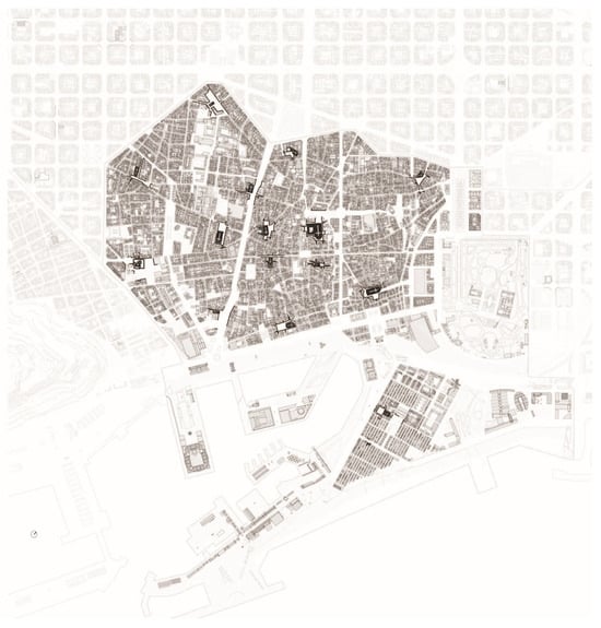
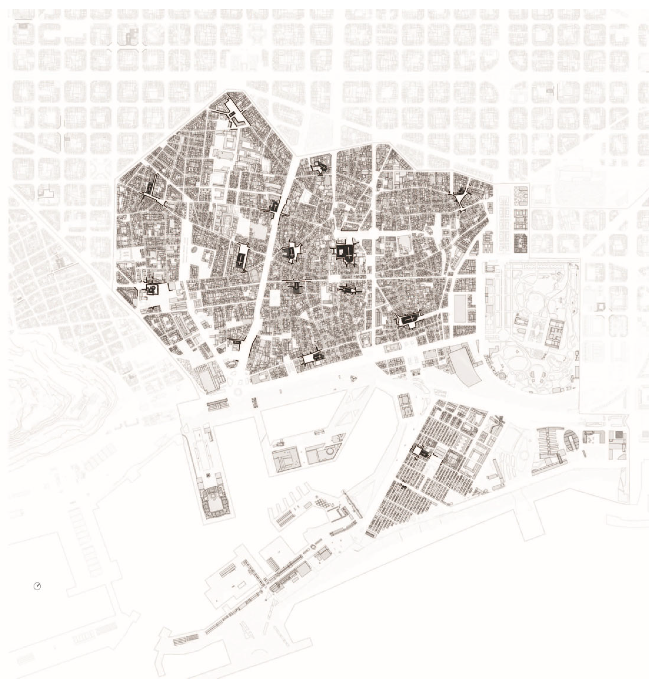
In the fabric of the Ciutat Vella district, proximity between parish nodes becomes evident, as does the frequency of small-scale voids, most of which correspond to former parish cemeteries or spaces previously occupied by conventual dependencies that have since disappeared, within a compact street pattern (Figure 4).
Figure 4.
Plan of Ciutat Vella highlighting parish churches and their surrounding urban space. Author: Alba Arboix-Alió.
In Ciutat Vella (4,368,000 m2), comprising the neighbourhoods of Barceloneta, the Gothic Quarter, El Raval, and Sant Pere, Santa Caterina i la Ribera, 16 Catholic parish churches are observed. Figure 4 highlights the proximity between parish nodes and the frequent presence of small-scale voids and complex settings, consistent with a compact and stratified fabric. During the research period, Santa Maria de Cervelló (1F) ceased to be a parish church; however, it is retained in the corpus for the reasons stated above (camouflaged condition, distinctive public-space relationship, and continued presence within the city’s parish imaginary).
Regarding the church–public-space relationship, the 16 churches distribute across four typologies: 2 are aligned to the street with no frontal open space; 3 present a street widening that generates a minimal forecourt/atrium; 10 are associated with one or more squares; and 1 is concealed within a block interior. This typological spread reinforces the value of comparative redrawing for relating situations that conventional cartographies often render difficult to compare.
Within the historic centre, parish concentration reflects the logic of a compact city structured by short distances. Medieval parishes—often established before the surrounding urban nuclei—were inscribed within an irregular fabric of narrow streets and small squares, where physical proximity was a condition of territorial organisation. The density of churches aligns with the period of maximum historical compactness.
The drawings that highlight churches and their surrounding urban space enable fabrics as different as Ciutat Vella, the Eixample, Gràcia, and Nou Barris to be compared under a shared graphic criterion, with the aim of defining a representative typology. This comparison relates parish location to street morphology, the presence of voids, and the continuity or discontinuity of the fabric.
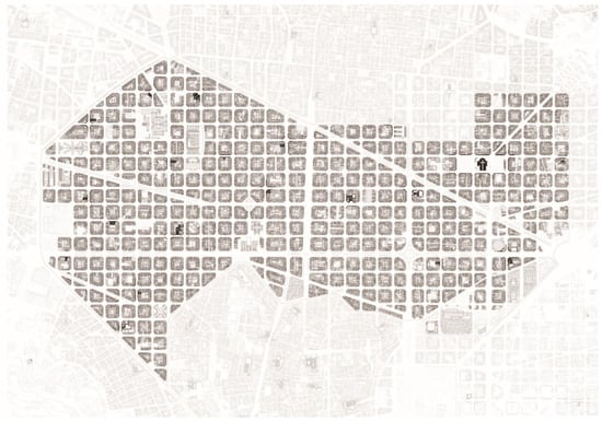
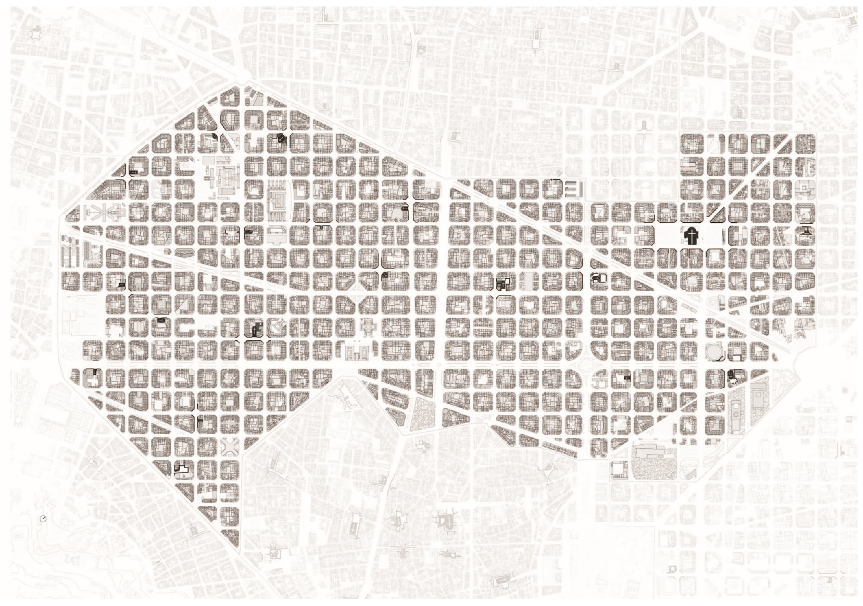
In the Eixample, the relative position of parishes within the grid, as well as variability in immediate open space, can be described within a regular fabric projected before its effective construction (Figure 5). Cerdà’s planned expansion introduced a decisive change of scale: the orthogonal grid redefined the relationship between built mass and void, establishing an extensive, homogeneous structure [25]. Parishes implanted in this fabric adopt a more regular and less dense distribution than in the historic centre and adjust to a limited set of possible orientations depending on their position within the chamfered block.
Figure 5.
Plan of the Eixample highlighting parish churches and their surrounding urban space. Author: Alba Arboix-Alió.
In Eixample (7,476,000 m2), comprising Dreta de l’Eixample, Antiga Esquerra de l’Eixample, Nova Esquerra de l’Eixample, Fort Pienc, Sagrada Família, and Sant Antoni, 19 Catholic parish churches are observed. In this regular fabric, redrawing shows that churches’ urban presence is predominantly constructed through street alignment and volumetric legibility within the block system, with limited availability of a distinct frontal void.
Regarding the church–public-space relationship, of the 19 churches: 16 are street-aligned with no frontal open space (3 of which occupy chamfer corners, a characteristic condition of the grid); 2 present a street widening functioning as a minimal forecourt/atrium; 1 is associated with one or more squares; and 0 are concealed within block interiors.
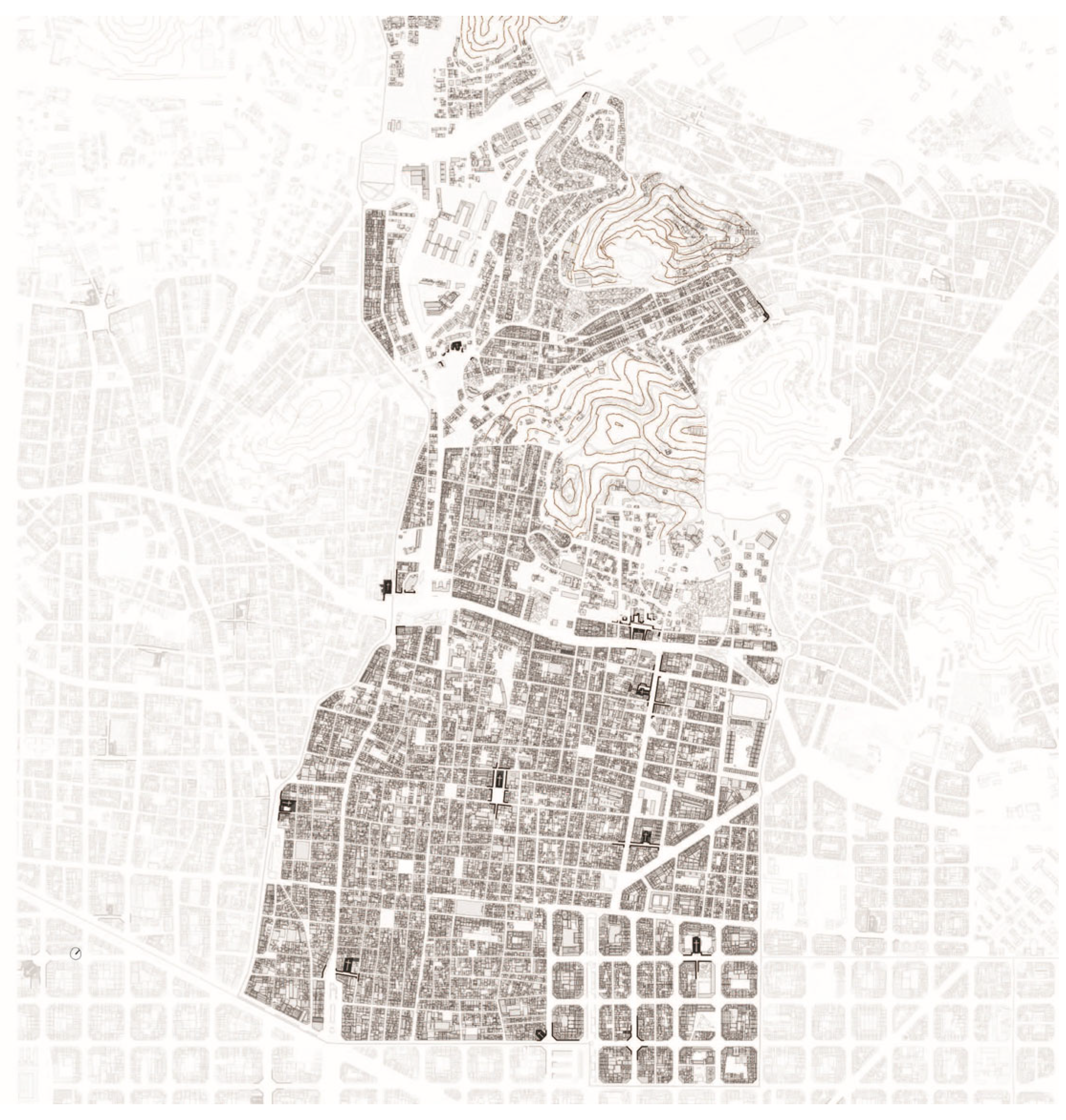
In Gràcia, the pre-metropolitan structure of streets and squares makes parish nodes associated with local centralities and urban voids defined by façades clearly. In former municipalities such as Gràcia, Sants, Sant Andreu, and Sant Martí, parish implantation also originates in medieval settlement patterns. As in the historic core, the church acted as an initial node around which population consolidated: located at strategic points along rural paths or agrarian territories, it generated a recognisable centre from which the urban fabric developed gradually. Gràcia is used here as a representative example of this type of implantation (Figure 6).
Figure 6.
Plan of Gràcia highlighting parish churches and their surrounding urban space. Author: Alba Arboix-Alió.
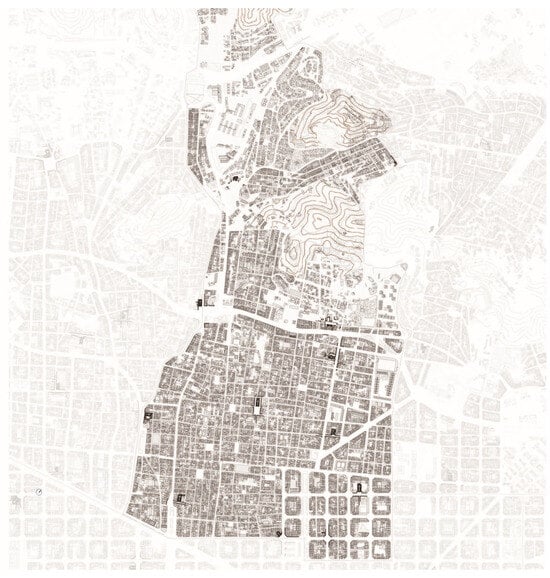
In Gràcia (4,186,000 m2), comprising Vila de Gràcia, Camp d’en Grassot i Gràcia Nova, La Salut, El Coll, and Vallcarca i els Penitents, 11 Catholic parish churches are observed. The set makes visible a pre-metropolitan logic: streets and squares articulating local centralities, and a relationship between church and urban void that is often more direct than within the Eixample grid.
Regarding the church–public-space relationship, of the 11 churches, 7 are street-aligned with no frontal open space (including 1 on a chamfer corner); 2 have a street widening functioning as a minimal forecourt/atrium; 2 are associated with one or more squares; and 0 are concealed within block interiors. This variety—within a fabric less regular than the Eixample yet more structured than the medieval core—is particularly useful for describing intermediate typologies and for understanding how centrality is constructed through public-space continuity and the definition of façades.
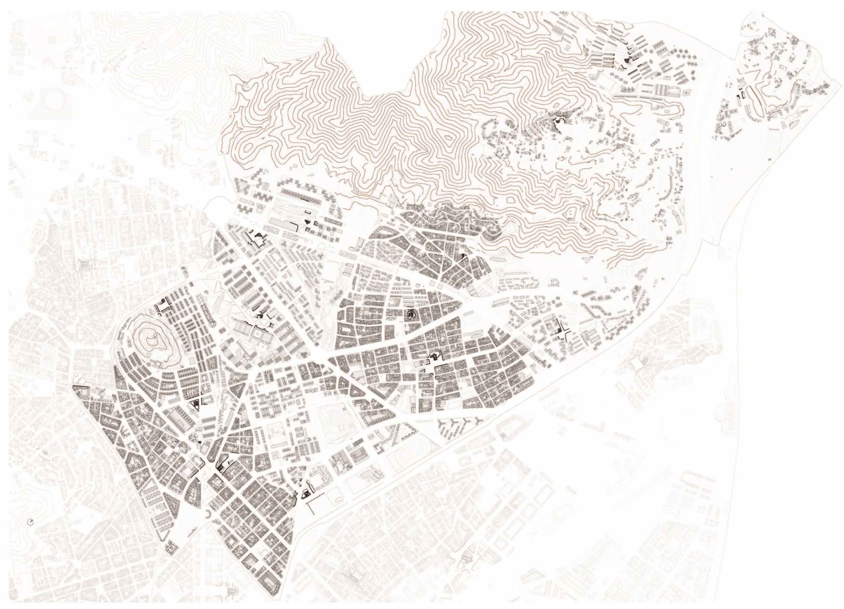
Parish distribution in twentieth-century urban fragments reveals differences in spacing and coverage in relation to large residential pieces, enabling an implantation adapted to more extensive and fragmented urban structures to be described (Figure 7). The mass creation of parishes in this period responded to the need for territorial coverage in newly formed areas. Unlike medieval density or the regularity of the Eixample, distribution here is more strategic, aimed at ensuring accessibility within large residential fields [26,27].
Figure 7.
Plan of Nou Barris highlighting parish churches and their surrounding urban space. Author: Alba Arboix-Alió.
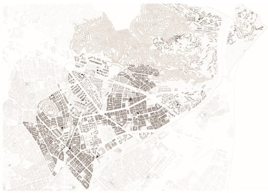
In Nou Barris (8,041,000 m2), comprising Vilapicina i la Torre Llobeta, Porta, Turó de la Peira, Can Peguera, La Guineueta, Canyelles, Les Roquetes, Verdun, La Prosperitat, Trinitat Nova, Torre Baró, Ciutat Meridiana, and Vallbona, 14 Catholic parish churches are observed. Redrawing shows an implantation typical of twentieth-century urban fragments, with extensive residential pieces and open spaces that do not always adopt the ‘classical’ form of a square defined by continuous façades. In this context, the reading of the adjacent void becomes more ambiguous, and the church can function as a recognisable element within environments of repetitive building form.
Regarding the church–public-space relationship, of the 14 churches, 4 are street-aligned with no frontal open space; 9 are associated with one or more squares or equivalent open spaces; and 1 is concealed within a block interior. Table 1 summarises the four district samples used for detailed comparison, providing basic quantitative spatial indicators—district area, parish counts, parish density (churches/km2), and the distribution of church–public-space typologies.
Table 1.
District-level summary of the four samples (area, parish counts, density, and typology breakdown). Created by the authors.
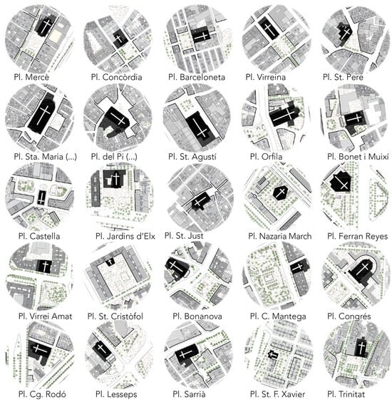
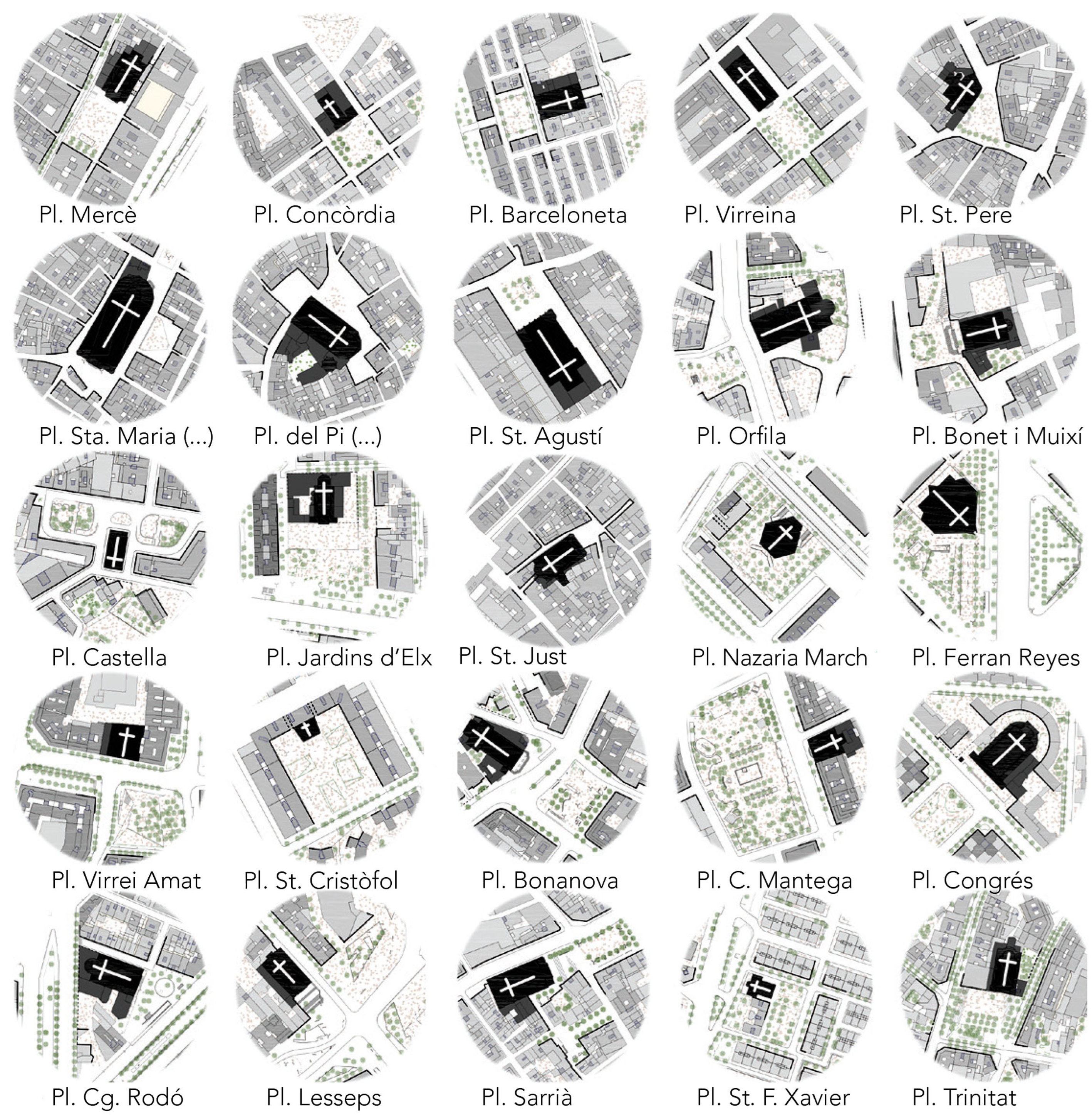
With regard to the urban relationship between churches and the surrounding public space, within the set of 132 parishes distributed across Barcelona’s 10 districts, at least 25 churches are identified as being associated with squares. These 25 cases correspond to the morphologically stable church–square relationships redrawn and compiled for Figure 8, and constitute a representative sample through which recurrent configurations of the urban void can be described, in which the church façade acts as a dominant boundary (Figure 8).
Figure 8.
Parish churches with an associated square in Barcelona. The address is included for each case, given as the name of the square (or, where more than one square is associated with the church, the name of the principal square). Author: Alba Arboix-Alió.
As shown in the figure, four main arrangements can be distinguished within these 25 cases: 12 churches with a single square in front of the main façade; 4 churches with multiple concatenated squares around the lateral façades; 3 churches surrounded by open space on all sides, in which the sacred building reads as an isolated object; and 6 churches with a square in front that is cut by a through-traffic road infrastructure which, while not weakening the visual dialogue or the morphological reading of solids and voids, interrupts urban use by producing a physical pedestrian discontinuity at ground level.
A small number of additional cases (on the order of five) could also be considered to have a “square” in front, but primarily due to contingent circumstances—for example, the presence of a vacant plot or other conditions that create an open foreground without establishing a stable and morphologically comparable church–square relationship. Although such cases may be equally valid as examples within other interpretative frames, they are not included here in order to preserve the coherence of the subset with the comparative and typological aims of the analysis.
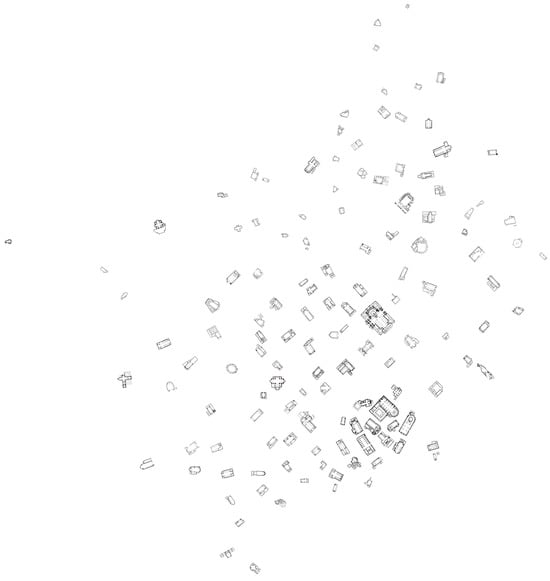
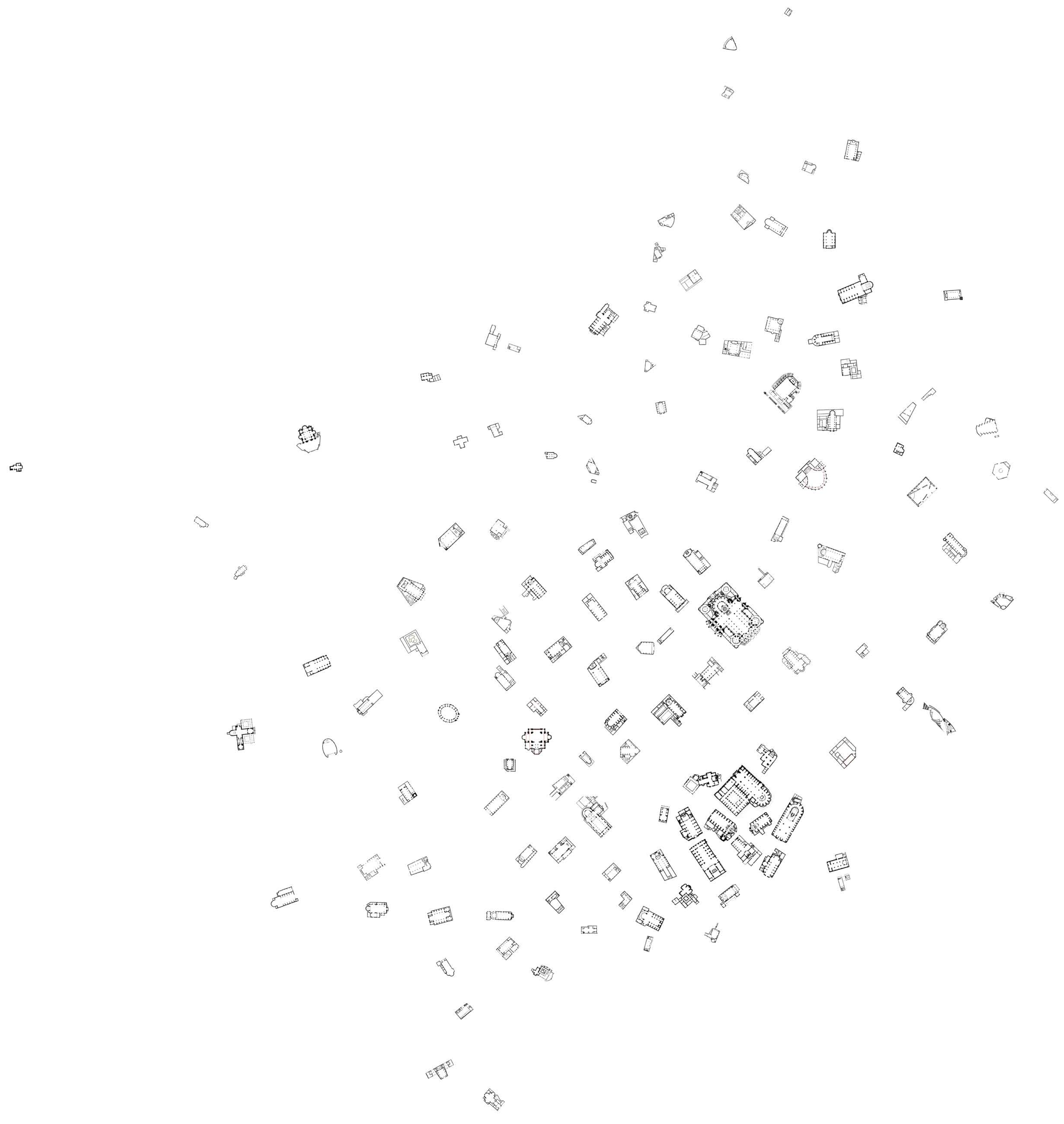
Finally, a global reading of the corpus identifies densities, orientations, and distribution patterns at the city scale. All churches are represented at the same scale and their centres placed at their implantation coordinates. The map also incorporates information on architectural typology—beyond the scope of this article—yet indicative of promising future lines of work (Figure 9).
Figure 9.
Plan of Barcelona showing only the parish churches (scaled proportionally). Author: Alba Arboix-Alió.
4. Discussion
4.1. Physical Interpretation, Urban Planning, and Methodological Transferability
The combined reading of the results shows that parishes configure a mesh of fixed points that accompanies urban growth and makes local centralities legible across fabrics of different kinds. The combined protocol inspired by Sitte and Nolli shifts the analysis from the building to the setting: the adjacent void, thresholds, and façades that shape public space. Comparative readings reveal systematic differences in the church–open-space relationship [3,5]. Under a ‘15 min city’ lens [6,7], the parish network can be interpreted as a pre-existing mesh of neighbourhood-scale nodes whose distribution aligns with proximity-based planning logics. However, the figure also underlines that proximity is not only a matter of distance: where church-adjacent open spaces are severed by through-traffic infra-structure, potential walkable access and everyday use are diminished despite continued visual legibility.
At the municipal scale, this mesh functions as an infrastructure of proximity: a capillary network of nodes that articulates immediate domains and collectively traverses heterogeneous morphologies. In sustainability terms, the drawings allow parish nodes to be positioned in relation to walkability and the continuity of open spaces, informing prioritisation criteria for interventions in vulnerable fabrics [28,29]. At the city scale, the network operates as a capillary system of minor centralities and can be discussed alongside approaches that emphasise distributed facilities and the role of public-space networks in producing cohesion and accessibility [30].
From a morphological perspective, observed patterns reinforce readings of Barcelona as a stratified city, where systems and fragments maintain continuities within transformation; from a social perspective, these nodes can operate as sites of everyday activation and civic use. The opposition between churches with squares and churches without squares provides an operational morphological language for discussing quality of use and reversibility of public space, including the temporary recovery of surface for collective uses [31]. In addition, the subset of cases where squares are intersected by through-traffic infrastructure indicates a specific form of functional erosion: the visual church–square dialogue may remain legible, yet pedestrian continuity is interrupted, weakening the square’s capacity to operate as an everyday meeting space.
The value of parish cartography lies both in its graphic outputs (comparable drawings) and in the underlying protocol of representation and comparison, which is potentially transferable to other cities and to other networks of singular buildings. Operationally, the reading can be complemented by quantitative indicators (walking distances, route continuity, fabric densities) without losing its qualitative value: redrawing renders comparable situations that often remain diluted in generic cartographies. The protocol is likewise transferable to other networks of singular buildings (schools, markets, health centres, cultural facilities) when the goal is to describe how the location and morphological fit of a set of nodes contributes to the construction of centralities.
4.2. Temporal Interpretation of Urban Formation Through the Parish Network
Beyond its spatial legibility, parish cartography also supports a temporal interpretation of urban formation.
In the medieval city, the parish operated as a primary territorial unit, reinforcing proximity-based communities within a compact and irregular fabric. In this period, the church–settlement relationship was not only adaptive but often generative: in singular territorial points, a parish foundation could precede and catalyse the emergence of a stable urban nucleus. In the drawings, this condition is legible from the old core to the medieval suburbs, where ecclesiastical foundations articulate continuities and transitions within the fabric.
In annexed municipalities such as Gràcia (now neighbourhoods within the city), parish churches remain legible as anchors of former civic nuclei that survive metropolitan incorporation. Their persistence confirms Barcelona’s aggregated condition and the continuity of local centralities [32].
Mid-twentieth-century accelerated growth produced a different morphology: large residential estates often disconnected from the historical fabric and initially lacking facilities [26,27]. In these estates, the parish church frequently assumes an additional role as a singular element: placed in central positions, it introduces hierarchy and recognisability within an environment of repetitive blocks.
Within the regular grid of the Eixample—chronologically after the medieval city and annexed towns and before the residential estates—parish insertion introduces singularity within geometric repetition [25].
Taken together, the network reveals a coherent mesh of distributed nodes traversing heterogeneous fabrics. This systemic reading aligns with long-term interpretations that stress superposition, adjustment, and the persistence of structural elements. In summary, parish cartography shows not only chronological accumulation but also structural continuity: genesis in the historic core, singularisation in the Eixample, persistence in annexed municipalities, and the production of centrality in late estate neighbourhoods.
4.3. Urban Centrality, Public Space, Symbolism, and Collective Memory
Beyond chronology, results can be read by considering the parish as a component of urban centrality and as a carrier of collective memory. Its implantation introduces a point of formal concentration that structures the immediate environment and activates public space as a stage for collective uses, not only religious ones (Figure 10).
Figure 10.
Photograph of Sant Joan de Gràcia. Author: Alba Arboix-Alió.
Based on the redrawn results, the church square can be read as a specific urban entity: a void inseparable from the parish building, in which façades and open space form a dialogue. This recalls Sitte’s emphasis on the square as a spatial composition structured by singular buildings and resonates with Mediterranean conceptions of the square as an urban stage defined by its façades [33]. Classical urban theory understands the square as a space structured by singular buildings that organise perception [34]. In Barcelona, the parish church often serves as the principal façade of such spaces, fixing axes and hierarchies and establishing recognisable centralities within the fabric.
The comparative corpus also brings into focus two contrasting morphological conditions. On the one hand, some churches are ‘embedded’ within the fine grain of the block, with limited frontal relief and a more discreet civic presence; on the other, churches that open onto a square (or multiple concatenated squares) read as singular objects that anchor perception and orientation. Distinguishing between these conditions helps interpret how different church–public-space configurations may support neighbourhood resilience: embedded churches tend to operate through proximity and everyday routes, whereas square-facing churches concentrate collective visibility and facilitate congregation and civic encounter.
Beyond physical permanence, parish nodes accumulate layers of memory and everyday recognition. Places become meaningful through repeated practices and perceptual anchors, and churches often provide stable references even as their surroundings change [35].
Redrawing also highlights the role of thresholds (steps, porches, atria, and small widenings) as transitional rooms that support encounter and routine. This attention to thresholds connects with debates on perception and lived space [36,37] and with urban readings that value streets and public spaces as key civic rooms [38,39].
Finally, parish churches share with other facilities the condition of permanence within urban transformation. They can be understood as fixed elements capable of traversing successive phases of change while retaining central positions despite profound modifications to their surroundings.
4.4. Social Infrastructure, Secularisation, and Urban Regeneration
Cartographic results also enable a reading related to symbolic centrality and collective memory of urban spaces. Several twentieth-century parishes incorporate multifunctional halls, educational uses, and meeting rooms. Parishes have long functioned as more than places of worship. In peripheral contexts, they contributed to a civic role overlapping with urban facilities, helping organise collective life while other installations were still absent [40,41,42].
In institutional terms, parish churches operate within vertical ecclesiastical structures, yet their material settings intersect with local civic culture through everyday accessibility, the configuration of adjacent open space, and the capacity to host compatible non-liturgical activities. This tension—between stable territorial governance and changing practices of use—becomes especially visible where religious participation declines and the building’s role shifts towards broader social infrastructure [10].
Contemporary secularisation and changing religious practices raise questions about how these durable nodes are maintained, reinterpreted, or adapted. Recent studies offer perspectives on proximity and accessibility frameworks [28], on reclaiming public space [31], on the sustainable renewal of vulnerable urban spaces [29], on user-centred approaches to social housing and urban improvement [43], and on quasi-public spaces as contemporary urban interiors [44].
Without abandoning the social dimension, and reading results from a more architectural standpoint, the persistence of parish buildings also invites attention to typological variation and the experience of thresholds and interiors. Phenomenological and typological debates, from the poetics of interior space to the complexity of urban artefacts, help situate parish churches as singular buildings mediating between a civic exterior and a collective interior [36,45,46]. From an urban-planning perspective, the issue is less whether churches remain religious in a strict sense than whether their locations, relationships with public space, and architectural capacity can continue to serve collective life.
Understanding parishes as part of a wider network of public and social facilities aligns with approaches that treat public-space systems as infrastructures and seek to regenerate vulnerable areas through the careful design of nodes, edges, and programmes [43,47]. Rather than proposing a universal solution, the results suggest criteria for case-by-case assessment: degree of openness of thresholds and adjacent voids, relationship with pedestrian axes, capacity to host temporary uses, and fit with nearby facilities. Comparative cartography can support the selection of pilot sites, the definition of measurable objectives, and evaluation of whether programme changes effectively improve the use and quality of public space. Operationally, we specify these criteria through observable morphological variables, including ground-floor permeability, threshold depth, definition of the adjacent void, pedestrian continuity across edges, alignment with everyday pedestrian axes, and compatibility with nearby facilities.
4.5. Study Limitations and Future Lines
This study focuses primarily on the morphological relationships between parish churches and public space through a standardised redrawing protocol. Consequently, it does not comprehensively address sociological, demographic, or institutional dimensions of parish life, nor does it measure the current use of the associated open spaces. In addition, the paper does not undertake a parallel mapping of other worship buildings or civic facility networks, which could refine comparative readings of centrality in future work. The 15 min catchments are shown as radial buffers and therefore do not account for street-network constraints, gradients, or barrier effects; they are presented as an interpretative proxy rather than as a precise accessibility model.
As future lines of research, the cartographic reading could be complemented with quantitative indicators (pedestrian accessibility, network continuity, centrality measures) to test the observed patterns. Likewise, and in line with the results, the analysis could be developed further through an architectural–typological reading of churches and parish complexes, as initiated in the final figure of the Results section (plan type, volumetric articulation, thresholds, and ground-floor permeability), to relate architectural form more explicitly to the configuration and use of adjacent public space. In addition, extending the corpus beyond Catholic parish churches to other religious buildings and/or to non-religious public facilities (e.g., schools, markets, civic centres) would allow the interpretation of urban centrality to be tested against alternative institutional networks and may shift the observed centrality patterns. Finally, the protocol’s transferability could be tested through comparative applications in other cities. The conditions for transferability include the availability of reliable base cartography, access to building plans and historical imagery, and a sufficiently stable institutional corpus to be inventoried as a network.
5. Conclusions
This article has addressed Barcelona’s network of 132 Catholic parish churches as a territorial infrastructure of centrality and, above all, as a cartographic analytical layer useful for morphological reading and for urban and regional planning. Based on an exhaustive inventory, fieldwork, and archival consultation, and through a standardised redrawing protocol inspired by Sitte and Nolli, a set of comparable drawings has been produced, enabling the observation of spatial patterns and recurrent relationships between churches, public space, and urban fabrics. The district plates drawn at the same scale further strengthen comparability, enabling direct contrasts of density, orientation, and church–void configurations across different urban fabrics.
The main conclusions are as follows:
- ❖
- Achievement of the primary objective and support for hypothesis (a). Parish cartography constitutes a reproducible analytical layer for describing Barcelona’s long-term morphological formation and identifying distributed centralities. Its distribution is not random: it accompanies stages of urban expansion and renders transitions between fabrics and aggregated fragments legible, reinforcing readings of Barcelona as a stratified city built through the superposition of systems.
- ❖
- Achievement of the secondary objective and support for hypothesis (b): typologies of relationships with public space. The study systematises morphological relationships between church and adjacent voids, including the presence or absence of open space, degrees of pedestrian continuity, and fit within the urban grid. The analysis confirms that the intensity and quality of the church–public-space relationship depend on the configuration of the void and its continuity, providing an operational language for discussing centrality, use, and the governance of public space. Within the representative subset of 25 cases associated with squares, four recurrent arrangements are identified including situations where through-traffic infrastructure interrupts pedestrian continuity.
- ❖
- Fabric- and phase-specific spatial patterns. Sequential readings of the drawings reveal consistent differences: density and proximity in the historic core, regularity and adaptation to the Eixample grid, persistence of local centralities in annexed municipalities, and coverage strategies in twentieth-century fabrics. These patterns allow territorial continuities within urban transformation to be described without reducing growth to a single causal mechanism.
- ❖
- Implications for planning, sustainability, and urban governance. Cartographic patterns can inform diagnostics of proximity and accessibility and help prioritise strategies of regeneration and reprogramming of public spaces in consolidated and vulnerable fabrics. The contrast between cases with and without adjacent open space also enables the discussion, on morphological grounds, of reversibility of uses and the temporary recovery of public surface for collective activities.
- ❖
- Methodological contribution: a protocol transferable to urbanism and regional planning. The contribution lies not only in the final drawings but also in the production protocol: inventory, consistent representation, and comparison across fabrics. This method is replicable in other cities and can be extended to other networks of singular buildings (civic, welfare, or heritage-related) when the aim is to analyse their influence on centralities and urban structure.
In summary, Barcelona’s parish cartography is presented as an urban-analytical tool with scientific and operational value: it makes distributed centralities, relationships with public space, and long-term territorial patterns legible, and opens a methodological field applicable to urban and regional planning.
Author Contributions
Conceptualization, A.A.-A. and A.A.; methodology, A.A.-A. and A.A.; formal analysis, A.A.-A.; data curation, A.A.-A.; investigation A.A.-A.; writing—original draft preparation, A.A.-A., J.M.P.-P. and A.A.; writing—review and editing, A.A.-A., J.M.P.-P. and A.A.; project administration, A.A.-A. All authors have read and agreed to the published version of the manuscript.
Funding
This research received no external funding.
Data Availability Statement
The data presented in this study are available on reasonable request from the corresponding author.
Conflicts of Interest
The authors reported no potential conflict of interest.
References
- Knott, K. The Location of Religion: A Spatial Analysis; Equinox Pub.: Oakville, CT, USA, 2005. [Google Scholar]
- Tweed, T.A. Crossing and Dwelling: A Theory of Religion; Harvard University Press: Cambridge, MA, USA, 2006. [Google Scholar]
- Sitte, C. Construcción de Ciudades Según Principios Artísticos; Gustavo Gili: Barcelona, Spain, 1980. [Google Scholar]
- Rossi, A. La Arquitectura de la Ciudad; Gustavo Gili: Barcelona, Spain, 1982. [Google Scholar]
- Collins, G.R.; Collins, C.C. Camillo Sitte y el Nacimiento del Urbanismo Moderno; Gustavo Gili: Barcelona, Spain, 1980. [Google Scholar]
- Moreno, C.; Allam, Z.; Chabaud, D.; Gall, C.; Pratlong, F. Introducing the “15-Minute City”: Sustainability, Resilience and Place Identity in Future Post-Pandemic Cities. Smart Cities 2021, 4, 93–111. [Google Scholar] [CrossRef] [Scilit]
- Pozoukidou, G.; Angelidou, M. Urban Planning in the 15-Minute City: Revisited under Sustainable and Smart City Developments until 2030. Smart Cities 2022, 5, 1356–1375. [Google Scholar] [CrossRef] [Scilit]
- Arias-Molinares, D.; Geurs, K.; Grigolon, A.; Ulak, B.; Duran-Rodas, D.; McCormick, B.; Baguet, J.; van Vessem, C.; Adjeroud, H.; Dörrzapf, L.; et al. Exploring the 15-Minute City concept for the urban outskirts: A systematic literature review. Eur. Transp. Res. Rev. 2025, 17, 50. [Google Scholar] [CrossRef] [Scilit] [PubMed]
- Allam, Z.; Nieuwenhuijsen, M.; Chabaud, D.; Moreno, C. The 15-minute city offers a new framework for sustainability, liveability, and health. Lancet Planet. Health 2022, 6, e181–e183. [Google Scholar] [CrossRef] [Scilit] [PubMed]
- Klinenberg, E. Palaces for the People: How Social Infrastructure Can Help Fight Inequality, Polarization, and the Decline of Civic Life; Crown: New York, NY, USA, 2018. [Google Scholar]
- Martí Bonet, J.M. Novum Speculum: Les Parròquies dels Tres Bisbats de Barcelona, Terrassa i Sant Feliu de Llobregat; Arxiu Diocesà de Barcelona: Barcelona, Spain, 2012. [Google Scholar]
- de Solà-Morales, M. Deu Lliçons sobre Barcelona; Col·legi Oficial d’Arquitectes de Catalunya: Barcelona, Spain, 2008. [Google Scholar]
- Lynch, K. La Imagen de la Ciudad; Gustavo Gili: Barcelona, Spain, 2013. [Google Scholar]
- Busquets, J. Barcelona. La Construcció Urbanística d’una Capital Compacta; Edicions UPC: Barcelona, Spain, 2018. [Google Scholar]
- Centre de Cultura Contemporània de Barcelona (CCCB). Cerdà i la Barcelona del Futur/Cerdà y la Barcelona del Futuro: Realitat Versus Projecte/Realidad Versus Proyecto; CCCB: Barcelona, Spain, 2009. [Google Scholar]
- de Solà-Morales, M. Las Formas de Crecimiento Urbano/Les Formes de Creixement Urbà; Edicions UPC: Barcelona, Spain, 1997. [Google Scholar]
- Fernàndez-Cobián, E. El Espacio Sagrado en la Arquitectura Española Contemporánea. Ph.D. Thesis, Universidade da Coruña, A Coruña, Spain, 2000. [Google Scholar]
- Delgado Orusco, E. Arquitectura Sacra Española, 1939–1975: De la Posguerra al Posconcilio. Ph.D. Thesis, Universidad Politécnica de Madrid, Madrid, Spain, 1999. [Google Scholar]
- Casanova, J. Public Religions in the Modern World; University of Chicago Press: Chicago, IL, USA, 1994. [Google Scholar]
- Rowe, C.; Koetter, F. Ciudad Collage; Gustavo Gili: Barcelona, Spain, 1981. [Google Scholar]
- Arboix-Alió, A. Església i Ciutat. El Paper Dels Temples Parroquials en la Construcció de Barcelona. Ph.D. Thesis, Universitat Politècnica de Catalunya, Barcelona, Spain, 2016. [Google Scholar]
- Arboix-Alió, A. Barcelona. Esglésies i Construcció de la Ciutat; Ajuntament de Barcelona: Barcelona, Spain, 2018. [Google Scholar]
- Arboix-Alió, A.; Pons-Poblet, J.M.; Arboix, A.; Arboix-Alió, J. Relevance of Catholic Parish Churches in Public Space in Barcelona: Historical Analysis and Future Perspectives. Buildings 2023, 13, 1370. [Google Scholar] [CrossRef] [Scilit]
- Arboix-Alió, A.; Mària i Serrano, M. Religious Architecture, Public Space, and Contemporary Society. Religions 2025, 16, 862. [Google Scholar] [CrossRef] [Scilit]
- Cerdà, I.; Soria y Puig, A. (Compiler) Cerdà: Las Cinco Bases de la Teoría General de la Urbanización; Electa España: Madrid, Spain, 1996. [Google Scholar]
- Serra Riera, E. Geometria i Projecte Del Sòl Als Orígens de la Barcelona Moderna: La Vila de Gràcia; Edicions UPC: Barcelona, Spain, 1995. [Google Scholar]
- Ferrer i Aixalà, A. Els Polígons de Barcelona; Edicions UPC: Barcelona, Spain, 1996. [Google Scholar]
- Sagarra i Trias, F.; Carreras, M.; Huertas, J.M.; Oliveras, J. De les Cases Barates als Grans Polígons: El Patronat Municipal de l’Habitatge de Barcelona Entre 1929 i 1979; Sagarra i Trias, F., Ed.; Ajuntament de Barcelona; Patronat Municipal de l’Habitatge: Barcelona, Spain, 2003. [Google Scholar]
- Ferrer-Ortiz, C.; Marquet, O.; Mojica, L.; Vich, G. Barcelona under the 15-Minute City Lens: Mapping the Accessibility and Proximity Potential Based on Pedestrian Travel Times. Smart Cities 2022, 5, 146–161. [Google Scholar] [CrossRef] [Scilit]
- Gao, C.; Hou, J.; Ma, Y.; Yang, J. Evaluation and Analysis of Design Elements for Sustainable Renewal of Urban Vulnerable Spaces. Int. J. Environ. Res. Public Health 2022, 19, 16562. [Google Scholar] [CrossRef] [Scilit] [PubMed]
- Portas, N. A Cidade Como Arquitectura; Livros Horizonte: Lisboa, Portugal, 2011. [Google Scholar]
- Fayyaz, M.; Gonzalez-Gonzalez, E.; Nogues, S. Autonomous Mobility: A Potential Opportunity to Reclaim Public Spaces for People. Sustainability 2022, 14, 1568. [Google Scholar] [CrossRef] [Scilit]
- Ortega y Gasset, J. Obras Completas. Tomo II (1916); Taurus: Madrid, Spain, 2004. [Google Scholar]
- Cullen, G. El Paisaje Urbano: Tratado de Estética Urbanística; Blume-Labor: Barcelona, Spain, 1974. [Google Scholar]
- Perec, G. Especies de Espacios; Montesinos: Barcelona, Spain, 2003. [Google Scholar]
- Bachelard, G. La Poética del Espacio; Fondo de Cultura Económica: Mexico City, Mexico, 1975. [Google Scholar]
- Rasmussen, S.E. La Experiencia de la Arquitectura: Sobre la Percepción de Nuestro Entorno; Reverté: Barcelona, Spain, 2004. [Google Scholar]
- Rudofsky, B. Streets for People: A Primer for Americans; Doubleday: Garden City, NY, USA, 1969. [Google Scholar]
- Gehl, J. La Humanización del Espacio Urbano: La Vida Social Entre los Edificios; Reverté: Barcelona, Spain, 2006. [Google Scholar]
- Lois Alcázar, S. Una Església D’urgència. La Construcció del Passat Imperfecte de la Perifèria de Barcelona. Master’s Thesis, Universitat Ramon Llull (La Salle), Barcelona, Spain, 2014. [Google Scholar]
- Gómez Val, R. La Construcción de Templos Parroquiales en Barcelona entre 1952 y 2000. Ph.D. Thesis, Universitat Politècnica de Catalunya, Barcelona, Spain, 2012. [Google Scholar] [CrossRef] [Scilit]
- Cuadrench i Aragonès, J. Sant Sebastià de Verdum: Mig Segle d’una Parròquia de Barri, 1958–2008; Parròquia de Sant Sebastià: Barcelona, Spain, 2008. [Google Scholar]
- Lucchi, E.; Delera, A.C. Enhancing the Historic Public Social Housing through a User-Centered Design-Driven Approach. Buildings 2020, 10, 159. [Google Scholar] [CrossRef] [Scilit]
- Sahito, N.; Han, H.; Nguyen, T.V.T.; Kim, I.; Hwang, J.; Jameel, A. Examining the Quasi-Public Spaces in Commercial Complexes. Sustainability 2020, 12, 1830. [Google Scholar] [CrossRef] [Scilit]
- Venturi, R. Complejidad y Contradicción en la Arquitectura; Gustavo Gili: Barcelona, Spain, 1978. [Google Scholar]
- Alexander, C.; Ishikawa, S.; Silverstein, M. Un Lenguaje de Patrones: Ciudades, Edificios, Construcciones; Gustavo Gili: Barcelona, Spain, 1980. [Google Scholar]
- Suchoń, F.; Olesiak, J. Historical Analysis of the Example of Nowy Sącz in Space Syntax Perspective. Guidelines for Future Development of Urban Matrix in Medium-Sized Cities. Sustainability 2021, 13, 11071. [Google Scholar] [CrossRef] [Scilit]

Disclaimer/Publisher’s Note: The statements, opinions and data contained in all publications are solely those of the individual author(s) and contributor(s) and not of MDPI and/or the editor(s). MDPI and/or the editor(s) disclaim responsibility for any injury to people or property resulting from any ideas, methods, instructions or products referred to in the content. |
© 2026 by the authors. Licensee MDPI, Basel, Switzerland. This article is an open access article distributed under the terms and conditions of the Creative Commons Attribution (CC BY) license.