Next Issue
Volume 17, June-1
Previous Issue
Volume 17, May-1
 
 
water-logo

Journal Browser

Journal Browser

Water, Volume 17, Issue 10 (May-2 2025) – 151 articles

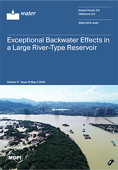
Cover Story (view full-size image): Backwater phenomena occur in many river confluences and reservoirs around the world, severely increasing flood risk. Large river-type reservoirs represent key integrated engineering projects for flood regulation, power generation, navigation and water supply, while causing frequent inundations in the reservoir tail due to backwater effects in high-flow conditions. This study revealed exceptional backwater effects on wedge storages and flood stages using HEC-RAS modeling in the large river-type Feilaixia Reservoir in the North River, South China. The ratios of wedge storages to static water storages were 125% and 147% during both flood events in June 2022 and April 2024, increasing up to 199%. The backwater effect is influenced by flood flow and river channel topography and should be carefully considered in operational flood regulation and levee height design in reservoirs. View this paper
  • Issues are regarded as officially published after their release is announced to the table of contents alert mailing list.
  • You may sign up for e-mail alerts to receive table of contents of newly released issues.
  • PDF is the official format for papers published in both, html and pdf forms. To view the papers in pdf format, click on the "PDF Full-text" link, and use the free Adobe Reader to open them.
Order results
Result details
Section
Select all
Export citation of selected articles as:
29 pages, 4752 KiB  
Article
Is the Indus Basin Drying? Disparities in the Environmental Flow, Inflow, and Outflow of the Basin
by Naveed Ahmed, Haishen Lu, Bojan Đurin, Nikola Kranjčić, Oluwafemi E. Adeyeri, Muhammad Shahid Iqbal and Youssef M. Youssef
Water 2025, 17(10), 1557; https://doi.org/10.3390/w17101557 - 21 May 2025
Viewed by 522
Abstract
Under the 1960 Indus Water Treaty, Pakistan owned the Western rivers (Indus, Jhelum, and Chenab) and India the Eastern rivers (Ravi, Suleimanki, and Beas). Pakistan’s per capita water availability will reduce from 5260 m3 to less than 1000 m3 by 2025, [...] Read more.
Under the 1960 Indus Water Treaty, Pakistan owned the Western rivers (Indus, Jhelum, and Chenab) and India the Eastern rivers (Ravi, Suleimanki, and Beas). Pakistan’s per capita water availability will reduce from 5260 m3 to less than 1000 m3 by 2025, causing water stress. The Indus Basin’s water availability was examined at inflow and outflow gauges between 1991 and 2015. The Indus Basin inflow and outflow gauges indicated exceptionally low and high flows before, during, and after floods. Lower flow values vary greatly for the Indus, Chenab, and Jhelum rivers. During Rabi and Kharif, the Indus and Chenab rivers behaved differently. Lower flows (Q90 to Q99) in Western Rivers are more periodic than higher flows (Q90 to Q99) and medium flows (Q90 to Q99). The outflow gauge Kotri reported 35% exceedance with zero flows during pre-flood and post-flood seasons and 50% during flood season, indicating seasonal concerns. Outflow and inflow both fell, particularly after the year 2000, according to data collected over a longer period (1976–2015). Low storage and regulating upstream capacity caused the Indus Basin outflow to reach 28 MAF (million acre feet) between 1976 and 2015, which is 70% more than the permitted 8.6 MAF downstream Kotri gauge. For 65 percent of the year, the Indus Basin does not release any water downstream of Kotri. As a result, the ecosystem relies on an annual influx of at least 123 MAF to sustain itself, and an outflow of 8.6 MAF from the Indus Basin necessitates an inflow of 113.51 MAF. At high-flow seasons, the Indus Basin experiences devastating floods, yet it dries out at a frightening rate before and after floods. The preservation of ecosystems and riparian zones downstream depends on the large environmental flows in eastern rivers. This is achievable only by fully implementing IWT and improving water management practices at western rivers. Full article
Show Figures

Figure 1

23 pages, 1732 KiB  
Article
Comprehensive Evaluation of Water-Saving Ecological Irrigation Districts Based on the Variable-Weight Matter-Element Method
by Ruirui Jiang, Liangjun Fei and Pan Ren
Water 2025, 17(10), 1556; https://doi.org/10.3390/w17101556 - 21 May 2025
Viewed by 106
Abstract
The irrational development of traditional irrigation districts has negatively impacted ecosystems, while current evaluation indicators for ecological irrigation districts lack systematic and objective selection. To address this, a new model and multi-indicator optimization approach are urgently needed for sustainable irrigation development. Using the [...] Read more.
The irrational development of traditional irrigation districts has negatively impacted ecosystems, while current evaluation indicators for ecological irrigation districts lack systematic and objective selection. To address this, a new model and multi-indicator optimization approach are urgently needed for sustainable irrigation development. Using the Jiaokou Irrigation District in Guanzhong as a case study, this research applied water-saving ecological irrigation district principles, eight indicator selection criteria, and an optimization screening model. A database with six criteria layers and 19 indicators was constructed, with 52.78% of the indicators capturing 85.57% of the information. The modified weight variation method was employed to determine indicator weights, and a matter-element extension model was established for evaluation. Results classify the ecological health development level as “Passable” and trending toward “Moderate”. Socio-economic and ecological resource indicators were found to exert significant influence, with water-saving irrigation coverage and domestic sewage treatment rates identified as the most sensitive indicators. These factors substantially impact the development level of water-saving ecological irrigation districts, highlighting their importance in guiding sustainable development strategies. Full article
(This article belongs to the Section Water, Agriculture and Aquaculture)
Show Figures

Figure 1

19 pages, 6430 KiB  
Article
Groundwater–River Water Interaction in an Urban Setting (Rome, Italy) Using a Multi-Method Approach (Hydrogeological and Radon Analyses)
by Martina Mattia, Gianmarco Mondati, Roberto Mazza, Carlo Rosa, Cristina Di Salvo and Paola Tuccimei
Water 2025, 17(10), 1555; https://doi.org/10.3390/w17101555 - 21 May 2025
Viewed by 176
Abstract
The interaction of the Almone River with groundwater in the Caffarella area (Rome, Italy) was investigated using a multi-method approach based on hydrogeological and radon analyses. Eleven measurement stations were established along the river at distances of approximately 270 m from one another. [...] Read more.
The interaction of the Almone River with groundwater in the Caffarella area (Rome, Italy) was investigated using a multi-method approach based on hydrogeological and radon analyses. Eleven measurement stations were established along the river at distances of approximately 270 m from one another. Stream discharge, water physicochemical properties, and radon levels were measured from June 2024 to March 2025. The contribution of two tributaries of the Almone was evaluated, but it was found to be negligible in terms of radon contribution. Except for an average increase of 40 L/s between stations 1A and 2A, the Almone’s discharge (corrected for the streams input) was constant (around 150 L/s) in June and slightly increasing from 6A to 11A in March due to heavier rainfalls. The increased discharge between stations 1A and 2A was interpreted as groundwater overflow from the volcanic aquifer into the alluvial body and in turn into the river due to a change in geometry and volume of the volcanic aquifer. In that part of the river, radon concentration increased only in March, due to the fast transition of the groundwater from a high to a lower radon emanation unit. Radon decreased along the valley due to atmospheric evasion, as confirmed by pH growth due to CO2 degassing. Full article
(This article belongs to the Special Issue Research on Hydrogeology and Hydrochemistry: Challenges and Prospects)
Show Figures

Figure 1

22 pages, 5308 KiB  
Article
Investigating the Compound Influence of Tidal and River Floodplain Discharge Under Storm Events in the Brisbane River Estuary, Australia
by Usman Khalil, Mariam Sajid, Muhammad Zain Bin Riaz, Umair Iqbal, Essam Jnead, Shu-Qing Yang and Muttucumaru Sivakumar
Water 2025, 17(10), 1554; https://doi.org/10.3390/w17101554 - 21 May 2025
Viewed by 95
Abstract
Effective flood management requires a comprehensive understanding of interactions between multiple flooding sources. This study investigates compound flooding in the Brisbane River Estuary (BRE), Australia, using the MIKE 21 hydrodynamic model to assess the combined effects of tidal and riverine processes on flood [...] Read more.
Effective flood management requires a comprehensive understanding of interactions between multiple flooding sources. This study investigates compound flooding in the Brisbane River Estuary (BRE), Australia, using the MIKE 21 hydrodynamic model to assess the combined effects of tidal and riverine processes on flood extent and water levels. Unlike conventional studies that evaluate these factors separately, this research quantifies the impact of boundary condition variations at the Moreton Bay entrance on flood modelling accuracy. The model was calibrated by adjusting Manning’s n, achieving a Nash–Sutcliffe efficiency (Ens) ranging from 0.84 to 0.95. Validation results show a 90% agreement between the simulated and observed 2011 flood extent. The findings highlight the critical role of tidal boundary conditions, as their exclusion led to a 0.62 m and 0.12 m reduction in flood levels at Jindalee and Brisbane City gauges, respectively. This study provides valuable insights for improving flood risk assessment, model accuracy, and decision-making in estuarine flood management. Full article
(This article belongs to the Special Issue Coastal Management and Nearshore Hydrodynamics, 2nd Edition)
Show Figures

Figure 1

18 pages, 5538 KiB  
Article
Wetlands as Climate-Sensitive Hotspots: Evaluating Greenhouse Gas Emissions in Southern Chhattisgarh
by Adikant Pradhan, Abhinav Sao, Tarun Kumar Thakur, James T. Anderson, Girish Chandel, Amit Kumar, Venkatesh Paramesh, Dinesh Jinger and Rupesh Kumar
Water 2025, 17(10), 1553; https://doi.org/10.3390/w17101553 - 21 May 2025
Viewed by 108
Abstract
In recent decades, wetlands have played a significant role in the global carbon cycle, making it essential to quantify their greenhouse gas (GHG) emissions at regional, national, and international levels. This study examines three dammed water bodies (Dalpatsagar, Gangamunda, and Dudhawa lake–wetland complexes) [...] Read more.
In recent decades, wetlands have played a significant role in the global carbon cycle, making it essential to quantify their greenhouse gas (GHG) emissions at regional, national, and international levels. This study examines three dammed water bodies (Dalpatsagar, Gangamunda, and Dudhawa lake–wetland complexes) in Chhattisgarh, India, to estimate their GHG emission potentials. Methane (CH4) showed the highest emission rate, peaking at 167.24 mg m−2 h−1 at 29.4 °C in Dalpatsagar during the standard meteorological week of 21–27 May. As temperatures rose from 17 °C to 18 °C, CH4 emissions ranged from 125–130 mg m−2 h−1. Despite slightly higher temperatures, Dudhawa showed lower emissions, likely due to its larger surface area and shallower depth. Carbon dioxide (CO2) emissions from Gangamunda increased sharply from 124.25 to 144.84 mg m−2 h−1 as temperatures rose from 12 °C to 25 °C, while Dudhawa recorded a peak CO2 emission of 113.72 mg m−2 h−1 in April. Nitrous oxide (N2O) emissions peaked at 29.11 mg m−2 h−1 during the 8th meteorological week, with an average of approximately 10.0 mg m−2 h−1. These findings indicate that climate-induced changes in water quality may increase health risks. This study offers critical insights to inform policies and conservation strategies aimed at mitigating emissions and enhancing the carbon sequestration potential of wetlands. Full article
(This article belongs to the Special Issue Monitoring and Modelling of Contaminants in Water Environment)
Show Figures

Figure 1

21 pages, 2034 KiB  
Article
Stabilization of Sandy Soil Against Internal Erosion Using Fly Ash with Alkali-Activated Binder
by Mohammad Almasaeid, Mousa Attom, Magdi El-Emam and Mohamad G. Arab
Water 2025, 17(10), 1552; https://doi.org/10.3390/w17101552 - 21 May 2025
Viewed by 375
Abstract
Seepage forces due to the flow of water inside embankment hydraulic structures, such as dams or levees, result in internal erosion or piping. This will result in a reduction in soil strength, causing the failure of hydraulic structures. Stabilization of the soil is [...] Read more.
Seepage forces due to the flow of water inside embankment hydraulic structures, such as dams or levees, result in internal erosion or piping. This will result in a reduction in soil strength, causing the failure of hydraulic structures. Stabilization of the soil is one of the most effective approaches to avoid such catastrophic failure and prevent significant loss of life and property. The objective of this research is to stabilize sandy soil against internal erosion using fly ash (FA) alone and fly ash mixed with alkali-activated binder (NaOH). Although fly ash is commonly used for clay soil, its reactivity with alkali activators like NaOH makes it a potential candidate for stabilizing non-cohesive sandy soils when combined with alkaline solutions. A well-graded sandy soil was selected and mixed with fly ash alone and fly ash with sodium hydroxide at different percentages. Compaction curves were determined for each percentage, and specimens from the mix were remolded at 98% relative compaction and optimum moisture content corresponding to the compaction curve value. The hole erosion test (HET) was employed to evaluate internal erosion parameters. During the hole erosion test, seepage conditions were simulated by applying a controlled water flow through remolded specimens to replicate erosion caused by internal seepage forces. Additionally, the internal erosion parameters were evaluated at different curing times (2 days, 7 days, and 28 days were selected to capture short-term, intermediate, and long-term effects of chemical reactions on soil stabilization). Parameters such as the friction factor, coefficient of soil erosion, and critical shear stress were obtained, and the erosion rate index (IHET) was determined. It was found that using FA–NaOH significantly reduced internal erosion and increased the erosion rate index and the critical shear of the soil. The addition of 10% fly ash mixed with activated-alkali binder at 7 days curing time stabilized the soil against erosion. At this percentage, the erosion rate index equal to 5.3 and soil was categorized as: “very slow erosion”. However, mixing the sand with fly ash alone has a small or insignificant effect on the internal erosion of the soil, especially at higher percentages of fly ash. The optimum percentage of fly ash alone to improve the soil resistance to internal erosion was found to be 5% at 28 days of curing time where the soil rated as “moderately slow”. Full article
(This article belongs to the Special Issue Soil Erosion and Sedimentation by Water)
Show Figures

Figure 1

19 pages, 2863 KiB  
Article
Data Mining to Evaluate the Effect of Eichhornia crassipes and Lemna minor in the Phytoremediation of Wastewater in the Canton of Milagro
by Denny William Moreno Castro, Omar Orlando Franco Arias, Juan Diego Valenzuela Cobos, Daniel Prieto Sánchez and Cícero Pimenteira
Water 2025, 17(10), 1551; https://doi.org/10.3390/w17101551 - 21 May 2025
Viewed by 77
Abstract
The constant increase in industrialization and urbanization has led to the regular discharge of wastewater into the environment in excessive amounts, which has caused significant impacts on both human and wildlife ecosystems. The sustainable management and treatment of wastewater, whether of industrial or [...] Read more.
The constant increase in industrialization and urbanization has led to the regular discharge of wastewater into the environment in excessive amounts, which has caused significant impacts on both human and wildlife ecosystems. The sustainable management and treatment of wastewater, whether of industrial or domestic origin, represents a crucial challenge in this century. In this study, phytoremediation was employed as a wastewater treatment strategy using two species of aquatic macrophytes: water hyacinth (Eichhornia crassipes) and duckweed (Lemna minor). The study was conducted over seven consecutive evaluation periods, with five-day intervals between each. The objective was to apply the multivariate HJ-Biplot methodology to evaluate the effects of phytoremediation of two species of aquatic microphytes on the physicochemical characteristics of wastewater from Milagro canton, Ecuador. Additionally, a microbiological analysis was conducted to determine the effectiveness of the floating macrophytes. The analysis was based on the measurement of various physicochemical parameters, such as pH, electrical conductivity (EC), dissolved oxygen (DO), oxidation–reduction potential (ORP), salinity, total dissolved solids (TDSs), biochemical oxygen demand (BOD), chemical oxygen demand (COD), hardness, and temperature. The results showed that the highest efficiency in pollutant removal was achieved with duckweed (Lemna minor) in five out of nine measured parameters, suggesting that this species was the most effective compared to the control sample and Eichhornia crassipes. The capacity of these macrophytes for wastewater treatment was confirmed by this study. To ensure effective water purification, timely extraction of aquatic macrophytes from water bodies is recommended. If this collection is not properly carried out, the nutrients absorbed and stored in the plant tissues may be released back into the aquatic environment due to plant decomposition. Full article
(This article belongs to the Special Issue Monitoring and Remediation of Contaminants in Soil and Water)
Show Figures

Figure 1

22 pages, 4345 KiB  
Article
Impact of Diverse Calcite Vein Patterns on Dissolution Characteristics of Triassic Limestone in Three Gorges Reservoir Area
by Jingyun Guo, Shouding Li, Jianming He, Zhaobin Zhang and Xiao Li
Water 2025, 17(10), 1550; https://doi.org/10.3390/w17101550 - 21 May 2025
Viewed by 69
Abstract
Carbonate rock slopes in reservoir environments are increasingly exposed to dissolution-induced deterioration due to water level fluctuations. However, the influence of internal structures—particularly calcite veins—on dissolution behavior remains inadequately understood. The acid-induced dissolution of limestone by a sulfuric acid solution leads to the [...] Read more.
Carbonate rock slopes in reservoir environments are increasingly exposed to dissolution-induced deterioration due to water level fluctuations. However, the influence of internal structures—particularly calcite veins—on dissolution behavior remains inadequately understood. The acid-induced dissolution of limestone by a sulfuric acid solution leads to the removal of soluble minerals and changes to the rock structure. Natural variation in rock structures—particularly in the presence, density, and morphology of calcite veins—can significantly affect the dissolution process and its outcomes. In this study, we obtained three types of Triassic limestone from the same host rock but with varying vein structures from the Three Gorges Reservoir area. Cylindrical rock specimens were prepared to investigate the acid-induced dissolution behavior of limestone in a sulfuric acid solution. We identified and analyzed the macrostructures on the rock specimens before and after the interaction. Additionally, SEM was employed to observe the microstructures of the specimens before and after the acid-induced dissolution, and fractal dimension analysis was conducted on the SEM images to quantify surface complexity. Furthermore, we used a focused ion beam–scanning electron microscope (FIB-SEM) with an automatic mineral identification and characterization system, as well as mineral roundness calculation, for mineral identification and analysis. Based on the experiments and analyses, we determined the following: The contact surfaces between the host rock and the calcite veins increase the dissolution areas between the limestone and the sulfuric acid solution, intensifying the dissolution reactions, enhancing the connectivity of the original microstructural planes, and generating new, highly extended dissolution fissures. The calcite veins facilitate the entry of sulfuric acid solution into the limestone, intensifying the dissolution of the edges and corners of dolomite and resulting in the gradual rounding of dolomite shapes. Quantitatively, the limestone with dense, fine calcite veins exhibited the most severe dissolution, with water absorption rates nearly twice as high as the non-veined samples (0.13% vs. 0.07%), a 2.2% reduction in fractal dimension, and a 19.53% increase in dolomite roundness with the 1 ≤ R ≤ 3 interval, indicating significantly enhanced surface complexity and mineral reshaping. In summary, the presence of more calcite veins, regardless of their width, leads to more severe rock dissolution. Full article
(This article belongs to the Special Issue Water–Rock Interaction)
Show Figures

Figure 1

16 pages, 3402 KiB  
Article
Trends, Patterns, and Persistence of Rainfall, Streamflow, and Flooded Area in the Upper Paraguay Basin (Brazil)
by Maria Eduarda Moraes Sarmento Coelho, Henrique Marinho Leite Chaves and Maria Rita Fonseca
Water 2025, 17(10), 1549; https://doi.org/10.3390/w17101549 - 21 May 2025
Viewed by 106
Abstract
The Pantanal, considered the world’s largest floodplain, exhibits hydrological and ecological dynamics that are intrinsically linked to water inflows from the surrounding highlands. While the impacts of large-scale climatic phenomena and land-use changes on hydrological variables within the Upper Paraguay River Basin (UPRB) [...] Read more.
The Pantanal, considered the world’s largest floodplain, exhibits hydrological and ecological dynamics that are intrinsically linked to water inflows from the surrounding highlands. While the impacts of large-scale climatic phenomena and land-use changes on hydrological variables within the Upper Paraguay River Basin (UPRB) are acknowledged, their combined effects remain unknown. Recent reductions in precipitation and river discharge have adversely affected both environmental and socioeconomic aspects of the Cerrado (Brazilian Savannah) and Pantanal biomes in Brazil, raising concerns about the long-term sustainability of these important ecosystems. This study analyzes a 37-year hydrological time series (1986–2023) of rainfall, streamflow, and flooded area in three contributing basins of the Pantanal (Jauru—JB; Taquari—TB; and Miranda—MB), and reveals distinct hydrological trends influenced by different climate systems. Significant decreasing trends in rainfall and streamflow were observed in the northern JB and TB, contrasted by increasing trends in the southern MB. Consequently, a declining trend in downstream flooded areas within the Pantanal floodplain was identified. Long-term memory processes (Hurst phenomena) were identified in the time series of the Pantanal flooded area and also in the Paraguay river stage data. These findings indicate a persistent and aggregated reduction in the Pantanal’s hydrologic variables, adversely affecting its water-dependent ecology and economic activities, such as ranching, fishing, and navigation. This study underscores the necessity of adaptative management strategies to tackle the impacts of water surface loss, increased fire risks, and climate variability in the UPRB. Full article
(This article belongs to the Section Hydrology)
Show Figures

Figure 1

20 pages, 5767 KiB  
Article
Mainstream Wastewater Treatment Process Based on Multi-Nitrogen Removal Under New Anaerobic–Swing–Anoxic–Oxic Model
by Jiashun Cao, Jinyu Wang and Runze Xu
Water 2025, 17(10), 1548; https://doi.org/10.3390/w17101548 - 21 May 2025
Viewed by 151
Abstract
The Anaerobic–Swing Aerobic–Anoxic–Oxic (ASAO) process was developed to tackle problems such as temperature sensitivity during the Anaerobic–Oxic–Anoxic (AOA) process. By introducing a swing zone (S zone) with adjustable dissolved oxygen (DO), during the 112-day experimentation period, the ASAO system achieved removal rates of [...] Read more.
The Anaerobic–Swing Aerobic–Anoxic–Oxic (ASAO) process was developed to tackle problems such as temperature sensitivity during the Anaerobic–Oxic–Anoxic (AOA) process. By introducing a swing zone (S zone) with adjustable dissolved oxygen (DO), during the 112-day experimentation period, the ASAO system achieved removal rates of 88.18% for total inorganic nitrogen (TIN), 78.23% for total phosphorus (TP), and 99.78% for ammonia nitrogen. Intermittent aeration effectively suppressed nitrite-oxidizing bacteria (NOB), and the chemical oxygen demand (COD) removal rate exceeded 90%, with 60% being transformed into internal carbon sources like polyhydroxyalkanoates (PHAs) and glycogen (Gly). The key functional microorganisms encompassed Dechloromonas (denitrifying phosphorus-accumulating bacteria), Candidatus Competibacter, and Thauera, which facilitated simultaneous nitrification–denitrification (SND) and anaerobic ammonium oxidation (ANAMMOX). The enrichment of Candidatus Brocadia further enhanced the ANAMMOX activity. The flexibility of DO control in the swing zone optimized microbial activity and mitigated temperature dependence, thereby verifying the efficacy of the ASAO process in enhancing the removal rates of nutrients and COD in low-C/N wastewater. The intermittent aeration strategy and the continuous low-dissolved-oxygen (DO) operating conditions inhibited the activity of nitrite-oxidizing bacteria (NOB) and accomplished the elimination of NOB. Full article
(This article belongs to the Section Water Quality and Contamination)
Show Figures

Figure 1

29 pages, 923 KiB  
Article
International Legal Systems in Tackling the Marine Plastic Pollution: A Critical Analysis of UNCLOS and MARPOL
by Yen-Chiang Chang and Muhammad Saqib
Water 2025, 17(10), 1547; https://doi.org/10.3390/w17101547 - 21 May 2025
Viewed by 155
Abstract
Marine plastic pollution (MPP) has become one of the most pressing environmental challenges, severely affecting marine ecosystems and human health. Even though international agreements such as UNCLOS and the International Convention for the Prevention of Pollution from Ships (MARPOL) of the International Maritime [...] Read more.
Marine plastic pollution (MPP) has become one of the most pressing environmental challenges, severely affecting marine ecosystems and human health. Even though international agreements such as UNCLOS and the International Convention for the Prevention of Pollution from Ships (MARPOL) of the International Maritime Organization (IMO) exist, the existing laws are often being introduced to question the inability of the present laws to do something about the escalating issue of plastic pollution. This study uses a doctrinal legal approach to examine how UNCLOS and MARPOL respond to marine plastic pollution (MPP) with a focus on their ability to handle land-based and ship-based MPP. Gaps in these frameworks are underlined, such as a lack of enforceable requirements under UNCLOS on reducing plastic rubbish from LBS and disparities in implementing MARPOL’s regulations on plastic discharges from ships. This paper also explores activities of organizations such as the United Nations Environment Programme (UNEP), with a focus on the Regional Seas Programme and the Global Programme of Action. Although a lot has been achieved, much remains to be done to resolve the problem of marine plastic pollution. This paper concludes with a series of practical proposals aimed at refining international laws, strengthening enforcement, and encouraging collective action at the international level. The proposed measures are aimed at advancing a circular economy model, strengthening legal infrastructure, and fostering a single global response against marine plastic pollution. Full article
(This article belongs to the Special Issue Coastal and Marine Governance and Protection)
Show Figures

Figure 1

33 pages, 15457 KiB  
Article
A Hybrid Approach for Assessing Aquifer Health Using the SWAT Model, Tree-Based Classification, and Deep Learning Algorithms
by Amit Bera, Litan Dutta, Sanjit Kumar Pal, Rajwardhan Kumar, Pradeep Kumar Shukla, Wafa Saleh Alkhuraiji, Bojan Đurin and Mohamed Zhran
Water 2025, 17(10), 1546; https://doi.org/10.3390/w17101546 - 21 May 2025
Viewed by 479
Abstract
Aquifer health assessment is essential for sustainable groundwater management, particularly in semi-arid regions with challenging geological conditions. This study presents a novel methodology for assessing aquifer health in the Barakar River Basin, a hard-rock terrain, by integrating tree-based classification, deep learning, and the [...] Read more.
Aquifer health assessment is essential for sustainable groundwater management, particularly in semi-arid regions with challenging geological conditions. This study presents a novel methodology for assessing aquifer health in the Barakar River Basin, a hard-rock terrain, by integrating tree-based classification, deep learning, and the Soil and Water Assessment Tool (SWAT) model. Employing Random Forest, Decision Tree, and Convolutional Neural Network (CNN) models, the research examines 20 influential factors, including hydrological, water quality, and socioeconomic variables, to classify aquifer health into four categories: Good, Moderately Good, Semi-Critical, and Critical. The CNN model exhibited the highest predictive accuracy, identifying 33% of the basin as having good aquifer health, while Random Forest assessed 27% as Critical heath. Pearson correlation analysis of CNN-predicted aquifer health indicates that groundwater recharge (r = 0.52), return flow (r = 0.50), and groundwater fluctuation (r = 0.48) are the most influential positive factors. Validation results showed that the CNN model performed strongly, with a precision of 0.957, Area Under the Curve–Receiver Operating Characteristic (AUC-ROC) of 0.95, and F1 score of 0.828, underscoring its reliability and robustness. Geophysical Electrical Resistivity Tomography (ERT) field surveys validated these classifications, particularly in high- and low-aquifer health zones. This study enhances understanding of aquifer dynamics and presents a robust methodology with broader applicability for sustainable groundwater management worldwide. Full article
(This article belongs to the Section Water Quality and Contamination)
Show Figures

Graphical abstract

19 pages, 7780 KiB  
Article
Biofilm Characteristics and Microbial Community Structure in Pipeline Systems Using Tea Polyphenols as Disinfectant
by Ziwei Wang, Jiacheng Luo, Tongtong Yang, Ying Li, Yihao Li and Cuimin Feng
Water 2025, 17(10), 1545; https://doi.org/10.3390/w17101545 - 21 May 2025
Viewed by 108
Abstract
Polyphenols show promising application prospects as a novel natural disinfectant for drinking water. This study employed a simulated pipe network system to investigate the effects of tea polyphenols at an initial concentration of 5 mg/L on the characteristics of biofilm on pipe walls [...] Read more.
Polyphenols show promising application prospects as a novel natural disinfectant for drinking water. This study employed a simulated pipe network system to investigate the effects of tea polyphenols at an initial concentration of 5 mg/L on the characteristics of biofilm on pipe walls and microbial community succession patterns under different water ages (12–48 h). The results showed that with increasing water age, the tea polyphenol residual concentration gradually decreased, and the biofilm structure significantly evolved: the surface roughness increased from 5.57 nm to 32.8 nm, and the biofilm thickness increased from 40 nm to 150 nm. Microbial community diversity exhibited a trend of first increasing and then decreasing, with the Shannon index reaching its peak (2.847) at a water age of 36 h and remaining significantly higher than the control group (1.336) at all stages. High-throughput sequencing revealed a transition from a single dominant genus of Methylophilus (54.41%) at a water age of 12 h to a multi-genus coexistence pattern at a water age of 48 h, with Methylophilus (24.33%), unclassified_Saprospiraceae (21.70%), and Hydrogenophaga (16.52%) as the main dominant groups. Functional bacterial groups exhibited temporal changes, with biofilm colonization-related genera (Caulobacter, Sphingobium) reaching their peaks at 36 h, while special metabolic genera (Methylophilus, Hydrogenophaga) dominated at 48 h. Potential pathogens in the tea polyphenol treatment groups were effectively controlled at low levels (<0.21%), except for a temporary increase in Legionella (6.50%) at 36 h. Tea polyphenols’ selective inhibition mechanism helps suppress the excessive proliferation of specific genera and reduces the risk of potential pathogen outbreaks. This has important implications for ensuring the microbiological safety of drinking water. Full article
(This article belongs to the Section Urban Water Management)
Show Figures

Figure 1

21 pages, 2076 KiB  
Article
A Numerical Investigation into the Performance of Bypass Systems During Filling and Air Removal in Partially Drained Pipelines
by Samane Aghaei, Mehdi Hamidi, Ahmad Malekpour and Mohsen Besharat
Water 2025, 17(10), 1544; https://doi.org/10.3390/w17101544 - 21 May 2025
Viewed by 71
Abstract
This study presents an elastic one-dimensional numerical model to simulate the filling process of a large-scale, partially drained pipeline with an undulating profile, incorporating bypass systems. The model uses the Method of Characteristics to solve water hammer equations and integrates the Discrete Gas [...] Read more.
This study presents an elastic one-dimensional numerical model to simulate the filling process of a large-scale, partially drained pipeline with an undulating profile, incorporating bypass systems. The model uses the Method of Characteristics to solve water hammer equations and integrates the Discrete Gas Cavity Model to capture column separation effects. Validation is performed using two experimental test rigs and comparisons with existing numerical models, showing RMSE values between 1.06 and 7.95. The results highlight three key findings: (1) oversized bypasses generate severe transient pressures; (2) effective air management enables higher filling flow rates, significantly reducing filling time; and (3) bypass lines help dampen pressure fluctuations, with a notable drop in H from 528 m to 6.8 m occurring in stage b, following the release of trapped air. Additionally, this study challenges the practicality of the AWWA’s recommended pipeline filling velocity limit of 0.3 m/s, showing that strict adherence to this guideline is often unrealistic for large-scale systems. Overall, the findings emphasize the need for a balanced design approach that reduces transient risks while maintaining operational efficiency in large-scale pipelines. Full article
(This article belongs to the Special Issue Hydrodynamics in Pressurized Pipe Systems)
Show Figures

Figure 1

27 pages, 4979 KiB  
Article
A New Methodology to Estimate the Level of Water Stress (SDG 6.4.2) by Season and by Sub-Basin Avoiding the Double Counting of Water Resources
by Michela Marinelli, Riccardo Biancalani, Brian Joyce and Metogbe Belfrid Djihouessi
Water 2025, 17(10), 1543; https://doi.org/10.3390/w17101543 - 21 May 2025
Viewed by 123
Abstract
While at the global level, water stress does not seem to present a serious threat to the sustainability of freshwater withdrawal and use, the situation appears much grimmer if a closer look is given to the status of the freshwater resources at basin [...] Read more.
While at the global level, water stress does not seem to present a serious threat to the sustainability of freshwater withdrawal and use, the situation appears much grimmer if a closer look is given to the status of the freshwater resources at basin and sub-basin levels. Unfortunately, such information is often not available to water managers and decision-makers, due both to the scarcity of sufficient data and also to the lack of methods capable of transforming the existing data into usable information. Hence, disaggregating water stress at basin and sub-basin levels is fundamental to provide a finer view of both its causes and effects, allowing the targeting of interventions at areas with high water stress and sectors with high water use. The spatial disaggregation of SDG indicator 6.4.2 by major river basin already implemented at a global scale showed the existence of a water stress belt running across the globe approximately between 10 and 45 degrees north, with a few other areas above and below it. The value of SDG indicator 6.4.2 at the country level is influenced by its size: the larger the country, the more the national average masks local variability. When the disaggregation is performed at sub-basin level, there is the possibility that the same amount of water is counted twice or even more (double counting), as it flows from one sub-basin to the neighbouring ones. Current water accounting methods do not allow this issue to be overcome. This causes an underestimation of water stress and an overestimation of the water resources available for human use in a given area. This paper presents a new methodology to assess SDG indicator 6.4.2 (water stress) seasonally and at the sub-basin level, addressing double counting by factoring in water demands between upstream and downstream sub-basins. This approach supports more informed water management. A corresponding plugin for the WEAP tool was developed, tested in the Senegal River basin countries, and is available online with a user manual in English, French, and Spanish. Full article
(This article belongs to the Special Issue Balancing Competing Demands for Sustainable Water Development)
Show Figures

Figure 1

32 pages, 32067 KiB  
Article
Genesis Mechanism of Geothermal Water in Binhai County, Jiangsu Province, China
by Zhuoqun Yang, Zujiang Luo and Jinyuan Han
Water 2025, 17(10), 1542; https://doi.org/10.3390/w17101542 - 20 May 2025
Viewed by 129
Abstract
Taking the coastal area of Binhai County, Jiangsu Province, as an example, this study first investigated the basic natural geography and the regional geological and hydrogeological conditions of the study area, and then carried out in-depth geophysical prospecting, hydrogeological tests, geothermal temperature monitoring, [...] Read more.
Taking the coastal area of Binhai County, Jiangsu Province, as an example, this study first investigated the basic natural geography and the regional geological and hydrogeological conditions of the study area, and then carried out in-depth geophysical prospecting, hydrogeological tests, geothermal temperature monitoring, hydrochemistry and isotope analyses, and other studies based on the results to comprehensively and systematically reveal the genesis mechanism of the geothermal water resources of this coastal area from multiple perspectives. The results showed the following: the geothermal water in this area mainly comes from atmospheric precipitation; the deep east–northwest interlaced fracture is the recharge and transportation channel; the Cambrian–Ordovician carbonate rock layer, enriched by the development of cavernous fissures, forms the thermal storage layer; the underground heat mainly comes from the upward heat flow along the deep fracture and the natural warming of the strata; and the thermal reservoir cover comprises Paleozoic and Mesozoic clastic rocks that have a high mud content and form a thick layer. The genesis mode of this area is as follows: the atmospheric precipitation infiltrates and is recharged through the exposed alpine carbonate fissures in the Lianyungang area, and then it is transported to the south along the large deep fracture under the action of a high hydraulic pressure head; meanwhile, it is heated by the heat flow in the deep part of the fracture and water–rock interactions with the strata occur. Geothermal water with a calculated thermal storage temperature of 83.6 °C is formed at a depth of 2.9 km, which is blocked by the intersection of the northeast and northwest fractures to form a stagnant zone in the coastal area. Full article
(This article belongs to the Section Hydrogeology)
Show Figures

Figure 1

18 pages, 2147 KiB  
Article
Multi-Scale Impacts of Land Use Change on River Water Quality in the Xinxian River, Yangtze River Basin
by Yongsheng Guo, Ying Liu, Weilin Li, Xiting Cai, Xinyi Liu and Haikuo Liao
Water 2025, 17(10), 1541; https://doi.org/10.3390/w17101541 - 20 May 2025
Viewed by 131
Abstract
This study investigated the impact of land use change on water quality in the Xinxian River Basin amidst rapid urbanization. While previous studies have predominantly focused on single-scale buffer analyses or specific land use types, the interactions between multi-scale riparian buffers and diverse [...] Read more.
This study investigated the impact of land use change on water quality in the Xinxian River Basin amidst rapid urbanization. While previous studies have predominantly focused on single-scale buffer analyses or specific land use types, the interactions between multi-scale riparian buffers and diverse land cover dynamics remain rarely understudied, particularly in a rapidly urbanizing county in the Yangtze River Basin. Land use type data for the Xinxian River Basin in 2000, 2010, and 2020 were acquired using GIS technology, and subsequent analysis quantified land use pattern changes over this 20-year period. Additionally, 2023 land use data for riparian buffer zones (50 m, 100 m, 200 m, 400 m, and 600 m) were obtained via GIS and subjected to Redundancy Analysis (RDA) with 2023 water quality monitoring data to evaluate the impact of land use on water quality. The results revealed significant land use conversion dynamics, particularly between natural and anthropogenic cover types. Forest cover exhibited negative correlations with riverine nutrient concentrations, while built-up areas displayed strong positive associations, especially at finer scales (50–100 m buffers). Notably, the dominant influencing factor shifted from built-up land at smaller buffer scales (50–100 m) to forest land at larger scales (400–600 m), whereas agricultural land showed no significant correlation. These findings highlight scale-dependent relationships between land use and aquatic ecosystems, emphasizing the critical role of spatial planning in mitigating urbanization impacts. The work is conducive to the sustainable development of Longgan Lake National Wetland Nature Reserve and the protection of water ecology in the middle and lower reaches of the Yangtze River. Full article
(This article belongs to the Section Water Quality and Contamination)
Show Figures

Figure 1

25 pages, 2640 KiB  
Article
Differentiated Optimization Policies for Water–Energy–Food Resilience Security: Empirical Evidence Based on Shanxi Province and the GWR Model
by Ruopeng Huang and Yue Han
Water 2025, 17(10), 1540; https://doi.org/10.3390/w17101540 - 20 May 2025
Viewed by 212
Abstract
Shanxi Province, a key energy base and water source in China, has long borne the responsibility of supplying external resources. Ensuring the security of its water–energy–food (WEF) resilience has remained a persistent challenge for local authorities. Conventional WEF nexus optimization policies often overlook [...] Read more.
Shanxi Province, a key energy base and water source in China, has long borne the responsibility of supplying external resources. Ensuring the security of its water–energy–food (WEF) resilience has remained a persistent challenge for local authorities. Conventional WEF nexus optimization policies often overlook the heterogeneity of influencing factors arising from geographic variability, leading to generalized approaches that lack precision and efficiency in resource governance. To address these limitations, this study employed the Moran’s I index, exploratory regression analysis, and the geographically weighted regression (GWR) model to investigate the spatial patterns of factors influencing WEF resilience across 11 cities in Shanxi Province from 2014 to 2023. Based on these analyses, the study proposes targeted policy recommendations that account for regional heterogeneity and prioritize differentiated strategies, thereby avoiding the pitfalls of a one-size-fits-all framework. This tailored approach aims to support Shanxi in managing the enduring pressures of external resource supply. The main findings are as follows: (1) WEF resilience in Shanxi exhibited significant spatial autocorrelation, with Moran’s I values ranging from 0.013 to 0.043, confirming the influence of spatial geographic factors on the studied variables and supporting the applicability of the GWR model; (2) key factors influencing WEF resilience included population density, technological innovation, industrial structure, and resource mismatch, with effect sizes ranging from −0.90 to −0.48, 0.68 to 1.01, 0.43 to 0.79, and −0.45 to −0.22, respectively; (3) drawing on the spatially variable impact of these factors, the study offers optimization strategies that emphasize regional specificity and multi-policy prioritization to enhance WEF resilience across Shanxi Province. Full article
Show Figures

Figure 1

32 pages, 2679 KiB  
Article
An In-Depth Statistical Analysis of the Pearson Type III Distribution Behavior in Modeling Extreme and Rare Events
by Cristian-Gabriel Anghel and Dan Ianculescu
Water 2025, 17(10), 1539; https://doi.org/10.3390/w17101539 - 20 May 2025
Viewed by 291
Abstract
Statistical distributions play a crucial role in water resources management and civil engineering, particularly for analyzing data variability and predicting rare events with extremely long return periods (e.g., T = 1000 years, T = 10,000 years). Among these, the Pearson III (PE3) distribution [...] Read more.
Statistical distributions play a crucial role in water resources management and civil engineering, particularly for analyzing data variability and predicting rare events with extremely long return periods (e.g., T = 1000 years, T = 10,000 years). Among these, the Pearson III (PE3) distribution is widely used in hydrology and flood frequency analysis (FFA). This study aims to provide a comprehensive guide to the practical application of the PE3 distribution in FFA. It explores five parameter estimation methods, presenting both exact and newly developed approximate relationships for calculating distribution parameters and frequency factors. The analysis relies on data from four rivers with varying morphometric characteristics and record lengths. The results highlight that the Pearson III distribution, when used with the L-moments method, offers the most reliable quantile estimates, characterized by the smallest biases compared to other methods (e.g., 31% for the Nicolina River and, respectively, 5% for the Siret and Ialomita Rivers) and the highest confidence in predicting rare events. Based on these findings, the L-moments approach is recommended for flood frequency analysis to improve the accuracy of extreme flow forecasts. Full article
(This article belongs to the Special Issue Urban Flood Frequency Analysis and Risk Assessment)
Show Figures

Figure 1

39 pages, 23429 KiB  
Article
Attribution Analysis of Runoff Change in a Changing Environment: A Case Study of the Dawen River Basin
by Chuan Huang, Zhizhou Yang, Xuyang Yang, Huan Ma, Yinke Yang and Jincheng Zhang
Water 2025, 17(10), 1538; https://doi.org/10.3390/w17101538 - 20 May 2025
Viewed by 112
Abstract
Surface runoff change is significantly influenced by both human activities and climate change. Decoupling their respective contributions to runoff change represents a critical frontier in hydrological research and a pressing challenge for water resource management. This study focuses on the Dawen River Basin, [...] Read more.
Surface runoff change is significantly influenced by both human activities and climate change. Decoupling their respective contributions to runoff change represents a critical frontier in hydrological research and a pressing challenge for water resource management. This study focuses on the Dawen River Basin, a strategic area for ecological conservation and high-quality development in the lower Yellow River region. By integrating three methodological approaches—empirical models (Precipitation–Runoff Double Mass Curve), conceptual models (elasticity coefficient methods), and hydrological models (Soil and Water Assessment Tool, SWAT)—we systematically quantify the impacts of climate change and human activities on runoff change. A correlation analysis was first applied to screen independent runoff drivers and basin characteristic factors, followed by a random forest algorithm to rank their relative importance. This process informed the establishment of a comprehensive framework for runoff attribution analysis. Results demonstrate that hydrological modeling (SWAT) is the most appropriate method for the Dawen River Basin, revealing human activities as the dominant driver of runoff changes, accounting for 70% to 82%. These findings provide critical insights for guiding sustainable water resource planning and management in anthropogenically stressed basins under a changing environment. Full article
(This article belongs to the Section Hydrology)
Show Figures

Figure 1

18 pages, 610 KiB  
Article
Fenton-Based Treatment of Meat and Bone Meal Wastewater: Influence of Variable Fe2+/H2O2 Ratios on Microbiological Abundance and Community Composition
by Agnieszka Makara, Zygmunt Kowalski, Weronika Suchoń, Agnieszka Generowicz and Iwona Wiewiórska
Water 2025, 17(10), 1537; https://doi.org/10.3390/w17101537 - 20 May 2025
Viewed by 144
Abstract
Processing of meat waste into meat and bone meal generates wastewater that must be properly treated to minimize its environmental impact. In addition to its high organic load, it contains microorganisms, including pathogens, that pose a threat to human health. In this study, [...] Read more.
Processing of meat waste into meat and bone meal generates wastewater that must be properly treated to minimize its environmental impact. In addition to its high organic load, it contains microorganisms, including pathogens, that pose a threat to human health. In this study, wastewater from meat and bone meal production was treated using the Fenton process with a variable Fe2⁺/H2O2 mass ratio ranging from 1:2 to 1:10, followed by neutralization with lime milk. A microbiological analysis was performed on both the raw wastewater and the liquid fractions obtained after treatment, along with additional analyses of selected physicochemical parameters. The identification of isolated microorganisms was carried out using the MALDI-TOF MS technique. Qualitative analysis of the treated wastewater samples showed the presence of microorganisms belonging to the genera Staphylococcus, Enterococcus, Alcaligenes, and Pseudomonas. Staphylococcus aureus and Alcaligenes faecalis were present in each of the treated samples. The Fenton process effectively reduced the total number of microorganisms, with the lowest counts of 1.3 × 10² CFU/mL and 3.2 × 10² CFU/mL found in wastewater samples treated with Fe2⁺/H2O2 mass ratios of 1:8 and 1:10, which correlated with higher doses of hydrogen peroxide. Full article
Show Figures

Figure 1

28 pages, 830 KiB  
Review
Enhancing Urban Drainage Resilience Through Holistic Stormwater Regulation: A Review
by Jiankun Xie, Wei Qiang, Yiyuan Lin, Yuzhou Huang, Kai-Qin Xu, Dangshi Zheng, Shengzhen Chen, Yanyan Pei and Gongduan Fan
Water 2025, 17(10), 1536; https://doi.org/10.3390/w17101536 - 20 May 2025
Viewed by 241
Abstract
Under the dual pressures of global climate change and rapid urbanization, urban drainage systems (UDS) face severe challenges caused by extreme precipitation events and altered surface hydrological processes. The drainage paradigm is shifting toward resilient systems integrating grey and green infrastructure, necessitating a [...] Read more.
Under the dual pressures of global climate change and rapid urbanization, urban drainage systems (UDS) face severe challenges caused by extreme precipitation events and altered surface hydrological processes. The drainage paradigm is shifting toward resilient systems integrating grey and green infrastructure, necessitating a comprehensive review of the design and operation of grey infrastructure. This study systematically summarizes advances in urban stormwater process-wide regulation, focusing on drainage network design optimization, siting and control strategies for flow control devices (FCDs), and coordinated management of Quasi-Detention Basins (QDBs). Through graph theory-driven topological design, real-time control (RTC) technologies, and multi-objective optimization algorithms (e.g., genetic algorithms, particle swarm optimization), the research demonstrates that decentralized network layouts, dynamic gate regulation, and stormwater resource utilization significantly enhance system resilience and storage redundancy. Additionally, deep learning applications in flow prediction, flood assessment, and intelligent control exhibit potential to overcome limitations of traditional models. Future research should prioritize improving computational efficiency, optimizing hybrid infrastructure synergies, and integrating deep learning with RTC to establish more resilient and adaptive urban stormwater management frameworks. Full article
(This article belongs to the Section Urban Water Management)
Show Figures

Figure 1

18 pages, 2409 KiB  
Article
Characteristics of Stream Water Quality on Draining of Planted Coniferous and Natural Deciduous Forest Catchments in South Korea
by Sooyoun Nam, Qiwen Li, Byoungki Choi, Hyung Tae Choi and Honggeun Lim
Water 2025, 17(10), 1535; https://doi.org/10.3390/w17101535 - 20 May 2025
Viewed by 160
Abstract
The quality characteristics of runoff water during selected precipitation events in planted coniferous (CP) and natural deciduous (DN) forest stands in Pocheon-si, 27.0 km north of Seoul, were assessed via the mean event concentrations and discharge loads. The relationship [...] Read more.
The quality characteristics of runoff water during selected precipitation events in planted coniferous (CP) and natural deciduous (DN) forest stands in Pocheon-si, 27.0 km north of Seoul, were assessed via the mean event concentrations and discharge loads. The relationship between stream water quality and the runoff time differential (dQ/dt) indicated that the characteristics of the latter differed during the rising and falling stages of the two catchments. Pearson’s product moment correlation analysis revealed that chemical oxygen demand was significantly correlated with total organic carbon in the rising and falling limbs of the two catchments. When discharge loads were transported with actual precipitation events, the event load at the two sites increased with increasing discharge load. In particular, the total organic carbon and total nitrogen were higher in the CP catchment than in the DN catchment, whereas biological oxygen demand, total suspended solids, total nitrogen, and total phosphorus were higher in the DN catchment than in the CP catchment. Sequences of high and intense precipitation elevated discharge loads, with differences in loads related to the vegetation conditions in headwater areas (≤100 ha) with steep slopes (>20°) and narrow valleys. Full article
(This article belongs to the Special Issue Soil Erosion and Sedimentation by Water)
Show Figures

Figure 1

16 pages, 2523 KiB  
Article
Optimized Regulation Scheme of Valves in Self-Pressurized Water Pipeline Network and Water Hammer Protection Research
by Yunpeng Zheng, Yihai Tan, Lin Li and Qixuan Zhang
Water 2025, 17(10), 1534; https://doi.org/10.3390/w17101534 - 20 May 2025
Viewed by 156
Abstract
This study addresses the water hammer protection challenges in the JH gravity-fed bifurcated pipeline network system in Xinjiang, China. A hydraulic transient numerical model is developed using the one-dimensional method of characteristics and implemented in Bentley HAMMER software to systematically analyze the transient [...] Read more.
This study addresses the water hammer protection challenges in the JH gravity-fed bifurcated pipeline network system in Xinjiang, China. A hydraulic transient numerical model is developed using the one-dimensional method of characteristics and implemented in Bentley HAMMER software to systematically analyze the transient response characteristics under different valve closure schemes, with a focus on revealing pressure fluctuation patterns in branch and main pipelines under various shutdown modes. Key findings include the following: Single-valve linear slow closure reduces the maximum water hammer pressure by 54.7%, while the two-stage closure strategy suppresses pressure extremes below safety thresholds with 73.1% higher efficiency than linear closure. For multi-valve conditions, although two-stage closure eliminates negative pressure risks, most of nodes exhibit transient overpressure exceeding 1.5 times the working pressure. By integrating overpressure relief valves into a composite protection system, the maximum transient pressure is strictly controlled within 1.5× rated pressure, and the minimum pressure remains above −2 mH2O, successfully resolving protection challenges in this complex network. These results provide technical guidelines for the safe operation of gravity-fed pipeline systems in high-elevation-difference regions. Full article
Show Figures

Figure 1

16 pages, 2508 KiB  
Article
Photocatalytic Degradation of Trichloroethylene Under Different Environmental Conditions: Kinetics and Carbon Isotope Effects
by Yufeng Wang, Yaqiong Dong, Lantian Xing, Yuanxiao Guan and Changjie Liu
Water 2025, 17(10), 1533; https://doi.org/10.3390/w17101533 - 20 May 2025
Viewed by 206
Abstract
Photocatalytic degradation technology is an important tool for treating trichloroethylene (TCE) pollution in water bodies. While previous studies have focused on catalyst optimization and degradation kinetics for trichloroethylene (TCE) photocatalysis, the systematic impact of environmental conditions on carbon isotope effects (ε) and their [...] Read more.
Photocatalytic degradation technology is an important tool for treating trichloroethylene (TCE) pollution in water bodies. While previous studies have focused on catalyst optimization and degradation kinetics for trichloroethylene (TCE) photocatalysis, the systematic impact of environmental conditions on carbon isotope effects (ε) and their mechanistic implications remains poorly understood. This limits the reliability of quantitative isotope analyses in field applications. We conducted a series of laboratory experiments on the photocatalytic degradation of TCE to investigate the kinetic and isotopic effects under different conditions. Increasing the concentration of TCE, anions (NO3 and HCO3), and cations (Mg2+ and Ca2+) decreased the photocatalytic degradation of TCE. O2 will increase the degradation efficiency of TCE. The dose required to achieve maximum photocatalytic efficiency varies for different types of catalysts, which needs to be determined on a case-by-case basis. TCE photocatalytic degradation had a small carbon isotope effect (ε = −2.0 ± 0.2‰ to −3.2 ± 0.5‰), which was slightly affected by the catalyst dosage and species (TiO2 and ZnO), and concentrations of TCE, O2, and inorganic ions (NO3, HCO3, Mg2+, and Ca2+). The ε values are stable and reproducible and relatively insensitive to our selected environmental factors in this study, which can reduce the uncertainty of applying stable carbon isotope enrichment factors to quantify the photocatalytic reaction for remediation of TCE contaminated sites. Full article
(This article belongs to the Section Wastewater Treatment and Reuse)
Show Figures

Figure 1

22 pages, 4712 KiB  
Review
Evaluation of the Performance of Optimized Horizontal-Axis Hydrokinetic Turbines
by Rossen Iliev, Georgi Todorov, Konstantin Kamberov and Blagovest Zlatev
Water 2025, 17(10), 1532; https://doi.org/10.3390/w17101532 - 19 May 2025
Viewed by 245
Abstract
This review examines various methods for the design and optimization of horizontal-axis hydrokinetic turbines. A detailed analysis is presented of the results from numerical and experimental studies on small axial hydrokinetic turbines optimized through different methodologies. The influence of individual components of the [...] Read more.
This review examines various methods for the design and optimization of horizontal-axis hydrokinetic turbines. A detailed analysis is presented of the results from numerical and experimental studies on small axial hydrokinetic turbines optimized through different methodologies. The influence of individual components of the flow passage on the turbine’s efficiency is emphasized. The energy performance of the studied turbines is compared with that of modern commercial hydrokinetic turbines. It is demonstrated that Computational Fluid Dynamics (CFD) can be used to optimize the geometry of the flow passage, achieving a higher power coefficient compared to commercial hydrokinetic turbines. All of this contributes to the future development of more efficient axial hydrokinetic turbines suitable for operation at lower flow velocities. Full article
(This article belongs to the Section Water-Energy Nexus)
Show Figures

Figure 1

28 pages, 13842 KiB  
Article
Asymmetric Impacts of Urbanization on Extreme Hourly Precipitation Across the Yangtze River Delta Urban Agglomeration During 1978–2012
by Xiaomeng Song, Jinjiang Wei, Jiachen Qi, Jianyun Zhang and Xiaojun Wang
Water 2025, 17(10), 1531; https://doi.org/10.3390/w17101531 - 19 May 2025
Viewed by 319
Abstract
Significant progress has been made in understanding how extreme precipitation responds to climate warming across various time scales. However, the impact of urbanization on these events remains unclear. This study aims to thoroughly examine the effects of urbanization on extreme hourly precipitation (EHP) [...] Read more.
Significant progress has been made in understanding how extreme precipitation responds to climate warming across various time scales. However, the impact of urbanization on these events remains unclear. This study aims to thoroughly examine the effects of urbanization on extreme hourly precipitation (EHP) and its spatial heterogeneity based on dynamic station classification methods and various EHP indices using high-resolution records of hourly precipitation in the Yangtze River Delta (YRD) urban agglomeration. We also explore how urbanization has contributed to changes in extreme precipitation and the associated uncertainties. The results indicate an overall increase in all EHP indices across the YRD, with significant increases being more pronounced in urban areas. Furthermore, the changes in the EHP correlate positively with urbanization, showing greater increases at higher levels of urbanization. While the impact of urbanization on the EHP changes cannot be overlooked, its contribution appears relatively limited, with the contributions being less than 50%. The effects of urbanization on precipitation changes are predominantly positive, with noticeable spatial heterogeneity for different sub-regions and temporal variations during various stages or levels of urbanization. Moreover, urbanization effects and contributions are influenced by the urban–rural classification methods, especially regarding their contributions. Full article
(This article belongs to the Special Issue Analysis of Extreme Precipitation Under Climate Change)
Show Figures

Figure 1

15 pages, 2210 KiB  
Article
A New Insight into Sulfate Contamination in Over-Exploited Groundwater Areas: Integrating Multivariate and Geostatistical Techniques
by Li Wang, Qi Wang, Wenchang Li, Yifeng Liu and Qianqian Zhang
Water 2025, 17(10), 1530; https://doi.org/10.3390/w17101530 - 19 May 2025
Viewed by 238
Abstract
The issue of sulfate (SO42−) pollution in groundwater has already attracted widespread attention from scientists. However, at the large-scale regional level, especially in areas with groundwater overexploitation, the pollution mechanisms and sources of sulfate remain unclear. This study innovatively investigates [...] Read more.
The issue of sulfate (SO42−) pollution in groundwater has already attracted widespread attention from scientists. However, at the large-scale regional level, especially in areas with groundwater overexploitation, the pollution mechanisms and sources of sulfate remain unclear. This study innovatively investigates the spatial distribution characteristics and sources of SO42− in the groundwater of the Hutuo River alluvial fan area, an understudied region facing significant environmental challenges due to overexploitation. Utilizing a combination of hydrochemical analysis, multivariate statistical methods, and geostatistical techniques, we reveal that the mean concentration of SO42− is significantly higher (127 mg/L) in overexploited areas, with an exceedance rate of 5.1%. Our findings uncover substantial spatial heterogeneity in SO42− concentrations, with particularly high levels in the river valley plain (RVP) (175 mg/L) and the upper area of the alluvial fan (UAF) (169 mg/L), which we attribute to distinct human activities. A novel contribution of our study is the identification of groundwater depth as a critical factor influencing SO42− distribution (p < 0.001). We also demonstrate that the higher proportion of sulfate-type waters in overexploited areas is primarily due to the accelerated oxidation of sulfide minerals caused by overexploitation. Principal component analysis (PCA) and correlation analysis further identify the main sources of SO42− as industrial wastewater, domestic sewage, the dissolution of evaporites, and the oxidation of sulfide minerals. By integrating geostatistical techniques, we present the spatial distribution of sulfate pollution sources at a fine scale, providing a comprehensive and spatially explicit understanding of the pollution dynamics. These results offer a novel scientific basis for developing targeted strategies to control sulfate pollution and protect the sustainable use of regional groundwater resources. Our study thus fills a critical knowledge gap and provides actionable insights for groundwater management in similar regions facing overexploitation challenges. Full article
Show Figures

Figure 1

19 pages, 4764 KiB  
Article
Identification and Assessment of Critical Waterways in Water Network Areas from a Community Detection Perspective
by Peng Liao, Wenya Lu and Muhua Yan
Water 2025, 17(10), 1529; https://doi.org/10.3390/w17101529 - 19 May 2025
Viewed by 237
Abstract
Inland water transport, a critical component of integrated transportation systems, relies on the unobstructed status of critical waterways to ensure network efficiency. Firstly, a weighted topological network was constructed based on waterway class and length. The Leiden algorithm was then employed to divide [...] Read more.
Inland water transport, a critical component of integrated transportation systems, relies on the unobstructed status of critical waterways to ensure network efficiency. Firstly, a weighted topological network was constructed based on waterway class and length. The Leiden algorithm was then employed to divide the inland waterway network into communities, with community bridges identified as critical waterways. Finally, attack simulation experiments were conducted to verify the methodology. Results revealed that the Jiangsu inland waterway network exhibits a distinct community structure, and the regional division is closely aligned with the actual river system. The rapid performance degradation under community bridge attacks confirmed the validity of the critical waterway identification method. Furthermore, a recommended method for waterway class assignment was explored in the inland waterway weighting network. The innovative identification and assessment of critical waterways from the perspective of community detection breaks through the limitations of traditional methods that rely on betweenness centrality and waterway class. Vessel traffic flow across different waterway classes was analyzed using the Automatic Identification System (AIS) data, enabling tailored management strategies for critical waterways. This research provides theoretical support for an in-depth understanding of the structure and function of the inland waterway network, guiding policymaking and promoting the efficiency and security of inland water transport. Full article
(This article belongs to the Section Hydraulics and Hydrodynamics)
Show Figures

Figure 1

11 pages, 873 KiB  
Article
Valorization of Golden Mussel Shells for Sustainable Phosphorus Recovery in Wastewater Treatment
by Danielle Andrade de Souza, Juliano Curi de Siqueira, Rodolfo Appoloni Crippa, Andre Luiz Watanabe, Paulo dos Santos Pompeu, Jéssica Cristina Teodoro, Ivan Célio Andrade Ribeiro and Mateus Pimentel de Matos
Water 2025, 17(10), 1528; https://doi.org/10.3390/w17101528 - 19 May 2025
Viewed by 278
Abstract
The golden mussel (Limnoperna fortunei) poses environmental and infrastructural challenges due to its ability to attach to various substrates and form dense colonies. These colonies are difficult to remove and threaten hydroelectric power stations, water treatment plants and fishing activities. However, [...] Read more.
The golden mussel (Limnoperna fortunei) poses environmental and infrastructural challenges due to its ability to attach to various substrates and form dense colonies. These colonies are difficult to remove and threaten hydroelectric power stations, water treatment plants and fishing activities. However, the high calcium carbonate content of golden mussel shells (GMSs) presents an opportunity for phosphorus (P) recovery from wastewater, addressing both waste management and resource scarcity. This study evaluated the effectiveness of GS for P recovery from synthetic and real wastewater. Batch experiments were conducted to assess P recovery capacity under varying adsorbent dosages, pH levels, contact times and isotherm conditions (Langmuir, Freundlich and Temkin). Also, the chemical and physical analyses of GMSs were performed to elucidate the mechanisms of P recovery. The Freundlich isotherm model best describes the process, while the Langmuir model suggests a maximum recovery potential of approximately 59.9 mg P g−1 of GMS, demonstrating a P recovery efficiency of up to 60.7% at a P concentration of 40–50 g L−1 and a contact time of 3 h. Due to the predominance of negative charges, it was concluded that the precipitation was the major mechanism for P recovery by GS. This study highlights the potential of GMSs as a sustainable and low-cost material for phosphorus recovery in wastewater treatment, offering a promising solution for both waste valorization and environmental management contributing to a circular economy. Full article
(This article belongs to the Special Issue Advanced Technologies on Water and Wastewater Treatment)
Show Figures

Figure 1

Previous Issue
Next Issue
Back to TopTop