You are currently viewing a new version of our website. To view the old version click .

Remote Sensing, Volume 15, Issue 3

February-1 2023 - 325 articles

Cover Story: 
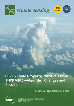
The Clouds and the Earth’s Radiant Energy System (CERES) has monitored clouds and radiation since 2000 with broadband radiometers collocated with cloud properties retrieved from radiances measured by the MODerate-Resolution Imaging Spectroradiometer (MODIS) on Terra and Aqua. Continuing the CERES cloud record employs radiances from the Visible Infrared Imaging Radiometer Suite (VIIRS) in the Suomi National Polar-orbiting Partnership. The MODIS retrieval techniques are adapted to VIIRS to minimize spectral and channel differences, with several additional changes. With a few exceptions, the resulting 2012–2020 VIIRS cloud amount, phase, height, optical depth, and hydrometeor size retrievals agree reasonably well with their Aqua MODIS counterparts. Various sources of disagreement are identified and will be mitigated in future editions. View this paper
  • Issues are regarded as officially published after their release is announced to the table of contents alert mailing list .
  • You may sign up for email alerts to receive table of contents of newly released issues.
  • PDF is the official format for papers published in both, html and pdf forms. To view the papers in pdf format, click on the "PDF Full-text" link, and use the free Adobe Reader to open them.

Articles (325)

  • Article
  • Open Access
19 Citations
4,014 Views
17 Pages

Spatiotemporal Distribution and Main Influencing Factors of Grasshopper Potential Habitats in Two Steppe Types of Inner Mongolia, China

  • Jing Guo,
  • Longhui Lu,
  • Yingying Dong,
  • Wenjiang Huang,
  • Bing Zhang,
  • Bobo Du,
  • Chao Ding,
  • Huichun Ye,
  • Kun Wang and
  • Yanru Huang
  • + 3 authors

3 February 2023

Grasshoppers can greatly interfere with agriculture and husbandry, and they will breed and grow rapidly in suitable habitats. Therefore, it is necessary to extract the distribution of the grasshopper potential habitat (GPH), analyze the spatial-tempo...

  • Article
  • Open Access
1 Citations
4,018 Views
25 Pages

3 February 2023

The existing formulas for the synthetic aperture radar (SAR) Doppler centroid estimation standard deviation (STD) suffer from various limitations, especially for a dynamic sea surface. In this study, we derive an improved version of these formulas th...

  • Article
  • Open Access
5 Citations
4,088 Views
18 Pages

X-Band Radar Attenuation Correction Method Based on LightGBM Algorithm

  • Qiang Yang,
  • Yan Feng,
  • Li Guan,
  • Wenyu Wu,
  • Sichen Wang and
  • Qiangyu Li

3 February 2023

X-band weather radar can provide high spatial and temporal resolution data, which is essential to precipitation observation and prediction of mesoscale and microscale weather. However, X-band weather radar is susceptible to precipitation attenuation....

  • Article
  • Open Access
116 Citations
12,931 Views
24 Pages

Design and Application of a UAV Autonomous Inspection System for High-Voltage Power Transmission Lines

  • Ziran Li,
  • Yanwen Zhang,
  • Hao Wu,
  • Satoshi Suzuki,
  • Akio Namiki and
  • Wei Wang

3 February 2023

As the scale of the power grid continues to expand, the human-based inspection method struggles to meet the needs of efficient grid operation and maintenance. Currently, the existing UAV inspection system in the market generally has short endurance p...

  • Article
  • Open Access
33 Citations
6,536 Views
24 Pages

Impacts of Green Fraction Changes on Surface Temperature and Carbon Emissions: Comparison under Forestation and Urbanization Reshaping Scenarios

  • Faisal Mumtaz,
  • Jing Li,
  • Qinhuo Liu,
  • Aqil Tariq,
  • Arfan Arshad,
  • Yadong Dong,
  • Jing Zhao,
  • Barjeece Bashir,
  • Hu Zhang and
  • Chenpeng Gu
  • + 1 author

3 February 2023

Global land cover dynamics alter energy, water, and greenhouse gas exchange between land and atmosphere, affecting local to global weather and climate change. Although reforestation can provide localized cooling, ongoing land use land cover (LULC) sh...

  • Technical Note
  • Open Access
5 Citations
2,518 Views
15 Pages

3 February 2023

In real estate appraisal, especially of residential buildings, one of the primary evaluation parameters is the property’s usable area. When determining the property price, Polish appraisers use data from comparable transactions included in the...

  • Article
  • Open Access
7 Citations
3,711 Views
17 Pages

Stability Analysis of Rocky Slopes on the Cuenca–Girón–Pasaje Road, Combining Limit Equilibrium Methods, Kinematics, Empirical Methods, and Photogrammetry

  • Xavier Delgado-Reivan,
  • Cristhian Paredes-Miranda,
  • Silvia Loaiza,
  • Michelle Del Pilar Villalta Echeverria,
  • Maurizio Mulas and
  • Luis Jordá-Bordehore

3 February 2023

The 3D point clouds obtained from the low-cost, remote, and precise SfM (Structure from Motion) technique allow the extraction and acquisition of discontinuities and their characteristics both manually, with the compass and virtual ruler of the Cloud...

  • Article
  • Open Access
9 Citations
4,592 Views
24 Pages

AI-Prepared Autonomous Freshwater Monitoring and Sea Ground Detection by an Autonomous Surface Vehicle

  • Sebastian Pose,
  • Stefan Reitmann,
  • Gero Jörn Licht,
  • Thomas Grab and
  • Tobias Fieback

3 February 2023

Climate change poses special and new challenges to inland waters, requiring intensive monitoring. An application based on an autonomous operation swimming vehicle (ASV) is being developed that will provide simulations, spatially and depth-resolved wa...

  • Article
  • Open Access
6 Citations
2,498 Views
18 Pages

3 February 2023

Potentially toxic elements (PTEs) from natural and anthropogenic activities threaten the environment and human health. The associations of PTEs with natural hazards can be powerful and prominent mechanisms to release PTEs, considerably hastening thei...

  • Technical Note
  • Open Access
5 Citations
3,301 Views
17 Pages

3 February 2023

As drought vulnerability assessment is fundamental to risk management, it is urgent to develop scientific and reasonable assessment models to determine such vulnerability. A vulnerability curve is the key to risk assessment of various disasters, conn...

of 33

Get Alerted

Add your email address to receive forthcoming issues of this journal.

XFacebookLinkedIn
Remote Sens. - ISSN 2072-4292