Article

Vegetation Trend Detection Using Time Series Satellite Data as Ecosystem Condition Indicators for Analysis in the Northwestern Highlands of Ethiopia

by
Bireda Alemayehu
1,2,*,
Juan Suarez-Minguez
3,
Jacqueline Rosette
4 and
Saeed A. Khan
5
1
Space Science and Geospatial Institute, Addis Ababa P.O. Box 33679, Ethiopia
2
Department of Geography and Environmental Studies, Debre Markos University, Debre Markos P.O. Box 269, Ethiopia
3
Forest Research Agency of the Forestry Commission, Northern Research Station, Midlothian EH25 9SY, UK
4
Department of Geography, Swansea University, Swansea SA2 8PP, UK
5
Department of Geography, University of Bayreuth, D-95447 Bayreuth, Germany
*
Author to whom correspondence should be addressed.
Remote Sens. 2023, 15(20), 5032; https://doi.org/10.3390/rs15205032
Submission received: 12 August 2023 / Revised: 20 September 2023 / Accepted: 22 September 2023 / Published: 20 October 2023
(This article belongs to the Section Ecological Remote Sensing)

Abstract

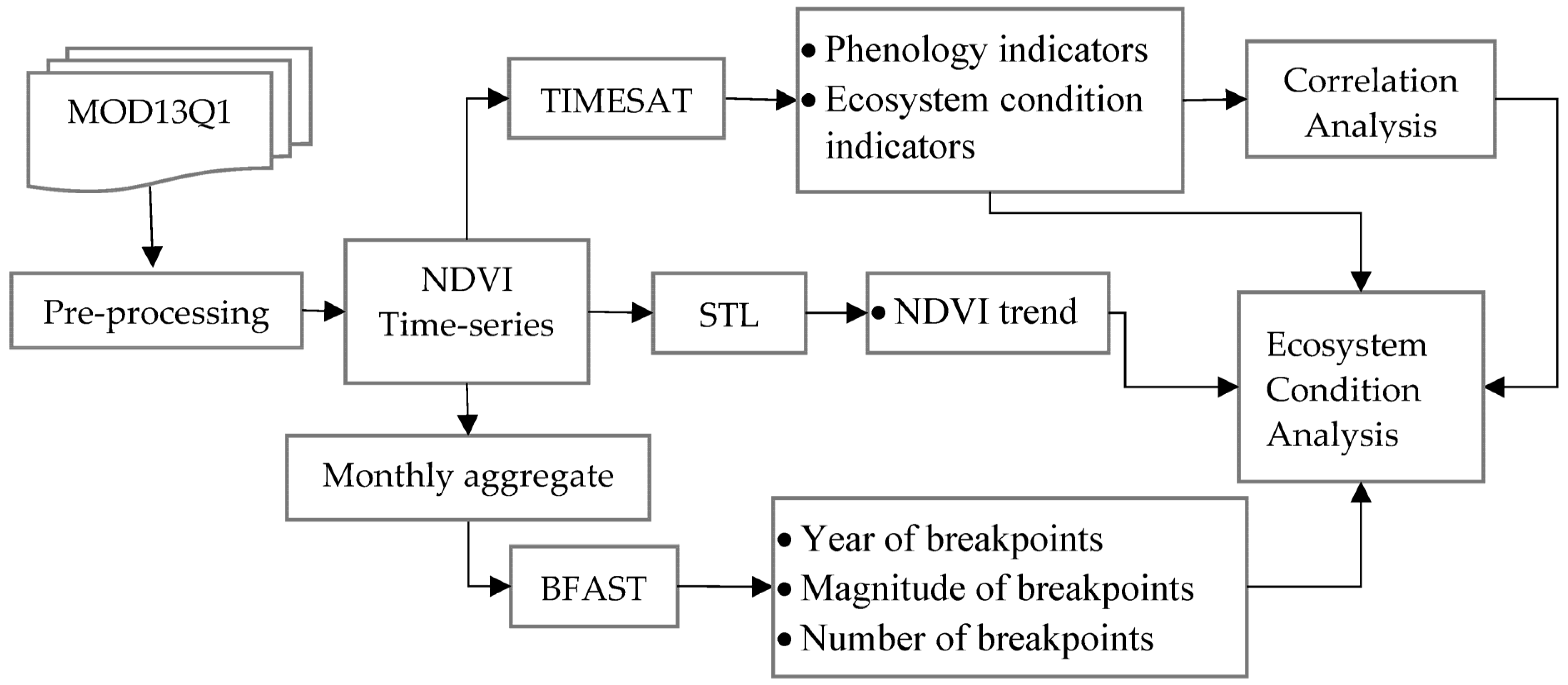
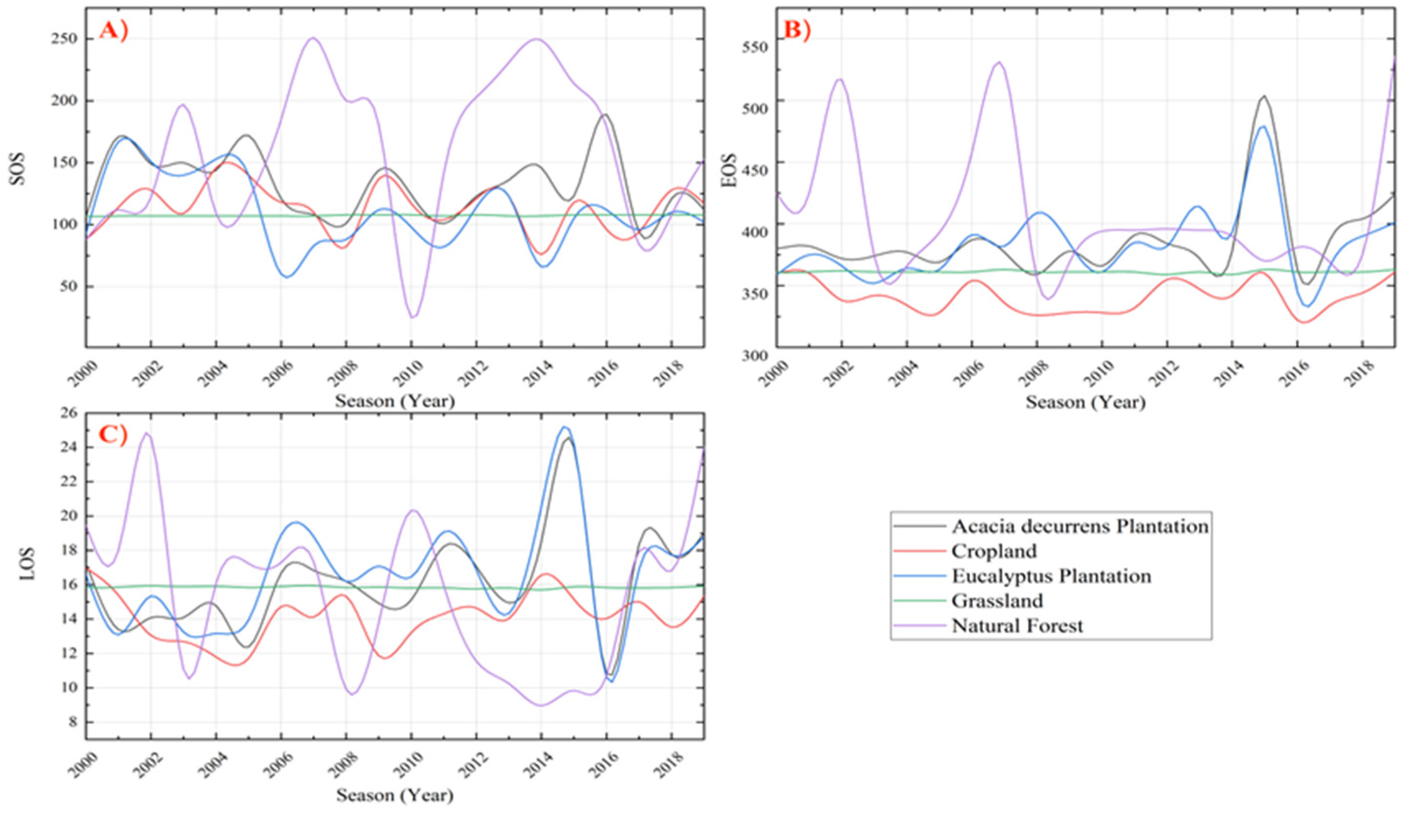
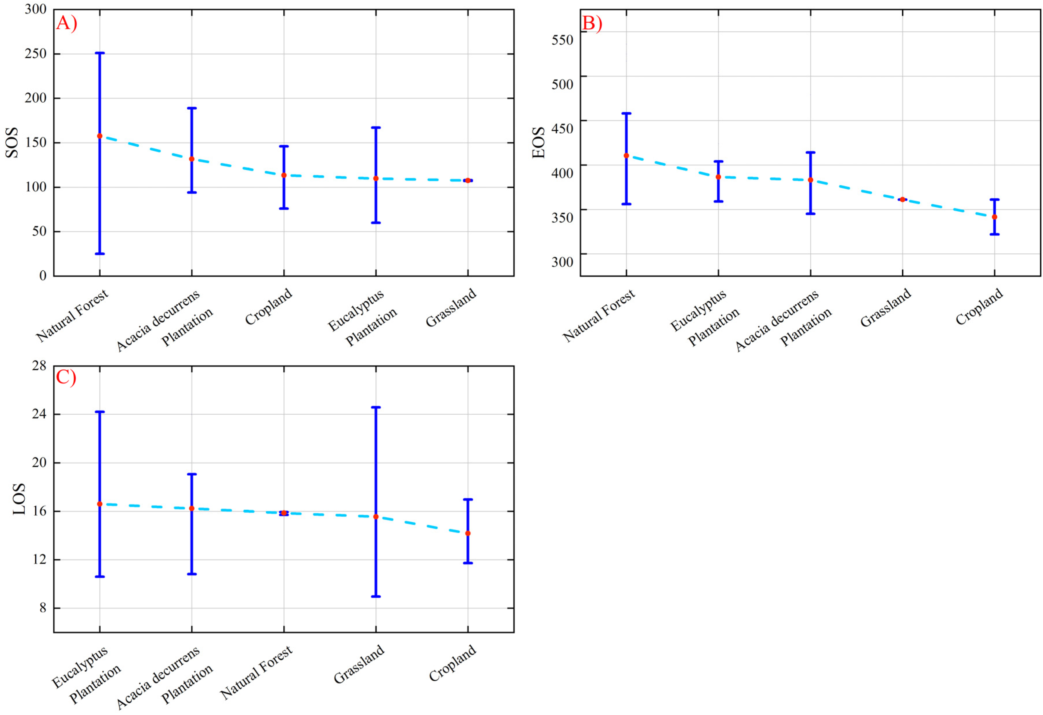
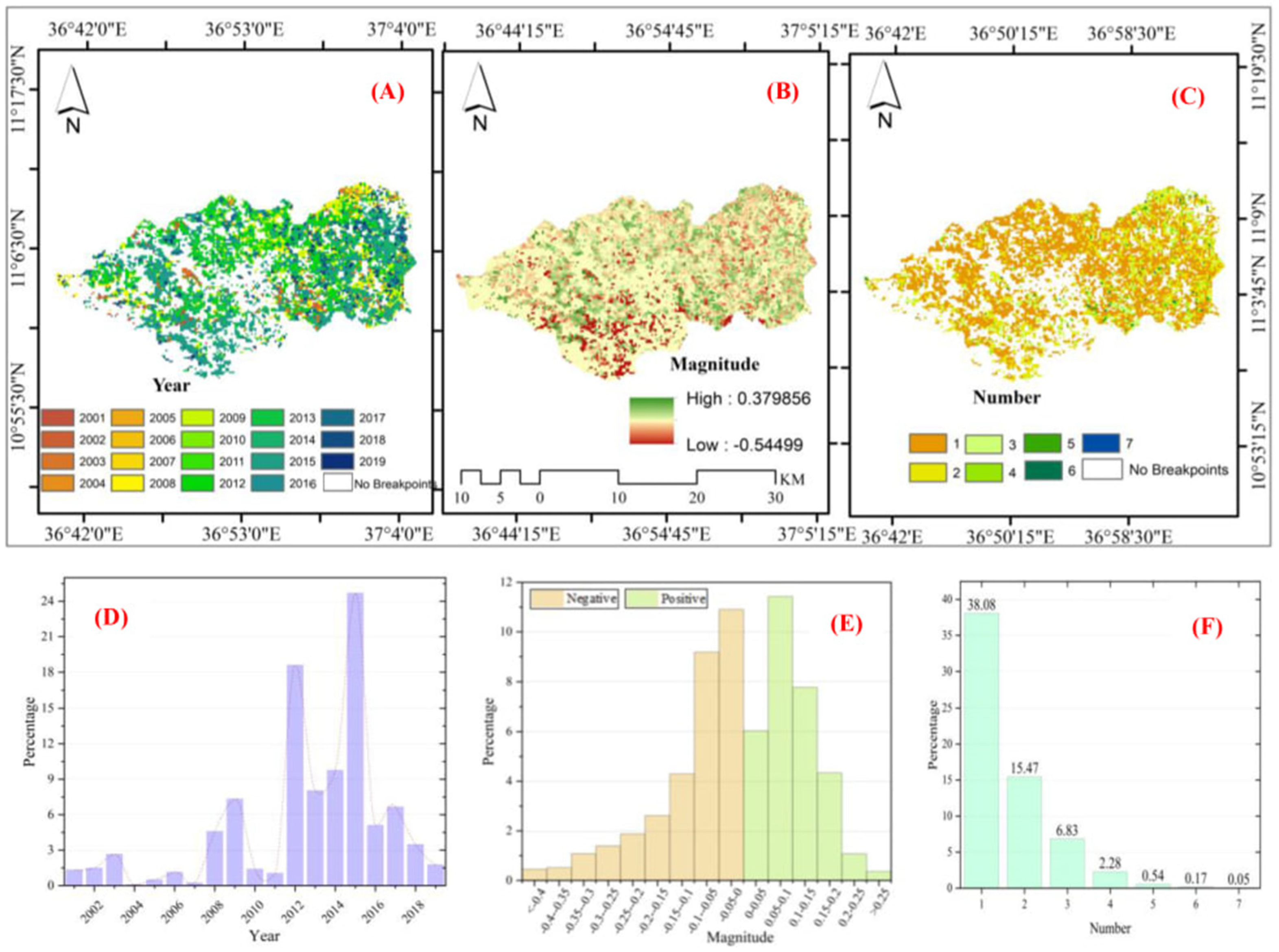
Vegetation is an essential component of the terrestrial ecosystem and has changed significantly over the last two decades in the Northwestern Highlands of Ethiopia. However, previous studies have focused on the detection of bitemporal change and lacked the incorporation of entire vegetation time series changes, which are considered significant indicators of ecosystem conditions. The Normalized Difference Vegetation Index (NDVI) time series dataset from the Moderate-Resolution Imaging Spectroradiometer (MODIS) is an efficient method for analyzing the dynamics of vegetation change over a lengthy period using remote sensing techniques. This study aimed to utilize time series satellite data to detect vegetation changes from 2000 to 2020 and investigate their links with ecosystem conditions. The time-series satellite processing package (TIMESAT) was used to estimate the seasonal parameter values of NDVI and their correlation across the seasons during the study period. Break Detection for Additive Season and Trend (BFAST) was applied to identify the year of breakpoints, the direction of magnitude, and the number of breakpoints. The results were reported, analyzed, and linked to ecosystem conditions. The overall trend in the study area increased from 0.58 (2000–2004) to 0.65 (2015–2020). As a result, ecosystem condition indicators such as peak value (PV), base value (BV), amplitude (Amp), and large integral (LI) exhibited significant positive trends, particularly for Acacia decurrens plantations, Eucalyptus plantations, and grasslands, but phenology indicator parameters such as start of season (SOS), end of season (EOS), and length of season (LOS) did not show significant trends for almost any vegetation type. The most abrupt changes were recorded in 2015 (24.7%), 2012 (18.6%), and 2014 (9.8%). Approximately 30% of the vegetation changes were positive in magnitude. The results of this study imply that there was an improvement in the ecosystem’s condition following the establishment of the Acacia decurrens plantation. The findings are considered relevant inputs for policymakers and serve as an initial stage for the assessment of the other environmental and climatic implications of Acacia decurrens plantations at the local scale.
Keywords: BFAST; ecosystem condition; Fagita Lekoma; TIMESAT; time series; vegetation trend BFAST; ecosystem condition; Fagita Lekoma; TIMESAT; time series; vegetation trend