Next Issue
Volume 3, September
Previous Issue
Volume 3, March


Drones, Volume 3, Issue 2 (June 2019) – 21 articles

Cover Story (view full-size image): 
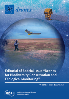
Wetlands are biodiversity hotsposts all across the globe. These ecosystems are very sensitive to global change, and long-term monitoring is essential to track changes and trends. Early alert protocols for alien species, water pollution, algal blooms, etc. assist in providing rapid management responses. In situ monitoring requires permanent and extensive sampling in harsh environments. Satellite images contribute to enlarge scales with the need for ground- truth. Drones equipped with multispectral sensors play a very relevant role in upscaling data collected in the field with pixel-derived information. This is the case of the Doñana wetlands, where inundation level, water depth, and turbidity, together with aquatic plant cover, have been mapped with multispectral images captured by a fixed wing drone and used to upscale ground-truth to Sentinel-2 images. View this paper.
  • Issues are regarded as officially published after their release is announced to the table of contents alert mailing list.
  • You may sign up for e-mail alerts to receive table of contents of newly released issues.
  • PDF is the official format for papers published in both, html and pdf forms. To view the papers in pdf format, click on the "PDF Full-text" link, and use the free Adobe Reader to open them.
Order results
Result details
Section
Select all
Export citation of selected articles as:
24 pages, 6236 KiB  
Article
Sun Tracking Technique Applied to a Solar Unmanned Aerial Vehicle
by Jorge L. Hernandez-Toral, Iván González-Hernández and Rogelio Lozano
Drones 2019, 3(2), 51; https://doi.org/10.3390/drones3020051 - 22 Jun 2019
Cited by 5 | Viewed by 8635
Abstract
In recent years, solar energy has been used as an energy source for many different applications. Currently in the area of Unmanned Aerial Vehicles (UAVs), there are research studies that incorporate this renewable energy technology to increase the vehicle’s autonomy. This technique also [...] Read more.
In recent years, solar energy has been used as an energy source for many different applications. Currently in the area of Unmanned Aerial Vehicles (UAVs), there are research studies that incorporate this renewable energy technology to increase the vehicle’s autonomy. This technique also needs particular construction techniques and electronic boards, designed to reduce weight and increase the efficiency of all solar systems on board the UAV. As is well known, the amount of generated solar energy could be increased throughout a day a sun tracking technique is added. The present paper proves that the roll angle of a fixed wing UAV can be used to track the sun to increase the energy generated by the solar panels placed on the wing. In that case, the plane’s attitude must be compensated with the yaw angle control to be able to perform a photogrammetric mission. This will be achieved using a control strategy based on the super-twisting technique that ensures convergence in finite time even in the presence of bounded perturbations. The design of the control laws as well as the numerical simulation and real flight results are shown to validate the use of the sun tracking system. Full article
Show Figures

Figure 1

12 pages, 4378 KiB  
Article
A Low Cost Approach to Disturbed Soil Detection Using Low Altitude Digital Imagery from an Unmanned Aerial Vehicle
by Elizabeth Parrott, Heather Panter, Joanne Morrissey and Frederic Bezombes
Drones 2019, 3(2), 50; https://doi.org/10.3390/drones3020050 - 21 Jun 2019
Cited by 11 | Viewed by 5800
Abstract
Until recently, clandestine burial investigations relied upon witness statements to determine target search areas of soil and vegetation disturbance. Due to this, remote sensing technologies are increasingly used to detect fresh clandestine graves. However, despite the increased capabilities of remote sensing, clandestine burial [...] Read more.
Until recently, clandestine burial investigations relied upon witness statements to determine target search areas of soil and vegetation disturbance. Due to this, remote sensing technologies are increasingly used to detect fresh clandestine graves. However, despite the increased capabilities of remote sensing, clandestine burial searches remain resourcefully intensive as the police have little access to the technology when it is required. In contrast to this, Unmanned Aerial Vehicle (UAV) technology is increasingly popular amongst law enforcement worldwide. As such, this paper explores the use of digital imagery collected from a low cost UAV for the aided detection of disturbed soil sites indicative of fresh clandestine graves. This is done by assessing the unaltered UAV video output using image processing tools to detect sites of disturbance, therefore highlighting previously unrecognised capabilities of police UAVs. This preliminary investigation provides a low cost rapid approach to detecting fresh clandestine graves, further supporting the use of UAV technology by UK police. Full article
Show Figures

Figure 1

24 pages, 10153 KiB  
Article
Insights into Sensitivity of Wing Shape and Kinematic Parameters Relative to Aerodynamic Performance of Flapping Wing Nano Air Vehicles
by G. Throneberry, M. Hassanalian and A. Abdelkefi
Drones 2019, 3(2), 49; https://doi.org/10.3390/drones3020049 - 19 Jun 2019
Cited by 11 | Viewed by 4017
Abstract
In this work, seven wings inspired from insects’ wings, including those inspired by the bumblebee, cicada, cranefly, fruitfly, hawkmoth, honeybee, and twisted parasite, are patterned and analyzed in FlapSim software in forward and hovering flight modes for two scenarios, namely, similar wingspan (20 [...] Read more.
In this work, seven wings inspired from insects’ wings, including those inspired by the bumblebee, cicada, cranefly, fruitfly, hawkmoth, honeybee, and twisted parasite, are patterned and analyzed in FlapSim software in forward and hovering flight modes for two scenarios, namely, similar wingspan (20 cm) and wing surface (0.005 m2). Considering their similar kinematics, the time histories of the aerodynamic forces of lift, thrust, and required mechanical power of the inspired wings are calculated, shown, and compared for both scenarios. The results obtained from FlapSim show that wing shape strongly impacts the performance and aerodynamic characteristics of the chosen seven wings. To study the effects of different geometrical and physical factors including flapping frequency, elevation amplitude, pronation amplitude, stroke-plane angle, flight speed, wing material, and wingspan, several analyses are carried out on the honeybee-inspired shape, which had a 20 cm wingspan. This study can be used to evaluate the efficiency of different bio-inspired wing shapes and may provide a guideline for comparing the performance of flapping wing nano air vehicles with forward flight and hovering capabilities. Full article
(This article belongs to the Special Issue Bio-Inspired Drones)
Show Figures

Figure 1

16 pages, 1665 KiB  
Technical Note
Giant Big Stik R/C UAV Computer Model Development in JSBSim for Sense and Avoid Applications
by Oihane Cereceda, Luc Rolland and Siu O’Young
Drones 2019, 3(2), 48; https://doi.org/10.3390/drones3020048 - 18 Jun 2019
Cited by 5 | Viewed by 3573
Abstract
Open-source aerospace simulation packages often lack unmanned aerial vehicles (UAVs) models, limiting the study of their interaction with other elements in the airspace. These events, which are a consequence of encounters between manned and unmanned aircraft, have recently attracted interest due to the [...] Read more.
Open-source aerospace simulation packages often lack unmanned aerial vehicles (UAVs) models, limiting the study of their interaction with other elements in the airspace. These events, which are a consequence of encounters between manned and unmanned aircraft, have recently attracted interest due to the uncertainties created by UAVs in real environments. In this paper, a fit-for-purpose flight dynamics model specific for sense and avoid (SAA) strategies in near mid-air collision scenarios is developed based on existing model development practices and adjusted from flight data. The Giant Big Stik is recognized as the representative aircraft for testing SAA manoeuvres due to its capabilities. The simulation platform is based on the JSBSim open-source flight dynamics model, and the SAA application is carried out following the current regulations and flight recommendations for UAVs in Canada. Through this methodology, the error between the real and the computer model is reduced in every step that is minimal for the SAA application. The relevance of this paper is also shown in future applications, where this model will be incorporated into more complex simulations with manned aircraft for the study of avoidance manoeuvres that will serve the safe integration of UAVs into the airspace. Full article
Show Figures

Figure 1

4 pages, 194 KiB  
Editorial
Editorial of Special Issue “Drones for Biodiversity Conservation and Ecological Monitoring”
by Ricardo Díaz-Delgado and Sander Mücher
Drones 2019, 3(2), 47; https://doi.org/10.3390/drones3020047 - 07 Jun 2019
Cited by 8 | Viewed by 9533
Abstract
Unmanned Aerial Vehicles (UAV) have already become an affordable and cost-efficient tool to quickly map a targeted area for many emerging applications in the arena of Ecological Monitoring and Biodiversity Conservation. Managers, owners, companies and scientists are using professional drones equipped with high-resolution [...] Read more.
Unmanned Aerial Vehicles (UAV) have already become an affordable and cost-efficient tool to quickly map a targeted area for many emerging applications in the arena of Ecological Monitoring and Biodiversity Conservation. Managers, owners, companies and scientists are using professional drones equipped with high-resolution visible, multispectral or thermal cameras to assess the state of ecosystems, the effect of disturbances, or the dynamics and changes of biological communities inter alia. It is now a defining time to assess the use of drones for these types of applications over natural areas and protected areas. UAV missions are increasing but most of them are just testing its applicability. It is time now to move to frequent revisiting missions, aiding in the retrieval of important biophysical parameters in ecosystems or mapping species distributions. This Special Issue is aimed at collecting UAV applications contributing to a better understanding of biodiversity and ecosystem status, threats, changes and trends. Submissions were welcomed from purely scientific missions to operational management missions, evidencing the enhancement of knowledge in: Essential biodiversity variables and ecosystem services mapping; ecological integrity parameters mapping; long-term ecological monitoring based on UAVs; mapping of alien species spread and distribution; upscaling ecological variables from drone to satellite images: methods and approaches; rapid risk and disturbance assessment using drones, ecosystem structure and processes assessment by using UAVs, mapping threats, vulnerability and conservation issues of biological communities and species; mapping of phenological and temporal trends and habitat mapping; monitoring and reporting of conservation status. Full article
(This article belongs to the Special Issue Drones for Biodiversity Conservation and Ecological Monitoring)
10 pages, 3555 KiB  
Article
Positional Precision Analysis of Orthomosaics Derived from Drone Captured Aerial Imagery
by I-Kuai Hung, Daniel Unger, David Kulhavy and Yanli Zhang
Drones 2019, 3(2), 46; https://doi.org/10.3390/drones3020046 - 31 May 2019
Cited by 25 | Viewed by 7106
Abstract
The advancement of drones has revolutionized the production of aerial imagery. Using a drone with its associated flight control and image processing applications, a high resolution orthorectified mosaic from multiple individual aerial images can be produced within just a few hours. However, the [...] Read more.
The advancement of drones has revolutionized the production of aerial imagery. Using a drone with its associated flight control and image processing applications, a high resolution orthorectified mosaic from multiple individual aerial images can be produced within just a few hours. However, the positional precision and accuracy of any orthomosaic produced should not be overlooked. In this project, we flew a DJI Phantom drone once a month over a seven-month period over Oak Grove Cemetery in Nacogdoches, Texas, USA resulting in seven orthomosaics of the same location. We identified 30 ground control points (GCPs) based on permanent features in the cemetery and recorded the geographic coordinates of each GCP on each of the seven orthomosaics. Analyzing the cluster of each GCP containing seven coincident positions depicts the positional precision of the orthomosaics. Our analysis is an attempt to answer the fundamental question, “Are we obtaining the same geographic coordinates for the same feature found on every aerial image mosaic captured by a drone over time?” The results showed that the positional precision was higher at the center of the orthomosaic compared to the edge areas. In addition, the positional precision was lower parallel to the direction of the drone flight. Full article
Show Figures

Figure 1

17 pages, 5100 KiB  
Article
Calibrating Sentinel-2 Imagery with Multispectral UAV Derived Information to Quantify Damages in Mediterranean Rice Crops Caused by Western Swamphen (Porphyrio porphyrio)
by Magda Pla, Gerard Bota, Andrea Duane, Jaume Balagué, Antoni Curcó, Ricard Gutiérrez and Lluís Brotons
Drones 2019, 3(2), 45; https://doi.org/10.3390/drones3020045 - 21 May 2019
Cited by 18 | Viewed by 6353
Abstract
Making agricultural production compatible with the conservation of biological diversity is a priority in areas in which human–wildlife conflicts arise. The threatened Western Swamphen (Porphyrio porphyrio) feeds on rice, inducing crop damage and leading to decreases in rice production. Due to [...] Read more.
Making agricultural production compatible with the conservation of biological diversity is a priority in areas in which human–wildlife conflicts arise. The threatened Western Swamphen (Porphyrio porphyrio) feeds on rice, inducing crop damage and leading to decreases in rice production. Due to the Swamphen protection status, economic compensation policies have been put in place to compensate farmers for these damages, thus requiring an accurate, quantitative, and cost-effective evaluation of rice crop losses over large territories. We used information captured from a UAV (Unmanned Aerial Vehicle) equipped with a multispectral Parrot SEQUOIA camera as ground-truth information to calibrate Sentinel-2 imagery to quantify damages in the region of Ebro Delta, western Mediterranean. UAV vegetation index NDVI (Normalized Difference Vegetation Index) allowed estimation of damages in rice crops at 10 cm pixel resolution by discriminating no-green vegetation pixels. Once co-registered with Sentinel grid, we predicted the UAV damage proportion at a 10 m resolution as a function of Sentinel-2 NDVI, and then we extrapolated the fitted model to the whole Sentinel-2 Ebro Delta image. Finally, the damage predicted with Sentinel-2 data was quantified at the agricultural plot level and validated with field information compiled on the ground by Rangers Service. We found that Sentinel2-NDVI data explained up to 57% of damage reported with UAV. The final validation with Rangers Service data pointed out some limitations in our procedure that leads the way to improving future development. Sentinel2 imagery calibrated with UAV information proved to be a viable and cost-efficient alternative to quantify damages in rice crops at large scales. Full article
(This article belongs to the Special Issue Drones for Biodiversity Conservation and Ecological Monitoring)
Show Figures

Figure 1

19 pages, 3608 KiB  
Article
Assessing Reef-Island Shoreline Change Using UAV-Derived Orthomosaics and Digital Surface Models
by Meagan K. Lowe, Farrah Anis Fazliatul Adnan, Sarah M. Hamylton, Rafael C. Carvalho and Colin D. Woodroffe
Drones 2019, 3(2), 44; https://doi.org/10.3390/drones3020044 - 14 May 2019
Cited by 33 | Viewed by 6240
Abstract
This study presents an analysis of shoreline change on reef islands using unmanned aerial vehicle (UAV)-derived orthomosaics and digital surface models (DSMs) collected on Sipadan Island, Sabah, Malaysia, and Sasahura Ite Island, Isabel Province, Solomon Islands. The high resolution of UAV-derived orthomosaics enabled [...] Read more.
This study presents an analysis of shoreline change on reef islands using unmanned aerial vehicle (UAV)-derived orthomosaics and digital surface models (DSMs) collected on Sipadan Island, Sabah, Malaysia, and Sasahura Ite Island, Isabel Province, Solomon Islands. The high resolution of UAV-derived orthomosaics enabled changes in the position of the base of beach to be detected with confidence. The accuracy of the UAV-derived DSMs was assessed against equivalent topographic profiles via root-mean-square error, and found to be <0.21 m in all but one case; this demonstrates the potential for using UAV-derived DSMs to interpret three-dimensional island beach morphology and detect patterns of geomorphic change. The correlation between planimetric and volumetric change along selected beach transects was also investigated and found to be variable, indicating that a multifaceted approach including both planimetric (two-dimensional) and volumetric (three-dimensional) metrics is of value when analysing reef-island change. However, interpretations of UAV-derived data must carefully consider errors associated with global positioning system (GPS) positioning, the distribution of ground control points, the chosen UAV flight parameters, and the data processing methodology. Further application of this technology has the potential to expand our understanding of reef-island morphodynamics and their vulnerability to sea-level rise and other stressors. Full article
(This article belongs to the Special Issue Drones for Coastal Environments)
Show Figures

Figure 1

18 pages, 10854 KiB  
Article
Remote Sensing of Wildfire Using a Small Unmanned Aerial System: Post-Fire Mapping, Vegetation Recovery and Damage Analysis in Grand Bay, Mississippi/Alabama, USA
by Sathishkumar Samiappan, Lee Hathcock, Gray Turnage, Cary McCraine, Jonathan Pitchford and Robert Moorhead
Drones 2019, 3(2), 43; https://doi.org/10.3390/drones3020043 - 09 May 2019
Cited by 29 | Viewed by 7348
Abstract
Wildfires can be beneficial for native vegetation. However, wildfires can impact property values, human safety, and ecosystem function. Resource managers require safe, easy to use, timely, and cost-effective methods for quantifying wildfire damage and regeneration. In this work, we demonstrate an approach using [...] Read more.
Wildfires can be beneficial for native vegetation. However, wildfires can impact property values, human safety, and ecosystem function. Resource managers require safe, easy to use, timely, and cost-effective methods for quantifying wildfire damage and regeneration. In this work, we demonstrate an approach using an unmanned aerial system (UAS) equipped with a MicaSense RedEdge multispectral sensor to classify and estimate wildfire damage in a coastal marsh. We collected approximately 7.2 km2 of five-band multispectral imagery after a wildfire event in February 2016, which was used to create a photogrammetry-based digital surface model (DSM) and orthomosaic for object-based classification analysis. Airborne light detection and ranging data were used to validate the accuracy of the DSM. Four-band airborne imagery from pre- and post-fire were used to estimate pre-fire health, post-fire damage, and track the vegetation recovery process. Immediate and long-term post-fire classifications, area, and volume of burned regions were produced to track the revegetation progress. The UAS-based classification produced from normalized difference vegetation index and DSM was compared to the Landsat-based Burned Area Reflectance Classification. Experimental results show the potential of using UAS and the presented approach compared to satellite-based mapping in terms of classification accuracies, turnaround time, and spatial and temporal resolutions. Full article
Show Figures

Figure 1

14 pages, 10940 KiB  
Article
Morphological Exposure of Rocky Platforms: Filling the Hazard Gap Using UAVs
by Rafael C. Carvalho and Colin D. Woodroffe
Drones 2019, 3(2), 42; https://doi.org/10.3390/drones3020042 - 03 May 2019
Cited by 6 | Viewed by 3649
Abstract
Rock platforms are dangerous environments commonly subject to high wave energy on the open coast. Platform morphology is central to understanding what makes one stretch of coastline more hazardous than another, and it can be used to create site-specific morphological exposure hazard indices [...] Read more.
Rock platforms are dangerous environments commonly subject to high wave energy on the open coast. Platform morphology is central to understanding what makes one stretch of coastline more hazardous than another, and it can be used to create site-specific morphological exposure hazard indices to assess the relative risk of being washed into the sea, assisting coastal managers in an effort to reduce the number of injuries and drowning incidents. This paper describes the use of an unmanned aerial vehicle (UAV) to derive morphological parameters for two data-poor rock platforms along the Illawarra coast of southern New South Wales, to fill the gap using an easily replicable site-specific hazard index, developed previously, that can be applied to other microtidal wave-dominated settings. The approach is based on the subdivision of the terrestrial seaward edge of platforms into segments, classified according to mean elevation, orientation and edge type, to model different weighting scenarios of predominant southeasterly and northeasterly wave direction. UAV-derived results were deemed satisfactory for all study sites, and a comparison of results derived from LiDAR for two platforms suggested that UAV data can be successfully used to guide risk policy on rock coasts, despite differences in the delimitation of the seaward edge due to tidal level during survey acquisition. Full article
(This article belongs to the Special Issue Drones for Coastal Environments)
Show Figures

Figure 1

11 pages, 658 KiB  
Article
Fright or Flight? Behavioural Responses of Kangaroos to Drone-Based Monitoring
by Elizabeth Brunton, Jessica Bolin, Javier Leon and Scott Burnett
Drones 2019, 3(2), 41; https://doi.org/10.3390/drones3020041 - 24 Apr 2019
Cited by 28 | Viewed by 7350
Abstract
Drones are often considered an unobtrusive method of monitoring terrestrial wildlife; however research into whether drones disturb wildlife is in its early stages. This research investigated the potential impacts of drone monitoring on a large terrestrial mammal, the eastern grey kangaroo (Macropus [...] Read more.
Drones are often considered an unobtrusive method of monitoring terrestrial wildlife; however research into whether drones disturb wildlife is in its early stages. This research investigated the potential impacts of drone monitoring on a large terrestrial mammal, the eastern grey kangaroo (Macropus giganteus), in urban and peri-urban environments. We assessed the response of kangaroos to drone monitoring by analysing kangaroo behaviour prior to and during drone deployments using a linear modelling approach. We also explored factors that influenced kangaroo responses including drone altitude, site characteristics and kangaroo population dynamics and demographics. We showed that drones elicit a vigilance response, but that kangaroos rarely fled from the drone. However, kangaroos were most likely to flee from a drone flown at an altitude of 30 m. This study suggests that drone altitude is a key consideration for minimising disturbance of large terrestrial mammals and that drone flights at an altitude of 60–100 m above ground level will minimise behavioural impacts. It also highlights the need for more research to assess the level of intrusion and other impacts that drone surveys have on the behaviour of wildlife and the accuracy of the data produced. Full article
Show Figures

Figure 1

27 pages, 409 KiB  
Review
A Review on the Use of Unmanned Aerial Vehicles and Imaging Sensors for Monitoring and Assessing Plant Stresses
by Jayme Garcia Arnal Barbedo
Drones 2019, 3(2), 40; https://doi.org/10.3390/drones3020040 - 20 Apr 2019
Cited by 165 | Viewed by 22595
Abstract
Unmanned aerial vehicles (UAVs) are becoming a valuable tool to collect data in a variety of contexts. Their use in agriculture is particularly suitable, as those areas are often vast, making ground scouting difficult, and sparsely populated, which means that injury and privacy [...] Read more.
Unmanned aerial vehicles (UAVs) are becoming a valuable tool to collect data in a variety of contexts. Their use in agriculture is particularly suitable, as those areas are often vast, making ground scouting difficult, and sparsely populated, which means that injury and privacy risks are not as important as in urban settings. Indeed, the use of UAVs for monitoring and assessing crops, orchards, and forests has been growing steadily during the last decade, especially for the management of stresses such as water, diseases, nutrition deficiencies, and pests. This article presents a critical overview of the main advancements on the subject, focusing on the strategies that have been used to extract the information contained in the images captured during the flights. Based on the information found in more than 100 published articles and on our own research, a discussion is provided regarding the challenges that have already been overcome and the main research gaps that still remain, together with some suggestions for future research. Full article
(This article belongs to the Special Issue UAV/Drones for Agriculture and Forestry)
22 pages, 26577 KiB  
Article
Using Fixed-Wing UAV for Detecting and Mapping the Distribution and Abundance of Penguins on the South Shetlands Islands, Antarctica
by Christian Pfeifer, Andres Barbosa, Osama Mustafa, Hans-Ulrich Peter, Marie-Charlott Rümmler and Alexander Brenning
Drones 2019, 3(2), 39; https://doi.org/10.3390/drones3020039 - 19 Apr 2019
Cited by 34 | Viewed by 8899
Abstract
Antarctic marine ecosystems undergo enormous changes, presumably due to climate change and fishery. Unmanned aerial vehicles (UAVs) have an unprecedented potential for measuring these changes by mapping indicator species such as penguins even in remote areas. We used a battery-powered fixed-wing UAV to [...] Read more.
Antarctic marine ecosystems undergo enormous changes, presumably due to climate change and fishery. Unmanned aerial vehicles (UAVs) have an unprecedented potential for measuring these changes by mapping indicator species such as penguins even in remote areas. We used a battery-powered fixed-wing UAV to survey colonies along a 30-km stretch of the remote coast of southwest King George Island and northwest Nelson Island (South Shetland Islands, Antarctica) during the austral summer 2016/17. With multiple flights, we covered a total distance of 317 km. We determined the exact position of 14 chinstrap penguin colonies, including two small unknown colonies, with a total abundance of 35,604 adults. To model the number of occupied nests based on the number of adults counted in the UAV imagery we used data derived from terrestrial time-lapse imagery. The comparison with previous studies revealed a decline in the total abundance of occupied nests. However, we also found four chinstrap penguin colonies that have grown since the 1980s against the general trend on the South Shetland Islands. The results proved the suitability of the use of small and lightweight fixed-wing UAVs with electric engines for mapping penguin colonies in remote areas in the Antarctic. Full article
Show Figures

Graphical abstract

22 pages, 8669 KiB  
Article
Reef Rover: A Low-Cost Small Autonomous Unmanned Surface Vehicle (USV) for Mapping and Monitoring Coral Reefs
by George T. Raber and Steven R. Schill
Drones 2019, 3(2), 38; https://doi.org/10.3390/drones3020038 - 17 Apr 2019
Cited by 29 | Viewed by 10570
Abstract
In the effort to design a more repeatable and consistent platform to collect data for Structure from Motion (SfM) monitoring of coral reefs and other benthic habitats, we explore the use of recent advances in open source Global Positioning System (GPS)-guided drone technology [...] Read more.
In the effort to design a more repeatable and consistent platform to collect data for Structure from Motion (SfM) monitoring of coral reefs and other benthic habitats, we explore the use of recent advances in open source Global Positioning System (GPS)-guided drone technology to design and test a low-cost and transportable small unmanned surface vehicle (sUSV). The vehicle operates using Ardupilot open source software and can be used by local scientists and marine managers to map and monitor marine environments in shallow areas (<20 m) with commensurate visibility. The imaging system uses two Sony a6300 mirrorless cameras to collect stereo photos that can be later processed using photogrammetry software to create underwater high-resolution orthophoto mosaics and digital surface models. The propulsion system consists of two small brushless motors powered by lithium batteries that follow pre-programmed survey transects and are operated by a GPS-guided autopilot control board. Results from our project suggest the sUSV provides a repeatable, viable, and low-cost (<$3000 USD) solution for acquiring images of benthic environments on a frequent basis from directly below the water surface. These images can be used to create SfM models that provide very detailed images and measurements that can be used to monitor changes in biodiversity, reef erosion/accretion, and assessing health conditions. Full article
(This article belongs to the Special Issue Drones for Coastal Environments)
Show Figures

Graphical abstract

18 pages, 8352 KiB  
Article
Quadcopter-Based Rapid Response First-Aid Unit with Live Video Monitoring
by Raffay Rizwan, Muhammad Naeem Shehzad and Muhammad Naeem Awais
Drones 2019, 3(2), 37; https://doi.org/10.3390/drones3020037 - 15 Apr 2019
Cited by 7 | Viewed by 5590
Abstract
Air transport is the fastest way to reach areas with no direct land routes for ambulances. This paper presents the development of a quadcopter-based rapid response unit in an efficient aerial aid system to eliminate the delay time for first aid supplies. The [...] Read more.
Air transport is the fastest way to reach areas with no direct land routes for ambulances. This paper presents the development of a quadcopter-based rapid response unit in an efficient aerial aid system to eliminate the delay time for first aid supplies. The system comprises a health monitoring and calling system for a field person working in open areas and a base station with the quadcopter. In an uncertain situation, the quadcopter is deployed from the base station towards the field person for immediate help through the specified path using constant Global System for Mobile (GSM)- and Global Positioning System (GPS)-based connections. The entire operation can be monitored at the base station with a Virtual Reality (VR) head-tracking system supported by a smartphone. The camera installed on the quadcopter is synchronized with the operator’s head movement while wearing a VR head-tracking system at the base station. Moreover, an Infrared (IR)-based obstacle-evasion model is implemented separately to explain the working of the autonomous collision-avoidance system. The system was tested, which confirmed the reduction in the response time to supply aid to the desired locations. Full article
Show Figures

Figure 1

15 pages, 24026 KiB  
Article
Assessment of Texture Features for Bermudagrass (Cynodon dactylon) Detection in Sugarcane Plantations
by Cesare Di Girolamo-Neto, Ieda Del’Arco Sanches, Alana Kasahara Neves, Victor Hugo Rohden Prudente, Thales Sehn Körting, Michelle Cristina Araujo Picoli and Luiz Eduardo Oliveira e Cruz de Aragão
Drones 2019, 3(2), 36; https://doi.org/10.3390/drones3020036 - 13 Apr 2019
Cited by 11 | Viewed by 5047
Abstract
Sugarcane products contribute significantly to the Brazilian economy, generating U.S. $12.2 billion in revenue in 2018. Identifying and monitoring factors that induce yield reduction, such as weed occurrence, is thus imperative. The detection of Bermudagrass in sugarcane crops using remote sensing data, however, [...] Read more.
Sugarcane products contribute significantly to the Brazilian economy, generating U.S. $12.2 billion in revenue in 2018. Identifying and monitoring factors that induce yield reduction, such as weed occurrence, is thus imperative. The detection of Bermudagrass in sugarcane crops using remote sensing data, however, is a challenge considering their spectral similarity. To overcome this limitation, this paper aims to explore the potential of texture features derived from images acquired by an optical sensor onboard anunmanned aerial vehicle (UAV) to detect Bermudagrass in sugarcane. Aerial images with a spatial resolution of 2 cm were acquired from a sugarcane field in Brazil. The Green-Red Vegetation Index and several texture metrics derived from the gray-level co-occurrence matrix were calculated to perform an automatic classification using arandom forest algorithm. Adding texture metrics to the classification process improved the overall accuracy from 83.00% to 92.54%, and this improvement was greater considering larger window sizes, since they representeda texture transition between two targets. Production losses induced by Bermudagrass presence reached 12.1 tons × ha−1 in the study site. This study not only demonstrated the capacity of UAV images to overcome the well-known limitation of detecting Bermudagrass in sugarcane crops, but also highlighted the importance of texture for high-accuracy quantification of weed invasion in sugarcane crops. Full article
(This article belongs to the Special Issue UAV/Drones for Agriculture and Forestry)
Show Figures

Figure 1

15 pages, 5441 KiB  
Article
Drone Laser Scanning for Modeling Riverscape Topography and Vegetation: Comparison with Traditional Aerial Lidar
by Jonathan P. Resop, Laura Lehmann and W. Cully Hession
Drones 2019, 3(2), 35; https://doi.org/10.3390/drones3020035 - 12 Apr 2019
Cited by 46 | Viewed by 12865
Abstract
Lidar remote sensing has been used to survey stream channel and floodplain topography for decades. However, traditional platforms, such as aerial laser scanning (ALS) from an airplane, have limitations including flight altitude and scan angle that prevent the scanner from collecting a complete [...] Read more.
Lidar remote sensing has been used to survey stream channel and floodplain topography for decades. However, traditional platforms, such as aerial laser scanning (ALS) from an airplane, have limitations including flight altitude and scan angle that prevent the scanner from collecting a complete survey of the riverscape. Drone laser scanning (DLS) or unmanned aerial vehicle (UAV)-based lidar offer ways to scan riverscapes with many potential advantages over ALS. We compared point clouds and lidar data products generated with both DLS and ALS for a small gravel-bed stream, Stroubles Creek, located in Blacksburg, VA. Lidar data points were classified as ground and vegetation, and then rasterized to produce digital terrain models (DTMs) representing the topography and canopy height models (CHMs) representing the vegetation. The results highlighted that the lower-altitude, higher-resolution DLS data were more capable than ALS of providing details of the channel profile as well as detecting small vegetation on the floodplain. The greater detail gained with DLS will provide fluvial researchers with better estimates of the physical properties of riverscape topography and vegetation. Full article
Show Figures

Graphical abstract

19 pages, 3805 KiB  
Article
Thermal Infrared Imaging from Drones Offers a Major Advance for Spider Monkey Surveys
by Denise Spaan, Claire Burke, Owen McAree, Filippo Aureli, Coral E. Rangel-Rivera, Anja Hutschenreiter, Steve N. Longmore, Paul R. McWhirter and Serge A. Wich
Drones 2019, 3(2), 34; https://doi.org/10.3390/drones3020034 - 11 Apr 2019
Cited by 51 | Viewed by 13887
Abstract
Accurate and precise population estimates form the basis of conservation action but are lacking for many arboreal species due to the high costs and difficulty in surveying these species. Recently, researchers have started to use drones to obtain data on animal distribution and [...] Read more.
Accurate and precise population estimates form the basis of conservation action but are lacking for many arboreal species due to the high costs and difficulty in surveying these species. Recently, researchers have started to use drones to obtain data on animal distribution and density. In this study, we compared ground and drone counts for spider monkeys (Ateles geoffroyi) at their sleeping sites using a custom-built drone fitted with a thermal infrared (TIR) camera. We demonstrated that a drone with a TIR camera can be successfully employed to determine the presence and count the number of spider monkeys in a forested area. Using a concordance analysis, we found high agreement between ground and drone counts for small monkey subgroups (<10 individuals), indicating that the methods do not differ when surveying small subgroups. However, we found low agreement between methods for larger subgroups (>10 individuals), with drone counts being higher than the corresponding ground counts in 83% of surveys. We could identify additional individuals from TIR drone footage due to a greater area covered compared to ground surveys. We recommend using TIR drones for surveys of spider monkey sleeping sites and discuss current challenges to implementation. Full article
Show Figures

Figure 1

14 pages, 2437 KiB  
Article
Identification of Ramularia Leaf Blight Cotton Disease Infection Levels by Multispectral, Multiscale UAV Imagery
by Thomaz W. F. Xavier, Roberto N. V. Souto, Thiago Statella, Rafael Galbieri, Emerson S. Santos, George S. Suli and Peter Zeilhofer
Drones 2019, 3(2), 33; https://doi.org/10.3390/drones3020033 - 02 Apr 2019
Cited by 29 | Viewed by 6036
Abstract
The reduction of the production cost and negative environmental impacts by pesticide application to control cotton diseases depends on the infection patterns spatialized in the farm scale. Here, we evaluate the potential of three-band multispectral imagery from a multi-rotor unmanned airborne vehicle (UAV) [...] Read more.
The reduction of the production cost and negative environmental impacts by pesticide application to control cotton diseases depends on the infection patterns spatialized in the farm scale. Here, we evaluate the potential of three-band multispectral imagery from a multi-rotor unmanned airborne vehicle (UAV) platform for the detection of ramularia leaf blight from different flight heights in an experimental field. Increasing infection levels indicate the progressive degradation of the spectral vegetation signal, however, they were not sufficient to differentiate disease severity levels. At resolutions of ~5 cm (100 m) and ~15 cm (300 m) up to a ground spatial resolution of ~25 cm (500 m flight height), two-scaled infection levels can be detected for the best performing algorithm of four classifiers tested, with an overall accuracy of ~79% and a kappa index of ~0.51. Despite limited classification performance, the results show the potential interest of low-cost multispectral systems to monitor ramularia blight in cotton. Full article
(This article belongs to the Special Issue UAV/Drones for Agriculture and Forestry)
Show Figures

Figure 1

17 pages, 8146 KiB  
Article
Estimating Mangrove Forest Volume Using Terrestrial Laser Scanning and UAV-Derived Structure-from-Motion
by Angus D. Warfield and Javier X. Leon
Drones 2019, 3(2), 32; https://doi.org/10.3390/drones3020032 - 01 Apr 2019
Cited by 13 | Viewed by 9834
Abstract
Mangroves provide a variety of ecosystem services, which can be related to their structural complexity and ability to store carbon in the above ground biomass (AGB). Quantifying AGB in mangroves has traditionally been conducted using destructive, time-consuming, and costly methods, however, Structure-from-Motion Multi-View [...] Read more.
Mangroves provide a variety of ecosystem services, which can be related to their structural complexity and ability to store carbon in the above ground biomass (AGB). Quantifying AGB in mangroves has traditionally been conducted using destructive, time-consuming, and costly methods, however, Structure-from-Motion Multi-View Stereo (SfM-MVS) combined with unmanned aerial vehicle (UAV) imagery may provide an alternative. Here, we compared the ability of SfM-MVS with terrestrial laser scanning (TLS) to capture forest structure and volume in three mangrove sites of differing stand age and species composition. We describe forest structure in terms of point density, while forest volume is estimated as a proxy for AGB using the surface differencing method. In general, SfM-MVS poorly captured mangrove forest structure, but was efficient in capturing the canopy height for volume estimations. The differences in volume estimations between TLS and SfM-MVS were higher in the juvenile age site (42.95%) than the mixed (28.23%) or mature (12.72%) age sites, with a higher stem density affecting point capture in both methods. These results can be used to inform non-destructive, cost-effective, and timely assessments of forest structure or AGB in mangroves in the future. Full article
(This article belongs to the Special Issue Drones for Coastal Environments)
Show Figures

Figure 1

13 pages, 1469 KiB  
Article
A K Nearest Neighborhood-Based Wind Estimation for Rotary-Wing VTOL UAVs
by Liyang Wang, Gaurav Misra and Xiaoli Bai
Drones 2019, 3(2), 31; https://doi.org/10.3390/drones3020031 - 30 Mar 2019
Cited by 15 | Viewed by 3922
Abstract
Wind speed estimation for rotary-wing vertical take-off and landing (VTOL) UAVs is challenging due to the low accuracy of airspeed sensors, which can be severely affected by the rotor’s down-wash effect. Unlike traditional aerodynamic modeling solutions, in this paper, we present a K [...] Read more.
Wind speed estimation for rotary-wing vertical take-off and landing (VTOL) UAVs is challenging due to the low accuracy of airspeed sensors, which can be severely affected by the rotor’s down-wash effect. Unlike traditional aerodynamic modeling solutions, in this paper, we present a K Nearest Neighborhood learning-based method which does not require the details of the aerodynamic information. The proposed method includes two stages: an off-line training stage and an on-line wind estimation stage. Only flight data is used for the on-line estimation stage, without direct airspeed measurements. We use Parrot AR.Drone as the testing quadrotor, and a commercial fan is used to generate wind disturbance. Experimental results demonstrate the accuracy and robustness of the developed wind estimation algorithms under hovering conditions. Full article
Show Figures

Figure 1

Previous Issue
Next Issue
Back to TopTop