Next Issue
Volume 10, July
Previous Issue
Volume 10, May


Hydrology, Volume 10, Issue 6 (June 2023) – 21 articles

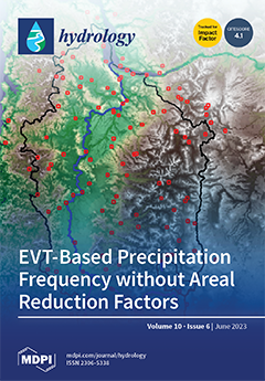
Cover Story (view full-size image): Extreme precipitation frequency areal estimates over watersheds are key to estimating flood hazards and assessing hydrological risk. Max-stable process (MSP) models can be fitted to data collected over a spatial domain to directly estimate areal-based exceedances while accounting for spatial dependence in extremes. They have theoretical grounding within the framework of extreme value theory. MSP models do not depend upon the subjective assumptions associated with L-moments regional precipitation frequency analysis, e.g., the definition of homogeneous subareas and the need to convert point estimates into areal average depths using uncertain empirical regional depth–area reduction factors. The results from the study showed that MSPs can be robustly deployed to efficiently and dynamically support dam and levee safety applications. View this paper
  • Issues are regarded as officially published after their release is announced to the table of contents alert mailing list.
  • You may sign up for e-mail alerts to receive table of contents of newly released issues.
  • PDF is the official format for papers published in both, html and pdf forms. To view the papers in pdf format, click on the "PDF Full-text" link, and use the free Adobe Reader to open them.
Order results
Result details
Section
Select all
Export citation of selected articles as:
20 pages, 3202 KiB  
Article
The Characterization of Groundwater Quality for Safe Drinking Water Wells via Disinfection and Sterilization in Jordan: A Case Study
by Mehaysen Al-Mahasneh, Abeer Al Bsoul, Nada Al-Ananzeh, Hussam Elddin Al-Khasawane, Marwan Al-Mahasneh and Raeda Tashtoush
Hydrology 2023, 10(6), 135; https://doi.org/10.3390/hydrology10060135 - 19 Jun 2023
Cited by 2 | Viewed by 2005
Abstract
This work aims to evaluate the quality of drinking water in the Disi aquifer in Jordan. Several water quality parameters are included in the mathematical equation to evaluate the average water quality and establish the suitability of water for drinking purposes. Water sampling [...] Read more.
This work aims to evaluate the quality of drinking water in the Disi aquifer in Jordan. Several water quality parameters are included in the mathematical equation to evaluate the average water quality and establish the suitability of water for drinking purposes. Water sampling zones from three wells were used to calculate the water quality indices (WQI). The water samples were analyzed for several physicochemical parameters, including pH, turbidity, total dissolved solids, Na+, Ca2+, Mg2+, Na+, K+, HCO3−, SO42−, Cl, NO3, total hardness, electrical conductivity (EC) and other elements (Fe2+, Zn2+, Mn2+, Cd2+, As2−, Pb4+ and Cu2+), in the groundwater wells. Biological parameters, such as faecal coliform, were also tested. The Weighted Arithmetic WQI indicated that most of the wells were of good to excellent quality. These determined indices support decision making and are beneficial to monitoring the groundwater quality in the Disi aquifer. The relative weight is specific to each parameter and ranges from 1 to 5; it establishes the importance of the water quality parameters for domestic purposes. The WQI analysis rates the water quality between 75 to 65 from good to medium. The water quality of the Disi aquifer for potable drinking water was compared with the guidelines of the World Health Organization (2011) and the Jordan Drinking Standard (JS286); the results indicated that water in the Disi aquifer was of high quality and was fit for drinking. Full article
(This article belongs to the Topic Groundwater Pollution Control and Groundwater Management)
Show Figures

Figure 1

4 pages, 175 KiB  
Editorial
Editorial to the Special Issue “Drought and Water Scarcity: Monitoring, Modelling and Mitigation”
by Nicholas Dercas
Hydrology 2023, 10(6), 134; https://doi.org/10.3390/hydrology10060134 - 19 Jun 2023
Viewed by 1933
Abstract
Drought is considered to be among the major natural hazards faced by human society, with significant impacts on environment, society, agriculture and economy stemming from its consequences [...] Full article
(This article belongs to the Special Issue Drought and Water Scarcity: Monitoring, Modelling and Mitigation)
24 pages, 7357 KiB  
Article
Stable Isotopic Evaluation of Recharge into a Karst Aquifer in a Glaciated Agricultural Region of Northeastern Wisconsin, USA
by John A. Luczaj, Amber Konrad, Mark Norfleet and Andrew Schauer
Hydrology 2023, 10(6), 133; https://doi.org/10.3390/hydrology10060133 - 17 Jun 2023
Viewed by 2004
Abstract
Ground water contamination from septic systems and the application of dairy cattle manure has been a long-standing problem in rural northeastern Wisconsin, especially in areas with thin soils over karstified Silurian dolostone bedrock, where as many as 60% of the wells show evidence [...] Read more.
Ground water contamination from septic systems and the application of dairy cattle manure has been a long-standing problem in rural northeastern Wisconsin, especially in areas with thin soils over karstified Silurian dolostone bedrock, where as many as 60% of the wells show evidence of fecal contamination. We present the results of a citizen science supported water-isotope study in Kewaunee County, Wisconsin to evaluate aquifer recharge processes in the critical zone and to demonstrate the viability of time-series stable isotope data as a supplement to traditional water quality indicators in a contamination-prone aquifer. A meteoric water line was also constructed for Green Bay, Wisconsin, providing reasonable isotopic ranges for aquifer recharge events. Volunteer homeowners collected water samples from their domestic wells for a period of ~14 months to provide a measure of long-term isotopic variation in produced water and to determine whether event-driven responses could be identified using δ18O and δ2H isotopic values. Three shallower wells with a prior history of contamination exhibited significant seasonal variation, while the deepest well with the greatest soil thickness (above bedrock) showed less variation. For moderate precipitation events, the shallowest well showed as much as 5–13% of produced water coming from direct recharge, with smaller contributions for deeper wells. Our case study provides a clear example of how citizen science can collect useful time-series isotopic data to support groundwater recharge studies. Full article
(This article belongs to the Special Issue Advances in Isotope Investigations of Groundwater Resources)
Show Figures

Figure 1

17 pages, 2197 KiB  
Article
The Cantareira System, the Largest South American Water Supply System: Management History, Water Crisis, and Learning
by Antonio Carlos Zuffo, Sergio Nascimento Duarte, Marco Antonio Jacomazzi, Maíra Simões Cucio and Marcus Vinícius Galbetti
Hydrology 2023, 10(6), 132; https://doi.org/10.3390/hydrology10060132 - 14 Jun 2023
Cited by 1 | Viewed by 1794
Abstract
Located in the southeast region of Brazil, the Cantareira System consists of six interconnected reservoirs and supplies around 14 million people in the state of São Paulo. Built in the 1970s, when extensive fluviometric series were not available in the region, the system [...] Read more.
Located in the southeast region of Brazil, the Cantareira System consists of six interconnected reservoirs and supplies around 14 million people in the state of São Paulo. Built in the 1970s, when extensive fluviometric series were not available in the region, the system underwent several operating rules that culminated in the water crisis caused by the 2014/2015 drought. This article makes a brief critical account of what has been experienced in these almost 50 years of operating the system, the factors that influenced the water crisis, and what has been learned. Full article
(This article belongs to the Special Issue Coupling of Human and Hydrological Systems)
Show Figures

Figure 1

19 pages, 3157 KiB  
Article
Benchmarking Three Event-Based Rainfall-Runoff Routing Models on Australian Catchments
by David Kemp and Guna Hewa Alankarage
Hydrology 2023, 10(6), 131; https://doi.org/10.3390/hydrology10060131 - 13 Jun 2023
Cited by 1 | Viewed by 1898
Abstract
In the field of hydrology, event-based models are commonly used for flood-flow prediction in catchments, for use in flood forecasting, flood risk assessment, and infrastructure design. The models are simplistic, as they do not consider longer-term catchment processes such as evaporation and transpiration. [...] Read more.
In the field of hydrology, event-based models are commonly used for flood-flow prediction in catchments, for use in flood forecasting, flood risk assessment, and infrastructure design. The models are simplistic, as they do not consider longer-term catchment processes such as evaporation and transpiration. This paper examines the relative performance of two widely used models, the American HEC-HMS model, the Australian RORB model, and a newer model, the RRR model. The evaluation is conducted on four case study catchments in Australia. The first two models, HEC-HMS and RORB, do not include baseflow, necessitating the estimation of baseflow through alternate means. By contrast, the RRR model includes baseflow, by extracting a separate loss from the rainfall, and then routing the resultant flow through the catchment, much like quickflow, but with a longer delay time. The models are calibrated and then verified with weighted mean parameter values on an independent set of events in each case study catchment. This gives an indication of the ability of the models to correctly predict flow, which is important when the models are used with design rainfalls to predict design flows. The results demonstrate that all models perform adequately on the four examined catchments, but the RRR model exhibits superior calibration, and, to a lesser extent, better validation compared to the other two models. Full article
(This article belongs to the Special Issue New Perspectives in Rainfall-Runoff Modelling and Flood Forecasting)
Show Figures

Figure 1

18 pages, 1340 KiB  
Review
Use of Mixed Methods in the Science of Hydrological Extremes: What Are Their Contributions?
by Raymond Kabo, Marc-André Bourgault, Jean François Bissonnette, Nathalie Barrette and Louis Tanguay
Hydrology 2023, 10(6), 130; https://doi.org/10.3390/hydrology10060130 - 09 Jun 2023
Viewed by 1897
Abstract
Research in hydrological sciences is constantly evolving to provide adequate answers to address various water-related issues. Methodological approaches inspired by mathematical and physical sciences have shaped hydrological sciences from its inceptions to the present day. Nowadays, as a better understanding of the social [...] Read more.
Research in hydrological sciences is constantly evolving to provide adequate answers to address various water-related issues. Methodological approaches inspired by mathematical and physical sciences have shaped hydrological sciences from its inceptions to the present day. Nowadays, as a better understanding of the social consequences of extreme meteorological events and of the population’s ability to adapt to these becomes increasingly necessary, hydrological sciences have begun to integrate knowledge from social sciences. Such knowledge allows for the study of complex social-ecological realities surrounding hydrological phenomena, such as citizens’ perception of water resources, as well as individual and collective behaviors related to water management. Using a mixed methods approach to combine quantitative and qualitative approaches has thus become necessary to understand the complexity of hydrological phenomena and propose adequate solutions for their management. In this paper, we detail how mixed methods can be used to research flood hydrology and low-flow conditions, as well as in the management of these hydrological extremes, through the analysis of case studies. We frame our analysis within the three paradigms (positivism, post-positivism, and constructivism) and four research designs (triangulation, complementary, explanatory, and exploratory) that guide research in hydrology. We show that mixed methods can notably contribute to the densification of data on extreme flood events to help reduce forecasting uncertainties, to the production of knowledge on low-flow hydrological states that are insufficiently documented, and to improving participatory decision making in water management and in handling extreme hydrological events. Full article
Show Figures

Figure 1

41 pages, 6341 KiB  
Article
Dynamic Assimilation of Deep Learning Predictions to a Process-Based Water Budget
by Nick Martin
Hydrology 2023, 10(6), 129; https://doi.org/10.3390/hydrology10060129 - 09 Jun 2023
Viewed by 1567
Abstract
A three-step data assimilation (DA) of deep learning (DL) predictions to a process-based water budget is developed and applied to produce an active, operational water balance for groundwater management. In the first step, an existing water budget model provides forward model predictions of [...] Read more.
A three-step data assimilation (DA) of deep learning (DL) predictions to a process-based water budget is developed and applied to produce an active, operational water balance for groundwater management. In the first step, an existing water budget model provides forward model predictions of aquifer storage from meteorological observations, estimates of pumping and diversion discharge, and estimates of recharge. A Kalman filter DA approach is the second step and generates updated storage volumes by combining a long short-term memory (LSTM) network, a DL method, and predicted “measurements” with forward model predictions. The third “correction” step uses modified recharge and pumping, adjusted to account for the difference between Kalman update storage and forward model predicted storage, in forward model re-simulation to approximate updated storage volume. Use of modified inputs in the correction provides a mass-conservative water budget framework that leverages DL predictions. LSTM predictor “measurements” primarily represent missing observations due to missing or malfunctioning equipment. Pumping and recharge inputs are uncertain and unobserved in the study region and can be adjusted without contradicting measurements. Because DL requires clean and certain data for learning, a common-sense baseline facilitates interpretation of LSTM generalization skill and accounts for feature and outcome uncertainty when sufficient target data are available. DA, in contrast to DL, provides for explicit uncertainty analysis through an observation error model, which allows the integrated approach to address uncertainty impacts from an LSTM predictor developed from limited outcome observations. Full article
Show Figures

Graphical abstract

23 pages, 5268 KiB  
Article
Smart Data Blending Framework to Enhance Precipitation Estimation through Interconnected Atmospheric, Satellite, and Surface Variables
by Niloufar Beikahmadi, Antonio Francipane and Leonardo Valerio Noto
Hydrology 2023, 10(6), 128; https://doi.org/10.3390/hydrology10060128 - 05 Jun 2023
Cited by 3 | Viewed by 2349
Abstract
Accurate precipitation estimation remains a challenge, though it is fundamental for most hydrological analyses. In this regard, this study aims to achieve two objectives. Firstly, we evaluate the performance of two precipitation products from the Integrated Multi-satellitE Retrievals for Global Precipitation Measurement (GPM-IMERG) [...] Read more.
Accurate precipitation estimation remains a challenge, though it is fundamental for most hydrological analyses. In this regard, this study aims to achieve two objectives. Firstly, we evaluate the performance of two precipitation products from the Integrated Multi-satellitE Retrievals for Global Precipitation Measurement (GPM-IMERG) for Sicily, Italy, from 2016 to 2020 by a set of categorical indicators and statistical indices. Analyses indicate the favorable performance of daily estimates, while half-hourly estimates exhibited poorer performance, revealing larger discrepancies between satellite and ground-based measurements at sub-hourly timescales. Secondly, we propose four multi-source merged models within Artificial Neural Network (ANN) and Multivariant Linear Regression (MLR) blending frameworks to seek potential improvement by exploiting different combinations of Soil Moisture (SM) measurements from the Soil Moisture Active Passive (SMAP) mission and atmospheric factor of Precipitable Water Vapor (PWV) estimations, from the Advanced Microwave Scanning Radiometer-2 (AMSR2). Spatial distribution maps of some diagnostic indices used to quantitatively evaluate the quality of models reveal the best performance of ANNs over the entire domain. Assessing variable sensitivity reveals the importance of IMERG satellite precipitation and PWV in non-linear models such as ANNs, which outperform the MLR modeling framework and individual IMERG products. Full article
Show Figures

Figure 1

13 pages, 3220 KiB  
Article
Purpose-Designed Hydrogeological Maps for Wide Interconnected Surface–Groundwater Systems: The Test Example of Parma Alluvial Aquifer and Taro River Basin (Northern Italy)
by Riccardo Pinardi, Alessandra Feo, Andrea Ruffini and Fulvio Celico
Hydrology 2023, 10(6), 127; https://doi.org/10.3390/hydrology10060127 - 04 Jun 2023
Cited by 2 | Viewed by 1615
Abstract
Hydrogeological maps must synthesize scientific knowledge about the hydraulic features and the hydrogeological behavior of a specific area, and, at the same time, they must meet the expectations of land planners and administrators. Thus, hydrogeological maps can be fully effective when they are [...] Read more.
Hydrogeological maps must synthesize scientific knowledge about the hydraulic features and the hydrogeological behavior of a specific area, and, at the same time, they must meet the expectations of land planners and administrators. Thus, hydrogeological maps can be fully effective when they are purpose-designed, especially in complex interconnected systems. In this case study, purpose-designed graphical solutions emphasize all the hydraulic interconnections that play significant roles in recharging the multilayered alluvial aquifer, where the majority of wells have been drilled for human purposes, artificial channels are used for agricultural purposes, and the shallow groundwater feeds protected groundwater-dependent ecosystems. The hydrogeological map was then designed to be the synthesis of three different and hydraulically interconnected main contexts: (i) the alluvial aquifer, (ii) the hydrographic basin of the Taro losing river, and (iii) those hard-rock aquifers whose springs feed the same river. The main hydrogeological map was integrated with two smaller sketches and one hydrogeological profile. One small map was drawn from a modeling perspective because it facilitates visualization of the alluvial aquifer bottom and the “no-flow boundaries.” The other small sketch shows the artificial channel network that emphasizes the hydraulic connection between water courses and groundwater within the alluvial aquifer. The hydrogeological profile was reconstructed to be able to (i) show the main heterogeneities within the aquifer system (both layered and discontinuous), (ii) visualize the coexistence of shallower and deeper groundwater, (iii) emphasize the hydraulic interconnections between subsystems, and (iv) suggest the coexistence of groundwater pathways with different mean residence times. Full article
(This article belongs to the Topic Groundwater Pollution Control and Groundwater Management)
Show Figures

Figure 1

27 pages, 9399 KiB  
Article
A Silhouette-Width-Induced Hierarchical Clustering for Defining Flood Estimation Regions
by Ajla Mulaomerović-Šeta, Borislava Blagojević, Vladislava Mihailović and Andrea Petroselli
Hydrology 2023, 10(6), 126; https://doi.org/10.3390/hydrology10060126 - 03 Jun 2023
Cited by 1 | Viewed by 1430
Abstract
Flood quantile estimation in ungauged basins is often performed using regional analysis. A regionalization procedure consists of two phases: the definition of homogeneous regions among gauged basins, i.e., clusters of stations, and information transfer to the ungauged sites. Due to its simplicity and [...] Read more.
Flood quantile estimation in ungauged basins is often performed using regional analysis. A regionalization procedure consists of two phases: the definition of homogeneous regions among gauged basins, i.e., clusters of stations, and information transfer to the ungauged sites. Due to its simplicity and widespread use, a combination of hierarchical clustering by Ward’s algorithm and the index-flood method is applied in this research. While hierarchical clustering is very efficient, its shortcomings are the lack of flexibility in the definition of clusters/regions and the inability to transfer objects/stations from one cluster center to another. To overcome this, using silhouette width for induced clustering of stations in flood studies is proposed in this paper. A regionalization procedure is conducted on 53 gauging stations under a continental climate in the West Balkans. In the induced clustering, a negative silhouette width is used as an indicator for the relocation of station(s) to another cluster. The estimates of mean annual flood and 100-year flood quantiles assessed by the original and induced clustering are compared. A jackknife procedure is applied for mean annual flood estimation and 100-year flood quantiles. Both the Hosking–Wallis and Anderson–Darling bootstrap tests provide better results regarding the homogeneity of the defined regions for the induced clustering compared to the original one. The goodness-of-fit measures indicate improved clustering results by the proposed intervention, reflecting flood quantile estimation at the stations with significant overestimation by the original clustering. Full article
(This article belongs to the Section Hydrological and Hydrodynamic Processes and Modelling)
Show Figures

Figure 1

27 pages, 3954 KiB  
Article
Spatiotemporal Variability in Total Dissolved Solids and Total Suspended Solids along the Colorado River
by Godson Ebenezer Adjovu, Haroon Stephen and Sajjad Ahmad
Hydrology 2023, 10(6), 125; https://doi.org/10.3390/hydrology10060125 - 02 Jun 2023
Cited by 6 | Viewed by 2390
Abstract
The Colorado River is a principal source of water for 40 million people and farmlands in seven states in the western US and the Republic of Mexico. The river has been under intense pressure from the effects of climate change and anthropogenic activities [...] Read more.
The Colorado River is a principal source of water for 40 million people and farmlands in seven states in the western US and the Republic of Mexico. The river has been under intense pressure from the effects of climate change and anthropogenic activities associated with population growth leading to elevated total dissolved solid (TDS) and total suspended solid (TSS) concentrations. Elevated TDS- and TSS-related issues in the basin have a direct negative impact on the water usage and the ecological health of aquatic organisms. This study, therefore, analyzed the spatiotemporal variability in the TDS and TSS concentrations along the river. Results from our analysis show that TDS concentration was significantly higher in the Upper Colorado River Basin while the Lower Colorado River Basin shows a generally high level of TSSs. We found that the activities in these two basins are distinctive and may be a factor in these variations. Results from the Kruskal–Wallis significance test show there are statistically significant differences in TDSs and TSSs from month to month, season to season, and year to year. These significant variations are largely due to seasonal rises in consumptive use, agriculture practices, snowmelts runoffs, and evaporate rates exacerbated by increased temperature in the summer months. The findings from this study will aid in understanding the river’s water quality, detecting the sources and hotspots of pollutions to the river, and guiding legislative actions. The knowledge obtained forms a strong basis for management and conservation efforts and consequently helps to reduce the economic damage caused by these water quality parameters including the over USD 300 million associated with TDS damages. Full article
Show Figures

Figure 1

3 pages, 165 KiB  
Editorial
Special Issue: Stormwater/Drainage Systems and Wastewater Management
by Shirley Gato-Trinidad
Hydrology 2023, 10(6), 124; https://doi.org/10.3390/hydrology10060124 - 02 Jun 2023
Cited by 1 | Viewed by 1399
Abstract
For the purposes of this Special Issue of Hydrology, “Stormwater/Drainage Systems and Wastewater Management”, it is worth noting that hydrology, as defined by the US National Research Council [...] Full article
(This article belongs to the Special Issue Stormwater/Drainage Systems and Wastewater Management)
21 pages, 14365 KiB  
Article
Applying Floodplain Inundation Modeling to Estimate Suitable Spawning Habitat and Recruitment Success for Alligator Gar in the Guadalupe River, Texas
by Kimberly M. Meitzen, Clinton R. Robertson, Jennifer L. Jensen, Daniel J. Daugherty, Thomas B. Hardy and Kevin B. Mayes
Hydrology 2023, 10(6), 123; https://doi.org/10.3390/hydrology10060123 - 31 May 2023
Cited by 3 | Viewed by 1698
Abstract
We developed a floodplain inundation model to extract specific flood extent and depth parameters and combined these with vegetation land cover and historic flow data to quantify spatial habitat suitability and temporal hydrologic metrics that support Alligator Gar Atractosteus spatula spawning within a [...] Read more.
We developed a floodplain inundation model to extract specific flood extent and depth parameters and combined these with vegetation land cover and historic flow data to quantify spatial habitat suitability and temporal hydrologic metrics that support Alligator Gar Atractosteus spatula spawning within a 257 km segment of the lower Guadalupe River, Texas, USA. We modeled nine flows across a range of flood frequency recurrence intervals from 257 m3s−1 to ~4997 m3s−1 and estimated the availability of suitable spawning water depths (0.2 to 2 m) and lateral connectedness between the river and suitable floodplain landcover types. We estimated the ages via otoliths of 95 Alligator Gar collected in the reach to determine the year that they were recruited into the system. We analyzed a total of 30 Indicators of Hydrologic Alteration flow metrics to examine how the spatially derived suitable habitats related to the temporal aspects of flow occurrence during the spawning season for the period of flow record April–July (1935–2020) and to the years spanning the recruitment data of the Alligator Gar (1981–2010). A non-linear relationship existed between suitable spawning habitat area and the flow regime, with the most habitat availability corresponding to the 10–20-year flood recurrence interval frequency with peak flows of 2057–3108 m3s−1, respectively. The Alligator Gar recruitment data indicated that six years provided high recruitment, which correlated with peak flows of ~5-year frequency with an available spawning area of ~9000 Ha, moderate recruitment years related to peak flows with ~3-year frequency with an available spawning area of 6000 Ha, and low recruitment years where spawning was likely to occur at least every other year with at least 2500 Ha of available spawning area. The results of this model support the development of legislatively mandated environmental flow standards for the Guadalupe River Basin, inform field-based efforts for collecting empirical and observational data on the species’ reproduction, and provide spatial and temporal information for designing conservation strategies for Alligator Gar. Full article
(This article belongs to the Special Issue Flood Inundation Mapping in Hydrological Systems)
Show Figures

Figure 1

15 pages, 2834 KiB  
Article
The Boron Budget in Waters of the Mono Basin, California
by Mengqu Han, E. Troy Rasbury, N. Gary Hemming, Sidney R. Hemming and Paul B. Tomascak
Hydrology 2023, 10(6), 122; https://doi.org/10.3390/hydrology10060122 - 28 May 2023
Viewed by 1831
Abstract
Mono Lake in eastern California has the highest natural boron concentrations measured in a natural water body. Inputs to Mono Lake are from creeks that drain from the Sierra Nevada, accounting for over 80% of the total water input, and springs account for [...] Read more.
Mono Lake in eastern California has the highest natural boron concentrations measured in a natural water body. Inputs to Mono Lake are from creeks that drain from the Sierra Nevada, accounting for over 80% of the total water input, and springs account for most of the rest of the water budget. We measured boron concentrations and isotope compositions of water sources in the lake and lake water collected over several seasons. The δ11B offset of at least +2.5‰ between Mono Lake water compared to its inputs suggests that, like seawater, the boron isotopic composition of the lake is influenced by the removal of light boron by coprecipitation and/or sorption of borate. Given the alkalinity of the lake, boron fractionation likely occurs before or as the water sources enter the lake. The famous tufa towers around the lake are a physical representation of a ‘chemical delta’ that alters the boron isotopic composition of the source fluids as they enter the lake. Based on different combinations of the measured end members, the residence time of boron in Mono Lake is estimated to be within the range of 5~80 ka. Full article
(This article belongs to the Special Issue Advances in Isotope Investigations of Groundwater Resources)
Show Figures

Figure 1

32 pages, 8254 KiB  
Article
Impacts of Max-Stable Process Areal Exceedance Calculations to Study Area Sampling Density, Surface Network Precipitation Gage Extent and Density, and Model Fitting Method
by Brian Skahill, Cole Haden Smith, Brook T. Russell and John F. England
Hydrology 2023, 10(6), 121; https://doi.org/10.3390/hydrology10060121 - 28 May 2023
Cited by 1 | Viewed by 1567
Abstract
Max-stable process (MSP) models can be fit to data collected over a spatial domain to estimate areal-based exceedances while accounting for spatial dependence in extremes. They have theoretical grounding within the framework of extreme value theory (EVT). In this work, we fit MSP [...] Read more.
Max-stable process (MSP) models can be fit to data collected over a spatial domain to estimate areal-based exceedances while accounting for spatial dependence in extremes. They have theoretical grounding within the framework of extreme value theory (EVT). In this work, we fit MSP models to three-day duration cool season precipitation maxima in the Willamette River Basin (WRB) of Oregon and to 48 h mid-latitude cyclone precipitation annual maxima in the Upper Trinity River Basin (TRB) of Texas. In total, 14 MSP models were fit (seven based on the WRB data and seven based on the TRB data). These MSP model fits were developed and applied to explore how user choices of study area sampling density, gage extent, and model fitting method impact areal precipitation-frequency calculations. The impacts of gage density were also evaluated. The development of each MSP involved the application of a recently introduced trend surface modeling methodology. Significant reductions in computing times were achieved, with little loss in accuracy, applying random sample subsets rather than the entire grid when calculating areal exceedances for the Cougar dam study area in the WRB. Explorations of gage extent revealed poor consistency among the TRB MSPs with modeling the generalized extreme value (GEV) marginal distribution scale parameter. The gauge density study revealed the robustness of the trend surface modeling methodology. Regardless of the fitting method, the final GEV shape parameter estimates for all fourteen MSPs were greater than their prescribed initial values which were obtained from spatial GEV fits that assumed independence among the extremes. When two MSP models only differed by their selected fitting method, notable differences were observed with their dependence and trend surface parameter estimates and resulting areal exceedances calculations. Full article
Show Figures

Figure 1

23 pages, 5365 KiB  
Article
Integration of Unmanned Aerial Vehicle Imagery with Landsat Imagery for Better Watershed Scale ET Prediction
by Rajendra Khanal and Michael E. Barber
Hydrology 2023, 10(6), 120; https://doi.org/10.3390/hydrology10060120 - 27 May 2023
Viewed by 1773
Abstract
Evapotranspiration (ET) is a critical component of the water cycle, and an accurate prediction of ET is essential for water resource management, irrigation scheduling, and agricultural productivity. Traditionally, ET has been estimated using satellite-based remote sensing, which provides synoptic coverage but can be [...] Read more.
Evapotranspiration (ET) is a critical component of the water cycle, and an accurate prediction of ET is essential for water resource management, irrigation scheduling, and agricultural productivity. Traditionally, ET has been estimated using satellite-based remote sensing, which provides synoptic coverage but can be limited in spatial resolution and accuracy. Unmanned aerial vehicles (UAVs) offer improved ET prediction by providing high-resolution imagery of the Earth’s surface but are limited to a small area. Therefore, UAV and satellite images provide complementary data, but the integration of these two data for ET prediction has received limited attention. This paper presents a method that integrates UAV and satellite imagery for improved ET prediction and applies it to five crops (corn, rye grass, wheat, and alfalfa) from agricultural fields in the Walla Walla of eastern Washington State. We collected UAV and satellite data for five crops and used the combination of remote sensing models and statistical techniques to estimate ET. We show that UAV-based ET can be integrated with the Landsat-based ET with the application of integration factors. Our result shows that the Root Mean Square Error (RMSE) of daily ET for corn (Zea mays), rye grass (Lolium perenne), wheat (Triticum aestivum), peas (Pisum sativum), and alfalfa (Medicago sativa) can be improved by the application of the integration factor to the Landsat based ET in the range of (35.75–65.52%). We also explore the variability and effect of partial cloud on UAV-based ET estimation. Our findings have implications for the use of UAVs in water resource management and highlight the importance of considering multiple sources of data in ET prediction. Full article
Show Figures

Figure 1

4 pages, 156 KiB  
Editorial
Editorial for the Special Issue on Aquatic Ecosystems and Water Resources
by Amartya K. Saha
Hydrology 2023, 10(6), 119; https://doi.org/10.3390/hydrology10060119 - 25 May 2023
Viewed by 1041
Abstract
Water is essential for all life, as the age-old universal adage holds[...] Full article
(This article belongs to the Special Issue Aquatic Ecosystems and Water Resources)
20 pages, 8049 KiB  
Article
Hydrogeochemistry, Geothermometry, and Sourcing of High Dissolved Boron, Tungsten, and Chlorine Concentrations in the Trans-Himalayan Hotsprings of Ladakh, India
by Arif H. Ansari, Veeru Kant Singh, Pankaj Kumar, Mukund Sharma, Anupam Sharma, Satyakam Patnaik, Gurumurthy P. Gundiga, Ishwar Chandra Rahi, Mohammad Arif Ansari and AL Ramanathan
Hydrology 2023, 10(6), 118; https://doi.org/10.3390/hydrology10060118 - 24 May 2023
Viewed by 2662
Abstract
Boron (B) and Tungsten (W) are often found enriched in high-temperature geothermal waters associated with the development of subduction-related mafic to felsic arc magma. However, knowledge about the sourcing and transportation of these elements from such hydrothermal systems is sparse and ambiguous. Being [...] Read more.
Boron (B) and Tungsten (W) are often found enriched in high-temperature geothermal waters associated with the development of subduction-related mafic to felsic arc magma. However, knowledge about the sourcing and transportation of these elements from such hydrothermal systems is sparse and ambiguous. Being the only active continental collision site in the world, the Trans-Himalaya offers a unique chance to study how continental collision sources the high boron and tungsten concentrations in geothermal fluids. This study investigated the distribution of trace elements, major cations, and anions in three physicochemically distinct hotspring sites in the Ladakh region. The results were integrated with the existing geochemical and isotopic data to address the research problem more effectively. This study exhibits that the extreme concentrations of boron, sodium, chlorine, potassium, and tungsten in the hotspring waters were primarily governed by magmatic fluid inputs. In addition, this study recorded the highest-ever chlorine and boron concentrations for the Trans-Himalayan hotspring waters. The highest-ever boron and chlorine concentrations in the hotspring waters probably represented an increase in magmatic activity in the deeper source zone. Full article
(This article belongs to the Special Issue Groundwater Decline and Depletion)
Show Figures

Figure 1

16 pages, 2600 KiB  
Article
Non-Stationary Precipitation Frequency Estimates for Resilient Infrastructure Design in a Changing Climate: A Case Study in Sydney
by Shahab Doulabian, Erfan Ghasemi Tousi, Amirhossein Shadmehri Toosi and Sina Alaghmand
Hydrology 2023, 10(6), 117; https://doi.org/10.3390/hydrology10060117 - 24 May 2023
Viewed by 1826
Abstract
The intensity–duration–frequency (IDF) curve is a commonly utilized tool for estimating extreme rainfall events that are used for many purposes including flood analysis. Extreme rainfall events are expected to become more intense under the changing climate, and there is a need to account [...] Read more.
The intensity–duration–frequency (IDF) curve is a commonly utilized tool for estimating extreme rainfall events that are used for many purposes including flood analysis. Extreme rainfall events are expected to become more intense under the changing climate, and there is a need to account for non-stationarity IDF curves to mitigate an underestimation of the risks associated with extreme rainfall events. Sydney, Australia, has recently started experiencing flooding under climate change and more intense rainfall events. This study evaluated the impact of climate change on altering the precipitation frequency estimates (PFs) used in generating IDF curves at Sydney Airport. Seven general circulation models (GCMs) were obtained, and the best models in terms of providing the extreme series were selected. The ensemble of the best models was used for comparing the projected 24 h PFs in 2031–2060 with historical values provided by Australian Rainfall and Runoff (ARR). The historical PFs consistently underestimate the projected 24 h PFs for all return periods. The projected 24 h 100 yr rainfall events are increased by 9% to 41% for the least and worst-case scenario compared to ARR historical PFs. These findings highlight the need for incorporating the impact of climate change on PFs and IDF curves in Sydney toward building a more prepared and resilient community. The findings of this study can also aid other communities in adapting the same framework for developing more robust and adaptive approaches to reducing extreme rainfall events’ repercussions under changing climates. Full article
(This article belongs to the Special Issue New Perspectives in Rainfall-Runoff Modelling and Flood Forecasting)
Show Figures

Figure 1

14 pages, 6303 KiB  
Article
Discerning Watershed Response to Hydroclimatic Extremes with a Deep Convolutional Residual Regressive Neural Network
by Albert Larson, Abdeltawab Hendawi, Thomas Boving, Soni M. Pradhanang and Ali S. Akanda
Hydrology 2023, 10(6), 116; https://doi.org/10.3390/hydrology10060116 - 23 May 2023
Cited by 1 | Viewed by 1791
Abstract
The impact of climate change continues to manifest itself daily in the form of extreme events and conditions such as droughts, floods, heatwaves, and storms. Better forecasting tools are mandatory to calibrate our response to these hazards and help adapt to the planet’s [...] Read more.
The impact of climate change continues to manifest itself daily in the form of extreme events and conditions such as droughts, floods, heatwaves, and storms. Better forecasting tools are mandatory to calibrate our response to these hazards and help adapt to the planet’s dynamic environment. Here, we present a deep convolutional residual regressive neural network (dcrrnn) platform called Flux to Flow (F2F) for discerning the response of watersheds to water-cycle fluxes and their extremes. We examine four United States drainage basins of varying acreage from smaller to very large (Bear, Colorado, Connecticut, and Mississippi). F2F combines model and ground observations of water-cycle fluxes in the form of surface runoff, subsurface baseflow, and gauged streamflow. We use these time series datasets to simulate, visualize, and analyze the watershed basin response to the varying climates and magnitudes of hydroclimatic fluxes in each river basin. Experiments modulating the time lag between remotely sensed and ground-truth measurements are performed to assess the metrological limits of forecasting with this platform. The resultant mean Nash–Sutcliffe and Kling–Gupta efficiency values are both greater than 90%. Our results show that a hydrological machine learning platform such as F2F can become a powerful resource to simulate and forecast hydroclimatic extremes and the resulting watershed responses and natural hazards in a changing global climate. Full article
Show Figures

Figure 1

17 pages, 5027 KiB  
Article
Developing a Modified Online Water Quality Index: A Case Study for Brazilian Reservoirs
by Pamela Lais Cabral Silva, Alisson Carraro Borges, Lucas Sampaio Lopes and André Pereira Rosa
Hydrology 2023, 10(6), 115; https://doi.org/10.3390/hydrology10060115 - 23 May 2023
Cited by 1 | Viewed by 1352
Abstract
Online approaches for monitoring water quality can be an alternative aid to rapid decision-making in watershed management, especially reservoirs, given their vulnerability to the process of eutrophication. In this study, a modified water quality index (WQI) was developed using parameters that are easily [...] Read more.
Online approaches for monitoring water quality can be an alternative aid to rapid decision-making in watershed management, especially reservoirs, given their vulnerability to the process of eutrophication. In this study, a modified water quality index (WQI) was developed using parameters that are easily measured with sensors, which would allow for the online monitoring of reservoirs. The modified WQI was based on WQICETESB and we used regression models to obtain values for the parameters: total phosphorus (TP), total nitrogen (TN), biochemical oxygen demand (BOD) and total solids (TS). Water quality data from reservoirs from 2003 to 2020 were used, which were provided by the Environmental Company of the State of São Paulo (CETESB), Brazil. The adjusted modified WQI employing weight redistribution (WQIRWAdj or WQISOL) presented the most promising results, with a Pearson correlation of 0.92 and a success rate of 72.6% and 97.0% for the CETESB and simplified classifications, respectively. WQISOL, which was proposed in the present study, exhibited a satisfactory performance, allowing the water quality of reservoirs to be monitored remotely and in real-time. Full article
(This article belongs to the Special Issue Advances in River Monitoring)
Show Figures

Figure 1

Previous Issue
Next Issue
Back to TopTop