You are currently viewing a new version of our website. To view the old version click .

ISPRS International Journal of Geo-Information, Volume 7, Issue 6

June 2018 - 35 articles

Cover Story: 
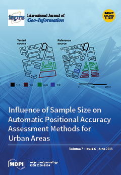
In the last years, new approaches aimed to increase the automation level of the positional accuracy assessment processes of spatial data have been developed. However, in such cases, an aspect as significant as the sample size has not been addressed. In our work, we study the influence of the sample size when estimating the planimetric positional accuracy of urban databases by means of an automatic assessment polygon-based methodology. Our research is based on a simulation process which extracts pairs of homologous polygons from the assessed data source and from the reference data source and applies two buffer-based methods. Our results show a significant reduction in the variability of the estimations when the sample size increased from 5 Km to 100 Km. View Paper here.
  • Issues are regarded as officially published after their release is announced to the table of contents alert mailing list .
  • You may sign up for email alerts to receive table of contents of newly released issues.
  • PDF is the official format for papers published in both, html and pdf forms. To view the papers in pdf format, click on the "PDF Full-text" link, and use the free Adobe Reader to open them.

Articles (35)

  • Article
  • Open Access
14 Citations
6,597 Views
19 Pages

4D Time Density of Trajectories: Discovering Spatiotemporal Patterns in Movement Data

  • Yebin Zou,
  • Yijin Chen,
  • Jing He,
  • Gehu Pang and
  • Kaixuan Zhang

Modern positioning and sensor technology enable the acquisition of movement positions and attributes on an unprecedented scale. Therefore, a large amount of trajectory data can be used to analyze various movement phenomena. In cartography, a common w...

  • Article
  • Open Access
34 Citations
5,797 Views
21 Pages

Building change detection based on remote sensing imagery is a significant task for urban construction, management, and planning. Feature differences caused by changes are fundamental in building change detection, but the spectral and spatial disturb...

  • Article
  • Open Access
1 Citations
4,354 Views
19 Pages

Analyzing Space-Time Dynamics of Theft Rates Using Exchange Mobility

  • Yicheng Tang,
  • Xinyan Zhu,
  • Wei Guo,
  • Lian Duan and
  • Ling Wu

A critical issue in the geography of crime is the quantitative analysis of the spatial distribution of crimes which usually changes over time. In this paper, we use the concept of exchange mobility across different time periods to determine the spati...

  • Article
  • Open Access
21 Citations
6,765 Views
26 Pages

Groundwater nitrate contamination in the Central Valley (CV) aquifer of California is widespread throughout the valley because of excess nitrogen fertilizer leaching down into the aquifer. The percolation of nitrate depends on several hydrogeological...

  • Article
  • Open Access
20 Citations
5,145 Views
19 Pages

Shape similarity measurement model is often used to solve shape-matching problems in geospatial data matching. It is widely used in geospatial data integration, conflation, updating and quality assessment. Many shape similarity measurements apply onl...

  • Article
  • Open Access
17 Citations
8,099 Views
22 Pages

Change acts as an inherent characteristic of the landscape, and expresses dynamic interactions between its tangible and intangible elements. While the documentation and analysis of spatiotemporal patterns have been broadly discussed, major challenges...

  • Article
  • Open Access
95 Citations
13,161 Views
17 Pages

Hydrological modeling and the hydrological response to land-use/land-cover changes induced by human activities have gained enormous research interest over the last few decades. The study presented here analyzes the spatial and qualitative changes in...

  • Article
  • Open Access
16 Citations
4,868 Views
14 Pages

As urban thermal environments are being caused by global climatic changes and urbanization is not uniform on diurnal, seasonal, or annual scales, the spatiotemporal patterns of surface urban heat islands (SUHI) similarly vary between cities across re...

  • Article
  • Open Access
28 Citations
9,002 Views
12 Pages

The stream threshold is a user-defined and important parameter that directly affects the drainage network and basin boundaries that would be obtained as a result of hydrological analysis. There have been several approaches developed for the stream th...

  • Article
  • Open Access
45 Citations
9,391 Views
22 Pages

The increase of consumer income has resulted in the rapid development of the retail industry in China, which provides high market potential for retail companies worldwide. However, site selection for retail shops has been a confusing business issue i...

of 4

Get Alerted

Add your email address to receive forthcoming issues of this journal.

XFacebookLinkedIn
ISPRS Int. J. Geo-Inf. - ISSN 2220-9964