You are currently viewing a new version of our website. To view the old version click .

ISPRS International Journal of Geo-Information, Volume 7, Issue 10

October 2018 - 32 articles

Cover Story: 
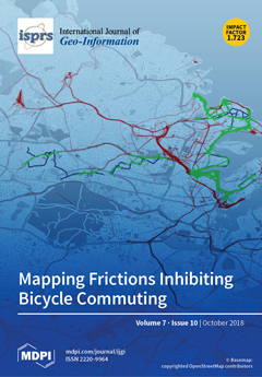
How does cycling work and look like in cities? What and where are the elements inhibiting urban cycling? We analysed a geospatial dataset crowdsourced by urban cyclists using a mobile geo-game. The spatial aggregation of bicycle trips recorded during two weeks showed that cyclists’ preferred streets but also revealed the physical frictions encountered during cycling. We found the location of 284 potential frictions in Münster, Germany; Castelló, Spain; and Valletta, Malta. To describe the potential frictions inhibiting bicycle commuting, we compared the number of segments at lower speeds versus segments at cycling speed and we described the surrounding bicycle paths, infrastructure, and their location in the urban area. City governments can use similar analyses to optimise cycling infrastructure. View this paper.
  • Issues are regarded as officially published after their release is announced to the table of contents alert mailing list .
  • You may sign up for email alerts to receive table of contents of newly released issues.
  • PDF is the official format for papers published in both, html and pdf forms. To view the papers in pdf format, click on the "PDF Full-text" link, and use the free Adobe Reader to open them.

Articles (32)

  • Article
  • Open Access
23 Citations
6,402 Views
12 Pages

Multi-dimensional representation of urban settings has received a great deal of attention among urban planners, policy makers, and urban scholars. This is due to the fact that cities grow vertically and new urbanism strategies encourage higher densit...

  • Article
  • Open Access
76 Citations
9,533 Views
20 Pages

As wetlands are one of the world’s most important ecosystems, their vulnerability necessitates the constant monitoring and mapping of their changes. Satellite-based remote sensing has become an essential data source for mapping and monitoring w...

  • Article
  • Open Access
24 Citations
5,434 Views
23 Pages

Known to be structured in several patterns at the same time, the prior image of interest is always modeled with the idea of enforcing multiple constraints on unknown signals. For instance, when dealing with a hyperspectral restoration problem, the co...

  • Article
  • Open Access
42 Citations
4,595 Views
19 Pages

Line-Constrained Shape Feature for Building Change Detection in VHR Remote Sensing Imagery

  • Haifei Liu,
  • Minhua Yang,
  • Jie Chen,
  • Jialiang Hou and
  • Min Deng

Buildings represent the most relevant features of human activity in urban regions, but their change detection using very-high-resolution (VHR) remote sensing imagery is still a major challenge. Effective representation of the building is the key poin...

  • Article
  • Open Access
71 Citations
10,155 Views
21 Pages

Comparison of Landscape Metrics for Three Different Level Land Cover/Land Use Maps

  • Elif Sertel,
  • Raziye Hale Topaloğlu,
  • Betül Şallı,
  • Irmak Yay Algan and
  • Gül Aslı Aksu

This research aims to investigate how different landscape metrics are affected by the enhancement of the thematic classes in land cover/land use (LC/LU) maps. For this aim, three different LC/LU maps based on three different levels of CORINE (Coordin...

  • Article
  • Open Access
25 Citations
5,373 Views
18 Pages

The progressive TIN (triangular irregular network) densification (PTD) filter algorithm is widely used for filtering point clouds. In the PTD algorithm, the iterative densification parameters become smaller over the entire process of filtering. This...

  • Article
  • Open Access
46 Citations
8,834 Views
24 Pages

The European Common Agricultural Policy (CAP) post-2020 timeframe reform will reshape the agriculture land use control procedures from a selected risk fields-based approach into an all-inclusive one. The reform fosters the use of Sentinel data with t...

  • Article
  • Open Access
16 Citations
5,428 Views
24 Pages

Crowd-sourced geographic information is becoming increasingly available, providing diverse and timely sources for updating existing spatial databases to facilitate urban studies, geoinformatics, and real estate practices. However, the discrepancies b...

  • Article
  • Open Access
6 Citations
4,815 Views
20 Pages

Vegetation plays an irreplaceable role for urban ecosystem services. Urban greenness represents all vegetation cover in and around cities. Understanding spatiotemporal patterns of the changes in urban greenness (CUG) provides fundamental clues for ur...

  • Article
  • Open Access
17 Citations
4,942 Views
13 Pages

This paper introduces an urban growth simulation model applied to the full scope of China. The model uses a multicriteria decision analysis to calculate the land conversion probability and then integrates it with a cellular automata model. A nonlinea...

of 4

Get Alerted

Add your email address to receive forthcoming issues of this journal.

XFacebookLinkedIn
ISPRS Int. J. Geo-Inf. - ISSN 2220-9964