Skip to Content
You are currently on the new version of our website. Access the old version .

ISPRS International Journal of Geo-Information, Volume 10, Issue 3

2021 March - 89 articles

Cover Story: 
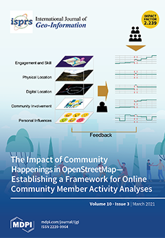
The ubiquity of the Internet enabled the establishment of well-recognised online projects and knowledge bases. Online communities evolve around these projects that enhance and maintain their content, but these communities and their members are often ignored during the usage or analysis of the projects’ data. The systematic framework established in this publication enables a comparable analysis of online community members. Four contextual dimensions of effect on community members are identified: engagement and skill, physical location, digital location, community involvement and personal attributes. They influence many aspects of the data produced by community members. The framework is applied to the use case of OpenStreetMap mappers to assess the impact of community events on them and how these events influence the knowledge they produce. View this paper
  • Issues are regarded as officially published after their release is announced to the table of contents alert mailing list .
  • You may sign up for email alerts to receive table of contents of newly released issues.
  • PDF is the official format for papers published in both, html and pdf forms. To view the papers in pdf format, click on the "PDF Full-text" link, and use the free Adobe Reader to open them.

Articles (89)

  • Article
  • Open Access
34 Citations
8,507 Views
11 Pages

Multitemporal Analysis of Land Use and Land Cover within an Oil Block in the Ecuadorian Amazon

  • Sergio Llerena-Montoya,
  • Andrés Velastegui-Montoya,
  • Bryan Zhirzhan-Azanza,
  • Viviana Herrera-Matamoros,
  • Marcos Adami,
  • Aline de Lima,
  • Francisco Moscoso-Silva and
  • Luis Encalada

The Ecuadorian Amazon is considered a biodiverse region, and at the same time contains the largest number of oil blocks and oilfields in the country. Oil exploitation requires the implementation of oil facilities and related infrastructure, such as r...

  • Article
  • Open Access
22 Citations
4,776 Views
29 Pages

Evapotranspiration is the major component of the water cycle, so a correct estimate of this variable is fundamental. The purpose of the present research is to assess the monthly scale accuracy of six meteorological data-based models in the prediction...

  • Article
  • Open Access
10 Citations
3,353 Views
21 Pages

The Three-River Source Region (TRSR) is vital to the ecological security of China. However, the impact of global warming on the dynamics of vegetation along the elevation gradient in the TRSR remains unclear. Accordingly, we used multi-source remote...

  • Article
  • Open Access
27 Citations
4,694 Views
21 Pages

A Precision Evaluation Index System for Remote Sensing Data Sampling Based on Hexagonal Discrete Grids

  • Yue Ma,
  • Guoqing Li,
  • Xiaochuang Yao,
  • Qianqian Cao,
  • Long Zhao,
  • Shuang Wang and
  • Lianchong Zhang

With the rapid development of earth observation, satellite navigation, mobile communication, and other technologies, the order of magnitude of the spatial data we acquire and accumulate is increasing, and higher requirements are put forward for the a...

  • Article
  • Open Access
5 Citations
5,943 Views
41 Pages

Over the last decade, innovative computer technologies and the multiplication of geospatial data acquisition solutions have transformed the geographic information systems (GIS) landscape and opened up new opportunities to close the gap between GIS an...

  • Article
  • Open Access
46 Citations
6,486 Views
17 Pages

The Influence of Spatial Grid Division on the Layout Analysis of Urban Functional Areas

  • Shaohua Luo,
  • Yang Liu,
  • Mingyi Du,
  • Siyan Gao,
  • Pengfei Wang and
  • Xiaoyu Liu

The identification of urban functional areas is essential for urban planning and sustainable development. Spatial grids are the basic units for the implementation of urban plans and management by cities or development zones. The emergence of internet...

  • Article
  • Open Access
4 Citations
4,872 Views
22 Pages

Current spatiotemporal data has facilitated movement studies to shift objectives from descriptive models to explanations of the underlying causes of movement. From both a practical and theoretical standpoint, progress in developing approaches for the...

  • Article
  • Open Access
19 Citations
8,022 Views
26 Pages

Determining the flow accumulation threshold (FAT) is a key task in the extraction of river networks from digital elevation models (DEMs). Several methods have been developed to extract river networks from Digital Elevation Models. However, few studie...

  • Article
  • Open Access
61 Citations
8,204 Views
23 Pages

3D scene classification has become an important research field in photogrammetry, remote sensing, computer vision and robotics with the widespread usage of 3D point clouds. Point cloud classification, called semantic labeling, semantic segmentation,...

  • Article
  • Open Access
4 Citations
7,598 Views
24 Pages

The General Allotment Act of 1887, also known as the Dawes Act, established the legal basis for the United States government to break up remaining tribally-owned reservation lands in the U.S. by allotting individual parcels to tribal members and sell...

  • Article
  • Open Access
30 Citations
5,020 Views
20 Pages

Dam deformation monitoring can directly identify the safe operation state of a dam in advance, which plays an important role in dam safety management. Three-dimensional (3D) terrestrial laser scanning technology is widely used in the field of deforma...

  • Article
  • Open Access
4 Citations
3,534 Views
19 Pages

Inferring Mixed Use of Buildings with Multisource Data Based on Tensor Decomposition

  • Chenyang Zhang,
  • Qingli Shi,
  • Li Zhuo,
  • Fang Wang and
  • Haiyan Tao

Information on the mixed use of buildings helps understand the status of mixed-use urban vertical land and assists in urban planning decisions. Although a few studies have focused on this topic, the methods they used are quite complex and require man...

  • Article
  • Open Access
6 Citations
10,322 Views
24 Pages

The Mosque-Cathedral of Cordoba: Graphic Analysis of Interior Perspectives by Girault de Prangey around 1839

  • Antonio Gámiz-Gordo,
  • Juan Cantizani-Oliva and
  • Juan Francisco Reinoso-Gordo

The work of Philibert Girault de Prangey, who was a draughtsman, pioneering photographer and an Islamic architecture scholar, has been the subject of recent exhibitions in his hometown (Langres, 2019), at the Metropolitan Museum (New York, 2019) and...

  • Article
  • Open Access
5 Citations
4,230 Views
21 Pages

In this paper, we propose a decentralized semantic reasoning approach for modeling vague spatial objects from sensor network data describing vague shape phenomena, such as forest fire, air pollution, traffic noise, etc. This is a challenging problem...

  • Feature Paper
  • Review
  • Open Access
4 Citations
4,275 Views
33 Pages

Synthesizing Vulnerability, Risk, Resilience, and Sustainability into VRRSability for Improving Geoinformation Decision Support Evaluations

  • Timothy Nyerges,
  • John A. Gallo,
  • Steven D. Prager,
  • Keith M. Reynolds,
  • Philip J. Murphy and
  • WenWen Li

This paper synthesizes vulnerability, risk, resilience, and sustainability (VRRS) in a way that can be used for decision evaluations about sustainable systems, whether such systems are called coupled natural–human systems, social–ecological systems,...

  • Article
  • Open Access
14 Citations
5,105 Views
24 Pages

Habitat Connectivity for the Conservation of Small Ungulates in A Human-Dominated Landscape

  • Rajashekhar Niyogi,
  • Mriganka Shekhar Sarkar,
  • Poushali Hazra,
  • Masidur Rahman,
  • Subham Banerjee and
  • Robert John

Conserving landscape connections among favorable habitats is a widely used strategy to maintain populations in an increasingly fragmented world. A species can then exist as a metapopulation consisting of several subpopulations connected by dispersal....

  • Article
  • Open Access
12 Citations
5,252 Views
19 Pages

Spatial-Planning-Based Ecosystem Adaptation (SPBEA): A Concept and Modeling of Prone Shoreline Retreat Areas

  • Dewayany Sutrisno,
  • Mulyanto Darmawan,
  • Ati Rahadiati,
  • Muhammad Helmi,
  • Armaiki Yusmur,
  • Mazlan Hashim,
  • Peter Tian-Yuan Shih,
  • Rongjun Qin and
  • Li Zhang

Ecosystem-based adaptation to climate change impacts, such as shoreline retreat, has been promoted at the international, national, and even local levels. However, among scientists, opinions about how to implement it in spatial-planning practices are...

  • Article
  • Open Access
18 Citations
6,398 Views
18 Pages

Against the backdrop of urban stock renewal, as the core area of a city rich in culture, aesthetics, and tourism resources, the assessment of landscape visual sensitivity of historic districts can provide an accurate, objective, and intuitive decisio...

  • Article
  • Open Access
8 Citations
4,471 Views
24 Pages

Urban road traffic spatio-temporal characters reflect how citizens move and how goods are transported, which is crucial for trip planning, traffic management, and urban design. Video surveillance camera plays an important role in intelligent transpor...

  • Article
  • Open Access
7 Citations
3,669 Views
14 Pages

In developing countries, crime is a serious problem that affects the operation and viability of firms. Offenses such as vandalism, robbery, and theft raise the operating costs of firms and imposes on them indirect costs. The literature on spatial ana...

  • Article
  • Open Access
12 Citations
7,276 Views
17 Pages

Innovation City projects, aimed at balanced national development in South Korea, have relocated public institutions from the Seoul metropolitan area to provinces, decentralizing population and economic functions, over the past decade. This study meas...

  • Article
  • Open Access
19 Citations
4,381 Views
15 Pages

Small object detection in very-high-resolution (VHR) optical remote sensing images is a fundamental but challenaging problem due to the latent complexities. To tackle this problem, the MdrlEcf model is proposed by modifying deep reinforcement learnin...

  • Article
  • Open Access
5 Citations
3,222 Views
16 Pages

Accessibility analyses are an essential step in the evaluation and planning of urban infrastructures such as transport or pipeline networks. However, these studies generally produce sharply defined lines (called isovarones) or areas (called isovarone...

  • Article
  • Open Access
10 Citations
2,792 Views
14 Pages

The natural ecological lands, such as forest land, grassland, wetland, etc., constitute the most important factor for maintaining and preserving the earth’s ecosystem, which must be well concerned in the regional function-oriented planning for the su...

  • Article
  • Open Access
8 Citations
3,057 Views
16 Pages

The bus stop layout and route deployment may influence the efficiency of bus services. Evaluating the supply of bus service requires the consideration of demand from various urban activities, such as residential and job-related activities. Although v...

  • Article
  • Open Access
14 Citations
3,850 Views
26 Pages

Typhoon is one of the most destructive natural disasters in the world. Real-time information on the process of typhoon events serves as important reference for disaster emergency. In the era of big data, microblog text has been gradual applied to the...

  • Article
  • Open Access
18 Citations
5,934 Views
20 Pages

There is an increasing need for spatial planning to manage coastal tourism, and applying social media data has emerged as an effective strategy to support coastal tourism spatial planning. Researchers and decision-makers require spatially explicit in...

  • Article
  • Open Access
54 Citations
4,519 Views
17 Pages

A Research on Landslides Automatic Extraction Model Based on the Improved Mask R-CNN

  • Peng Liu,
  • Yongming Wei,
  • Qinjun Wang,
  • Jingjing Xie,
  • Yu Chen,
  • Zhichao Li and
  • Hongying Zhou

Landslides are the most common and destructive secondary geological hazards caused by earthquakes. It is difficult to extract landslides automatically based on remote sensing data, which is import for the scenario of disaster emergency rescue. The li...

  • Article
  • Open Access
14 Citations
10,540 Views
24 Pages

The collaborative nature of activities in Web 2.0 projects leads to the formation of online communities. To reinforce this community, these projects often rely on happenings centred around data creation and curation activities. We suggest an integrat...

  • Article
  • Open Access
39 Citations
8,480 Views
20 Pages

Building a Large-Scale Micro-Simulation Transport Scenario Using Big Data

  • Joerg Schweizer,
  • Cristian Poliziani,
  • Federico Rupi,
  • Davide Morgano and
  • Mattia Magi

A large-scale agent-based microsimulation scenario including the transport modes car, bus, bicycle, scooter, and pedestrian, is built and validated for the city of Bologna (Italy) during the morning peak hour. Large-scale microsimulations enable the...

  • Article
  • Open Access
5 Citations
4,105 Views
20 Pages

The Covid-19 pandemic put a heavy burden on member states in the European Union. To govern the pandemic, having access to reliable geo-information is key for monitoring the spatial distribution of the outbreak over time. This study aims to analyze th...

  • Article
  • Open Access
37 Citations
5,352 Views
21 Pages

RGB-D SLAM (Simultaneous Localization and Mapping) generally performs smoothly in a static environment. However, in dynamic scenes, dynamic features often cause wrong data associations, which degrade accuracy and robustness. To address this problem,...

  • Article
  • Open Access
10 Citations
3,917 Views
20 Pages

Structurally describing the portrayal-related information by using a standalone Digital Cartographic Model on top of a Digital Landscape Model has been proved applicable and beneficial for 2D mapping but has not yet been applied to 3D cadastre. This...

  • Article
  • Open Access
12 Citations
4,750 Views
16 Pages

There is no consensus on the importance of satellite images in the process of memorizing a route from a map image, especially if the route is displayed on the Internet using dynamic (animated) cartographic visualization. In modern dynamic maps built...

  • Article
  • Open Access
24 Citations
3,828 Views
18 Pages

The urban heat island effect caused by the rapid increase in urban anthropogenic heat has gradually become an important factor affecting the living environment of urban residents. Studying the temporal and spatial variation characteristics of urban a...

  • Article
  • Open Access
6 Citations
4,134 Views
15 Pages

Spatial analysis is an important means of mining floating car trajectory information, and clustering method and density analysis are common methods among them. The choice of the clustering method affects the accuracy and time efficiency of the analys...

  • Article
  • Open Access
26 Citations
10,390 Views
24 Pages

End Point Rate Tool for QGIS (EPR4Q): Validation Using DSAS and AMBUR

  • Lucas Terres de Lima,
  • Sandra Fernández-Fernández,
  • Jean Marcel de Almeida Espinoza,
  • Miguel da Guia Albuquerque and
  • Cristina Bernardes

This paper presents the validation of the End Point Rate (EPR) tool for QGIS (EPR4Q), a tool built-in QGIS graphical modeler for calculating the shoreline change with the end point rate method. The EPR4Q tries to fill the gaps in user-friendly and fr...

  • Article
  • Open Access
17 Citations
6,303 Views
19 Pages

Anyone can contribute geographic information to OpenStreetMap (OSM), regardless of their level of experience or skills, which has raised concerns about quality. When reference data is not available to assess the quality of OSM data, intrinsic methods...

  • Article
  • Open Access
27 Citations
8,020 Views
27 Pages

Key to the quantification of rockfall hazard is an understanding of its magnitude-frequency behaviour. Remote sensing has allowed for the accurate observation of rockfall activity, with methods being developed for digitally assembling the monitored o...

  • Article
  • Open Access
8 Citations
2,951 Views
25 Pages

One of the most important challenges of volunteered geographic information (VGI) is the quality assessment. Existing methods of VGI quality assessment, either assess the quality by comparing a reference map with the VGI map or deriving the quality fr...

  • Article
  • Open Access
42 Citations
14,594 Views
20 Pages

The Impact of COVID-19 on Crime: A Spatial Temporal Analysis in Chicago

  • Mengjie Yang,
  • Zhe Chen,
  • Mengjie Zhou,
  • Xiaojin Liang and
  • Ziyue Bai

The coronavirus disease 2019 (COVID-19) pandemic has had tremendous and extensive impacts on the people’s daily activities. In Chicago, the numbers of crime fell considerably. This work aims to investigate the impacts that COVID-19 has had on the spa...

  • Article
  • Open Access
19 Citations
6,990 Views
32 Pages

In 2015, 193 countries declared their commitment to “leave no one behind” in pursuit of 17 Sustainable Development Goals (SDGs). However, the world’s refugees have been routinely excluded from national censuses and representative surveys, and, as a r...

  • Article
  • Open Access
3 Citations
5,073 Views
37 Pages

Providing long-term data about the evolution of railway networks in Europe may help us understand how European Union (EU) member states behave in the long-term, and how they can comply with present EU recommendations. This paper proposes a methodolog...

  • Article
  • Open Access
9 Citations
6,562 Views
23 Pages

In this work, we present a novel approach to understand the quality of public transit system in resource constrained regions using user-generated contents. With growing urban population, it is getting difficult to manage travel demand in an effective...

  • Article
  • Open Access
15 Citations
3,840 Views
21 Pages

The COVID-19 pandemic is a major problem facing humanity throughout the world. The rapid and accurate tracking of population flows may therefore be epidemiologically informative. This paper adopts a massive amount of daily population flow data (from...

  • Article
  • Open Access
10 Citations
3,303 Views
15 Pages

The extraction of roads and centerlines from aerial imagery is considered an important topic because it contributes to different fields, such as urban planning, transportation engineering, and disaster mitigation. Many researchers have studied this t...

  • Article
  • Open Access
5 Citations
3,140 Views
19 Pages

Lacking indoor navigation graph has become a bottleneck in indoor applications and services. This paper presents a novel automated indoor navigation graph reconstruction approach from large-scale low-frequency indoor trajectories without any other da...

  • Article
  • Open Access
16 Citations
4,480 Views
15 Pages

Interpersonal and intrapersonal variabilities are two important perspectives to understand daily travel behaviors, while only a small number of studies incorporate them for understanding human dynamics. This paper employed a network analysis approach...

  • Article
  • Open Access
13 Citations
6,009 Views
15 Pages

Cellular automata (CA) models have been used in urban studies for dealing with land use change. Transport and accessibility are arguably the main drivers of urban change and have a direct influence on land use. Land use and transport interaction mode...

  • Article
  • Open Access
63 Citations
8,484 Views
17 Pages

Effects of Virtual Reality Locomotion Techniques on Distance Estimations

  • Julian Keil,
  • Dennis Edler,
  • Denise O’Meara,
  • Annika Korte and
  • Frank Dickmann

Mental representations of geographic space are based on knowledge of spatial elements and the spatial relation between these elements. Acquiring such mental representations of space requires assessing distances between pairs of spatial elements. In v...

of 2

Get Alerted

Add your email address to receive forthcoming issues of this journal.

XFacebookLinkedIn
ISPRS Int. J. Geo-Inf. - ISSN 2220-9964