You are currently viewing a new version of our website. To view the old version click .

ISPRS International Journal of Geo-Information, Volume 10, Issue 4

April 2021 - 75 articles

Cover Story: 
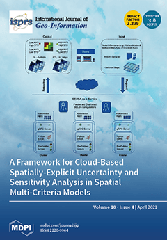
There is an ongoing paradigm shift in geoinformatics. Cloud computing promises to provide almost unlimited availability, reliability, and scalability for memory-intensive and computational demandingspatial analysis, such as Spatially Explicit Uncertainty and Sensitivity Analysis (SEUSA), to quantify the robustness of spatial model solutions. The number of model runs, the spatial, spectral, and temporal resolutions, the number of criterion maps, and the model complexity mainly influence the computational effort. Complex spatial use cases that incorporate massive raster datasets easily exceed local cluster capacity limits by performing SEUSA. Consequently, this study focuses on designing a framework to perform SEUSA as a Service in a cloud-based environment scalable to very large raster datasets and applicable for various spatial domains. View this paper
  • Issues are regarded as officially published after their release is announced to the table of contents alert mailing list .
  • You may sign up for email alerts to receive table of contents of newly released issues.
  • PDF is the official format for papers published in both, html and pdf forms. To view the papers in pdf format, click on the "PDF Full-text" link, and use the free Adobe Reader to open them.

Articles (75)

  • Article
  • Open Access
7 Citations
4,033 Views
19 Pages

The Road Map to Classify the Potential Risk of Wind Erosion

  • Hana Středová,
  • Jana Podhrázská,
  • Filip Chuchma,
  • Tomáš Středa,
  • Josef Kučera,
  • Petra Fukalová and
  • Martin Blecha

Environmental degradation, for example, by wind erosion, is a serious global problem. Despite the enormous research on this topic, complex methods considering all relevant factors remain unpublished. The main intent of our paper is to develop a metho...

  • Article
  • Open Access
8 Citations
3,630 Views
17 Pages

Modeling the distribution of daily and hourly human mobility metrics is beneficial for studying underlying human travel patterns. In previous studies, some probability distribution functions were employed in order to establish a base for human mobili...

  • Article
  • Open Access
4 Citations
3,665 Views
27 Pages

TATSSI: A Free and Open-Source Platform for Analyzing Earth Observation Products with Quality Data Assessment

  • Inder Tecuapetla-Gómez,
  • Gerardo López-Saldaña,
  • María Isabel Cruz-López and
  • Rainer Ressl

Earth observation (EO) data play a crucial role in monitoring ecosystems and environmental processes. Time series of satellite data are essential for long-term studies in this context. Working with large volumes of satellite data, however, can still...

  • Article
  • Open Access
3 Citations
6,348 Views
16 Pages

Passengers were unsatisfied with the navigation signs in Taipei station based on the Report on the Taiwan Railway Passenger Survey. This study conducted two experiments. Experiment 1 involved 14 participants using the present Taipei Main Station floo...

  • Article
  • Open Access
7 Citations
4,314 Views
20 Pages

Landscape Pattern Theoretical Optimization of Urban Green Space Based on Ecosystem Service Supply and Demand

  • Qinqin Liu,
  • Yichen Tian,
  • Kai Yin,
  • Feifei Zhang,
  • Huiping Huang and
  • Fangmiao Chen

Assessing the supply and demand of urban green space (UGS) ecosystem services (ESs) can provide relevant insights for urban planning. This study presents an analysis method for the spatial distribution of UGS ES supply and demand at administrative un...

  • Article
  • Open Access
8 Citations
5,417 Views
16 Pages

An Open Source GIS Application for Spatial Assessment of Health Care Quality Indicators

  • Lia Duarte,
  • Ana Cláudia Teodoro,
  • Mariana Lobo,
  • João Viana,
  • Vera Pinheiro and
  • Alberto Freitas

Prevention quality indicators (PQIs) constitute a set of measures that can be combined with hospital inpatient data to identify the quality of care for ambulatory care sensitive conditions (ACSC). Geographical information system (GIS) web mapping and...

  • Article
  • Open Access
43 Citations
14,280 Views
25 Pages

Analysis of OpenStreetMap Data Quality at Different Stages of a Participatory Mapping Process: Evidence from Slums in Africa and Asia

  • Godwin Yeboah,
  • João Porto de Albuquerque,
  • Rafael Troilo,
  • Grant Tregonning,
  • Shanaka Perera,
  • Syed A. K. Shifat Ahmed,
  • Motunrayo Ajisola,
  • Ornob Alam,
  • Navneet Aujla and
  • Syed Iqbal Azam
  • + 40 authors

This paper examines OpenStreetMap data quality at different stages of a participatory mapping process in seven slums in Africa and Asia. Data were drawn from an OpenStreetMap-based participatory mapping process developed as part of a research project...

  • Article
  • Open Access
14 Citations
4,411 Views
19 Pages

The space–time behaviour of COVID-19 needs to be analysed from microdata to understand the spread of the virus. Hence, 3D space–time bins and analysis of associated emerging hotspots are useful methods for revealing the areas most at risk from the pa...

  • Article
  • Open Access
45 Citations
6,488 Views
14 Pages

Soils provide important regulating ecosystem services and have crucial implications for human well-being and environmental conservation. However, soil degradation and particularly soil erosion jeopardize the maintenance and existence of these service...

  • Article
  • Open Access
10 Citations
4,678 Views
23 Pages

Indonesia currently has 269 million people or 3.49% of the world’s total population and is ranked as the fourth most populous country in the world. Analysis by the Ministry of Public Works and Public Housing of Indonesia in 2010 shows that Java’s bio...

of 8

Get Alerted

Add your email address to receive forthcoming issues of this journal.

XFacebookLinkedIn
ISPRS Int. J. Geo-Inf. - ISSN 2220-9964Creative Common CC BY license