Next Issue
Volume 13, January
Previous Issue
Volume 12, November


J. Mar. Sci. Eng., Volume 12, Issue 12 (December 2024) – 260 articles

Cover Story (view full-size image): 
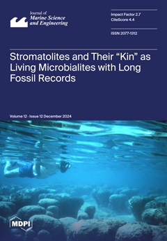
Stromatolites are structures formed by microbial bacteria that trap and bind fine particles in water with ample sunlight. They appeared in the Archean and Proterozoic eons as the oldest known form of life and persisted through the Phanerozoic to the present day. The type locality for fossil stromatolites is at Lester Park in New York State, as first described with regard to Cambrian rocks in 1884. Recognition that living cyanobacteria form stromatolites occurred in 1961 with the discovery of modern forms in Shark Bay, Western Australia. Regarded at first as a one-of-a-kind sanctuary, these stromatolites thrive in seawater under high levels of salinity that limit biological competition. Other settings with living stromatolites were since found in the Bahamas, East African rift lakes, Mexico’s Baja California, and saline lakes in Argentina. View this paper
  • Issues are regarded as officially published after their release is announced to the table of contents alert mailing list.
  • You may sign up for e-mail alerts to receive table of contents of newly released issues.
  • PDF is the official format for papers published in both, html and pdf forms. To view the papers in pdf format, click on the "PDF Full-text" link, and use the free Adobe Reader to open them.
Order results
Result details
Section
Select all
Export citation of selected articles as:
14 pages, 4728 KiB  
Article
Experimental Analysis of Elastic Property Variations in Methane Hydrate-Bearing Sediments with Different Porosities
by Weiping Xu, Bangrang Di, Haifeng Chen and Jianxin Wei
J. Mar. Sci. Eng. 2024, 12(12), 2370; https://doi.org/10.3390/jmse12122370 - 23 Dec 2024
Viewed by 425
Abstract
Natural gas hydrates, a promising clean energy resource, hold substantial potential. Porosity plays a crucial role in hydrate systems by influencing formation processes and physical properties. To clarify the effects of porosity on hydrate elasticity, we examined methane hydrate formation and its acoustic [...] Read more.
Natural gas hydrates, a promising clean energy resource, hold substantial potential. Porosity plays a crucial role in hydrate systems by influencing formation processes and physical properties. To clarify the effects of porosity on hydrate elasticity, we examined methane hydrate formation and its acoustic characteristics. Experiments were conducted on sediment samples with porosities of 23%, 32%, and 37%. P- and S-wave velocities were measured to assess acoustic responses. Results show that as hydrate saturation increases, sample acoustic velocity also rises. However, high-porosity samples consistently exhibit lower acoustic velocities compared to low-porosity samples and reach a lower maximum hydrate saturation. This behavior is attributed to rapid pore filling in high-porosity samples, which blocks flow pathways and limits further hydrate formation. In contrast, hydrate formation in low-porosity sediments progresses more gradually, maintaining clearer pore channels and resulting in relatively higher hydrate saturation. Higher porosity also accelerates the shift of hydrates from cementing to load-bearing morphologies. These findings underscore porosity’s significant influence on hydrate formation and provide insights into observed variations in hydrate saturation and acoustic velocity across different experimental conditions. Full article
(This article belongs to the Section Marine Energy)
Show Figures

Figure 1

17 pages, 2965 KiB  
Article
Typhoon Effects on Surface Phytoplankton Biomass Based on Satellite-Derived Chlorophyll-a in the East Sea During Summer
by HwaEun Jung, JiSuk Ahn, Jae Joong Kang, Jae Dong Hwang, SeokHyun Youn, HyunJu Oh, HuiTae Joo and Changsin Kim
J. Mar. Sci. Eng. 2024, 12(12), 2369; https://doi.org/10.3390/jmse12122369 - 23 Dec 2024
Viewed by 518
Abstract
The East Sea is a jointly managed maritime area of Korea, Russia, and Japan, where the frequency of strong typhoons is anticipated to increase with climate change, affecting its marine ecosystem and regional climate regulation. This study investigated the environmental and ecological impacts [...] Read more.
The East Sea is a jointly managed maritime area of Korea, Russia, and Japan, where the frequency of strong typhoons is anticipated to increase with climate change, affecting its marine ecosystem and regional climate regulation. This study investigated the environmental and ecological impacts of summer typhoons entering the East Sea by analyzing satellite-derived chlorophyll-a (Chl-a) data, Argo float measurements, and ERA5 wind data. Our findings revealed that summer typhoons generally increased surface Chl-a concentrations by 65.4%, with typhoon intensity substantially influencing this process. Weak typhoons caused marginal Chl-a increases attributed to redistribution rather than nutrient supply, whereas normal and strong typhoons increased Chl-a through enhanced vertical mixing and nutrient upwelling in the East Sea. Stronger typhoons notably impacted the mixed layer depth and isothermal layer depth, leading to greater Chl-a concentrations within the strong wind radius. However, the increased Chl-a magnitude was lower than that of other strong typhoons in other regions. The East Sea uniquely responds to typhoons with fewer upper environment changes, possibly due to a stable barrier layer limiting vertical mixing. These findings underscore the importance of continuous monitoring and integrated observational methods in order to better understand the ecological effects of typhoons, particularly as their intensity increases with climate change. Full article
(This article belongs to the Section Marine Environmental Science)
Show Figures

Figure 1

33 pages, 12922 KiB  
Article
A Novel Hull Girder Design Methodology for Prediction of the Longitudinal Structural Strength of Ships
by Haicheng Yu, Songhao Wu, Yingdong Zhao, Wenlong Liu and Haiyi Yang
J. Mar. Sci. Eng. 2024, 12(12), 2368; https://doi.org/10.3390/jmse12122368 - 23 Dec 2024
Viewed by 330
Abstract
The ship hull girder model has been widely adopted in ship mechanics research such as small-scale and large-scale hydroelastic ship model experiments. Current design methods cannot seriously meet the structural rigidity requirement, and the distinction between the ship structural masses and the cargo [...] Read more.
The ship hull girder model has been widely adopted in ship mechanics research such as small-scale and large-scale hydroelastic ship model experiments. Current design methods cannot seriously meet the structural rigidity requirement, and the distinction between the ship structural masses and the cargo masses is rather vague. This research proposes a simple and novel ship hull girder design methodology. The main novelties are that (1) the structural rigidity design requirement for the ship hull girder corresponding to any targeted real ship with arbitrary structural complexity is precisely satisfied by the proposed strategy of adopting a composite hull girder system, and that (2) the mass density per unit length of the proposed hull girder is solely related to the mass density distribution of the targeted ship structures by considering the hull girder system as a complete finite element (FE) model, and thus (3) a better ship hull girder model for prediction of the total structural responses can be consequently established. A real ship is adopted as the design target, and the structural responses of the real ship and the proposed ship hull girder model are compared and analyzed. The proposed model is compared to the currently widely accepted ship hull girder models through numerical experiments. The proposed hull girder design methodology possesses the potential for upgrading the classical structural design approach to match the growing trend of adopting FEM-based approaches for ship structure research. Full article
(This article belongs to the Section Ocean Engineering)
Show Figures

Figure 1

17 pages, 6175 KiB  
Article
Multivariate, Automatic Diagnostics Based on Insights into Sensor Technology
by Astrid Marie Skålvik, Ranveig N. Bjørk, Enoc Martínez, Kjell-Eivind Frøysa and Camilla Saetre
J. Mar. Sci. Eng. 2024, 12(12), 2367; https://doi.org/10.3390/jmse12122367 - 23 Dec 2024
Viewed by 369
Abstract
With the rapid development of smart sensor technology and the Internet of things, ensuring data accuracy and system reliability is paramount. As the number of sensors increases with demand for high-resolution, high-quality input to decision-making systems, models and digital twins, manual quality control [...] Read more.
With the rapid development of smart sensor technology and the Internet of things, ensuring data accuracy and system reliability is paramount. As the number of sensors increases with demand for high-resolution, high-quality input to decision-making systems, models and digital twins, manual quality control of sensor data is no longer an option. In this paper, we leverage insights into sensor technology, environmental dynamics and the correlation between data from different sensors for automatic diagnostics of a sensor node. We propose a method for combining results of automatic quality control of individual sensors with tests for detecting simultaneous anomalies across sensors. Building on both sensor and application knowledge, we develop a diagnostic logic that can automatically explain and diagnose instead of just labeling the individual sensor data as “good” or “bad”. This approach enables us to provide diagnostics that offer a deeper understanding of the data and their quality and of the health and reliability of the measurement system. Our algorithms are adapted for real time and in situ operation on the sensor node. We demonstrate the diagnostic power of the algorithms on high-resolution measurements of temperature and conductivity from the OBSEA observatory about 50 km south of Barcelona, Spain. Full article
(This article belongs to the Special Issue Progress in Sensor Technology for Ocean Sciences)
Show Figures

Figure 1

18 pages, 4690 KiB  
Article
Calibration of Marine Pressure Sensors with a Combination of Temperature and Pressure: A Case Study of SBE 37-SM
by Muzi Zhang, Qingquan Sun, Xiaoxue Bai, Bo Yang, Wei Zhao and Chi Wu
J. Mar. Sci. Eng. 2024, 12(12), 2366; https://doi.org/10.3390/jmse12122366 - 23 Dec 2024
Viewed by 506
Abstract
Accurate pressure measurement is crucial for understanding ocean dynamics in marine research. However, pressure sensors based on strain measurement principles are significantly affected by temperature variations, impacting the accuracy of depth measurements. This study investigates the SBE37-SM sensor and presents an improved calibration [...] Read more.
Accurate pressure measurement is crucial for understanding ocean dynamics in marine research. However, pressure sensors based on strain measurement principles are significantly affected by temperature variations, impacting the accuracy of depth measurements. This study investigates the SBE37-SM sensor and presents an improved calibration method based on a constant-pressure, variable-temperature scheme that effectively addresses temperature-induced deviations in pressure measurement. Experiments were conducted across a pressure range of 2000 dbar to 6000 dbar and a temperature range of 2 °C to 35 °C, establishing a comprehensive pressure–temperature calibration grid. The results show that, at a pressure of 6000 dbar, temperature-induced variations in readings for brand new SBE37-SM sensors can reach up to 9 dbar, while, for used sensors, they exceed 12 dbar, following a U-shaped trend. After applying a polynomial regression model for calibration, these variations were reduced to within ±0.5 dbar, significantly reducing the measurement uncertainty of the sensors in complex marine environments. This method underscores the necessity of further optimizing the CTD system’s temperature compensation mechanism during calibration and highlights the importance of regular calibration to minimize measurement uncertainty. Full article
(This article belongs to the Section Ocean Engineering)
Show Figures

Graphical abstract

17 pages, 4611 KiB  
Article
Analysis of Deep-Sea Acoustic Ranging Features for Enhancing Measurement Capabilities in the Study of the Marine Environment
by Grigory Dolgikh, Yuri Morgunov, Aleksandr Golov, Aleksandr Burenin and Sergey Shkramada
J. Mar. Sci. Eng. 2024, 12(12), 2365; https://doi.org/10.3390/jmse12122365 - 23 Dec 2024
Viewed by 400
Abstract
This article explores the features of using hydroacoustic methods to measure and monitor climate-induced temperature variations along acoustic paths in the Sea of Japan. It delves into effective techniques for controlling and positioning of deep-sea autonomous measuring systems (DSAMS) for diverse applications. Theoretical [...] Read more.
This article explores the features of using hydroacoustic methods to measure and monitor climate-induced temperature variations along acoustic paths in the Sea of Japan. It delves into effective techniques for controlling and positioning of deep-sea autonomous measuring systems (DSAMS) for diverse applications. Theoretical and experimental findings from research conducted in the Sea of Japan in August 2023 along a 144.4 km acoustic route under summer–autumn hydrological conditions, including the aftermath of the powerful typhoon “Khanun”, are presented. The main hydrological regime characteristics for this period are compared with data obtained in 2022. This study explores the transmission of pulsed pseudorandom signals from a broad shelf into the deep area of the sea, with receptions occurring at depths of 69, 126, 680, and 914 m. An experiment was conducted to receive broadband pulse signals centered at a frequency of 400 Hz, located 144.4 km from the source of navigation signals (SNS), which is positioned on the shelf at a depth of 30 m in waters that are 45 m deep. A system of hydrophones, deployed to depths of up to 1000 m, was utilized to capture signal data, allowing for prolonged recording at fixed depths or during descent. An analysis of the experimentally acquired impulse characteristics revealed a series of ray arrivals lasting approximately 0.5 s, with a peak consistently observed across all depths. Findings from both full-scale and numerical experiments enabled the assessment of impulse characteristics within an acoustic waveguide, the calculation of effective signal propagation speeds at varying depths, and the development of conclusions regarding the viability of tackling control and positioning challenges for DSAMS at depths reaching up to 1000 m and distances spanning hundreds of kilometers from control stations. Full article
(This article belongs to the Section Physical Oceanography)
Show Figures

Figure 1

20 pages, 12015 KiB  
Article
Research on Trajectory Tracking of Robotic Fish Based on DBO-Backstepping Control
by Huibao Yang, Shuheng Hu, Bangshuai Li, Xiujing Gao and Hongwu Huang
J. Mar. Sci. Eng. 2024, 12(12), 2364; https://doi.org/10.3390/jmse12122364 - 23 Dec 2024
Viewed by 357
Abstract
Advancements in underwater robotic fish have generated new requirements for diverse underwater scenarios, presenting challenges in attaining efficient and precise control, particularly in the realm of classical trajectory tracking. In response to the inherently nonlinear and underactuated characteristics of underwater robot control design, [...] Read more.
Advancements in underwater robotic fish have generated new requirements for diverse underwater scenarios, presenting challenges in attaining efficient and precise control, particularly in the realm of classical trajectory tracking. In response to the inherently nonlinear and underactuated characteristics of underwater robot control design, this study introduces a trajectory tracking backstepping control method for the planar motion of underactuated underwater robotic systems. The method is grounded in dung beetle optimization (DBO) backstepping control. Firstly, a dynamic model of a single-node tail-actuated robotic fish is introduced, and the model is averaged. Based on the averaged model and Lyapunov functions, the design of the backstepping control scheme is derived to ensure the stability of the control system. Subsequently, the derived backstepping control is further optimized through the application of the DBO optimization algorithm, then the optimal backstepping control (OBC) approach is presented. Finally, the proposed control scheme is applied to the simulation experiments with the robotic fish. The simulation results for straight-line tracking indicate that OBC is superior to the PID method in terms of overshoot performance, reducing the average overshoot from 0.23 to 0.02. Additionally, OBC reduces the average velocity error from 0.043 m/s (backstepping control) to 0.035 m/s, which is lower than that of the PID method, with an average velocity error of 0.054 m/s. In turn tracking, the simulation results reveal that OBC reduces the average velocity error from 0.067 m/s (backstepping control) to 0.055 m/s and demonstrates better performance than the PID method, with an average velocity error of 0.066 m/s. Under various disturbance conditions, the simulations reveal that OBC exhibits superior performance when compared to other control methods. Full article
Show Figures

Figure 1

23 pages, 9429 KiB  
Article
Practical Fixed-Time Robust Containment Control of Multi-ASVs with Collision Avoidance
by Tao Wu, Zhengjiang Liu and Guoyou Shi
J. Mar. Sci. Eng. 2024, 12(12), 2363; https://doi.org/10.3390/jmse12122363 - 23 Dec 2024
Viewed by 491
Abstract
A practical fixed-time robust containment control method for multiple autonomous surface vehicles (multi-ASVs) is proposed in this study. This method addresses the containment control problem of multi-ASVs, considering both collision risks and external disturbances. This control scheme improves the cooperative performance of the [...] Read more.
A practical fixed-time robust containment control method for multiple autonomous surface vehicles (multi-ASVs) is proposed in this study. This method addresses the containment control problem of multi-ASVs, considering both collision risks and external disturbances. This control scheme improves the cooperative performance of the formation and guarantees safe collision avoidance behavior. First, to enable the online estimation of unknown time-varying disturbances from the external environment, a fixed-time disturbance observer (FNDO) is designed based on fixed-time control theory. Second, the distributed kinematic controller is modified to include the partial derivatives of the artificial potential energy function (APEF), thereby preventing collisions among multi-ASVs. Third, by applying fixed-time theory, graph theory, and fixed-time dynamic surface control techniques, a practical fixed-time robust containment controller for multi-ASVs is proposed. Additionally, the entire closed-loop control system is guaranteed to be practical and fixed-time stable through stability analysis. Finally, the proposed control strategy has been validated by simulation results. Full article
(This article belongs to the Section Ocean Engineering)
Show Figures

Figure 1

19 pages, 7596 KiB  
Article
Study on the Sealing Performance of Flexible Pipe End-Fittings Considering the Creep Behavior of PVDF Material at Different Temperatures
by Qingzhen Lu, Shengjie Xu, Tao Zhang, Yuanchao Yin, Hailong Lu and Jun Yan
J. Mar. Sci. Eng. 2024, 12(12), 2362; https://doi.org/10.3390/jmse12122362 - 22 Dec 2024
Viewed by 613
Abstract
Current designs of sealing systems for non-adhesive flexible pipe end-fittings primarily address short-term loading conditions, often overlooking the creep behavior of polyvinylidene fluoride (PVDF) and the material used in the sealing layer. Over time, the creep of PVDF, particularly at elevated temperatures, can [...] Read more.
Current designs of sealing systems for non-adhesive flexible pipe end-fittings primarily address short-term loading conditions, often overlooking the creep behavior of polyvinylidene fluoride (PVDF) and the material used in the sealing layer. Over time, the creep of PVDF, particularly at elevated temperatures, can lead to excessive reduction in the sealing layer’s thickness, thereby compromising the sealing performance of the end-fittings. In this study, to address the creep-related issues in the sealing layer, the compression and compression creep tests of PVDF were conducted at different temperatures to establish the material’s elastic-plastic constitutive relationship and develop a creep constitutive model based on the time hardening model. Using the pressure penetration method within ABAQUS software, a two-dimensional axisymmetric finite element model of the end-fitting sealing system was constructed, incorporating the effects of internal fluid pressure. This model was employed to analyze the sealing performance while accounting for the materials’ creep behavior across varying temperature conditions. The results demonstrate that creep in the sealing layer occurs predominantly in the early stages post-installation. Furthermore, the API 17J standard, which stipulates that reduction in sealing layer thickness should not exceed 30%, is found to be conservative at high temperatures. In these conditions, although the thickness reduction exceeds 30% before the maximum contact pressure drops below the fluid pressure, no fluid leakage is observed. Thus, in the initial phase following installation, especially at elevated temperatures, monitoring for potential leakage is critical. This research is the first to quantify the long-term impact of PVDF creep behavior on the sealing performance of flexible pipe end-fittings through comprehensive experiments and simulation analysis. The findings provide both a theoretical foundation and practical guidance for enhancing the long-term sealing performance of flexible pipe end-fittings. Full article
(This article belongs to the Section Ocean Engineering)
Show Figures

Figure 1

17 pages, 3093 KiB  
Article
Reliability of Inland Water Transportation Complex Network Based on Percolation Theory: An Empirical Analysis in the Yangtze River
by Dong Han, Zhongyi Sui, Changshi Xiao and Yuanqiao Wen
J. Mar. Sci. Eng. 2024, 12(12), 2361; https://doi.org/10.3390/jmse12122361 - 22 Dec 2024
Viewed by 670
Abstract
Inland water transportation is regarded as a crucial component of global trade, yet its reliability has been increasingly challenged by uncertainties such as extreme weather, port congestion, and geopolitical tensions. Although substantial research has focused on the structural characteristics of inland water transportation [...] Read more.
Inland water transportation is regarded as a crucial component of global trade, yet its reliability has been increasingly challenged by uncertainties such as extreme weather, port congestion, and geopolitical tensions. Although substantial research has focused on the structural characteristics of inland water transportation networks, the dynamic responses of these networks to disruptions remain insufficiently explored. This gap in understanding is critical for enhancing the resilience of global transportation systems as trade volumes grow and risks intensify. In this study, percolation theory was applied to evaluate the reliability of the Yangtze River transportation network. Ship voyage data from 2019 were used to construct a complex network model, and simulations of node removal were performed to identify key vulnerabilities within the network. The results showed that the failure of specific nodes significantly impacts the network’s connectivity, suggesting which nodes should be prioritized for protection. This research offers a dynamic framework for the assessment of inland water transportation network reliability and provides new insights that could guide policy decisions to improve the resilience of critical waterway systems. By identifying potential points of failure, this study contributes to the development of a more robust global trade infrastructure. Full article
Show Figures

Figure 1

21 pages, 7791 KiB  
Article
Simulation Study on Detection and Localization of a Moving Target Under Reverberation in Deep Water
by Jincong Dun, Shihong Zhou, Yubo Qi and Changpeng Liu
J. Mar. Sci. Eng. 2024, 12(12), 2360; https://doi.org/10.3390/jmse12122360 - 22 Dec 2024
Viewed by 387
Abstract
Deep-water reverberation caused by multiple reflections from the seafloor and sea surface can affect the performance of active sonars. To detect a moving target under reverberation conditions, a reverberation suppression method using multipath Doppler shift in deep water and wideband ambiguity function (WAF) [...] Read more.
Deep-water reverberation caused by multiple reflections from the seafloor and sea surface can affect the performance of active sonars. To detect a moving target under reverberation conditions, a reverberation suppression method using multipath Doppler shift in deep water and wideband ambiguity function (WAF) is proposed. Firstly, the multipath Doppler factors in the deep-water direct zone are analyzed, and they are introduced into the target scattered sound field to obtain the echo of the moving target. The mesh method is used to simulate the deep-water reverberation waveform in time domain. Then, a simulation model for an active sonar based on the source and short vertical line array is established. Reverberation and target echo in the received signal can be separated in the Doppler shift domain of the WAF. The multipath Doppler shifts in the echo are used to estimate the multipath arrival angles, which can be used for target localization. The simulation model and the reverberation suppression detection method can provide theoretical support and a technical reference for the active detection of moving targets in deep water. Full article
(This article belongs to the Section Ocean Engineering)
Show Figures

Figure 1

25 pages, 9865 KiB  
Article
Dual-Branch Feature Generalization Method for AUV Near-Field Exploration of Hydrothermal Areas
by Yihui Liu, Guofang Chen, Yufei Xu, Lei Wan and Ziyang Zhang
J. Mar. Sci. Eng. 2024, 12(12), 2359; https://doi.org/10.3390/jmse12122359 - 22 Dec 2024
Viewed by 334
Abstract
The simultaneous localization and mapping (SLAM) technique provides long-term near-seafloor navigation for autonomous underwater vehicles (AUVs). However, the stability of descriptors generated by interest point detectors remains a challenge in the hydrothermal environment. This paper proposes a dual-branch feature generalization method, incorporating volumetric [...] Read more.
The simultaneous localization and mapping (SLAM) technique provides long-term near-seafloor navigation for autonomous underwater vehicles (AUVs). However, the stability of descriptors generated by interest point detectors remains a challenge in the hydrothermal environment. This paper proposes a dual-branch feature generalization method, incorporating volumetric density and color distribution for enhanced robustness. The method utilizes shared descriptors and a feature confidence mechanism, combining neural radiance fields with Gaussian splatting models, ensuring fast and accurate feature generalization. The proposed approach improves recall while maintaining matching accuracy, ensuring stability and robustness in feature matching. This method achieves stable and reliable feature matching in a simulated hydrothermal environment. Full article
(This article belongs to the Section Ocean Engineering)
Show Figures

Figure 1

18 pages, 4581 KiB  
Article
A Design-Oriented Model for Transmission Loss Optimization in Marine DOCs
by Jan Kašpar, Francesco Mauro, Marco Biot, Giovanni Rognoni and Giada Kyaw Oo D’Amore
J. Mar. Sci. Eng. 2024, 12(12), 2358; https://doi.org/10.3390/jmse12122358 - 22 Dec 2024
Viewed by 400
Abstract
The even more restrictive regulations imposed on chemical and acoustic emissions of ships necessitate the installation of after-treatment systems onboard. The spaces onboard are limited, and the Exhaust Gas Cleaning Systems (EGCSs) have big dimensions, so an appropriate integration and optimization of EGCSs [...] Read more.
The even more restrictive regulations imposed on chemical and acoustic emissions of ships necessitate the installation of after-treatment systems onboard. The spaces onboard are limited, and the Exhaust Gas Cleaning Systems (EGCSs) have big dimensions, so an appropriate integration and optimization of EGCSs allows to save space and comply with international regulations. Moreover, in the available literature, there is a lack of guidelines about the design of integrated EGCSs. This study aims to develop an ad hoc optimization methodology that uses combined Computational Fluid Dynamics (CFD)–Finite Element Method (FEM) simulations, surrogate models, and Genetic Algorithms to optimize the acoustic properties of EGCSs while considering the limits imposed by the efficiency of chemical reactions for the abatement of NOx and SOx. The developed methodology is applied to a Diesel Oxidation Catalyst (DOC), and the obtained results lead to a system that integrates the silencing effect into the DOC. Full article
(This article belongs to the Special Issue Novel Maritime Techniques and Technologies, and Their Safety)
Show Figures

Figure 1

20 pages, 4957 KiB  
Article
Spatiotemporal Variability of Anthropogenic Film Pollution in Avacha Gulf near the Kamchatka Peninsula Based on Synthetic-Aperture Radar Imagery
by Valery Bondur, Vasilisa Chernikova, Olga Chvertkova and Viktor Zamshin
J. Mar. Sci. Eng. 2024, 12(12), 2357; https://doi.org/10.3390/jmse12122357 - 21 Dec 2024
Viewed by 517
Abstract
The paper addresses the spatiotemporal variability of anthropogenic film pollution (AFP) in Avacha Gulf near the Kamchatka Peninsula based on satellite synthetic-aperture radar (SAR) imagery. Coastal waters of the study area are subject to significant anthropogenic impacts associated with intensive marine traffic, as [...] Read more.
The paper addresses the spatiotemporal variability of anthropogenic film pollution (AFP) in Avacha Gulf near the Kamchatka Peninsula based on satellite synthetic-aperture radar (SAR) imagery. Coastal waters of the study area are subject to significant anthropogenic impacts associated with intensive marine traffic, as well as the flow of household and industrial wastewater from factories located on the coast. A quantitative approach to the registration and quantitative analysis of spatiotemporal AFP distributions was applied. This approach is based on the processing of long-term time series of SAR imagery, taking into account inhomogeneous observation coverage and changing hydrometeorological conditions of different regions of water areas in various time periods. In total, 318 cases of AFP were detected in 2014–2023 in Avacha Gulf, covering 332 km2 of the total area (~3% of the water area) based on the 1134 processed radar Sentinel-1A/B scenes. The average value of AFP exposure, e, was about 93 ppm, evidencing the high level of AFP in the studied water area (comparable to areas of the Black Sea with intensive marine traffic, for which e was previously determined to be between ~90 and ~130 ppm). An interannual positive trend was revealed, indicating that over the 10-year period under study, the exposure of the waters of Avacha Bay (the most polluted part of Avacha Gulf) to AFP increased ~3-fold. An analysis of AFP spatial distributions and marine traffic maps indicates that this type of activity is a significant source of anthropogenic film pollution in Avacha Gulf (including Avacha Bay). It was shown that the generated quantitative information products using the introduced AFP exposure concept can be interpreted and used, for example, for making management decisions. Full article
(This article belongs to the Section Marine Environmental Science)
Show Figures

Figure 1

22 pages, 2630 KiB  
Review
Underwater SSP Measurement and Estimation: A Survey
by Wei Huang, Pengfei Wu, Jiajun Lu, Junpeng Lu, Zhengyang Xiu, Zhenpeng Xu, Sijia Li and Tianhe Xu
J. Mar. Sci. Eng. 2024, 12(12), 2356; https://doi.org/10.3390/jmse12122356 - 21 Dec 2024
Viewed by 428
Abstract
Real-time and accurate construction of regional sound speed profiles (SSPs) is important for building underwater positioning, navigation, and timing (PNT) systems as it greatly affects signal propagation modes. In this paper, we summarize and analyze the current research status in the field of [...] Read more.
Real-time and accurate construction of regional sound speed profiles (SSPs) is important for building underwater positioning, navigation, and timing (PNT) systems as it greatly affects signal propagation modes. In this paper, we summarize and analyze the current research status in the field of underwater SSP construction, where the mainstream methods include direct SSP measurement and SSP inversion. For the direct measurement method, we compare the performance of popular international and commercial brands of temperature, conductivity, and depth profilers (CTDs). For the inversion methods, the framework and basic principles of matched field processing (MFP), compressive sensing (CS), and deep learning (DL) are introduced, and their advantages and disadvantages are compared. Presently, SSP inversion relies on sonar observation data, limiting its applicability to areas that can only be reached by underwater observation systems. Furthermore, these methods are unable to predict the distribution of sound velocity in future time. Therefore, the mainstream trend in future research on SSP construction will involve comprehensive utilization of multi-source data to offer elastic sound velocity distribution estimation services for underwater users without the need for sonar observation data. Full article
(This article belongs to the Section Ocean Engineering)
Show Figures

Figure 1

25 pages, 9193 KiB  
Article
Capacity Prognostics of Marine Lithium-Ion Batteries Based on ICPO-Bi-LSTM Under Dynamic Operating Conditions
by Qijia Song, Xiangguo Yang, Telu Tang, Yifan Liu, Yuelin Chen and Lin Liu
J. Mar. Sci. Eng. 2024, 12(12), 2355; https://doi.org/10.3390/jmse12122355 - 21 Dec 2024
Viewed by 438
Abstract
An accurate prognosis of the marine lithium-ion battery capacity is significant in guiding electric ships’ optimal operation and maintenance. Under real-world operating conditions, lithium-ion batteries are exposed to various external factors, making accurate capacity prognostication a complex challenge. The paper develops a marine [...] Read more.
An accurate prognosis of the marine lithium-ion battery capacity is significant in guiding electric ships’ optimal operation and maintenance. Under real-world operating conditions, lithium-ion batteries are exposed to various external factors, making accurate capacity prognostication a complex challenge. The paper develops a marine lithium-ion battery capacity prognostic method based on ICPO-Bi-LSTM under dynamic operating conditions to address this. First, the battery is simulated according to the actual operating conditions of an all-electric ferry, and in each charge/discharge cycle, the sum, mean, and standard deviation of each parameter (current, voltage, energy, and power) during battery charging, as well as the voltage difference before and after the simulated operating conditions, are calculated to extract a series of features that capture the complex nonlinear degradation tendency of the battery, and then a correlation analysis is performed on the extracted features to select the optimal feature set. Next, to address the challenge of determining the neural network’s hyperparameters, an improved crested porcupine optimization algorithm is proposed to identify the optimal hyperparameters for the model. Finally, to prevent the interference of test data during model training, which could lead to evaluation errors, the training dataset is used for parameter fitting, the validation dataset for hyperparameter adjustment, and the test dataset for the model performance evaluation. The experimental results demonstrate that the proposed method achieves high accuracy and robustness in capacity prognostics of lithium-ion batteries across various operating conditions and types. Full article
(This article belongs to the Special Issue Advancements in Power Management Systems for Hybrid Electric Vessels)
Show Figures

Figure 1

18 pages, 13069 KiB  
Article
Horizontal-Transverse Coherence of Bottom-Received Acoustic Field in Deep Water with an Incomplete Sound Channel
by Qianyu Wang, Zhaohui Peng, Bo Zhang, Feilong Zhu, Wenyu Luo, Tongchen Wang, Lingshan Zhang and Junjie Mao
J. Mar. Sci. Eng. 2024, 12(12), 2354; https://doi.org/10.3390/jmse12122354 - 21 Dec 2024
Viewed by 460
Abstract
The horizontal-transverse coherence of low-frequency (300 Hz) and long-range (10–40 km) acoustic fields near the bottom in deep water is investigated based on experimental data obtained from the South China Sea. The results indicate that the horizontal-transverse coherence length exhibits a strong dependence [...] Read more.
The horizontal-transverse coherence of low-frequency (300 Hz) and long-range (10–40 km) acoustic fields near the bottom in deep water is investigated based on experimental data obtained from the South China Sea. The results indicate that the horizontal-transverse coherence length exhibits a strong dependence on the source-receiver distance, with fluctuations consistent with sound intensity trends. In high-intensity regions, the horizontal-transverse coherence is relatively high, with a coherence length exceeding 600 λ, where λ is the acoustic wavelength, whereas in low-intensity regions, the horizontal-transverse coherence decreases significantly, with the coherence length shortening to 10–30 λ. The physical mechanisms underlying the horizontal-transverse coherence are analyzed using the ray theory. In high-intensity regions, the energy of the dominant ray (the ray with the highest energy) accounts for over 70% of the total energy of the rays, exerting a decisive influence on the coherence coefficient and leading to stable horizontal-transverse coherence in the received acoustic field. In contrast, in low-intensity regions, the energy distribution is dispersed, and when amplitude and phase disturbances due to spatial inhomogeneity are introduced, the horizontal coherence deteriorates significantly. The numerical simulations are also performed, and the results are consistent with the experimental observations. Full article
(This article belongs to the Section Ocean Engineering)
Show Figures

Figure 1

17 pages, 5298 KiB  
Article
Stratification Effects on Estuarine Mixing: Comparative Analysis of the Danshui Estuary and a Thermal Discharge Outlet
by Yaozhao Zhong and Hwa Chien
J. Mar. Sci. Eng. 2024, 12(12), 2353; https://doi.org/10.3390/jmse12122353 - 21 Dec 2024
Viewed by 464
Abstract
Estuaries serve as transitional zones between rivers and the ocean, and their mixed dynamic characteristics are crucial for the transport, transformation, and cycling of materials. This study investigates the mixing characteristics and their dominant factors in the Danshui Estuary and thermal discharge outlets [...] Read more.
Estuaries serve as transitional zones between rivers and the ocean, and their mixed dynamic characteristics are crucial for the transport, transformation, and cycling of materials. This study investigates the mixing characteristics and their dominant factors in the Danshui Estuary and thermal discharge outlets through field measurements. Based on CTD (Conductance Temperature Depth) profiles and nutrient concentration measurements, the Danshui Estuary exhibited significant stratification during the October 2016 cruise, while vertical mixing was uniform during the March 2017 cruise. Vertical mixing was suppressed during stratification, but the nutrient concentration varied with salinity in a manner that was similar to non-stratified conditions, generally conforming to the theoretical dilution curve, which means physical mixing dominated here, indicating that horizontal mixing is predominant in the Danshui Estuary. The spatial scale calibrated horizontal dispersion coefficients were measured as 9.16 ± 1.57 m2 s−1 and 11.84 ± 1.71 m2 s−1 for stratified and non-stratified conditions, respectively, highlighting the Danshui Estuary’s strong horizontal mixing. Thermal discharge outlets are an important type of estuarine environment in non-natural estuaries. The 3D thermohaline structure measured by the underway CTD revealed an upwelling of cold and high-salinity water during the flood tide. The calculated Richardson number during the flood tide was approximately 0.7, indicating a very strong stratification effect. The horizontal dispersion coefficients calibrated by spatial scale showed no significant difference between different tides (flood tide: 0.53 ± 0.18 m2 s−1, ebb tide: 0.46 ± 0.17 m2 s−1). Therefore, the slower temperature decay during the flood tide, as reflected by the e-folding time (flood tide: 4.19 ± 2.33 min, ebb tide: 2.14 ± 0.40 min), is attributed to the strong stratification. Based on these findings, it is recommended that the power plant mitigates the impact of waste heat on the marine environment by increasing discharge during the ebb tide and reducing it during the flood tide. Full article
(This article belongs to the Section Physical Oceanography)
Show Figures

Figure 1

17 pages, 8063 KiB  
Article
Research on the Comparison of the Flow Evolution Mechanisms of a Water-Jet Pump Between Valley and Peak Conditions
by Min Liu, Yun Long, Yingying Zheng, Jinqing Zhong and Hong Yin
J. Mar. Sci. Eng. 2024, 12(12), 2352; https://doi.org/10.3390/jmse12122352 - 21 Dec 2024
Viewed by 445
Abstract
The pump hump significantly influences the vibration and operational stability of pumps. During the development of the mixed-flow waterjet pump, our team found that the pump performance curve had a hump phenomenon and the platform had vibration, so it was suspected that there [...] Read more.
The pump hump significantly influences the vibration and operational stability of pumps. During the development of the mixed-flow waterjet pump, our team found that the pump performance curve had a hump phenomenon and the platform had vibration, so it was suspected that there was a strong secondary flow in the hump region. The calculation model is the SST k-ω turbulence model. The impeller and diffuser use structured grids. By using high-speed photography technology, we map the cavitation flow structures, thereby demonstrating the evolution of cavitation processes. The hump curve was obtained by an experimental test. By comparing the test data and numerical simulation, the consistency of the method and the hump curve is verified. A comparative analysis is performed to investigate the variations in the distribution of internal vortex structures and the evolution of rotating stalls in the impeller. In the valley condition, the main frequency of pressure pulsation in the inlet section of the impeller is 0.75 times the shaft frequency, the main frequency in the middle and outlet sections of the impeller is 1 times the shaft frequency, and the main frequency in the diffuser basin is 1.5 times the shaft frequency, the main frequency in the peak condition at the points of Span = 0.1 and Span = 0.5 of the impeller is the diffuser frequency, the main frequency at the point of Span = 0.9 is the impeller blade frequency, and the main frequency in the diffuser basin is either the shaft frequency or the diffuser blade frequency. This research reveals the characteristics of vortex flow in the pump under hump conditions. It reveals that the evolution mechanism of the hump offers a guide value for the subsequent hydrodynamic design of the hump. Full article
(This article belongs to the Section Ocean Engineering)
Show Figures

Figure 1

23 pages, 15475 KiB  
Article
Hydrodynamic Performance and Mooring Safety Assessment of an Offshore Floating Movable Fish Cage
by Sung-Jae Kim, Seong-Jae Jeong and Sung-Ju Park
J. Mar. Sci. Eng. 2024, 12(12), 2351; https://doi.org/10.3390/jmse12122351 - 21 Dec 2024
Viewed by 639
Abstract
This study evaluates the hydrodynamic performance of a movable fish cage equipped with a spread mooring system in offshore condition. It investigates the global behavior and safety of a mooring system under environmental influences such as waves, currents, and biofouling. A numerical model [...] Read more.
This study evaluates the hydrodynamic performance of a movable fish cage equipped with a spread mooring system in offshore condition. It investigates the global behavior and safety of a mooring system under environmental influences such as waves, currents, and biofouling. A numerical model was developed using the Cummins equation and a lumped-mass line model to capture the coupling effects between the floating structure and mooring lines. The steel frame was modeled using Morison members, whereas fishing nets were represented by a screen model incorporating drag forces. Parametric studies were performed to assess the effects of varying mooring line lengths, current speeds, and biofouling on cage behavior. Evidently, heavier chains reduced excursions but increased tension, whereas high current speeds increased the line tension (owing to increased drift) and mooring line stiffness by up to 66%. Biofouling increased the maximum excursion by 6% and line tension by up to 17%. Safety evaluations based on the American Bureau of Shipping rules examined intact and damaged conditions, comparing estimated line tensions with allowable values. The findings confirm that the mooring system ensures reliable station-keeping performance even under challenging conditions, validating its suitability for offshore deployment and ensuring the safety and stability of floating fish cage systems. Full article
(This article belongs to the Special Issue Numerical Analysis and Modeling of Floating Structures)
Show Figures

Figure 1

30 pages, 1989 KiB  
Article
Consensus-Based Formation Control and Gyroscopic Obstacle Avoidance for Multiple Autonomous Underwater Vehicles on SE(3)
by Qingzhe Zhen, Lei Wan, Yuansheng Zhang and Dapeng Jiang
J. Mar. Sci. Eng. 2024, 12(12), 2350; https://doi.org/10.3390/jmse12122350 - 21 Dec 2024
Viewed by 379
Abstract
To address the control challenges posed by increasingly complex mission scenarios, this paper aims to develop an advanced formation control and obstacle avoidance strategy for autonomous underwater vehicles (AUVs) in SE(3). This study establishes a dynamic model for fully actuated AUVs and designs [...] Read more.
To address the control challenges posed by increasingly complex mission scenarios, this paper aims to develop an advanced formation control and obstacle avoidance strategy for autonomous underwater vehicles (AUVs) in SE(3). This study establishes a dynamic model for fully actuated AUVs and designs a consensus-based formation control strategy to achieve coordinated movement. Motivated by limitations of existing obstacle avoidance strategies such as local minima issues and mutual interference between formation members in high-density environments, this paper introduces a novel gyroscopic force-based obstacle avoidance method. The proposed approach leverages the principles of rotation and angular momentum conservation to enable effective obstacle avoidance while maintaining formation integrity. Simulation results demonstrate the effectiveness of the proposed methodology in achieving robust formation control and collision avoidance under challenging conditions. Full article
(This article belongs to the Section Ocean Engineering)
Show Figures

Figure 1

16 pages, 10055 KiB  
Article
Coastal Protection for Tsunamis
by Angela Santos and Nelson Mileu
J. Mar. Sci. Eng. 2024, 12(12), 2349; https://doi.org/10.3390/jmse12122349 - 21 Dec 2024
Viewed by 356
Abstract
Previous research showed that a tsunami similar to the 1755 event would inundate Caxias’ low-ground areas in Oeiras municipality, Portugal. However, the streets of downtown Caxias were not well reproduced, which is a limitation of the area’s mitigation strategies and evacuation plan. For [...] Read more.
Previous research showed that a tsunami similar to the 1755 event would inundate Caxias’ low-ground areas in Oeiras municipality, Portugal. However, the streets of downtown Caxias were not well reproduced, which is a limitation of the area’s mitigation strategies and evacuation plan. For these reasons, new Lidar data were used for the first time in Portugal. The new local topography data allowed the construction of a more accurate DEM, which was used in the tsunami numerical model to update and improve the inundation results. As a complement, a field survey was conducted in several locations to assess coastal features and protection. The numerical model results show that low-ground areas up to 6 m in height were inundated by the tsunami, including the residential area, the road, and the railway. To stop the tsunami waves from inundating these areas, it is proposed that the construction of more sea walls up to 7 m in height and a third bridge over the Barcarena Stream, only for pedestrians, ranging from 5 to 7 m in height, which will serve as a gate for the incoming tsunami waves. These coastal protections should be part of the strategy to mitigate coastal overtopping (winter storm surges and tsunamis) not only in Caxias but also in other coastal zones. Full article
(This article belongs to the Special Issue Coastal Disaster Assessment and Response)
Show Figures

Figure 1

20 pages, 3439 KiB  
Article
Research on Fault Diagnosis Method for Marine Diesel Engines Based on Multi-Scale Attention Mechanism Transformer
by Manyi Chen, Huibing Gan and Hangjie Wu
J. Mar. Sci. Eng. 2024, 12(12), 2348; https://doi.org/10.3390/jmse12122348 - 21 Dec 2024
Viewed by 346
Abstract
In modern intelligent shipping, ensuring the stable and reliable technical condition of marine diesel engines is critical for safe and efficient vessel operations. Conventional fault diagnosis approaches and many existing Transformer-based methods often focus on single-scale features, potentially overlooking subtle fault indicators and [...] Read more.
In modern intelligent shipping, ensuring the stable and reliable technical condition of marine diesel engines is critical for safe and efficient vessel operations. Conventional fault diagnosis approaches and many existing Transformer-based methods often focus on single-scale features, potentially overlooking subtle fault indicators and reducing diagnostic accuracy under complex working conditions. To address these limitations, this paper proposes a Multi-Scale Attention Transformer (MSAT) model that integrates both high- and low-resolution attention mechanisms. This multi-scale strategy enhances the extraction of detailed and coarse-grained features, improving the model’s capacity to detect and characterize complex diesel engine faults. Additionally, an optimized Nadam optimizer is employed to refine convergence speed and accuracy, surpassing the Adam-based baseline by 0.71%. Rigorous testing on a publicly available diesel engine fault dataset demonstrates that the MSAT model achieves a diagnostic accuracy of 99.86% at a 60 dB signal-to-noise ratio (SNR), outperforming established models such as GRU and LSTM by more than 1%. Even under severe noise interference (0 dB SNR), the model maintains a high accuracy of 96.86%, highlighting its robustness and suitability for real-time monitoring in challenging marine environments. By quantitatively validating these improvements in diagnostic accuracy and noise resistance, this work offers a novel and effective solution for predictive maintenance and operational condition assessment of marine diesel engines, contributing to the reliability and safety of intelligent shipping systems. Full article
(This article belongs to the Section Ocean Engineering)
Show Figures

Figure 1

16 pages, 5883 KiB  
Article
A Vessel Position Precision Analysis Based on a Two-Star Combined Approach
by Yulin Wu, Chao Zhuo, Tao He, Gangjun Liu and Qingqing Liu
J. Mar. Sci. Eng. 2024, 12(12), 2347; https://doi.org/10.3390/jmse12122347 - 21 Dec 2024
Viewed by 332
Abstract
Traditional celestial navigation mainly utilized the sextant to measure the attitude and the position contour method to calculate and resolve the vessel’s positioning problem, but these methods are not rigorous, having major deficiencies in the positioning accuracy. Currently, the small field-of-view star sensor [...] Read more.
Traditional celestial navigation mainly utilized the sextant to measure the attitude and the position contour method to calculate and resolve the vessel’s positioning problem, but these methods are not rigorous, having major deficiencies in the positioning accuracy. Currently, the small field-of-view star sensor is becoming the main attitude measurement equipment on vessels, and its measurement accuracy directly affects the vessel positioning results. Aiming at this problem, this research provides a model of small field-of-view star sensor positioning accuracy based on the two-star combination method, and numerical solutions are given. In addition, it focuses on the influence of the measurement error of the star sensor, especially the elevation angle error, on the positioning accuracy of the vessel and gives the star selection strategy for practical application. In particular, the star selection strategy is also applicable to other two-star positioning methods. The results show that the analytical solution is computationally simple and real-time, and the effect of measurement errors on positioning can be minimized by the star selection strategy. This study reveals the error influence mechanism based on the dual-star combination approach, which has significant implications for practical vessel navigation using small-field-of-view star sensors. Full article
(This article belongs to the Section Ocean Engineering)
Show Figures

Figure 1

19 pages, 8538 KiB  
Article
An Integrative Approach to Assess and Map Zostera noltei Meadows Along the Romanian Black Sea Coast
by Oana Alina Marin, Florin Timofte, Adrian Filimon, Alina Mihaela Croitoru, Wouter van Broekhoven, Charlotte Harper and Roosmarijn van Zummeren
J. Mar. Sci. Eng. 2024, 12(12), 2346; https://doi.org/10.3390/jmse12122346 - 20 Dec 2024
Viewed by 678
Abstract
Seagrass meadows, including those formed by Zostera noltei, play a crucial role in marine ecosystem health by providing habitat stability and coastal protection. In the Romanian Black Sea, Z. noltei meadows are critically endangered due to pressures from eutrophication, habitat loss, and [...] Read more.
Seagrass meadows, including those formed by Zostera noltei, play a crucial role in marine ecosystem health by providing habitat stability and coastal protection. In the Romanian Black Sea, Z. noltei meadows are critically endangered due to pressures from eutrophication, habitat loss, and climate change. This study presents a comprehensive baseline assessment of Z. noltei meadows near Mangalia, Romania, utilizing in situ field methods and UAV mapping conducted in the spring and summer of 2023. Seven meadow sites (Z1–Z7) were identified, with notable variability in density, shoot counts, and coverage across sites. Site Z1 exhibited the highest density (1223 shoots/m−2) and Z5 and Z7 the longest leaves (an average of 60 cm), reflecting possible environmental influences. Statistical analyses revealed significant inter-site differences in shoot density and leaf length, with density emerging as a primary differentiator. Ex situ analyses of epiphyte load indicated a median, balanced epiphyte load. This baseline dataset supported the selection of Z1 as a reference donor site for seagrass relocation activities along the Romanian coast in 2023. By providing critical insights into Z. noltei structure and health, this study supports future conservation efforts and evidence-based management of these vulnerable coastal habitats. Full article
(This article belongs to the Section Marine Ecology)
Show Figures

Figure 1

20 pages, 9992 KiB  
Article
Distribution and Long-Term Variation of Wetland Land Cover Types in the Yellow River Delta Remote Sensing Monitoring
by Chao Zhou, Qian Zhao, Tong Wu, Xulong Liu and Yanlong Chen
J. Mar. Sci. Eng. 2024, 12(12), 2345; https://doi.org/10.3390/jmse12122345 - 20 Dec 2024
Viewed by 528
Abstract
Wetlands are dubbed the “kidneys of the earth” and are involved in climate regulation, carbon sequestration, ecological balance preservation, and reducing the surface water pollution. Ongoing economic development has introduced pressing challenges to wetland environments. In this context, extracting coastal wetland information and [...] Read more.
Wetlands are dubbed the “kidneys of the earth” and are involved in climate regulation, carbon sequestration, ecological balance preservation, and reducing the surface water pollution. Ongoing economic development has introduced pressing challenges to wetland environments. In this context, extracting coastal wetland information and monitoring the dynamic changes are essential. Using long-term sequence Sentinel-2 satellite remote sensing images and field observations, this research proposed a Dynamic Bayesian Network classification model framework based on conjugate gradient updates. We compared the wetland feature extraction effects of the Fletcher–Reeves and the Polak–Ribière–Polyak algorithms of the conjugate gradient. Then, remote sensing combined with the FRDBN classification model was used to extract the information pertinent to wetland feature types and changes in wetland areas and analyze alterations in the distribution characteristics of land cover types. The results showed that the FRDBN model achieved high accuracy (above 96%), and kappa coefficients exceeded 0.96. Long-term monitoring revealed that the area of wetlands increased by 0.85 × 10⁴ hm2 from 2016 to 2021. Non-aquatic land cover types exhibited pronounced dynamic changes, with the area of change representing 58–69% of the monitored total. Specifically, the transition between salt marsh vegetation and artificial wetlands was relatively obvious. The FRDBN model provides a new method for extracting wetland feature information. Wetland protection, dynamic monitoring, and carbon sink research can provide robust technology support, facilitating investigations into coastal salt marsh carbon sinks and technological advances in carbon sink assessment. Full article
(This article belongs to the Special Issue New Advances in Marine Remote Sensing Applications)
Show Figures

Figure 1

23 pages, 7503 KiB  
Article
Circumferential Background Field Temperature Inversion Prediction and Correction Based on Ground-Based Microwave Remote Sensing Data
by Changzhe Wu, Yuxin Zhao, Peng Wu and Xiong Deng
J. Mar. Sci. Eng. 2024, 12(12), 2344; https://doi.org/10.3390/jmse12122344 - 20 Dec 2024
Viewed by 405
Abstract
Microwave radiometers are passive remote sensing devices that provide important observational data on the state of the oceanic and terrestrial atmosphere. Temperature retrieval accuracy is crucial for radiometer performance. However, inversions during strong convective weather or seasonal phenomena are short-lived and spatially limited, [...] Read more.
Microwave radiometers are passive remote sensing devices that provide important observational data on the state of the oceanic and terrestrial atmosphere. Temperature retrieval accuracy is crucial for radiometer performance. However, inversions during strong convective weather or seasonal phenomena are short-lived and spatially limited, making it challenging for neural network algorithms trained on historical data to invert accurately, leading to significant errors. This paper proposes a long short-term memory (LSTM) network forecast correction model based on the temperature inversion phenomenon to resolve these large temperature inversion errors. The proposed model leverages the seasonal periodicity of atmospheric temperature profiles in historical data to form a circumferential background field, enabling the prediction of expected background profiles for the forecast day based on temporal and spatial continuity. The atmospheric profiles obtained using the radiometer retrieval are compensated with the forecast temperature inversion vector on the forecast day to obtain the final data. In this study, the accuracy of the forecast correction model was verified utilizing meteorological records for the Taizhou area from 2013 to 2017. Using a hierarchical backpropagation network based on the residual module for comparison, which had a forecast accuracy error of 0.0675 K, the error of our new model was reduced by 34% under the temperature inversion phenomenon. Meanwhile, error fluctuations were reduced by 33% compared with the residual network algorithm, improving the retrieval results’ stability in the temperature inversion state. Our results provide insights to improve radiometer remote sensing accuracy. Full article
(This article belongs to the Section Marine Environmental Science)
Show Figures

Figure 1

18 pages, 5399 KiB  
Article
Numerical Simulation on the Frequency Response of 3-D Reef–Seawater–Seabed Coupling System Under Seismic Excitation
by Liwen Yan, Xingwei Guo, Xunhua Zhang and Jianghao Qi
J. Mar. Sci. Eng. 2024, 12(12), 2343; https://doi.org/10.3390/jmse12122343 - 20 Dec 2024
Viewed by 380
Abstract
The seismic safety evaluation of artificial reef islands is of great significance for ensuring their long-term stable operation and the safety of residents’ lives. However, due to an insufficient understanding of coral reefs’ basic characteristics, current research on coral reef seismic stability neglects [...] Read more.
The seismic safety evaluation of artificial reef islands is of great significance for ensuring their long-term stable operation and the safety of residents’ lives. However, due to an insufficient understanding of coral reefs’ basic characteristics, current research on coral reef seismic stability neglects the influence of pore water pressure and abnormal reef layers formed during geological evolution. To further study the impact of earthquakes on coral reefs in the South China Sea, this paper takes Meiji Reef as the research object, establishes a 3-D model containing a saturated coral reef–seawater–seabed coupling system, and considers the influence of abnormally high-porosity weathered layers to study the seismic response of the coupling system in the frequency domain. The results show that ignoring the influence of pore water pressure will underestimate the impact of earthquakes on coral reefs. The seismic waves with a frequency of 4.1 Hz in the horizontal direction have a significant impact on the reef, and the side parallel to the direction of wave propagation is more affected, while the side perpendicular to the direction of wave propagation is less affected. The reef flat near the seawater side is less affected by earthquakes, while that on the lagoon side is more affected. Highly porous, weathered layers increase the seismic impact on reef flats. Full article
(This article belongs to the Section Marine Environmental Science)
Show Figures

Figure 1

18 pages, 5267 KiB  
Article
Sea State Parameter Prediction Based on Residual Cross-Attention
by Lei Sun, Jun Wang, Zi-Hao Li, Zi-Lu Jiao and Yu-Xiang Ma
J. Mar. Sci. Eng. 2024, 12(12), 2342; https://doi.org/10.3390/jmse12122342 - 20 Dec 2024
Viewed by 304
Abstract
The combination of onboard estimation and data-driven methods is widely applied for sea state parameter prediction. However, conventional data-driven approaches often exhibit limited adaptability to this task, resulting in suboptimal prediction performance. To enhance prediction accuracy, this study introduces Cross-Attention mechanisms to optimize [...] Read more.
The combination of onboard estimation and data-driven methods is widely applied for sea state parameter prediction. However, conventional data-driven approaches often exhibit limited adaptability to this task, resulting in suboptimal prediction performance. To enhance prediction accuracy, this study introduces Cross-Attention mechanisms to optimize the task of real-time sea state parameters prediction for maritime operations, innovatively develops a Residual Cross-Attention mechanism, and integrates it into representative networks for sea state parameter prediction. Three benchmark networks were selected, each evaluated under three configurations, without attention, with Cross-Attention, and with Residual Cross-Attention, resulting in a total of nine experimental scenarios for error assessment. The results demonstrate that both Cross-Attention and Residual Cross-Attention reduce prediction error to varying degrees and improve model robustness. Full article
(This article belongs to the Section Ocean Engineering)
Show Figures

Figure 1

19 pages, 35110 KiB  
Article
Data-Independent Acquisition-Based Quantitative Proteomics Analysis of Fertile Red Eggs and Spermatozoa in Hermatypic Coral Galaxea fascicularis: Revealing Key Proteins Related to Gamete Maturation and Fertilization
by Yinyin Zhou, Jingzhao Ke, Lingyu Zheng, Shaoyang Mo, Xiangbo Liu, He Zhao, Wentao Zhu and Xiubao Li
J. Mar. Sci. Eng. 2024, 12(12), 2341; https://doi.org/10.3390/jmse12122341 - 20 Dec 2024
Viewed by 430
Abstract
Sexually propagated scleractinian corals are in high demand for coral reef restoration. However, for threatened reef-building corals, many of the molecular mechanisms related to their reproduction remain largely unknown, which forms a major bottleneck in the large-scale cultivation of sexually reproducing corals. In [...] Read more.
Sexually propagated scleractinian corals are in high demand for coral reef restoration. However, for threatened reef-building corals, many of the molecular mechanisms related to their reproduction remain largely unknown, which forms a major bottleneck in the large-scale cultivation of sexually reproducing corals. In this study, we analyzed the proteomic signatures of red eggs and spermatozoa from the ecologically significant coral Galaxea fascicularis, using a data-independent acquisition mass spectrometry (DIA-MS) method. A total of 7741 and 7279 proteins from mature red eggs and spermatozoa were identified, respectively. Among these proteins, 596 proteins were spermatozoa-specific and 1056 were egg-specific. Additionally, a total of 4413 differentially abundant proteins (DAPs) were identified, among which 3121 proteins were up-regulated in red eggs and 1292 proteins were up-regulated in spermatozoa. Furthermore, anenrichment analyses showed that DAPs identified in red eggs were mainly involved in the progesterone-mediated oocyte maturation pathway and lectin pathway; and DAPs detected in spermatozoa were mainly involved in the insulin secretion pathway and metabolic pathways for the generation of energy. This result will contribute to the discovery of the intrinsic regulation pathway of gamete maturation and fertilization. Furthermore, at least 57 proteins associated with gamete maturation and reproduction were identified, including the red fluorescent protein (RFP), vitellogenin proteins (VG), the egg protein (EP), the testis-specific serine/threonine-protein kinase family (TSSKs), and the EF-hand Ca2+-binding protein family (EFHC1 and EFHC2). Particularly, the third yolk protein EUPHY was reported for the first time in G. fascicularis. In conclusion, this study unveiled groundbreaking molecular insights into coral sexual reproduction, paving the way for more effective conservation and sustainable development of coral reef ecosystems Full article
(This article belongs to the Section Marine Biology)
Show Figures

Figure 1

Previous Issue
Next Issue
Back to TopTop