


Abstract
As rural revitalization advances, the age-friendliness of public spaces directly impacts the well-being of left-behind elderly populations. However, the spatial and social marginalization of these vulnerable groups in tourism-driven peri-urban villages remains critically underexplored. To bridge this gap, this study proposes a quantitative evaluation framework integrating space syntax and multiple linear regression to investigate the matching mechanism between physical spatial layout and elderly activity needs. Focusing on Shixia Village in Beijing, surveys and satisfaction assessments were conducted with 30 elderly residents (representing a rigorous 27.3% of the permanent population). Space syntax analysis revealed a distinct “core-periphery” spatial differentiation. Despite a moderate spatial intelligibility (0.586), the rapid decay of integration in peripheral clusters acts as the primary physical bottleneck restricting the elderly’s social radius. Furthermore, regression results indicate that public facility accessibility (β = 0.703) and residential environment quality (β = 0.779) are the core positive drivers of satisfaction (p < 0.001). Conversely, road connectivity exhibited an unexpected negative correlation (β = −0.308). This highlights a crucial “double-edged sword” effect: in traditional villages with tourism development, excessive spatial permeability diminishes the elderly’s territorial sense of security due to external traffic interference. Finally, targeted optimization strategies—including traffic-calming interventions and hierarchical node layouts—are proposed, providing an operational evaluation model and design reference for age-friendly environmental construction in similar peri-urban villages.
1. Introduction
1.1. Research Background: Rural Revitalization and Policy Orientation Under an Aging Context
Globally, population aging has become a shared challenge for the sustainable development of both urban and rural areas, leading to increased scholarly attention on the construction of age-friendly societies from a geographical perspective [1,2]. In China, specifically, the demographic transition is accelerating at an unprecedented rate. According to the latest data from the National Bureau of Statistics (released in January 2026), the population aged 60 and above reached 323.38 million by the end of 2025, accounting for approximately 22.8% of the total population [3]. This significant demographic shift, accompanied by a continuously rising dependency ratio, serves as a critical signal to policymakers, highlighting the urgent necessity of incorporating the specific behavioral and spatial needs of older adults into territorial development strategies. Consequently, cardiovascular health among middle-aged and elderly populations has shown a significant correlation with the walkability of their residential environments [4].
The 2026 No. 1 Central Document explicitly proposed advancing rural revitalization with a “people-centered” approach [5], emphasizing the realization of sustainable rural development through land-use optimization [6]. Constructing high-quality, age-friendly communities [7], combined with sustainable food-security urban planning [8], has emerged as a vital pathway for achieving urban–rural integration. In rapidly urbanizing regions, exploring rural revitalization paths [9] and the strategic revitalization of traditional villages [10] must prioritize the well-being of left-behind elderly groups.
1.2. Literature Review: International Empirical Studies on Age-Friendly Spaces
The construction of age-friendly environments has evolved from conceptual frameworks to diverse international empirical practices. Early international studies predominantly employed qualitative methods and policy-driven case analyses to explore age-friendly transitions. The foundational concept of “aging in place” has been extensively explored in international discourse, emphasizing the profound psychological and physical connections between older adults and their community environments [11]. Furthermore, extensive empirical studies in Western contexts have demonstrated that micro-scale built environments—such as accessible public benches, walkable pathways, and neighborhood safety—are critical determinants of mobility and well-being for the elderly [12]. Building on these theoretical foundations, international practices have provided diverse operational models. For instance, Germany’s “Village Renewal Program” provides a long-term empirical model for mitigating social isolation among the rural elderly by integrating community services with pedestrian-friendly public spaces [13]. In Japan, empirical observations in the Echigo-Tsumari region demonstrate how activating idle spaces through co-construction and artistic interventions can effectively rebuild the daily activity networks of left-behind elderly populations [14]. Furthermore, neighborhood regeneration cases such as Jangsu Village in Seoul, South Korea, utilize qualitative interviews to prove that enhancing age-friendliness in high-density settlements is inseparable from micro-scale urban renewal and the preservation of informal social nodes [15].
While these qualitative experiences offer valuable governance references, recent international empirical studies have increasingly recognized the necessity of quantitative spatial assessment. Scholars have utilized Geographic Information Systems (GIS) and statistical modeling to objectively measure the walkability and spatial equity of age-friendly cities, revealing strong correlations between spatial physical metrics and the subjective well-being or cardiovascular health of older adults [16,17]. Domestically, empirical research into elderly care development strategies in edge-villages [18] and the “People-Land-Industry” synergy [19] is steadily deepening. The revival of overseas Chinese (Qiaoxiang) villages driven by cultural tourism [20] and age-friendly renewal practices in typical communities like Pingguoyuan Street in Beijing [21] further emphasize the necessity of balancing heritage preservation with functional accessibility in peri-urban settlements.
However, a critical methodological gap remains in the current empirical literature. While macroscopic GIS spatial analyses and microscopic qualitative surveys have been widely applied, there is a distinct lack of quantitative tools capable of precisely pinpointing the topological bottlenecks within the complex, micro-scale fabric of traditional villages. This highlights the urgent need to introduce topological modeling—such as Space Syntax—into age-friendly empirical research to bridge the gap between objective spatial configuration and the subjective satisfaction of the elderly.
1.3. Research Tools: Application of Space Syntax in Quantitative Evaluation
Space Syntax serves as a core tool for analyzing the topological configuration of physical space [22] and possesses a mature application system in urban design [23]. In recent years, its scope has expanded to the low-carbon reconstruction of community public spaces [24], user experience analysis on university campuses [25], and vitality assessment of historical districts [26]. Researchers have utilized BERTopic modeling to map the evolution of Space Syntax research [27] and explored its potential in site selection for the Grand Canal National Trails [28] and ecological resilience analysis in high-density cities [29]. Regarding rural environments, spatial construction from an environmental-behavioral perspective [30], cognitive evaluation of public space using eye-tracking technology [31], and spatial optimization based on behavioral network perspectives [32] have all demonstrated the effectiveness of quantitative tools in identifying spatial bottlenecks. Furthermore, inequality assessments of urban green spaces supported by multi-source data [33], urban form measurement at a human scale [34], and evaluations of public spaces along Beijing’s Central Axis via grounded theory [35] all emphasize the importance of focusing on the behavioral preferences of the elderly [36].
1.4. Research Gaps and Objectives
While progress has been made in evaluating age-friendly rural construction [37] and exploring renewal strategies in specific cases like Baohe Village [38], deeper investigation is required into the flexibility of public cultural spaces [39] and the vitality optimization of urban village spaces [40] in complex terrains. Specifically, a systematic quantitative framework is still lacking for the coupling of village morphology with microclimatic environments [41], the definition of rural public service thresholds [42], and the identification of physical bottlenecks in age-friendly retrofitting using Space Syntax [43].
To address these gaps, this study constructs an integrated framework of “Space Syntax–Perception Evaluation–Regression Analysis.” This framework draws on elderly residential support theories [44,45,46], spatial spectrum frameworks [47,48,49], and multidimensional satisfaction assessment methods [50,51,52,53,54,55,56]. Methodologically, the rigor of the model is ensured through multiple linear regression techniques [57,58] and comparative Space Syntax applications [59,60].
Based on the identified research gaps and the integrated methodological framework, this study defines the following research objectives: (1) to quantitatively measure the physical spatial configuration of peri-urban villages using space syntax; and (2) to parse the matching mechanism between spatial metrics and subjective elderly satisfaction. Consequently, we propose two primary hypotheses:
Hypothesis 1 (H1):
Public facility accessibility and residential environment quality exert a significant positive impact on elderly spatial satisfaction.
Hypothesis 2 (H2):
In the specific context of tourism-driven rural revitalization, excessive road connectivity negatively impacts elderly satisfaction due to external traffic interference.
To test these hypotheses, our specific research tasks include conducting field surveys for perception data, modeling the spatial logic via DepthmapX, and validating the correlations through multiple linear regression.
Finally, the overall structure of this study is organized as follows: Section 2 introduces the study area, data sources, and the methodological framework. Section 3 presents the empirical analysis, including the space syntax results and the regression model outcomes. Section 4 proposes targeted, long-term optimization strategies based on the empirical findings. Section 5 discusses the theoretical implications and practical challenges, and Section 6 concludes the study, highlighting its limitations and directions for future research.
2. Materials and Methods
2.1. Study Area Overview
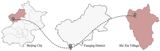
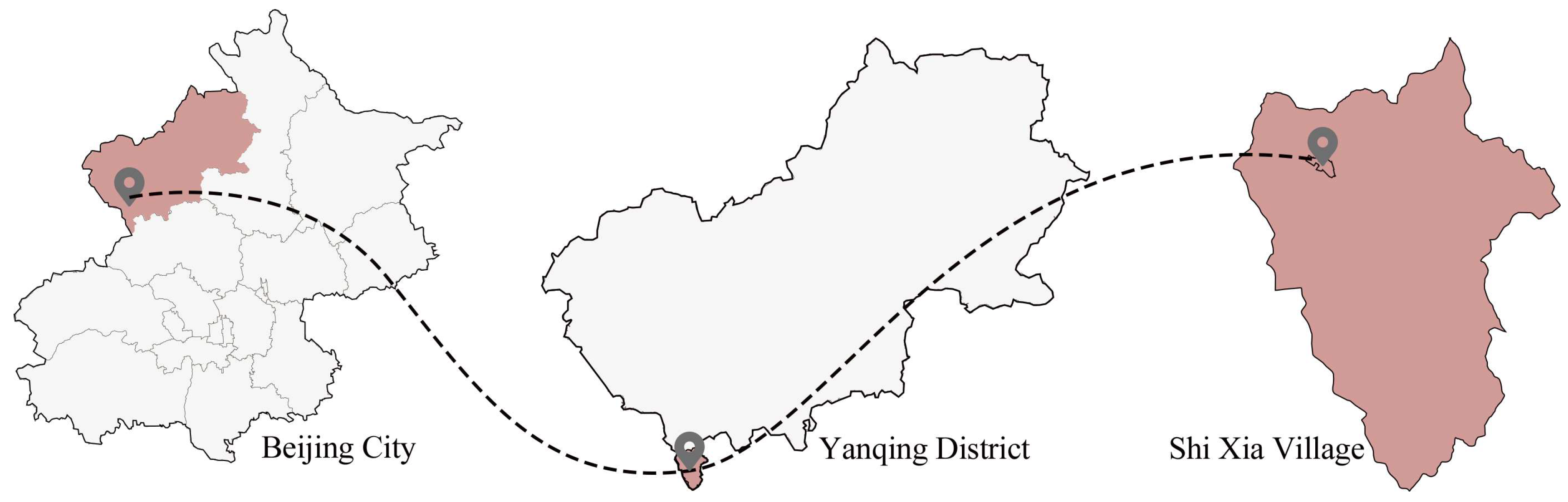
Shixia Village is located in the southwest of Badaling Town, Yanqing District, Beijing, situated at the foot of the Great Wall in the mountainous Yanshan region, representing a typical peri-urban traditional settlement (Figure 1). Morphologically, the core built-up area of the village covers approximately 15 hectares. The spatial morphology preserves the traditional layout logic of settlements along the Great Wall; however, the internal road network is unevenly distributed due to the inherent topographical constraints of the mountainous terrain and long-term historical evolution.
Figure 1.
Location map of Shixia Village. Source: Drawn by the authors.
According to multi-source statistical data and village committee records from 2023–2025, the permanent population of the village is approximately 110. Influenced by severe population outflow during the urbanization process, the village exhibits extreme “aging” and “hollowing out” characteristics—a profound demographic shift widely documented in international studies on global rural decline [61]. Currently, the elderly constitute the absolute majority of the left-behind population. To highlight the severity of this demographic shift: while the national proportion of the elderly population has reached 22.8% and Beijing’s municipal average is approximately 21.3%, Shixia Village represents an extreme case where residents aged 60 and above account for over 60% of the permanent population.
Currently, the village is in a transitional phase from traditional agriculture to a cultural tourism service industry guided by the “Shiguang Great Wall” IP. Analyzing this single, highly representative village provides a typical micro-sample for empirical research. According to established case study methodologies [62], a single-case design is highly appropriate and scientifically rigorous when the case represents an extreme or unique phenomenon. Therefore, Shixia Village was selected as the research object not only because of its extreme aging status but also to explore how public spaces in traditional peri-urban settlements can effectively balance the dual functions of “tourist attraction” and “age-friendliness” within the complex context of rural tourism development.
Socio-economically, the village presents a distinctly dualized structure. The primary economic driver has rapidly shifted from subsistence agriculture to tourism dividends and bed-and-breakfast (B&B) operations. However, this economic transition is unevenly distributed. While external tourism companies and a few returning youths manage the profitable B&Bs along the core main road, the majority of the peripheral residents—predominantly the left-behind elderly—rely on modest state pensions and fragmented subsistence farming. This socio-economic stratification directly translates into spatial inequality, where tourism capital prioritizes the optimization of commercial main roads, leaving the residential alleys of the elderly underfunded and neglected. Understanding this socio-economic dichotomy is crucial, as it dictates that any spatial optimization strategy must incorporate sustainable financial feedback mechanisms to truly benefit the vulnerable elderly population.
2.2. Data Sources
2.2.1. Spatial Data Collection and Processing
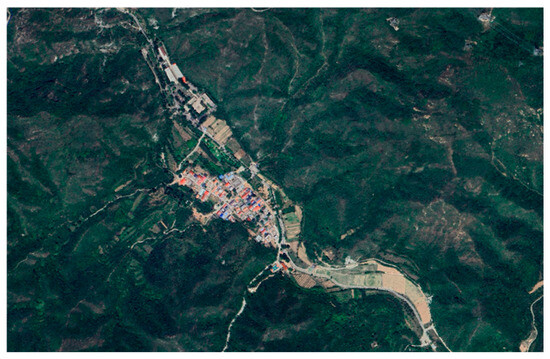
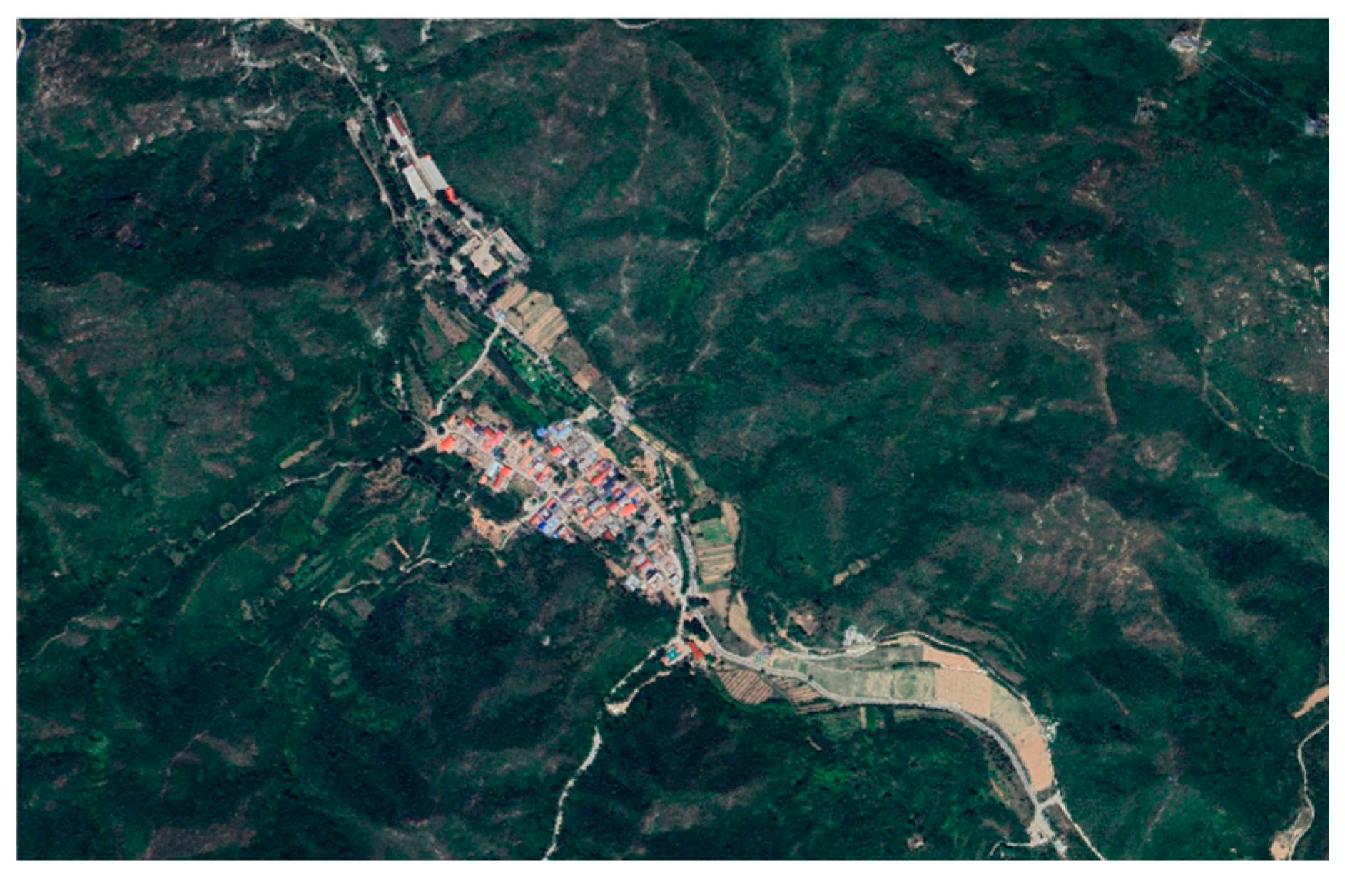
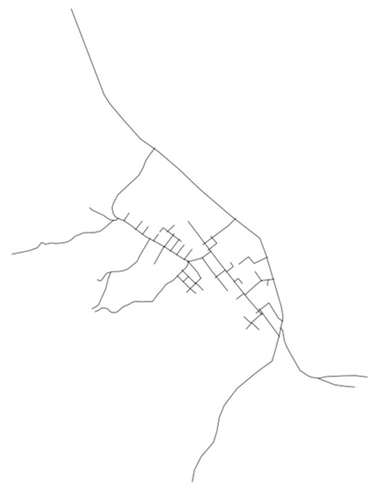
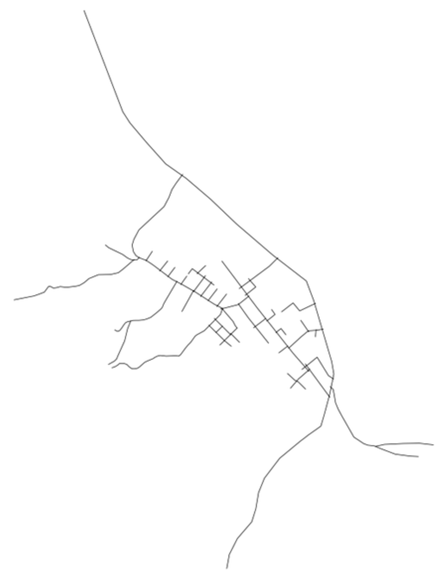
The physical spatial base map for this study was obtained through high-resolution satellite imagery (2024) and field surveying (Figure 2). The road centerlines of Shixia Village were vectorized using a CAD platform and subsequently converted into an axial model required for space syntax analysis (Figure 3).
Figure 2.
Satellite image of Shixia Village. Source: Map data ©2024 Google; drawn by the authors.
Figure 3.
Road network centerline map of Shixia Village. Source: Map data ©2024 Google; drawn by the authors.
2.2.2. Social Survey Data
Subjective evaluation data from the elderly population were collected through a field questionnaire survey (see Appendix A) in October 2025. The respondents were strictly limited to individuals aged 60 and above who had resided in the village for more than six months. In practice, the identification of these permanent residents was conducted through a direct verbal screening question prior to the questionnaire administration. Potential respondents were asked to self-report their continuous residency duration, and only those who confirmed living in the village for over six months were included in the sample. Given the village’s permanent population size of approximately 110, a total of 30 questionnaires were distributed, with an effective recovery rate of 100%. A sampling rate of 27.3% ensures significant representativeness for micro-settlement research.
To prevent perception bias caused by the potential overrepresentation of residents from the high-integration core areas, this study actively adopted a spatially stratified sampling approach. Based on the initial space syntax topological layout, surveyors were assigned to collect data proportionally from both the “spatial core” (the northern main road and village committee vicinity) and the “peripheral clusters” (the southern and high-terrain areas).
The detailed demographic and spatial characteristics of the sample are summarized in Table 1. Crucially, regarding residential distribution, 43.3% of the respondents (n = 13) reside in peripheral areas. This spatial stratification guarantees that the subjective evaluations—particularly regarding facility accessibility—accurately capture the “social island” effect and the integration decay experienced by marginalized residents, thereby providing solid empirical support for the regression model. Furthermore, comparative checks confirm that the sample’s age stratification and physical mobility levels closely align with the overall demographic structure of Shixia Village’s left-behind population, ensuring the statistical generalizability of the survey data.
Table 1.
Variable definition table. Demographic and spatial characteristics of the sample.
The questionnaire employed a five-point Likert scale, encompassing perceptions of road convenience, spatial cognitive difficulty, perception of facility distance, and residential environment quality.
2.3. Research Methodology and Task Alignment
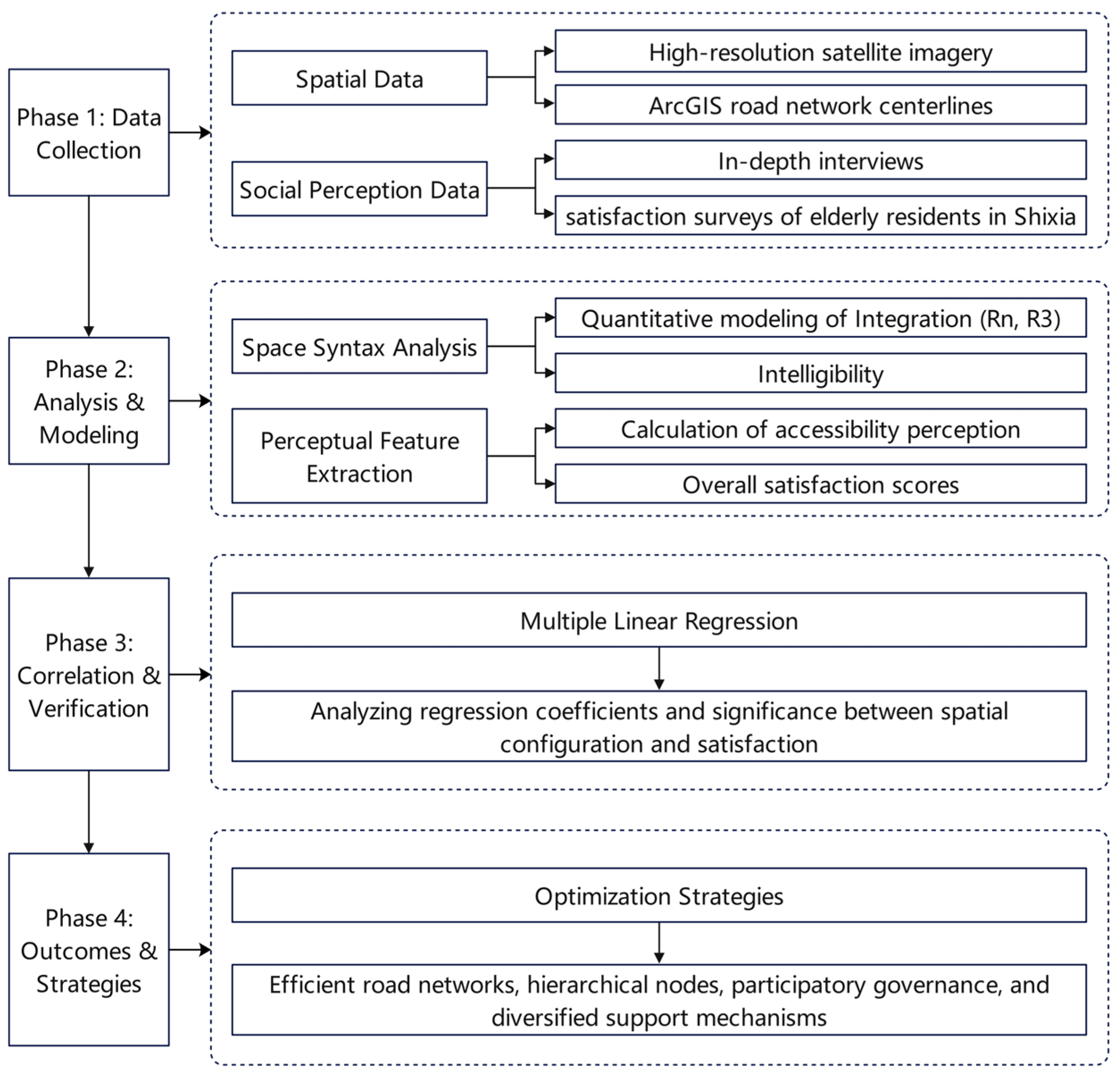
To systematically analyze the complex correlations between the public space configuration of peri-urban villages and elderly perception, this study constructs a multi-stage quantitative evaluation framework (Figure 4). This multi-stage research is driven by specific objectives at each phase:
Figure 4.
Research framework for the assessment and optimization of age-friendly public space in Shixia Village. Source: Drawn by the authors.
Phase 1 (Data Collection): Tasked with mapping the physical road network via satellite imagery and collecting subjective perception data through field surveys.
Phase 2 (Analysis & Modeling): Tasked with quantifying the topological spatial features (Integration and Intelligibility) using Space Syntax.
Phase 3 (Correlation & Verification): Tasked with parsing the causal relationships between spatial metrics and elderly satisfaction using statistical regression.
Phase 4 (Outcomes & Strategies): Tasked with proposing actionable, site-specific optimization guidelines.
By integrating material space quantitative analysis with social perception assessment, this closed-loop pathway aims to precisely identify key spatial bottlenecks restricting the village’s age-friendliness.
2.3.1. Space Syntax Modeling
Space syntax reflects the underlying logic of social activities by quantifying the topological configuration of physical space [22]. This study utilizes DepthmapX software (Version 0.8.0, UCL Bartlett School of Architecture, London, UK) to measure the following core indicators:
Integration: This reflects the centrality or accessibility of a spatial unit within the system. This study analyzes both global integration (Rn) and local integration (R3, R5, R7) representing the walking scale.
Intelligibility: This measures the efficiency with which people infer the global structure through local spaces via the correlation (R2) between global and local integration. A lower R2 value indicates greater cognitive difficulty for the elderly within the space.
2.3.2. Statistical Regression Analysis
To analyze the underlying influence mechanism of spatial characteristics on the activity needs of the elderly, this study constructed a multiple linear regression model.
Dependent Variable (Y): Overall satisfaction of the elderly with the use of public space.
Independent Variables (X): Including road connectivity (X1), local spatial integration (R3) (X2), public facility accessibility (X3), and residential environment quality (X4). Specifically, Local Integration (R3) was selected for X2 because a topological radius of 3 corresponds to a 500 m walking scale, which best captures the daily pedestrian range of the elderly.
The model formula is expressed as follows:
where Y represents the dependent variable (the overall satisfaction of the elderly with public space); β0 is the intercept constant; β1 to β4 denote the unstandardized regression coefficients, which indicate the relative impact weights of the four spatial elements; X1 to X4 represent the specific independent variables; and ε represents the random error term. The application of multiple linear regression to parse the complex causal relationship between physical spatial metrics and elderly subjective perception is firmly supported by established built environment methodologies [63]. In this study, four key elements reflecting physical spatial configuration, functional services, and the physical environment are selected as independent variables. To ensure the scientific validity of the regression results, the spatial integration index was extracted from the DepthmapX model values, while the other variables were obtained through field questionnaires. The specific definitions, measurement scales, and expected influence directions of each variable are detailed in Table 2. Notably, considering the specific tourism development context and topographical characteristics of Shixia Village, preliminary estimations of the weights and interactions of each variable were integrated into the model design.
Y = β0 + β1X1 + β2X2 + β3X3 + β4X4 + ɛ
Table 2.
Variable definition table.
3. Empirical Results and Analysis
To effectively translate the methodological framework into empirical evidence, the results of this study are presented in a structured, two-step logical sequence. First, Section 3.1 details the objective spatial quantitative results derived from Space Syntax, establishing the baseline physical configurational reality of Shixia Village. Following this objective foundation, Section 3.2 introduces the subjective perception data and the multiple linear regression outcomes. This specific order—moving from macroscopic physical space modeling to microscopic socio-spatial regression—is intentionally designed to clearly isolate how physical topological metrics influence subjective satisfaction before examining their complex interactions.
3.1. Spatial Syntax Quantitative Analysis Results
3.1.1. Integration Analysis
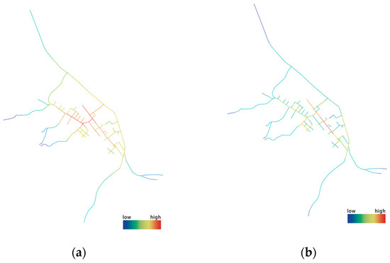
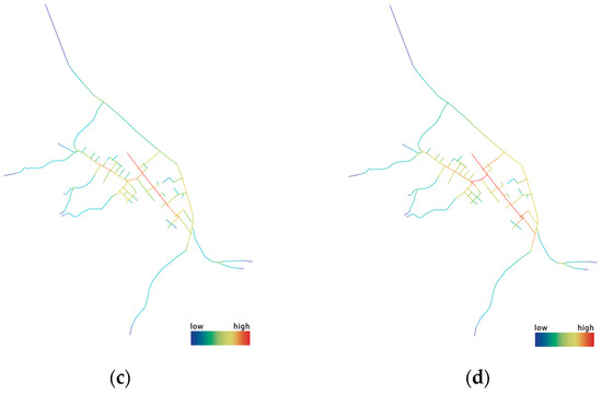
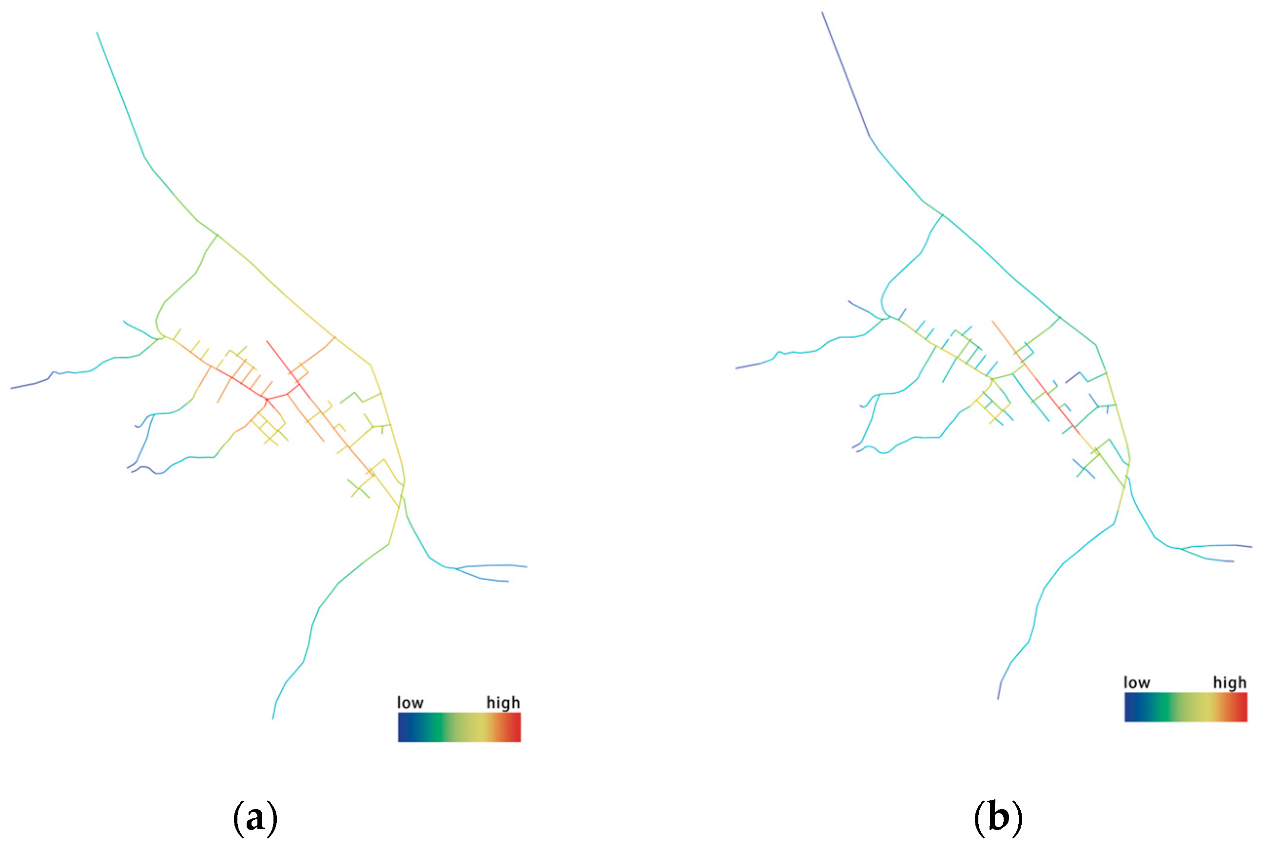
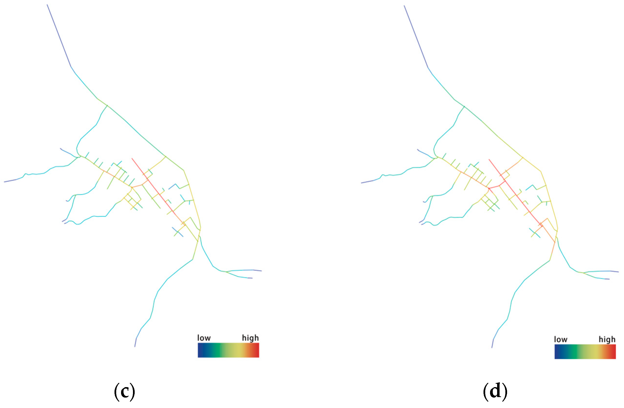
Global integration (Rn) and local integration (R3, R5, R7) of the axial model of Shixia Village were analyzed using DepthmapX software. The results reveal a distinct “core-periphery” configurational characteristic of the village’s public space (Figure 5).
Figure 5.
Axial integration maps of Shixia Village. (a) Rn global integration; (b) R3 local integration; (c) R5 local integration; (d) R7 local integration. Source: Drawn by the authors.
Global Level: The overall mean integration of Shixia Village is low, reflecting the strong introversion and closure of the spatial structure in traditional peri-urban villages during their natural evolution, constrained by topographical slopes and the Great Wall defense system. High-integration areas are concentrated along the northern main road and around the village committee, forming the “spatial core” of the village.
Local Level: Within a 500 m walking scale (R3), high-integration areas closely align with the primary activity nodes of the elderly. To quantify this concentration, our field survey indicates that 22 out of the 30 elderly respondents (73.3%) explicitly identified these high-integration core spaces as their most frequent daily gathering spots. However, the local integration of the southern part of Shixia Village and high-terrain residential clusters decays rapidly. This implies that elderly residents in peripheral areas face greater topological distances, and the sense of isolation in physical space directly inhibits their spontaneous willingness to move toward the village center, forming potential “social islands”.
3.1.2. Intelligibility Analysis
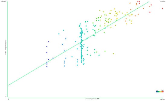
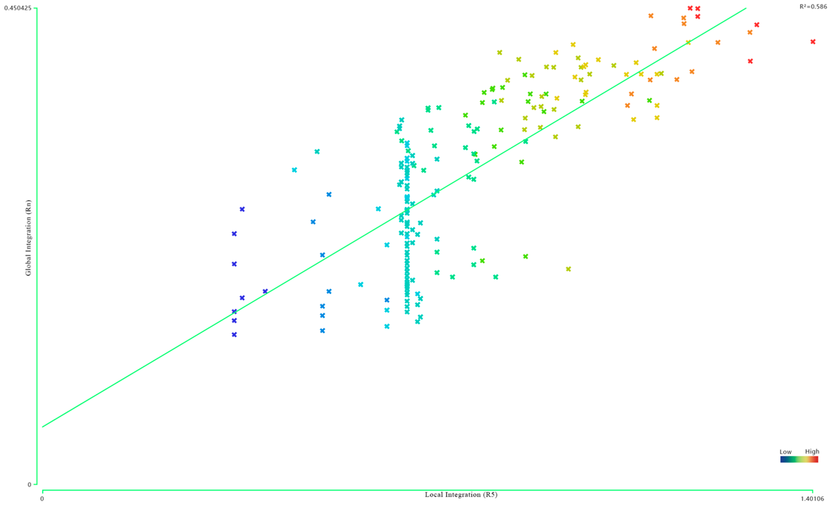
The spatial intelligibility of Shixia Village is 0.586 (Figure 6). In space syntax theory, this value is above the 0.5 threshold, indicating a relatively strong positive correlation between global and local integration. This quantitative result reflects that the spatial organization of Shixia Village possesses high logical consistency, allowing the elderly to relatively effectively infer the global structure of the village through local spatial features.
Figure 6.
Scatter plot of spatial intelligibility in Shixia Village (R2 = 0.586). The horizontal axis represents local integration (R5), and the vertical axis represents global integration (Rn). Note: The color gradient of the scatter points does not represent a specific demographic grouping; rather, it reflects the spatial topological values, transitioning from cold colors (blue, indicating low integration) to warm colors (red, indicating high integration). Source: Drawn by the authors.
While the overall layout exhibits high legibility, field observations indicate that the activity radius of the elderly remains restricted. This suggests that in this specific settlement environment, the primary obstacle to the social radius of the elderly is not the cognitive difficulty of the spatial configuration itself. Instead, it may stem more significantly from the physical decay of integration in peripheral residential clusters and the psychological barriers induced by external traffic interference associated with tourism development. Consequently, optimization strategies should prioritize enhancing the physical accessibility of peripheral areas rather than restructuring the overall spatial logic.
3.2. Regression Model Results and Influence Mechanisms
3.2.1. Descriptive Statistics of the Survey Data
Before conducting the regression analysis, a descriptive statistical analysis was performed on the raw survey data obtained from the 30 elderly respondents to understand their baseline perceptions. As shown in Table 3, the overall satisfaction (Y) has a mean score of 3.45, indicating a moderate level of satisfaction with significant room for improvement. Among the spatial variables, public facility accessibility (X3) received the lowest average rating (Mean = 2.65), reflecting the severe spatial decay and inconvenience experienced by residents at the village periphery. In contrast, residential environment quality (X4) scored relatively higher (Mean = 3.55). Notably, the objective local spatial integration (X2) derived from DepthmapX ranges from 0.68 to 2.14. These detailed descriptive statistics provide a solid and logical empirical foundation for the subsequent multiple linear regression.
Table 3.
Descriptive statistics of the variables (N = 30).
3.2.2. Model Reliability and Multicollinearity Test
This study employed a multiple linear regression model to analyze the contribution of spatial characteristics to elderly satisfaction. The model summary (Table 4) shows an R value of 0.952 and an R2 of 0.906, indicating that the independent variables can explain 90.6% of the variation in the spatial satisfaction of the elderly. The Durbin–Watson statistic is 2.079, confirming the independence of residuals.
Table 4.
Model summary table.
Regarding the collinearity diagnostics (Table 5), the Variance Inflation Factor (VIF) values range from 3.906 to 7.536. Notably, public facility accessibility (X3) and road connectivity (X1) exhibited relatively high VIF values (7.536 and 7.008, respectively). This moderate multicollinearity stems from the spatial reality of micro-scale traditional settlements: in Shixia Village, public facilities are highly clustered along the most connected main roads, leading to an inevitable statistical overlap between spatial permeability and functional proximity. While these values exceed the conservative threshold of 5, they remain below the acceptable threshold of 10 widely recognized in exploratory social science and urban planning studies [64,65]. Retaining these theoretically distinct variables is crucial for understanding rural spatial logic. However, the potential for inflated standard errors of the β coefficients should be acknowledged when interpreting the causal relationships.
Table 5.
Regression coefficient table.
3.2.3. Influence Paths of Key Variables
The regression coefficient table (Table 5) reveals the divergent impacts of different spatial elements on age-friendly perception:
Dominant Driving Factors: Public facility accessibility (β = 0.703, p < 0.001) and residential environment quality (β = 0.779, p < 0.001) exhibit significant positive effects. This validates that in peri-urban villages, the livability of the physical environment (such as non-slip paving and night lighting) and the proximity of public service facilities are the cornerstones for enhancing the well-being of the elderly.
Counter-intuitive Negative Correlation: The study found a negative correlation between road connectivity and satisfaction (β = −0.308, p = 0.081). Although the p-value (0.081) is marginally above the conventional 0.05 threshold, it is statistically significant at the α = 0.10 level. In exploratory micro-scale studies with restricted sample sizes (N = 30), this indicates a highly notable and robust trend. To validate this statistical causal link, we analyzed qualitative feedback gathered during the in-depth questionnaire interviews. Multiple elderly respondents explicitly expressed frustration over external tourist vehicles occupying highly connected main roads, especially during weekends, which created noise and safety hazards. In the specific context of Shixia Village, this empirical evidence confirms that excessive road connectivity brings frequent interference from external tourist traffic. This disrupts the quiet social atmosphere characteristic of traditional settlements, thereby diminishing the territorial sense of security among the elderly.
Weak and Negative Correlation of Spatial Integration: While local spatial integration (R3) was included in the model, its influence was unexpectedly negative and did not reach statistical significance (B = −0.146, p = 0.279). Despite our initial expectation of a positive correlation, this negative trend is highly consistent with the tourism-driven reality of Shixia Village. Highly integrated “topological cores” are often the most crowded areas dominated by tourist activities. Consequently, the elderly may subconsciously avoid these bustling centers, finding quieter, less integrated sub-lanes more satisfying for daily interactions. The non-significance further indicates that in such micro-scale villages, intuitive functional distances (X3) outweigh complex topological logic (X2) in shaping elderly spatial perception.
4. Long-Term Optimization Strategies for Public Space
4.1. Enhancing Public Facility Accessibility and Environmental Quality
The regression analysis results explicitly indicate that public facility accessibility (β = 0.703) and residential environment quality β = 0.779) are the core variables determining spatial satisfaction among the elderly. Addressing the current status of Shixia Village, optimization paths should first focus on the fine-grained renewal of the micro-physical environment. Specifically, systematic barrier-free modifications should be implemented along walking paths connecting core functional nodes, such as health stations, fitness equipment points, and public toilets. This includes laying high-performance non-slip flooring materials and installing auxiliary handrails. Furthermore, given the prevalent lack of nighttime lighting in peri-urban villages, sensor-based lighting systems should be strategically supplemented. This not only reduces the travel risks for the elderly in dim environments but also positively induces social behavior by enhancing the sense of spatial security. To alleviate the uneven distribution of spatial resources, it is recommended to embed micro-activity nodes specifically within the southern, high-terrain residential clusters where local integration (R3) rapidly decays (as indicated in Figure 5c,d). By utilizing fragmented idle residential land or abandoned courtyards, planners can create 50–100 square meter “pocket parks.” Functionally configuring these nodes with basic resting seats, chess tables, and fitness equipment will effectively shorten the physical radius for the oldest-old groups to access daily social services, directly mitigating the “social island” effect.
4.2. Implementing Traffic Calming and Hierarchical Road Network Design
This study observed a significant negative correlation between road connectivity and elderly satisfaction (β = −0.308). This finding reveals that in villages with cultural tourism development backgrounds, excessive connectivity may undermine the elderly’s territorial sense of security due to increased external traffic flow. Therefore, the strategy must prioritize traffic calming interventions at specific spatial junctures. Based on the axial model, these interventions should be strictly localized at the transitional intersections where the highly integrated northern tourist main road branches into the low-integration southern residential alleys. Practical measures, such as installing cobblestone paving, localized road narrowing, or green buffer planters at these specific chokepoints, will physically decelerate external tourist vehicles and visually demarcate the quiet residential territory, thereby protecting the elderly’s sense of security. Building upon this, a hierarchical spatial system should be constructed based on the integration results from the space syntax analysis. For village core areas with high global integration, their functions as multi-functional public activity centers should be strengthened; conversely, for peripheral residential clusters with low integration, semi-private neighborhood interaction spaces should be allocated. Such a differentiated layout strategy ensures the organization of large-scale collective activities while maintaining the quiet social environment required by the elderly.
4.3. Strengthening Spatial Intelligibility and Wayfinding Systems
Given the moderate spatial intelligibility (0.586) of Shixia Village, enhancing environmental identifiability remains a necessary supplement for optimizing public space. Since the spatial perception logic of the elderly relies heavily on local visual features, the study suggests installing high-recognition Great Wall cultural landscape landmarks at key topological decision nodes. Specifically, these should be positioned at the structural junctions where global integration (Rn) transitions into peripheral grids. Utilizing local rubble materials and Great Wall motifs, these localized landmarks serve as salient spatial anchors, helping the elderly establish a cognitive mapping between the complex peripheral alleys and the global village structure. Simultaneously, a physical identification system meeting age-friendly standards should be established. Through visual optimization means such as increasing font size and improving color contrast, it ensures that the elderly can quickly determine their orientation within the complex traditional settlement fabric. This initiative aims to encourage the elderly to expand their social range by reducing the psychological burden of spatial cognition, thereby enhancing the overall utilization efficiency of public space.
4.4. Improving Social Participation and Long-Term Guarantee Mechanisms
Beyond one-way improvements to the physical environment, constructing sustainable governance mechanisms and resource guarantee systems is the cornerstone of achieving long-term optimization. Led by the village committee, a multi-stakeholder consultation platform integrating elderly villagers, rural planners, and managers should be established. This allows spatial users to directly participate in decision-making processes regarding the site selection, design, and subsequent maintenance of public facilities. Such participatory governance not only improves the scientific rigor of planning but also strengthens the sense of place belonging among the elderly. Regarding financial support, a “tourism feedback” circular model should be actively explored. A certain proportion of the revenue from “Shiguang Great Wall” tourism should be extracted as a special fund for the daily maintenance and renewal of age-friendly facilities. By organically combining government subsidies with social welfare funds, Shixia Village can ensure the synchronized evolution of the physical environment and social support systems for public spaces, ultimately achieving social sustainability within the context of rural revitalization.
Furthermore, ensuring the practical operability of these strategies requires a pragmatic cost–benefit and feasibility assessment. From a capital expenditure (CAPEX) perspective, the proposed spatial interventions adopt an “acupuncture-style” micro-renewal approach. By utilizing existing idle land and local raw materials (e.g., local stones for traffic calming), the initial barrier-free modification costs are minimized, yielding high social returns in elderly well-being for a low financial investment. From an operational expenditure (OPEX) perspective, the “tourism feedback” circular model provides a sustainable financial mechanism. It is practically recommended that the local village committee establishes a policy to extract a 2% to 5% micro-levy from the revenue generated by the “Shiguang Great Wall” IP and local bed-and-breakfasts (B&Bs). This dedicated age-friendly fund ensures the financial feasibility of long-term facility maintenance, transforming theoretical optimization into a self-sustaining governance loop.
5. Discussion
5.1. The “Double-Edged Sword” Effect of Spatial Connectivity: An International Perspective
The most significant finding of this study is the marked negative correlation between road connectivity and elderly satisfaction (β = −0.308). This conclusion challenges the conventional Western urban planning paradigms, such as New Urbanism, which generally advocate that “higher road network density and permeability equate to superior spatial quality.” In peri-urban settlements like Shixia Village, which are heavily driven by cultural tourism, highly connected road networks often become the preferred routes for external tourist vehicles.
Crucially, this phenomenon resonates deeply with broader international observations regarding “overtourism”. Comparative studies on historic rural settlements in Southern Europe (e.g., Italy and Spain) and rural Japan [14] have documented similar “spatial squeeze” effects. In these international contexts, much like in our domestic cases of Qiaoxiang villages [20] and Wulin Village [32], increased spatial permeability enhances tourism efficiency but creates a severe squeeze on the social territory of the left-behind elderly. The surge in external traffic disrupts the originally quiet social micro-environment, undermining the elderly’s territorial sense of security. This cross-national validation suggests that in tourism-driven rural revitalization globally, spatial connectivity acts as a “double-edged sword”. A universal balance must be struck between “tourist mobility” and “resident well-being”, necessitating essential traffic-calming interventions to protect vulnerable groups rather than blindly pursuing spatial openness.
5.2. Priority Differentiation: Facility Accessibility vs. Configurational Logic
The regression model demonstrates that public facility accessibility (β = 0.703) contributes far more to satisfaction than spatial integration. This finding strongly aligns with the “Aging in Place” consensus prevalent in Western countries [11] and the World Health Organization’s (WHO) “Age-Friendly Cities” framework [16]. As demonstrated by cross-national empirical studies on rural residential satisfaction, the micro-scale proximity to basic amenities fundamentally dictates the happiness, independence, and social integration of older adults [12]. Just as Germany’s “Village Renewal Program” emphasizes the vital role of decentralized, walkable community services [13], the spatial logic of Shixia Village confirms that shortening the physical distance to basic health facilities is a universal, non-negotiable baseline for rural age-friendliness globally.
The weak and negative coefficient of local integration further exposes a paradigm shift in tourism villages: while topological centrality generates commercial vitality, it simultaneously introduces noise and spatial crowding, which detracts from the elderly’s residential satisfaction. This phenomenon reveals that in micro-scale rural settlements, the spatial behavior logic of the elderly is overwhelmingly “function-oriented” rather than “topology-oriented”. Due to the physical decay of walking capacity among the oldest-old groups, their proximity to health stations directly dictates their quality of life. In contrast, while topological integration in space syntax reflects potential spatial vitality, its explanatory power for daily elderly behavior diminishes in low-density, high-terrain peri-urban environments. Therefore, international and domestic age-friendly renovations should prioritize the “last mile” layout of micro-facilities over macro-road network optimization.
5.3. Spatial Response to Cognitive Foundation and Moderate Intelligibility
The spatial intelligibility of Shixia Village is 0.586, which is above the theoretical threshold of 0.5. This reveals that the village possesses a relatively consistent spatial logic, allowing the elderly to effectively infer the global structure through local features. However, despite this legible structure, the perceived isolation between the southern residential clusters and the northern public core remains a bottleneck. Such barriers may still induce anxiety at unfamiliar nodes. Utilizing highly recognizable Great Wall cultural landscape landmarks as spatial anchors to supplement physical environment deficiencies is a vital strategy. This is not merely a physical repair but a spatial strategy to achieve social inclusion by reducing cognitive burdens.
5.4. Institutional Constraints and Multi-Stakeholder Participation in Rural Governance
The empirical results further confirm that age-friendly rural construction is not only a physical planning issue but also a social governance challenge. In peri-urban areas with uneven resource distribution, the micro-renewal of idle residential land requires a multi-stakeholder consultation platform. Establishing a “tourism feedback” mechanism to convert tourism revenue into dedicated age-friendly funds is crucial for the long-term sustainability of Shixia Village. A collaborative governance model—integrating government leadership, social capital, and villager self-organization—can effectively respond to complex spatial changes under an aging context. This provides an operational institutional guideline for similar tourism-oriented peri-urban villages worldwide.
6. Conclusions
Faced with the profound global challenge of population aging, this study addresses a critical theoretical and practical gap: the spatial and social marginalization of the left-behind elderly in peri-urban traditional settlements experiencing rapid tourism-driven revitalization. To systematically evaluate this complex issue, this research integrated space syntax quantitative analysis with multiple linear regression models, using survey data to map the age-friendliness of public space layouts in Shixia Village, Beijing.
The empirical analysis reveals that the public space in Shixia Village exhibits a significant “core-periphery” differentiation. The low spatial integration and moderate intelligibility (0.586) in peripheral areas constitute the primary physical obstacles for the elderly participating in daily social activities. Regression results further highlight that public facility accessibility and residential environment quality are the fundamental drivers for enhancing elderly satisfaction. Crucially, the observed negative correlation between road connectivity and satisfaction reflects that in tourism-driven rural contexts, excessive spatial permeability may weaken the elderly’s sense of territorial security and tranquility due to severe external traffic interference.
Theoretically, this research proposes and validates a quantitative evaluation framework that bridges physical spatial configuration with subjective perception. This framework successfully overcomes the limitations of traditional qualitative descriptions in rural age-friendly research, enabling a more precise identification of spatial bottlenecks. In practice, the findings underscore the urgent need to implement “traffic-calming” interventions and “hierarchical” node layouts in rural revitalization. This challenges the conventional planning inertia of blindly increasing road connectivity and advocates for a protective, age-friendly public space system that strictly balances tourism economic development with the residential well-being of the vulnerable elderly.
Despite the high sampling rate (27.3%) ensuring representativeness, this study remains a case-specific exploration of a micro-settlement, and its generalizability to villages with different geographic or cultural backgrounds requires further cross-national validation. Crucially, due to the constraints of the total sample size and the inherent spatial overlap of rural facilities, the multiple linear regression model exhibited moderate multicollinearity (with VIF values up to 7.536). While retaining these variables preserves the contextual planning narrative of the village, we acknowledge that this issue may inflate the standard errors of the regression coefficients, potentially affecting the precision of the causal interpretation. To address this, future research with expanded empirical databases across multiple villages must implement statistical corrective measures—such as Principal Component Analysis (PCA) or stepwise regression—to decouple these spatial metrics and enhance overall statistical rigor. Furthermore, future studies should incorporate advanced technologies such as big data behavioral tracking and CLIP-based multi-modal visual perception analysis to provide deeper theoretical support for inclusive spatial governance amid global aging.
Author Contributions
Conceptualization, Q.L. and Z.Y.; Methodology, Q.L. and Z.Y.; Software, Z.Y. and X.W.; Investigation, Z.Y.; Resources, Z.Y., X.W. and W.L.; Data curation, Z.Y.; Writing—original draft, Q.L., Z.Y. and X.W.; Writing—review & editing, Q.L., Z.Y., W.L., Y.L. and L.J.; Visualization, Z.Y. and X.W.; Supervision, Q.L., W.L., Y.L. and L.J. All authors have read and agreed to the published version of the manuscript.
Funding
This research was funded Beijing Social Science Foundation Project grant number 24JCC077, the Subject of Beijing Association of Higher Education grant number MS2022276, the Research Project of Beijing University of Civil Engineering and Architecture grant number ZF16047, the Graduate Education and Teaching Quality Improvement Project of BUCEA grant number J2024004 and the Graduate Innovation Project of BUCEA grant number PG2025018.
Institutional Review Board Statement
The survey conducted in this study was a completely anonymous and non-invasive questionnaire regarding residents’ subjective perceptions of public spaces. No sensitive personal information, biological samples, or medical data were collected. All participants were fully informed about the study’s purpose and provided verbal consent prior to participation. Therefore, formal ethics approval was waived according to our institutional guidelines.
Informed Consent Statement
Informed consent was obtained from all subjects involved in the study.
Data Availability Statement
The original contributions presented in this study are included in the article. Further inquiries can be directed to the corresponding author.
Conflicts of Interest
The authors declare no conflict of interest.
Appendix A. Social Survey Questionnaire for Elderly Residents
Part I: Demographic Information
- Gender: ☐ Male ☐ Female
- Age: ☐ 60–69 ☐ 70–79 ☐ 80 or above
- Physical Mobility: ☐ Independent ☐ Requires walking aids ☐ Wheelchair/Limited mobility
- Residential Location: ☐ Northern/Central Core ☐ Southern/Peripheral Clusters
Part II: Spatial Perception Evaluation (5-Point Likert Scale)
(1 = Very Dissatisfied/Strongly Disagree, 5 = Very Satisfied/Strongly Agree)
- Overall Satisfaction (Y): Overall, how satisfied are you with the daily use of public spaces in the village? (1–5)
- Road Connectivity (X1): Do you feel that the roads connecting different parts of the village are highly accessible and not severely disrupted by tourist vehicles? (1–5)
- Facility Accessibility (X3): Do you feel it is convenient and close enough to walk from your home to public facilities (e.g., health station, village committee)? (1–5)
- Residential Environment Quality (X4): How would you rate the physical quality of the public spaces (e.g., non-slip paving, rest seats, night lighting)? (1–5)
References
- Gao, X.L.; Zhang, X.Y. Geography of Aging for Age-friendly Society. Shanghai Urban Plan. Rev. 2024, 3, 1–8. (In Chinese) [Google Scholar]
- Wang, L.; Zhou, S.; Kwan, P.M.; Liu, D.; Zhang, L.; Song, J. Space-based planning implications for age-friendly cities: Insights from spatial non-stationarity in multiple environment-health relationships. Cities 2026, 169, 106495. [Google Scholar] [CrossRef] [Scilit]
- National Bureau of Statistics of China. Statistical Communiqué of the People’s Republic of China on the 2025 National Economic and Social Development; National Bureau of Statistics of China: Beijing, China, 2026.
- Jia, X.; Yu, Y.; Xia, W.; Masri, S.; Sami, M.; Hu, Z.; Yu, Z.; Wu, J. Cardiovascular diseases in middle aged and older adults in China: The joint effects and mediation of different types of physical exercise and neighborhood greenness and walkability. Environ. Res. 2018, 167, 175–183. [Google Scholar] [CrossRef] [Scilit]
- CPC Central Committee; State Council. Opinions on Further Deepening Rural Reform and Solidly Promoting Comprehensive Rural Revitalization. Available online: https://www.gov.cn/yaowen/liebiao/202602/content_7056929.htm (accessed on 1 March 2026).
- Liu, Y. Introduction to land use and rural sustainability in China. Land Use Policy 2018, 74, 1–4. [Google Scholar] [CrossRef] [Scilit]
- Xia, Y. New paths for high-quality construction of age-friendly communities. J. South-Cent. Univ. Natl. (Humanit. Soc. Sci.) 2024, 44, 174–180. (In Chinese) [Google Scholar]
- Haikal, R.; Firdaus, T.; Herdiansyah, H.; Chairunnisa, R.S. Urban Planning Policies and Architectural Design for Sustainable Food Security: A Case Study of Smart Cities in Indonesia. Sustainability 2025, 17, 7546. [Google Scholar] [CrossRef] [Scilit]
- Zhao, Y.; Zhang, F.; Li, R. Path Analysis of Rural Revitalization in Rapid Urbanization Areas: A Case Study of Southern Jiangsu, China. City Plan. Rev. 2018, 42, 98–105. (In Chinese) [Google Scholar]
- Wang, C.; Zhang, G.; Zhai, Y. Integrating AHP-Entropy and IPA Models for Strategic Rural Revitalization: A Case Study of Traditional Villages in Northeast China. Buildings 2025, 15, 2475. [Google Scholar] [CrossRef] [Scilit]
- Wiles, J.L.; Leibing, A.; Guberman, N.; Reeve, J.; Allen, R.E. The meaning of “aging in place” to older people. Gerontologist 2012, 52, 357–366. [Google Scholar] [CrossRef] [Scilit]
- Ottoni, C.A.; Sims-Gould, J.; Winters, M.; Heijnen, M.; McKay, H.A. “Benches become like porches”: Built and social environment influences on older adults’ experiences of mobility and well-being. Soc. Sci. Med. 2016, 169, 33–41. [Google Scholar] [CrossRef] [Scilit]
- Ye, X.Q.; Cheng, Y.; Yu, X.H. German Rural Development Experience and Enlightenment for Rural Revitalization. China Rural. Discov. 2021, 3, 140–142. (In Chinese) [Google Scholar]
- Gu, Y. Experience and Enlightenment of Co-construction and Sharing of Rural Revitalization in Japan: A Case Study of Echigo-Tsumari Region. In Proceedings of the 2020 China Urban Planning Annual Conference, Chengdu, China, 25–27 September 2021; pp. 703–709. (In Chinese) [Google Scholar]
- Cho, M.; Kim, J. Coupling urban regeneration with age-friendliness: Neighborhood regeneration in Jangsu Village, Seoul. Cities 2016, 58, 107–114. [Google Scholar] [CrossRef] [Scilit]
- Plouffe, L.; Kalache, A. Towards global age-friendly cities: Determining urban features that promote active aging. J. Urban Health 2010, 87, 733–739. [Google Scholar] [CrossRef] [Scilit]
- Cerin, E.; Nathan, A.; van Cauwenberg, J.; Barnett, D.W.; Barnett, A. The neighbourhood physical environment and active travel in older adults: A systematic review and meta-analysis. Int. J. Behav. Nutr. Phys. Act. 2017, 14, 15. [Google Scholar] [CrossRef] [Scilit] [PubMed]
- Chen, L.; Chen, R.Y.; Guan, R.M. Development strategies of elderly care in edge-villages under the background of rural revitalization strategy. Huazhong Archit. 2021, 39, 121–125. (In Chinese) [Google Scholar]
- Tian, J.; Feng, Z.Y. Living and employment in aging villages from the perspective of “People-Land-Industry” synergy. In Proceedings of the 2023 China Urban Planning Annual Conference, Wuhan, China, 23–25 September 2023; pp. 73–83. (In Chinese) [Google Scholar]
- Xu, C.; Chen, H. Cultural Tourism-Driven Revitalization: A Strategy for Chaoshan’s Overseas Chinese Village Residences, Case Study of Chen Cihong’s Former Home, Qianmei Village. Art Des. 2024, 7, 4. [Google Scholar] [CrossRef] [Scilit]
- Wang, L.; Xue, R.; Wang, X.; Fang, X.; Cheng, K. Renewal Strategy of Public Space Suitable for Aging in a Typical Community in Beijing—A Case Study of Pingguoyuan Street. J. Soc. Sci. Humanit. 2022, 4, 11. [Google Scholar] [CrossRef] [Scilit]
- Karimi, K. A configurational approach to analytical urban design: ‘Space syntax’ methodology. Urban Des. Int. 2012, 17, 297–318. [Google Scholar] [CrossRef] [Scilit]
- Elek, P.; Kim, D.; Dpa, G.A. Limits of space syntax for urban design: Axiality, scale and sinuosity. Environ. Plan. B Urban Anal. City Sci. 2020, 47, 508–522. [Google Scholar]
- Liu, X.; Xu, C. Research on Low-Carbon Reconstruction of Community Public Space from the Perspective of Spatial Justice: A Space Syntax Empirical Study of Beijing’s Baiwanzhuang Community. Buildings 2026, 16, 235. [Google Scholar] [CrossRef] [Scilit]
- Zencirkiran, A.; Suta, O. Spatial Organization and User Experience in a University Campus: A Mixed-Method Space Syntax Analysis of Trakya University Balkan Campus. Sustainability 2025, 17, 11221. [Google Scholar] [CrossRef] [Scilit]
- Wu, Z.; Mao, M.; Yang, J.; Peng, C.; Zha, H. Street Vitality Evaluation of the Mengzi East Street Historical District Based on Space Syntax and POI Big Data. Buildings 2025, 15, 2896. [Google Scholar] [CrossRef] [Scilit]
- Mohamed, A.A. Using BERTopic modelling to map the evolution of space syntax research. Land Use Policy 2025, 157, 107639. [Google Scholar] [CrossRef] [Scilit]
- Sun, Y.; Xi, X.; Lyu, N. Research on the Route Selection Method of the Grand Canal National Trails for Central Urban Areas: A Case Study of the Grand Canal, the Old Town of Jining City Section, China. Land 2025, 14, 1053. [Google Scholar] [CrossRef] [Scilit]
- Fu, K.; Wu, J.; Huang, Y. Exploring the Nonlinear Effects of the Built Environment on Ecological Resilience in a High-Density City: A Case Study of Wuhan. Buildings 2026, 16, 844. [Google Scholar] [CrossRef] [Scilit]
- Wang, L.; Zhang, X.; Xie, A.L. Research on the space construction mechanism of urban graffiti from the perspective of environmental behavior—A case study of cultural and creative industry districts. Urban Dev. Stud. 2024, 31, 125–134. (In Chinese) [Google Scholar]
- Ren, H.; Yang, F.; Zhang, J.; Wang, Q. Evaluation of Cognition of Rural Public Space Based on Eye Tracking Analysis. Buildings 2024, 14, 1525. [Google Scholar] [CrossRef] [Scilit]
- Xu, J.; Lin, Z.; Xie, M.; Liu, H.; Tan, Y. Spatial Optimization Strategies for Rural Tourism Villages: A Behavioral Network Perspective—A Case Study of Wulin Village. Sustainability 2025, 17, 9710. [Google Scholar] [CrossRef] [Scilit]
- Hou, Y.; Liu, Y.; Wu, Y.; Wang, L. Assessing Inequality in Urban Green Spaces with Consideration for Physical Activity Promotion: Utilizing Spatial Analysis Techniques Supported by Multisource Data. Land 2024, 13, 626. [Google Scholar] [CrossRef] [Scilit]
- Xu, J. From walking buffers to active places: An activity-based approach to measure human-scale urban form. Landsc. Urban Plan. 2019, 191, 103452. [Google Scholar] [CrossRef] [Scilit]
- Tao, S.; Duan, W. A Post-Evaluation Study on the Renewal of Public Space in Qianmen Street of Beijing’s Central Axis Based on Grounded Theory. Buildings 2024, 14, 3969. [Google Scholar] [CrossRef] [Scilit]
- Siqiang, W.; Kwan, H.E.Y.; Yi, S. Effects of open space accessibility and quality on older adults’ visit: Planning towards equal right to the city. Cities 2022, 125, 103611. [Google Scholar] [CrossRef] [Scilit]
- Rong, Y.F.; Deng, Y.; Lin, H.X.; Guo, S.H. Evaluation and optimization of rural construction for “age-friendly”—A case study of 4 sample counties in Guangxi. Dev. Small Cities Towns 2024, 42, 58–65. (In Chinese) [Google Scholar]
- Chen, Y. Research on Age-friendly Renewal of Rural Community Public Space in Baohe Village, Changshou District, Chongqing. Master’s Thesis, Chongqing University, Chongqing, China, 2022. (In Chinese) [Google Scholar]
- Liu, C.; Gan, H.; He, M. Evaluating the Flexibility of Rural Public Cultural Spaces Based on Polyvalence Theory: A Case Study of Xiangyang Village, Shanghai. Land 2025, 14, 1177. [Google Scholar] [CrossRef] [Scilit]
- Liu, J.; Huang, Z.; Wu, X.; Hou, Q. Optimization of urban village public space vitality based on complex network. Sci. Rep. 2025, 15, 15392. [Google Scholar] [CrossRef] [Scilit] [PubMed]
- Fang, H.; Yang, T.; Dai, P. Research on the Coupling of Public Space Morphology and Summer Wind Environment in Qingdao’s Urban Villages. Buildings 2025, 15, 1066. [Google Scholar] [CrossRef] [Scilit]
- Yang, H.; Zou, J.; Wang, C.; Wu, R.; Ali, M.; Huang, Z.; Jiang, H.; Zhang, F.; Bai, Y. Thresholds for Rural Public and Ecosystem Services: Integration into Rural Green Space Spatial Planning for Sustainable Development. Land 2025, 14, 113. [Google Scholar] [CrossRef] [Scilit]
- Li, Q.; Yang, Z.; Cui, J.; Wu, X.; Liu, J.; Li, W.; Liu, Y. Age-Friendly Public-Space Retrofit in Peri-Urban Villages Using Space Syntax and Exploratory Factor Analysis. Buildings 2025, 15, 2219. [Google Scholar] [CrossRef] [Scilit]
- Li, X.Y. Review of research on elderly housing support. Urban Dev. Stud. 2014, 21, 17–20. (In Chinese) [Google Scholar]
- Yang, H.P. Research on urban and rural planning based on age-friendly concept—Also on the layout of elderly care facilities. In Proceedings of the 2012 China Urban Planning Annual Conference, Kunming, China, 17–19 June 2012; pp. 621–628. (In Chinese) [Google Scholar]
- Huang, Y.F.; Zhang, S.H. Research Progress on the Development of Age-Friendly Communities—Visual Analysis Based on Citespace. Urban Dev. Stud. 2024, 31, 17–21+33. (In Chinese) [Google Scholar]
- Wang, Y.Y.; Liu, L. Community age-friendly environment and life satisfaction of the elderly: On the mediating role of social adaptation. Urban Probl. 2024, 4, 85–94. (In Chinese) [Google Scholar]
- Lee, S.Y.; Lee, Y.D.; Jun, J.E. A Spatial Spectrum Framework for Age-Friendly Environments: Integrating Docility and Life Space Concepts. Buildings 2025, 15, 4164. [Google Scholar] [CrossRef] [Scilit]
- Cao, Y.; Li, D.; Gao, X.; Bi, S.; Yu, K.; Zhou, D. Age-Friendly Environment Design of High-Speed Railway Stations from a Healthy Ageing Perspective: A Case Implementation in Nanjing, China. Buildings 2024, 14, 3280. [Google Scholar] [CrossRef] [Scilit]
- Chen, Y.; Wang, S.; Yang, H.; Nah, K. The Impact of Wooden Design on User Satisfaction in Music Halls Based on a Serial Mediation Model: The Chain Mediation Mechanism of Perceived Restorativeness and Musical Resonance. Buildings 2025, 15, 4157. [Google Scholar] [CrossRef] [Scilit]
- Hong, T.T.; Chang, W.L. Life satisfaction and perceived and objective neighborhood environments in a green-accredited township: Quantile regression approach. Cities 2023, 134, 104196. [Google Scholar] [CrossRef] [Scilit]
- Kwon, M.; Remøy, H.; Dobbelsteen, D.V.A.; Knaack, U. Personal control and environmental user satisfaction in office buildings: Results of case studies in the Netherlands. Build. Environ. 2019, 149, 428–435. [Google Scholar] [CrossRef] [Scilit]
- Wang, J.; Zhao, D. Residents’ Satisfaction with Public Spaces in Old Urban Residential Communities: A PLS-SEM and IPMA-Based Case Study of Nankai District, Tianjin. Land 2025, 14, 2363. [Google Scholar] [CrossRef] [Scilit]
- Renaningtyas, O.M.; Byunghak, M.; Seiyong, K. Maximizing Public and Private Satisfaction for a Better Privately Owned Public Space: The Case of Yeouido Business District. Urban Sci. 2022, 6, 84. [Google Scholar] [CrossRef] [Scilit]
- Wang, M.; Pei, X.; Zhang, M.; Tang, Y. Evaluation and Optimization of Urban Public Space Accessibility for Residents’ Satisfaction: A Case Study of Nanshan District, Shenzhen City. Buildings 2023, 13, 2624. [Google Scholar] [CrossRef] [Scilit]
- Minou, W.; Gamze, D.; Pauline, B.D.V. Analyzing the Relationships between Citizens’ Emotions and their Momentary Satisfaction in Urban Public Spaces. Sustainability 2020, 12, 7921. [Google Scholar] [CrossRef] [Scilit]
- Mahdi, Q.S.; Gharghan, K.S.; Mutlag, H.A. A novel anomaly detection approach for structural health monitoring using multiple linear regression technique. J. Build. Pathol. Rehabil. 2025, 11, 51. [Google Scholar] [CrossRef] [Scilit]
- Xu, F.; Wang, J.; Sakai, Y.; Sabu, S.; Kanayama, H.; Zhang, R.; Satou, D.; Kansha, Y. Gray-box virtual sensor with constraints for predicting room temperature in cooling and heating modes. Build. Environ. 2025, 273, 112729. [Google Scholar] [CrossRef] [Scilit]
- Xu, K.; Chai, X.; Jiang, R.; Chen, Y. Quantitative Comparison of Space Syntax in Regional Characteristics of Rural Architecture: A Study of Traditional Rural Houses in Jinhua and Quzhou, China. Buildings 2023, 13, 1507. [Google Scholar] [CrossRef] [Scilit]
- Sun, Y.; Zhan, H.; Gao, C.; Li, H.; Guo, X. Spatial Syntactic Analysis and Revitalization Strategies for Rural Settlements in Ethnic Minority Areas: A Case Study of Shuanglang Town, China. Buildings 2024, 14, 2531. [Google Scholar] [CrossRef] [Scilit]
- Liu, Y.; Li, Y. Revitalize the world’s countryside. Nature 2017, 548, 275–277. [Google Scholar] [CrossRef] [Scilit]
- Yin, R.K. Case Study Research and Applications: Design and Methods, 6th ed.; Sage Publications: Thousand Oaks, CA, USA, 2018. [Google Scholar]
- Sugiyama, T.; Ward Thompson, C. Older people’s health, outdoor activity and supportiveness of neighbourhood environments. Landsc. Urban Plan. 2007, 83, 168–175. [Google Scholar] [CrossRef] [Scilit]
- Hair, J.F., Jr.; Black, W.C.; Babin, B.J.; Anderson, R.E. Multivariate Data Analysis, 7th ed.; Prentice Hall: Upper Saddle River, NJ, USA, 2010. [Google Scholar]
- O’Brien, R.M. A caution regarding rules of thumb for variance inflation factors. Qual. Quant. 2007, 41, 673–690. [Google Scholar] [CrossRef] [Scilit]

Disclaimer/Publisher’s Note: The statements, opinions and data contained in all publications are solely those of the individual author(s) and contributor(s) and not of MDPI and/or the editor(s). MDPI and/or the editor(s) disclaim responsibility for any injury to people or property resulting from any ideas, methods, instructions or products referred to in the content. |
© 2026 by the authors. Licensee MDPI, Basel, Switzerland. This article is an open access article distributed under the terms and conditions of the Creative Commons Attribution (CC BY) license.