You are currently viewing a new version of our website. To view the old version click .

Remote Sensing, Volume 12, Issue 18

September-2 2020 - 245 articles

Cover Story: 
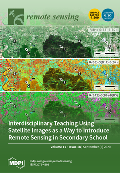
Since remote sensing is an actively developing area of science, economics, and industry, education in this field must also undergo changes. In this article, an introduction of remote sensing elements into secondary schools via interdisciplinary project "the Colors of Earth" is presented. It combines knowledge from physics, biology, geography and ITC. The students’ main task is to create various false color band compositions from the Sentinel-2 images of their neighborhood and, using this, distinguish between different types of land cover. A detailed description of the project, together with student and teacher evaluations, is presented in the paper. View this paper
  • Issues are regarded as officially published after their release is announced to the table of contents alert mailing list .
  • You may sign up for email alerts to receive table of contents of newly released issues.
  • PDF is the official format for papers published in both, html and pdf forms. To view the papers in pdf format, click on the "PDF Full-text" link, and use the free Adobe Reader to open them.

Articles (245)

  • Technical Note
  • Open Access
9 Citations
4,103 Views
16 Pages

22 September 2020

One of the key sources of uncertainties in sea ice freeboard and thickness estimates derived from satellite radar altimetry results from changes in sea ice surface properties. In this study, we analyse this effect, comparing upward-looking sonar (ULS...

  • Article
  • Open Access
2 Citations
3,290 Views
36 Pages

Joint Design of the Hardware and the Software of a Radar System with the Mixed Grey Wolf Optimizer: Application to Security Check

  • Julien Marot,
  • Claire Migliaccio,
  • Jérôme Lantéri,
  • Paul Lauga,
  • Salah Bourennane and
  • Laurent Brochier

22 September 2020

The purpose of this work is to perform the joint design of a classification system including both a radar sensor and an image processing software. Experimental data were generated with a three-dimensional scanner. The criterion which rules the design...

  • Technical Note
  • Open Access
4 Citations
3,943 Views
11 Pages

22 September 2020

Due to a limited number of monitoring stations in Western Africa, the impact of mineral dust on PM10 surface concentrations is still poorly known. We propose a new method to retrieve PM10 dust surface concentrations from sun photometer aerosol optica...

  • Article
  • Open Access
3,788 Views
19 Pages

22 September 2020

L-band brightness temperature (Tb) is one of the key remotely-sensed variables that provides information regarding surface soil moisture conditions. In order to harness the information in Tb observations, a radiative transfer model (RTM) is investiga...

  • Article
  • Open Access
10 Citations
4,063 Views
19 Pages

Minimum Redundancy Array—A Baseline Optimization Strategy for Urban SAR Tomography

  • Lianhuan Wei,
  • Qiuyue Feng,
  • Shanjun Liu,
  • Christian Bignami,
  • Cristiano Tolomei and
  • Dong Zhao

22 September 2020

Synthetic aperture radar (SAR) tomography (TomoSAR) is able to separate multiple scatterers layovered inside the same resolution cell in high-resolution SAR images of urban scenarios, usually with a large number of orbits, making it an expensive and...

  • Article
  • Open Access
4 Citations
7,035 Views
31 Pages

22 September 2020

Snow surface spectral reflectance is very important in the Earth’s climate system. Traditional land surface models with parameterized schemes can simulate broadband snow surface albedo but cannot accurately simulate snow surface spectral reflec...

  • Article
  • Open Access
10 Citations
5,091 Views
16 Pages

22 September 2020

This study aimed to assess the ability of using visible and near-infrared reflectance (Vis–NIR) spectroscopy to quantify soil erodibility factor (K) rapidly in an ecologically restored watershed. To achieve this goal, we explored the performanc...

  • Conference Report
  • Open Access
18 Citations
9,159 Views
25 Pages

Sensing Archaeology in the North: The Use of Non-Destructive Geophysical and Remote Sensing Methods in Archaeology in Scandinavian and North Atlantic Territories

  • Carmen Cuenca-García,
  • Ole Risbøl,
  • C. Richard Bates,
  • Arne Anderson Stamnes,
  • Fredrik Skoglund,
  • Øyvind Ødegård,
  • Andreas Viberg,
  • Satu Koivisto,
  • Mikkel Fuglsang and
  • Manuel Gabler
  • + 3 authors

22 September 2020

In August 2018, a group of experts working with terrestrial/marine geophysics and remote sensing methods to explore archaeological sites in Denmark, Finland, Norway, Scotland and Sweden gathered together for the first time at the Workshop ‘Sens...

  • Article
  • Open Access
7 Citations
3,734 Views
33 Pages

22 September 2020

This study is a follow-up of a full methodology for the homogenisation and harmonisation of the two Ocean and Land Colour Instrument (OLCI) payloads based on the OLCI-A/OLCI-B tandem phase analysis. This analysis provided cross-calibration factors be...

  • Article
  • Open Access
21 Citations
4,828 Views
21 Pages

On Improving the Training of Models for the Semantic Segmentation of Benthic Communities from Orthographic Imagery

  • Gaia Pavoni,
  • Massimiliano Corsini,
  • Marco Callieri,
  • Giuseppe Fiameni,
  • Clinton Edwards and
  • Paolo Cignoni

22 September 2020

The semantic segmentation of underwater imagery is an important step in the ecological analysis of coral habitats. To date, scientists produce fine-scale area annotations manually, an exceptionally time-consuming task that could be efficiently automa...

of 25

Get Alerted

Add your email address to receive forthcoming issues of this journal.

XFacebookLinkedIn
Remote Sens. - ISSN 2072-4292