


Abstract
This research establishes a high-fidelity documentation framework utilizing multi-sensor 3D data to support critical decisions regarding the conservation and preservation of monuments in urban environments. Focus is placed on the Morosini Fountain, Heraklion, Crete, a 17th-century monument facing significant deterioration due to environmental stressors, material-specific decay of limestone and marble, and cumulative historical interventions. Placed within the context of contemporary cultural heritage management, the research establishes a high-fidelity 3D digital representative to support interdisciplinary documentation and a decision-support framework for restoration. The methodology employs handheld structured light scanning for high geometric accuracy with close-range digital photogrammetry to ensure high-fidelity color acquisition. Strategic semantic segmentation of the monument into architectural components—such as lobes, lions, and basins—facilitated large scale dataset management and optimized alignment procedures under challenging urban conditions, including intense direct sunlight and active water flow. Results include the delivery of metrically accurate multi-resolution models and 2D orthographic products. Quantitative pathology mapping successfully identified extensive affected surface areas on specific panels, while multi-scale geometric morphological analysis effectively identified high-complexity surface areas, which were subsequently classified as either intentional artistic form or active decay through expert visual assessment between intentional artistic form and active alveolar erosion or exogenous accretions. The study concludes that this enhanced digital model serves as an indispensable tool for sustainable management, transforming passive records into active predictive simulations. The implementation of multi-sensor 3D data provides the essential evidentiary basis for high-stakes conservation decisions, demonstrating that comprehensive digital recording is vital for the resilience of urban heritage landmarks.
1. Introduction
Contemporary three-dimensional (3D) digital technologies provide a range of options for producing high-precision geometric and color models of urban historical monuments and landmarks [1,2]. These methods are non-contact and non-invasive, ensuring the protection of delicate or fragile surfaces. The ability to record and subsequently analyze the monument in three dimensions, as well as monitor it over time, contributes to a comprehensive understanding of its conservation status. This approach facilitates the examination of the depth and extent of losses and corrosion products, the delineation of various interventions, and even the identification of construction tools based on their imprints, among other aspects [3].
The resulting 3D digital models significantly enhance the analysis, monitoring, and conservation of historical urban monuments. They facilitate digital recording and documentation, conservation and restoration efforts, structural analysis, and enable effective monitoring [4], as well as digital dissemination and promotion [5]. According to various relative projects [6,7,8,9], digital 3D files can be utilized in: a. study of the current state of conservation of cultural heritage monument, b. documentation of damage through the development of measurement study plans, c. applications in digital repositories for marketing and promotion (virtual and Augmented Reality) [10], and d. 3D printing of precise replicas and physical models at various scales [11,12,13,14]. Specifically, conservators can work directly on the three-dimensional color model to identify and outline the affected areas and potential interventions [15], as well as to gather information about the materials and anthropogenic and environmental factors impacting monuments [3,16,17]. The creation of surface enlargements and orthophotographs is also effective for documenting the state of preservation and pathology, yielding high-resolution records [18]. Semantically enriched models of varied geometrical complexities may serve as less demanding digital representatives of the monument in virtual environments, raising awareness and interest [19,20].
1.1. Digital Restoration of Monuments
Three-dimensional models are a fundamental tool in the documentation of cultural heritage (CH), but their usefulness extends far beyond simple recording, facilitating a wide range of applications related to restoration [4]. There are several ways in which 3D models facilitate restoration processes: Surface cleaning analysis: 3D models are used to develop and test cleaning solutions. They allow conservators to visually compare surfaces before, during and after cleaning in real time, side by side, with high color and shape fidelity. This helps them assess progress, identify the initial layer of bronze, and make decisions on the correct operating protocol. In addition, the ability to calculate the total surface area of a thematic map helps estimate the quantity of products required for cleaning, influencing cost control and job scheduling. Water system and jet simulation: 3D models support the study and redesign of hydraulic systems. They allow the simulation of water flow and jet trajectories through computer graphics, without physical intervention in the monument. This facilitates the testing of different solutions, the verification of trajectories and the optimization of the project by restoring the original image of the fountain. Lighting design simulation: The textured 3D model is used as a basis for physically based lighting simulations, allowing for the virtual verification of new artificial lighting projects for night-time or special events. This includes controlling shadows, the effect of the reflective properties of materials after restoration, and the effect of various colored spotlights. It provides support for the preliminary analysis and project studies for hard-to-reach areas, as well as virtual access to internal and underground structures (e.g., tunnels, utility systems) for damage analysis and redesign of water and electrical systems. Also, it allows the production of orthoimages and cross-sections to understand internal/external correspondences and correctly determine masonry thickness, location of metal chains/supports and system placement. Structural analysis support: 3D models can support global seismic analysis, structural analysis of specific sections, determination of geometric features (volumes, areas, centers of gravity), and examination of construction features, such as anchorages. They help understand the relationships between elements for structural interpretation and provide reliable estimates of the thickness of the supporting structure. Base for filling gaps or missing elements via 3D printing. 3D models are used to digitally reconstruct missing parts and 3D print them to create perfectly matching elements to be incorporated into the original artwork. Modeling techniques are used for precise form and surface. Semantic-based data modeling and diagrams: Organize restoration data semantically and hierarchically on the 3D model, offering efficient information storage, advanced search, and better understanding of the composition and changes in the monument. This structure is based on the way conservators organize their work and documentation. Long-term maintenance and monitoring: The system acts as a reference point for future maintenance activities, with the ability to “temporally” visualize the state of the monument at various points in time. The system’s structure allows hosting different 3D versions of the same element, allowing for “chronological” visualization.
1.2. Technologies and Challenges in Digitization
The challenges arise from several factors, including the characteristics of the monument, environmental conditions, and the complexity of the digitization process [21,22]. Creating high-quality 3D models for restoration is a complex process [23]. 3D digitization methods include close-range photogrammetry and terrestrial laser scanning, handheld optical laser scanners, and structured light scanners. Adamopoulos et al. [24] critically compared 3D digitization workflows for heritage objects, evaluating active scanners against photogrammetry using DSLRs and smartphones. Testing four artifacts, the authors found that commercial Structure-from-Motion (SfM) software achieved sub-millimeter geometric accuracy comparable to expensive structured light scanners. While smartphone sensors proved geometrically viable, they lacked high-fidelity texture capabilities. Conversely, open-source software often produced noisy or incomplete models when handling complex geometries. The report validates low-cost photogrammetry for metric documentation, demonstrating that commercial processing algorithms allow passive sensors to match the precision of active sensors while offering superior texture quality. A combination of these technologies is often used for maximum coverage and accuracy, especially on large and complex monuments [8,18,25]. The accuracy and resolution of 3D models are critical, with requirements often reaching the millimeter or less. The quality of 3D models is affected by factors such as the surface conditions of the monument, accessibility, and the quality of the scanned data [3]. The transparency of materials (e.g., marble, water) can cause significant deficiencies in the data due to refraction and reflection of the laser beam. In addition, environmental conditions (e.g., air, dust, temperature, humidity, lighting and the human factor (personnel experience, choice of methodology) can affect the quality of the data.
For efficient management and access, 3D models are often integrated into web-based information systems, which allow access from anywhere via the internet and interaction with accurate 3D representations [26]. These systems are designed for high usability, requiring short training periods for users, and providing high-quality visual feedback even with limited bandwidth. The semantic structuring of the 3D model, with hierarchical organization of elements and use of a common vocabulary, is critical for the efficient management and visualization of restoration information [26]. 3D digitization in cultural heritage is a complex process influenced by factors such as stakeholder requirements, monument and environmental conditions, team expertise, and equipment [27]. However, understanding this complexity is crucial, as it affects the quality and purpose of using 3D models to support the full range of restoration activities as well as tasks of dissemination and publicity.
1.3. Main Aims and Objectives
The primary aim of this research is to establish a high-fidelity documentation framework for monuments situated within challenging and active urban settings. Using the Morosini Fountain as a case study, the project seeks to bridge the gap between advanced geomatics and practical conservation management. The specific objectives are structured as follows:
Development of a Robust Documentation Workflow under Adverse Conditions: To implement a geomatics approach—using handheld structured light scanning with close-range photogrammetry—that can overcome site-specific constraints such as intense direct sunlight, active water flow, and high pedestrian traffic.
Generation of Evidence-Based Decision-Support Deliverables: To provide the competent Heritage Services with a suite of precise digital products, including multi-resolution 3D models and high-definition orthophotos. These assets are designed to serve as an authoritative evidentiary basis for informing high-stakes conservation and restoration strategies.
Advanced Quantitative Decay Assessment: To move beyond qualitative descriptions by leveraging 3D data for the systematic quantification of surface pathologies. By calculating the exact extent (in mm2 and percentages) of material loss, erosion, and previous interventions, the study provides measurable decision variables for resource allocation and monitoring.
Valorization and Sustainable Management: To transform the resulting 3D model into a versatile tool for long-term resilience. This includes supporting 3D printing for potential component replication, structural simulations, and the creation of immersive digital assets for public dissemination.
The project aimed to provide a valuable digital tool, grounded in high-precision data, to support the interdisciplinary study, documentation, and management of the Morosini Fountain.
1.4. Relevant Works
The following analysis examines the provided scholarly contributions, evaluating their distinct roles in advancing the field of 3D digitization and cultural heritage (CH) documentation. Each source is scrutinized regarding its epistemological objectives, methodological rigor, inherent technical challenges, and resulting empirical or practical outcomes. Early efforts in 3D CH documentation set the stage for current practices. In 2010, Remondino and Rizzi [28] provided a comprehensive review of reality-based 3D recording techniques, highlighting both the rapid advances in sensors and the persistent challenges limiting widespread adoption. They noted that while high-quality 3D models greatly aid conservation and interpretation, factors like cost, technical complexity, and integration with traditional 2D records initially hindered 3D from becoming a default approach. Guidi et al. [29], surveyed both traditional surveying and new digital capture methods, affirming that combining techniques can significantly contribute to the documentation of an archeological site and its associated discoveries by enhancing accuracy and completeness in 3D models. Di Paola et al. [18] introduced computer-aided restoration tools for a colossal ancient statue, demonstrating how 3D models and digital analyses can assist conservators in planning treatments on complex sculptures. In ref. [17], the primary objective was the design and implementation of a web-based Information System for the Neptune Fountain in Bologna, that was intended to serve as a high-fidelity 3D repository for multidisciplinary documentation during complex restoration. The aim was to move beyond text-based or 2D-indexed systems to a holistic, spatially referenced interaction model accessible to a heterogeneous team of experts. The researchers employed a multi-scale acquisition strategy combining terrestrial laser scanning for global alignment with high-resolution handheld Artec Eva scanners for detailed component capture. The semantic structuring involved a hierarchical segmentation of the monument into levels and sub-components. Documentation was localized using 3D annotation primitives—points, polylines, and areas—integrated into a web interface via HTML5 and WebGL. Significant challenges included the computational management of “big data” models exceeding one billion triangles and the necessity of remote rendering over limited bandwidth. Furthermore, the lack of proficiency in 3D tools among traditional restorers necessitated the development of intuitive graphical user interfaces and video tutorials. The system successfully hosted nearly 3000 operations and 10,000 documents by early 2017. It enabled practical conservation tools, such as the automated calculation of surface areas from thematic maps to plan material costs and intervention schedules.
In Alcocer et al. [16] the study focuses on the material restoration of the Four Sewers Fountain in Daganzo, aiming to recover its original proportions and historical social role after it was partially buried by 20th-century paving works. The multidisciplinary approach integrated archival research, petrological analysis (including ultrasonic surveys and thermography), and archeological excavation to uncover the remains of an associated laundry structure. Restoration treatments utilized mechanical cleaning with white aluminum oxide micro-projection and the replacement of deleterious Portland cement with lime-based mortars. A critical difficulty was the chemical incompatibility between the original limestone and previous cement-based repairs, which caused sulfate-induced cracking and material decomposition. Additionally, biological colonization and filtration humidity on the northern elevation necessitated specialized biocidal and waterproofing treatments. The project restored the fountain’s original scale and proportions and successfully integrated archeological remains into a new public square. It also established a reversible waterproofing protocol using acrylic primers and lime-marble powder plasters.
In Dorninger et al. [9] the researchers sought to establish an efficient workflow for the millimeter-accurate documentation of the massive Neptune Fountain at Schönbrunn Palace (100 m × 50 m) to serve as a basis for future structural reconstruction. The methodology centered on phase-shift TLS from 230 scanning positions, yielding 5 billion data points. Surface reconstruction was achieved through an advanced Poisson triangulation implementation, while photorealistic rendering for mobile devices utilized displacement mapping to reduce polygonal count without sacrificing visual detail. Technical hurdles included the restricted field-of-view of close-range sensors and the measurement discrepancies (up to 20 mm) caused by the subsurface scattering of laser energy on translucent marble. The team produced a 120-million triangle mesh with a 5 mm absolute accuracy for non-translucent materials. The work demonstrated the economic feasibility of documenting huge, highly structured objects using automated processing chains.
In Apollonio et al. [30] the team explores the reuse of high-quality photographic datasets, originally intended for documentation, to create 3D models that support simulation and design tasks, such as hydraulics, lighting, and structural analysis. The workflow employed automated photogrammetry with customized SIFT detectors and radiometric calibration to ensure color fidelity. Applications included the computer graphics simulation of water jet trajectories based on historical drawings and mathematical formulations, and physically based rendering for event lighting design. Reusing non-optimized image datasets posed challenges regarding limited overlap and uneven lighting. Additionally, capturing occluded areas within the narrow underground hydraulic tunnels required the integration of active sensor data to fill gaps. The model supported the physical fabrication of a missing trident tip through T-spline modeling and 3D printing in ABS-M30™. It also yielded a high-definition animation of the fountain’s reactivated water system, enabling iterative design optimization. In Apollonio et al. [31] the aim was to develop a semi-automated 3D photogrammetric tool to assist restorers in the irreversible process of cleaning open-air bronze surfaces, specifically to identify and preserve the original patina. The researchers implemented a color-calibrated pipeline using X-rite ColorChecker targets and custom GLSL shaders. These shaders incorporated Lambertian and Beckmann microfacet BRDFs to model the complex reflectance of both patinated and cleaned bronze. Mesostructure detail was enhanced using Sobel-filter-based normal mapping. The inherent difficulty of identifying the original surface layer within complex stratigraphy and the inability of traditional digital microscopes to provide accurate color reproduction were primary drivers for this research. Empirical validation showed high color accuracy (ΔE*00 < 3.0) and geometric reliability, with mean discrepancies of 0.045 mm–0.088 mm compared to ground-truth TLS data. The system allows real-time, side-by-side comparison of different cleaning stages with locked cameras.
In Cerri et al. [32] the RESIMUS project aims to quantify museum site efficiency by integrating museography with anti-seismic methodologies. They aimed to evaluate the seismic vulnerability of Ammannati’s Venus, identified through geometric slenderness as the most at-risk component of the Juno Fountain. The team has utilized 3D laser scanner surveys to generate high-fidelity digital surrogates. These were simplified via MeshLab [33] and transformed into a volume-based Finite Element model for dynamic time-history analysis using Strauss 7 software. Main difficulties included restricted scanning access in museum spaces and the system’s high fundamental frequency, which heightened sensitivity to ground motion frequency content. The results indicated that while gravity causes a minor 0.05 mm asymmetry-driven displacement, seismic loads induce a maximum top displacement of 0.744 mm. Tensile stresses increased sixfold during seismic events but remained within the material’s elastic capacity.
In Scianna et al. [19], the study aimed to improve the temporal accessibility of CH by virtually repositioning the Wignacourt Fountain in its original 17th-century location in Valletta using Augmented Reality (AR). An integrated geomatics approach combined TLS for the square and digital photogrammetry for the fountain. The 3D environment was developed in Blender and Unity/Vuforia for AR, while the WebGL-based Verge 3D was used for browser-based VR navigation. The primary challenge was the lack of philological documentation for lost architectural elements (e.g., the Verlade Column), which required typological research to avoid “historical fakes”. Big data management for smooth mobile visualization also presented a significant hurdle. The project produced an AR application that allows tourists to frame a schematic map and witness the historical configuration of St. George Square, thereby enriching the site’s educational and cultural value.
The scholarly landscape of 3D digitization for fountain conservation reveals a field defined by technical convergence and strategic divergence. Transdisciplinary challenges: high-fidelity documentation faces persistent bottlenecks, including material-induced metric inaccuracies from translucent or reflective surfaces and the computational ‘big data’ visualization hurdle. Environmental instability and a socio-technical gap between complex 3D tools and conservators’ skills further complicate acquisition. Convergent methodologies: state-of-the-art practice utilizes ‘integrated geomatics’—using multi-scale sensors—and semantic structuring to transform raw point clouds/meshes into hierarchical ‘smart models’. Rigorous color management and the derivation of standard 2D metric products ensure these models meet archival and technical requirements. Strategic variations: strategic implementation varies from predictive engineering simulations (hydraulics and lighting) to material-focused conservation or temporal valorization via Augmented Reality. Specialized tools even support irreversible micro-restoration tasks, such as bronze cleaning. Ultimately, while technical workflows have stabilized, 3D data application oscillates between static historical records and active predictive simulations.
2. Historical Context and Characteristics of the Monument
The Morosini Fountain, located in the city of Heraklion on the island of Crete, was constructed under the supervision of the General Proveditore of Crete Francesco Morosini (1619–1694) in 1628 (Venetian rule) and it was part of a grandiose aqueduct that supplied the town with water (Figure 1). The elaborate fountain was placed in the central square of Candia, Piazza delle Biade (Square of the Grains) (Figure 2), and on the occasion of its inauguration a commemorative medal was issued with Morosini on one side, the fountain with Poseidon’s statue (part of the original structure that has not survived), and Zeus on the other accompanied by the Latin inscription GAVDET FLUMINE NON FULMINE (“Zeus delights in the waters and not in the thunderbolt”), along with the date of its inauguration, MDCXXVIII (1628) [34]. To this day, the monument has occupied scholars with regard to its original composition, as the statue’s fate remains unknown and all related historical testimonies are contradicting [35,36]. It has also been suggested that the four lions were not part of the original construction and rather constitute a later addition, a hypothesis however refuted by Morosini’s report drafted the day after the fountain’s inauguration [34].
Figure 1.
The Morosini Fountain.
Figure 2.
The Morosini Fountain and view of the square.
The fountain decorations’ theme was an inspiration of Morosini and Zorzi Corner—who had possibly undertaken its architectural design and had supervised its construction [37]—and they were created by sculptors Thomas, Michelis and Mathios Benetos (or Frambenetos). Certain inconsistencies on the reliefs, such as the schematic rendering of the human body in some areas and the high-quality workmanship in others, indicate that multiple individuals of varying skill levels had worked on them [38], whereas the statue of Poseidon is considered a work of Thomas Benetos [39]. During the Ottoman rule there were extensive interventions on the fountain due to the close connection of water with Ottomans’ religious practices. When they occupied Candia, Defterdar Ahmed Pasha converted the contiguous ducal church of Saint Mark into a mosque (Defterdar Mosque) and to facilitate worshippers, he had openings pierced into the eight lobes of the fountain’s basin, damaging the relief decorations [40]. During Egyptian Occupation (1830–1840) the aqueduct was repaired and supplemented with water from a new spring. In 1847, again under the Ottoman rule, the Divan (Council) of Mustafa Naili Pasha (1798–1871) decided to enclose the fountain with marble columns and a marble frieze inscribed with gilded letters and the fountain was renamed as Fontana Abdul Mecit in honor of the Sultan who was scheduled to visit Heraklion in 1850. These additions were removed by resolution of the Municipal Council on 29 May 1900 and the fountain was restored to its original form. In 1924, Stephanos Xanthoudidis (1864–1928), director of Crete’s Archaeological Ephorate at the time, mentions in his correspondence with Candia’s municipality that the Morosini Fountain was: “[…] a receptacle of every impurity, in the risk of destruction, as it was recently observed that a marble fragment of the basin’s frame has been detached and disappeared […]” [34,41].
2.1. Description of the Fountain
The Morosini Fountain is a free-standing, pericentral structure in which water was supplied through a subterranean system of conduits and reservoir. It consists of a stepped base, an eight-lobed basin and an octagonal pier, upon which stand four sculpted lions bearing a circular basin on their backs (Figure 1). At the center of this basin once rose the oversized statue of Poseidon which is today missing [42]. The structure’s octagonal form, articulated with eight deep lobes instead of angular corners, was the builder’s deliberate choice, aiming to enlarge the perimeter of the circular basin and thereby allow for a greater number of people to be served simultaneously [34]. The circular base is composed of three steps of equal height, forming three concentric rings. These steps are built from evenly sized limestone panels joined together with metal clamps. The base functioned both as a platform for the main structure and as a means of facilitating access for people and animals to the basin. Between the basin’s eight lobes are eight trapezoidal marble troughs for watering animals, some of which belong to the original structure and some are later additions—one of them is an Early Christian marble capital in second use [42].
The limestone basin is located at the center of the base, it bears a marble base and rim and it comprises 32 panels joined together with a thin layer of mortar (Figure 3). The panels’ inner surfaces were originally coated with a waterproof mortar, while their external surfaces are adorned to their full extent with a rich sculptural relief depicting the marine thiasos of Poseidon [43]. In the center of the basin rises an octagonal limestone pier, the base and top of which are framed by a triple wave molding. Upon this pier rest four fully sculpted lions made of limestone and on their slightly raised tails and backs there is a limestone circular articulated on its outer surface by two zones separated by curvilinear moldings (Figure 4), while its upper section bears four spout-like projections from which water once flowed into the main basin below [42].
Figure 3.
The limestone basin.
Figure 4.
The four limestone sculpted lions.
The marine thiasos that decorates the panels is arranged symmetrically with eight coats of arms belonging to Venetian officials [44], each one of which is positioned at the center of a lobe and is enriched with various decorative motifs [38,45]. The marine thiasos inspired by Greek mythology and the marine world (Figure 3), bears dolphins, hippocampi Tritons, Nereids, sea-centaurs and other mythological sea creatures often enlivened by erotes (winged cupids) or daimones (spirits or minor divinities) [46].
2.2. Current Preservation State and Factors of Decay
The main decay factors that have contributed to the monument’s current critical preservation state are the following.
Presence of water (and salts): Although the prolonged leakage from the upper basin into the structure has been repaired, water infiltration persists, the monument remains inherently exposed to rainwater, groundwater, and its own circulation system. Therefore, rising damp and water-related decay, including limited biological colonization are still present. Moreover, scientific analyses of stone and mortar have confirmed high salt concentrations as a major decay factor, linked both to water exposure and past conservation treatments. Residual chemical consolidants and cleaning agents promote salt crystallization, while aggressive cleaning has removed the patina and opened the stone’s pores, facilitating further salt accumulation, efflorescence, and cryptoflorescence.
Location in an urban environment, at a sea crossroads, on a windy island: Situated in the urban center of Heraklion at the junction of two main streets leading to the sea (Figure 2), the fountain lies in close proximity to the waterfront. Pedestrianization of the surrounding area in the early 2000s reduced vehicular emissions, limiting but not eliminating pollutant deposits on the stone surfaces. More critically, exposure to the marine environment and frequent strong winds constitute a major decay factor. Windborne sea salts are deposited on and absorbed into the stone, while wind action simultaneously accelerates the weathering of surfaces, reliefs, and carved details.
Human activity: Throughout its history, the fountain has been integral to daily life, serving successively as a water source, social gathering point, tourist attraction and a cultural monument, changing roles that have not been without tension, as collective memory and social habits adapt slowly. As far as actions of vandalism or misuse were rare, a severe act of vandalism took place during public festivities in May 2023 resulting in the partial breakage and collapse of one lion’s face, highlighting ongoing risks.
Touristic use with its economic and social impact indirectly affects conservation, particularly through reluctance to halt water circulation for fear of reducing the monument’s appeal. Water circulation must be strictly regulated and systematically monitored, ensuring continuity of the fountain’s symbolic connection with water without compromising its material integrity.
Analysis of archival data has confirmed that over a period of 51 years (1976–2017) at least 36 different materials were applied on the monument in a conservation context. This in conjunction with its dismantling and transfer, determined its current preservation state to a degree that may never be fully comprehended and reversed. Evaluation of the conservation approaches of the 1980s and 1990s must consider the challenge that the serious decay phenomena of the monument must have been for the people who were called to treat them, and ought to be done under the light of the era’s trend in conservation which shows a clear preference to chemical methods. The conservation programs of 1988 and 1990–1991 provided solutions to the problems and were relevant to the general context of practical conservation in Greece at the time.
Between 2002 and 2008 a conservation program was implemented during which the fountain was dismantled and transferred to another location—citing desalination as the primary justification—an unfortunate and unnecessary measure. Dismantling a monument is only warranted when it offers a permanent safeguard, namely when decay rates are so severe that relocation to a controlled environment, with a replica installed in situ, becomes the sole viable option. In such cases, thorough desalination may be appropriate, otherwise, desalinating a standing monument—especially one already compromised by prior interventions and without addressing the salts’ source—remains a futile and hazardous practice that ultimately increases the monument’s vulnerability. Since 2008, the Heraklion Ephorate has adopted a systematic, preventive and minimally invasive approach, which appears to be the only viable strategy until a definitive solution is established.
2.3. Weathering and Decay Phenomena
The previously outlined factors operate in a complementary manner, giving rise to the following phenomena of decay [47]:
- ○
- Fractures;
- ○
- Detachments;
- ○
- Cracks;
- ○
- Blistering—associated with soluble salts and materials introduced during previous interventions;
- ○
- Disintegration—initiated at the surface but progressing in depth;
- ○
- Scaling—characterized by detachments resembling fish scales;
- ○
- Peeling—associated with materials introduced during previous interventions;
- ○
- Perforation, alveolization, and cavitation—punctures, holes, and cavities of varying shapes and sizes, resulting from wasp activity, marine organisms, chemical residues, wind erosion and salt crystallization;
- ○
- Erosion—producing smoothly contoured surfaces;
- ○
- Mechanical damage—predominantly irregular abrasions caused by tools, handling, or transport;
- ○
- Pitting—small depressions caused by biological activity, chemical processes and aggressive mechanical cleaning;
- ○
- Crust—predominantly affecting the pedestal and the lions; coherent, of varying colors, with homogeneous thickness, strongly adhered to the stone surface, and extracting stone material;
- ○
- Deposits—accumulations of dust, pollutants, and salts;
- ○
- Discoloration—extensive and hard to distinguish/categorize; affects the stone in depth and is associated with salts, microorganisms, rising damp, water evaporation and materials from previous interventions;
- ○
- Efflorescence and cryptoflorescence;
- ○
- Biological colonization;
- ○
- Mortars from previous interventions.
3. Fieldwork Context and Challenges of Digitization
The digitization of the Morosini Fountain was conducted under real-world operational constraints where site security and public access had to be balanced against the requirements for high-resolution geometric and texture acquisition. The primary challenges were categorized into three thematic pillars:
Morphological and Material Constraints: The monument’s scale (≈7 m diameter, 3 m height) and intricate relief necessitated a strategic segmentation into manageable components—such as the eight lobes and the central lion group—to ensure full coverage and minimize occlusions. Due to the fragility of the weathered limestone and the prohibition of physical markers, a strictly non-contact workflow was implemented. Registration accuracy was maintained through a carefully planned scanning sequence with a minimum 20% overlap between adjacent acquisitions.
Environmental and Operational Obstacles: As an active landmark, the fountain presented significant atmospheric challenges. Direct sunlight and deep shadows (Figure 5), which introduce geometric noise and texture inconsistencies, were mitigated by scheduling work during overcast periods and deploying mobile shading solutions. To safeguard the equipment and ensure surface readability, the local Ephorate halted the water flow and drained the basins, allowing the porous stone to dry completely before data capture.
Figure 5.
The monument under direct sunlight and shadows.
Urban Logistics and Site Access: Operating in the bustling center of Heraklion imposed strict time constraints and required perimeter fencing that ensured equipment safety without isolating the landmark from its civic setting. Access to the upper sections and complex sculptural zones was achieved through mobile scaffolding installed within the basin, providing a stable platform for the sensors (≈3 m height) without structural interference (Figure 6). The resulting multi-terabyte heterogeneous datasets demanded a rigorous hierarchical management system to ensure traceability during the subsequent fusion of the multi-sensor data.
Figure 6.
Mobile scaffolding installation.
By systematically addressing these challenges—through segmentation of the monument’s acquisition, adaptive lighting control, careful water management, strategic scheduling, thoughtful site logistics, and robust data workflows—the project achieved a comprehensive, high-fidelity 3D record of the Morosini Fountain while safeguarding its integrity and preserving its public presence.
4. Methodology
The methodological framework was structured into four distinct phases (Figure 7), transitioning from preliminary site assessment to advanced quantitative analysis. The core strategy relied on disparate datasets to ensure both geometric precision and radiometric fidelity.
Figure 7.
Methodological framework consisting of four phases.
Planning and Semantic Segmentation (Phase A)
The preliminary assessment (Phase A) served as the foundation for overcoming the site’s complexity. A critical decision was the semantic segmentation of the monument into architectural components—specifically the eight lobes, the central lions, and the marble basin—to optimize data management and ensure millimeter coverage. This phase also dictated the logistical mitigation strategies, such as the strategic scheduling of acquisition to avoid direct sunlight and the halting of water flow to ensure surface dryability.
Multi-Sensor Data Acquisition (Phase B)
Fieldwork (Phase B) involved the simultaneous deployment of range-based and image-based sensors to mitigate the limitations of single-sensor documentation.
Data acquisition-combined techniques. The project employed a combination of two non-invasive techniques simultaneously or sequentially over a week-long period. The intricate geometric complexity of the fountain, particularly the high-relief panels and the free-standing sculptures (lions), necessitated close-range sensors. While TLS is efficient for large-scale environments, it often suffers from significant occlusions in complex decorative elements. Handheld structured light scanning (SLS) allowed for ‘omni-directional’ capture, reaching recessed areas that are inaccessible to fixed-position laser scanners [48].
This required a level of resolution (sub-millimeter) that exceeds the capabilities of standard TLS. SLS provided the necessary point density to detect minute morphological alterations, which is vital for a decision-support framework in conservation. Operational constraints in a high-traffic urban center further dictated the methodology (Figure 8). The use of Unmanned Aerial Vehicles (UAVs) was restricted due to safety regulations and the proximity of pedestrians. Furthermore, the limited footprint of the construction site precluded the extensive setups required for multiple TLS stations. The handheld nature of the sensors allowed for a non-invasive, flexible workflow within a confined safety perimeter. While SLS provides superior geometry, digital photogrammetry was integrated specifically to ensure radiometric consistency and high-fidelity color acquisition [49,50,51,52]. This dual-sensor approach was essential for the visual identification of different decay products and previous interventions, where color nuances are as diagnostic as geometric deformations.
Figure 8.
The monument with the perimeter fencing.
Structured light scanning. A portable handheld structured light scanner (EinScan Pro HD, Shining 3D) [53] with high accuracy (0.05 mm) and a colorpack was used (Figure 9). The scanner was calibrated beforehand. Scanning involved moving the device at a close range (approx. 20–30 cm) from the surface, following its morphology (Figure 9). Scanning was performed on the lobed basin (28 sections), lions (16 sections), polygonal base (2 sections), and marble basin (5 sections). Different settings (handheld HDscan at 0.5 mm, handheld RapidScan at 0.7 mm) were used depending on the part. Scans were visualized in real-time with proprietary software (EXScan Pro, v4.0). Registration, along with all scan processing and cleaning operations, was carried out using the scanner’s proprietary software.
Figure 9.
Hand-held 3D scanning.
Close-range digital photogrammetry. Specialized photography was conducted using a high-resolution mirrorless camera (Sony A7R III, 42M pixel, Sony Europe B.V. (Weybridge, UK) with different lenses. The camera was mounted on a tripod, and a wired remote was used for stability. Photos were taken during specific times of day to avoid direct sunlight and ensure color uniformity, using a color calibration chart. Image sets were captured for each section (lobed basin—1500 images, lions—1000 images, base—400 images, basin—600 images), ensuring a high overlap (at least 80%) (Figure 10).
Figure 10.
Camera position triangulation and dense point cloud creation. The view is from RealityScan.
Although combining image-based and range-based modeling is a conventional multi-sensor strategy, its implementation here is purposive and interpretation-driven. Structured light scanning was used as the geometry-stable reference for complex relief, undercuts, and recessed areas where image-only reconstruction can be locally unstable under field conditions (variable illumination, moisture, and occlusions). Close-range photogrammetry, in turn, provided radiometrically consistent texture and orthographic/unwrapped 2D products required for expert condition interpretation and annotation. Fusion is operationalized at component level (lobes/panels/sculptural elements) to preserve alignment quality and traceability across outputs; in this way, sensing is not treated as redundant “coverage”, but as complementary evidence streams—geometry supporting morphology-based diagnosis and imagery supporting pathology delineation on orthophotos/unwrappings.
4.1. Post-Processing (Phase C)
Structured light data processing. Individual scans were aligned using proprietary software (EXScan Pro, v4.0). The data was exported in formats like .obj and .asc. Further processing, including noise cleaning, hole filling, and merging scans for individual components (e.g., each lobe), was performed using Meshlab open-source software v. 2025.07 [33]. Creating the full model directly from this data was challenging due to volume.
Photogrammetry data processing. The photographs were imported into photogrammetry software (RealityCapture v. 1.3), now RealityScan, [54]), aligned, and used to create a 3D mesh of the monument (initially at 1 mm resolution). The software facilitated the reconstruction of both the total model and individual morphological components. For the project deliverables and ease of study, the monument was deconstructed into separate 3D models for the 8 lobes, 8 flat panels, and 4 lions at a resolution of 1.4–1.8 mm.
4.2. Deliverables—Phase D
The deliverables of the Morosini Fountain 3D digitization project consisted of specific digital products generated from the data acquisition and processing phases. These deliverables were intended to support the project’s objectives related to documentation, research, and potential future interventions. The requested deliverables of the study are explicitly outlined as follows:
- High-fidelity 3D model of the current state of the fountain (Figure 10).
- Orthographic projections of its components:
- -
- Four lions (orthographic projections from front, left, and right view) (Figure 11);Figure 11. East-view orthographic projection.
- -
- Figure 12. The four lions: (a) L1 north-west, (b) L2 north-east, (c) L3 south-east, (d) L4 south-west.Figure 13. The eight panels: (a) P1 female Triton, (b) P2 Aphrodite’s birth, (c) P3 Aphrodite or Nereida, (d) P4 lovers Poseidon and Amphitrite, (e) P5 Nereida, (f) P6 Triton and Cupid, (g) P7 Nereida, (h) P8 Triton.
Unwrapping of the Lobes. A range of 3D mesh processing and visualization tools, such as the GigaMesh Software Framework v.240221 [55], MeshLab v.2025.07 [33] and CloudCompare v.2.13.2 [56], enable direct unwrapping of virtual 3D models [57,58]. These tools use proxy geometries with simple surfaces of revolution—like cylinders, cones, or spheres—that closely approximate the shape of the object. The proxy geometry is computationally fitted to the 3D mesh, which is then unwrapped by rolling out the proxy around its axis of revolution. The resulting unwrapped surface can be projected into 2D, often along an optimally orthogonal angle. This produces a ‘flat’ representation showing the entire surface, although significant distortions may occur in areas with more pronounced curvature.
The resulting unwrappings were generated in Meshlab v.2025.07, post-processing software and are emphasized as effective for documenting the preservation state and pathology of the surfaces [59]. Each lobe was completely isolated, and the base, interior (back), and remnants of the rectilinear thorax were removed. The model was positioned at the center of the axes, with the Z-axis oriented vertically, and it was ‘unwrapped’ using the geometric cylindrical unwrapping filter. The results of the initial tests were promising. However, the two elongated straight sections caused deformations. Consequently, it was decided to divide each lobe into three sections, the central cylindrical section and the two straight side sections, while maintaining a common contact zone. This approach facilitated the development of the lobe, which was then aligned and connected to its side sections.
These specific outputs, which include 3D models of individual components and their corresponding 2D representations (orthophotos and unwrappings) (Figure 13 and Figure 14), serve as the foundation for digital documentation, enabling various analyses through an interdisciplinary approach. They were created to facilitate the study of the monument’s current state of preservation, document damages, and explore potential applications in digital dissemination and 3D printing. The multi-resolution approach allowed for the creation of separate 3D models for the lobes, flat panels, and lions, with a resolution ranging from 1.4 to 1.8 mm, making it easier to view and study each component in individual files.
Figure 14.
The eight lobes: (a) LB1 crest of Giovanni I Corner, (b) LB2 crest of a councilor, (c) LB3 crest of Marco Gradonico, (d) LB4 crest of a councilor, (e) LB5 crest of Morosini, (f) LB6 cherub head, (g) LB7 crest of general Lorenzo Pisani, (h) LB8 crest of archbishop Luca Stella.
5. Quantitative Analysis of Pathologies
The investigation and evaluation of the conservation state were extended through the quantification of identified pathologies. Quantified areas are treated here as decision variables (extent) rather than as stand-alone descriptive statistics. The mapping of pathological features integrated linear 2D CAD drawings with the isolation of corresponding regions on the 3D model, enabling the extraction of precise data regarding decay areas (expressed in mm2 and as percentages of the total surface area). 2D vector data were re-integrated into the 3D workspace by selecting the specific triangles (facets) of the 3D mesh that fell within the boundaries defined by the CAD mapping.
The quantification of decay was performed on both 2D projections and 3D manifold surfaces. While 2D CAD drawings provided a traditional baseline, the final metrics were derived from the 3D mesh to account for geometric complexity. Comparative analysis showed that the 3D surface areas were consistently larger than their 2D counterparts (projected areas), particularly in regions with high alveolar erosion or deep relief. This discrepancy highlights the necessity of 3D-based quantification in heritage conservation, as it captures the true extent of the affected surface, ensuring more reliable resource allocation for restoration treatments. Pathology boundaries were delineated by conservation expertise on the orthophotos and surface unwrappings (interpretive classification step), while the resulting extents were extracted as measurable variables and cross-checked against the 3D surface to mitigate projection bias and support metrically consistent reporting. This coupling ensures that visually grounded condition interpretation remains auditable and comparable, because each class assignment is linked to a spatially referenced footprint that can be re-evaluated and re-measured in future campaigns under the same reference system (Table 1 and Table 2).
Table 1.
Indicative agents of pathology.
Table 2.
Indicative agents of pathology.
The results for the flat panel P1 (female Triton) (Figure 15) and the lobes LB1 (crest of Giovanni I Corner) (Figure 16) are presented in Table 1 and Table 2. It is noted that the values derived from the 3D model exhibit deviations compared to the 2D drawings; the 3D representation eliminates distortions inherent in flat orthographic projections, thereby providing more accurate geometric information.
Figure 15.
Pathology documentation of panel P1.
Figure 16.
Pathology documentation of lobe LB1.
In panel P1 material loss accounts for 0.65%, while mortar fills are extensive, ranging between 21.5% and 23.5%. Surface disintegration (erosion and exfoliation) stands at 13–14%. When including cavities and pitting, the total affected surface area reaches 25.5% of the flat panel’s total surface. In lobe LB1 surface disintegration due to erosion and exfoliation amounts to 17.5%, material loss is 2%, and mortar fills cover 21% of the surface.
Geometrical Morphological Analysis (Lion Sculpture)
Regarding the lion sculpture, the potential to distinguish between intentional artistic morphology and pathological decay was investigated using geometrical morphological analysis in CloudCompare v.2.13.2, conducted at two distinct scales (kernel radii of 50 mm and 5 mm). The selection of 50 mm and 5 mm as kernel radii for the roughness analysis was strategically aligned with the monument’s physical characteristics. The 50 mm scale acts as a filter for macroscopic form analysis, allowing the detection of significant volumetric alterations while ignoring minor surface noise. In contrast, the 5 mm scale was specifically calibrated to the dimensions of the active decay phenomena; since the observed alveolar erosion on the Morosini lions manifests as small-scale pitting and cavities (typically <10 mm), a 5 mm kernel is the most effective resolution for capturing and quantifying these surface ‘micro-topographies’ without over-smoothing the data.
While the ‘Roughness 50’ index yields similarly high values (red zones) for both the intricate mane curls and the eroded muzzle, the nature of these deviations differs. In the case of the mane, the roughness aligns with the documented artistic intent, whereas on the muzzle, the irregular, non-symmetrical distribution of high-roughness values—confirmed by high-fidelity texturing—points to active alveolar erosion. Therefore, the metric acts as a diagnostic flag rather than an autonomous classification tool.
The analysis at the 50 mm scale (Roughness 50) focuses on deviations in form and volume by calculating the distance of each point from the best-fitting plane of its neighbors (Figure 17a). High-roughness areas, represented by red zones ranging from 16.8 to 22.4 units, were primarily identified on the muzzle and the base of the sculpture. The intense concentration of these values on the face suggests alveolar weathering (honeycombing) or severe material disintegration, a phenomenon frequently observed in limestone sculptures where moisture accumulates within recesses (Table 3). Corresponding diagnostic “hotspots” at the base indicate rising damp and salt efflorescence, which cause localized scaling or fragmentation of the stone. Conversely, the low-roughness areas shown in blue zones on the flanks and hindquarters of the lion indicate surface stability and serve as control surfaces for the evaluation of erosion.
Figure 17.
(a) L1—Roughness 50 and (b) L1—Roughness 5.
Table 3.
Geometrical morphological analysis (roughness 50; 5).
By reducing the processing radius to 5 mm (Roughness 5), the diagnostic focus shifts to material integrity and surface texture (Figure 17b). At this scale, the predominance of blue indicates surfaces where the stone’s “quarry skin” or patina is preserved. However, the red islands (0.8–3.6 mm) identified along the ridges of the mane suggest weathering due to a high surface-area-to-volume ratio (Table 3. Note: high values in Roughness 50 act as diagnostic flags; final classification is determined only through correlation with Roughness 5 metrics). Concurrently, the high roughness observed within the mane’s crevices—in contrast to the low roughness recorded at the 50 mm scale—diagnoses the presence of exogenous accretions, which generate a “noisy” geometry foreign to the original stone substrate. The correlation between the two scales allows for a definitive diagnosis of the sculpture’s surface state as shown in Table 3.
The quantification of pathological factors through 3D roughness and volume analysis provides an objective foundation for understanding the cause-and-effect relationship of stone decay. These data are vital for the optimal design of conservation interventions and the implementation of future protection measures, ensuring the long-term preservation of the cultural heritage.
The quantified condition mapping results (Table 1 and Table 2) establish an objective baseline by expressing each pathology class as both absolute area (mm2) and relative extent (% of the total surveyed surface) for the representative elements. In parallel, the multi-scale roughness diagnostics (Table 3) add a complementary morphological perspective by separating macro-form alteration from micro-textural disruption and deposits. Importantly, these outputs are not presented as descriptive statistics alone; they constitute decision-ready variables for conservation planning, enabling element-level prioritization, scenario comparison, and repeatable monitoring across future campaigns. Uncertainty arises from delineating pathology boundaries (operator judgment and class ambiguity) and from 2D projection effects in orthophoto-based mapping; where possible, 3D surface-derived areas and consistent registration are preferred to ensure longitudinal comparability.
Beyond mere documentation, the quantification of affected surface areas (as detailed in Table 1 and Table 2) facilitates the estimation of required conservation resources while also aiding in the scheduling of specialized man-hours. Establishing these high-fidelity baseline measurements provides a rigorous framework for longitudinal monitoring; it enables the generation of comparable quantitative data to track the rate of decay over time and evaluate the efficacy of future preservation treatments.
We demonstrate a clear sensing-to-interpretation chain. The condition quantification (Table 1 and Table 2) is interpretation-led but metric-controlled: pathology classes are delineated on orthographic/unwrapped texture products and then expressed as comparable extents (mm2 and %) to support planning and monitoring. Conversely, the sculpture diagnosis (Table 3) is geometry-led: the roughness at two spatial kernels separates macro-form alteration (active decay and loss of legibility) from micro-textural disruption and deposits, thereby structuring treatment selectivity. In this study, the multi-sensor approach is therefore not an end in itself; it is the means by which interpretive judgments and geometric diagnostics are anchored to measurable, repeatable decision variables that can be revisited in longitudinal surveys.
The following discussion therefore focuses on how these quantified pathology metrics and morphology indicators can guide preservation decisions and monitoring strategies.
6. Discussion
The digitization of the Morosini Fountain serves as a representative case study of the technical and operational complexities inherent in documenting high-traffic urban monuments. The principal contribution of the proposed framework is the transition from subjective, qualitative condition descriptions to spatially referenced, quantitative evidence designed to support administrative and conservation decision-making.
The Value of Multi-Sensor Implementation for Heritage Management.
The multi-sensor strategy (SLS and Photogrammetry) was specifically designed to provide the Heritage Service with a “baseline of truth” that single-sensor approaches cannot achieve in challenging environments. While photogrammetry ensures the radiometric consistency needed for visual interpretation, the inclusion of range-based SLS provides the geometric stability required for accurate change detection and potential component replication. For a monument as culturally significant and environmentally exposed as the Morosini Fountain, this enhanced record is vital for ensuring accountability in conservation choices.
Quantitative Metrics as Indicative Decision Variables
The pathology mapping and geometrical morphological analysis (roughness) presented in this study are intended as demonstrations of the framework’s analytical capabilities. By converting observed deterioration into measurable variables (mm2 and percentages), the framework allows stakeholders to:
Prioritize interventions: Distinguish between active pathology requiring urgent stabilization and stable surface deposits.
Allocate resources: Estimate quantities of conservation materials (e.g., mortars, consolidants) based on precise surface area calculations.
Monitor longitudinally: Establish a metrically rigorous reference system to track decay rates over time through repeat surveys.
Crucially, these metrics move beyond mere documentation; they structure the prioritization logic for high-stakes decisions, such as the potential relocation of original sculptural elements and their replacement with high-fidelity replicas.
In more detail, Table 1 and Table 2 translate the condition state of representative elements (panel P1 and lobe LB1) into measurable conservation variables (mm2 and % of total surface), enabling prioritization, resourcing, and future monitoring within a repeatable baseline. Specifically, panel P1 exhibits a compound deterioration profile in which surface disintegration (erosion + exfoliation) is non-trivial (≈13–14%), remedial materials from earlier interventions (mortar fills) occupy approximately one-fifth of the surface (≈21%), and additional micro-forms of loss (pitting/cavities) elevate the total “affected” area. For lobe LB1, the quantified pattern differs: erosion/exfoliation reaches ≈ 17.5%, mortar fills ≈ 21%, and material loss ≈ 2%. The translation of these metrics into intervention planning highlights the necessity for a preservation strategy focused on stone stabilization and the replacement of mortar infills, alongside targeted cleaning procedures.
A second decision-relevant outcome is the multi-scale geometrical morphological analysis of the lion sculpture (Table 3), which operationalizes a long-standing conservation problem: distinguishing intentional sculptural form from decay-induced morphology in weathered limestone. The paired roughness analyses (50 mm vs. 5 mm kernels) provide a defensible diagnostic separation between macro-form degradation (e.g., muzzle/nose as active alveolar erosion) and micro-textural disruption or accretions (e.g., crevices showing high micro-roughness consistent with exogenous deposits).
Sustainability and Digital Governance
The implementation of such a data-intensive workflow necessitates a robust strategy for long-term digital management. Long-term preservation depends not only on meshes and orthographic products but also on robust metadata and provenance. To ensure the sustainability of these assets, the following considerations are paramount:
Metadata and Provenance: Preserving the “biography” of the data is as critical as the models themselves for future auditability, and the archival package includes information regarding the acquisition (sensor/camera parameters, control and reference system, campaign date/conditions), processing provenance (software versions and key settings), and integrity controls (versioning and fixity checks).
Data Tiering: Managing the vast volumes of high-resolution data through the use of standardized, lightweight derivatives (orthophotos, simplified meshes) to ensure accessibility for non-technical users.
Interdisciplinary Integration: Bridging the gap between advanced geomatics and traditional conservation ethics to ensure that digital enhanced digital model remain active tools for heritage resilience rather than passive archives.
Third, this study does not implement a centralized, web-based documentation platform comparable to Neptune-like infrastructures, which limits multi-user annotation, access control, and institutional continuity. A practical deployment pathway is to integrate the produced derivatives (orthophotos/unwrappings and simplified semantic component models) into an institutional repository or controlled web viewer, while preserving the authoritative master dataset and metadata package for governance and longitudinal monitoring.
The successful implementation of this digitization initiative was made possible through an interdisciplinary and context-sensitive approach. It underscores the need for adaptive, collaborative strategies in heritage recording—where advanced technology, conservation ethics, and community integration must all be brought into dialog.
7. Conclusions
This research established a high-fidelity documentation framework specifically designed to support critical preservation decisions in urban environments. By using multi-sensor 3D data, the study delivered a metrically reliable digital representative of the Morosini Fountain.
The principal value of this methodology lies in its transition from passive recording to active decision-support. In this high-traffic urban context, preservation strategies may involve in situ preventive measures, or even more irreversible interventions, such as relocation of the monument and the placement of a high-fidelity replica, that impact the monument’s authenticity, structural safety, and long-term survivability, as well as its acceptance by the local community. To mitigate these risks, the proposed framework provides (i) a validated geometric baseline for longitudinal change detection, (ii) quantified pathology metrics for transparent prioritization and resource allocation, and (iii) production-grade digital assets to support accurate replication or substitution when justified.
The following key conclusions emerge:
Decision-Ready Evidence: The indicative quantitative mapping and multi-scale roughness diagnostics demonstrate a “proof-of-concept” for converting visual assessment into measurable decision variables. These metrics (expressed in mm2 and percentages) provide the objective baseline required for prioritizing interventions and estimating preservation resources.
Diagnostic Precision: The use of morphological diagnostics effectively distinguishes between intentional artistic form and active material decay. This separation is crucial for structured preservation, allowing stakeholders to target active erosion while safely characterizing stable deposits.
Strategic Resilience: The resulting digital architecture empowers the Heritage Service to evaluate high-stakes management alternatives. This includes the ability to perform predictive simulations, monitor longitudinal change detection, and—when justified—produce millimeter-accurate replicas to safeguard the original fabric from irreversible loss.
Sustainable Heritage Management: Strategic semantic segmentation and the generation of dual-use assets (high-resolution unwrappings and lightweight semantic models) ensure that the data remains accessible for both professional conservation governance and public-facing dissemination.
The Morosini project demonstrates that comprehensive digital recording is vital for the resilience of urban heritage landmarks. The established framework transforms the 3D model into an indispensable tool for sustainable management, ensuring the Morosini Fountain’s material integrity and cultural significance are preserved for future generations. This digital approach empowers conservators and stakeholders to make high-stakes decisions, including the potential relocation of at-risk original structures and their replacement with accurate replicas, ensuring the monument’s long-term resilience while maintaining its cultural and social presence within the urban fabric.
Author Contributions
Conceptualization, D.M., C.S. and L.K.; methodology, D.M., C.S. and L.K.; software, D.M. and C.S.; validation, D.M., C.S. and G.B.; formal analysis, C.S. and L.K.; investigation, M.D.; resources, D.M., C.S. and L.K.; data curation, D.M. and C.S.; writing—original draft preparation, D.M., C.S., L.K., M.D., A.-N.S., G.B. and M.M.; writing—review and editing, D.M. and C.S.; visualization, D.M. and C.S.; project administration, M.M. All authors have read and agreed to the published version of the manuscript.
Funding
The project was financially supported by national funds under project 81293 from the Directorate for the Conservation of Ancient and Modern Monuments, Hellenic Ministry of Culture. Hellenic Ministry of Culture. The publication of this article was financially supported by the Special Account for Research Grants of the University of West Attica.
Data Availability Statement
All data of 3D digital models are unavailable due to privacy.
Acknowledgments
The authors express their gratitude to the Ephorate of Antiquities of Heraklion and especially to K. Patedakis for their on-site support, and the British Archeological School, Villa Ariadne for the hospitality. We extend our sincere gratitude to the anonymous reviewers for their thorough examination of our manuscript and their invaluable feedback. Their reviews have been valuable in refining our work and ensuring its precision and integrity.
Conflicts of Interest
The authors declare no conflicts of interest.
References
- Tucci, G.; Bonora, V.; Conti, A.; Fiorini, L. High-quality 3D models and their use in a cultural heritage conservation project. Int. Arch. Photogramm. Remote Sens. Spat. Inf. Sci. 2017, XLII-2/W5, 687–693. [Google Scholar] [CrossRef] [Scilit]
- Guidi, G.; Frischer, B.D. Chapter 13 3D Digitization of Cultural Heritage. In 3D Imaging, Analysis and Applications; Liu, Y., Pears, N., Rosin, P.L., Huber, P., Eds.; Springer Nature: Cham, Switzerland, 2020. [Google Scholar] [CrossRef] [Scilit]
- Galantucci, R.A.; Fatiguso, F.; Galantucci, L.M. A proposal for a new standard quantification of damages of cultural heritages, based on 3D scanning. SCIRES-IT Sci. Res. Inf. Technol. 2018, 8, 121–138. [Google Scholar]
- Pietroni, E.; Ferdani, D. Virtual Restoration and Virtual Reconstruction in Cultural Heritage: Terminology, Methodologies, Visual Representation Techniques and Cognitive Models. Information 2021, 12, 167. [Google Scholar] [CrossRef] [Scilit]
- Makris, D. Towards a Dialogic Perpetuation of Cultural Heritage. In Proceedings of the 7th Symposium of the Hellenic Society for Archaeometry Archaeology Archaeometry: 30 Years Later; Filippaki, E., Ed.; Archaeopress Publishing Ltd.: Oxford, UK, 2024; pp. 337–346. [Google Scholar]
- Adamopoulos, E.; Tsilimantou, E.; Keramidas, V.; Apostolopoulou, M.; Karoglou, M.; Tapinaki, S.; Ioannidis, C.; Georgopoulos, A.; Moropoulou, A. Multi-Sensor Documentation of Metric and Qualitative Information of Historic Stone Structures. ISPRS Ann. Photogramm. Remote Sens. Spat. Inf. Sci. 2017, IV-2/W2, 1–8. [Google Scholar] [CrossRef] [Scilit]
- Muenster, S. Digital 3D Technologies for Humanities Research and Education: An Overview. Appl. Sci. 2022, 12, 2426. [Google Scholar] [CrossRef] [Scilit]
- Hixon, S.W.; Lipo, C.P.; Hunt, T.L.; Lee, C. Using Structure from Motion Mapping to Record and Analyze Details of the Colossal Hats (Pukao) of Monumental Statues on Rapa Nui (Easter Island). Adv. Archaeol. Pract. 2018, 6, 42–57. [Google Scholar] [CrossRef] [Scilit]
- Dorninger, P.; Nothegger, C.; Rasztovits, S. Efficient 3D Documentation of Neptune Fountain in The Park of Schönbrunn Palace at Millimeter Scale. ISPRS Ann. Photogramm. Remote Sens. Spat. Inf. Sci. 2013, II-5/W1, 103–108. [Google Scholar] [CrossRef] [Scilit]
- Fernie, K. 3D Content in Europeana: The Challenges of Providing Access. In The 3 Dimensions of Digitalised Archaeology; Hostettler, M., Buhlke, A., Drummer, C., Emmenegger, L., Reich, J., Stäheli, C., Eds.; Springer: Cham, Switzerland, 2024. [Google Scholar] [CrossRef] [Scilit]
- Sargentis, G.-F.; Frangedaki, E.; Chiotinis, M.; Koutsoyiannis, D.; Camarinopoulos, S.; Camarinopoulos, A.; Lagaros, N.D. 3D Scanning/Printing: A Technological Stride in Sculpture. Technologies 2022, 10, 9. [Google Scholar] [CrossRef] [Scilit]
- Liu, S.; Tu, Y.; Wang, X.; Qin, B.; Xie, Z.; Zhang, Y.; Zhang, H.; Hu, D. Transparent reversible prosthesis, a new way to complete the conservation–restoration of a Black Ding bowl with application of 3D technologies. Herit. Sci. 2022, 10, 14. [Google Scholar] [CrossRef] [Scilit]
- Comes, R.; Neamtu, C.G.D.; Grec, C.; Buna, Z.L.; Gazdac, C.; Mateescu-Suciu, L. Digital Reconstruction of Fragmented Cultural Heritage Assets: The Case Study of the Dacian Embossed Disk from Piatra Rosie. Appl. Sci. 2022, 12, 8131. [Google Scholar] [CrossRef] [Scilit]
- Tucci, G.; Conti, A.; Bonora, V.; Fiorini, L.; Pagliaricci, G. Recording Michelangelo’s David: Ultra-High Resolution 3D Scanning and Modeling for Digital and Physical Reproduction. Int. Arch. Photogramm. Remote Sens. Spat. Inf. Sci. 2023, XLVIII-M-2-2023, 1581–1588. [Google Scholar] [CrossRef] [Scilit]
- Vlachou, M.A.; Makris, D.; Karampinis, L. Vandalized Frescoes’ Virtual Retouching. In Transdisciplinary Multispectral Modeling and Cooperation for the Preservation of Cultural Heritage. TMM_CH 2018; Moropoulou, A., Korres, M., Georgopoulos, A., Spyrakos, C., Mouzakis, C., Eds.; Communications in Computer and Information Science; Springer: Cham, Switzerland, 2019; Volume 961, ISBN 978-3-030-12956-9 (pbk). [Google Scholar] [CrossRef] [Scilit]
- Alcocer, G.V.; Ballesta, J.J.; Hernanz, E.S. Obras de conservación y restauración de la Fuente de los Cuatro Caños en Dagando (Madrid, España). Ge-Conservacion 2017, 11, 172–179. [Google Scholar] [CrossRef] [Scilit]
- Apollonio, F.I.; Basilissi, V.; Callieri, M.; Dellepiane, M.; Gaiani, M.; Ponchio, F.; Rizzo, F.; Rubino, A.R.; Scopigno, R.; Sobra, G. A 3D-Centered Information System for the Documentation of a Complex Restoration Intervention. J. Cult. Herit. 2018, 29, 89–99. [Google Scholar] [CrossRef] [Scilit]
- Di Paola, F.; Milazzo, G.; Spatafora, F. Computer-aided restoration tools to assist the conservation of an ancient sculpture. the colossal statue of Zeus enthroned. Int. Arch. Photogramm. Remote Sens. Spat. Inf. Sci. 2017, XLII-2/W5, 177–184. [Google Scholar] [CrossRef] [Scilit]
- Scianna, A.; Gaglio, G.F.; Grima, R.; Guardia, M.L. The Virtualization of Cultural Heritage for Historical Reconstruction: The AR Fruition of the Fountain of St. George Square In Valletta (Malta). ISPRS—Int. Arch. Photogramm. Remote Sens. Spat. Inf. Sci. 2020, 44, 143–149. [Google Scholar] [CrossRef] [Scilit]
- Fascia, R.; Barbieri, F.; Gaspari, F.; Ioli, F.; Pinto, L. From 3d Survey to Digital Reality of A Complex Architecture: A Digital Workflow for Cultural Heritage Promotion. Int. Arch. Photogramm. Remote Sens. Spat. Inf. Sci. 2024, XLVIII-2/W4-2024, 205–212. [Google Scholar] [CrossRef] [Scilit]
- London Charter for the Computer-Based Visualization of Cultural Heritage. 2009. Available online: https://www.londoncharter.org/principles.html (accessed on 2 January 2026).
- Lopez-Menchero, V.M.; Grande, A. The principles of the Seville Charter. In Proceedings of the CIPA Symposium, Prague, Czech Republic, 12–16 September 2011; pp. 2–6. [Google Scholar]
- Ioannides, M.; Patias, P. The complexity and quality in 3D digitisation of the past: Challenges and risks. In 3D Research Challenges in Cultural Heritage III: Complexity and Quality in Digitisation; Ioannides, M., Patias, P., Eds.; Springer: Cham, Switzerland, 2023; pp. 1–33. [Google Scholar]
- Adamopoulos, E.; Rinaudo, F.; Ardissono, L. A Critical Comparison of 3D Digitization Techniques for Heritage Objects. ISPRS Int. J. Geo-Inf. 2021, 10, 10. [Google Scholar] [CrossRef] [Scilit]
- Mozas-Calvache, A.T.; Gómez-López, J.M.; Pérez-García, J.L.; Vico-García, D.; Barba-Colmenero, V.; Fernández-Ordóñez, A. Multi-Sensor Geomatic Techniques for the 3D Documentation and Virtual Repositioning of Elements of the Church of S. Miguel (Jaén, Spain). Heritage 2024, 7, 2924–2943. [Google Scholar] [CrossRef] [Scilit]
- Sideris, N.; Bardis, G.; Voulodimos, A.; Miaoulis, G.; Ghazanfarpour, D. Enhancing Urban Data Analysis: Leveraging Graph-Based Convolutional Neural Networks for a Visual Semantic Decision Support System. Sensors 2024, 24, 1335. [Google Scholar] [CrossRef] [Scilit]
- Ioannides, M. Study on Quality in 3D Digitisation of Tangible Cultural Heritage: Mapping Parameters, Formats, Standards, Benchmarks, Methodologies, and Guidelines [VIGIE 2020/654], Final Study Report; Cyprus University of Technology: Limassol, Cyprus; European Union: Brussels, Belgium, 2022. [Google Scholar] [CrossRef]
- Remondino, F.; Rizzi, A. Reality-based 3D documentation of natural and cultural heritage sites—Techniques, problems, and examples. Appl. Geomat. 2010, 2, 85–100. [Google Scholar] [CrossRef] [Scilit]
- Guidi, G.; Russo, M.; Angheleddu, D. 3D Survey and Virtual Reconstruction of archaeological sites. Digit. Appl. Archaeol. Cult. Herit. 2014, 1, 55–69. [Google Scholar] [CrossRef] [Scilit]
- Apollonio, F.I.; Ballabeni, M.; Bertacchi, S.; Fallavollita, F.; Foschi, R.; Gaiani, M. From Documentation Images to Restauration Support Tools: A Pathfollowing the Neptune Fountain in Bologna Design Process. ISPRS—Int. Arch. Photogramm. Remote Sens. Spat. Inf. Sci. 2017, XLII-5/W1, 329–336. [Google Scholar] [CrossRef] [Scilit]
- Apollonio, F.I.; Gaiani, M.; Basilissi, W.; Rivaroli, L. Photogrammetry driven tools to support the restauration of open-air bronze surfaces of sculptures: An integrated solution starting from the experience of the Neptune fountain in Bologna. Int. Arch. Photogramm. Remote Sens. Spat. Inf. Sci. 2017, XLII-2/W3, 47–54. [Google Scholar] [CrossRef] [Scilit]
- Cerri, G.; Pirazzoli, G.; Tanganelli, M.; Verdiani, G.; Rotunno, T.; Pintucchi, B.; Viti, S. Seismic Assessment of Artefacts: The Case of Juno’s Fountain of The National Museum of Bargello. IOP Conf. Ser. Mater. Sci. Eng. 2018, 364, 012057. [Google Scholar] [CrossRef] [Scilit]
- Cignoni, P.; Callieri, M.; Corsini, M.; Dellepiane, M.; Ganovelli, F.; Ranzuglia, G. Meshlab: An open-source mesh processing tool. In Proceedings of the Eurographics Italian Chapter Conference 2008, Salerno, Italy, 2–4 July 2008; pp. 129–136. [Google Scholar]
- Spanakis, S. The Water Supply of Heraklion 828-1939; Publication of the Technical Chamber of Greece, Department of Eastern Crete: Heraklion, Greece, 1981; pp. 85–86. [Google Scholar]
- Spanakis, S. The report of the general prospector Isero Civran (1639). In Cretan Chronicles; EKIM: Heraklion, Greece, 1969; Volume 21, pp. 365–458. [Google Scholar]
- Dimitriadis, B. Monuments of Heraklion according to Evliya Celebi. In Ariadne 6; Cretan University Press: Rethymno, Greece, 1993; pp. 213–219, (In Greek). [Google Scholar] [CrossRef]
- Chrysochoou, S.; Vincent, A. The Cretan cartographer Zorzi Corner. In Proceedings of the 9th International Cretological Conference; Association of Cretan Historical Studies: Heraklion, Greece, 2004; Volume B2, pp. 369–384. (In Greek) [Google Scholar]
- Kazanaki-Lappa, M. Thomas Benetos scultore et intagliatorein Candia (notizie 1612–1645) e la fontana Morosini. In I Greci Durante la Venetocratia: Uomini, Spazio, Idee (XIII-XVIII sec) Maltezou, Ch, Atti del Convegno Internazionale di Studi, Venezia, Italy, 3–7 December 2007; Tzavara, V., Vlassi, D., Eds.; Istituto Ellenico di studi Bizantini e post Bizantini di Venezia: Venezia, Italy, 2009; pp. 749–756. [Google Scholar]
- Xirouchakis, A. The Cretan War (1645–1669); Diakrousi, A., Zane, M., Eds.; Lloyd: Trieste, Italy, 1908. [Google Scholar]
- Stavrinidis, N. The Charitable Fountains of M. Kastro, Newspaper. Patris, 15 November 1969.
- Deli, M. Morosini Fountain. Conservation Study; Ministry of Culture and Sports-DSANM: Athens, Greece, 2024. [Google Scholar]
- Varthalitou, P. Elaborate fountains with sculptural decoration. In Sculpture in Crete During the Venetian Period (1211–1669); Vakondiou, M., Gratziou, O., Eds.; Cretan University Press: Heraklion, Greece, 2024; pp. 105–141. (In Greek) [Google Scholar]
- Sahana, Ι. The Representations of the Marine Thiasos in the Art of the Hellenistic Age and the Early Roman Empire. Ph.D. Thesis, Aristotle University of Thessaloniki, School of Philosophy, Department of History and Archaeology, Thessaloniki, Greece, 2012. (In Greek) [Google Scholar]
- Isychaki-Fatourou, K. Italian and Cretan Renaissance Art. In Proceedings of the 6th International Cretanological Conference; Philological Association “Chrysostom”: Chania, Greece, 1992; Volume B, pp. 653–670. (In Greek) [Google Scholar]
- Gerola, G. I monumenti Veneti dell’ Isola di Creta, t. IV. R; Istituto Veneto di Scienze, Lettere ed Arti: Venezia, Italy, 1932. [Google Scholar]
- Trullinos, M. Morosini Fountain, Heraklion, Crete. Conservation Study; Ephorate of Antiquities: Rethymno, Greece, 2003. [Google Scholar]
- ICOMOS. Illustrated Glossary on Stone Deterioration Patterns, Monuments and Sites XV; ICOMOS, Ateliers 30 Impression: Champigny/Marne, France, 2008. [Google Scholar]
- Bozza, S. 2025, 3D-STONE: A comprehensive workflow for structured light scanning and digital twin modeling of stone architectural elements in archaeology. Archeol. E Calc. 2025, 36.1, 277–304. [Google Scholar] [CrossRef]
- Graham, C.A.; Akoglu, K.G.; Lassen, A.W.; Simon, S. Epic Dimensions: A Comparative Analysis of 3D Acquisition Methods. Int. Arch. Photogramm. Remote Sens. Spat. Inf. Sci. 2017, XLII-2/W5, 287–293. [Google Scholar] [CrossRef] [Scilit]
- Mandelli, A.; Achille, C.; Tommasi, C.; Fassi, F. Integration of 3d Models and Diagnostic Analyses Through a Conservation-Oriented Information System. Int. Arch. Photogramm. Remote Sens. Spat. Inf. Sci. 2017, XLII-2/W5, 497–504. [Google Scholar] [CrossRef] [Scilit]
- Ruiz, R.M.; Torres, M.T.M.; Allegue, P.S. Comparative analysis between the main 3d scanning techniques: Photogrammetry, terrestrial laser scanner, and structured light scanner in religious imagery: The case of the holy christ of the blood. J. Comput. Cult. Herit. 2021, 15, 18. [Google Scholar] [CrossRef] [Scilit]
- Vannini, E.; Lunghi, I.; Grifoni, E.; Farioli, P.; Ginanni, M.; Santacesaria, A.; Fontana, R. Three-Dimensional Analysis for the Documentation of the Restoration of an Earthquake-Damaged Triptych. Heritage 2024, 7, 2176–2194. [Google Scholar] [CrossRef] [Scilit]
- Morena, S.; Barba, S.; Álvaro-Tordesillas, A. Shining 3D Einscan-Pro, application and validation in the field of cultural heritage, from the Chillida-Leku Museum to the Archaeological Museum of Sarno. Int. Arch. Photogramm. Remote Sens. Spat. Inf. Sci. 2019, 42, 135–142. [Google Scholar] [CrossRef] [Scilit]
- RealityScan. Epic Games. 2026. Available online: https://www.realityscan.com/en-US (accessed on 4 January 2026).
- Mara, H.; Krömker, S.; Jakob, S.; Breuckmann, B. GigaMesh and Gilgamesh 3D Multiscale Integral Invariant Cuneiform Character Extraction. In VAST: International Symposium on Virtual Reality, Archaeology and Intelligent Cultural Heritage; Artusi, A., Joly, M., Lucet, G., Pitzalis, D., Ribes, A., Eds.; The Eurographics Association: Eindhoven, The Netherlands, 2010; ISBN 978-3-905674-29-3. [Google Scholar] [CrossRef]
- Girardeau-Montaut, D. CloudCompare. 2021. Available online: https://www.danielgm.net/cc (accessed on 4 January 2026).
- Trinkl, E.; Karl, S.; Lengauer, S.; Preiner, R.; Schreck, T. Cross-Modal Search and Exploration of Greek Painted Pottery. In The 3 Dimensions of Digitalised Archaeology; Hostettler, M., Buhlke, A., Drummer, C., Emmenegger, L., Reich, J., Stäheli, C., Eds.; Springer: Cham, Switzerland, 2024. [Google Scholar] [CrossRef] [Scilit]
- Karl, S.; Bayer, P.; Márton, A.; Mara, H. Advanced documentation methods in studying Corinthian black-figure vase painting. In Digitize: Research–Record–Reactivate–Reconstruct, Proceedings of the 23rd International Conference on Cultural Heritage and New Technologies 2018 (CHNT 23), Vienna, Austria, 12–15 November 2018; Börner, W., Uhlirz, S., Eds.; Museen der Stadt Wien—Stadtarchäologie: Vienna, Austria, 2019; pp. 1–13. Available online: https://www.chnt.at/wp-content/uploads/eBook_CHNT23_Karl.pdf (accessed on 4 January 2026).
- Bitelli, G.; Forte, A.; Tini, M.A.; Belfiori, F.; Tirincanti, A. High-Detail 3D Reconstruction and Digital Strategies for the Enhancements of Archaeological Properties in Museums. Heritage 2025, 8, 49. [Google Scholar] [CrossRef] [Scilit]
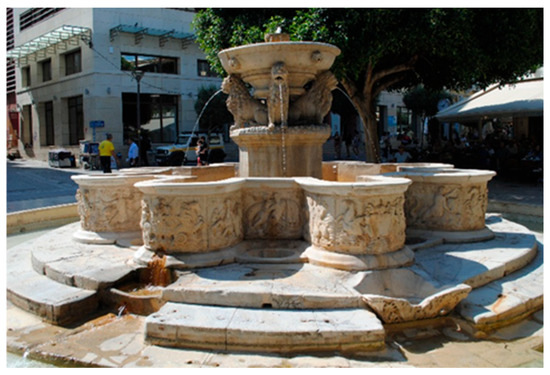
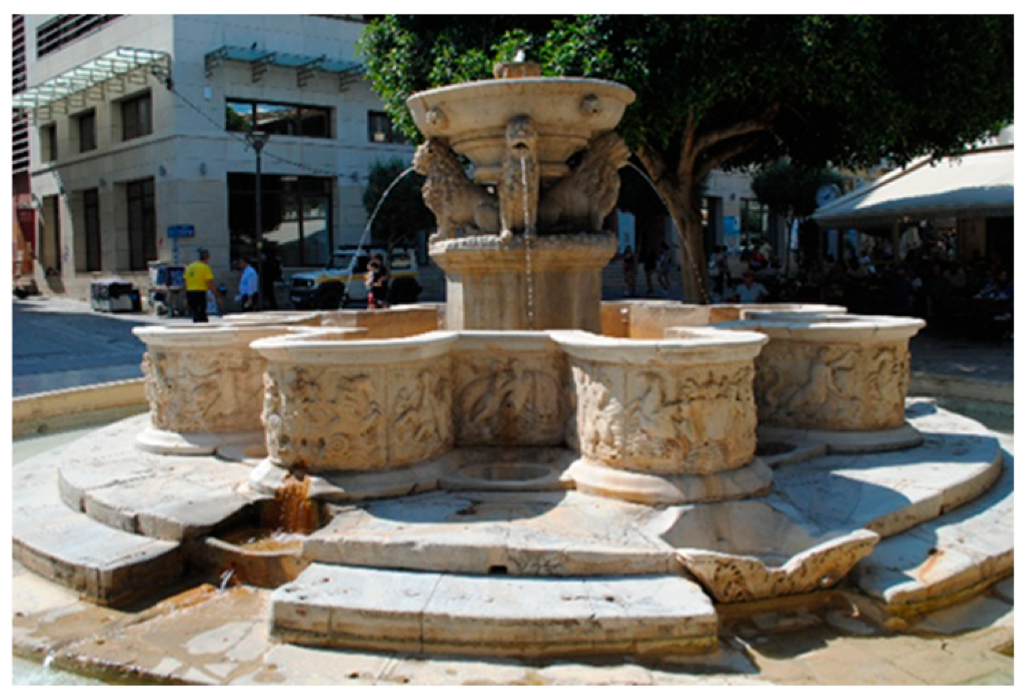
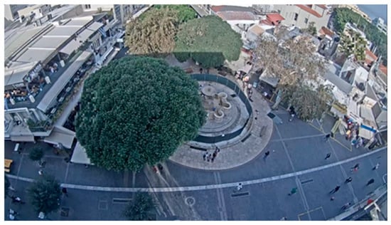
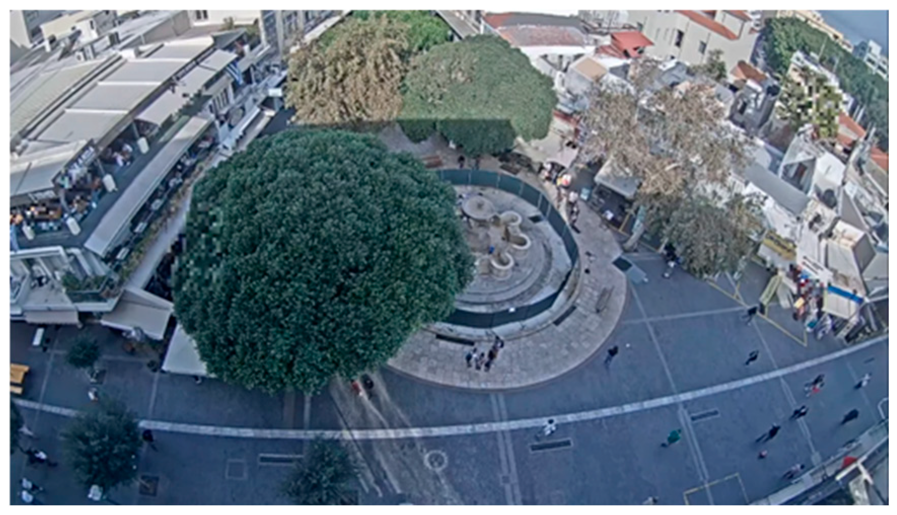
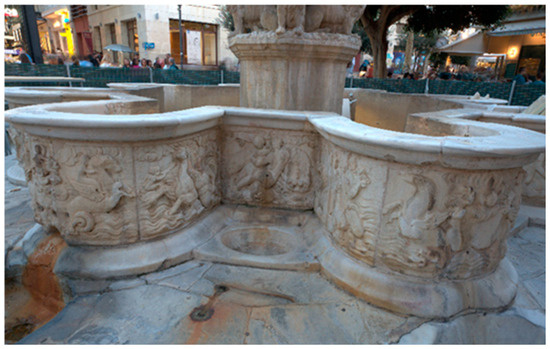
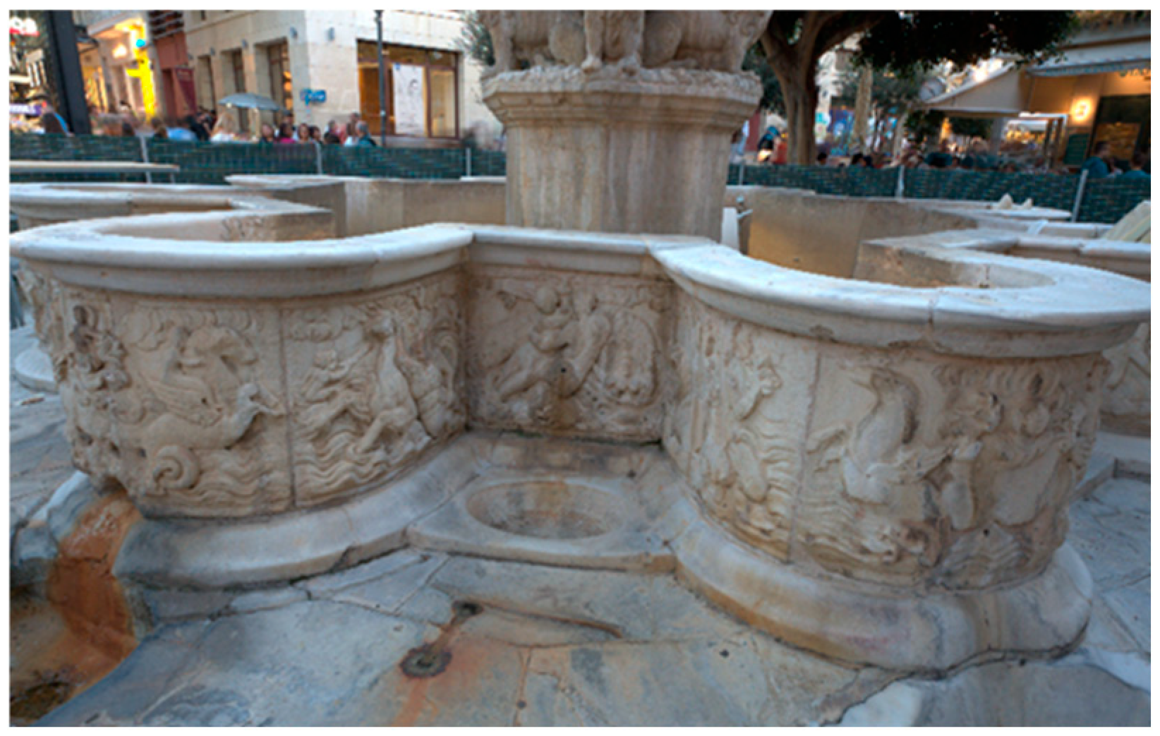
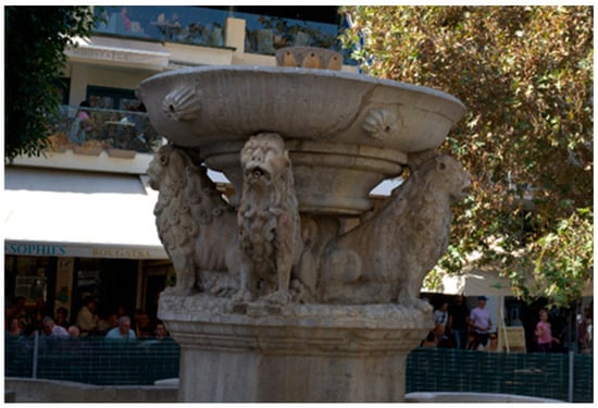
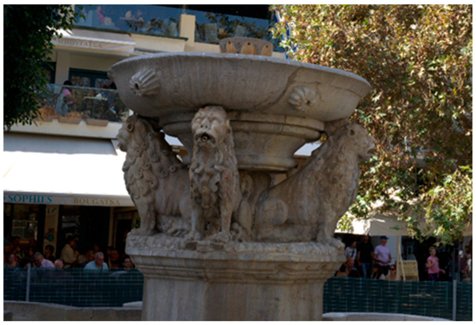
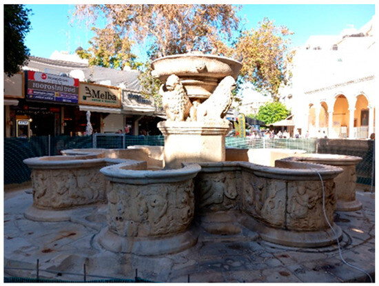
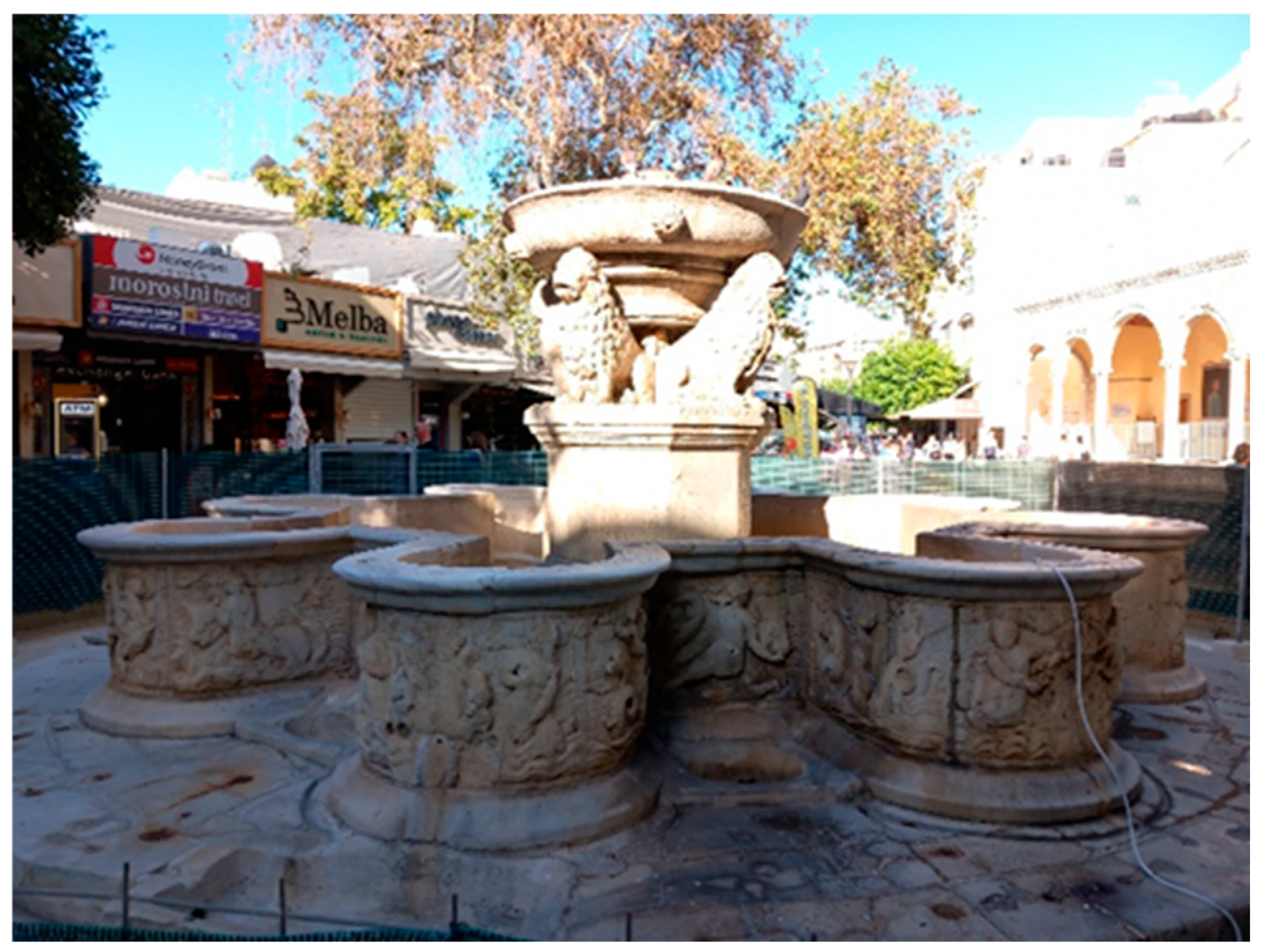
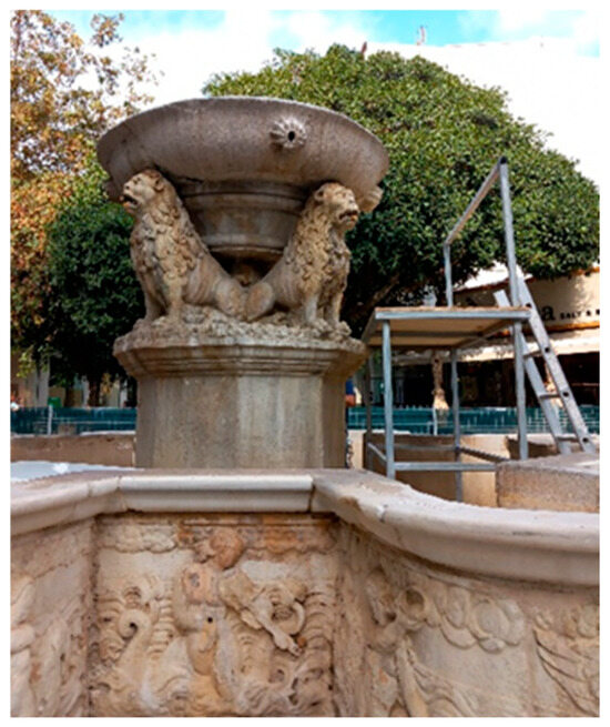
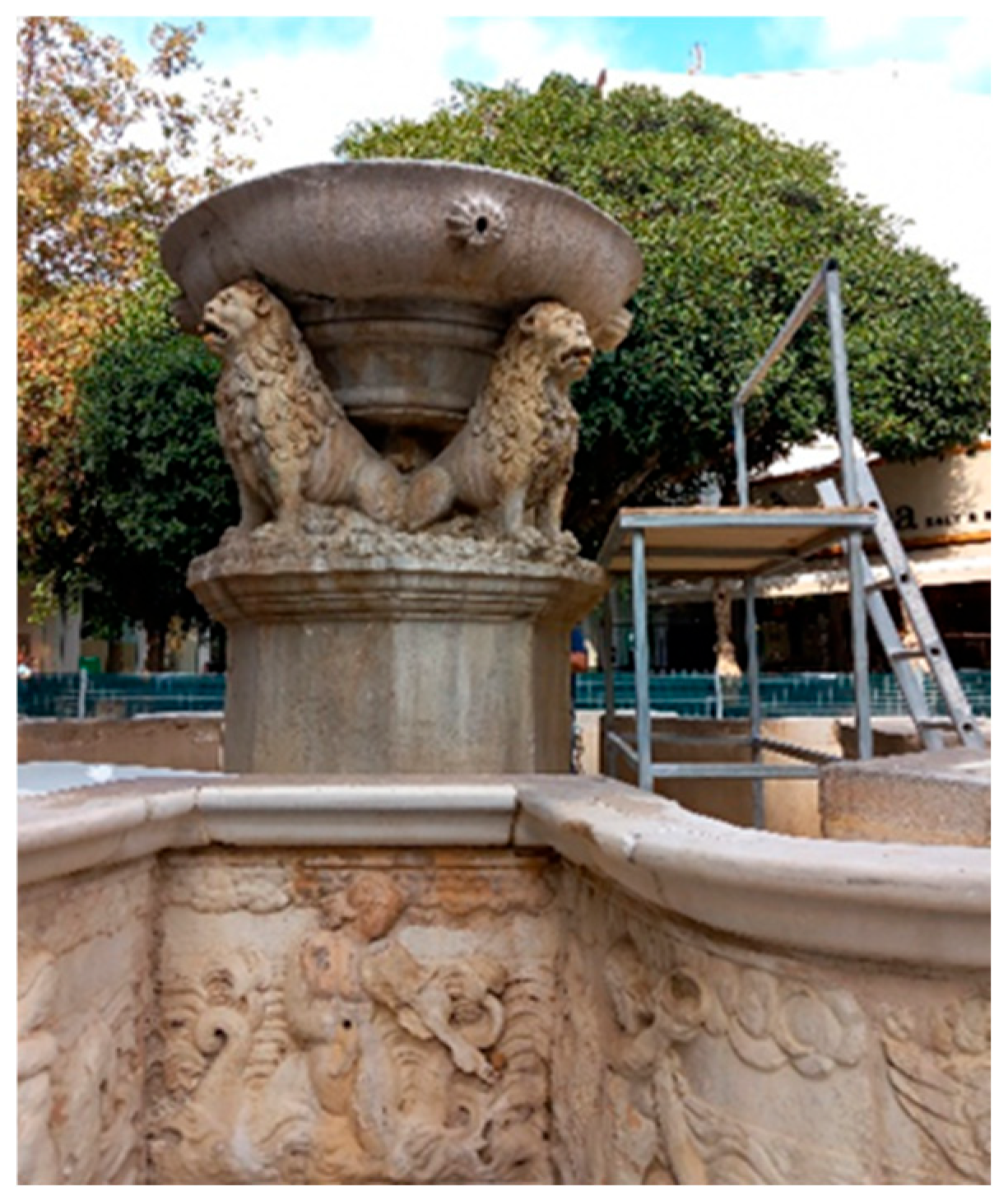
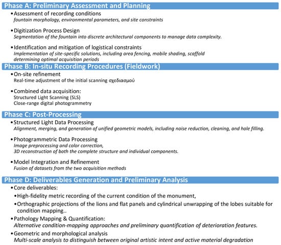
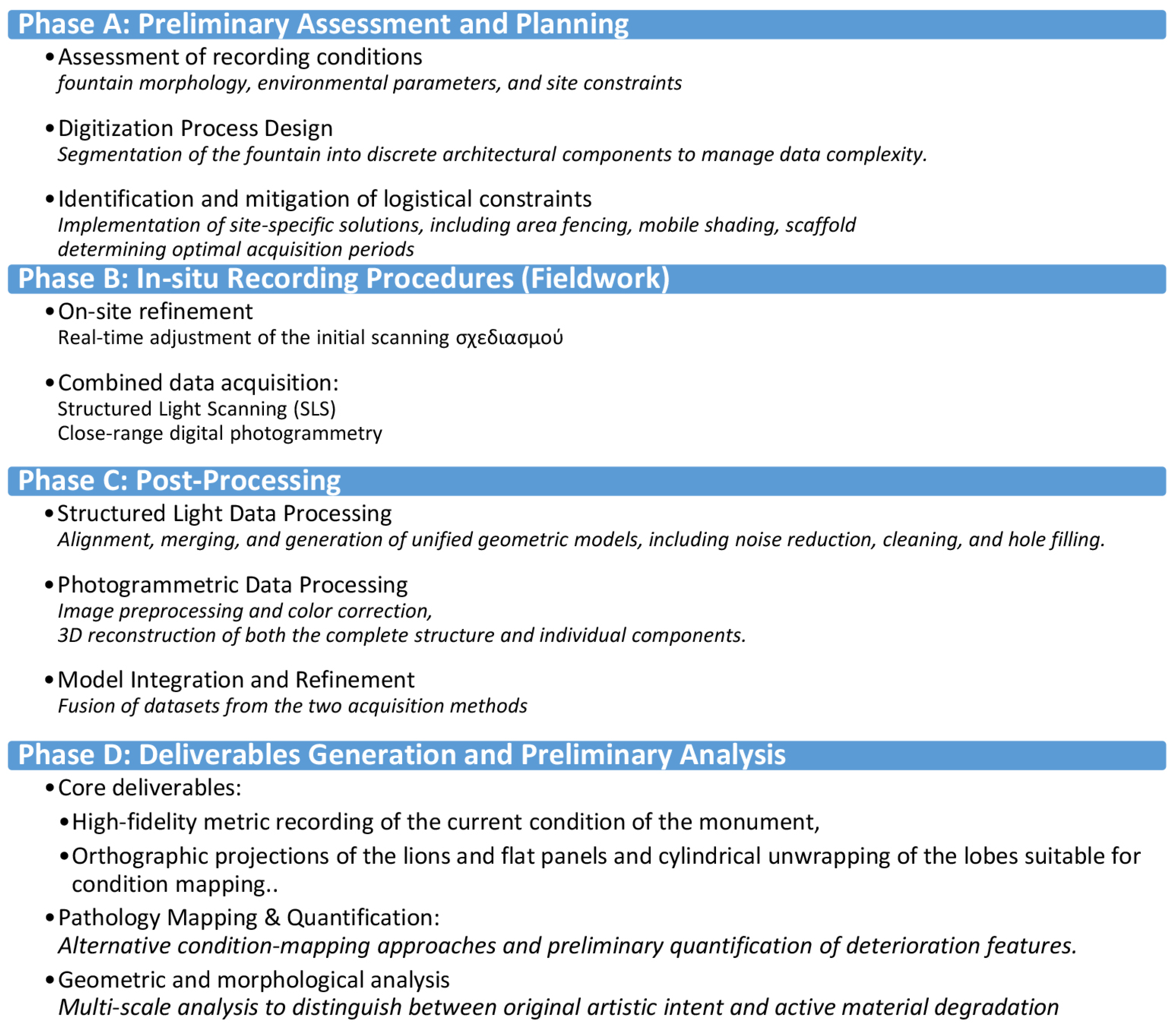
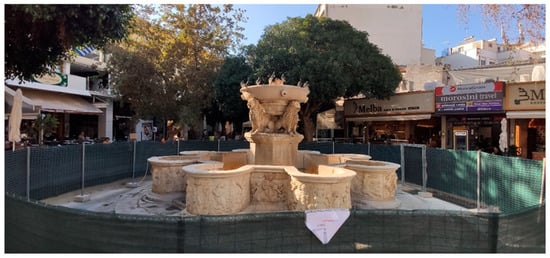
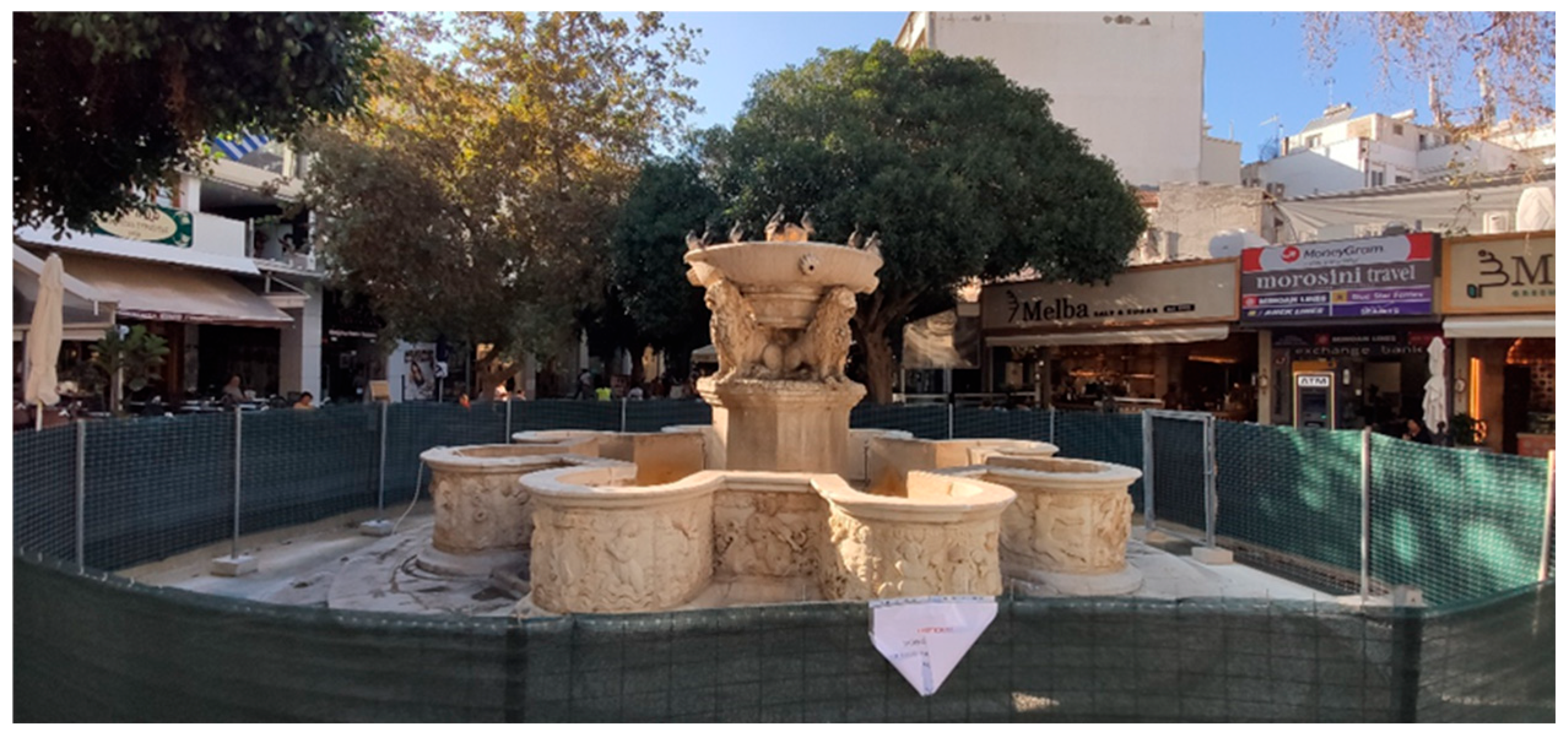
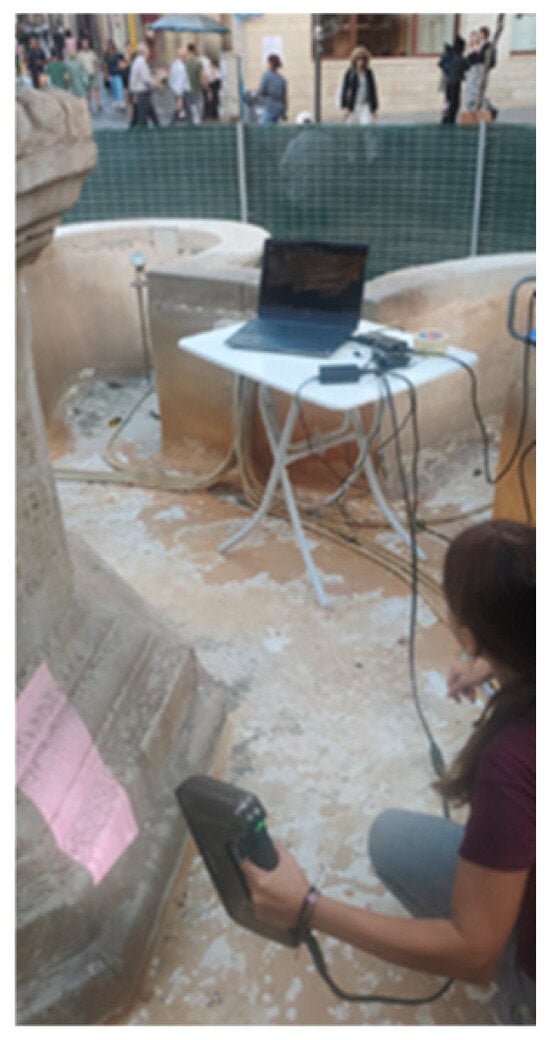
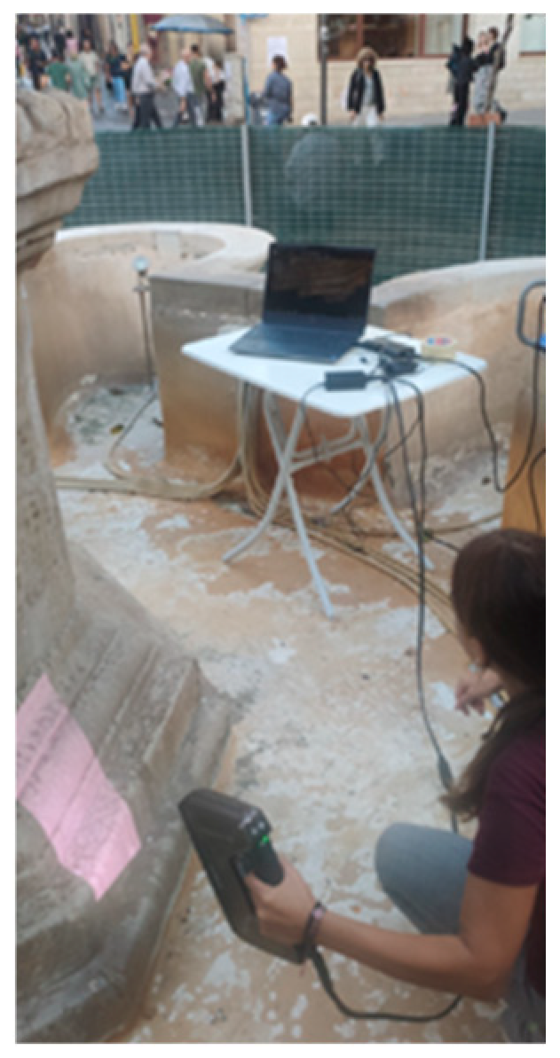
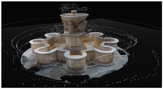
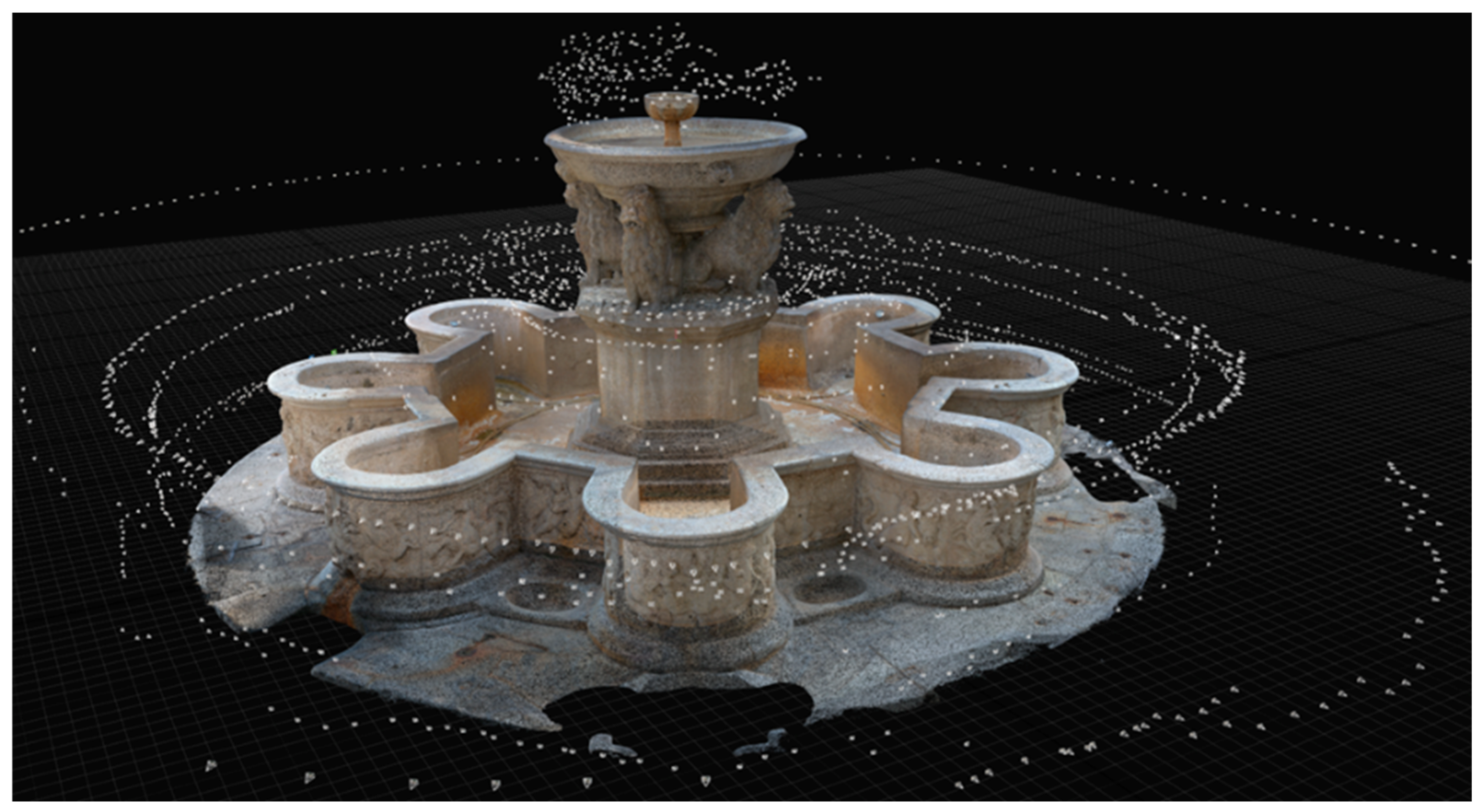
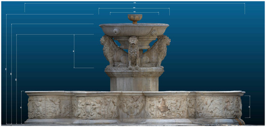
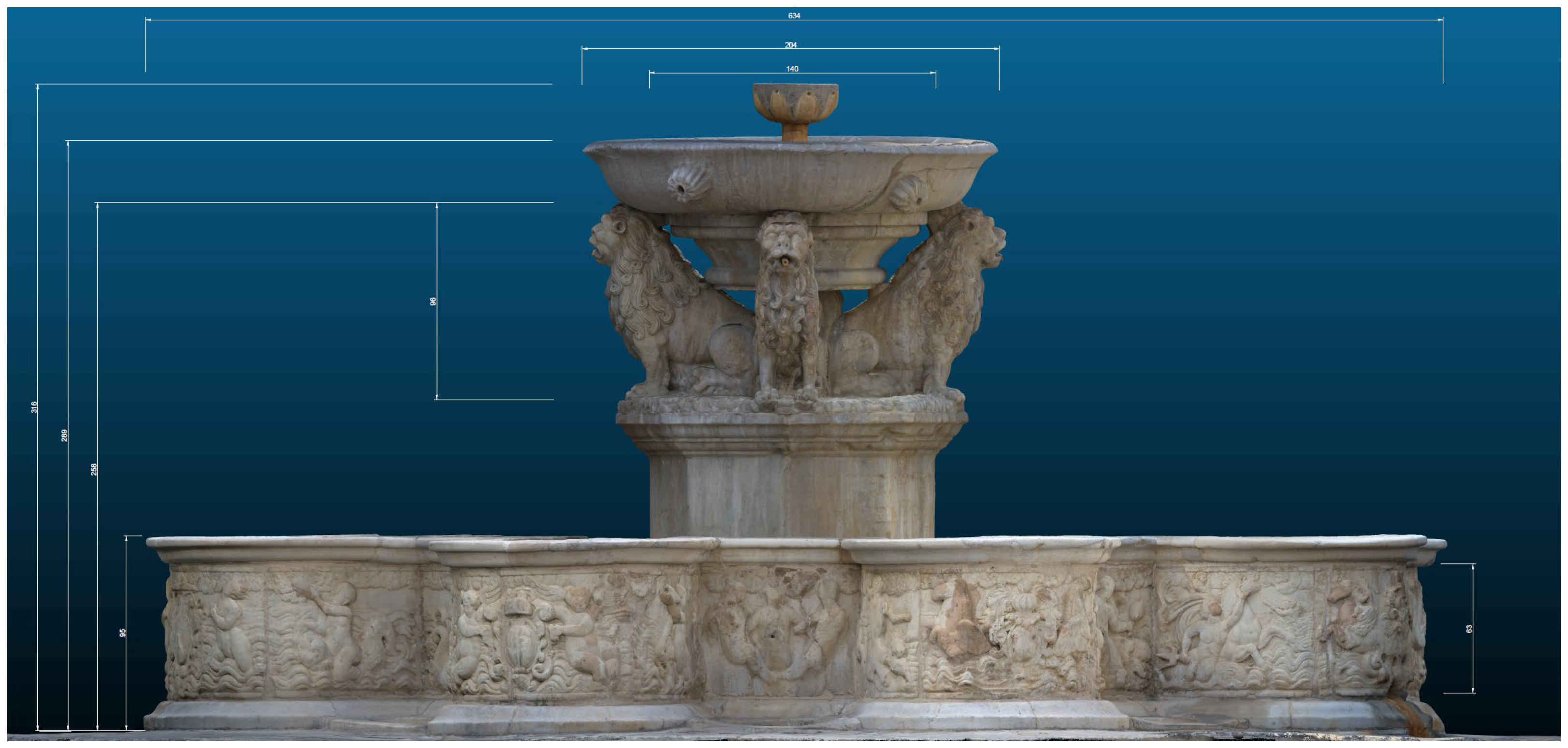
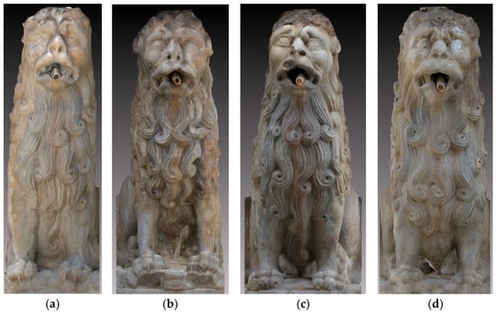
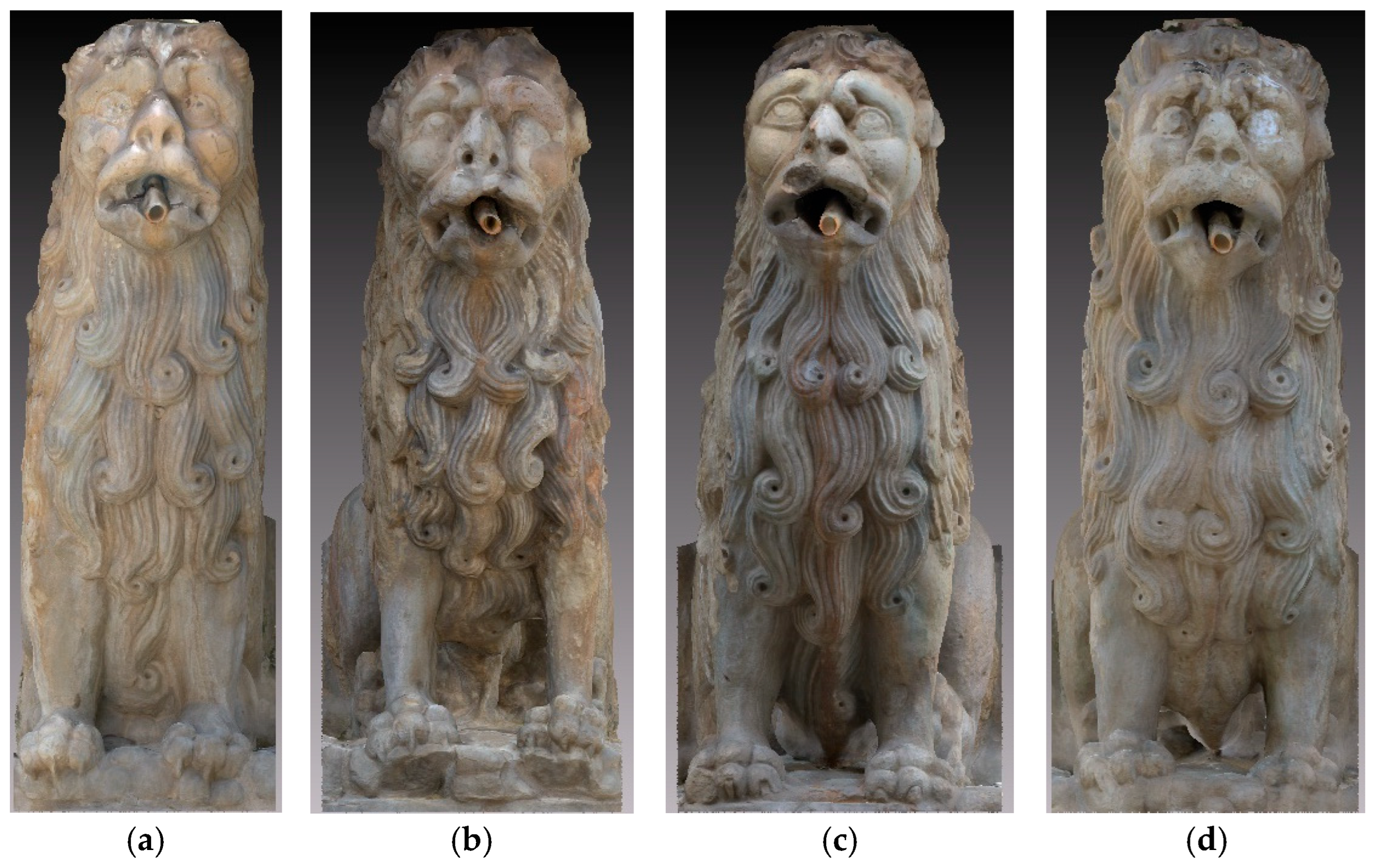
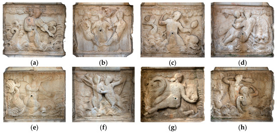
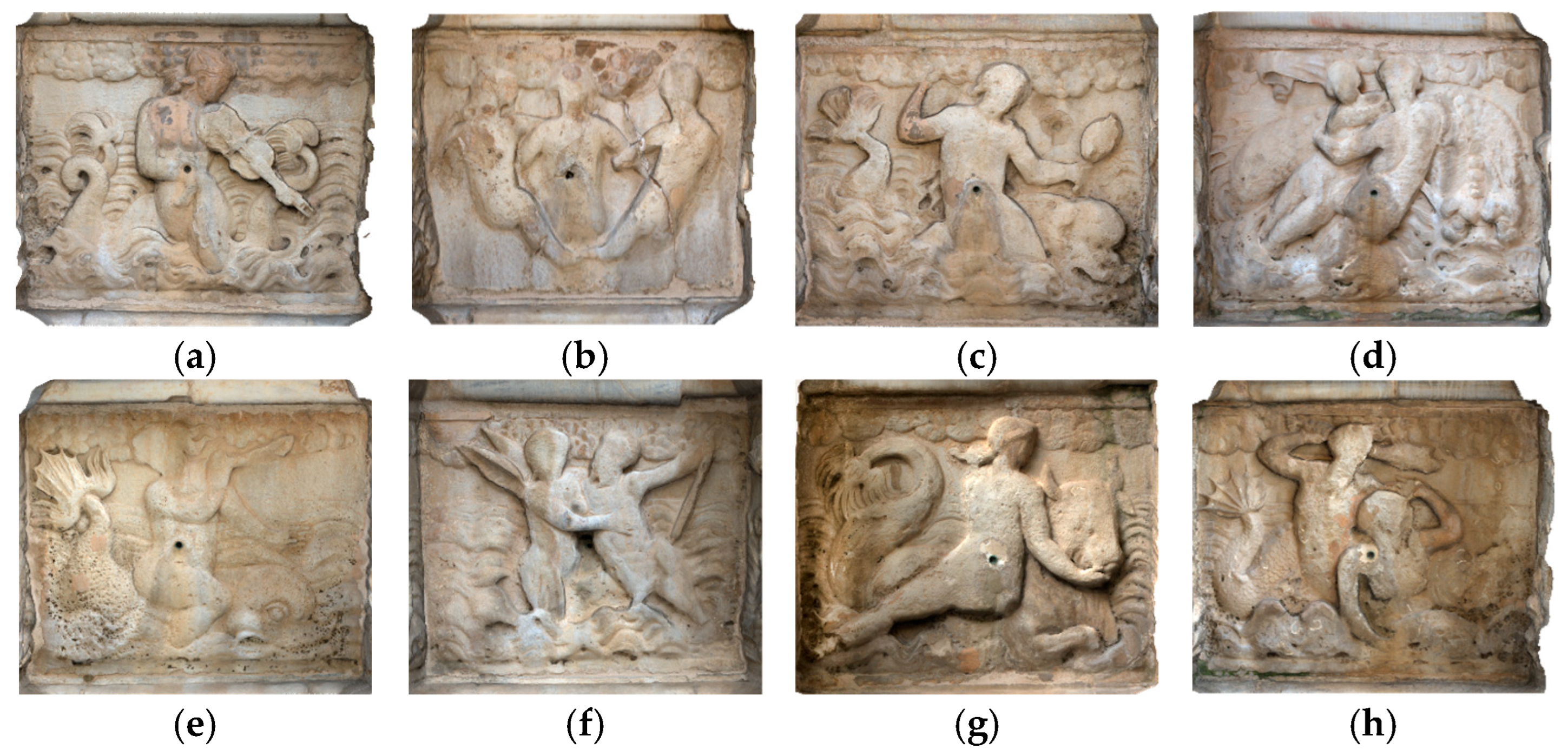
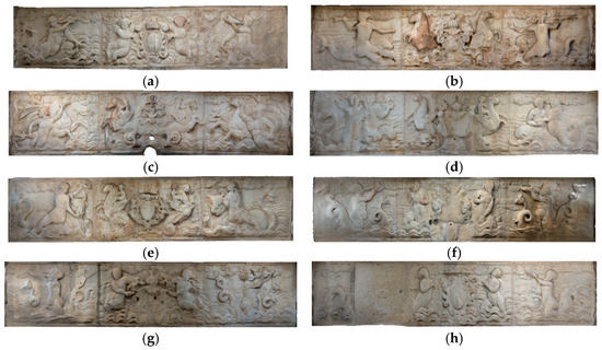
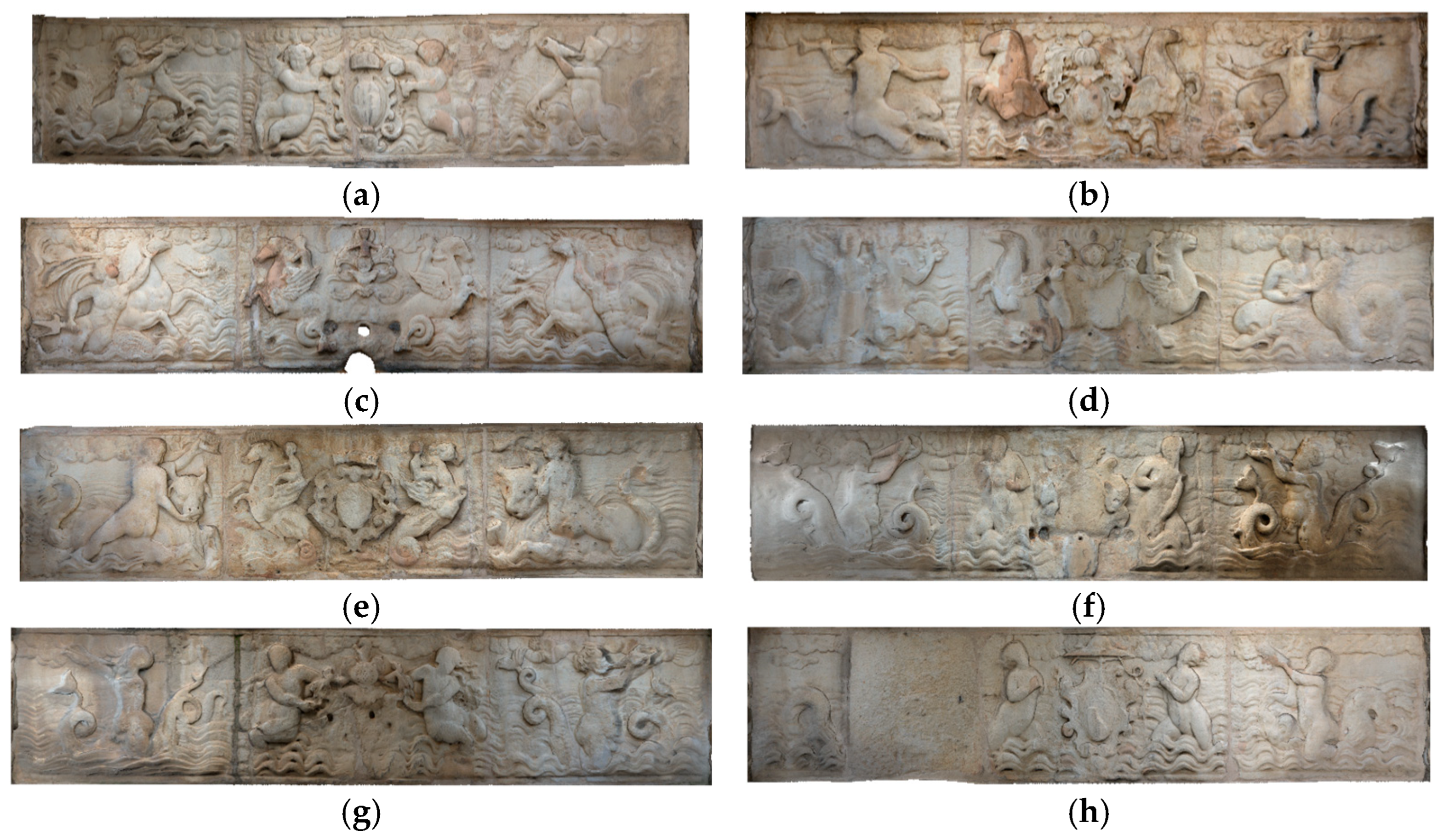
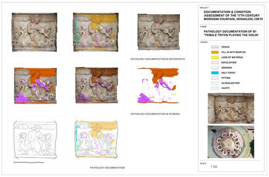
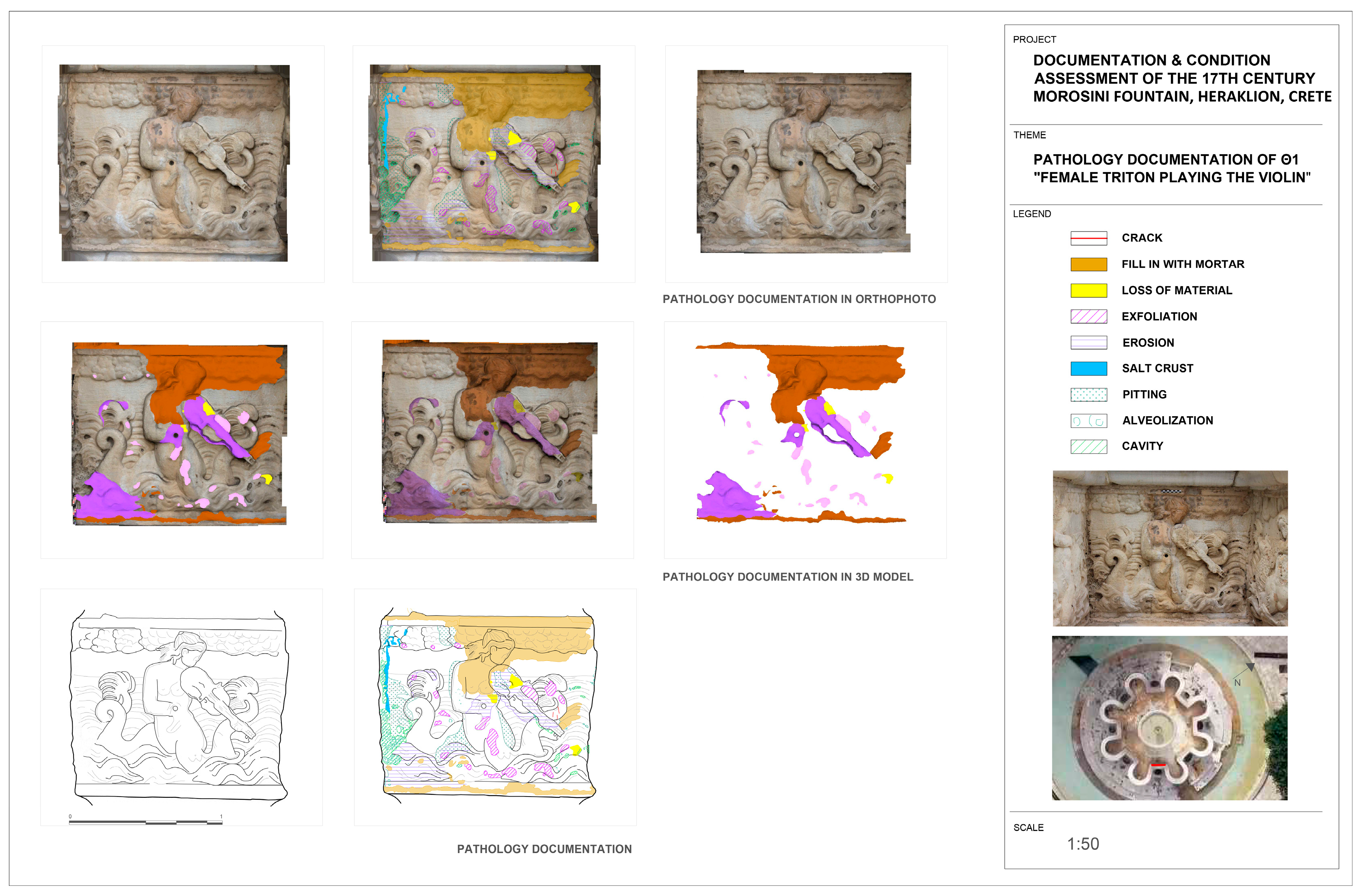
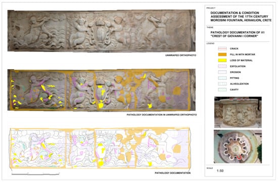
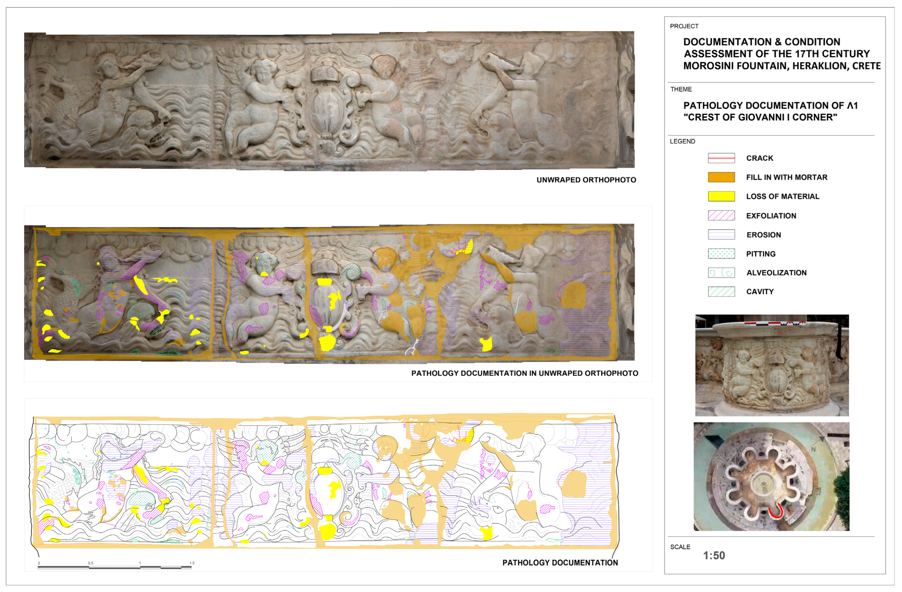
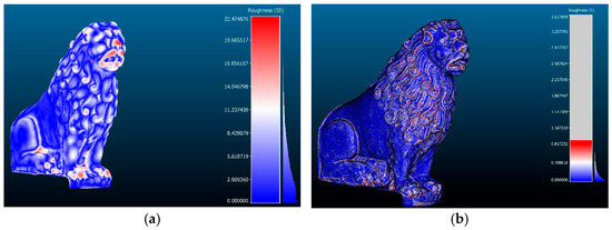
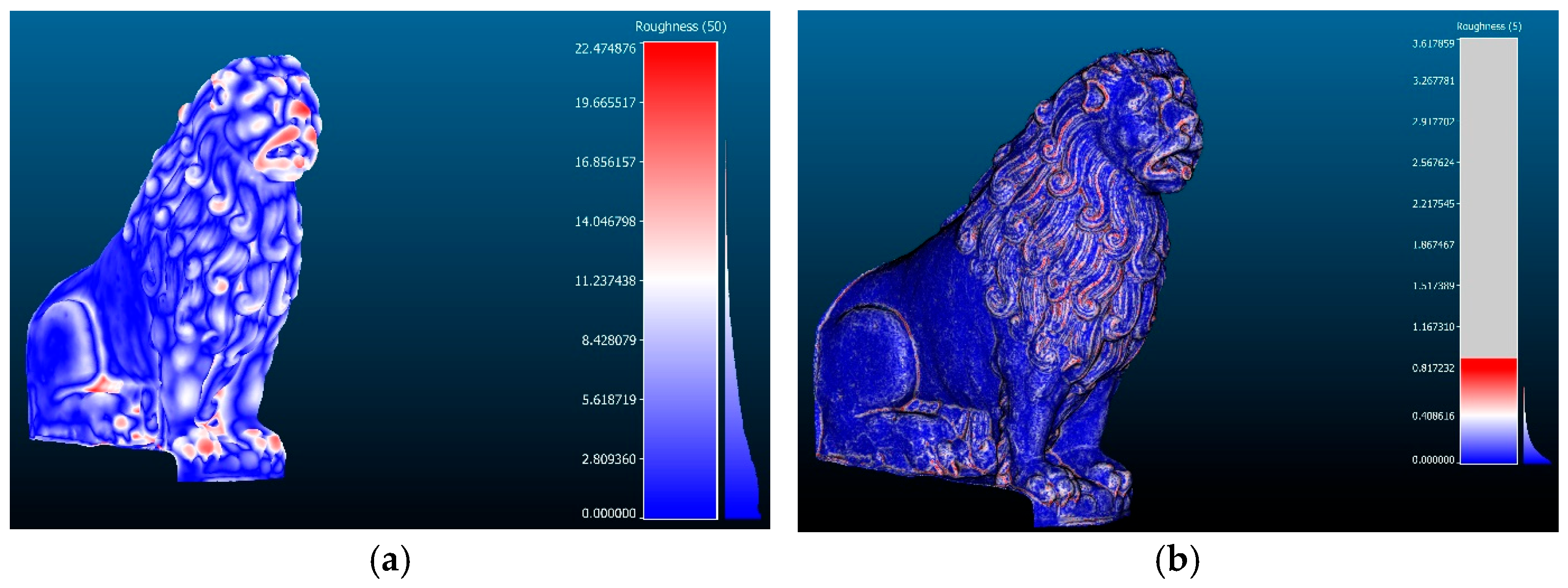

Disclaimer/Publisher’s Note: The statements, opinions and data contained in all publications are solely those of the individual author(s) and contributor(s) and not of MDPI and/or the editor(s). MDPI and/or the editor(s) disclaim responsibility for any injury to people or property resulting from any ideas, methods, instructions or products referred to in the content. |
© 2026 by the authors. Licensee MDPI, Basel, Switzerland. This article is an open access article distributed under the terms and conditions of the Creative Commons Attribution (CC BY) license.