

Fractal Fract., Volume 6, Issue 11 (November 2022) – 72 articles
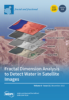
Cover Story (view full-size image):
The identification and monitoring of existing surface water bodies on Earth is important in many scientific disciplines and for different industrial uses. The objective of this study is to establish and validate a method to distinguish efficiently between water and land zones using high-resolution satellite images. The adopted method is based on image segmentation plus fractal dimension analysis of the resulting tiles. The proposed scheme is particularly simple and computationally efficient compared with heavy artificial-intelligence-based methods. The results of a practical case study show that the adopted method is able to detect surface water with an average accuracy of 96.03%. View this paper
- Issues are regarded as officially published after their release is announced to the table of contents alert mailing list.
- You may sign up for e-mail alerts to receive table of contents of newly released issues.
- PDF is the official format for papers published in both, html and pdf forms. To view the papers in pdf format, click on the "PDF Full-text" link, and use the free Adobe Reader to open them.
Previous Issue
Next Issue