Next Issue
Volume 7, June
Previous Issue
Volume 7, April


Climate, Volume 7, Issue 5 (May 2019) – 12 articles

Cover Story (view full-size image): 
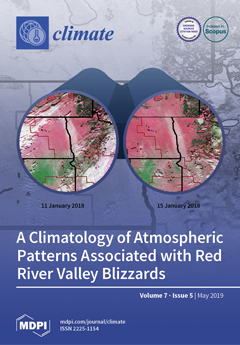
Stretching along the border of North Dakota and Minnesota, The Red River Valley (RRV) has the highest frequency of reported blizzards within the contiguous United States. Despite their impacts, many aspects of these events are unknown, creating challenges for local forecasters. This study presents a climatology of the atmospheric patterns associated with RRV blizzards. Patterns were identified with subjective and objective techniques using meteorological fields from reanalysis data. The objective classification of these blizzards using a self-organizing map (SOM) demonstrates that the gross segregation of the events can be achieved. This implies that objective analysis techniques can be used to identify these events in weather and climate model outputs, which may aid future forecasting and risk assessment projects. View this paper.
  • Issues are regarded as officially published after their release is announced to the table of contents alert mailing list.
  • You may sign up for e-mail alerts to receive table of contents of newly released issues.
  • PDF is the official format for papers published in both, html and pdf forms. To view the papers in pdf format, click on the "PDF Full-text" link, and use the free Adobe Reader to open them.
Order results
Result details
Section
Select all
Export citation of selected articles as:
16 pages, 7731 KiB  
Article
A Statistical Method for Determining Optical and Geometrical Characteristics of Cirrus Clouds
by Manoj Kumar Nellore, Venkatramanan Kannan and Arul Lenus Roy Vellaisamy
Climate 2019, 7(5), 72; https://doi.org/10.3390/cli7050072 - 27 May 2019
Cited by 3 | Viewed by 3356
Abstract
Altitude occurrences of cirrus clouds, their base, mid, and top heights are identified by using a powerful statistical approach called the Variance Centroid Method (VCM). This method is effective in determining the geometrical properties of cirrus clouds at a height range of 8 [...] Read more.
Altitude occurrences of cirrus clouds, their base, mid, and top heights are identified by using a powerful statistical approach called the Variance Centroid Method (VCM). This method is effective in determining the geometrical properties of cirrus clouds at a height range of 8 km to 20 km. This statistical method provides in-depth information on Generation Circulation Models (GCM’s) because of its significant role in the radiative balance of the earth’s atmosphere. The output related to geometrical and optical properties of cirrus clouds obtained from this statistical method for the years 2014 and 2015 are studied. Altitude distributions of base, mid, top, and thickness of tropical cirrus clouds are analyzed in terms of percentage occurrences. For the year 2014, it was found that 14.8%, 75.2%, and 9.9% of cirrus clouds were sub-visual, thin, and thick clouds and for the year 2015, 71.2% and 28.7% of cirrus clouds were found to be thin and thick clouds, and sub-visual types of clouds were not observed. The interdependence of optical depth with the depolarization ratio is discussed and it is observed that the correlation is negative (−0.0303) for the year 2014 and positive (0.1311) for the year 2015. High optical depths with values from 0.502 to 0.849 are observed in the height regions from 9 km to 15 km (for 2014) and for the year 2015, the observed value ranges from 0.514 to 0.822 for the height regions from 9 km to 11 km. Statistical variation of characteristics of tropical cirrus clouds is presented for the period of study. The characterization of these cirrus clouds is highly useful for climate modeling studies, and their impact plays a vital role in the Earth’s radiation budget at the top of the atmosphere. Full article
Show Figures

Figure 1

11 pages, 1365 KiB  
Article
Attitudes of Farmers and Rural Area Residents Toward Climate Change Adaptation Measures: Their Preferences and Determinants of Their Attitudes
by Kenshi Baba and Mitsuru Tanaka
Climate 2019, 7(5), 71; https://doi.org/10.3390/cli7050071 - 26 May 2019
Cited by 8 | Viewed by 4240
Abstract
In this study, data obtained from an online survey were analyzed to identify the perception gap between farmers and nonfarmers (rural area residents) toward climate change adaptation measures with conventional and new elements of the psychological mechanism. Key findings from the study were [...] Read more.
In this study, data obtained from an online survey were analyzed to identify the perception gap between farmers and nonfarmers (rural area residents) toward climate change adaptation measures with conventional and new elements of the psychological mechanism. Key findings from the study were as follows. First, the perception of climate change risk and awareness of impacts of climate change had strong effects on the preferences for and willingness to participate in measures rather than trusting the government and values pertaining to the policy decision-making process. Second, farmers tended to prefer “protection” and “transfer of risks (insurance)” as climate change adaptation measures more than nonfarmers did. Farmers also tended to be unwilling to participate in “withdrawal”, reflecting the difficulty of relocating agricultural land. Third, farmers’ willingness to participate in climate change adaptation measures was determined strongly by their preferences. Therefore, to increase preference, there needs to be communication about multiple risks including climate change risks associated with not only “adjustment” and “protection”, which tend to be preferred, but also “withdrawal”, which tends to not be preferred. Contrasting with these, nonfarmers tended to prefer any particular climate change adaptation measures statistically-significantly, but they tended to be willing to accept “self-help” absolutely and “withdrawal” relatively. Also, farmers’ willingness to participate in climate change adaptation measures was determined strongly by their preference. One of the ways to increase the preference is communicating about the multiple risks including climate change risks associated with “adjustment,” “protection” and “transfer” which tend to be preferred more than nonfarmers did. Finally, trust in the government and values pertaining to the policy decision-making process did not necessarily have a serious impact on policy preferences and willingness to participate, both for farmers and nonfarmers. More analyses for other sectors will be needed for further study. Full article
(This article belongs to the Special Issue Social-Ecological Systems, Climate and Global Change Impacts)
Show Figures

Figure 1

17 pages, 1784 KiB  
Article
Climate Change-Induced Impacts on Smallholder Farmers in Selected Districts of Sidama, Southern Ethiopia
by Tafesse Matewos
Climate 2019, 7(5), 70; https://doi.org/10.3390/cli7050070 - 22 May 2019
Cited by 23 | Viewed by 7596
Abstract
Different factors control the types of adaptive strategies and likelihoods of experiencing climate change-induced impacts by smallholder farmers. By using a mixed research method, this study examines the types and determinants of climate change-induced impacts on smallholder rural farmers in drought-prone low lands [...] Read more.
Different factors control the types of adaptive strategies and likelihoods of experiencing climate change-induced impacts by smallholder farmers. By using a mixed research method, this study examines the types and determinants of climate change-induced impacts on smallholder rural farmers in drought-prone low lands of Sidama, Southern Ethiopia. Randomly selected (401) households were surveyed on climate change-induced impacts. Longitudinal climatic data were also collected from the Ethiopian National Meteorological Agency to assess the trend of rainfall (RF), temperature and drought incidents. The analyses of the data revealed that RF and temperature had shown decreasing and increasing trends, respectively, during the three decades under consideration (1983–2014). These changes in RF and temperature exposed farmers to climate-related epidemics, drought, harvest loss, and hunger. The logit model results revealed that different factors control the likelihood of exposure to climate change-induced impacts. The findings revealed that literacy level, involving women in family decisions and farmers’ involvement in adaptation planning, reduces the likelihood of exposure to climate change-induced hunger. Therefore, there is a need to work on human capital of the farmers through expanding education, strengthening women’s participation in family decision-making, and by improving public participation in climate change adaptation undertakings to minimize climate change-induced impacts. Full article
(This article belongs to the Special Issue Sustainable Agriculture for Climate Change Adaptation)
Show Figures

Figure 1

23 pages, 15034 KiB  
Article
The Dominant Climate Change Event for Salinity Intrusion in the GBM Delta
by Rabeya Akter, Tansir Zaman Asik, Mohiuddin Sakib, Marin Akter, Mostofa Najmus Sakib, A. S. M. Alauddin Al Azad, Montasir Maruf, Anisul Haque and Md. Munsur Rahman
Climate 2019, 7(5), 69; https://doi.org/10.3390/cli7050069 - 21 May 2019
Cited by 28 | Viewed by 5953
Abstract
Salinity intrusion through the estuaries in low-lying tide-dominated deltas is a serious threat that is expected to worsen in changing climatic conditions. This research makes a comparative analysis on the impact of salinity intrusion due to a reduced upstream discharge, a sea level [...] Read more.
Salinity intrusion through the estuaries in low-lying tide-dominated deltas is a serious threat that is expected to worsen in changing climatic conditions. This research makes a comparative analysis on the impact of salinity intrusion due to a reduced upstream discharge, a sea level rise, and cyclonic conditions to find which one of these event dominates the salinity intrusion. A calibrated and validated salinity model (Delft3D) and storm surge model (Delft Dashboard) are used to simulate the surface water salinity for different climatic conditions. Results show that the effects of the reduced upstream discharge, a sea level rise, and cyclones cause different levels of impacts in the Ganges-Brahmaputra-Meghna (GBM) delta along the Bangladesh coast. Reduced upstream discharge causes an increased saltwater intrusion in the entire region. A rising sea level causes increased salinity in the shallower coast. The cyclonic impact on saltwater intrusion is confined within the landfall zone. These outcomes suggest that, for a tide dominated delta, if a sea level rise (SLR) or cyclone occurred, the impact would be conditional and local. However, if the upstream discharge reduces, the impact would be gradual and along the entire coast. Full article
Show Figures

Figure 1

19 pages, 6137 KiB  
Article
Developing Gridded Climate Data Sets of Precipitation for Greece Based on Homogenized Time Series
by Flora Gofa, Anna Mamara, Manolis Anadranistakis and Helena Flocas
Climate 2019, 7(5), 68; https://doi.org/10.3390/cli7050068 - 16 May 2019
Cited by 20 | Viewed by 5258
Abstract
The creation of realistic gridded precipitation fields improves our understanding of the observed climate and is necessary for validating climate model output for a wide range of applications. The challenge in trying to represent the highly variable nature of precipitation is to overcome [...] Read more.
The creation of realistic gridded precipitation fields improves our understanding of the observed climate and is necessary for validating climate model output for a wide range of applications. The challenge in trying to represent the highly variable nature of precipitation is to overcome the lack of density of observations in both time and space. Data sets of mean monthly and annual precipitations were developed for Greece in gridded format with an analysis of 30 arcsec (∼800 m) based on data from 1971 to 2000. One hundred and fifty-seven surface stations from two different observation networks were used to cover a satisfactory range of elevations. Station data were homogenized and subjected to quality control to represent changes in meteorological conditions rather than changes in the conditions under which the observations were made. The Meteorological Interpolation based on Surface Homogenized Data Basis (MISH) interpolation method was used to develop data sets that reproduce, as closely as possible, the spatial climate patterns over the region of interest. The main geophysical factors considered for the interpolation of mean monthly precipitation fields were elevation, latitude, incoming solar irradiance, Euclidian distance from the coastline, and land-to-sea percentage. Low precipitation interpolation uncertainties estimated with the cross-validation method provided confidence in the interpolation method. The resulting high-resolution maps give an overall realistic representation of precipitation, especially in fall and winter, with a clear longitudinal dependence on precipitation decreasing from western to eastern continental Greece. Full article
(This article belongs to the Special Issue From Local to Global Precipitation Dynamics and Climate Interaction)
Show Figures

Figure 1

7 pages, 2480 KiB  
Comment
Climatization—Negligent Attribution of Great Salt Lake Desiccation: A Comment on Meng (2019)
by Michael L. Wine, Sarah E. Null, R. Justin DeRose and Wayne A. Wurtsbaugh
Climate 2019, 7(5), 67; https://doi.org/10.3390/cli7050067 - 14 May 2019
Cited by 9 | Viewed by 4198
Abstract
A recent article reviewed data on Great Salt Lake (Utah) and concluded falsely that climate changes, especially local warming and extreme precipitation events, are primarily responsible for lake elevation changes. Indeed climatically influenced variation of net inflows contribute to huge swings in the [...] Read more.
A recent article reviewed data on Great Salt Lake (Utah) and concluded falsely that climate changes, especially local warming and extreme precipitation events, are primarily responsible for lake elevation changes. Indeed climatically influenced variation of net inflows contribute to huge swings in the elevation of Great Salt Lake (GSL) and other endorheic lakes. Although droughts and wet cycles have caused lake elevation changes of over 4.5 m, they have not caused a significant long-term change in the GSL stage. This recent article also suggests that a 1.4 °C rise in air temperature and concomitant increase in the lake’s evaporative loss is an important reason for the lake’s decline. However, we calculate that a 1.4 °C rise may have caused only a 0.1 m decrease in lake level. However, since 1847, the lake has declined 3.6 m and the lake area has decreased by ≈50%, despite no significant change in precipitation (p = 0.52) and a slight increase, albeit insignificant, in river flows above irrigation diversions (p = 0.085). In contrast, persistent water extraction for agriculture and other uses beginning in 1847 now decrease water flows below diversions by 39%. Estimates of consumptive water use primarily for irrigated agriculture in the GSL watershed suggest that approximately 85% (2500 km2) of the reduced lake area can be attributed to human water consumption. The recent article’s failure to calculate a water budget for the lake that included extensive water withdrawals misled the author to focus instead on climate change as a causal factor for the decline. Stable stream flows in GSL’s headwaters, inadequate temperature increase to explain the extent of its observed desiccation, stable long-term precipitation, and the magnitude of increased water consumption from GSL together demonstrate conclusively that climatic factors are secondary to human alterations to GSL and its watershed. Climatization, in which primarily non-climatic processes are falsely attributed to climatic factors, is a threat to the credibility of hydrological science. Despite a recent suggestion to the contrary, pressure to support Earth’s rising human population—in the form of increasing consumption of water in water-limited regions, primarily to support irrigated agriculture—remains the leading driver of desiccation of inland waters within Earth’s water-limited regions. Full article
Show Figures

Figure 1

19 pages, 11640 KiB  
Article
A Climatology of Atmospheric Patterns Associated with Red River Valley Blizzards
by Aaron Kennedy, Alexander Trellinger, Thomas Grafenauer and Gregory Gust
Climate 2019, 7(5), 66; https://doi.org/10.3390/cli7050066 - 06 May 2019
Cited by 5 | Viewed by 5769
Abstract
Stretching along the border of North Dakota and Minnesota, The Red River Valley (RRV) of the North has the highest frequency of reported blizzards within the contiguous United States. Despite the numerous impacts these events have, few systematic studies exist that discuss the [...] Read more.
Stretching along the border of North Dakota and Minnesota, The Red River Valley (RRV) of the North has the highest frequency of reported blizzards within the contiguous United States. Despite the numerous impacts these events have, few systematic studies exist that discuss the meteorological properties of blizzards. As a result, forecasting these events and lesser blowing snow events is an ongoing challenge. This study presents a climatology of atmospheric patterns associated with RRV blizzards for the winter seasons of 1979–1980 and 2017–2018. Patterns were identified using subjective and objective techniques using meteorological fields from the North American Regional Re-analysis (NARR). The RRV experiences, on average, 2.6 events per year. Blizzard frequency is bimodal, with peaks occurring in December and March. The events can largely be typed into four meteorological categories dependent on the forcing that drives the blizzard: Alberta Clippers, Arctic Fronts, Colorado Lows, and Hybrids. The objective classification of these blizzards using a competitive neural network known as the Self-Organizing Map (SOM) demonstrates that gross segregation of the events can be achieved with a small (eight-class) map. This implies that objective analysis techniques can be used to identify these events in weather and climate model output that may aid future forecasting and risk assessment projects. Full article
(This article belongs to the Special Issue Climate and Atmospheric Dynamics and Predictability)
Show Figures

Figure 1

17 pages, 14093 KiB  
Article
Intraurban Temperature Variations: Urban Morphologies of the Densification Process of Copacabana Neighborhood, Brazil
by Gisele S. Barbosa, Patricia R. C. Drach and Oscar D. Corbella
Climate 2019, 7(5), 65; https://doi.org/10.3390/cli7050065 - 06 May 2019
Cited by 11 | Viewed by 4324
Abstract
The idea of compact cities is attracting enthusiasts, and some have proposed sustainable options for its implementation. This concept is based on planning for higher density cities with efficient connectivity in their structures. Because climatic characteristics are one of the basic factors to [...] Read more.
The idea of compact cities is attracting enthusiasts, and some have proposed sustainable options for its implementation. This concept is based on planning for higher density cities with efficient connectivity in their structures. Because climatic characteristics are one of the basic factors to consider when planning a town, the models imported from different climates of Brazil must be intensely scrutinized and analyzed for their adequacy and effectiveness. Previous studies have revealed the inadequacy of the compact city model for tropical countries. In this study, the Copacabana neighborhood in Rio de Janeiro, a city that is currently compact, was assessed using computational tools (ENVI-met) to observe the intraurban temperature dynamics and sky view factor (SVF) alterations at three time-points’ unit occupation history: 1930, 1950, and 2018. To determine the effects of morphological changes on thermal sensation, two outdoor comfort indexes were calculated: the physiological equivalent temperature (PET) and the universal thermal climate (UTCI). From the obtained results, the relationship between urban morphology, air temperature, and thermal comfort indicates that the debate about urban models will be heightened, particularly with regard to the concept of compact cities in the formation of new cities and neighborhoods in the tropics. Full article
(This article belongs to the Special Issue Urban Heat Islands)
Show Figures

Graphical abstract

21 pages, 2697 KiB  
Article
Do Farmers Perceive the Trends of Local Climate Variability Accurately? An Analysis of Farmers’ Perceptions and Meteorological Data in Myanmar
by Yarzar Hein, Kampanat Vijitsrikamol, Witsanu Attavanich and Penporn Janekarnkij
Climate 2019, 7(5), 64; https://doi.org/10.3390/cli7050064 - 05 May 2019
Cited by 21 | Viewed by 4770
Abstract
With the existing state of issues related to global climate change, the accuracy of farmers’ perceptions of climate is critically important if they plan to implement appropriate adaptation measures in their farming. This article evaluated if farmers perceive the trends of local climate [...] Read more.
With the existing state of issues related to global climate change, the accuracy of farmers’ perceptions of climate is critically important if they plan to implement appropriate adaptation measures in their farming. This article evaluated if farmers perceive the trends of local climate variability accurately, and was verified by the historical meteorological data analysis. Ordered probit perception models were applied in this study to determine the factors influencing the accuracy of farmer perception. It was observed that farmers’ perceptions of the rainfall amount during the early, mid, and late monsoon periods were highly accurate, and they also accurately perceived summer temperature change, but less accuracy of perception was observed of the temperate changes of the winter and monsoon seasons. Access to weekly weather information, participation in agricultural trainings, farming experience, and education level of the farmer were the major factors determining the accuracy of perception in this study. Based on the empirical results, this study suggested policy implications for (a) the locally specified weather information distribution, and (b) integration of weather information into agricultural training programs, which are available to the farming community to enhance the government implantation of the Myanmar Climate Smart Agriculture Strategy and Myanmar Climate Change Master Plan 2018–2030. Full article
Show Figures

Figure 1

18 pages, 5232 KiB  
Article
GPS Precipitable Water Vapor Estimations over Costa Rica: A Comparison against Atmospheric Sounding and Moderate Resolution Imaging Spectrometer (MODIS)
by Polleth Campos-Arias, Germain Esquivel-Hernández, José Francisco Valverde-Calderón, Stephanie Rodríguez-Rosales, Jorge Moya-Zamora, Ricardo Sánchez-Murillo and Jan Boll
Climate 2019, 7(5), 63; https://doi.org/10.3390/cli7050063 - 03 May 2019
Cited by 7 | Viewed by 4370
Abstract
The quantification of water vapor in tropical regions like Central America is necessary to estimate the influence of climate change on its distribution and the formation of precipitation. This work reports daily estimations of precipitable water vapor (PWV) using Global Positioning System (GPS) [...] Read more.
The quantification of water vapor in tropical regions like Central America is necessary to estimate the influence of climate change on its distribution and the formation of precipitation. This work reports daily estimations of precipitable water vapor (PWV) using Global Positioning System (GPS) delay data over the Pacific region of Costa Rica during 2017. The GPS PWV measurements were compared against atmospheric sounding and Moderate Resolution Imaging Spectrometer (MODIS) data. When GPS PWV was calculated, relatively small biases between the mean atmospheric temperatures (Tm) from atmospheric sounding and the Bevis equation were found. The seasonal PWV fluctuations were controlled by two of the main circulation processes in Central America: the northeast trade winds and the latitudinal migration of the Intertropical Convergence Zone (ITCZ). No significant statistical differences were found for MODIS Terra during the dry season with respect GPS-based calculations (p > 0.05). A multiple linear regression model constructed based on surface meteorological variables can predict the GPS-based measurements with an average relative bias of −0.02 ± 0.19 mm/day (R2 = 0.597). These first results are promising for incorporating GPS-based meteorological applications in Central America where the prevailing climatic conditions offer a unique scenario to study the influence of maritime moisture inputs on the seasonal water vapor distribution. Full article
(This article belongs to the Special Issue Climate and Atmospheric Dynamics and Predictability)
Show Figures

Figure 1

17 pages, 10901 KiB  
Article
The 10-Year Return Levels of Maximum Wind Speeds under Frozen and Unfrozen Soil Forest Conditions in Finland
by Mikko Laapas, Ilari Lehtonen, Ari Venäläinen and Heli M. Peltola
Climate 2019, 7(5), 62; https://doi.org/10.3390/cli7050062 - 30 Apr 2019
Cited by 17 | Viewed by 3776
Abstract
Reliable high spatial resolution information on the variation of extreme wind speeds under frozen and unfrozen soil conditions can enhance wind damage risk management in forestry. In this study, we aimed to produce spatially detailed estimates for the 10-year return level of maximum [...] Read more.
Reliable high spatial resolution information on the variation of extreme wind speeds under frozen and unfrozen soil conditions can enhance wind damage risk management in forestry. In this study, we aimed to produce spatially detailed estimates for the 10-year return level of maximum wind speeds for frozen (>20 cm frost depth) and unfrozen soil conditions for dense Norway spruce stands on clay or silt soil, Scots pine stands on sandy soil and Scots pine stands on drained peatland throughout Finland. For this purpose, the coarse resolution estimates of the 10-year return levels of maximum wind speeds based on 1979–2014 ERA-Interim reanalysis were downscaled to 20 m grid by using the wind multiplier approach, taking into account the effect of topography and surface roughness. The soil frost depth was estimated using a soil frost model. Results showed that due to a large variability in the timing of annual maximum wind speed, differences in the 10-year return levels of maximum wind speeds between the frozen and unfrozen soil seasons are generally rather small. Larger differences in this study are mostly found in peatlands, where soil frost seasons are notably shorter than in mineral soils. Also, the high resolution of wind multiplier downscaling and consideration of wind direction revealed some larger local scale differences around topographic features like hills and ridgelines. Full article
(This article belongs to the Special Issue Climate Variability and Change in the 21th Century)
Show Figures

Graphical abstract

13 pages, 679 KiB  
Article
Perception of Climate Change Risk and Adaptation in the Czech Republic
by Eliška Krkoška Lorencová, Blanka Loučková and Dava Vačkářů
Climate 2019, 7(5), 61; https://doi.org/10.3390/cli7050061 - 26 Apr 2019
Cited by 22 | Viewed by 5350
Abstract
Public perception of climate change is an important element that affects attitudes towards adaptation and mitigation. Understanding the general public’s perception of the issue can assist decision-makers, though the climate change perception is affected by multiple factors. This study examines the main sociodemographic [...] Read more.
Public perception of climate change is an important element that affects attitudes towards adaptation and mitigation. Understanding the general public’s perception of the issue can assist decision-makers, though the climate change perception is affected by multiple factors. This study examines the main sociodemographic factors, including gender, and the role of previous personal experience with extreme weather events on climate change perception and engagement in individual adaptation and mitigation actions among the general population in the Czech Republic. Based on statistical analysis, gender, age and previous experience with extreme weather events have been found to play a significant role in the climate change beliefs of individuals and in the perception of the cause of the changing climate. The analysis revealed that respondents with previous experience with extreme weather events were significantly more likely to implement adaptation and mitigation actions than respondents with no experience. The survey represents insights into climate change perception and beliefs of the general public at the national level. Full article
(This article belongs to the Special Issue Social-Ecological Systems, Climate and Global Change Impacts)
Show Figures

Figure 1

Previous Issue
Next Issue
Back to TopTop