You are currently viewing a new version of our website. To view the old version click .

ISPRS International Journal of Geo-Information, Volume 6, Issue 9

September 2017 - 32 articles

Cover Story: 
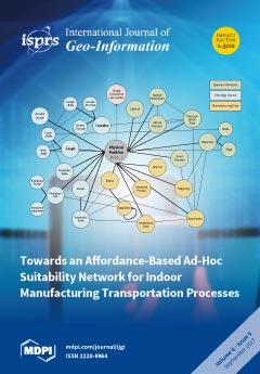
We developed an approach for optimal indoor transportation of assets based on an ad-hoc suitability network. The approach tailors indoor transportation towards the ‘needs’ of production assets, as it considers objects’ affordances and spatial suitability in respect to productivity and efficiency. We realized a Linked Data approach as a spatial graph database, comprising manufacturing data on an application ontology, linking the indoor manufacturing environment and a graph-based network. For optimal transportation, an ad-hoc network is generated when a path needs to be found and transportation necessities and disturbances present in the environment are considered at the time of the path calculation. The results of the optimal transportation with respect to affordances of the manufacturing environment based on linked data and an evaluation of computational complexity are presented in detail. View the paper
  • Issues are regarded as officially published after their release is announced to the table of contents alert mailing list .
  • You may sign up for email alerts to receive table of contents of newly released issues.
  • PDF is the official format for papers published in both, html and pdf forms. To view the papers in pdf format, click on the "PDF Full-text" link, and use the free Adobe Reader to open them.

Articles (32)

  • Article
  • Open Access
18 Citations
6,149 Views
15 Pages

Citizens are increasingly sharing their location and movements through “check-ins” on location based social networks (LBSNs). These services are collecting unprecedented amounts of big data that can be used to study how we travel and interact with ou...

  • Article
  • Open Access
131 Citations
10,732 Views
15 Pages

This study aims to develop a method to estimate chlorophyll-a concentration (Chla) in tropical freshwater lake waters using in situ data of Chla, water reflectance, and concurrent Sentinel 2A MSI imagery (S2A) over Lake Ba Be, a Ramsar site and the...

  • Article
  • Open Access
11 Citations
5,126 Views
21 Pages

The current methods that use hyperspectral remote sensing imagery to extract and monitor marine oil spills are quite popular. However, the automatic extraction of endmembers from hyperspectral imagery remains a challenge. This paper proposes a data f...

  • Article
  • Open Access
31 Citations
7,559 Views
16 Pages

Topographic Correction to Landsat Imagery through Slope Classification by Applying the SCS + C Method in Mountainous Forest Areas

  • René Vázquez-Jiménez,
  • Raúl Romero-Calcerrada,
  • Rocío N. Ramos-Bernal,
  • Patricia Arrogante-Funes and
  • Carlos J. Novillo

The aim of the topographic normalization of remotely sensed imagery is to reduce reflectance variability caused by steep terrain and thus improve further processing of images. A process of topographic correction was applied to Landsat imagery in a mo...

  • Article
  • Open Access
29 Citations
9,344 Views
20 Pages

In the era of big data, Internet-based geospatial information services such as various LBS apps are deployed everywhere, followed by an increasing number of queries against the massive spatial data. As a result, the traditional relational spatial dat...

  • Article
  • Open Access
157 Citations
12,559 Views
21 Pages

Spatial–temporal analysis of land-use/land-cover (LULC) change as well as the monitoring and modeling of urban expansion are essential for the planning and management of urban environments. Such environments reflect the economic conditions and qualit...

  • Article
  • Open Access
11 Citations
5,421 Views
25 Pages

The Governance Landscape of Geospatial E-Services—The Belgian Case

  • Maxim Chantillon,
  • Joep Crompvoets and
  • Vassilios Peristeras

Geospatial data and geospatial e-services require governance and coordination between different governmental organisations. This article aims to understand what governance, and specifically what coordination, is used in Belgium for geospatial e-servi...

  • Article
  • Open Access
14 Citations
8,125 Views
20 Pages

With the increasing use of geographical information and technology in a variety of knowledge domains and disciplines, the need to discover and access suitable geospatial data is imperative. Most spatial data infrastructures (SDI) provide geoportals a...

  • Article
  • Open Access
40 Citations
6,202 Views
16 Pages

Spatial Modelling and Prediction Assessment of Soil Iron Using Kriging Interpolation with pH as Auxiliary Information

  • Panagiotis Tziachris,
  • Eirini Metaxa,
  • Frantzis Papadopoulos and
  • Maria Papadopoulou

In this study, different interpolation techniques are presented, assessed, and compared for the estimation of soil iron (Fe) contents in locations where observations were not available. Initially, 400 soil samples from the Kozani area, which is near...

  • Article
  • Open Access
5 Citations
5,541 Views
16 Pages

Mapping Parallels between Outdoor Urban Environments and Indoor Manufacturing Environments

  • Stefan Schabus,
  • Johannes Scholz and
  • Thomas J. Lampoltshammer

The concepts of “Smart Cities” and “Smart Manufacturing” are different data-driven domains, although both rely on intelligent information technology and data analysis. With the application of linked data and affordance-based approaches, both domains...

of 4

Get Alerted

Add your email address to receive forthcoming issues of this journal.

XFacebookLinkedIn
ISPRS Int. J. Geo-Inf. - ISSN 2220-9964