Next Issue
Volume 10, January
Previous Issue
Volume 9, November


J. Mar. Sci. Eng., Volume 9, Issue 12 (December 2021) – 151 articles

Cover Story (view full-size image): 
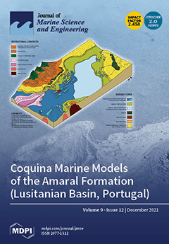
The different depositional contexts for the Amaral Formation (Lusitanian Basin, Portugal) enabled the distinction of three sectors: lagoon, lagoon-barrier, and marine-distal. The integration of the evolutionary taphonomic analysis with multiscale properties allowed the classification 84 petrofacies. The relationship between the structural context, the systems tracts, the diversity of the fossil record, the classification of taphofacies and petrofacies, and the understanding of vertical and lateral variations of the sediments´ deposition within the unit support the construction of geological and theoretical models for coquina deposits. These models support prediction of the spatial distribution of facies in other coquina analogous hydrocarbon reservoirs. View this paper.
  • Issues are regarded as officially published after their release is announced to the table of contents alert mailing list.
  • You may sign up for e-mail alerts to receive table of contents of newly released issues.
  • PDF is the official format for papers published in both, html and pdf forms. To view the papers in pdf format, click on the "PDF Full-text" link, and use the free Adobe Reader to open them.
Order results
Result details
Section
Select all
Export citation of selected articles as:
16 pages, 8124 KiB  
Article
Potential Effect of the Intrusion of the Kuroshio Current into the South China Sea on Catches of Japanese Eel (Anguilla Japonica) in the South China Sea and Taiwan Strait
by Ching-Hsien Ho, Long-Jing Wu, Zhen Lu, Bo-Yi Lu and Yang-Chi Lan
J. Mar. Sci. Eng. 2021, 9(12), 1465; https://doi.org/10.3390/jmse9121465 - 20 Dec 2021
Cited by 1 | Viewed by 3067
Abstract
This study examined the effect of the intrusion of the Kuroshio Current (KC) into the South China Sea (SCS) and the Taiwan Strait (TS) (SCS–TS region) on changes in catches of larval A. japonica in the traditional fishing ground waters of Gaoping near [...] Read more.
This study examined the effect of the intrusion of the Kuroshio Current (KC) into the South China Sea (SCS) and the Taiwan Strait (TS) (SCS–TS region) on changes in catches of larval A. japonica in the traditional fishing ground waters of Gaoping near southwestern Taiwan in the SCS–TS region. First, the oceanic environment and recruitment trends from 1967 to 2019 were investigated based on secondary data. Then, field surveys were conducted to obtain primary data regarding the intrusion of the KC into the SCS, as well as the changes in the fishing sites and catches of A. japonica in the fall and winter of 2014–2015. Hence, the association between oceanic conditions and the number of A. japonica migrating into the SCS–TS region was explored. From 1967 to 2019, the recruitment proportion in the fishing grounds that formed due to the Kuroshio Branch Current (PKSBC) fluctuated significantly. Overall, positive values were observed for the Oceanic Niño Index for each year with a PKSBC > 50%, corresponding to El Niño conditions. In each year with a PKSBC > 70%, a looping path and a warm–core eddy appeared. Full article
(This article belongs to the Special Issue Interannual Variation of Planktonic Species and Fish Populations)
Show Figures

Figure 1

15 pages, 21578 KiB  
Article
CLTS-Net: A More Accurate and Universal Method for the Long-Term Prediction of Significant Wave Height
by Shuang Li, Peng Hao, Chengcheng Yu and Gengkun Wu
J. Mar. Sci. Eng. 2021, 9(12), 1464; https://doi.org/10.3390/jmse9121464 - 20 Dec 2021
Cited by 8 | Viewed by 2549
Abstract
Significant wave height (SWH) prediction plays an important role in marine engineering areas such as fishery, exploration, power generation, and ocean transportation. For long-term forecasting of a specific location, classical numerical model wave height forecasting methods often require detailed climatic data and incur [...] Read more.
Significant wave height (SWH) prediction plays an important role in marine engineering areas such as fishery, exploration, power generation, and ocean transportation. For long-term forecasting of a specific location, classical numerical model wave height forecasting methods often require detailed climatic data and incur considerable calculation costs, which are often impractical in emergencies. In addition, how to capture and use the dynamic correlation between multiple variables is also a major research challenge for multivariate SWH prediction. To explore a new method for predicting SWH, this paper proposes a deep neural network model for multivariate time series SWH prediction—namely, CLTS-Net. In this study, the sea surface wind and wave height in the ERA5 dataset of the relevant points P1, P2, and P3 from 2011 to 2018 were used as input information to train the model and evaluate the model’s SWH prediction performance. The results show that the correlation coefficients (R) of CLTS-Net are 0.99 and 0.99, respectively, in the 24 h and 48 h SWH forecasts at point P1 along the coast. Compared with the current mainstream artificial intelligence-based SWH solutions, it is much higher than ANN (0.79, 0.70), RNN (0.82, 0.83), LSTM (0.93, 0.91), and Bi-LSTM (0.95, 0.94). Point P3 is located in the deep sea. In the 24 h and 48 h SWH forecasts, the R of CLTS-Net is 0.97 and 0.98, respectively, which are much higher than ANN (0.71, 0.72), RNN (0.85, 0.78), LSTM (0.85, 0.78), and Bi-LSTM (0.93, 0.93). Especially in the 72 h SWH forecast, when other methods have too large errors and have lost their practical application value, the R of CLTS-Net at P1, P2, and P3 can still reach 0.81, 0.71, and 0.98. The results also show that CLTS-Net can capture the short-term and long-term dependencies of data, so as to accurately predict long-term SWH, and has wide applicability in different sea areas. Full article
(This article belongs to the Special Issue Models of Ocean-Wave-Atmosphere Interaction Processes)
Show Figures

Figure 1

21 pages, 11298 KiB  
Article
A High-Resolution Numerical Model of the North Aegean Sea Aimed at Climatological Studies
by Ioannis G. Mamoutos, Emmanuel Potiris, Elina Tragou, Vassilis Zervakis and Stamatios Petalas
J. Mar. Sci. Eng. 2021, 9(12), 1463; https://doi.org/10.3390/jmse9121463 - 20 Dec 2021
Cited by 4 | Viewed by 3186
Abstract
A new, high-resolution model for the northern part of the Aegean Sea, aimed primarily at climatological research (relaxation and data assimilation-free climate simulations), is hereby presented, along with the results of a 28-year-long simulation covering the period from 1986 to 2013. The model [...] Read more.
A new, high-resolution model for the northern part of the Aegean Sea, aimed primarily at climatological research (relaxation and data assimilation-free climate simulations), is hereby presented, along with the results of a 28-year-long simulation covering the period from 1986 to 2013. The model applied is the Regional Ocean Modelling System (ROMS). A significant improvement over previous models of the Aegean introduced in this work is the replacement of parameterizations of the Dardanelles exchange by a fully three-dimensional simulation of the flow in the Strait. The incorporation of part of the Marmara Sea in the model domain enables the interaction with other regional climate simulations, thus allowing climatic variability of the exchange of the Mediterranean and Black Seas. An extensive validation is carried out comparing the model output with all the available observations from several different platforms, i.e., satellite sea surface temperature and height, T/S profiles from R/V ships, and HF radar surface currents velocity. We focus on the model’s ability to reproduce, to some extent, the distinct thermohaline features and circulation patterns that characterize this specific area of the Mediterranean Sea. Our findings, after comparing simulation results with all the available observations, revealed the model’s sufficiency to simulate very adequately the complex hydrology of the North Aegean Sea, and the model’s ability to reproduce incidents of deep-water formation that took place in the region in previous decades during the Eastern Mediterranean Transient (EMT). Full article
(This article belongs to the Special Issue Hydrodynamic Circulation Modelling in the Marine Environment)
Show Figures

Figure 1

19 pages, 9564 KiB  
Article
Morphological Traits and Capture Depth of the Norwegian Skate (Dipturus nidarosiensis (Storm, 1881)) from Two Mediterranean Populations
by Pierluigi Carbonara, Andrea Bellodi, Walter Zupa, Marilena Donnaloia, Palma Gaudio, Cosmidano Neglia and Maria Cristina Follesa
J. Mar. Sci. Eng. 2021, 9(12), 1462; https://doi.org/10.3390/jmse9121462 - 20 Dec 2021
Cited by 4 | Viewed by 2897
Abstract
The Norwegian skate Dipturus nidarosiensis (Storm, 1881) has only recently been recorded in the western-central Mediterranean Sea. It was hypothesized a more ancient presence of the species, which has not been detected due to a misidentification with other species of the same genus. [...] Read more.
The Norwegian skate Dipturus nidarosiensis (Storm, 1881) has only recently been recorded in the western-central Mediterranean Sea. It was hypothesized a more ancient presence of the species, which has not been detected due to a misidentification with other species of the same genus. This situation could lead to underestimate the risk of a dramatic decline of the spawning stock. In the IUCN Red List, the species is listed as near threatened and considered rare in both the northeast Atlantic and the Mediterranean areas. In the Mediterranean Sea, Norwegian skates were repeatedly caught mostly in two areas between 2005 and 2020: Sardinia Seas and Adriatic-Ionian Seas. In total, 58 specimens were caught, and 28 morphological length measurements were taken on all specimens. The Canonical Discriminant Analysis proved the presence of significant differences only for assemblages made on the basis of the specimen’s area of capture, but not on the basis of sex or ontogenetic development. This analysis could be the first step to highlight the differences between the populations of Norwegian skate in the Mediterranean basin. Moreover, a preliminary analysis of depth of capture was performed as a first step to study this species vertical distribution. Full article
(This article belongs to the Special Issue Deep-Sea Ecosystem Management)
Show Figures

Figure 1

21 pages, 24372 KiB  
Article
A Projection Method for the Estimation of Error Covariance Matrices for Variational Data Assimilation in Ocean Modelling
by Jose M. Gonzalez-Ondina, Lewis Sampson and Georgy I. Shapiro
J. Mar. Sci. Eng. 2021, 9(12), 1461; https://doi.org/10.3390/jmse9121461 - 20 Dec 2021
Cited by 1 | Viewed by 3050
Abstract
Data assimilation methods are an invaluable tool for operational ocean models. These methods are often based on a variational approach and require the knowledge of the spatial covariances of the background errors (differences between the numerical model and the true values) and the [...] Read more.
Data assimilation methods are an invaluable tool for operational ocean models. These methods are often based on a variational approach and require the knowledge of the spatial covariances of the background errors (differences between the numerical model and the true values) and the observation errors (differences between true and measured values). Since the true values are never known in practice, the error covariance matrices containing values of the covariance functions at different locations, are estimated approximately. Several methods have been devised to compute these matrices, one of the most widely used is the one developed by Hollingsworth and Lönnberg (H-L). This method requires to bin (combine) the data points separated by similar distances, compute covariances in each bin and then to find a best fit covariance function. While being a helpful tool, the H-L method has its limitations. We have developed a new mathematical method for computing the background and observation error covariance functions and therefore the error covariance matrices. The method uses functional analysis which allows to overcome some shortcomings of the H-L method, for example, the assumption of statistical isotropy. It also eliminates the intermediate steps used in the H-L method such as binning the innovations (differences between observations and the model), and the computation of innovation covariances for each bin, before the best-fit curve can be found. We show that the new method works in situations where the standard H-L method experiences difficulties, especially when observations are scarce. It gives a better estimate than the H-L in a synthetic idealised case where the true covariance function is known. We also demonstrate that in many cases the new method allows to use the separable convolution mathematical algorithm to increase the computational speed significantly, up to an order of magnitude. The Projection Method (PROM) also allows computing 2D and 3D covariance functions in addition to the standard 1D case. Full article
(This article belongs to the Special Issue Technological Oceanography)
Show Figures

Figure 1

19 pages, 64275 KiB  
Article
A Fine Grid Tide-Wave-Ocean Circulation Coupled Model for the Yellow Sea: Comparison of Turbulence Closure Schemes in Reproducing Temperature Distributions
by Youngjin Choi, Youngmin Park, Minbum Choi, Kyung Tae Jung and Kyeong Ok Kim
J. Mar. Sci. Eng. 2021, 9(12), 1460; https://doi.org/10.3390/jmse9121460 - 20 Dec 2021
Cited by 3 | Viewed by 2720
Abstract
The performance of three turbulence closure schemes (TCSs), the generic length scale scheme (GLS), the Mellor–Yamada 2.5 scheme (MY2.5) and the K-profile parameterization scheme (KPP), embedded in the ocean model ROMS, was compared with attention to the reproduction of summertime temperature distribution in [...] Read more.
The performance of three turbulence closure schemes (TCSs), the generic length scale scheme (GLS), the Mellor–Yamada 2.5 scheme (MY2.5) and the K-profile parameterization scheme (KPP), embedded in the ocean model ROMS, was compared with attention to the reproduction of summertime temperature distribution in the Yellow Sea. The ROMS model has a horizontal resolution of 1/30° and 30 vertical sigma layers. For model validation, root mean square errors were checked, comparing model results with wave and temperature buoy data as well as tidal station data supplied by various organizations within the Republic of Korea. Computed temperature and vertical temperature diffusion coefficients were mainly compared along Lines A (36° N) and B (125° E) crossing the central Yellow Sea, Lines C (32° N) and E (34° N) passing over the Yangtze Bank and Line D off the Taean Peninsula. Calculations showed that GLS and MY2.5 produced vertical mixing stronger than KPP in both the surface and bottom layers, but the overall results were reasonably close to each other. The lack of observational data was a hindrance in comparing the detailed performance between the TCSs. However, it was noted that the simulation capability of cold patches in the tidal mixing front can be useful in identifying the better performing turbulence closure scheme. GLS and MY2.5 clearly produced the cold patch located near the western end of Line E (122° E–122.3° E), while KPP hardly produced its presence. Similar results were obtained along Line D but with a less pronounced tidal mixing front. Along Line C, GLS and MY2.5 produced a cold patch on the western slope of the Yellow Sea, the presence of which had never been reported. Additional measurements near 125° E–126° E of Line C and along the channel off the Taean Peninsula (Line D) are recommended to ensure the relative performance superiority between the TCSs. Full article
Show Figures

Figure 1

16 pages, 20887 KiB  
Article
RANS Prediction of Wave-Induced Ship Motions, and Steady Wave Forces and Moments in Regular Waves
by Qingze Gao, Lifei Song and Jianxi Yao
J. Mar. Sci. Eng. 2021, 9(12), 1459; https://doi.org/10.3390/jmse9121459 - 20 Dec 2021
Cited by 13 | Viewed by 2761
Abstract
The wave-induced motions, and steady wave forces and moments for the oil tanker KVLCC2 in regular head and oblique waves are numerically predicted by using the expanded RANS solver based on OpenFOAM. New modules of wave boundary condition are programed into OpenFOAM for [...] Read more.
The wave-induced motions, and steady wave forces and moments for the oil tanker KVLCC2 in regular head and oblique waves are numerically predicted by using the expanded RANS solver based on OpenFOAM. New modules of wave boundary condition are programed into OpenFOAM for this purpose. In the present consideration, the steady wave forces and moments include not only the contribution of hydrodynamic effects but also the contribution of the inertial effects due to wave-induced ship motions. The computed results show that the contribution of the inertial effects due to heave and pitch in head waves is non-negligible when wave-induced motions are of large amplitude, for example, in long waves. The influence of wave amplitude on added resistance in head waves is also analyzed. The dimensionless added resistance becomes smaller with the increasing wave amplitude, indicating that added resistance is not proportional to the square of wave amplitude. However, wave amplitude seems not to affect the heave and pitch RAOs significantly. The steady wave surge force, sway force and yaw moment for the KVLCC2 with zero speed in oblique waves are computed as well. The present RANS results are compared with available experimental data, and very good agreements are found between them. Full article
(This article belongs to the Special Issue Ship Dynamics and Hydrodynamics)
Show Figures

Figure 1

16 pages, 4540 KiB  
Article
Navigation Situation Clustering Model of Human-Operated Ships for Maritime Autonomous Surface Ship Collision Avoidance Tests
by Taewoong Hwang and Ik-Hyun Youn
J. Mar. Sci. Eng. 2021, 9(12), 1458; https://doi.org/10.3390/jmse9121458 - 20 Dec 2021
Cited by 12 | Viewed by 2542
Abstract
The collision avoidance system is one of the core systems of MASS (Maritime Autonomous Surface Ships). The collision avoidance system was validated using scenario-based experiments. However, the scenarios for the validation were designed based on COLREG (International Regulations for Preventing Collisions at Sea) [...] Read more.
The collision avoidance system is one of the core systems of MASS (Maritime Autonomous Surface Ships). The collision avoidance system was validated using scenario-based experiments. However, the scenarios for the validation were designed based on COLREG (International Regulations for Preventing Collisions at Sea) or are arbitrary. Therefore, the purpose of this study is to identify and systematize objective navigation situation scenarios for the validation of autonomous ship collision avoidance algorithms. A data-driven approach was applied to collect 12-month Automatic Identification System data in the west sea of Korea, to extract the ship’s trajectory, and to hierarchically cluster the data according to navigation situations. Consequently, we obtained the hierarchy of navigation situations and the frequency of each navigation situation for ships that sailed the west coast of Korea during one year. The results are expected to be applied to develop a collision avoidance test environment for MASS. Full article
(This article belongs to the Special Issue Maritime Autonomous Vessels)
Show Figures

Figure 1

15 pages, 5952 KiB  
Article
Spatial Analysis of the Ship Gas Emission Inventory in the Port of Busan Using Bottom-Up Approach Based on AIS Data
by Donghan Woo and Namkyun Im
J. Mar. Sci. Eng. 2021, 9(12), 1457; https://doi.org/10.3390/jmse9121457 - 20 Dec 2021
Cited by 8 | Viewed by 3338
Abstract
Dense hub port-cities have been suffering from ship gas emissions causing atmospheric pollution and a threat to the health of coastal residents. To control ship gas emissions, many regulations have been established internationally. Analyses of ship gas emission inventories are essential to quantify [...] Read more.
Dense hub port-cities have been suffering from ship gas emissions causing atmospheric pollution and a threat to the health of coastal residents. To control ship gas emissions, many regulations have been established internationally. Analyses of ship gas emission inventories are essential to quantify mass and track emission changes over time in a given geographical area. Based on the gas emissions inventory, applicable regulations such as Emission Control Area (ECA) realization and Vessel Speed Reduction (VSR) may be established. The ship gas emission inventory (CO2, CO, NOx, SOx and PM) from the Busan Port (BP), including the North Port (NP) and Gamcheon Dadae-po Port (GDP), which is the biggest port in the Republic of Korea and which is also surrounded by residential, commercial, and industrial areas, were spatially analyzed. To calculate geographical ship gas emissions in real-time, this study introduces a bottom-up methodology using Automatic Identification System (AIS) data. According to the geographical density analysis of the gas emissions inventory, this study highlights that about 35% of the annual ship gas emissions of BP in 2019 were concentrated in the passageway to NP because of high ship speeds when leaving or arriving at the port. To protect the health of coastal residents, ship speed limit regulations along the passageway should be revised based on our spatial analysis results. The spatial analysis of the ship gas emission inventory in BP will be useful basic data for properly evaluating the local gas emission state on newly established or revised environmental regulations for BP. Full article
(This article belongs to the Section Ocean Engineering)
Show Figures

Figure 1

22 pages, 11002 KiB  
Article
Natural and Anthropogenic Factors Shaping the Shoreline of Klaipėda, Lithuania
by Vitalijus Kondrat, Ilona Šakurova, Eglė Baltranaitė and Loreta Kelpšaitė-Rimkienė
J. Mar. Sci. Eng. 2021, 9(12), 1456; https://doi.org/10.3390/jmse9121456 - 20 Dec 2021
Cited by 8 | Viewed by 2696
Abstract
Port of Klaipėda is situated in a complex hydrological system, between the Curonian Lagoon and the Baltic Sea, at the Klaipėda strait in the South-Eastern part of the Baltic Sea. It has almost 300 m of jetties separating the Curonian Spit and the [...] Read more.
Port of Klaipėda is situated in a complex hydrological system, between the Curonian Lagoon and the Baltic Sea, at the Klaipėda strait in the South-Eastern part of the Baltic Sea. It has almost 300 m of jetties separating the Curonian Spit and the mainland coast, interrupting the main path of sediment transport through the South-Eastern coast of the Baltic Sea. Due to the Port of Klaipėda reconstruction in 2002 and the beach nourishment project, which was started in 2014, the shoreline position change tendency was observed. Shoreline position measurements of various periods can be used to derive quantitative estimates of coastal process directions and intensities. These data can be used to further our understanding of the scale and timing of shoreline changes in a geological and socio-economic context. This study analyzes long- and short-term shoreline position changes before and after the Port of Klaipėda reconstruction in 2002. Positions of historical shorelines from various sources were used, and the rates (EPR, NSM, and SCE) of shoreline changes have been assessed using the Digital Shoreline Analysis System (DSAS). An extension of ArcGIS K-means clustering was applied for shoreline classification into different coastal dynamic stretches. Coastal development has changed in the long-term (1984–2019) perspective: the eroded coast length increased from 1.5 to 4.2 km in the last decades. Coastal accumulation processes have been restored by the Port of Klaipėda executing the coastal zone nourishment project in 2014. Full article
(This article belongs to the Special Issue Sediment Dynamics in Artificial Nourishments)
Show Figures

Figure 1

20 pages, 35574 KiB  
Article
Relationship of Spatial Phytoplankton Variability during Spring with Eutrophic Inshore and Oligotrophic Offshore Waters in the East Sea, Including Dokdo, Korea
by Minji Lee, Hyejoo Ro, Yun-Bae Kim, Chan-Hong Park and Seung-Ho Baek
J. Mar. Sci. Eng. 2021, 9(12), 1455; https://doi.org/10.3390/jmse9121455 - 20 Dec 2021
Cited by 4 | Viewed by 2485
Abstract
The area near the subpolar front of the East Sea has high primary productivity during the spring season. We conducted two surveys, one in early spring and another in late spring, to assess environmental factors that influence phytoplankton community structure during these times. [...] Read more.
The area near the subpolar front of the East Sea has high primary productivity during the spring season. We conducted two surveys, one in early spring and another in late spring, to assess environmental factors that influence phytoplankton community structure during these times. During early spring, vertical mixing supplied abundant nutrients to the surface. Due to the well-mixed water column, there were high nutrient levels, but total phytoplankton abundances and diversity were relatively low and were dominated by the diatom Chaetoceros spp. During late spring, the water column gradually stratified, with relatively high levels of nutrients in the surface layers near the coastal areas. Phytoplankton abundance and diversity at that time were higher, and there were diatoms (Pseudo-nitzschia spp. and Chaetoceros spp.), cryptophytes, and small flagellates. Pseudo-nitzschia spp. were especially abundant in re-sampled areas. The presence of a stratified and stable water mass and sufficient nitrate led to high phytoplankton growth, even in the open sea during late spring. These findings provide a better understanding of how phytoplankton population dynamics in the East Sea depend on water column stability during both early and late spring seasons. Full article
Show Figures

Figure 1

15 pages, 23669 KiB  
Article
A Novel Strength Model for Cement Marine Clay Based on the Mechanical-Chemical Coupling Behavior
by Liyang Xu, Zihai Yan, Jiajia Yan, Qiliang Xu, Jiancai Zhu and Riqing Xu
J. Mar. Sci. Eng. 2021, 9(12), 1454; https://doi.org/10.3390/jmse9121454 - 19 Dec 2021
Cited by 3 | Viewed by 2370
Abstract
Crucial mechanical-chemical (MC) interactions occur during the cement hydration process in cement marine clay; however, the role of such an important element of the resulting strength has been subject to less investigation, particularly from the theoretical perspective. To overcome this scientific gap, an [...] Read more.
Crucial mechanical-chemical (MC) interactions occur during the cement hydration process in cement marine clay; however, the role of such an important element of the resulting strength has been subject to less investigation, particularly from the theoretical perspective. To overcome this scientific gap, an efficient strength-based model accounting for the coupled MC processes is proposed here. Based on the analysis of the cement hydration mechanism, the porosity was chosen as the main factor to characterize the influence of the MC interactions on the overall response. To verify the accuracy of the MC model, the unconfined compressive strength (UCS) experiment was conducted for the cement marine clay samples, and the corresponding simulation model was constructed using COMSOL multiphysics®. In addition, a comparison between the predicted results by the existing three strength models and the proposed MC model was performed. Subsequently, the sensitivity analysis and identification of mechanical parameters were carefully carried out. The obtained results show that the UCS strength for Taizhou clay ranges from 10.21 kPa to 354.2 kPa as the cement content increases from 10% to 20%, and the curing time varies from 3 days to 28 days. The mechanical parameters in the MC model can be obtained according to the porosity level. A reasonably good agreement between the UCS strength results of simulations and the experimentally observed data is reported. Additionally, the predicted UCS strength results by the MC model demonstrate the best correspondence with the measured values, indicating the high efficacy of the established model. Full article
(This article belongs to the Section Geological Oceanography)
Show Figures

Figure 1

15 pages, 4692 KiB  
Article
Factors Affecting Soil Organic Carbon Content between Natural and Reclaimed Sites in Rudong Coast, Jiangsu Province, China
by Peipei Yang, Zhou Hu and Qiang Shu
J. Mar. Sci. Eng. 2021, 9(12), 1453; https://doi.org/10.3390/jmse9121453 - 18 Dec 2021
Cited by 8 | Viewed by 2574
Abstract
The physical and chemical properties of coastal soils in China have changed due to the development of reclaimed stretches of coastline, which has a significant impact on the dynamics of organic carbon (OC) in the soils. We evaluated changes in the physical and [...] Read more.
The physical and chemical properties of coastal soils in China have changed due to the development of reclaimed stretches of coastline, which has a significant impact on the dynamics of organic carbon (OC) in the soils. We evaluated changes in the physical and chemical properties of soils in both a natural area and a reclaimed area along the coast of Rudong County, China, as well as the effects that these changes had on the OC content of the soils. A partial least squares regression (PLSR) model was used to determine which factors are most important for driving changes in soil OC at four sites from each area. According to dominant vegetation types, there were significant differences in soil physical and chemical properties and OC content between the reclaimed area and natural coastal area. The mean grain size and pH increased gradually with depth, and values were highest in reclaimed areas. Mean total N (TN), P, and S, salinity, water content, and soil OC were highest in natural areas and decreased with depth. The PLSR model determined that TN, silt content, and sand content were the most important factors affecting soil OC in the reclaimed area, whereas TN, clay content, and water content were important factors affecting soil OC dynamics in the natural coastal areas. This study provides important reference data for correctly assessing the role and status of coastal areas in the global carbon cycle. Full article
(This article belongs to the Special Issue Ocean Engineering and Oceanography for Carbon Neutralization)
Show Figures

Figure 1

22 pages, 7522 KiB  
Article
Numerical Study on Spatio-Temporal Distribution of Cold Front-Induced Waves along the Southeastern Coast of China
by Pinyan Xu, Yunfei Du, Qiao Zheng, Zhumei Che and Jicai Zhang
J. Mar. Sci. Eng. 2021, 9(12), 1452; https://doi.org/10.3390/jmse9121452 - 18 Dec 2021
Cited by 4 | Viewed by 1936
Abstract
Cold fronts, as one of the most frequent extreme weather events, can induce significant waves on the sea. This work analyzes the spatial and temporal variations in cold front events, especially the characteristics of wind directions during cold fronts in the East China [...] Read more.
Cold fronts, as one of the most frequent extreme weather events, can induce significant waves on the sea. This work analyzes the spatial and temporal variations in cold front events, especially the characteristics of wind directions during cold fronts in the East China Sea (ECS). The SWAN (Simulating Waves Nearshore) model is applied to simulating the waves induced by cold fronts. To calibrate the model, two typical cold front events were selected to simulate the corresponding waves in the ECS. The results indicate that the data misfit between the observed and modeled significant wave heights (SWH) is within a reasonable range. Idealized sensitivity experiments were then designed in order to analyze and discuss the responses of ocean waves to wind direction, swell distribution, maximum of significant wave heights (MSWH), and time lag during the cold fronts. The results show that the average MSWH in the ECS decreases monotonically with the deflection of wind direction from north-east to north-west, while specific nearshore sites do not conform to this pattern due to topography. The time series of SWH indicate that the action of the swells leads to a prolongation of the duration of catastrophic waves. This work investigates the temporal and spatial distribution characteristics of cold front-induced wind wave fields in offshore Zhejiang, which has important value for the study of the impact of cold fronts on the ocean as well as disaster prevention and mitigation efforts. Full article
(This article belongs to the Section Marine Hazards)
Show Figures

Figure 1

24 pages, 6151 KiB  
Article
Six-DOF CFD Simulations of Underwater Vehicle Operating Underwater Turning Maneuvers
by Kunyu Han, Xide Cheng, Zuyuan Liu, Chenran Huang, Haichao Chang, Jianxi Yao and Kangli Tan
J. Mar. Sci. Eng. 2021, 9(12), 1451; https://doi.org/10.3390/jmse9121451 - 18 Dec 2021
Cited by 9 | Viewed by 3986
Abstract
Maneuverability, which is closely related to operational performance and safety, is one of the important hydrodynamic properties of an underwater vehicle (UV), and its accurate prediction is essential for preliminary design. The purpose of this study is to analyze the turning ability of [...] Read more.
Maneuverability, which is closely related to operational performance and safety, is one of the important hydrodynamic properties of an underwater vehicle (UV), and its accurate prediction is essential for preliminary design. The purpose of this study is to analyze the turning ability of a UV while rising or submerging; the computational fluid dynamics (CFD) method was used to numerically predict the six-DOF self-propelled maneuvers of submarine model BB2, including steady turning maneuvers and space spiral maneuvers. In this study, the overset mesh method was used to deal with multi-body motion, the body force method was used to describe the thrust distribution of the propeller at the model scale, and the numerical prediction also included the dynamic deflection of the control planes, where the command was issued by the autopilot. Then, this study used the published model test results of the tank to verify the effectiveness of the CFD prediction of steady turning maneuvers, and the prediction of space spiral maneuvers was carried out on this basis. The numerical results show that the turning motion has a great influence on the depth and pitch attitude of the submarine, and a “stern heavier” phenomenon occurs to a submarine after steering. The underwater turning of a submarine can not only reduce the speed to brake but also limit the dangerous depth. The conclusion is of certain reference significance for submarine emergency maneuvers. Full article
(This article belongs to the Special Issue Ship Hydrodynamics and Manoeuvring)
Show Figures

Figure 1

20 pages, 3698 KiB  
Article
A Power Demand Analytical Model of Self-Propelled Vessels
by Javier Zamora
J. Mar. Sci. Eng. 2021, 9(12), 1450; https://doi.org/10.3390/jmse9121450 - 18 Dec 2021
Viewed by 2386
Abstract
The article herein presents a closed-form mathematical equation by which it is possible to estimate the propulsion power demand of ships as a function of the propeller parameters and total Resistance. The validation of the derived model is conducted by use of the [...] Read more.
The article herein presents a closed-form mathematical equation by which it is possible to estimate the propulsion power demand of ships as a function of the propeller parameters and total Resistance. The validation of the derived model is conducted by use of the Series 60 Model data and of the Korea Research Institute of Ships and Ocean Engineering (KRISO) Very Large Crude-oil Carrier 2 (KVLCC2) data. In all the cases tested, the derived model explained more than 99.9% of the data variability. Furthermore, the paper describes a practical method for quantifying changes in hull and propeller performance and provides an application example. Full article
Show Figures

Figure 1

10 pages, 3355 KiB  
Article
A Study on the Estimation of Source Bearing in an ASA Wedge: Diminishing the Estimation Error Caused by Horizontal Refraction
by Jianbo Zhou, Jun Tang and Yixin Yang
J. Mar. Sci. Eng. 2021, 9(12), 1449; https://doi.org/10.3390/jmse9121449 - 18 Dec 2021
Cited by 3 | Viewed by 1857
Abstract
The performance of warping transformation in diminishing the error in underwater source-bearing estimation, caused by horizontal refraction effects (also named 3D effects), is studied. First, the capability of warping transformation for separating the normal modes, as well as their direct and horizontally refracted [...] Read more.
The performance of warping transformation in diminishing the error in underwater source-bearing estimation, caused by horizontal refraction effects (also named 3D effects), is studied. First, the capability of warping transformation for separating the normal modes, as well as their direct and horizontally refracted paths, in a standard Acoustical Society of America (ASA) wedge is demonstrated. Second, the error values for source bearing estimation in three different manners, i.e., using the full signal, using its component corresponding to the first mode, and using the component of the latter corresponding only to the direct path are compared for the same wedge case. The results show that the estimation error can be significantly reduced by beamforming, with only the first mode, or using the direct path of the first mode in cases where there exists a horizontally refracted path of the first mode. Full article
Show Figures

Figure 1

21 pages, 3627 KiB  
Article
Investigation on Improving Strategies for Navigation Safety in the Offshore Wind Farm in Taiwan Strait
by Yuh-Ming Tsai and Cherng-Yuan Lin
J. Mar. Sci. Eng. 2021, 9(12), 1448; https://doi.org/10.3390/jmse9121448 - 17 Dec 2021
Cited by 5 | Viewed by 3914
Abstract
The Taiwan Strait, to the west of Taiwan, is rich in wind energy resources and has the greatest offshore wind power potential in the world. Therefore, Taiwan has been actively expanding its offshore wind power industry in this area in recent years and [...] Read more.
The Taiwan Strait, to the west of Taiwan, is rich in wind energy resources and has the greatest offshore wind power potential in the world. Therefore, Taiwan has been actively expanding its offshore wind power industry in this area in recent years and expects to achieve the total installed capacity to 15.6 GW by 2035. Due to the large vessel traffic flow in Western Taiwan’s sea area, wind farms will inevitably reduce the navigable space and shadow some existing marine aids to navigation, thus worsening navigation safety. An approach using a fault tree analysis was used to carry out analysis of collision risk between ship-to-ship and ship-to-turbine. The vessel density distribution and traffic flow within the open sea of offshore wind farms would further increase to curtail the available navigable space. The shadowing effects along navigation channels would thereafter be worsened to raise the probability of collision risks in the sea. The results of the fault tree analysis revealed that if the ship is out of control, the time allowed to provide assistance is rather short, leading to the increase of collision risk extent between ships and wind turbines. Moreover, the study also found that unfit functions of the Vessel Traffic Service System and navigation aids and frequently and arbitrarily crossing the navigation channel of fishery vessels are the main causes of ship collisions. In order to effectively improve the navigation safety, competitive strategies for navigation safety are investigated and evaluated in this study. These strategies include making a complete plan for utilizing the whole sea, integrating the offshore vessel traffic service and management system, providing remote pilotage services, and building salvage vessels. The above promising strategies would enhance the navigation safety within the open sea. Collision risk might occur once marine accident occurs and no salvage vessel is available. Full article
(This article belongs to the Topic Marine Renewable Energy)
Show Figures

Figure 1

20 pages, 3248 KiB  
Article
Seasonal Dietary Shifts of the Gammarid Amphipod Gondogeneia antarctica in a Rapidly Warming Fjord of the West Antarctic Peninsula
by In-Young Ahn, Francyne Elias-Piera, Sun-Yong Ha, Sergio Rossi and Dong-U Kim
J. Mar. Sci. Eng. 2021, 9(12), 1447; https://doi.org/10.3390/jmse9121447 - 17 Dec 2021
Cited by 4 | Viewed by 2551
Abstract
The amphipod Gondogeneia antarctica is among the most abundant benthic organisms, and a key food web species along the rapidly warming West Antarctic Peninsula (WAP). However, little is known about its trophic strategy for dealing with the extreme seasonality of Antarctic marine primary [...] Read more.
The amphipod Gondogeneia antarctica is among the most abundant benthic organisms, and a key food web species along the rapidly warming West Antarctic Peninsula (WAP). However, little is known about its trophic strategy for dealing with the extreme seasonality of Antarctic marine primary production. This study, using trophic markers, for the first time investigated seasonal dietary shifts of G. antarctica in a WAP fjord. We analyzed δ13C and δ15N in G. antarctica and its potential food sources. The isotopic signatures revealed a substantial contribution of red algae to the amphipod diet and also indicated a significant contribution of benthic diatoms. The isotope results were further supported by fatty acid (FA) analysis, which showed high similarities in FA composition (64% spring–summer, 58% fall–winter) between G. antarctica and the red algal species. G. antarctica δ13C showed a small shift seasonally (−18.9 to −21.4‰), suggesting that the main diets do not change much year-round. However, the relatively high δ15N values as for primary consumers indicated additional dietary sources such as animal parts. Interestingly, G. antarctica and its potential food sources were significantly enriched with δ15N during the fall–winter season, presumably through a degradation process, suggesting that G. antarctica consumes a substantial portion of its diets in the form of detritus. Overall, the results revealed that G. antarctica relies primarily on food sources derived from benthic primary producers throughout much of the year. Thus, G. antarctica is unlikely very affected by seasonal Antarctic primary production, and this strategy seems to have allowed them to adapt to shallow Antarctic nearshore waters. Full article
(This article belongs to the Special Issue Adaptation of Marine Animals to Extreme Environments)
Show Figures

Figure 1

16 pages, 2530 KiB  
Article
On the Non-Gaussianity of the Height of Sea Waves
by Alicia Nieto-Reyes
J. Mar. Sci. Eng. 2021, 9(12), 1446; https://doi.org/10.3390/jmse9121446 - 17 Dec 2021
Cited by 2 | Viewed by 1921
Abstract
The objective of this paper is to prove that the sea wave height is not a Gaussian process. This is contrary to the common belief, as the height of a sea wave is generally considered a Gaussian process. With this aim in mind, [...] Read more.
The objective of this paper is to prove that the sea wave height is not a Gaussian process. This is contrary to the common belief, as the height of a sea wave is generally considered a Gaussian process. With this aim in mind, an empirical study of the buoys along the US coast at a random day is pursued. The analysis differs from those in the literature in that we study the Gaussianity of the process as a whole and not just of its one-dimensional marginal. This is done by making use of random projections and a variety of tests that are powerful against different types of alternatives. The study has resulted in a rejection of the Gaussianity in over 96% of the studied cases. Full article
(This article belongs to the Section Ocean Engineering)
Show Figures

Figure 1

26 pages, 12868 KiB  
Article
A Semi-Analytical Model for Studying Hydroelastic Behaviour of a Cylindrical Net Cage under Wave Action
by Mingyuan Ma, Hong Zhang, Dong-Sheng Jeng and Chien Ming Wang
J. Mar. Sci. Eng. 2021, 9(12), 1445; https://doi.org/10.3390/jmse9121445 - 16 Dec 2021
Cited by 6 | Viewed by 2081
Abstract
In the present study, a semi-analytical model based on the small-amplitude wave theory is developed to describe the wave fields around a single gravity-type cylindrical open fish net cage. The cage may be submerged to different depths below the free-water surface. The fish [...] Read more.
In the present study, a semi-analytical model based on the small-amplitude wave theory is developed to describe the wave fields around a single gravity-type cylindrical open fish net cage. The cage may be submerged to different depths below the free-water surface. The fish cage net is modelled as a flexible porous membrane, and the deflection of the net chamber is expressed by the transverse vibration equation of strings. The velocity potential is expanded in the form of the Fourier–Bessel series and the unknown coefficients in these series are determined from matching the boundary conditions and the least squares method. The number of terms for the series solution to be used is determined from convergence studies. The model results exhibit significant hydroelastic characteristics of the net cages, including the distribution properties of wave surface, pressure drop at the net interface, structural deflection, and wave loading along the cage height. In addition, the relationships between wave forces on the net cage with hydrodynamic and structural parameters are also revealed. The findings presented herein should be useful to engineers who are designing fish cage systems. Full article
(This article belongs to the Special Issue Hydrodynamics of Fish Cages and Floating Permeable Structures)
Show Figures

Figure 1

24 pages, 14108 KiB  
Article
Effect of Dissipation on the Moonpool-Javelin Wave Energy Converter
by Dan Yu, Keyi Wang, Yeqing Jin, Fankai Kong, Hailong Chen and Can Yang
J. Mar. Sci. Eng. 2021, 9(12), 1444; https://doi.org/10.3390/jmse9121444 - 16 Dec 2021
Viewed by 1757
Abstract
In this work, the hydrodynamic performance of a novel wave energy converter (WEC) configuration which combines a moonpool platform and a javelin floating buoy, called the moonpool–javelin wave energy converter (MJWEC), was studied by semianalytical, computational fluid dynamics (CFD), and experimental methods. The [...] Read more.
In this work, the hydrodynamic performance of a novel wave energy converter (WEC) configuration which combines a moonpool platform and a javelin floating buoy, called the moonpool–javelin wave energy converter (MJWEC), was studied by semianalytical, computational fluid dynamics (CFD), and experimental methods. The viscous term is added to the potential flow solver to obtain the hydrodynamic coefficients. The wave force, the added mass, the radiation damping, the wave capture, and the energy efficiency of the configuration were assessed, in the frequency and time domains, by a semianalytical method. The CFD method results and the semianalytical results were compared for the time domain by introducing nonlinear power take-off (PTO) damping; additionally, the viscous dissipation coefficients under potential flow could be confirmed. Finally, a 1:10 scale model was physically tested to validate the numerical model and further prove the feasibility of the proposed system. Full article
(This article belongs to the Section Ocean Engineering)
Show Figures

Figure 1

27 pages, 4237 KiB  
Article
Environmental Pollution Indices and Multivariate Modeling Approaches for Assessing the Potentially Harmful Elements in Bottom Sediments of Qaroun Lake, Egypt
by Ali H. Saleh, Mohamed Gad, Moataz M. Khalifa, Salah Elsayed, Farahat S. Moghanm, Adel M. Ghoneim, Subhan Danish, Rahul Datta, Moustapha E. Moustapha and Magda M. Abou El-Safa
J. Mar. Sci. Eng. 2021, 9(12), 1443; https://doi.org/10.3390/jmse9121443 - 16 Dec 2021
Cited by 10 | Viewed by 2821
Abstract
This research intends to offer a scientific foundation for environmental monitoring and early warning which will aid in the environmental protection management of Qaroun Lake. Qaroun Lake is increasingly influenced by untreated wastewater discharge from many anthropogenic activities, making it vulnerable to pollution. [...] Read more.
This research intends to offer a scientific foundation for environmental monitoring and early warning which will aid in the environmental protection management of Qaroun Lake. Qaroun Lake is increasingly influenced by untreated wastewater discharge from many anthropogenic activities, making it vulnerable to pollution. For that, six environmental pollution indices, namely contamination factor (Cf), enrichment factor (EF), geo-accumulation index (Igeo), degree of contamination (Dc), pollution load index (PLI), and potential ecological risk index (RI), were utilized to assess the bottom sediment and to determine the different geo-environmental variables affecting the lake system. Cluster analysis (CA), and principal component analysis (PCA) were used to explore the potential pollution sources of heavy metal. Moreover, the efficiency of partial least-square regression (PLSR) and multiple linear regression (MLR) were tested to assess the Dc, PLI, and RI depending on the selected elements. The sediment samples were carefully collected from 16 locations of Qaroun Lake in two investigated years in 2018 and 2019. Total concentrations of Al, As, Ba, Cd, Co, Cr, Cu, Fe, Ga, Hf, Li, Mg, Mn, Mo, Ni, P, Pb, Sb, Se, Zn, and Zr were quantified using inductively coupled plasma mass spectra (ICP-MS). According to the Cf, EF, and Igeo results, As, Cd, Ga, Hf, P, Sb, Se, and Zr demonstrated significant enrichment in sediment and were derived from anthropogenic sources. According to Dc results, all collected samples were categorized under a very high degree of contamination. Further, the results of RI showed that the lake is at very high ecological risk. Meanwhile, the PLI data indicated 59% of lake was polluted and 41% had PLI < 1. The PLSR and MLR models based on studied elements presented the highest efficiency as alternative approaches to assess the Dc, PLI, and RI of sediments. For examples, the validation (Val.) models presented the best performance of these indices, with R2val = 0.948–0.989 and with model accuracy ACCv = 0.984–0.999 for PLSR, and with R2val = 0.760–0.979 and with ACCv = 0.867–0.984 for MLR. Both models for Dc, PLI, and RI showed that there was no clear overfitting or underfitting between measuring, calibrating, and validating datasets. Finally, the combinations of Cf, EF, Igeo, PLI, Dc, RI, CA, PCA, PLSR, and MLR approaches represent valuable and applicable methods for assessing the risk of potentially harmful elemental contamination in the sediment of Qaroun Lake. Full article
(This article belongs to the Special Issue Monitoring and Assessment of Marine Environmental Pressures)
Show Figures

Figure 1

17 pages, 4478 KiB  
Article
Modeling the Habitat Distribution of Acanthopagrus schlegelii in the Coastal Waters of the Eastern Taiwan Strait Using MAXENT with Fishery and Remote Sensing Data
by Sheng-Yuan Teng, Nan-Jay Su, Ming-An Lee, Kuo-Wei Lan, Yi Chang, Jinn-Shing Weng, Yi-Chen Wang, Riah Irawati Sihombing and Ali Haghi Vayghan
J. Mar. Sci. Eng. 2021, 9(12), 1442; https://doi.org/10.3390/jmse9121442 - 16 Dec 2021
Cited by 12 | Viewed by 3405
Abstract
Black sea bream, Acanthopagrus schlegelii, is among the most commercially valuable species in the coastal fishery industry and marine ecosystems. Catch data comprising capture locations for the gillnet fisheries, remotely sensed environmental data (i.e., sea surface temperature, chlorophyll-a concentration, and current velocity), [...] Read more.
Black sea bream, Acanthopagrus schlegelii, is among the most commercially valuable species in the coastal fishery industry and marine ecosystems. Catch data comprising capture locations for the gillnet fisheries, remotely sensed environmental data (i.e., sea surface temperature, chlorophyll-a concentration, and current velocity), and topography (bathymetry) from 2015 to 2018 were used to construct a spatial habitat distribution of black sea bream. This species is concentrated in coastal waters (<3 nm) from December to April (spawning season). The maximum entropy (MaxEnt) method and corresponding habitat suitability index among seasons were used to clarify the species’ spatial distribution and identify the seasonal variations in habitat selection. The patterns corresponded closely to the changes in oceanographic conditions, and the species exhibited synchronous trends with the marine environment’s seasonal dynamics. Chlorophyll-a concentration and bathymetry substantially influenced (80.1–92.9%) black sea bream’s habitat selection. By applying the MaxEnt model, the optimal habitats were identified with four variables including depth and satellite-derived temperature, current velocity and chlorophyll-a concentration, which provides a foundation for the scientific assessment and management of black sea bream in coastal waters of the Eastern Taiwan Strait. Full article
(This article belongs to the Special Issue Interannual Variation of Planktonic Species and Fish Populations)
Show Figures

Figure 1

20 pages, 6340 KiB  
Article
The Effects of Bubble Scattering on Sound Propagation in Shallow Water
by Ruoyun Liu and Zhenglin Li
J. Mar. Sci. Eng. 2021, 9(12), 1441; https://doi.org/10.3390/jmse9121441 - 16 Dec 2021
Cited by 6 | Viewed by 2963
Abstract
As sea waves break, a bubble layer forms beneath the sea surface. The bubble scattering affects sound propagation, thus influencing the accuracy of sound field prediction. This paper aims to investigate the effects of bubble scattering on the statistical characteristics of the sound [...] Read more.
As sea waves break, a bubble layer forms beneath the sea surface. The bubble scattering affects sound propagation, thus influencing the accuracy of sound field prediction. This paper aims to investigate the effects of bubble scattering on the statistical characteristics of the sound field, the distribution of transmission loss (TL), and the average scattering attenuation in shallow water. A bubble layer model based on the bubble spectrum and a parallel Parabolic Equation (PE) model are combined to calculate and analyse the sound field in the marine environment with bubbles. The effects of the bubble layer are then compared with those of the fluctuant sea surface. The results show that the bubble scattering causes additional energy loss and random fluctuations of the sound field. The TL distribution properties and the average scattering attenuation are related to the wind speed, range, frequency, and source position relative to the negative gradient sound speed layer in shallow water. The comparison demonstrates that the random variation caused by the fluctuation of the sea surface is more significant than that caused by bubbles, and the energy loss caused by bubble scattering is more significant than the fluctuant sea surface under strong wind conditions. Full article
Show Figures

Figure 1

21 pages, 13202 KiB  
Article
Unstructured Finite-Volume Model of Sediment Scouring Due to Wave Impact on Vertical Seawalls
by Miguel Uh Zapata, Damien Pham Van Bang and Kim Dan Nguyen
J. Mar. Sci. Eng. 2021, 9(12), 1440; https://doi.org/10.3390/jmse9121440 - 16 Dec 2021
Cited by 2 | Viewed by 2633
Abstract
The numerical modeling of sediment transport under wave impact is challenging because of the complex nature of the triple wave–structure–sediment interaction. This study presents three-dimensional numerical modeling of sediment scouring due to non-breaking wave impact on a vertical seawall. The Navier–Stokes–Exner equations are [...] Read more.
The numerical modeling of sediment transport under wave impact is challenging because of the complex nature of the triple wave–structure–sediment interaction. This study presents three-dimensional numerical modeling of sediment scouring due to non-breaking wave impact on a vertical seawall. The Navier–Stokes–Exner equations are approximated to calculate the full evolution of flow fields and morphodynamic responses. The bed erosion model is based on the van Rijn formulation with a mass-conservative sand-slide algorithm. The numerical solution is obtained by using a projection method and a fully implicit second-order unstructured finite-volume method in a σ-coordinate computational domain. This coordinate system is employed to accurately represent the free-surface elevation and sediment/water interface evolution. Experimental results of the velocity field, surface wave motion, and scour hole formation hole are used to compare and demonstrate the proposed numerical method’s capabilities to model the seawall scour. Full article
(This article belongs to the Special Issue Experiments and Numerical Analysis of Flow)
Show Figures

Figure 1

29 pages, 5864 KiB  
Article
Scheduling of AGVs in Automated Container Terminal Based on the Deep Deterministic Policy Gradient (DDPG) Using the Convolutional Neural Network (CNN)
by Chun Chen, Zhi-Hua Hu and Lei Wang
J. Mar. Sci. Eng. 2021, 9(12), 1439; https://doi.org/10.3390/jmse9121439 - 16 Dec 2021
Cited by 17 | Viewed by 4376
Abstract
In order to improve the horizontal transportation efficiency of the terminal Automated Guided Vehicles (AGVs), it is necessary to focus on coordinating the time and space synchronization operation of the loading and unloading of equipment, the transportation of equipment during the operation, and [...] Read more.
In order to improve the horizontal transportation efficiency of the terminal Automated Guided Vehicles (AGVs), it is necessary to focus on coordinating the time and space synchronization operation of the loading and unloading of equipment, the transportation of equipment during the operation, and the reduction in the completion time of the task. Traditional scheduling methods limited dynamic response capabilities and were not suitable for handling dynamic terminal operating environments. Therefore, this paper discusses how to use delivery task information and AGVs spatiotemporal information to dynamically schedule AGVs, minimizes the delay time of tasks and AGVs travel time, and proposes a deep reinforcement learning algorithm framework. The framework combines the benefits of real-time response and flexibility of the Convolutional Neural Network (CNN) and the Deep Deterministic Policy Gradient (DDPG) algorithm, and can dynamically adjust AGVs scheduling strategies according to the input spatiotemporal state information. In the framework, firstly, the AGVs scheduling process is defined as a Markov decision process, which analyzes the system’s spatiotemporal state information in detail, introduces assignment heuristic rules, and rewards the reshaping mechanism in order to realize the decoupling of the model and the AGVs dynamic scheduling problem. Then, a multi-channel matrix is built to characterize space–time state information, the CNN is used to generalize and approximate the action value functions of different state information, and the DDPG algorithm is used to achieve the best AGV and container matching in the decision stage. The proposed model and algorithm frame are applied to experiments with different cases. The scheduling performance of the adaptive genetic algorithm and rolling horizon approach is compared. The results show that, compared with a single scheduling rule, the proposed algorithm improves the average performance of task completion time, task delay time, AGVs travel time and task delay rate by 15.63%, 56.16%, 16.36% and 30.22%, respectively; compared with AGA and RHPA, it reduces the tasks completion time by approximately 3.10% and 2.40%. Full article
(This article belongs to the Special Issue Artificial Intelligence in Marine Science and Engineering)
Show Figures

Figure 1

8 pages, 1703 KiB  
Article
Organic Matter Redox State Driven by Specific Sources in Mangrove Sediments: A Case Study from Peruvian Ecosystems
by Alexander Pérez, Gerardo Cebrián-Torrejón, Noemí Montoya, Joan Piquero-Cilla, Christian J. Sanders, Antonio Doménech-Carbó and Wilson Machado
J. Mar. Sci. Eng. 2021, 9(12), 1438; https://doi.org/10.3390/jmse9121438 - 15 Dec 2021
Viewed by 2136
Abstract
In order to determine the organic matter redox state in relation to specific sources in mangrove sediments, two 60 cm-long sediment cores were collected from mangrove-covered and mudflat zones within a mangrove forest in Peru. Sediment subsamples from these cores were analyzed to [...] Read more.
In order to determine the organic matter redox state in relation to specific sources in mangrove sediments, two 60 cm-long sediment cores were collected from mangrove-covered and mudflat zones within a mangrove forest in Peru. Sediment subsamples from these cores were analyzed to determine δ13C values and C:N ratios, whereas two redox indices, namely, electrochemical (fEAOM) and spectroscopical (A1650/A3400) indices, were taken from a previous study and correlated with the geochemical indices obtained from this work. These indices may provide accurate information on sedimentary organic matter diagenesis by oxidative processes through its redox state. The results show that the electrochemical index (fEAOM) and the spectroscopical index (A1650/A3400) for mangrove-covered sediments exhibited a positive correlation with δ13C values and a negative correlation with C:N molar ratios. These correlations suggest that the more labile sedimentary organic matter derived from non-terrestrial sources is in a more oxidized state than that derived from mangrove vegetation. However, this was not valid for mudflat zones, where non-significant correlations between geochemical indices were observed. Furthermore, the results suggest that the redox state of the organic matter deposited over time is dependent on source mixing influences, being better preserved in the presence of mangrove-derived organic matter. Full article
(This article belongs to the Section Chemical Oceanography)
Show Figures

Figure 1

21 pages, 59293 KiB  
Article
Analysis of Thermal Plume Dispersion into the Sea by Remote Sensing and Numerical Modeling
by Luis Laguna-Zarate, Héctor Barrios-Piña, Hermilo Ramírez-León, Raudel García-Díaz and Rocio Becerril-Piña
J. Mar. Sci. Eng. 2021, 9(12), 1437; https://doi.org/10.3390/jmse9121437 - 15 Dec 2021
Cited by 3 | Viewed by 2971
Abstract
The aim of this work was to study, by remote sensing and numerical modeling, the thermal dispersion of a plume discharged into the sea by a nuclear power plant. The case study is the thermal discharge of the Laguna Verde nuclear power plant, [...] Read more.
The aim of this work was to study, by remote sensing and numerical modeling, the thermal dispersion of a plume discharged into the sea by a nuclear power plant. The case study is the thermal discharge of the Laguna Verde nuclear power plant, located on the coast of the Gulf of Mexico. First, the thermal plume dispersion was characterized by applying remote sensing for different scenarios. Afterwards, Delft3D-FLOW numerical simulations were performed to expand the analysis of the thermal processes for a case in which the thermal plume tends towards the intake of the power plant. This thermal analysis was carried out by comparing the behavior of different dimensionless parameters. Moreover, the results of the numerical simulations were used to investigate the performance of the AEM and the k-L and k-ε turbulence models, available in the Delft3D-FLOW model. An LES turbulence model contribution was also analyzed. The results show that forced convection is predominant near the plume discharge area and at the vicinity of the intake structure. According to the metrics calculated, all turbulence models produced good agreement with the remote sensing data, except when the LES scheme was considered. Finally, the use of remote sensing and numerical simulations is helpful to better understand thermal plume dispersion. Full article
(This article belongs to the Section Ocean Engineering)
Show Figures

Figure 1

4 pages, 179 KiB  
Editorial
Optimization and Energy Maximizing Control Systems for Wave Energy Converters
by Giuseppe Giorgi and Sergej Antonello Sirigu
J. Mar. Sci. Eng. 2021, 9(12), 1436; https://doi.org/10.3390/jmse9121436 - 15 Dec 2021
Viewed by 1935
Abstract
In recent years, we have been witnessing great interest and activity in the field of wave energy converters’ (WECs) development, striving for competitiveness and economic viability via increasing power conversion while decreasing costs and ensuring survivability [...] Full article
Previous Issue
Next Issue
Back to TopTop