Article

Spatiotemporal Assessment of Soil Erosion Under Historical and Projected Land-Use Scenarios in the Myjava Basin, Slovakia


Department of Land and Water Resources Management, Faculty of Civil Engineering, Slovak University of Technology in Bratislava, Radlinského 11, 810 05 Bratislava, Slovakia
*
Author to whom correspondence should be addressed.
Water 2026, 18(2), 254; https://doi.org/10.3390/w18020254
Submission received: 9 December 2025 / Revised: 3 January 2026 / Accepted: 15 January 2026 / Published: 18 January 2026
(This article belongs to the Section Water Erosion and Sediment Transport)

Abstract

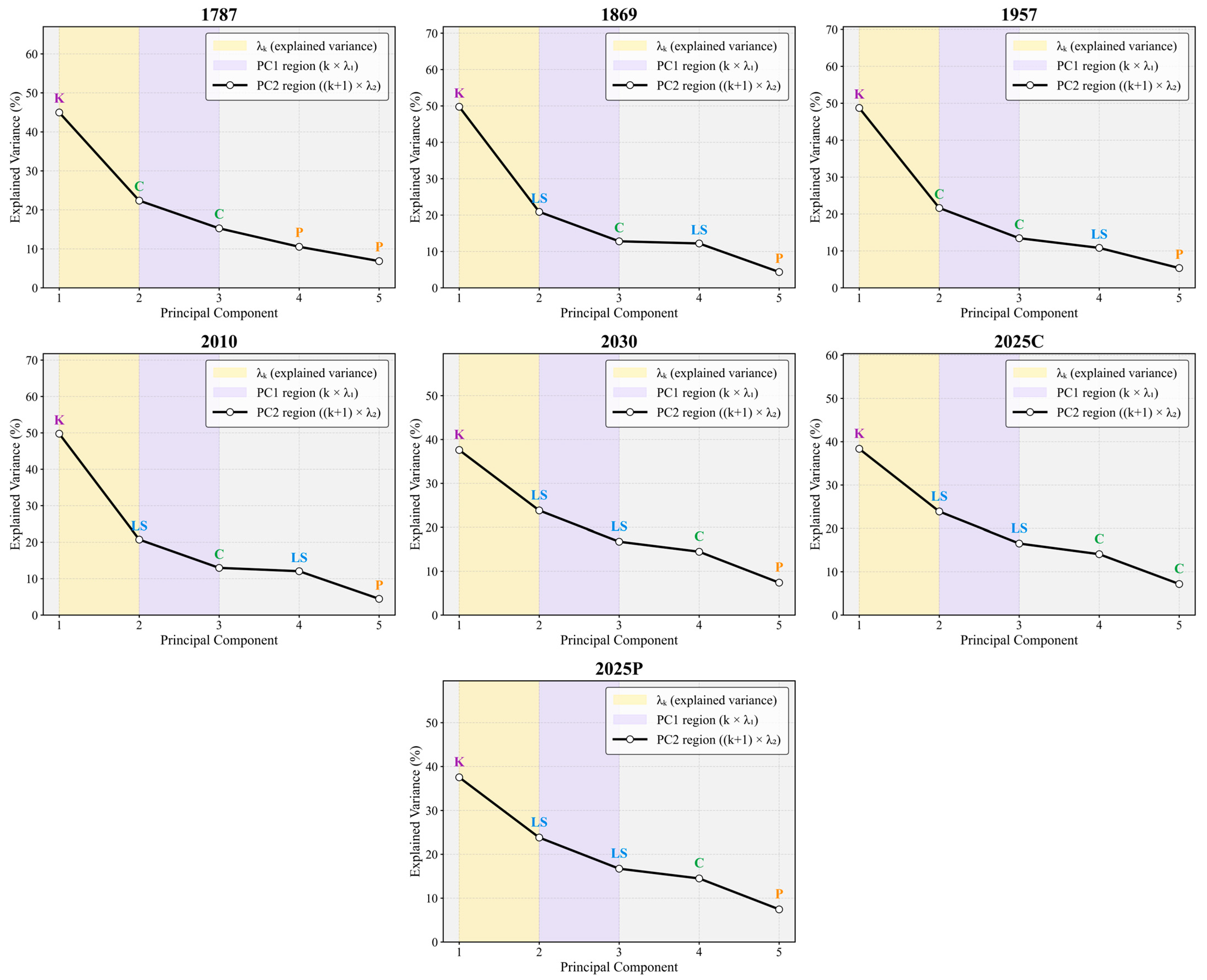
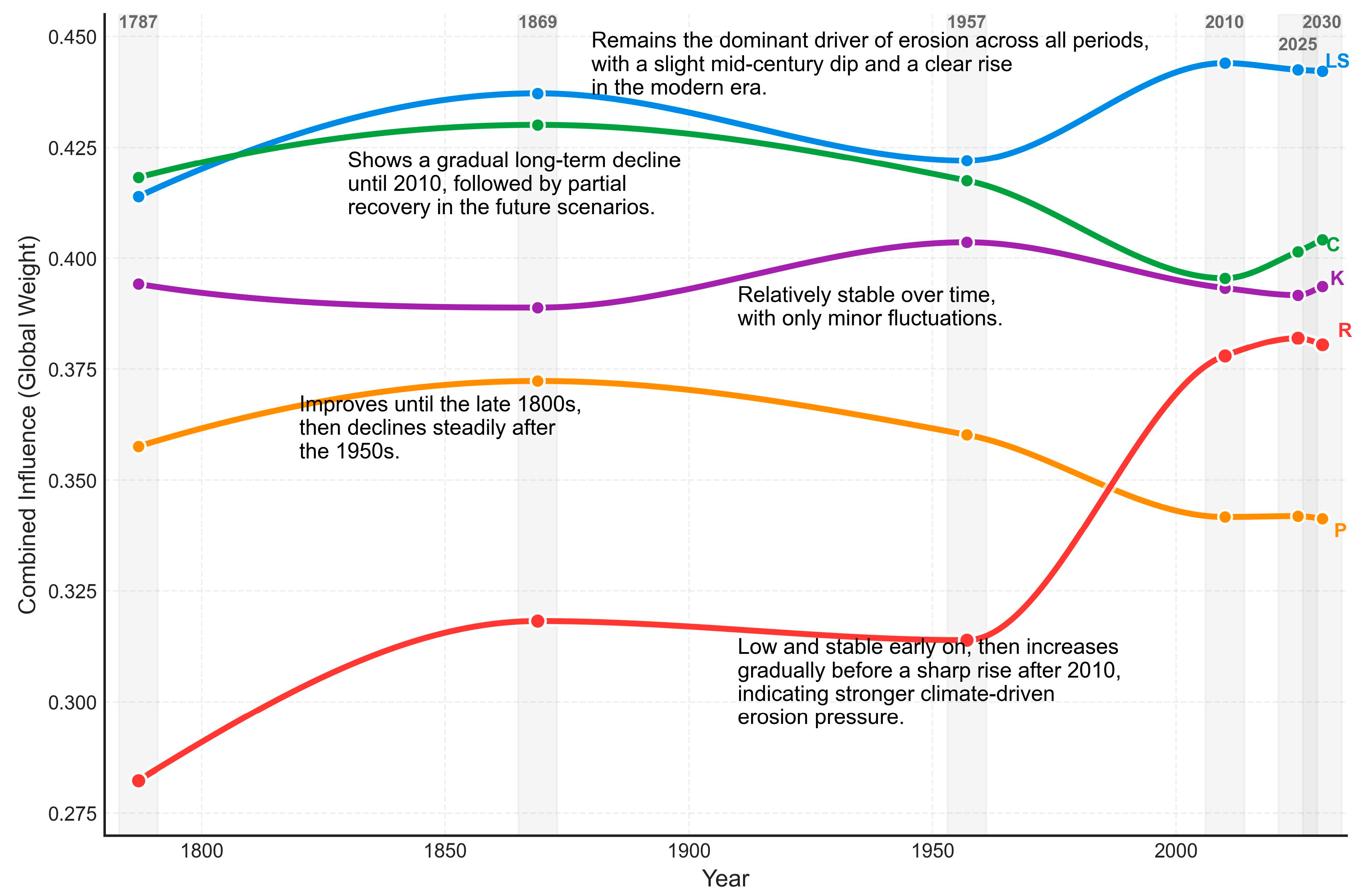
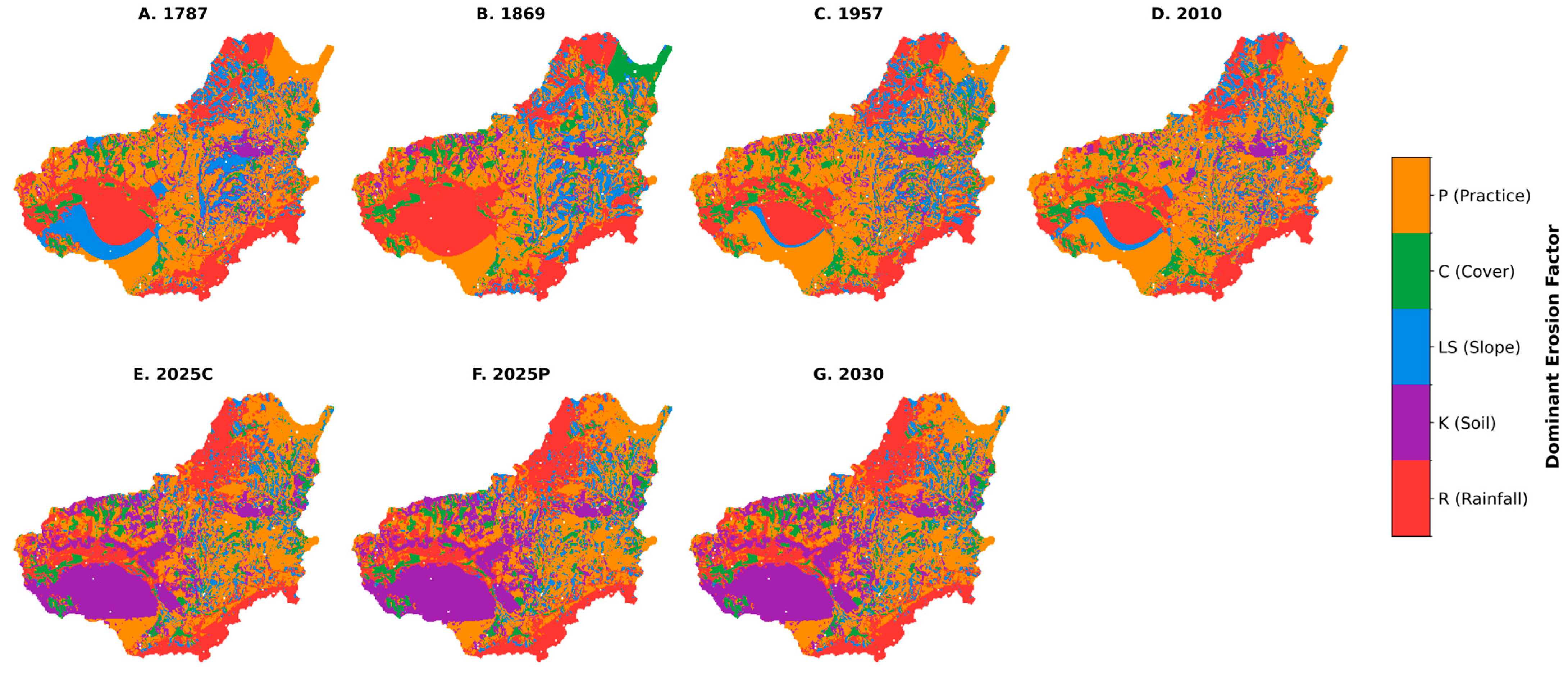
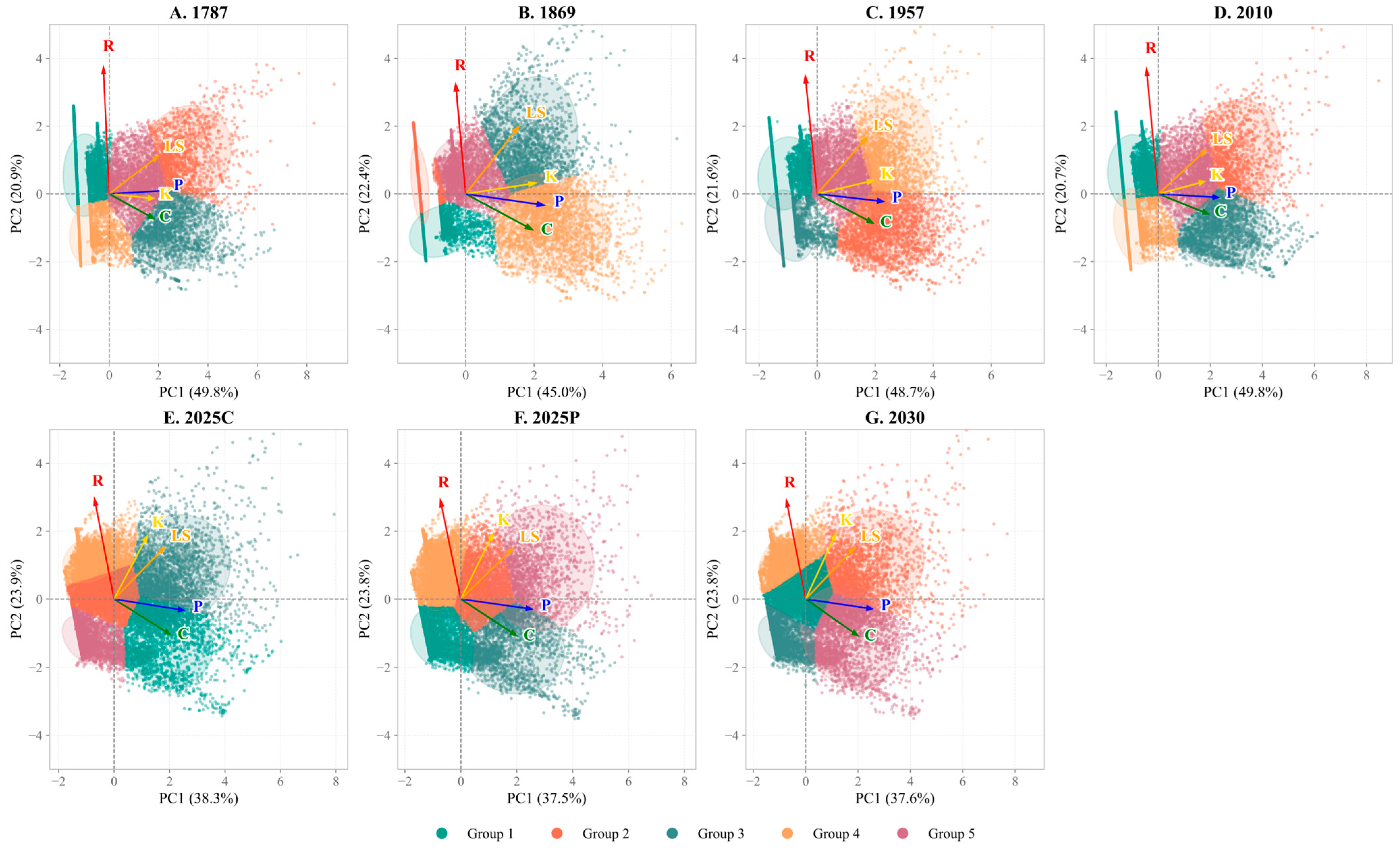
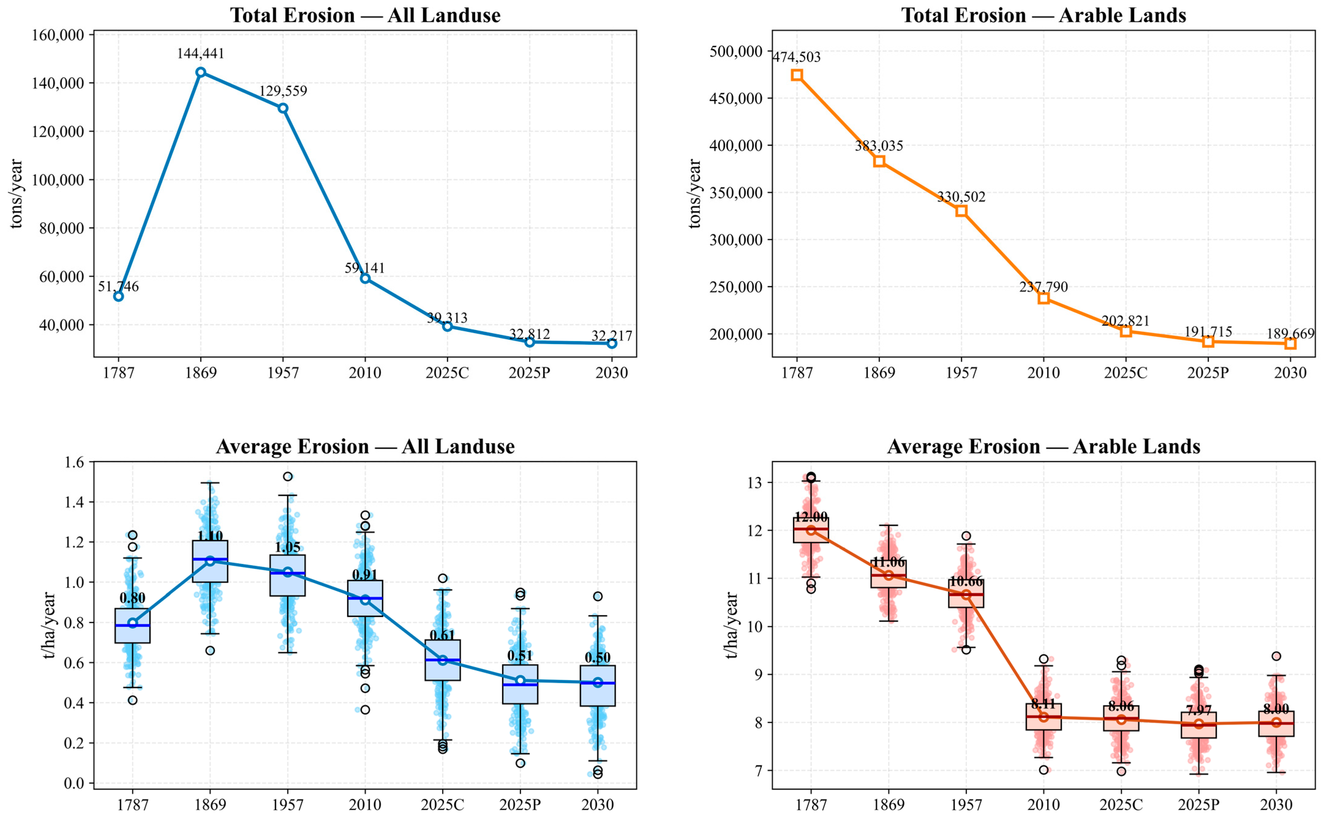
Soil erosion remains a critical global concern, yet long-term catchment-scale assessments that explicitly link historical land-use transitions with erosion responses remain limited. This study evaluates how ±240 years record of historical and projected land-use changes influence soil erosion in the Myjava Basin by integrating parcel-level land-use reconstructions from 1787 to 2030 into a distributed USLE-2D framework. R, K, and parcel-based C and P factors were temporally standardized, and LS was derived using an ensemble of four widely applied algorithms. A PCA was applied to quantify the relative contribution of RUSLE factors across time, and all analyses were performed within a reproducible geospatial modelling environment. The results indicated a long-term decline in total erosion of ±78% at the landscape scale and ±60% within arable land from the 19th century to the present, driven mainly by a major reduction in arable land (from ±62% to ±37%) and expansion of forest and shrub vegetation. Despite this decline, persistent hotspots remain concentrated on steep upland slopes with high LS (>10%), while agricultural parcels experienced erosion rates 10–20 times higher than the basin-wide mean across all periods. PCA shows that LS and rainfall erosivity dominate erosion variability (PC loadings ±0.78–0.84), while C and P factors increase in influence in recent and projected periods, contributing up to ±40% of total explained variance. These findings demonstrate that long-term land-use transitions have substantially reduced basin-scale erosion risk.
Keywords: Myjava Basin; soil erosion modelling; land-use change; spatiotemporal analysis; catchment-scale assessment Myjava Basin; soil erosion modelling; land-use change; spatiotemporal analysis; catchment-scale assessment