Next Issue
Volume 17, January-1
Previous Issue
Volume 16, December-1
 
 
remotesensing-logo

Journal Browser

Journal Browser

Remote Sens., Volume 16, Issue 24 (December-2 2024) – 197 articles

Cover Story (view full-size image): 
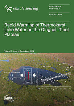
Permafrost regions of the Qinghai–Tibet Plateau are experiencing a steady warming trend, profoundly influencing landscape evolution, hydrological processes, and ecosystem stability. This study employs the Air2Water model, integrating historical observations and future climate projections, to simulate lake-surface temperature changes in thermokarst lakes on the plateau. The results reveal pronounced warming trends in lake surface temperatures, particularly during the ice-free season, with future projections indicating substantial temperature increases under varying climate scenarios. These findings enhance our understanding of the response of thermokarst lakes to climate warming and emphasize the broader environmental consequences of accelerating changes in permafrost landscapes. View this paper
  • Issues are regarded as officially published after their release is announced to the table of contents alert mailing list.
  • You may sign up for e-mail alerts to receive table of contents of newly released issues.
  • PDF is the official format for papers published in both, html and pdf forms. To view the papers in pdf format, click on the "PDF Full-text" link, and use the free Adobe Reader to open them.
Order results
Result details
Section
Select all
Export citation of selected articles as:
34 pages, 2586 KiB  
Review
Advancements and Perspective in the Quantitative Assessment of Soil Salinity Utilizing Remote Sensing and Machine Learning Algorithms: A Review
by Fei Wang, Lili Han, Lulu Liu, Chengjie Bai, Jinxi Ao, Hongjiang Hu, Rongrong Li, Xiaojing Li, Xian Guo and Yang Wei
Remote Sens. 2024, 16(24), 4812; https://doi.org/10.3390/rs16244812 - 23 Dec 2024
Viewed by 793
Abstract
Soil salinization is a significant global ecological issue that leads to soil degradation and is recognized as one of the primary factors hindering the sustainable development of irrigated farmlands and deserts. The integration of remote sensing (RS) and machine learning algorithms is increasingly [...] Read more.
Soil salinization is a significant global ecological issue that leads to soil degradation and is recognized as one of the primary factors hindering the sustainable development of irrigated farmlands and deserts. The integration of remote sensing (RS) and machine learning algorithms is increasingly employed to deliver cost-effective, time-efficient, spatially resolved, accurately mapped, and uncertainty-quantified soil salinity information. We reviewed articles published between January 2016 and December 2023 on remote sensing-based soil salinity prediction and synthesized the latest research advancements in terms of innovation points, data, methodologies, variable importance, global soil salinity trends, current challenges, and potential future research directions. Our observations indicate that the innovations in this field focus on detection depth, iterations of data conversion methods, and the application of newly developed sensors. Statistical analysis reveals that Landsat is the most frequently utilized sensor in these studies. Furthermore, the application of deep learning algorithms remains underexplored. The ranking of soil salinity prediction accuracy across the various study areas is as follows: lake wetland (R2 = 0.81) > oasis (R2 = 0.76) > coastal zone (R2 = 0.74) > farmland (R2 = 0.71). We also examined the relationship between metadata and prediction accuracy: (1) Validation accuracy, sample size, number of variables, and mean sample salinity exhibited some correlation with modeling accuracy, while sampling depth, variable type, sampling time, and maximum salinity did not influence modeling accuracy. (2) Across a broad range of scales, large sample sizes may lead to error accumulation, which is associated with the geographic diversity of the study area. (3) The inclusion of additional environmental variables does not necessarily enhance modeling accuracy. (4) Modeling accuracy improves when the mean salinity of the study area exceeds 30 dS/m. Topography, vegetation, and temperature are relatively significant environmental covariates. Over the past 30 years, the global area affected by soil salinity has been increasing. To further enhance prediction accuracy, we provide several suggestions for the challenges and directions for future research. While remote sensing is not the sole solution, it provides unique advantages for soil salinity-related studies at both regional and global scales. Full article
(This article belongs to the Section Biogeosciences Remote Sensing)
Show Figures

Graphical abstract

23 pages, 10005 KiB  
Article
Time-Series InSAR Technology for Monitoring and Analyzing Surface Deformations in Mining Areas Affected by Fault Disturbances
by Kuan He, Youfeng Zou, Zhigang Han and Jilei Huang
Remote Sens. 2024, 16(24), 4811; https://doi.org/10.3390/rs16244811 - 23 Dec 2024
Viewed by 619
Abstract
Faults, as unique geological structures, disrupt the mechanical connections between rock masses. During coal mining, faults in the overlying strata can disturb the original stress balance, leading to fault activation and altering the typical subsidence patterns. This can result in abnormal ground deformation [...] Read more.
Faults, as unique geological structures, disrupt the mechanical connections between rock masses. During coal mining, faults in the overlying strata can disturb the original stress balance, leading to fault activation and altering the typical subsidence patterns. This can result in abnormal ground deformation and significant damage to surface structures, posing a serious geological hazard in mining areas. This study examines the influence of a known fault (F13 fault) on ground subsidence in the Wannian Mine of the Fengfeng Mining Area. We utilized 12 Sentinel-1A images and applied SBAS-InSAR, StaMPS-InSAR, and DS-InSAR time-series InSAR methods, alongside the D-InSAR method, to investigate surface deformations caused by the F13 fault. The monitoring accuracy of these methods was evaluated using leveling measurements from 28 surface movement observation stations. In addition, the density of effective monitoring points and the relative strengths and limitations of the three time-series methods were compared. The findings indicate that, in low deformation areas, DS-InSAR has a monitoring accuracy of 7.7 mm, StaMPS-InSAR has a monitoring accuracy of 16.4 mm, and SBAS-InSAR has an accuracy of 19.3 mm. Full article
Show Figures

Figure 1

19 pages, 4696 KiB  
Article
The Analysis of Land Use and Climate Change Impacts on Lake Victoria Basin Using Multi-Source Remote Sensing Data and Google Earth Engine (GEE)
by Maram Ali, Tarig Ali, Rahul Gawai, Lara Dronjak and Ahmed Elaksher
Remote Sens. 2024, 16(24), 4810; https://doi.org/10.3390/rs16244810 - 23 Dec 2024
Viewed by 630
Abstract
Over 30 million people rely on Lake Victoria for survival in Northeast African countries, including Ethiopia, Eritrea, Somalia, and Djibout. The lake faces significant challenges due to changes in land use and climate. This study used multi-source remote sensing data in the Google [...] Read more.
Over 30 million people rely on Lake Victoria for survival in Northeast African countries, including Ethiopia, Eritrea, Somalia, and Djibout. The lake faces significant challenges due to changes in land use and climate. This study used multi-source remote sensing data in the Google Earth Engine (GEE) platform to create Land Use and Land Cover (LULC), land surface temperature (LST), and Normalized Difference Water Index (NDWI) layers in the period 2000–2023 to understand the impact of LULC and climate change on Lake Victoria Basin. The land use/land cover trends before 2020 indicated an increase in the urban areas from 0.13% in 2000 to 0.16% in 2020. Croplands increased from 6.51% in 2000 to 7.88% in 2020. The water surface area averaged 61,559 square km, which has increased since 2000 with an average rate of 1.3%. The “Permanent Wetland” size change from 2000 to 2020 varied from 1.70% to 1.83%. Cropland/Natural Vegetation Mosaics rose from 12.77% to 15.01%, through 2000 to 2020. However, more than 29,000 residents were displaced in mid-2020 as the water increased by 1.21 m from the fall of 2019 to the middle of 2020. Furthermore, land-surface temperature averaged 23.98 degrees in 2000 and 23.49 in 2024. Full article
(This article belongs to the Special Issue Image Processing from Aerial and Satellite Imagery)
Show Figures

Figure 1

29 pages, 37603 KiB  
Article
Multi-Scale Mapping and Analysis of Broadleaf Species Distribution Using Remotely Piloted Aircraft and Satellite Imagery
by Aishwarya Chandrasekaran, Joseph P. Hupy and Guofan Shao
Remote Sens. 2024, 16(24), 4809; https://doi.org/10.3390/rs16244809 - 23 Dec 2024
Viewed by 585
Abstract
Tree species mapping from the individual crown to landscape scales provides crucial information on the diversity and richness of forest ecosystems, supporting major conservation decisions under ongoing climate change. With the emergence of Remote Piloted Aircraft (RPA), high spatial resolution datasets can be [...] Read more.
Tree species mapping from the individual crown to landscape scales provides crucial information on the diversity and richness of forest ecosystems, supporting major conservation decisions under ongoing climate change. With the emergence of Remote Piloted Aircraft (RPA), high spatial resolution datasets can be obtained and analyzed to inherently improve the current understanding of broadleaf tree species distribution. The utility of RPA for mapping broadleaf species at broader scales using satellite data needs to be explored. This study investigates the use of RPA RGB imagery captured during peak fall foliage to leverage coloration commonly exhibited by different broadleaf tree species during phenology transition to delineate individual tree crowns and map species distribution. Initially, a two-step hybrid segmentation procedure was designed to delineate tree crowns for two broadleaf forests using RPA imagery collected during the fall season. With the tree crowns, a subsequent Object-based Random Forest (ORF) model was tested for classifying common and economically important broadleaf tree species groups. The classified map was further utilized to improve ground reference data for mapping species distribution at the stand and landscape scales using multispectral satellite imagery (1.4 m to 10 m). The results indicated an improvement in the overall accuracy of 0.13 (from 0.68 to 0.81) and a MICE metric of 0.14 (from 0.61 to 0.75) using reference samples derived from RPA data. The results of this preliminary study are promising in utilizing RPA for multi-scale mapping of broadleaf tree species effectively. Full article
Show Figures

Figure 1

20 pages, 10713 KiB  
Article
Detecting Ocean Eddies with a Lightweight and Efficient Convolutional Network
by Haochen Sun, Hongping Li, Ming Xu, Tianyu Xia and Hao Yu
Remote Sens. 2024, 16(24), 4808; https://doi.org/10.3390/rs16244808 - 23 Dec 2024
Viewed by 437
Abstract
As a ubiquitous mesoscale phenomenon, ocean eddies significantly impact ocean energy and mass exchange. Detecting these eddies accurately and efficiently has become a research focus in ocean remote sensing. Many traditional detection methods, rooted in physical principles, often encounter challenges in practical applications [...] Read more.
As a ubiquitous mesoscale phenomenon, ocean eddies significantly impact ocean energy and mass exchange. Detecting these eddies accurately and efficiently has become a research focus in ocean remote sensing. Many traditional detection methods, rooted in physical principles, often encounter challenges in practical applications due to their complex parameter settings, while effective, deep learning models can be limited by the high computational demands of their extensive parameters. Therefore, this paper proposes a new approach to eddy detection based on the altimeter data, the Ghost Attention Deeplab Network (GAD-Net), which is a lightweight and efficient semantic segmentation model designed to address these issues. The encoder of GAD-Net consists of a lightweight ECA+GhostNet and an Atrous Spatial Pyramid Pooling (ASPP) module. And the decoder integrates an Efficient Attention Network (EAN) module and an Efficient Ghost Feature Integration (EGFI) module. Experimental results show that GAD-Net outperforms other models in evaluation indices, with a lighter model size and lower computational complexity. It also outperforms other segmentation models in actual detection results in different sea areas. Furthermore, GAD-Net achieves detection results comparable to the Py-Eddy-Tracker (PET) method with a smaller eddy radius and a faster detection speed. The model and the constructed eddy dataset are publicly available. Full article
(This article belongs to the Special Issue Artificial Intelligence for Ocean Remote Sensing)
Show Figures

Figure 1

16 pages, 5342 KiB  
Article
Optimization of Grassland Carrying Capacity with Grass Quality Indicators Through GF5B Hyperspectral Images
by Xuejun Cheng, Maoxin Liao, Shuangyin Zhang, Siying Wang, Yiyun Chen and Teng Fei
Remote Sens. 2024, 16(24), 4807; https://doi.org/10.3390/rs16244807 - 23 Dec 2024
Viewed by 391
Abstract
The accurate estimation of grassland carrying capacity (GCC) in the alpine grasslands of the Changjiang River source region is crucial for managing livestock loads and ensuring ecological security on the Qinghai-Tibetan Plateau. Previous remote sensing methods have predominantly focused on yield indicators, often [...] Read more.
The accurate estimation of grassland carrying capacity (GCC) in the alpine grasslands of the Changjiang River source region is crucial for managing livestock loads and ensuring ecological security on the Qinghai-Tibetan Plateau. Previous remote sensing methods have predominantly focused on yield indicators, often neglecting quality indicators, which hampers precise GCC estimation. Here, we collected 25 samples from the Dangqu basin, analyzing various grass parameters including yield, crude protein (CP), neutral detergent fiber (NDF), and acid detergent fiber (ADF). Then, we developed models to optimize GCC using quality indicators derived from GF5B images, assessing performance through Pearson correlation coefficient (R2), root mean square error (RMSE), and relative root mean square error (rRMSE). Results were found to show an average yield of 61.26 g/m2, with CP, ADF, and NDF ranging from 5.81% to 18.75%, 45.47% to 58.80%, and 27.50% to 31.81%, respectively. Spectra in the near-infrared range, such as 1918 nm, and spectral indices improved the accuracy of the hyperspectral inversion of grass parameters. The GCC increased from 0.51 SU·hm−2 to 0.63 SU·hm−2 post-optimization, showing an increasing trend from northwest to southeast. This study enhances GCC estimation accuracy, aiding in reasonable livestock management and effective ecological preservation. Full article
Show Figures

Figure 1

18 pages, 9538 KiB  
Technical Note
Region-Focusing Data Augmentation via Salient Region Activation and Bitplane Recombination for Target Detection
by Huan Zhang, Xiaolin Han and Weidong Sun
Remote Sens. 2024, 16(24), 4806; https://doi.org/10.3390/rs16244806 - 23 Dec 2024
Viewed by 443
Abstract
As the performance of a convolutional neural network is logarithmically proportional to the amount of training data, data augmentation has attracted increasing attention in recent years. Although the current data augmentation methods are efficient because they force the network to learn multiple parts [...] Read more.
As the performance of a convolutional neural network is logarithmically proportional to the amount of training data, data augmentation has attracted increasing attention in recent years. Although the current data augmentation methods are efficient because they force the network to learn multiple parts of a given training image through occlusion or re-editing, most of them can damage the internal structures of targets and ultimately affect the results of subsequent application tasks. To this end, region-focusing data augmentation via salient region activation and bitplane recombination for the target detection of optical satellite images is proposed in this paper to solve the problem of internal structure loss in data augmentation. More specifically, to boost the utilization of the positive regions and typical negative regions, a new surroundedness-based strategy for salient region activation is proposed, through which new samples with meaningful focusing regions can be generated. And to generate new samples of the focusing regions, a region-based strategy for bitplane recombination is also proposed, through which internal structures of the focusing regions can be reserved. Thus, a multiplied effect of data augmentation by the two strategies can be achieved. In addition, this is the first time that data augmentation has been examined from the perspective of meaningful focusing regions, rather than the whole sample image. Experiments on target detection with public datasets have demonstrated the effectiveness of this proposed method, especially for small targets. Full article
Show Figures

Figure 1

29 pages, 5124 KiB  
Review
Combination of Remote Sensing and Artificial Intelligence in Fruit Growing: Progress, Challenges, and Potential Applications
by Danielle Elis Garcia Furuya, Édson Luis Bolfe, Taya Cristo Parreiras, Jayme Garcia Arnal Barbedo, Thiago Teixeira Santos and Luciano Gebler
Remote Sens. 2024, 16(24), 4805; https://doi.org/10.3390/rs16244805 - 23 Dec 2024
Viewed by 724
Abstract
Fruit growing is important in the global agricultural economy, contributing significantly to food security, job creation, and rural development. With the advancement of technologies, mapping fruits using remote sensing and machine learning (ML) and deep learning (DL) techniques has become an essential tool [...] Read more.
Fruit growing is important in the global agricultural economy, contributing significantly to food security, job creation, and rural development. With the advancement of technologies, mapping fruits using remote sensing and machine learning (ML) and deep learning (DL) techniques has become an essential tool to optimize production, monitor crop health, and predict harvests with greater accuracy. This study was developed in four main stages. In the first stage, a comprehensive review of the existing literature was made from July 2018 (first article found) to June 2024, totaling 117 articles. In the second stage, a general analysis of the data obtained was made, such as the identification of the most studied fruits with the techniques of interest. In the third stage, a more in-depth analysis was made focusing on apples and grapes, with 27 and 30 articles, respectively. The analysis included the use of remote sensing (orbital and proximal) imagery and ML/DL algorithms to map crop areas, detect diseases, and monitor crop development, among other analyses. The fourth stage shows the data’s potential application in a Southern Brazilian region, known for apple and grape production. This study demonstrates how the integration of modern technologies can transform fruit farming, promoting more sustainable and efficient agriculture through remote sensing and artificial intelligence technologies. Full article
(This article belongs to the Section Remote Sensing in Agriculture and Vegetation)
Show Figures

Figure 1

15 pages, 4947 KiB  
Technical Note
Deep-Transfer-Learning Strategies for Crop Yield Prediction Using Climate Records and Satellite Image Time-Series Data
by Abhasha Joshi, Biswajeet Pradhan, Subrata Chakraborty, Renuganth Varatharajoo, Shilpa Gite and Abdullah Alamri
Remote Sens. 2024, 16(24), 4804; https://doi.org/10.3390/rs16244804 - 23 Dec 2024
Viewed by 559
Abstract
The timely and reliable prediction of crop yields on a larger scale is crucial for ensuring a stable food supply and food security. In the last few years, many studies have demonstrated that deep learning can offer reliable solutions for crop yield prediction. [...] Read more.
The timely and reliable prediction of crop yields on a larger scale is crucial for ensuring a stable food supply and food security. In the last few years, many studies have demonstrated that deep learning can offer reliable solutions for crop yield prediction. However, a key challenge in applying deep-learning models to crop yield prediction is their reliance on extensive training data, which are often lacking in many parts of the world. To address this challenge, this study introduces TrAdaBoost.R2, along with fine-tuning and domain-adversarial neural network deep-transfer-learning strategies, for predicting the winter wheat yield across diverse climatic zones in the USA. All methods used the bidirectional LSTM (BiLSTM) architecture to leverage its sequential feature extraction capabilities. The proposed transfer-learning approaches outperformed the baseline deep-learning model, with mean absolute error reductions ranging from 9% to 28%, demonstrating the effectiveness of these methods. Furthermore, the results demonstrate that the semi-supervised transfer-learning approach using the two-stage version of TrAdaBoost.R2 and fine-tuning achieved a superior performance compared to the domain-adversarial neural network and standard TrAdaBoost.R2. Additionally, the study offers insights for improving the accuracy and generalizability of crop yield prediction models in diverse agricultural landscapes across different regions. Full article
Show Figures

Figure 1

24 pages, 5566 KiB  
Article
Validation of CRU TS v4.08, ERA5-Land, IMERG v07B, and MSWEP v2.8 Precipitation Estimates Against Observed Values over Pakistan
by Haider Abbas, Wenlong Song, Yicheng Wang, Kaizheng Xiang, Long Chen, Tianshi Feng, Shaobo Linghu and Muneer Alam
Remote Sens. 2024, 16(24), 4803; https://doi.org/10.3390/rs16244803 - 23 Dec 2024
Viewed by 374
Abstract
Global precipitation products (GPPs) are vital in weather forecasting, efficient water management, and monitoring floods and droughts. However, the precision of these datasets varies considerably across different climatic regions and topographic conditions. Therefore, the accuracy assessment of the precipitation dataset is crucial at [...] Read more.
Global precipitation products (GPPs) are vital in weather forecasting, efficient water management, and monitoring floods and droughts. However, the precision of these datasets varies considerably across different climatic regions and topographic conditions. Therefore, the accuracy assessment of the precipitation dataset is crucial at the local scale before its application. The current study initially compared the performance of recently modified and upgraded precipitation datasets, including Climate Research Unit Time-Series (CRU TS v4.08), fifth-generation ERA5-Land (ERA-5), Integrated Multi-satellite Retrievals for GPM (IMERG) final run (IMERG v07B), and Multi-Source Weighted-Ensemble Precipitation (MSWEP v2.8), against ground observations on the provincial basis across Pakistan from 2003 to 2020. Later, the study area was categorized into four regions based on the elevation to observe the impact of elevation gradients on GPPs’ skills. The monthly and seasonal precipitation estimations of each product were validated against in situ observations using statistical matrices, including the correlation coefficient (CC), root mean square error (RMSE), percent of bias (PBias), and Kling–Gupta efficiency (KGE). The results reveal that IMERG7 consistently outperformed across all the provinces, with the highest CC and lowest RMSE values. Meanwhile, the KGE (0.69) and PBias (−0.65%) elucidated, comparatively, the best performance of MSWEP2.8 in Sindh province. Additionally, all the datasets demonstrated their best agreement with the reference data toward the southern part (0–500 m elevation) of Pakistan, while their performance notably declined in the northern high-elevation glaciated mountain regions (above 3000 m elevation), with considerable overestimations. The superior performance of IMERG7 in all the elevation-based regions was also revealed in the current study. According to the monthly and seasonal scale evaluation, all the precipitation products except ERA-5 showed good precipitation estimation ability on a monthly scale, followed by the winter season, pre-monsoon season, and monsoon season, while during the post-monsoon season, all the datasets showed weak agreement with the observed data. Overall, IMERG7 exhibited comparatively superior performance, followed by MSWEP2.8 at a monthly scale, winter season, and pre-monsoon season, while MSWEP2.8 outperformed during the monsoon season. CRU TS showed a moderate association with the ground observations, whereas ERA-5 performed poorly across all the time scales. In the current scenario, this study recommends IMERG7 and MSWEP2.8 for hydrological and climate studies in this region. Additionally, this study emphasizes the need for further research and experiments to minimize bias in high-elevation regions at different time scales to make GPPs more reliable for future studies. Full article
Show Figures

Figure 1

19 pages, 23094 KiB  
Article
Research on the Heavy Rainstorm–Flash Flood–Debris Flow Disaster Chain: A Case Study of the “Haihe River ‘23·7’ Regional Flood”
by Renzhi Li, Shuwen Qi, Zhonggen Wang, Xiaoran Fu, Huiran Gao, Junxue Ma and Liang Zhao
Remote Sens. 2024, 16(24), 4802; https://doi.org/10.3390/rs16244802 - 23 Dec 2024
Viewed by 509
Abstract
Over the past decades, China has experienced severe compound natural disasters, such as extreme rainfalls, which have led to significant losses. In response to the challenges posed by the lack of a clear investigation process and inadequate comprehensiveness in evaluating the natural disaster [...] Read more.
Over the past decades, China has experienced severe compound natural disasters, such as extreme rainfalls, which have led to significant losses. In response to the challenges posed by the lack of a clear investigation process and inadequate comprehensiveness in evaluating the natural disaster chains, this study proposes a comprehensive retrospective simulation strategy for emergency investigation and simulation of heavy rainstorm–flash flood–debris flow chain disasters at the county–town level. The primary aim is to avert potential new chain disasters and alleviate subsequent disasters. This study combines emergency investigation efforts with hydrodynamic models to digitally simulate and analyze compound chain disasters triggered by an extreme rainfall event in the Haihe River regional area, specifically Gaoyakou Valley, Liucun Town, Changping District, Beijing, in July 2023, along with potential new disasters in adjacent regions. The findings indicate that the heavy rainstorm chain disaster on “7.29” resulted from a complex interplay of interrelated natural phenomena, including flash floods, debris flows, urban floodings, and river overflows. Hantai Village has experienced flash flood and debris flow events at different times in this area. Should the rainfall volume experienced in Liucun Town be replicated in the Ming Tombs Town area, approximately 6.2 km2 of land would be inundated, leading to damages to 458 residences and impacting around 240 ha of agricultural land. The anticipated release of floodwater from the reservoir would lead to significant impacts on downstream residents and roads. Our research can improve the efficacy of emergency investigations and assessments, which in turn can help with the management and reduction of disaster risks at the grassroots level. Full article
(This article belongs to the Special Issue Remote Sensing Applications in Flood Forecasting and Monitoring)
Show Figures

Graphical abstract

16 pages, 8606 KiB  
Article
Annual Cropping Intensity Dynamics in China from 2001 to 2023
by Jie Ren, Yang Shao and Yufei Wang
Remote Sens. 2024, 16(24), 4801; https://doi.org/10.3390/rs16244801 - 23 Dec 2024
Viewed by 462
Abstract
Spatial and temporal information about cropping patterns of single and multiple crops is important for monitoring crop production and land-use intensity. We used time-series MODIS NDVI 8-day composite data to develop annual cropping pattern products at a 250 m spatial resolution for China, [...] Read more.
Spatial and temporal information about cropping patterns of single and multiple crops is important for monitoring crop production and land-use intensity. We used time-series MODIS NDVI 8-day composite data to develop annual cropping pattern products at a 250 m spatial resolution for China, covering the period from 2001 to 2023. To address the potential impacts of varying parameters in both data pre-processing and the peak detection algorithm on the accuracy of cropping pattern mapping, we employed a grid-search method to fine-tune these parameters. This process focused on optimizing the Savitzky–Golay smoothing window size and the peak width parameters using a calibration dataset. The results highlighted that an optimal combination of a five to seven MODIS composite window size in Savitzky–Golay smoothing and a peak width of four MODIS composites achieved good overall mapping accuracy. Pixel-wise accuracy assessments were conducted for the selected mapping years of 2001, 2011, and 2021. Overall accuracies were between 89.7% and 92.0%, with F1 scores ranging from 0.921 to 0.943. Nationally, this study observed a fluctuating trend in multiple cropping percentages, with a notable increase after 2013, suggesting shifts toward more intensive agricultural practices in recent years. At a finer spatial scale, the combination of Mann–Kendall and Sen’s slope analyses revealed that approximately 12.9% of 3 km analytical windows exhibited significant changes in cropping intensity. We observed spatial clusters of increasing and decreasing crop intensity trends across provinces such as Hebei, Shandong, Shaanxi, and Gansu. This study underscores the importance of data smoothing and peak detection methods in analyzing high temporal resolution remote sensing data. The generation of annual single/multiple cropping pattern maps at a 250 m spatial resolution enhances our comprehension of agricultural dynamics through time and across different regions. Full article
Show Figures

Graphical abstract

23 pages, 10008 KiB  
Review
Multi-Global Navigation Satellite System for Earth Observation: Recent Developments and New Progress
by Shuanggen Jin, Xuyang Meng, Gino Dardanelli and Yunlong Zhu
Remote Sens. 2024, 16(24), 4800; https://doi.org/10.3390/rs16244800 - 23 Dec 2024
Viewed by 671
Abstract
The Global Navigation Satellite System (GNSS) has made important progress in Earth observation and applications. With the successful design of the BeiDou Navigation Satellite System (BDS), four global navigation satellite systems are available worldwide, together with Galileo, GLONASS, and GPS. These systems have [...] Read more.
The Global Navigation Satellite System (GNSS) has made important progress in Earth observation and applications. With the successful design of the BeiDou Navigation Satellite System (BDS), four global navigation satellite systems are available worldwide, together with Galileo, GLONASS, and GPS. These systems have been widely employed in positioning, navigation, and timing (PNT). Furthermore, GNSS refraction, reflection, and scattering signals can remotely sense the Earth’s surface and atmosphere with powerful implications for environmental remote sensing. In this paper, the recent developments and new application progress of multi-GNSS in Earth observation are presented and reviewed, including the methods of BDS/GNSS for Earth observations, GNSS navigation and positioning performance (e.g., GNSS-PPP and GNSS-NRTK), GNSS ionospheric modelling and space weather monitoring, GNSS meteorology, and GNSS-reflectometry and its applications. For instance, the static Precise Point Positioning (PPP) precision of most MGEX stations was improved by 35.1%, 18.7%, and 8.7% in the east, north, and upward directions, respectively, with PPP ambiguity resolution (AR) based on factor graph optimization. A two-layer ionospheric model was constructed using IGS station data through three-dimensional ionospheric model constraints and TEC accuracy was increased by about 20–27% with the GIM model. Ten-minute water level change with centimeter-level accuracy was estimated with ground-based multiple GNSS-R data based on a weighted iterative least-squares method. Furthermore, a cyclone and its positions were detected by utilizing the GNSS-reflectometry from the space-borne Cyclone GNSS (CYGNSS) mission. Over the years, GNSS has become a dominant technology among Earth observation with powerful applications, not only for conventional positioning, navigation and timing techniques, but also for integrated remote sensing solutions, such as monitoring typhoons, river water level changes, geological geohazard warnings, low-altitude UAV navigation, etc., due to its high performance, low cost, all time and all weather. Full article
Show Figures

Graphical abstract

20 pages, 7294 KiB  
Article
Prelaunch Reflective Solar Band Radiometric Performance of JPSS-3 and -4 VIIRS
by Amit Angal, David Moyer, Xiaoxiong Xiong, Qiang Ji and Daniel Link
Remote Sens. 2024, 16(24), 4799; https://doi.org/10.3390/rs16244799 - 23 Dec 2024
Viewed by 341
Abstract
The Joint Polar Satellite System 3 (JPSS-3) and -4 (JPSS-4) Visible Infrared Imaging Radiometer Suite (VIIRS) instruments are the last in the series (S-NPP VIIRS launched in October 2011, JPSS-1 VIIRS launched in November 2017, and JPSS-2 VIIRS launched in November 2022) of [...] Read more.
The Joint Polar Satellite System 3 (JPSS-3) and -4 (JPSS-4) Visible Infrared Imaging Radiometer Suite (VIIRS) instruments are the last in the series (S-NPP VIIRS launched in October 2011, JPSS-1 VIIRS launched in November 2017, and JPSS-2 VIIRS launched in November 2022) of highly advanced polar-orbiting environmental satellites. Both instruments underwent a comprehensive sensor-level thermal vacuum (TVAC) testing at the Raytheon Technologies El Segundo facility to characterize the spatial, spectral, and radiometric aspects of the VIIRS sensor performance. This paper focuses on the radiometric performance of the 14 reflective solar bands (RSBs) that cover the wavelength range from 0.41 to 2.3 µm. Key instrument calibration parameters such as instrument gain, signal-to-noise ratio (SNR), dynamic range, and radiometric calibration uncertainty were derived from the TVAC measurements for both the primary and redundant electronics at three instrument temperature plateaus: cold, nominal, and hot. This paper shows that all the JPSS-3 and -4 VIIRS RSB detectors have been well characterized, with key performance metrics comparable to the previous VIIRS instruments on-orbit. The radiometric calibration uncertainty of the RSBs is within the 2% requirement, except in the case of band M1 of JPSS-4. Comparison of the radiometric performance to sensor requirements, as well as a summary of key instrument testing and performance issues, is also presented. Full article
(This article belongs to the Collection The VIIRS Collection: Calibration, Validation, and Application)
Show Figures

Figure 1

24 pages, 6174 KiB  
Article
Towards Real-Time Detection of Wakes for Various Sea States with Lightweight Deep Learning Model in Synthetic Aperture Radar Images
by Xixuan Zhou, Fengjie Zheng, Haoyu Wang and Haitao Yang
Remote Sens. 2024, 16(24), 4798; https://doi.org/10.3390/rs16244798 - 23 Dec 2024
Viewed by 445
Abstract
Synthetic aperture radar (SAR) is an essential tool for monitoring and managing maritime traffic and ensuring safety. It is particularly valuable because it can provide surveillance in all weather conditions. Ship wake detection has attracted considerable attention in offshore management as it has [...] Read more.
Synthetic aperture radar (SAR) is an essential tool for monitoring and managing maritime traffic and ensuring safety. It is particularly valuable because it can provide surveillance in all weather conditions. Ship wake detection has attracted considerable attention in offshore management as it has potential for widespread use in ship positioning and motion parameter inversion, surpassing conventional ship detection methods. Traditional wake detection methods depend on linear feature extraction through image transformation processing techniques, which are often ineffective and time-consuming when applied to large-scale SAR data. Conversely, deep learning (DL) algorithms have been infrequently utilized in wake detection and encounter significant challenges due to the complex ocean background and the effect of the sea state. In this study, we propose a lightweight rotating target detection network designed for detecting ship wakes under various sea states. For this purpose, we initially analyzed the features of wake samples across various frequency domains. In the framework, a YOLO structure-based deep learning is implemented to achieve wake detection. Our network design enhances the YOLOv8’s structure by incorporating advanced techniques such as deep separation convolution and combined frequency domain–spatial feature extraction modules. These modules are used to replace the usual convolutional layer. Furthermore, it integrates an attention technique to extract diverse features. By conducting experiments on the OpenSARWake dataset, our network exhibited outstanding performance, achieving a wake detection accuracy of 66.3% while maintaining a compact model size of 51.5 MB and time of 14 ms. This model size is notably less than the existing techniques employed for rotating target detection and wake detection. Additionally, the algorithm exhibits excellent generalization ability across different sea states, addressing to a certain extent the challenge of wake detection being easily influenced by varying sea states. Full article
(This article belongs to the Section Ocean Remote Sensing)
Show Figures

Figure 1

22 pages, 10101 KiB  
Article
Spatial-Temporal Evolution and Cooling Effect of Irrigated Cropland in Inner Mongolia Region
by Long Li, Shudong Wang, Yuewei Bo, Banghui Yang, Xueke Li and Kai Liu
Remote Sens. 2024, 16(24), 4797; https://doi.org/10.3390/rs16244797 - 23 Dec 2024
Viewed by 384
Abstract
Monitoring the dynamic distribution of irrigated cropland and assessing its cooling effects are essential for advancing sustainable agriculture amid climate change. This study presents an integrated framework for irrigated cropland monitoring and cooling effect assessment. Leveraging dense time series vegetation indices with Google [...] Read more.
Monitoring the dynamic distribution of irrigated cropland and assessing its cooling effects are essential for advancing sustainable agriculture amid climate change. This study presents an integrated framework for irrigated cropland monitoring and cooling effect assessment. Leveraging dense time series vegetation indices with Google Earth Engine (GEE), we evaluated multiple machine learning algorithms within to identify the most robust approach (random forest algorithm) for mapping irrigated cropland in Inner Mongolia from 2010 to 2020. Furthermore, we developed an effective method to quantify the diurnal, seasonal, and interannual cooling effects of irrigation. Our generated irrigated cropland maps demonstrate high accuracy, with overall accuracy ranging from 0.85 to 0.89. This framework effectively captures regional cropland expansion patterns, revealing a substantial increase in irrigated cropland across Inner Mongolia by 27,466.09 km2 (about +64%) between 2010 and 2020, with particularly pronounced growth occurring after 2014. Analysis reveals that irrigated cropland lowered average daily land surface temperature (LST) by 0.25 °C compared to rain-fed cropland, with the strongest cooling effect observed between July and August by approximately 0.64 °C, closely associated with increased evapotranspiration. Our work highlights the potential of satellite-based irrigation monitoring and climate impact analysis, offering a valuable tool for supporting climate-resilient agriculture practices. Full article
(This article belongs to the Special Issue Advancements in Remote Sensing for Sustainable Agriculture)
Show Figures

Figure 1

18 pages, 6570 KiB  
Article
Assessing the Effectiveness of Estimating the Construction Years of Cambodia Road Bridges Using an Improved Satellite-Based Method
by Bennie Hamunzala, Hiroto Goto and Koji Matsumoto
Remote Sens. 2024, 16(24), 4796; https://doi.org/10.3390/rs16244796 - 23 Dec 2024
Viewed by 450
Abstract
This study evaluates the effectiveness of an enhanced satellite-based method for estimating the construction years of Cambodian road bridges. By leveraging Landsat satellite imagery and the Normalized Difference Water Index 2 (NDWI_2), in combination with the sequential t-test analysis of regime shifts [...] Read more.
This study evaluates the effectiveness of an enhanced satellite-based method for estimating the construction years of Cambodian road bridges. By leveraging Landsat satellite imagery and the Normalized Difference Water Index 2 (NDWI_2), in combination with the sequential t-test analysis of regime shifts (STARS) method, this research identifies significant shifts in NDWI_2 values indicative of bridge construction activities. A total of 423 road bridges were analyzed, with the accuracy of the method assessed using the Mean Absolute Error (MAE). The improved method demonstrated considerable accuracy, with 64.3% of bridges classified as high-accuracy (MAE of 0–5), 20.8% as moderate-accuracy (MAE of 6–10), and 14.9% as low-accuracy (MAE of 11–30). Factors such as the bridge length and data quality were found to influence accuracy. A regression analysis comparing the actual bridge age to damage ratings closely aligned with the model using the estimated bridge age to damage ratings, suggesting that the the estimated bridge age obtained from the estimated construction years, in conjunction with damage ratings, provide a reliable basis for evaluating the damage trends of road bridges. The findings underscore the method’s potential for broader applications in regions with limited infrastructure data. Although effective for medium to large bridges, challenges remain for smaller bridges due to spatial resolution limitations. Recommendations for further enhancement include refining data preprocessing, segmenting bridges by size, and incorporating auxiliary datasets. This research highlights the critical role of accurate construction year estimation in effective bridge infrastructure monitoring and maintenance planning. Full article
(This article belongs to the Special Issue Remote Sensing Applications for Infrastructures)
Show Figures

Figure 1

19 pages, 7595 KiB  
Article
A Two-Stage Nearshore Seafloor ICESat-2 Photon Data Filtering Method Considering the Spatial Relationship
by Longjiao Zuo, Xuying Wang, Qianzhe Sun, Jian Shi and Yunsheng Zhang
Remote Sens. 2024, 16(24), 4795; https://doi.org/10.3390/rs16244795 - 23 Dec 2024
Viewed by 367
Abstract
“Ice, Cloud, and Land Elevation Satellite-2” (ICESat-2) produces photon-point clouds that can be used to obtain nearshore bathymetric data through density-based filtering methods. However, most traditional methods simplified the variable spatial density distribution of a photon to a linear relationship with water depth, [...] Read more.
“Ice, Cloud, and Land Elevation Satellite-2” (ICESat-2) produces photon-point clouds that can be used to obtain nearshore bathymetric data through density-based filtering methods. However, most traditional methods simplified the variable spatial density distribution of a photon to a linear relationship with water depth, causing a limited extraction effect. To address this limitation, we propose a two-stage filtering method that considers spatial relationships. Stage one constructs the adaptive photon density threshold by mapping a nonlinear relationship between the water depth and photon density to obtain initial signal photons. Stage two adopts a seed-point expanding method to fill gaps in initial signal photons to obtain continuous signal photons that more fully reflect seabed topography. The proposed method is applied to ICESat-2 data from Oahu Island and compared with three other density-based filtering methods: AVEBM (Adaptive Variable Ellipse filtering Bathymetric Method), Bimodal Gaussian fitting, and Quadtree Isolation. Our method (F-measure, F = 0.803) outperforms other methods (F = 0.745, 0.598, and 0.454, respectively). The accuracy of bathymetric data gained from seabed photons filtered using our method can achieve 0.615 m (Mean Absolute Error) and 0.716 m (Root Mean Squared Error). We demonstrate the effectiveness of incorporating photon spatial relationships to enhance the filtering of seabed signal photons. Full article
Show Figures

Figure 1

18 pages, 9870 KiB  
Article
Identification of Green Tide Decomposition Regions in the Yellow Sea, China: Based on Time-Series Remote Sensing Data
by Guangzong Zhang, Yufang He, Lifeng Niu, Mengquan Wu, Hermann Kaufmann, Jian Liu, Tong Liu, Qinglei Kong and Bo Chen
Remote Sens. 2024, 16(24), 4794; https://doi.org/10.3390/rs16244794 - 23 Dec 2024
Viewed by 370
Abstract
Approximately 1 million tons of green tides decompose naturally in the Yellow Sea of China every year, releasing large quantities of nutrients that disrupt the marine ecological balance and cause significant environmental consequences. Currently, the identification of areas affected by green tides primarily [...] Read more.
Approximately 1 million tons of green tides decompose naturally in the Yellow Sea of China every year, releasing large quantities of nutrients that disrupt the marine ecological balance and cause significant environmental consequences. Currently, the identification of areas affected by green tides primarily relies on certain methods, such as ground sampling and biochemical analysis, which limit the ability to quickly and dynamically identify decomposition regions at large spatial and temporal scales. While multi-source remote sensing data can monitor the extent of green tides, accurately identifying areas of algal decomposition remains a challenge. Therefore, satellite data were integrated with key biochemical parameters, such as the carbon-to-nitrogen ratio (C/N), to develop a method for identifying green tide decomposition regions (DRIM). The DRIM shows a high accuracy in identifying green tide decomposition areas, validated through regional repetition rates and UAV measurements. Results indicate that the annual C/N threshold for green tide decomposition regions is 1.2. The method identified the primary decomposition areas in the Yellow Sea from 2015 to 2020, concentrated mainly in the southeastern region of the Shandong Peninsula, covering an area of approximately 1909.4 km2. In 2015, 2016, and 2017, the decomposition areas were the largest, with an average annual duration of approximately 35 days. Our method provides a more detailed classification of the dissipation phase, offering reliable scientific support for accurate and detailed monitoring and management of green tide disasters. Full article
(This article belongs to the Section Ocean Remote Sensing)
Show Figures

Figure 1

18 pages, 7713 KiB  
Article
Water Quality Inversion Framework for Taihu Lake Based on Multilayer Denoising Autoencoder and Ensemble Learning
by Zhihao Sun, Liang Guo, Zhe Tao, Yana Li, Yang Zhan, Shuling Li and Ying Zhao
Remote Sens. 2024, 16(24), 4793; https://doi.org/10.3390/rs16244793 - 23 Dec 2024
Viewed by 411
Abstract
In river and lake ecosystem management, comprehensive water quality monitoring is crucial. Traditional in situ water quality monitoring is costly, and it is challenging to cover entire water bodies. Remote sensing imagery offers the possibility of efficient monitoring of water quality over large [...] Read more.
In river and lake ecosystem management, comprehensive water quality monitoring is crucial. Traditional in situ water quality monitoring is costly, and it is challenging to cover entire water bodies. Remote sensing imagery offers the possibility of efficient monitoring of water quality over large areas. However, remote sensing data typically contain a large amount of noise and redundant information, making it difficult for models to capture the effective spectral information and the relationships in the water quality in the remote sensing data. Consequently, this hinders the achievement of high-precision water quality inversion performance. Therefore, this study proposes a comprehensive water quality inversion framework based on a multilayer denoising autoencoder that automatically extracts effective spectral features, utilizing a multilayer denoising autoencoder to extract effective features from Sentinel-2 remote sensing data, thereby reducing noise in the subsequent model input data and mitigating the overfitting problem in subsequent models. A bagging ensemble learning model was established to invert the total phosphorus concentration in Taihu Lake. This model reduces the prediction bias generated by a single machine learning model and was compared with decision tree, random forest, and linear regression models. The research results indicate that compared to a single model, the bagging ensemble learning model achieved better water quality retrieval results, with a coefficient of determination of 0.9 and an MAE of 0.014, while the linear regression model performed the worst, with a coefficient of determination of 0.42. Additionally, models trained using spectral effective information extracted by multilayer denoising autoencoders showed improved water quality retrieval accuracy compared to those trained with raw data, with the coefficient of determination for the bagging model increasing from 0.62 to 0.9. This study provides a rapid and accurate method for large-scale watershed water quality monitoring using remote sensing data, offering technical support for applying remote sensing data to watershed environmental management and water resource protection. Full article
Show Figures

Figure 1

18 pages, 8573 KiB  
Article
ResTUnet: A Novel Neural Network Model for Nowcasting Using Radar Echo Sequences by Ground-Based Remote Sensing
by Lei Zhang, Ruoyang Zhang, Yu Wu, Yadong Wang, Yanfeng Zhang, Lijuan Zheng, Chongbin Xu, Xin Zuo and Zeyu Wang
Remote Sens. 2024, 16(24), 4792; https://doi.org/10.3390/rs16244792 - 23 Dec 2024
Viewed by 380
Abstract
Radar echo extrapolation by ground-based remote sensing is essential for weather prediction and flight guiding. Existing radar echo extrapolation methods can hardly capture complex spatiotemporal features, resulting in the low accuracy of predictions, and, therefore, severely restrict their use in extreme weather situations. [...] Read more.
Radar echo extrapolation by ground-based remote sensing is essential for weather prediction and flight guiding. Existing radar echo extrapolation methods can hardly capture complex spatiotemporal features, resulting in the low accuracy of predictions, and, therefore, severely restrict their use in extreme weather situations. A deep learning method was recently applied for extrapolating radar echoes; however, its accuracy declines too quickly over a short time. In this study, we introduce a solution: Residual Transformer and Unet (ResTUnet), a novel model that improves prediction accuracy and exhibits good stability with a slow rate of accuracy decline. This presented Rest-Net model is designed to solve the issue of declining prediction accuracy by integrating a 1*1 convolution to diminish the neural network parameters. We constructed an observed dataset by Zhengzhou East Airport radar observation from July 2022 to August 2022 and performed 90 min experiments comprising five aspects, including extrapolation images, the Probability of Detection (POD) index, the Critical Success Index (CSI), the False Alarm Rate (FAR) index, and the Heidke Skill Score (HSS) index. The experimental results show that the ResTUnet model improved the CSI, HSS index, and the POD index by 17.20%, 11.97%, and 11.35%, compared to current models, including Convolutional Long Short-Term Memory (convLSTM), the Convolutional Gated Recurrent Unit (convGRU), the Trajectory Gated Recurrent Unit (TrajGRU), and the improved recurrent network for video predictive learning, the Predictive Recurrent Neural Network++ (predRNN++). In addition, the mean squared error of the ResTUnet model remains stable at 15% between 0 and 60 min and starts to increase after 60–90 min, which is 12% better than the current models. This enhancement in prediction accuracy has practical applications in meteorological services and decision making. Full article
(This article belongs to the Special Issue Advance of Radar Meteorology and Hydrology II)
Show Figures

Graphical abstract

25 pages, 9000 KiB  
Article
Five-Year Evaluation of Sentinel-2 Cloud-Free Mosaic Generation Under Varied Cloud Cover Conditions in Hawai’i
by Francisco Rodríguez-Puerta, Ryan L. Perroy, Carlos Barrera, Jonathan P. Price and Borja García-Pascual
Remote Sens. 2024, 16(24), 4791; https://doi.org/10.3390/rs16244791 - 22 Dec 2024
Viewed by 996
Abstract
The generation of cloud-free satellite mosaics is essential for a range of remote sensing applications, including land use mapping, ecosystem monitoring, and resource management. This study focuses on remote sensing across the climatic diversity of Hawai’i Island, which encompasses ten Köppen climate zones [...] Read more.
The generation of cloud-free satellite mosaics is essential for a range of remote sensing applications, including land use mapping, ecosystem monitoring, and resource management. This study focuses on remote sensing across the climatic diversity of Hawai’i Island, which encompasses ten Köppen climate zones from tropical to Arctic: periglacial. This diversity presents unique challenges for cloud-free image generation. We conducted a comparative analysis of three cloud-masking methods: two Google Earth Engine algorithms (CloudScore+ and s2cloudless) and a new proprietary deep learning-based algorithm (L3) applied to Sentinel-2 imagery. These methods were evaluated against the best monthly composite selected from high-frequency Planet imagery, which acquires daily images. All Sentinel-2 bands were enhanced to a 10 m resolution, and an advanced weather mask was applied to generate monthly mosaics from 2019 to 2023. We stratified the analysis by cloud cover frequency (low, moderate, high, and very high), applying one-way and two-way ANOVAs to assess cloud-free pixel success rates. Results indicate that CloudScore+ achieved the highest success rate at 89.4% cloud-free pixels, followed by L3 and s2cloudless at 79.3% and 80.8%, respectively. Cloud removal effectiveness decreased as cloud cover increased, with clear pixel success rates ranging from 94.6% under low cloud cover to 79.3% under very high cloud cover. Additionally, seasonality effects showed higher cloud removal rates in the wet season (88.6%), while no significant year-to-year differences were observed from 2019 to 2023. This study advances current methodologies for generating reliable cloud-free mosaics in tropical and subtropical regions, with potential applications for remote sensing in other cloud-dense environments. Full article
(This article belongs to the Special Issue Advances in Deep Learning Approaches in Remote Sensing)
Show Figures

Figure 1

24 pages, 8042 KiB  
Article
Quantitative Genetic Aspects of Accuracy of Tree Biomass Measurement Using LiDAR
by Haruka Sano, Naoko Miura, Minoru Inamori, Yamato Unno, Wei Guo, Sachiko Isobe, Kazutaka Kusunoki and Hiroyoshi Iwata
Remote Sens. 2024, 16(24), 4790; https://doi.org/10.3390/rs16244790 - 22 Dec 2024
Viewed by 639
Abstract
The growing focus on the role of forests in carbon sequestration highlights the importance of accurately and efficiently measuring biophysical traits, such as diameter at breast height (DBH) and tree height. Understanding genetic contributions to trait variation is crucial for enhancing carbon storage [...] Read more.
The growing focus on the role of forests in carbon sequestration highlights the importance of accurately and efficiently measuring biophysical traits, such as diameter at breast height (DBH) and tree height. Understanding genetic contributions to trait variation is crucial for enhancing carbon storage through the genetic improvement of forest trees. Light detection and ranging (LiDAR) has been used to estimate DBH and tree height; however, few studies have explored the heritability of these traits or assessed the accuracy of biomass increment selection based on them. Therefore, this study aimed to leverage LiDAR to measure DBH and tree height, estimate tree heritability, and evaluate the accuracy of timber volume selection based on these traits, using 60-year-old larch as the study material. Unmanned aerial vehicle laser scanning (ULS) and backpack laser scanning (BLS) were compared against hand-measured values. The accuracy of DBH estimations using BLS resulted in a root mean square error (RMSE) of 2.7 cm and a coefficient of determination of 0.67. Conversely, the accuracy achieved with ULS was 4.0 cm in RMSE and a 0.24 coefficient of determination. The heritability of DBH was higher with BLS than with ULS and even exceeded that of hand measurements. Comparisons of timber volume selection accuracy based on the measured traits demonstrated comparable performance between BLS and ULS. These findings underscore the potential of using LiDAR remote sensing to quantitatively measure forest tree biomass and facilitate their genetic improvement of carbon-sequestration ability based on these measurements. Full article
Show Figures

Figure 1

18 pages, 7403 KiB  
Article
A Full-Scale Shadow Detection Network Based on Multiple Attention Mechanisms for Remote-Sensing Images
by Lei Zhang, Qing Zhang, Yu Wu, Yanfeng Zhang, Shan Xiang, Donghai Xie and Zeyu Wang
Remote Sens. 2024, 16(24), 4789; https://doi.org/10.3390/rs16244789 - 22 Dec 2024
Viewed by 459
Abstract
Shadows degrade image quality and complicate interpretation, underscoring the importance of accurate shadow detection for many image analysis tasks. However, due to the complex backgrounds and variable shadow characteristics of remote sensing images (RSIs), existing methods often struggle with accurately detecting shadows of [...] Read more.
Shadows degrade image quality and complicate interpretation, underscoring the importance of accurate shadow detection for many image analysis tasks. However, due to the complex backgrounds and variable shadow characteristics of remote sensing images (RSIs), existing methods often struggle with accurately detecting shadows of various scales and misclassifying dark, non-shaded areas as shadows. To address these issues, we proposed a comprehensive shadow detection network called MAMNet. Firstly, we proposed a multi-scale spatial channel attention fusion module, which extracted multi-scale features incorporating both spatial and channel information, allowing the model to flexibly adapt to shadows of different scales. Secondly, to address the issue of false detection in non-shadow areas, we introduced a criss-cross attention module, enabling non-shadow pixels to be compared with other shadow and non-shadow pixels in the same row and column, learning similar features of pixels in the same category, which improved the classification accuracy of non-shadow pixels. Finally, to address the issue of important information from the other two modules being lost due to continuous upsampling during the decoding phase, we proposed an auxiliary branch module to assist the main branch in decision-making, ensuring that the final output retained the key information from all stages. The experimental results demonstrated that the model outperformed the current state-of-the-art RSI shadow detection method on the aerial imagery dataset for shadow detection (AISD). The model achieved an overall accuracy (OA) of 97.50%, an F1 score of 94.07%, an intersection over union (IOU) of 88.87%, a precision of 95.06%, and a BER of 4.05%, respectively. Additionally, visualization results indicated that our model could effectively detect shadows of various scales while avoiding false detection in non-shadow areas. Therefore, this model offers an efficient solution for shadow detection in aerial imagery. Full article
Show Figures

Figure 1

23 pages, 10716 KiB  
Article
Leveraging the Potential of PRISMA Hyperspectral Data for Forest Tree Species Classification: A Case Study in Southern Italy
by Gabriele Delogu, Miriam Perretta, Eros Caputi, Alessio Patriarca, Cassandra Carroll Funsten, Fabio Recanatesi, Maria Nicolina Ripa and Lorenzo Boccia
Remote Sens. 2024, 16(24), 4788; https://doi.org/10.3390/rs16244788 - 22 Dec 2024
Viewed by 544
Abstract
Hyperspectral imagery and advanced classification techniques can significantly enhance remote sensing’s role in forest monitoring. Thanks to recent missions, such as the Italian Space Agency’s PRISMA (PRecursore IperSpettrale della Missione Applicativa—Hyperspectral PRecursor of the Application Mission), hyperspectral data in narrow bands spanning visible/near [...] Read more.
Hyperspectral imagery and advanced classification techniques can significantly enhance remote sensing’s role in forest monitoring. Thanks to recent missions, such as the Italian Space Agency’s PRISMA (PRecursore IperSpettrale della Missione Applicativa—Hyperspectral PRecursor of the Application Mission), hyperspectral data in narrow bands spanning visible/near infrared to shortwave infrared are now available. In this study, hyperspectral data from PRISMA were used with the aim of testing the applicability of PRISMA with different band sizes to classify tree species in highly biodiverse forest environments. The Serre Regional Park in southern Italy was used as a case study. The classification focused on forest category classes based on the predominant tree species in sample plots. Ground truth data were collected using a global positioning system together with a smartphone application to test its contribution to facilitating field data collection. The final result, measured on a test dataset, showed an F1 greater than 0.75 for four classes: fir (0.81), pine (0.77), beech (0.90), and holm oak (0.82). Beech forests showed the highest accuracy (0.92), while chestnut forests (0.68) and a mixed class of hygrophilous species (0.69) showed lower accuracy. These results demonstrate the potential of hyperspectral spaceborne data for identifying trends in spectral signatures for forest tree classification. Full article
(This article belongs to the Special Issue Machine Learning in Global Change Ecology: Methods and Applications)
Show Figures

Figure 1

13 pages, 4861 KiB  
Technical Note
Research on 2-D Direction of Arrival (DOA) Estimation for an L-Shaped Array
by Kun Ye, Lang Zhou, Shaohua Hong, Xuebo Zhang and Haixin Sun
Remote Sens. 2024, 16(24), 4787; https://doi.org/10.3390/rs16244787 - 22 Dec 2024
Viewed by 429
Abstract
Lately, there has been a significant increase in interest in coprime array configurations, as they offer the advantage of generating more extensive array apertures and enhanced degrees of freedom when contrasted with standard linear arrays. This document introduces an innovative two-dimensional direction-of-arrival (2-D [...] Read more.
Lately, there has been a significant increase in interest in coprime array configurations, as they offer the advantage of generating more extensive array apertures and enhanced degrees of freedom when contrasted with standard linear arrays. This document introduces an innovative two-dimensional direction-of-arrival (2-D DOA) estimation technique founded on the zero-completion principle. In particular, our initial step involves interpolating the synthetic co-array signals to achieve completion, followed by the regeneration of the covariance matrix utilizing the interpolated synthetic signals. Then, the 2-D angle estimation is realized based on the complemented matrix using the auto-pairing method. The computational modeling outcomes indicate that the suggested method demonstrates superior angular discriminability. Moreover, this method excels in estimation accuracy when contrasted with its algorithmic counterparts. Full article
(This article belongs to the Special Issue Ocean Remote Sensing Based on Radar, Sonar and Optical Techniques)
Show Figures

Figure 1

21 pages, 16188 KiB  
Article
Classification of Karst Rocky Desertification Levels in Jinsha County Using a Feature Space Method Based on SDGSAT-1 Multispectral Data
by Qi Chen, Han Fu, Xiaoming Li, Xiaochuan Qin and Lin Yan
Remote Sens. 2024, 16(24), 4786; https://doi.org/10.3390/rs16244786 - 22 Dec 2024
Viewed by 389
Abstract
Karst rocky desertification (KRD) is a significant issue that affects the ecological and economic sustainability of southwest China. Obtaining the accurate distribution of different levels of KRD can provide decision-making support for the effective management of KRD. The Sustainable Development Goals Science Satellite [...] Read more.
Karst rocky desertification (KRD) is a significant issue that affects the ecological and economic sustainability of southwest China. Obtaining the accurate distribution of different levels of KRD can provide decision-making support for the effective management of KRD. The Sustainable Development Goals Science Satellite 1 (SDGSAT-1) is the world’s first scientific satellite serving the 2030 Agenda for Sustainable Development of the United Nations, and is dedicated to developing high-resolution, multi-scale, global public datasets to support policy and decision-making support systems for sustainable development. SDGSAT-1 multispectral data provide detailed ground information with a spatial resolution of 10 m and a rich spectral resolution. In this study, we combined the red-modified carbonate rock index (RCRI, an index that characterizes the degree of carbonate rock exposure) and the normalized difference red edge index (NDRE, an index that characterizes the degree of vegetation coverage) to propose a novel feature space method based on SDGSAT-1 multispectral data to classify the different levels of KRD in the Jinsha County of Guizhou Province, a representative region with significant KRD in southwest China. This method effectively identified different levels of KRD with an overall classification accuracy of 87%. This was 20% higher than that of the grading index method, indicating that SDGSAT-1 multispectral data have promising potential for KRD classification. In this study, we offer a new insight into the classification of KRD and a greater quantity of remote-sensing data to monitor KRD over a wider area and for a longer period of time, contributing to the economic development and environmental protection of KRD areas. Full article
Show Figures

Figure 1

31 pages, 12950 KiB  
Article
Exploring Trends and Variability of Water Quality over Lake Titicaca Using Global Remote Sensing Products
by Vann Harvey Maligaya, Analy Baltodano, Afnan Agramont and Ann van Griensven
Remote Sens. 2024, 16(24), 4785; https://doi.org/10.3390/rs16244785 - 22 Dec 2024
Viewed by 595
Abstract
Understanding the current water quality dynamics is necessary to ensure that ecological and sociocultural services are provided to the population and the natural environment. Water quality monitoring of lakes is usually performed with in situ measurements; however, these are costly, time consuming, laborious, [...] Read more.
Understanding the current water quality dynamics is necessary to ensure that ecological and sociocultural services are provided to the population and the natural environment. Water quality monitoring of lakes is usually performed with in situ measurements; however, these are costly, time consuming, laborious, and can have limited spatial coverage. Nowadays, remote sensing offers an alternative source of data to be used in water quality monitoring; by applying appropriate algorithms to satellite imagery, it is possible to retrieve water quality parameters. The use of global remote sensing water quality products increased in the last decade, and there are a multitude of products available from various databases. However, in Latin America, studies on the inter-comparison of the applicability of these products for water quality monitoring is rather scarce. Therefore, in this study, global remote sensing products estimating various water quality parameters were explored on Lake Titicaca and compared with each other and sources of data. Two products, the Copernicus Global Land Service (CGLS) and the European Space Agency Lakes Climate Change Initiative (ESA-CCI), were evaluated through a comparison with in situ measurements and with each other for analysis of the spatiotemporal variability of lake surface water temperature (LSWT), turbidity, and chlorophyll-a. The results of this study showed that the two products had limited accuracy when compared to in situ data; however, remarkable performance was observed in terms of exhibiting spatiotemporal variability of the WQ parameters. The ESA-CCI LSWT product performed better than the CGLS product in estimating LSWT, while the two products were on par with each other in terms of demonstrating the spatiotemporal patterns of the WQ parameters. Overall, these two global remote sensing water quality products can be used to monitor Lake Titicaca, currently with limited accuracy, but they can be improved with precise pixel identification, accurate optical water type definition, and better algorithms for atmospheric correction and retrieval. This highlights the need for the improvement of global WQ products to fit local conditions and make the products more useful for decision-making at the appropriate scale. Full article
Show Figures

Figure 1

18 pages, 4247 KiB  
Article
Temporal Vine Water Status Modeling Through Machine Learning Ensemble Technique and Sentinel-2 Multispectral Images Under Semi-Arid Conditions
by Vincenzo Giannico, Simone Pietro Garofalo, Luca Brillante, Pietro Sciusco, Mario Elia, Giuseppe Lopriore, Salvatore Camposeo, Raffaele Lafortezza, Giovanni Sanesi and Gaetano Alessandro Vivaldi
Remote Sens. 2024, 16(24), 4784; https://doi.org/10.3390/rs16244784 - 22 Dec 2024
Viewed by 523
Abstract
New challenges will be experienced by the agriculture sector in the near future, especially due to the effects of climate change. For example, rising temperatures could result in increased evapotranspiration demand, causing difficulties in the management of irrigation practices. Generally, an important predictor [...] Read more.
New challenges will be experienced by the agriculture sector in the near future, especially due to the effects of climate change. For example, rising temperatures could result in increased evapotranspiration demand, causing difficulties in the management of irrigation practices. Generally, an important predictor of plant water status to be taken into account for irrigation monitoring and management is the stem water potential. However, it requires a huge amount of time-consuming fieldwork, particularly when an adequate data amount is necessary to fully investigate the spatial and temporal variability of large areas under monitoring. In this study, the integration of machine learning and satellite remote sensing (Sentinel-2) was investigated to obtain a model able to predict the stem water potential in viticulture using multispectral imagery. Vine water status data were acquired within a Montepulciano vineyard in the south of Italy (Puglia region), under semi-arid conditions; data were acquired over two years during the irrigation seasons. Different machine learning algorithms (lasso, ridge, elastic net, and random forest) were compared using vegetation indices and spectral bands as predictors in two independent analyses. The results show that it is possible to remotely estimate vine water status with random forest from vegetation indices (R2 = 0.72). Integrating machine learning techniques and satellite remote sensing could help farmers and technicians manage and plan irrigation, avoiding or reducing fieldwork. Full article
Show Figures

Figure 1

21 pages, 12247 KiB  
Article
The Impact of Autumn Snowfall on Vegetation Indices and Autumn Phenology Estimation
by Yao Tang, Jin Chen, Jingyi Xu, Jiahui Xu, Jingwen Ni, Zhaojun Zheng, Bailang Yu, Jianping Wu and Yan Huang
Remote Sens. 2024, 16(24), 4783; https://doi.org/10.3390/rs16244783 - 22 Dec 2024
Viewed by 477
Abstract
Monitoring autumn vegetation dynamics in alpine regions is crucial for managing local livestock, understanding regional productivity, and assessing the responses of alpine regions to climate change. However, remote sensing-based vegetation monitoring is significantly affected by snowfall. The impact of autumn snowfall, particularly when [...] Read more.
Monitoring autumn vegetation dynamics in alpine regions is crucial for managing local livestock, understanding regional productivity, and assessing the responses of alpine regions to climate change. However, remote sensing-based vegetation monitoring is significantly affected by snowfall. The impact of autumn snowfall, particularly when vegetation has not fully entered dormancy, has been largely overlooked. To demonstrate the uncertainties caused by autumn snowfall in remote sensing-based vegetation monitoring, we analyzed 16 short-term snowfall events in the Qinghai–Tibet Plateau. We employed a synthetic difference-in-differences estimation framework and conducted simulated experiments to isolate the impact of snowfall from other factors, revealing its effects on vegetation indices (VIs) and autumn phenology estimation. Our findings indicate that autumn snowfall notably affects commonly used VIs and their associated phenology estimates. Modified VIs (i.e., Normalized Difference Infrared Index (NDII), Phenology Index (PI), Normalized Difference Phenology Index (NDPI), and Normalized Difference Greenness Index (NDGI)) revealed greater resilience to snowfall compared to conventional VIs (i.e., Normalized Difference Vegetation Index (NDVI) and Enhanced Vegetation Index (EVI)) in phenology estimation. Areas with remaining green vegetation in autumn showed more pronounced numerical changes in VIs due to snowfall. Furthermore, the impact of autumn snowfall closely correlated with underlying vegetation types. Forested areas experienced less impact from snowfall compared to grass- and shrub-dominated regions. Earlier snowfall onset and increased snowfall frequency further exacerbated deviations in estimated phenology caused by snowfall. This study highlights the significant impact of autumn snowfall on remote sensing-based vegetation monitoring and provides a scientific basis for accurate vegetation studies in high-altitude regions. Full article
(This article belongs to the Section Environmental Remote Sensing)
Show Figures

Graphical abstract

Previous Issue
Back to TopTop