Article

Land-Use and Land-Cover Changes in Cottbus City and Spree-Neisse District, Germany, in the Last Two Decades: A Study Using Remote Sensing Data and Google Earth Engine


1
Department of Atmospheric Processes, Brandenburg University of Technology Cottbus-Senftenberg, 03046 Cottbus, Germany
2
Department of Civil Engineering, Bangladesh Army International University of Science and Technology (BAIUST), Comilla 3501, Bangladesh
*
Author to whom correspondence should be addressed.
Remote Sens. 2024, 16(15), 2773; https://doi.org/10.3390/rs16152773
Submission received: 15 May 2024 / Revised: 10 July 2024 / Accepted: 27 July 2024 / Published: 29 July 2024
(This article belongs to the Special Issue Remote Sensing Applications in Land Use and Land Cover Monitoring)

Abstract

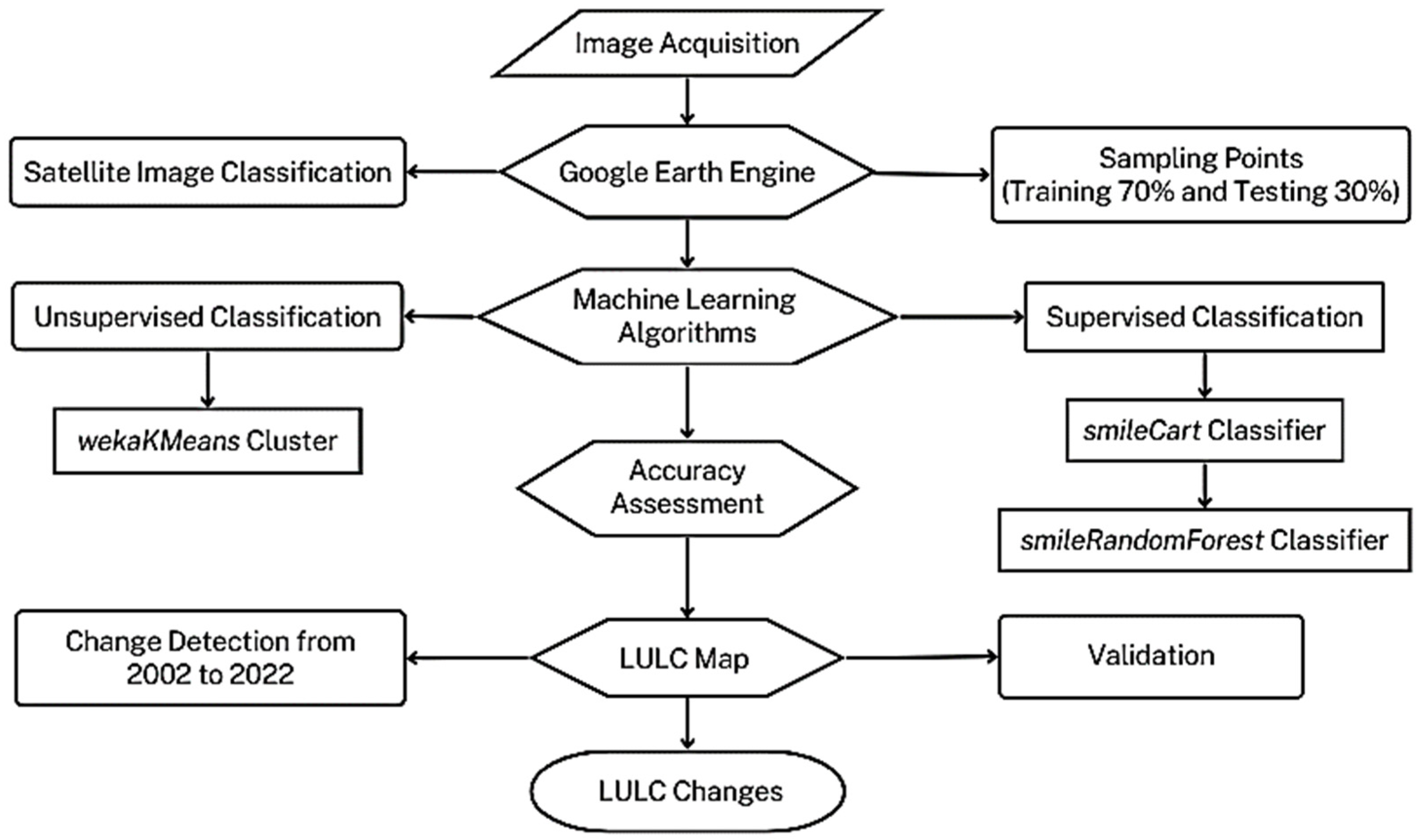
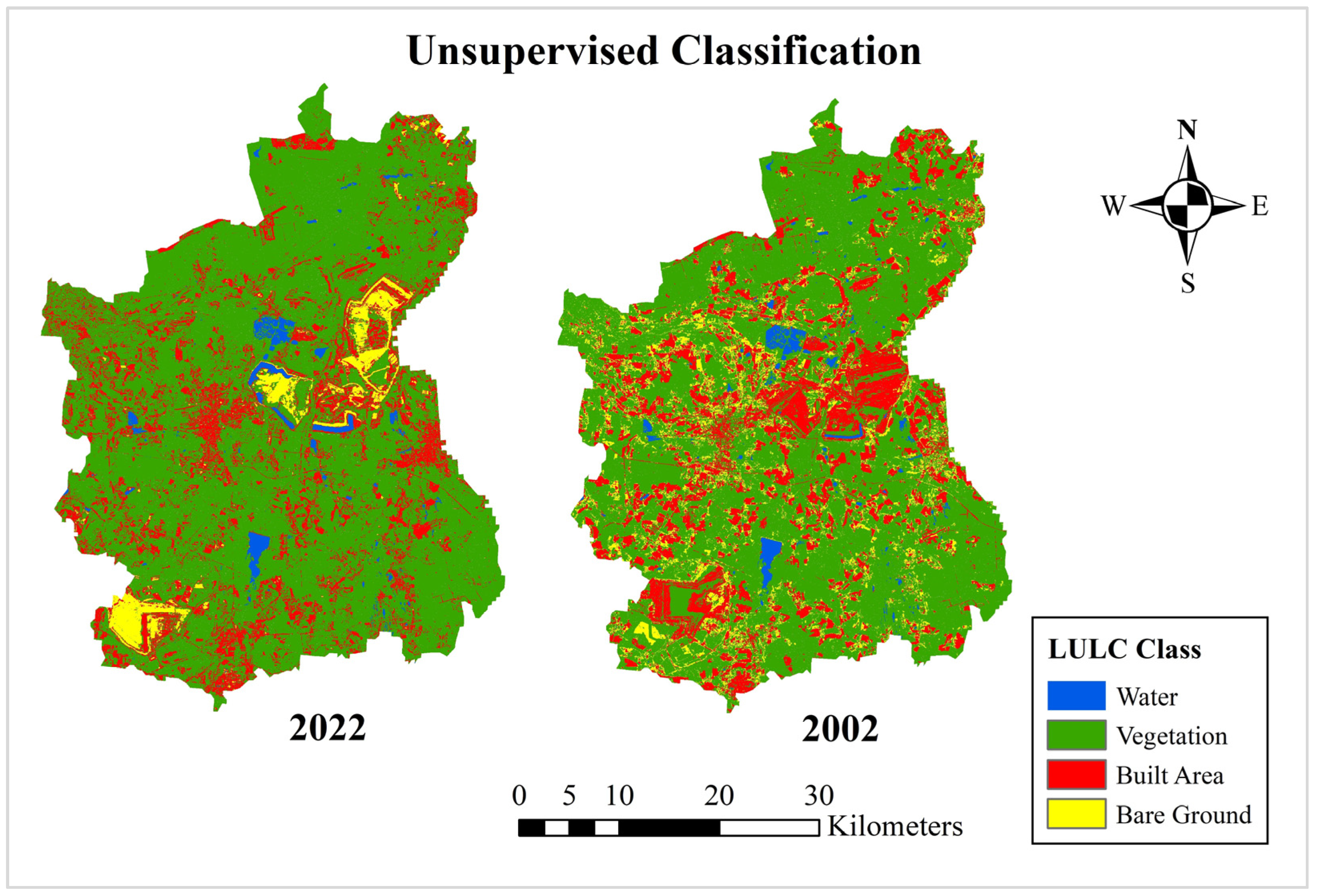
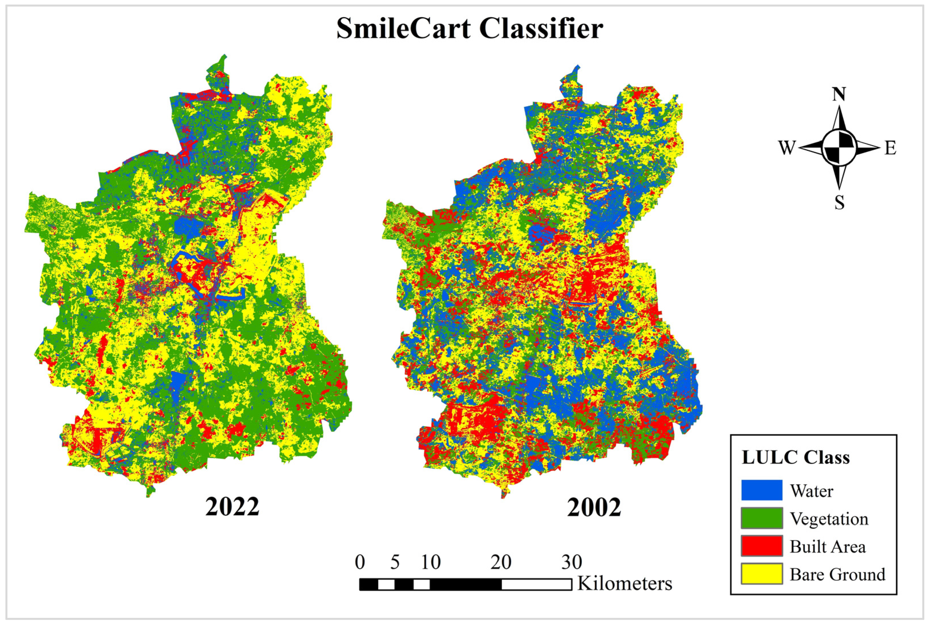
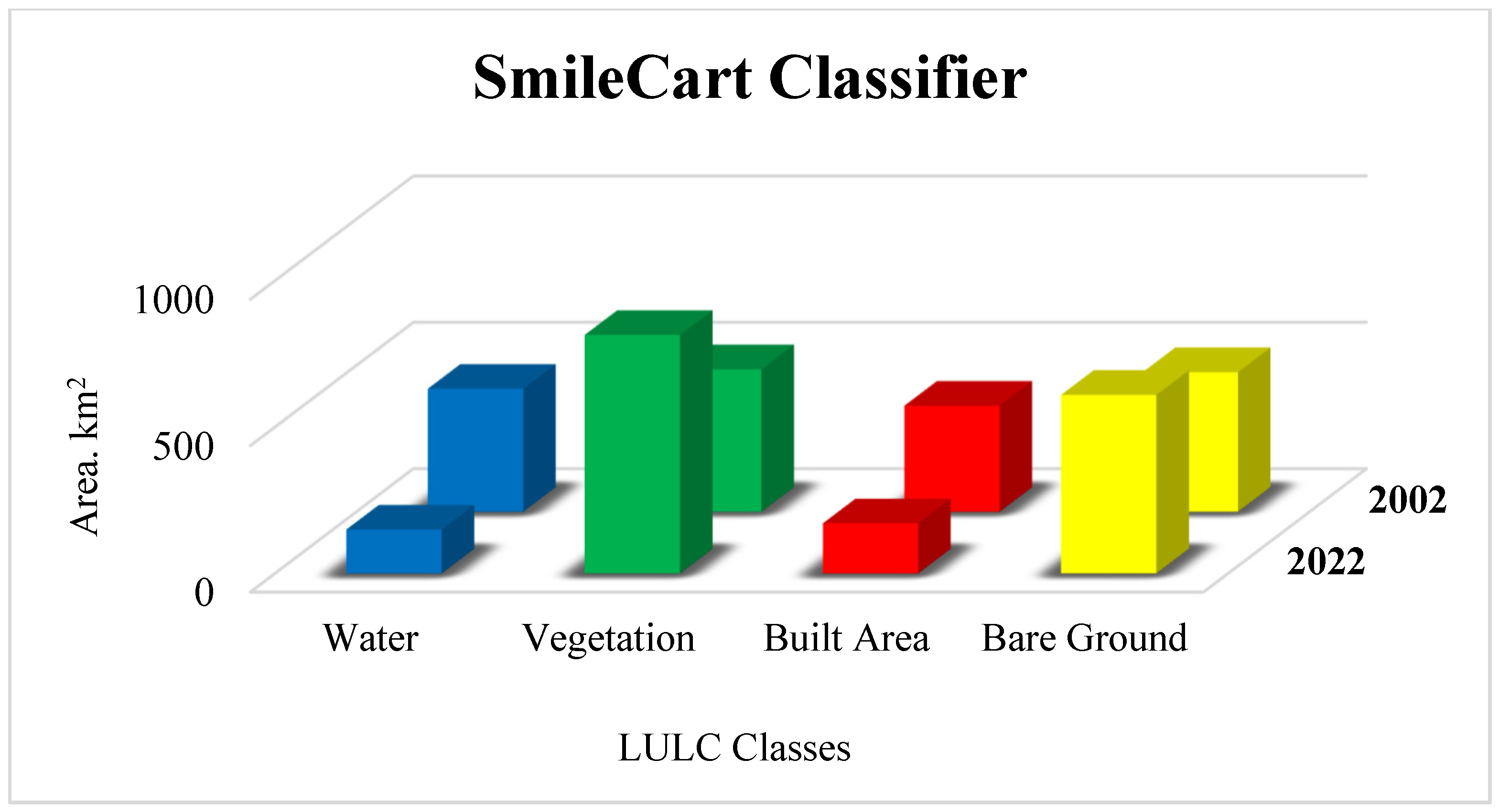
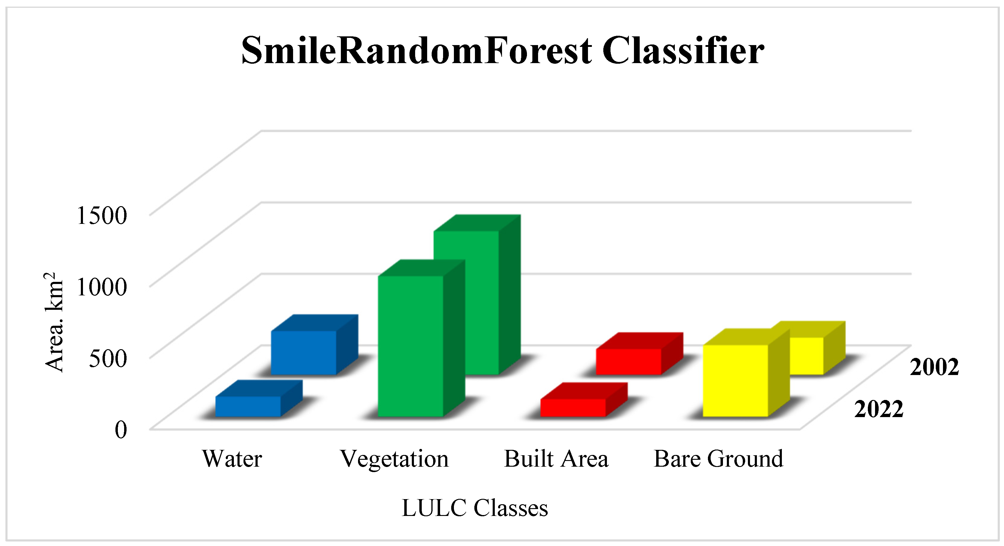
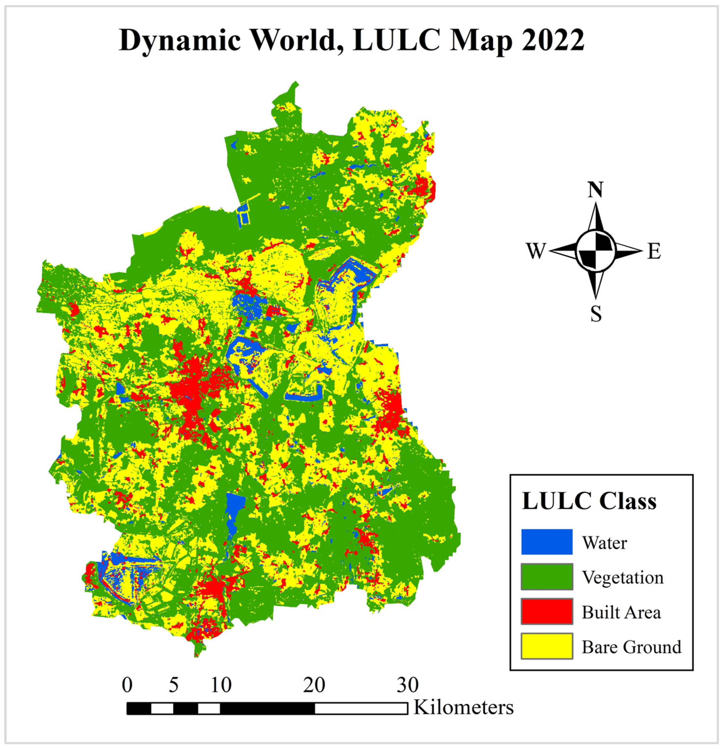
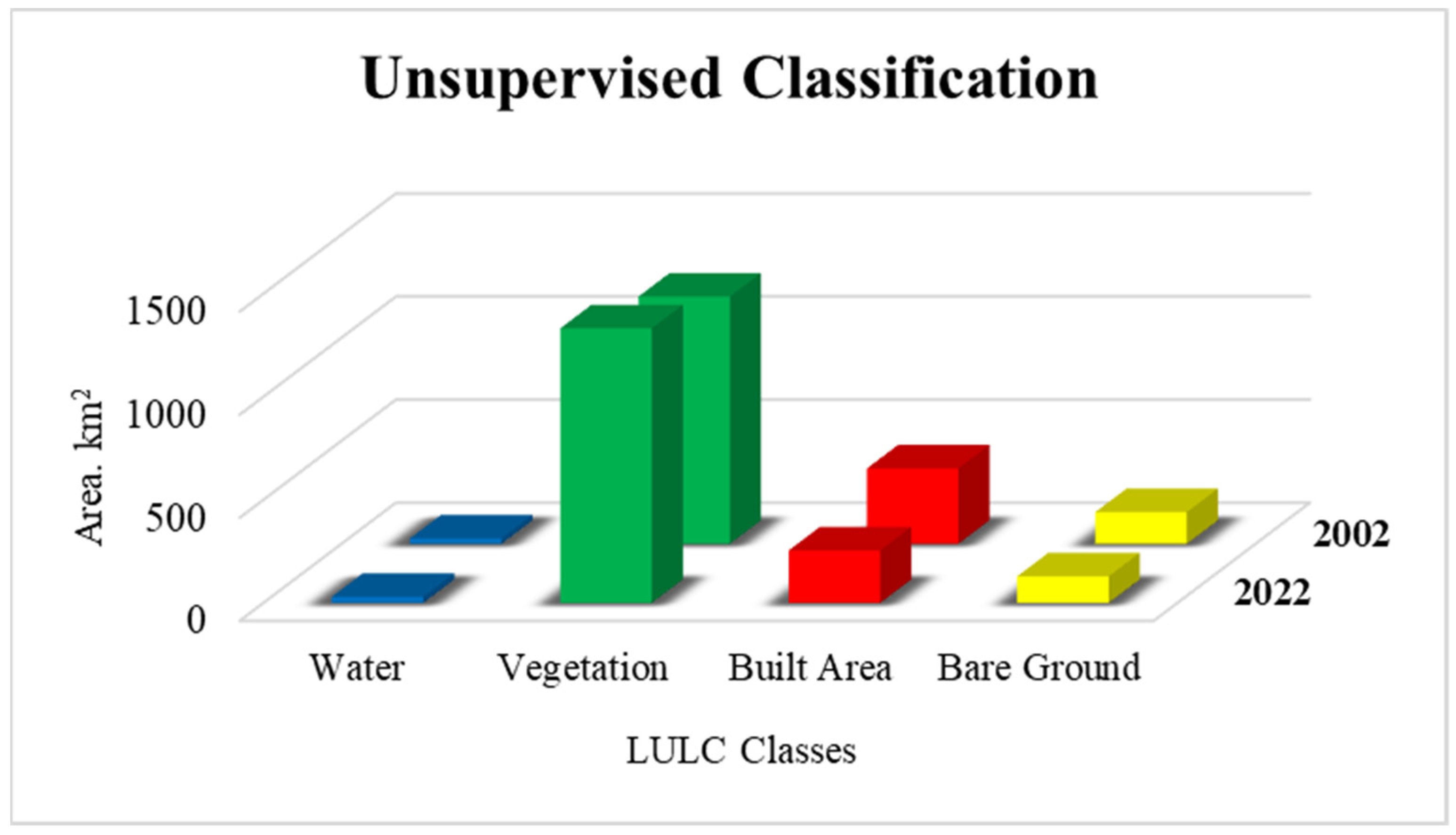
Regular detection of land-use and land-cover (LULC) changes with high accuracy is necessary for natural resources management and sustainable urban planning. The produced LULC maps from Google Earth Engine (GEE) also illustrate the transformation of the LULC for the respective landscape over time. The selected study area, Cottbus City and the Spree-Neisse district in northeastern Germany, has undergone significant development over the past decades due to various factors, including urbanization and industrialization; also, the landscape has been converted in some areas for post-mining activities. Detection of LULC changes that have taken place over the last few decades thus plays a vital role in quantifying the impact of these factors while improving the knowledge of these developments and supporting the city planners or urban management officials before implementing further long-term development initiatives for the future. Therefore, the study aims to (i) detect LULC changes for the time slices 2002 and 2022, testing machine learning (ML) algorithms in supervised and unsupervised classification for Landsat satellite imageries, and (ii) validate the newly produced LULC maps with the available regional database (RDB) from the federal and state statistical offices, Germany, and the Dynamic World (DW) near real-time 10 m global LULC data set powered by artificial intelligence (AI). The results of the Random Forest (RF) and the Smilecart classifiers of supervised classification using Landsat 9 OLI-2/TIRS-2 in 2022 demonstrated a validation accuracy of 88% for both, with Kappa Index (KI) of 83% and 84%, respectively. Moreover, the Training Overall Accuracy (TOA) was 100% for both years. The wekaKMeans cluster of the unsupervised classification also illustrated a similar transformation pattern in the LULC maps. Overall, the produced LULC maps offered an improved representation of the selected region’s various land-cover classes (i.e., vegetation, waterbodies, built areas, and bare ground) in the last two decades (20022 to 2022).
Keywords: LULC; machine learning; Landsat; Google Earth Engine; supervised; unsupervised LULC; machine learning; Landsat; Google Earth Engine; supervised; unsupervised